The Barbary Coast Trail walking tour, established in May of 1998, was created by the San Francisco Historical Society and historian Daniel Bacon, a member of the society. It follows north to south, from Aquatic Park to the old U.S. Mint Building on 5th Street, or south to north from the Mint to Aquatic Park, whichever is preferred. It trails through much of old San Francisco, and at times travels along the original shoreline. The entire trail can be followed on the old McQuillan map from 1878 below. Our tour will follow the south to north route. Some references suggest that you can take this tour all in one day. I broke it up over three days and I still felt old and tired when I finished, although, I enjoyed every step of the way! So put on some comfortable shoes and kick back, you’re in for a long armchair walk!

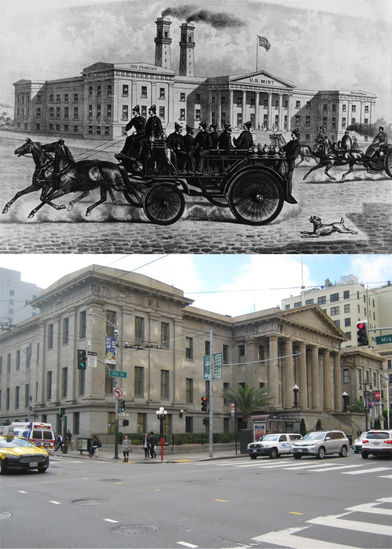 Beginning at the old Mint Building on 5th and Mission Street the trail moves north along 5th to Market Street. (SFGate)
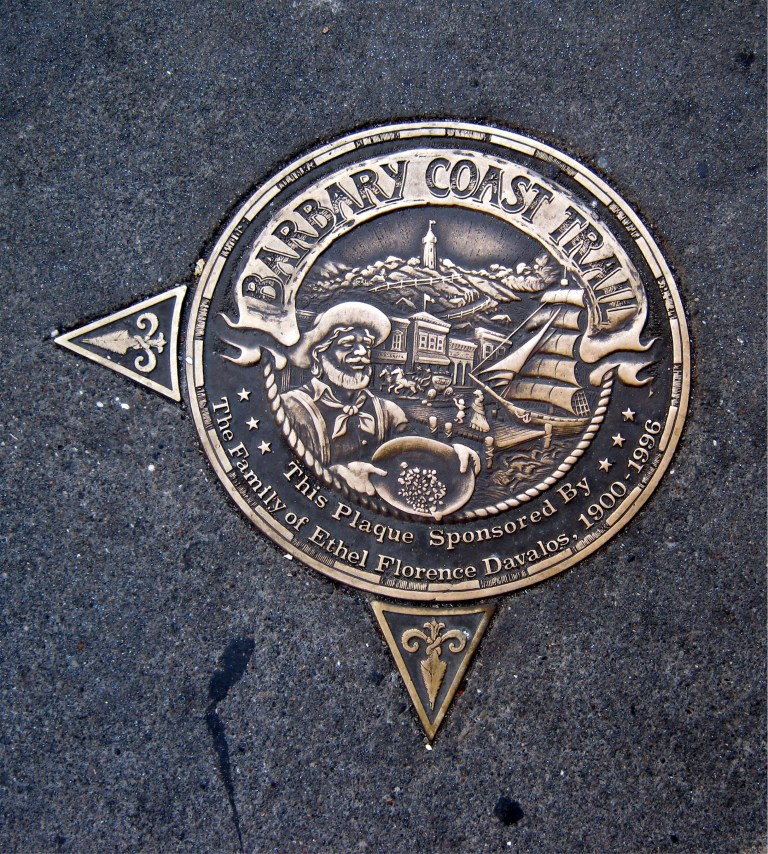
 Along the way, you’ll spot gold medallions placed in sidewalks along the trail like this one at the Mint Building. The medallions have an arrow pointing toward the direction of the Barbary Coast Trail. I’ll have more on these later in the post.
 The trail crosses Market Street and heads up Powell Street to Union Square. The cable cars at the Powell Street turntable were temporarily shut down when the vintage picture was taken. The photo looks like the 1970’s so I don’t think that this was during the big shut down from 1982 to 1984.
 We’re now at Union Square across from the St. Francis Hotel.
http://opensfhistory.org/
 The tour crosses Union Square, seen here just after the 1906 Earthquake and Fire, and enters Maiden Lane.
 Moving through Maiden Lane we turn left onto Grant Avenue. Maiden Lane, once called Morton Street, was an alley filled with brothels before the 1906 Earthquake.
 Along Grant Avenue we’ll cross Sutter Street where the old Whitehouse Department Store was located. Our view is from Sutter Street looking east toward Grant.
 At the next block we arrive at the official entrance to Chinatown at Bush Street. In 1983 I took the top picture looking back down Grant Ave. toward Sutter Street. The Whitehouse Store had not yet become the Banana Republic.
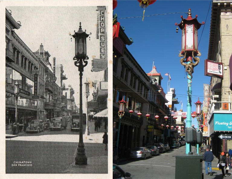 We’ve entered Chinatown and we’ll head north past where the old postcard was taken.
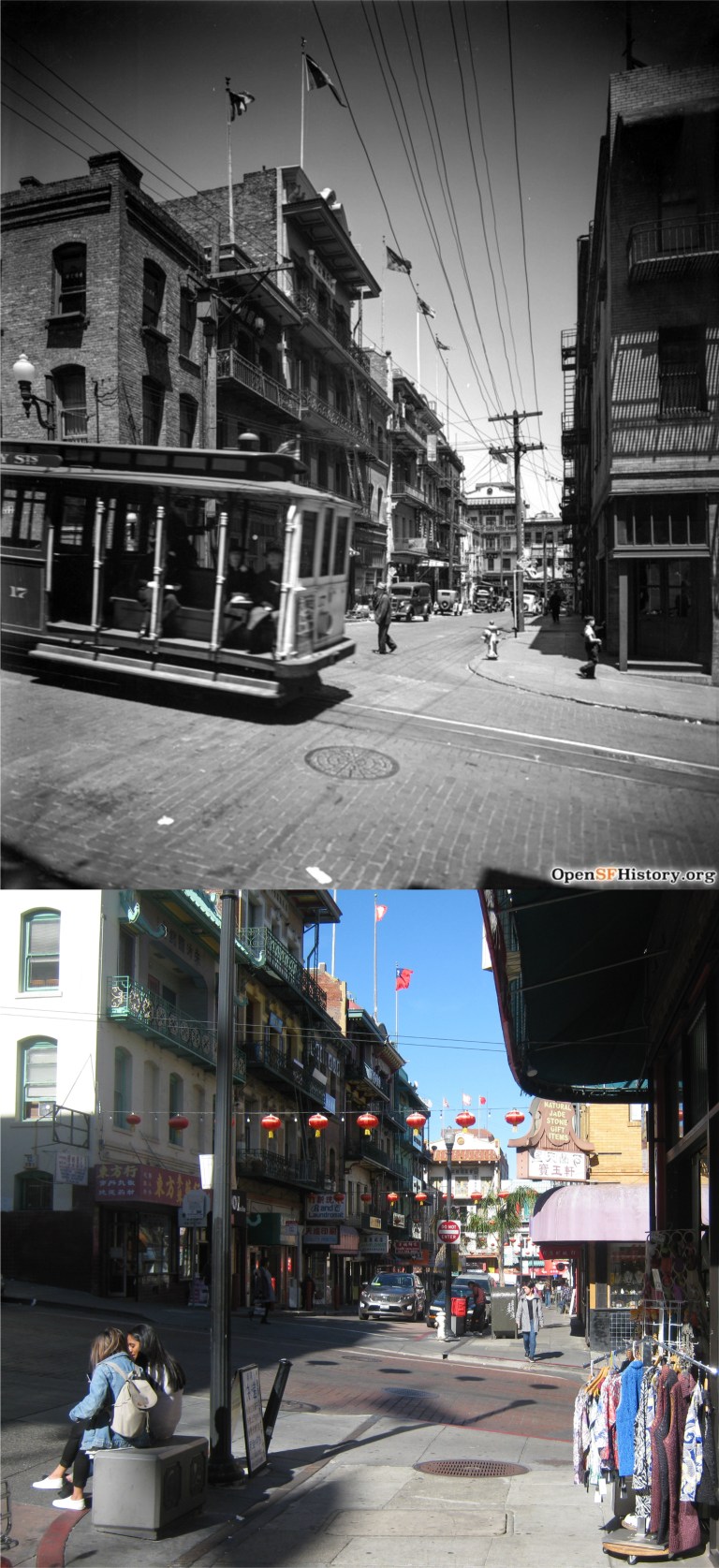 The trail moves into Waverly Place, seen here from Clay Street in 1938 when a cable car line ran along Clay.
http://opensfhistory.org/
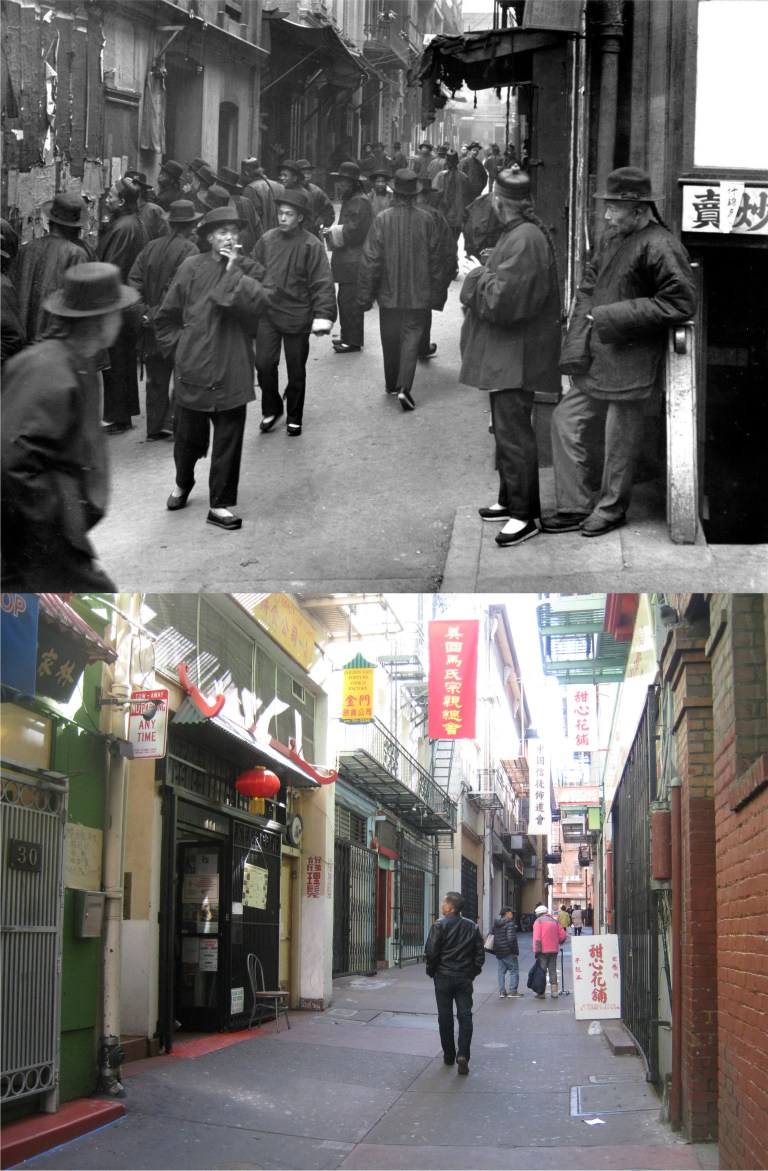 From Waverly place we’ll head into once notorious Ross Alley, long ago famous for Shanghaiing, Tong Wars, and prostitution cribs. Seen here in Arnold Genthe’s vintage photo from before the 1906 Earthquake and Fire, the alley is quaint and peaceful today. The building the gentleman is looking into in my picture is the Golden Gate Fortune Cookie Factory where you can have your own fortune baked into a cookie.
 From Ross Alley we’ll double back to Washington Street and Grant Avenue. The medallion on the northwest corner of this intersection has two arrows. These are the medallions placed between the two origination points of the Barbary Coast Trail directing visitors traveling either north along the trail or south.
 The trail passes through the old Portsmouth Square. We are now in some of the oldest settled areas of San Francisco and near the original city shoreline. The vintage photo is another Arnold Genthe picture taken at Portsmouth Square.
 Let’s head down to Montgomery and Clay Streets, where the old Montgomery Block, a hangout for writers and poets, was torn down at the end of the 1950’s. The Transamerica Pyramid building, seen from Montgomery and Clay Streets under construction, occupies the location of the old “Monkey Block” today.
 Now we’re on Pacific Avenue, the street that epitomizes the “Barbary Coast” more than any other street in San Francisco. “Blackie” Norton’s Paradise Saloon from the 1936 film ‘San Francisco’ was on Pacific Ave. Nick’s Saloon, from William Saroyan’s play ‘The Time of Your Life’ was on Pacific. Just about every old movie about San Francisco before the 1906 Earthquake is centered around or mentions Pacific Avenue. In the 1940’s and 1950’s it became the ‘International Settlement’ the center of San Francisco’s wickedest nightlife. The two posts that held up the International Settlement sign on Pacific Avenue at Montgomery Street are still there today.
http://opensfhistory.org/
 We’re going to turn north onto Columbus Avenue from Pacific and head north, or more accurately, northwest. Look back at the old Sentinel Building, also known as Columbus Tower, completed in 1907. The vintage picture is from the Charles W. Cushman Collection.
 We’re going to travel along Columbus Avenue, seen here at Columbus and Stockton Street, and head toward Washington Square. I couldn’t get the most accurate lineup with the OpenSFHistory picture because of the construction, but you can still see the steeples of Saints Peter and Paul Church in the background of my picture.
 Washington Square at Saints Peter and Paul Church: The famous San Francisco Chronicle columnist Herb Caen once quoted something to the effect, “Washington Square, which is not a square, has a statue of Benjamin Franklin not George Washington, and is located in North Beach where there is no beach!” From Washington Square we’ll head up to the top of Telegraph Hill.
 A 1926 picture from the Shorpy Historic Photo Archive shows the old urn balustrade that circled the parking lot where Coit Tower is today. The balustrade was considered unattractive and removed by the end of the 1930’s.

 We’ll head back down Lombard Street from the top of Telegraph Hill. In October of 1983 I took the above two pictures of the Parade of Ships for Fleet Week from here on Lombard Street when there was a greater navy presence for the occasion. These are two perfect photos for today’s November 11th posting.
 From Telegraph Hill the Barbary Coast Trail takes you down to the Embarcadero, probably my favorite street in San Francisco. There’s just something magical to me about the shipping history, the fog, and the film noir like setting of this street. The foggy vintage picture is from the great photographer Fred Lyon.
 After leaving the Embarcadero the Barbary Coast Trail travels along Jefferson Street past Fisherman’s Wharf and where the old Joe DiMaggio Restaurant was located. (Gordon Clark)
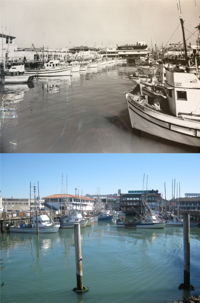 We can’t pass by here without stopping at the Fisherman’s Wharf Boat Lagoon. The vintage picture is on the wall of Alioto’s Restaurant, seen in both photos.
 We’re nearing the end of our journey. These two photos were taken at the Hyde Street Pier from the ferryboat Eureka looking over to Aquatic Park across the 1895 schooner C.A. Thayer. The top picture is from a slide I took in 1985 from the third deck of the Eureka. Yesterday’s photo was from the second deck, the third deck being closed off now.
 The trail ends (and begins) at Aquatic Park. We’re looking at the Hyde Street Pier from behind the Maritime Museum. My 1985 slide looks very similar to the picture that I took yesterday. The 1886 square-rigger Balclutha has been relocated to the Hyde Street Pier since my 1985 picture but is temporarily away from the pier in dry dock for repairs at the current time.
 We’ll end on the steps behind the Maritime Museum. I don’t remember what was going on in 1985 when I took the top slide picture, and I don’t know who the girl dancing was, but it must have been a fun day!

 I started out at the Powell and Market Streets cable car turntable at twilight in the rain. Trees block the view past the St. Francis Hotel and up Nob Hill today. The old Powell Theater that went back to the 1920’s is where the Burger King is today. (Vintage picture from Vintage Everyday)
 Before catching a cable car up Nob Hill, I headed one block east to 4th and Market Streets across from Stockton Street to get a comparison of this twilight picture from 1954. (SFGate, San Francisco Chronicle)
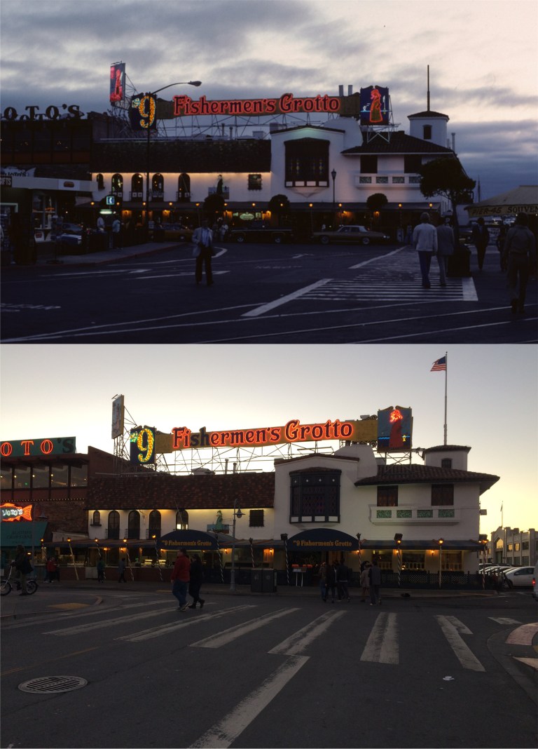 Fisherman’s Wharf at dusk:
 Looking east of Fisherman’s Wharf at dusk from Alioto’s Restaurant: Funny how the rain stopped so suddenly, huh? Actually, I took in two evenings for my nocturnal knock around, the 16th and the 17th. That mast ship in the background of the vintage picture is the square rigged ‘Balclutha’, built in 1886. In 1988 she was moved from this location to the Hyde Street Pier. (Peter Stratmoen)
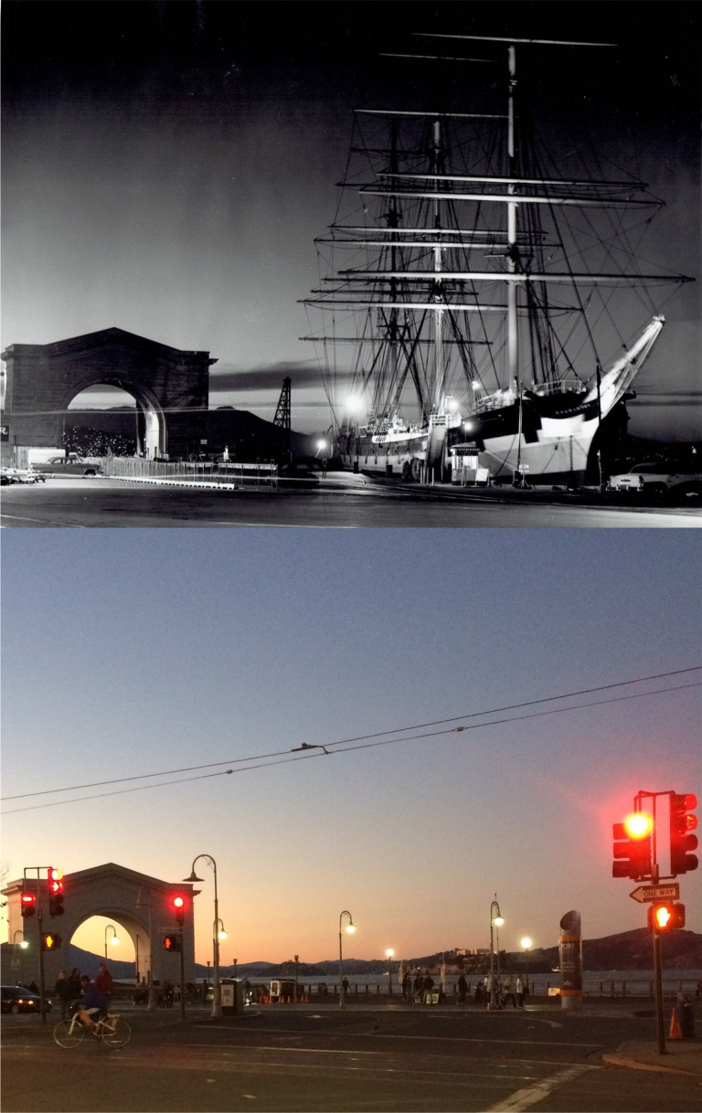 Speaking of the Balclutha, here she is docked at Pier 43. Also, here’s something I didn’t know until I researched the Wikipedia entry on her, the Balclutha was filmed in a scene in the 1935 movie ‘Mutiny on the Bounty’ with Clark Gable and Charles Laughton!
 The Fairmont Hotel on Nob Hill, where Tony Bennett introduced the world to ‘I Left My Heart in San Francisco’, probably, around the time that the vintage picture was taken: (Vintage Everyday)
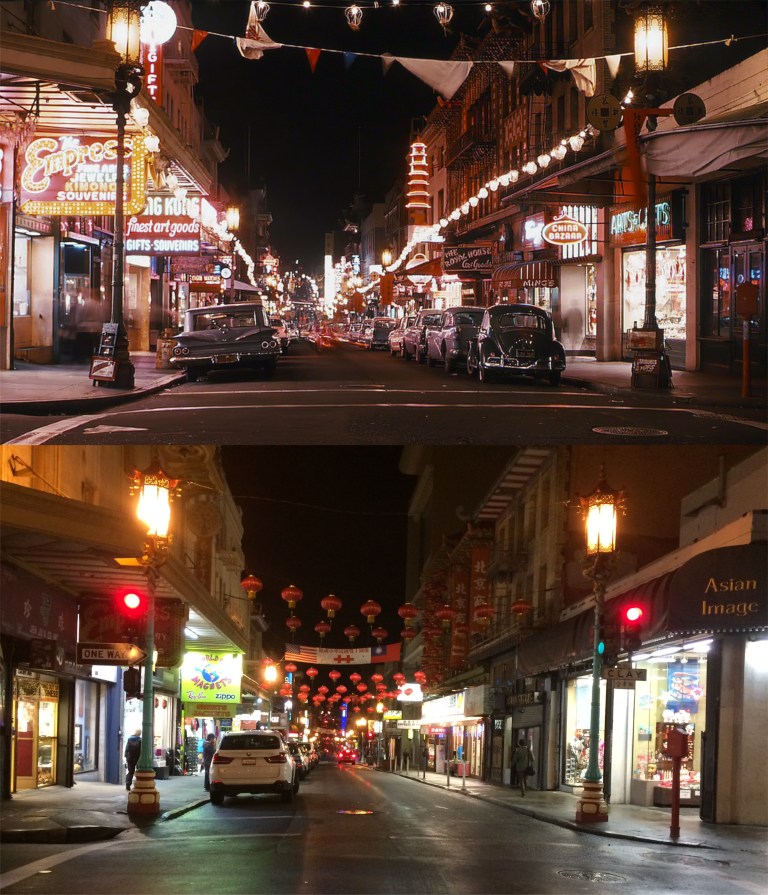 Grant Avenue at Clay Street, and the never-changing Chinatown with its multicolored manhole covers: (Vintage Everyday)
 With the accuracy in continuity of the ‘Bullitt’ car chase scene, we’re back where I ended the night before. This is at Market and Powell Streets at 5:15 PM on December 14th 1945, and Market and Powell Streets at 6:15 PM on November 16th 2017. I took my picture an hour later because it isn’t as dark at 5:15 PM in November as it is in December. The Market Street crosswalk has been relocated since December of 1945 so my picture is a little farther back. The old Emporium Store, now Bloomingdale’s is in the background of both photos. (SFGate, San Francisco Chronicle)
 This image is looking north on Rhode Island Street from 20th in the 1920’s. That house on the left is still there today. (Peter Linenthal and Abigail Johnston)
 An unpaved corner of De Haro where it branches off, and 25th in 1941: I can spot some of the houses still there.
 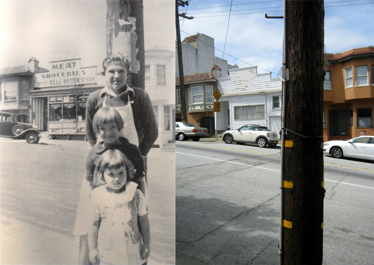 De Haro Street, between 22nd and 23rd Streets in 1939: Maybe, the same telephone pole. (Peter Linenthal and Abigail Johnston)
 The 101 Freeway skirts the western side of Potrero hill: (Phil Palmer)
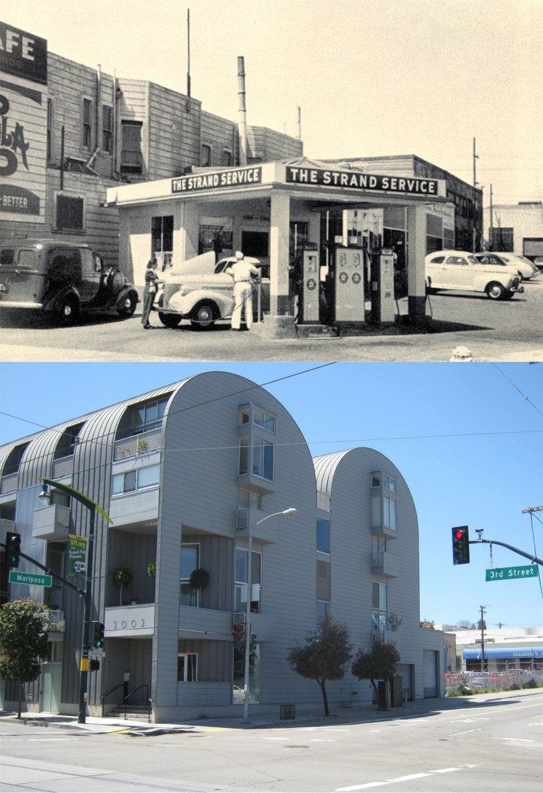 On the eastern side of the hill on the corner of Mariposa and 3rd was the Strand Service Station.
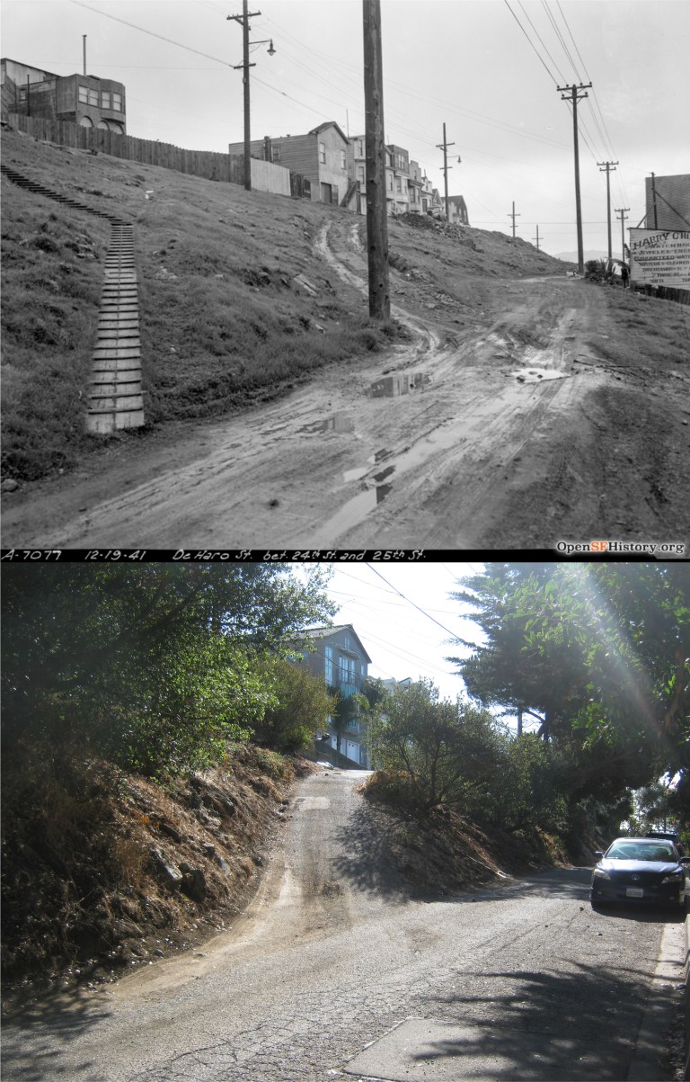 DeHaro between 24th and 24th Street on December 19th 1941, looking south:
 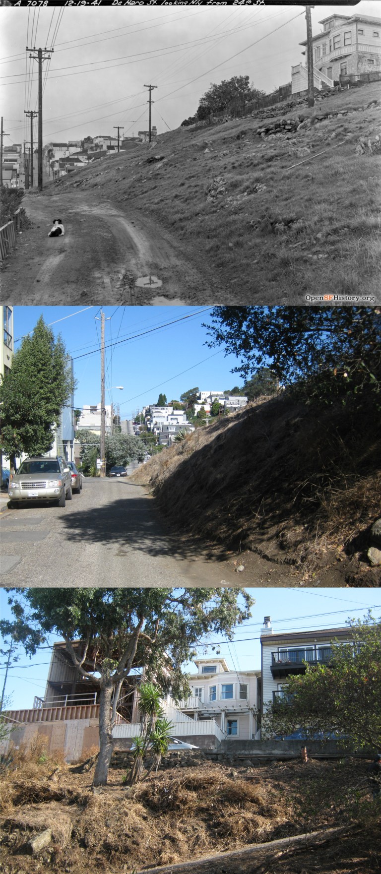 DeHaro between 24th and 25th looking north, on the same day in December 1941: That looks like a puppy dog in the old photo. The house at the top of the hill in the vintage picture is still up there.
  Vermont Street from 21st, San Francisco’s real “Crookedest Street in the World” not Lombard Street, according to Wikipedia:
 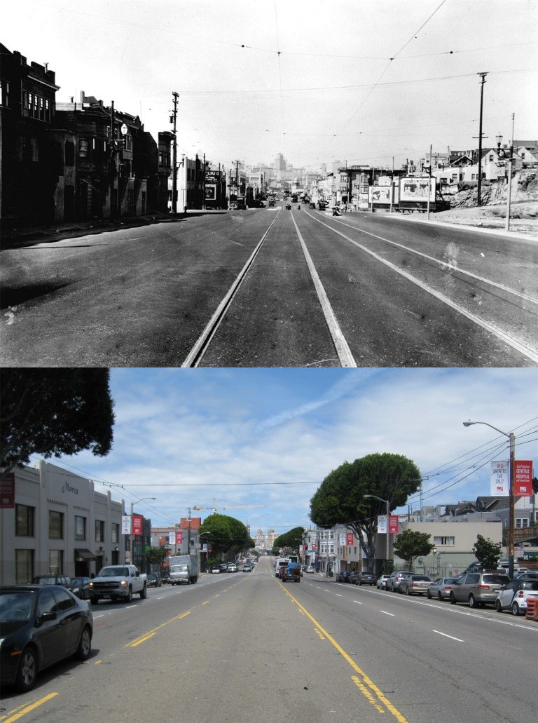 An image from the 1930’s looking north on Potrero Avenue at 19th Street: (Found SF)
 We’ll start with Bernal Heights. Its steep, winding and narrow streets made me wonder how anybody ever drove around this area before automatic transmissions were invented. Here we are at Mullen and Franconia in 1941.
  Cortland and Bradford, 1952: This must have been a nasty accident! Look at the distance between the banged up car near the damaged telephone pole and another damaged car further up the hill. (Bold Italics)
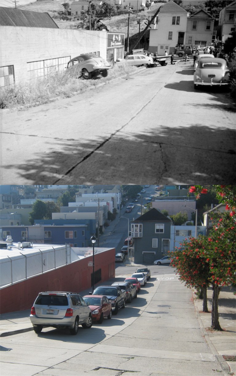 Here’s another angle of the accident. (Bold Italics)
 439 Cortland Avenue: They’ve changed from selling drugs to booze here. I suppose there’s a fine parable for that, but I don’t know what it is.
  Bernal Heights from Holly Park in 1973: (MaxKirkeberg)
 The views from Bernal Heights are among the best in San Francisco. Of course, it’s always recommended that you stay on the walking paths.
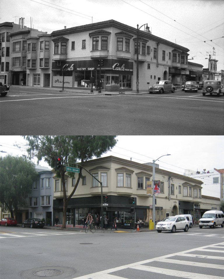 Now we’ll wander on down to the Mission District. You can do it in one day here on the internet, but I needed two days, and even that wasn’t enough to see most of these areas. Here we are at 18th and Guerrero Streets in 1947. (Uptown Almanac)
 An accident at 24th Street at Bryant Street in the 1940’s: The streetcar tracks are gone now, and you can’t see the Roosevelt Theater up the street anymore through the trees. The “Roosie”, as it was affectionately nicknamed, was a neighborhood movie theater that opened up in 1924 at York Street and 24th. The theater is still there, but it’s now called the Brava and is used mostly for performing arts rather than film today. (Uptown Almanac)
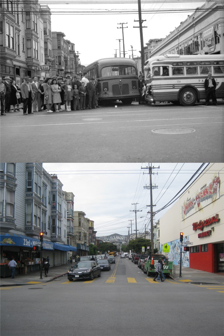 Another accident, two buses colliding at Mission and 23rd Streets in 1942: It could have been worse; I once read where a police bus and a cement truck collided into each other and ten hardened criminals escaped! I think I got that joke from the movie ‘Raising Arizona’. (Uptown Almanac)
 Still another accident, this time at 24th Street and Potrero Avenue: They needed to be more careful around here during the 1940’s! The person in the back of the ambulance being rushed to the hospital wasn’t having a red letter day!
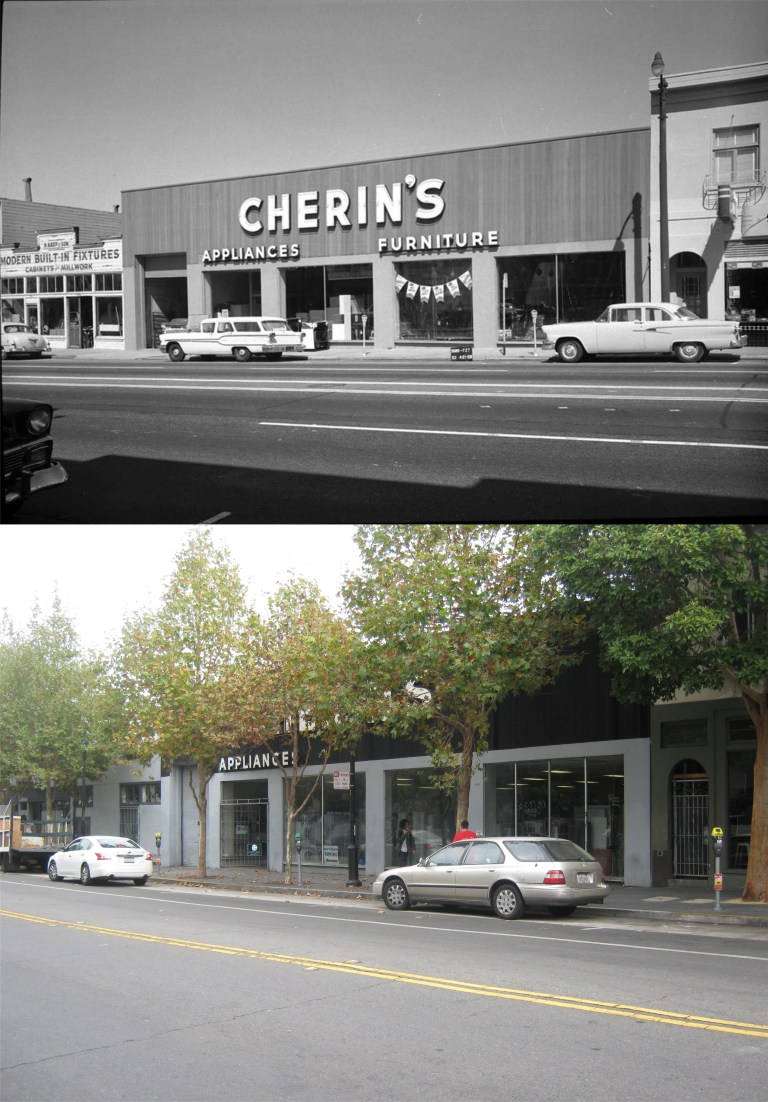 727 Valencia Street: Cherin’s is still there, but I can see how the store might be easy to miss on your first visit there nowadays. (Uptown Almanac)
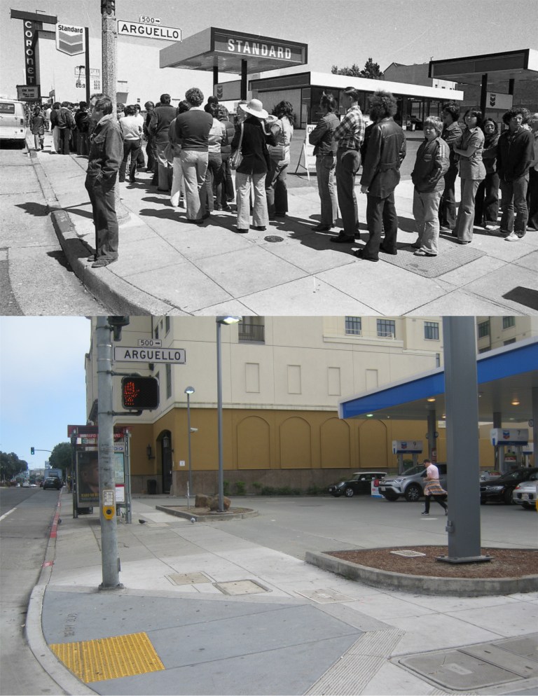 It’s a mild afternoon, so let’s take in a movie. How about Star Wars at the Coronet Theater in 1977? We’ll have lots of leisure time waiting in line for two or three hours! (Vintage photo from the San Francisco Chronicle)
 How about lunch at Fisherman’s Wharf, and a stroll around the boat lagoon with these three ladies, whoever they were? There are a lot more buildings on Russian and Nob Hills now, but you can still see all of the ones in the vintage picture in my photo.
 We’ll head out to Ocean Beach around 1972. Hope I can get the Cliff House in my picture through the fog! It wasn’t a bad attempt as far as bad attempts go, especially considering that you couldn’t see the Cliff House half the time. There’s some really strange looking people in that early 1970’s picture, particularly the lady with the child in the center. I have no idea what kind of a beach outfit that is! This was at the time that the Cliff House was painted blue with ocean waves around the top.
 Or, maybe, a leisure stroll through the “Oriental” Tea Garden is your cup of tea. The vintage picture is where the old entrance used to be to the Japanese Tea Garden, you can see it in the background of my photo. There have been a lot of changes to the landscape in the garden since the name was changed to the Oriental Tea Garden after Pearl Harbor. The original name was restored in 1952.
 We can spend to a pleasant afternoon listening to music in the old Music Concourse in Golden Gate Park, and then wander over to the DeYoung Museum; except, there’s never a band playing there when I visit. That’s the old art deco museum during the 1920’s.
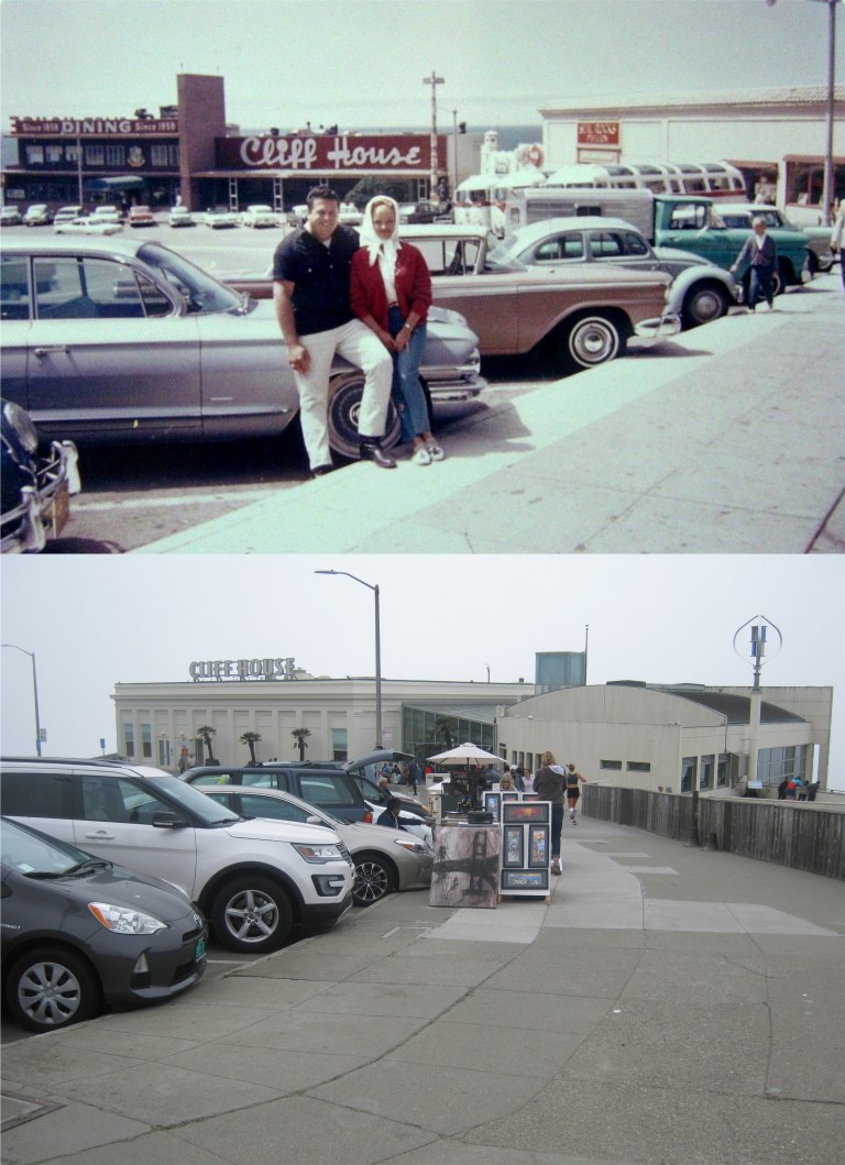 Well, if you’d like to ride the Sky Tram behind the Cliff House or ring the bell at sunset in the Redwood Dining Room we can hang around here for awhile! I never rode the Sky Tram, but I did listen to them ring the bell at sunset when the sun disappeared behind the ocean horizon quite a number of times.
 Would you like to do some shopping at the Cliff House Gift Shop? I know, there were a lot more items to choose from long ago, but it’s not a bad little shop today and I almost always buy something when I go in there.
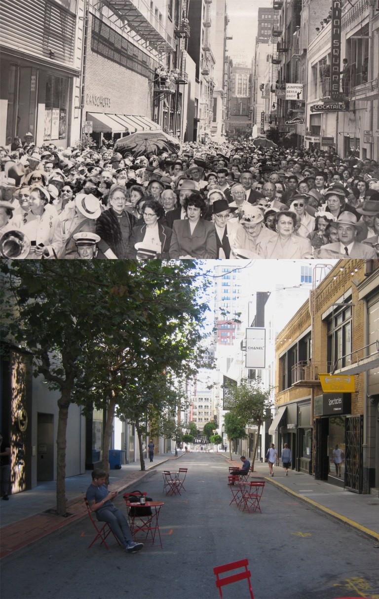 I don’t know what was going on in Maiden Lane in the 1955 vintage picture, but I’ve never seen it that crowded. The Union Square Lounge was a popular watering hole during the 1940’s into the 1960’s. It was where the Optik Store is now.
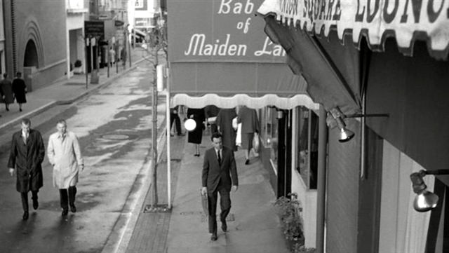 Jack Lemmon, in the center, goes into the Union Square Lounge at the beginning of his descent into alcoholism in the 1962 film ‘The Days of Wine and Roses’.
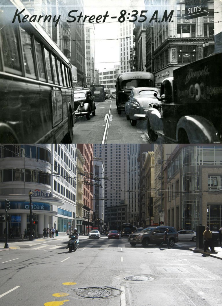 Kearny Street at Post in December of 1946, at 8:35 AM: My picture was taken at 1:35 PM, and I wasn’t as nervy as the 1946 photographer. I got my little…… camera out of the street before I was run over! (Vintage picture San Francisco Chronicle)
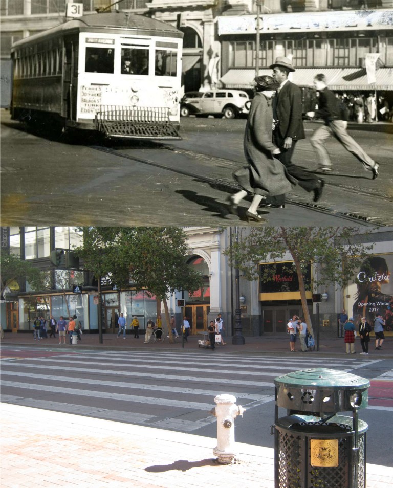 San Francisco almost got less crowded by three in this old 1940’s picture! Eddy Street used to cut through to Market Street here. The old 31 Streetcar Line that ran down Eddy to Divisadero Street would turn onto Eddy from Market right here. Now, Eddy Street stops at Cyril Magnin Street. The smaller arched entrance to the old Emporium Building is across Market Street in both photos. (SF Chronicle)
 In March of 1957 an earthquake centered near Daly City shook San Francisco. This image from OpenSFHistory.org on Post Street east of Grant Avenue shows some of the confusion and alarm by people in San Francisco. However, I don’t think that there were any reported injuries.
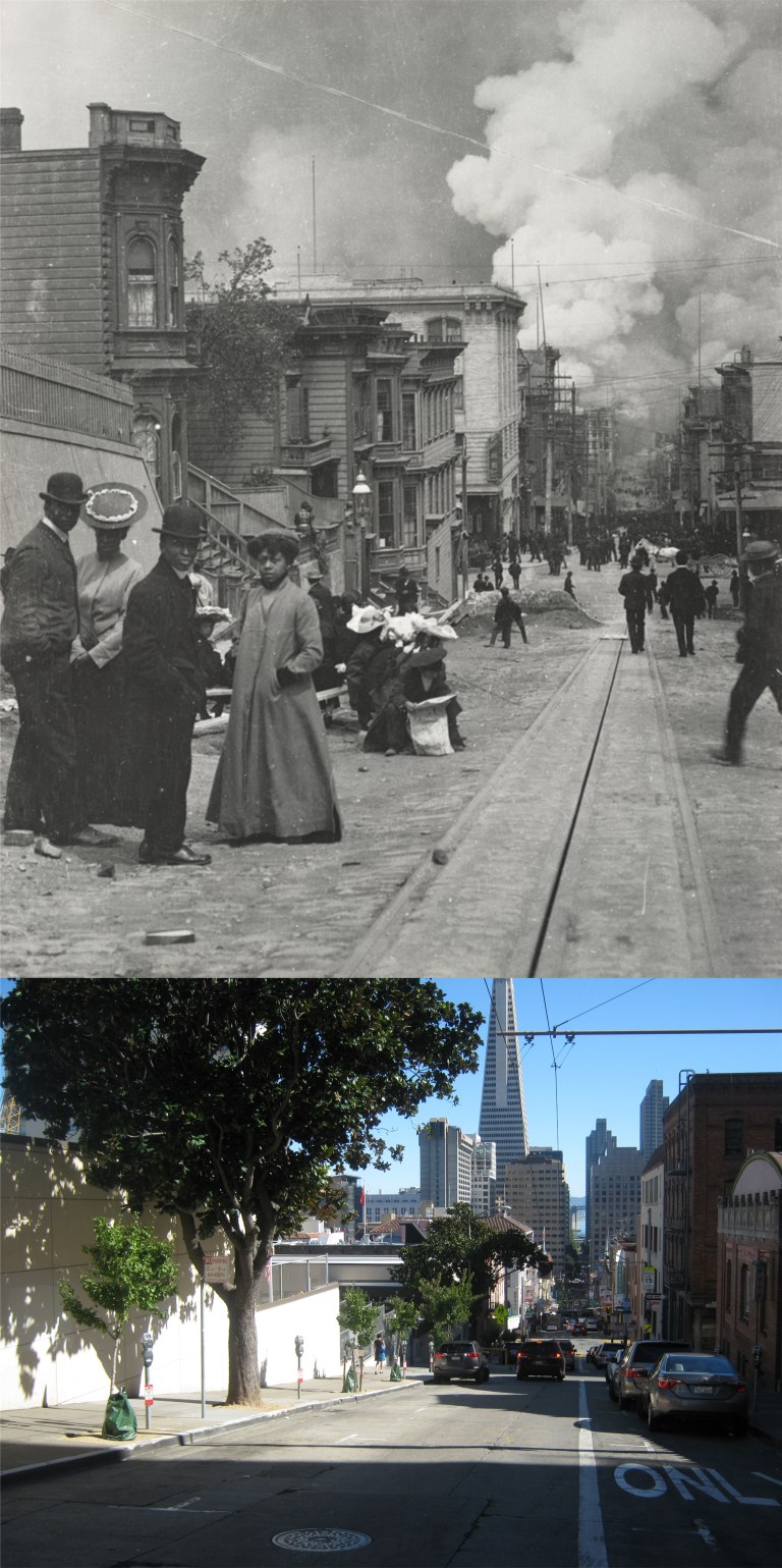 There was a lot more than confusion and alarm over one half of a century earlier on April 18th 1906; there was death and destruction. This terrific photo by Arnold Genthe looking down Clay Street just east of Powell captures it all. Personally, I think it ranks right up there with his more famous picture one block over looking down Sacramento Street from Powell.
 “Well that does it for me, I’m heading for Oakland!”
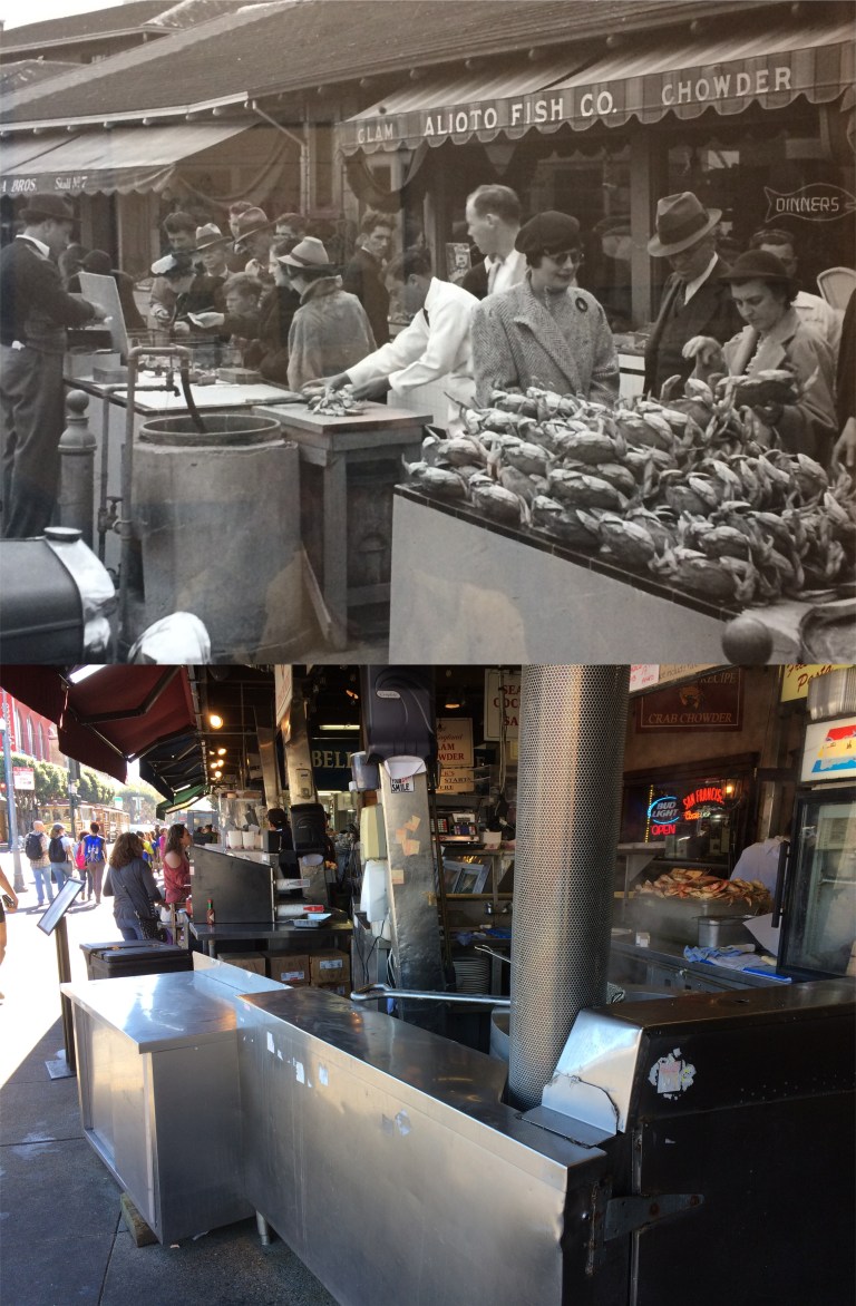 This little stretch of outdoor seafood shops at the end of Taylor Street at Fisherman’s Wharf was even more crowded in the 1930’s than it was today. The vintage photo is on the wall of the stairs leading up to Alioto’s Restaurant. Speaking of film noir, a number of movie and television noir scenes were filmed in this half a block of Taylor Street. Probably the most famous was ‘Nora Prentiss’ with Ann Sheridan filmed in 1947. The 1950’s television show ‘The Lineup’ also called “San Francisco Beat’, in my opinion the best on location show filmed in San Francisco, has a “bad guy” take down scene here in one episode. Also, a lady who works for the Market Street Railway named Alison Cant introduced me to a 1946 movie entitled ‘That Brennan Girl’ that shows a scene featuring the outdoor crab pots on Taylor Street.
 ‘The Lineup’ television show ran from 1954 until 1960 on CBS and was very popular. It featured historically entertaining locations such as a bomb scare at Seals Stadium, a suicide attempt behind the Cliff House where police drive their patrol car down the walking path to behind the restaurant, and a scene filmed at Fleishhacker Pool with a great look at the swimming pool and the old Pool house. I’ve only been able to find a few poor quality DVDs of the show. In this episode, in the upper left image, police close in on a lunatic at Fisherman’s Wharf who has been shooting people and planting bombs around San Francisco. The bad guy is the man in the center of the lower left image. The man to his left is a police officer pretending to be a customer. At the upper right is the police officer’s partner hiding behind a rack of postcards. I would have spotted him. In the lower right the cops take him down before he can draw his gun. The scene was filmed in front of the entrance to #9 Fishermen’s Grotto.
 The spot where the police “take down” in the above set of pictures from ‘The Lineup’ occurred:
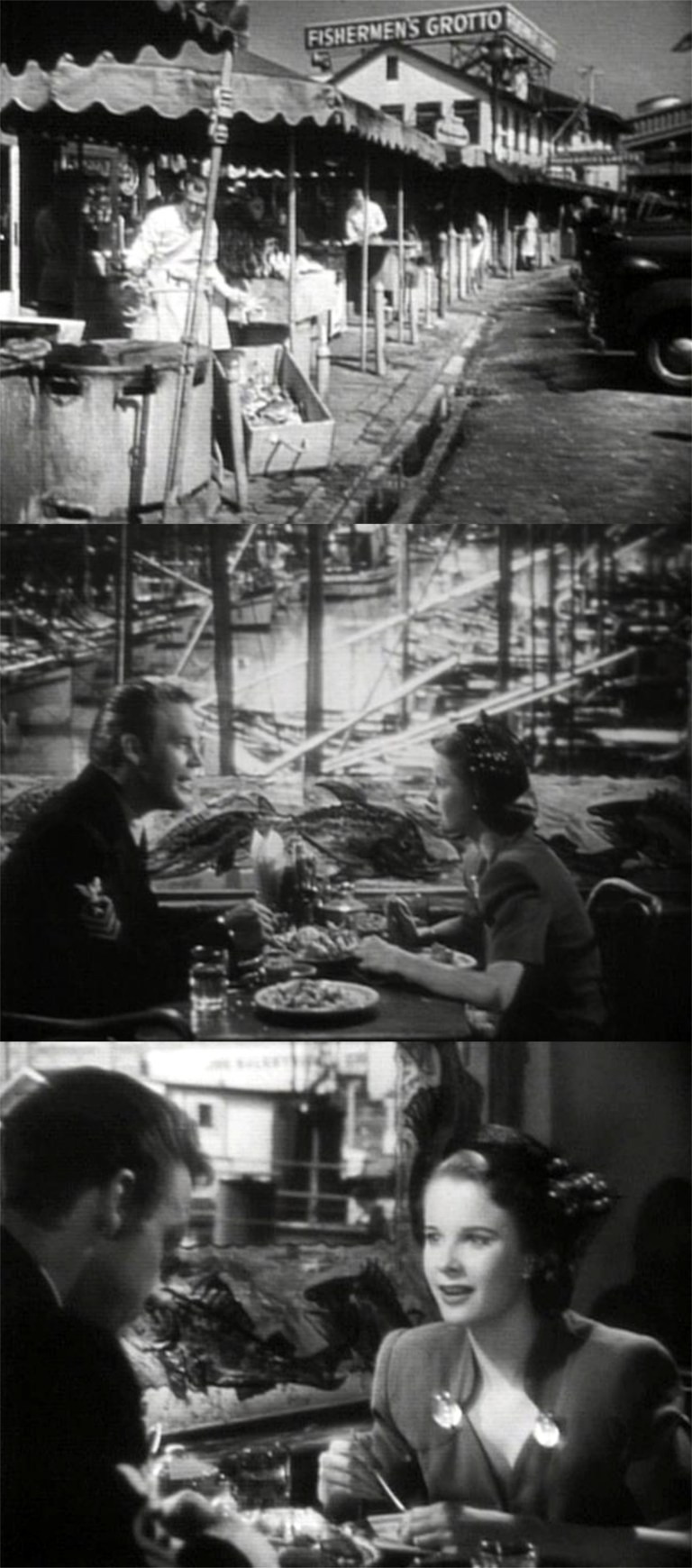 In ‘That Brennan Girl’, Mona Freeman portrays a rip-off artist named ‘Ziggy Brennan. (I like that name) Set during World War Two, Ziggy steals a watch from a sailor, but winds up going to lunch with him at Fisherman’s Wharf at a table overlooking the boat lagoon. Naturally, they fall in love, and naturally, they get married. Naturally, he dies in the war, and naturally, she has a baby. Because of Ziggy’s past associates, society judges her as an unfit mother. The top image from the film is how Taylor Street in front of Alioto’s looked in the 1940’s. This movie has some interesting on location San Francisco scenes for a B movie including a great tracking scene at the end along Market Street and the cable car turntable at Powell Street.
 The same stretch of Taylor Street seen in the top image from the above set from ‘That Brennan Girl’ and the Fisherman’s Wharf Lagoon from Alioto’s Restaurant:
 “Steve McQueen! It was awesome the way you took after those bad guys in your Mustang! Why are you here on Broadway?”
 “Sidney Poitier! What’s that contraption you’re going into here near Fisherman’s Wharf?”
 The building behind Sidney in the top movie image is the Longshoremen’s Hall on North Point Street.
 “Cindy Williams! What are you looking deep in thought about here in Union Square?”
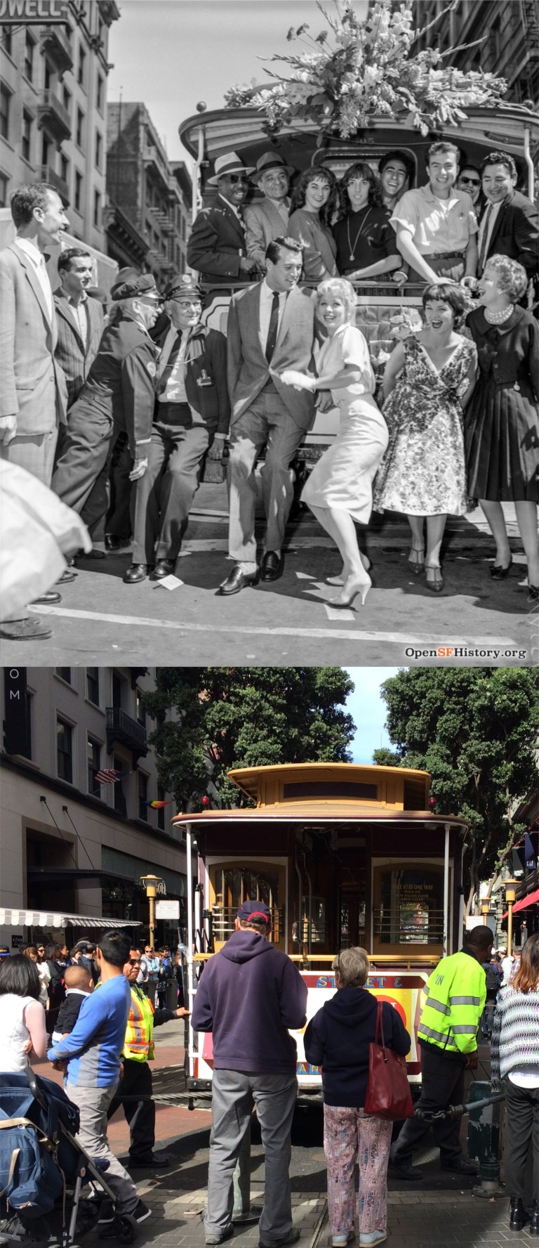 “Rock Hudson! What on earth are you doing here at the Powell Street cable car turnaround?”
 “Barbara Lawrence! You look cross!”
 “Charlie Chaplin! Does your back hurt?”
 “Humphrey Bogart! What are you doing up here on Russian Hill?”
 Getting around San Francisco by car can still be convenient on the occasional times when traffic is light, like the last time it was on Lombard Street in 1922. (OpenSFHistory.org)
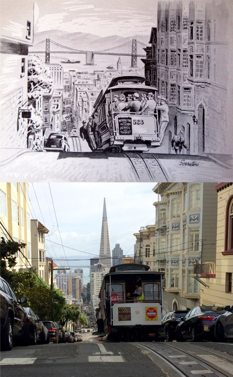 Although, not as convenient of a way to travel as they once were now that there are only three lines, they’re still the best way of getting up and down San Francisco’s steep hills.
 The bus, or in this case the “motor coach”, is still the most practical way around town. Once you could ride on a Muni bus for up to six hours sometimes on a single fare. Unfortunately, they recently cut their transfer allowed time down to no more than 90 minutes. Muni will never be as inexpensive again. What can you do? The Muni bus in the top photo is from circa 1935. The lower picture is a similar motor coach passing the old Southern Pacific Building at the foot of Market Street. (SFGate)
 A police escort is an easy way to get around town, like here on Post Street next to Union Square in 1952, but I usually turn those down when they offer them to me. (Shorpy Collection)
 “The roar of the four” is how they referred to the four streetcar lines that ran along Market Street, and you can still ride old streetcars along Market today. I didn’t get a “roar of the four” but I did give a “Gee!” for the three on Market Street between Stockton and Powell Streets today; two streetcars and a bus.
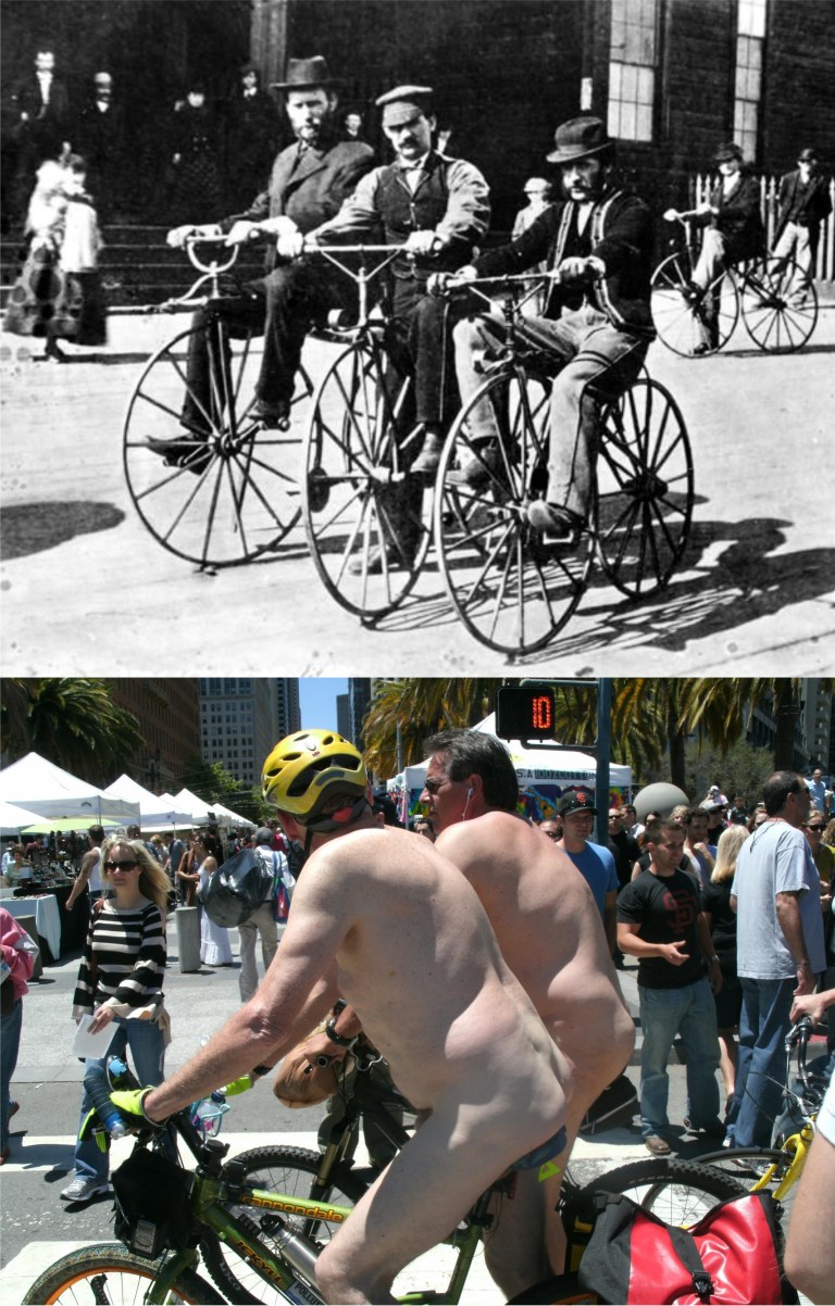 Long before automobiles were invented, bicycles were a great way to get around San Francisco. They still are…… although, that’s not the usual attire when bike riding around the city. I, kind of, felt sorry for that girl crossing the Embarcadero over to the Ferry Building.
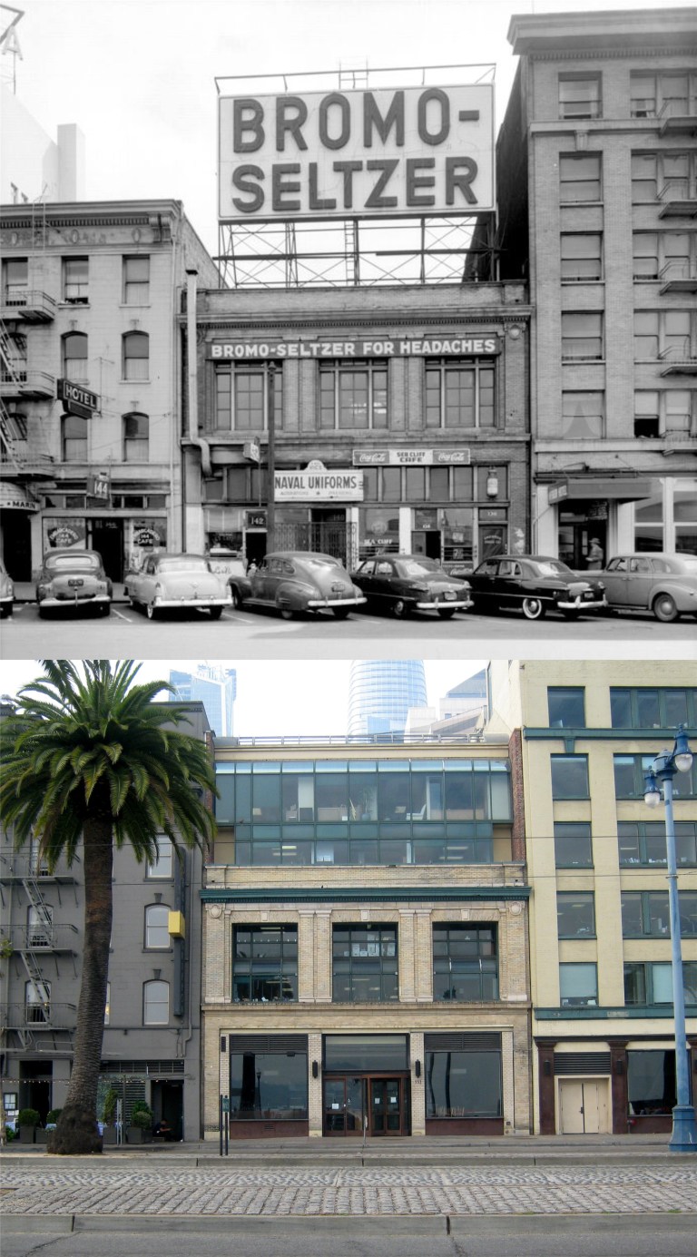 The 100 Block of the Embarcadero: Bromo-Seltzer, the famous hangover treatment; I logged a few doses of that myself. According to Wikipedia it was removed from the market in 1975 because of a toxic sedative in the ingredients. The vintage picture is from 1951.
 I didn’t have too hard a time finding where the previous picture was taken; I’ve seen the 1958 movie ‘The Lineup’ too many times. Here, hit man Eli Wallach walks across the Embarcadero to the old YMCA Building to knock off his first victim.
 The 800 Block of Market Street: The view is toward the Powell Street cable car turntable next to the Flood Building. Look how small the crowds were in the vintage 1950s picture from OpenSFHistory.org.
 The 400 Block of Sutter Street: A lonely looking Sergeant, it looks like, walks past the garage entrance to the Sir Francis Drake Hotel during World War Two.
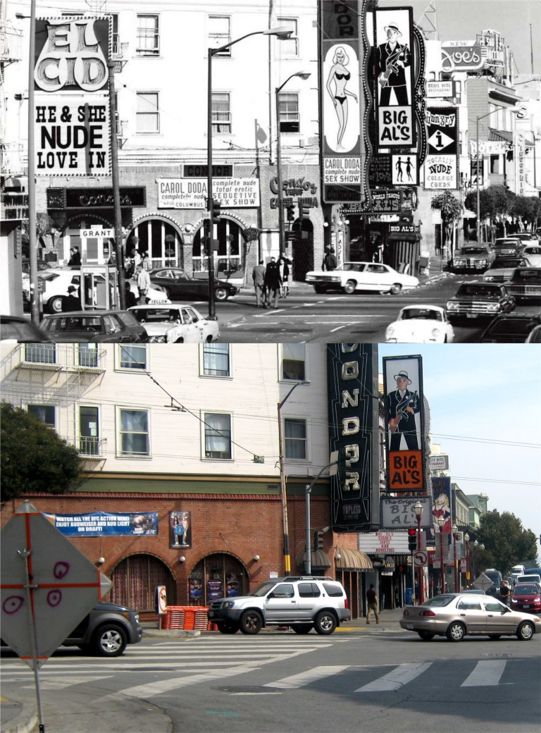 The 500 Block of Broadway: The sex and sin area of the International Settlement moved up one block to Broadway in the 1960s, probably due to Carol Doda, who died in 2015. Most of the strip clubs closed down by the 1980s, and this section of Broadway became something of a ghost town by the 1990s. This area has picked up again with new clubs to hang out at and the nighttime crowds are back.
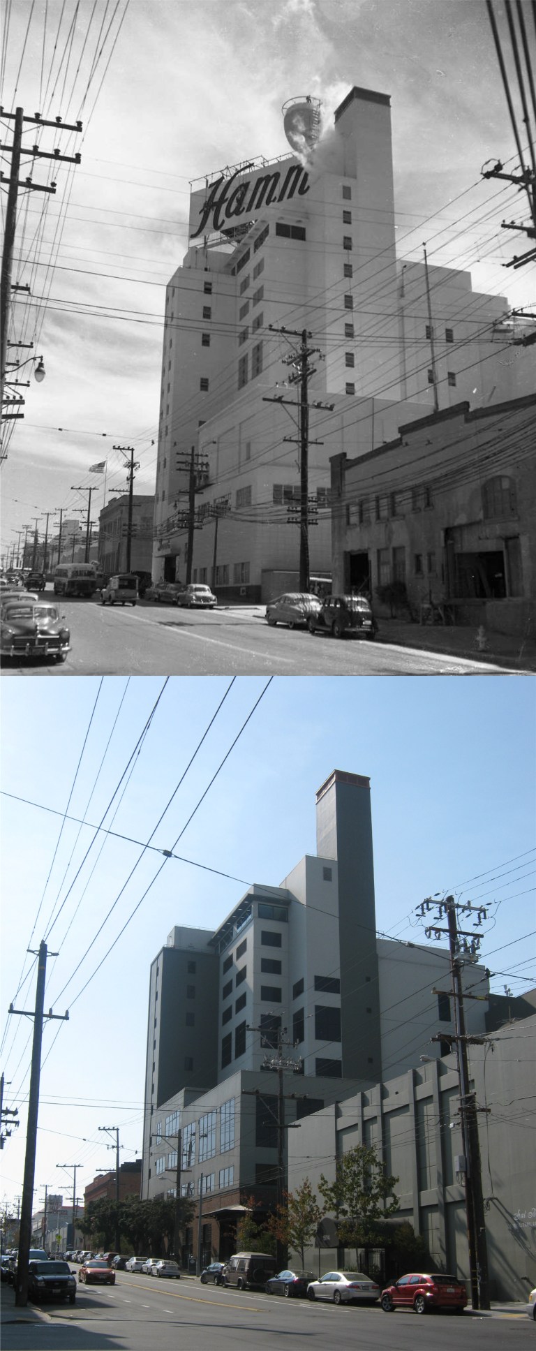 The 1500 Block of Bryant Street: The old Hamm’s Brewery on Bryant Street, closed in 1972, will bring back a lot of memories to older baseball fans in San Francisco. Just across Bryant Street from the brewery was where home plate at Seals Stadium was. (SF Chronicle)
 A Flickr Photo shows Seals Stadium from the air. The minor league stadium for the San Francisco Seals was built in 1931 and demolished in 1959. Joe DiMaggio hit safely in 61 straight games when he played here in the minors. The major league New York Giants played their 1958 and 1959 seasons here while they waited for Candlestick Park to be built. The street on the right is Bryant Street, the street at the top is 16th Street.
 The 2300 Block of 16th Street: A bus stop on 16th Street is now where fans once entered Seals Stadium.
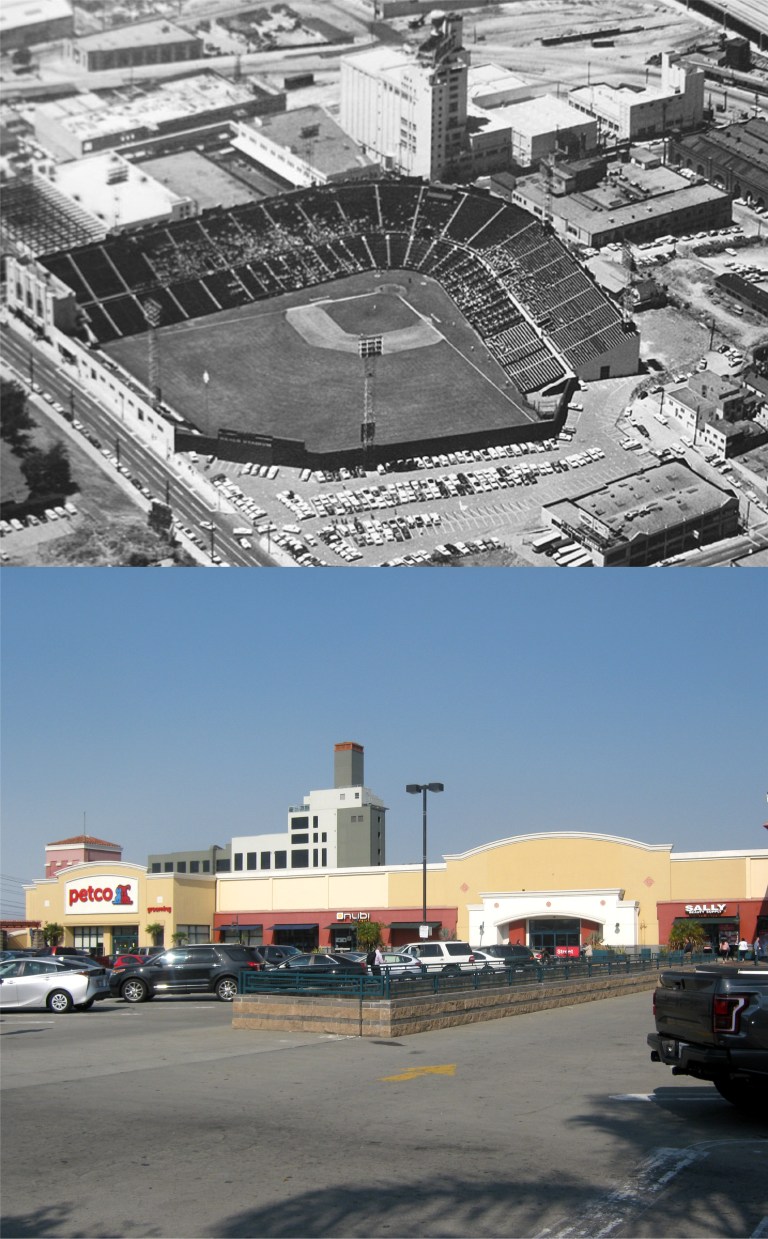 Potrero Center now occupies where Seals Stadium was located. In a vintage FoundSF.org photo of Seals Stadium from the air, the Hamm’s Brewery can be seen at the top of the picture. I took my picture from about where deep center field close to the right field side was.
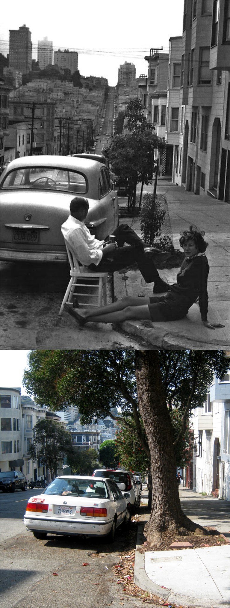
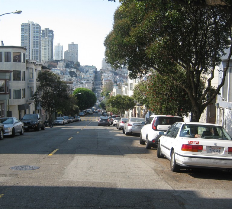 The 400 Block of Union Street: A couple relaxes on Union Street at Genoa Place in the 1950s. Their little tree has grown quite a bit now and blocks the view of Russian Hill from this spot today. I had to go out in Union Street a ways to get Russian Hill into the picture in the lowest photo.
 The top picture was a slide that I took of the Jeremiah O’Brien in 1985 when she was still tied up at Fort Mason. The bottom picture was of the visitors logging in for yesterday’s cruise. They served free beer all day long on the ship so we got pretty well logged when we got aboard too!
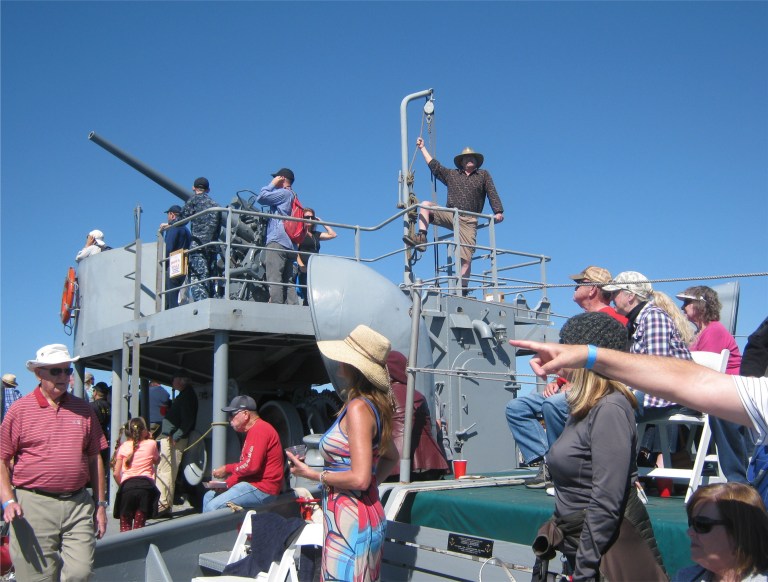 Self appointed Quartermaster, Brother Kevin, near the forward gun, attempts to take charge.
 “Fire at will!”
 It was so calm that when we went under the Golden Gate Bridge the people on the ship and the people on the bridge were yelling back and forth to each other! I was still at the gun, so I yelled, “Which one of you is Will?”
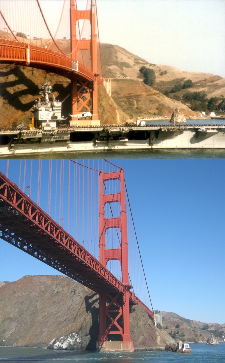 There was much more of a navy presence when I took the top picture from Fort Point on Fleet Day, 1985. The crew of the ships would stand at attention for San Francisco, and it was really something to see! I’ll have to look the number up and see what carrier that was.
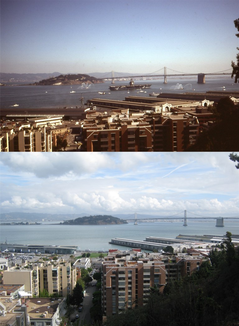
 These two pictures I took from Telegraph Hill on Fleet Day in 1986, in the top photo, and 1983 in the lower picture. Remember, this was still during the Cold War and there were a lot more active navy vessels in the fleet back then.
 The price of the ticket included a stunning bridge to bridge tour, all of the coffee, donuts, hamburgers, hot dogs, sodas, and beer you can hold for free, and a sunburn on your face if you’re like some dummy whose name we won’t mention who didn’t bring sunscreen! You can see one of the navy ships that came in for Fleet Week docked on the left of the Bay Bridge picture.
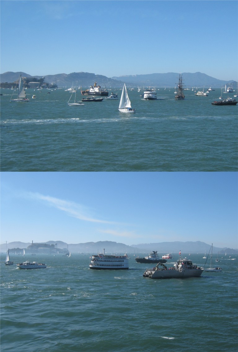 The ships begin to gather near “The Rock” for the air show:
 We had a fly over from a 747 as part of the show.
 The Blue Angels are awesome, but to me, the best part of the show is always San Francisco Bay. The video below is a little bit of both.