
These are three picture sets of vintage picture updates I took around San Francisco in the past that I redid last week. The top pictures are the vintage pictures, the middle pictures are my first updates when San Francisco was a bustling town, and the bottom photos were taken at the same spots only a lot less crowded right now due to the Covid-19 outbreak.
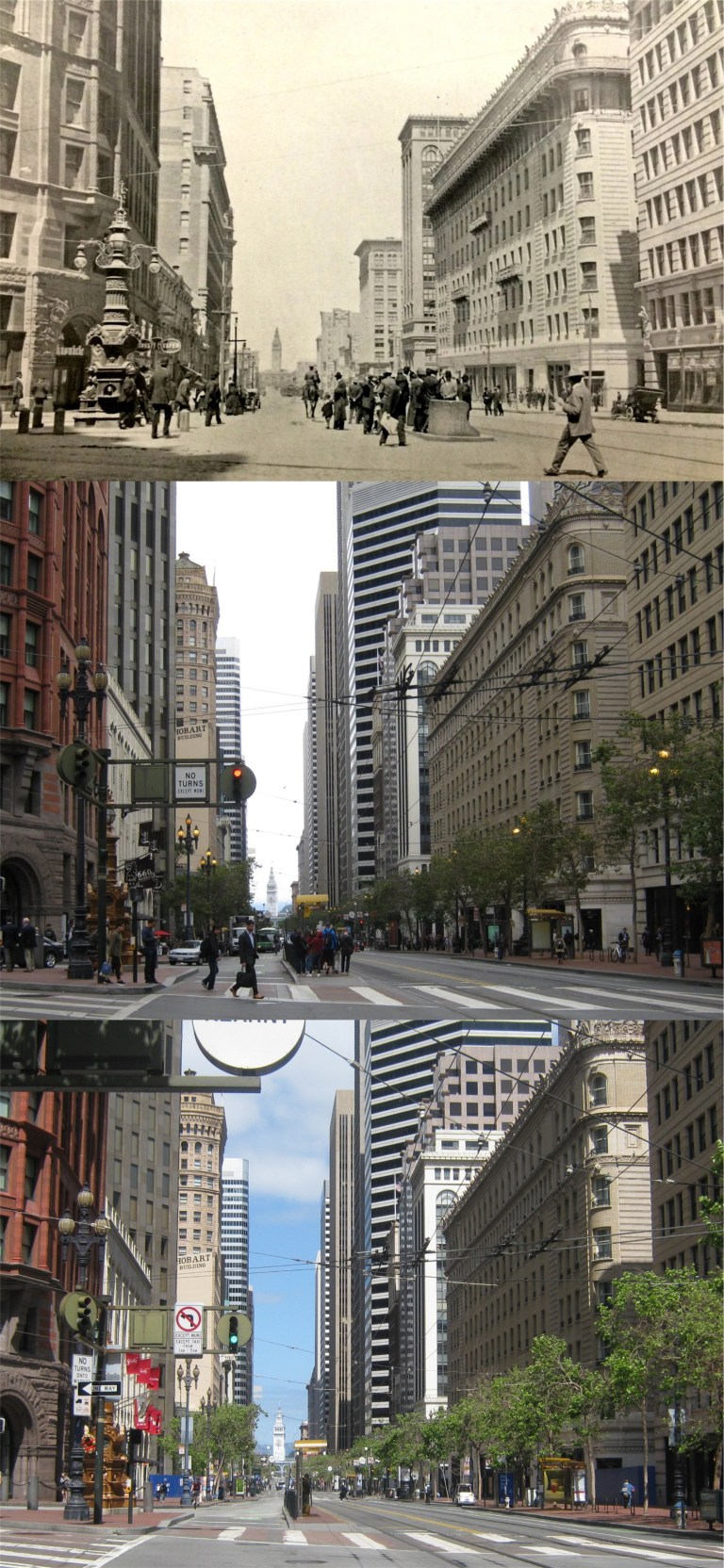 Market Street at Kearny: The top picture from the San Francisco Library History Room is from 1910, the center photo is from 2016, the bottom photo was taken April 18th 2020, the anniversary of the 1906 Earthquake and Fire. For almost one hundred years survivors of that disaster met at Lotta’s Fountain on the left at the exact time and day of the earthquake.
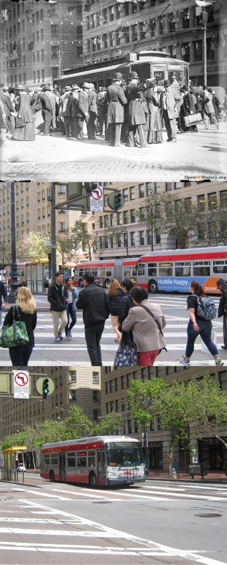 Another picture taken in 1910 at Kearny and Market Streets looking toward the Palace Hotel on the left: The middle picture was taken in 2017. (opensfhistory.org)
 The corner of Powell Street and Geary, looking from Union Square: The top picture is from 1948, the middle picture was taken on Veterans Day, 2016.
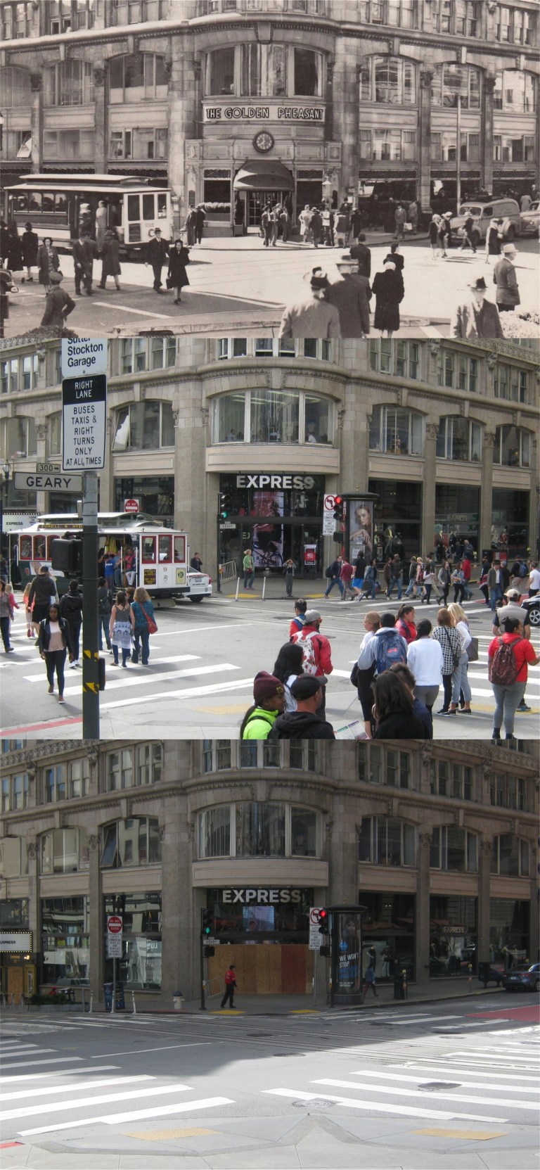
 Stockton Street at O’Farrell looking north: The top photo from the San Francisco Chronicle was taken in 1951, the middle photo I took on “Black Friday”, November 24th 2017.
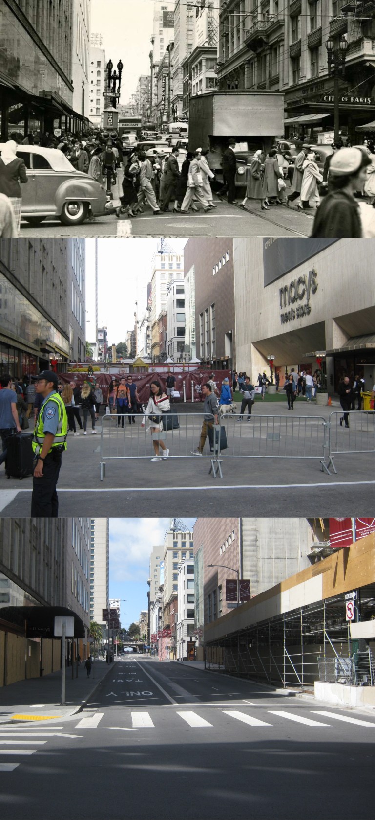
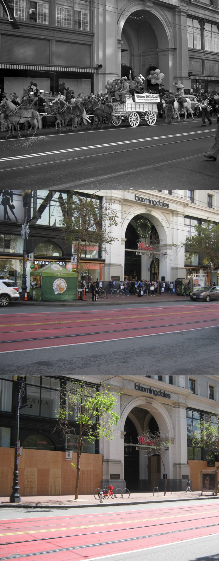 Another photo from the San Francisco Chronicle in front of the Old Emporium Store taken in 1949: My picture in the center was taken on “Black Friday” in November of 2017. Many of the closed businesses along Market Street, like Bloomingdale’s where the old Emporium was, are boarding up their windows during the shelter-in-place order still in effect.
 This August 14th will be the 75th anniversary of VJ Day when Japan surrendered ending World War Two. The top picture is vintage film footage from C. R. Skinner on Market Street at 7th looking east as San Francisco celebrates the end of the war. A tremendous crowd in the background where the streetcars have stopped is surging up toward the cameraman. Also in the background, the Flood Building on the left of Market Street, and the crowned Humboldt Bank Building across Market Street on the right can be seen in all three photos. A million on Market Street was the estimated crowd gathered to celebrate the parade for the San Francisco Giants first World Series victory on November 3rd 2010 when I took my comparison picture in the middle. Although not as important as the end of World War Two, I waited most of my life to see this and I wasn’t going to miss it.
 I had that song stuck in my head when I went over to SF yesterday. I heard that they may be discouraging people from going to Ocean Beach during the pandemic, but there isn’t any problem; people are practicing social distancing, and there were plenty of social distancing police on hand to make sure they behaved.
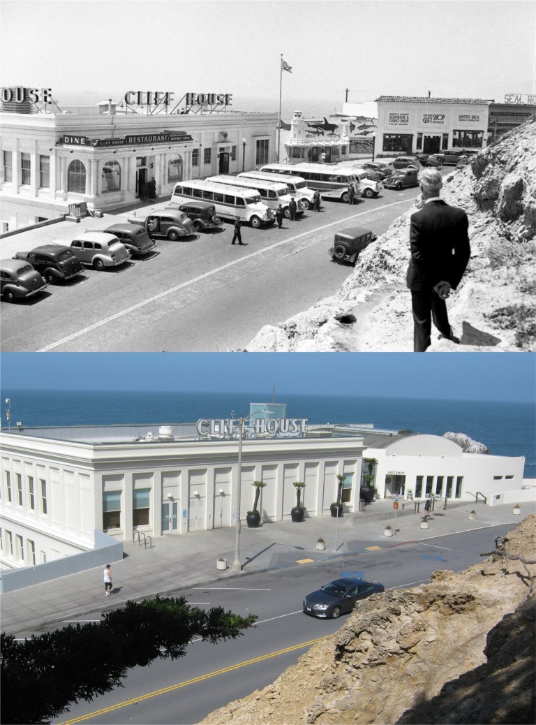 A stranger on the shore on Sutro Heights above the Cliff House: (Pinterest and ebay)
 A view of Playland-at-the-Beach from Sutro Heights in the 1970s near the end of its run: You can see the Funhouse and Merry-go-round in the upper right. The new then Safeway in the upper left is still there. (mksgrist.wix.com)
 Looking down Point Lobos Road past the Cliff House and Sutr0 Heights toward Ocean Beach in the 1940s: (Pinterest)
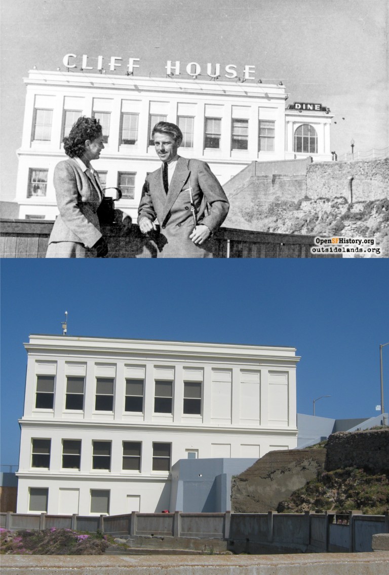 Two strangers on the shore, Although maybe not to each other, at the Cliff House in the 1940s: (opensfhistory and outsidelands.org))
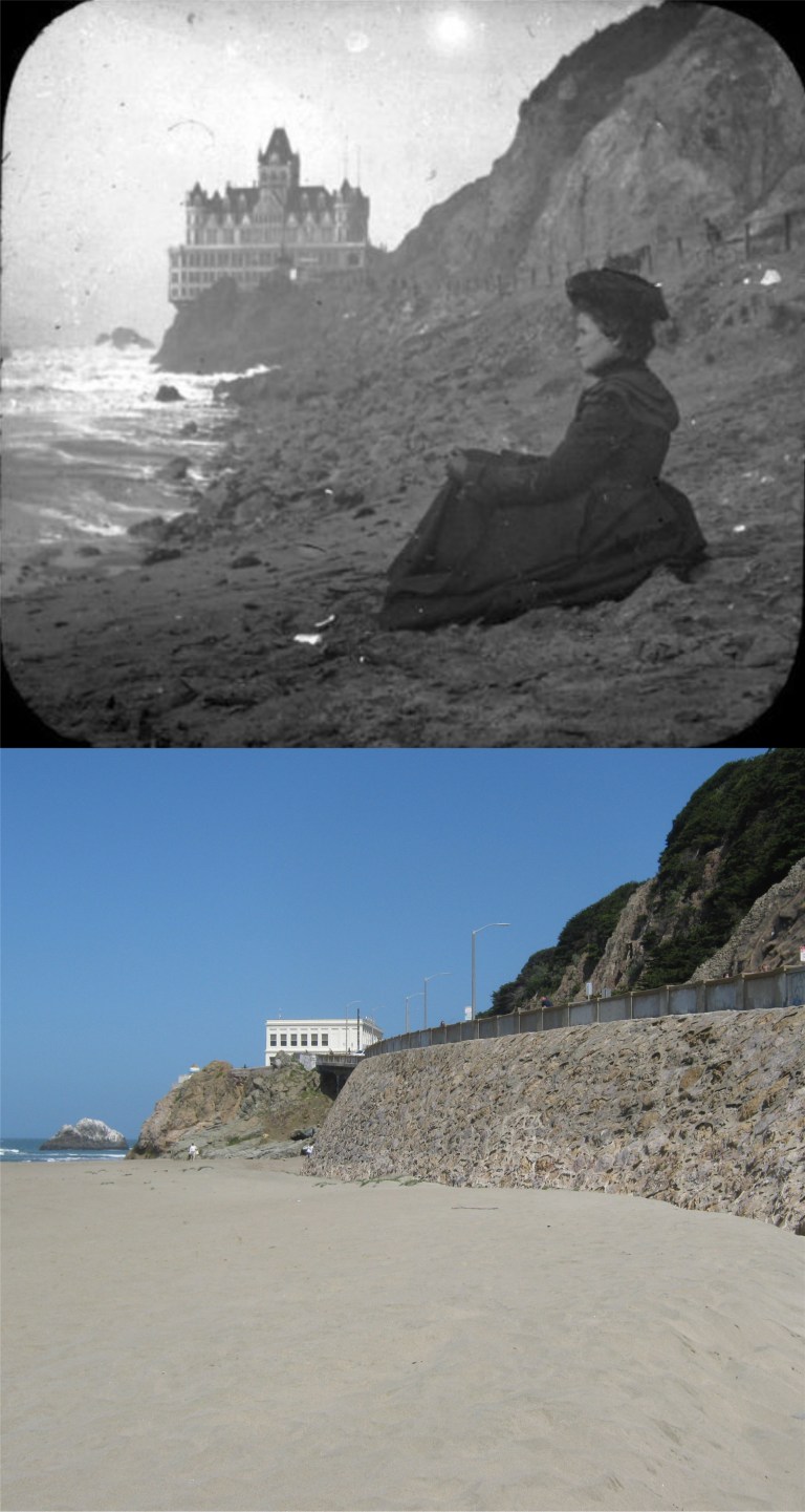 A Victorian stranger on the shore: (Vintage photography)
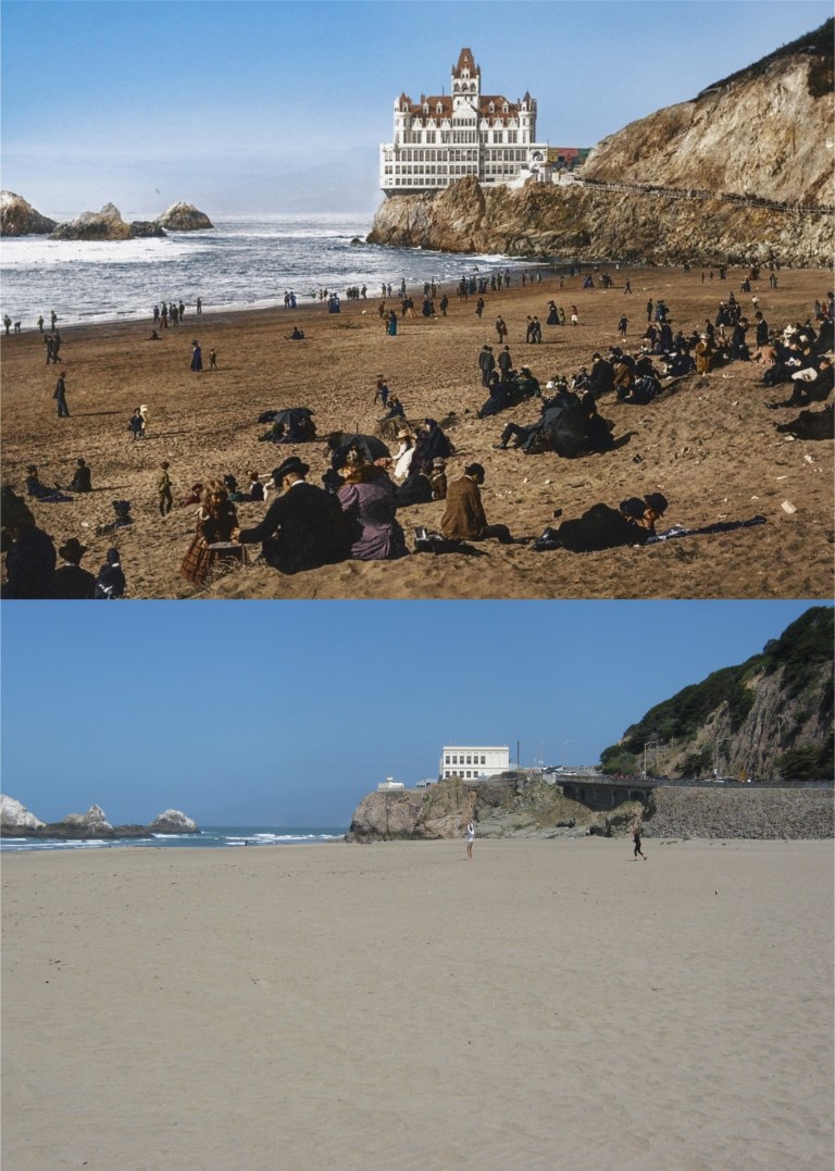 A great colorized picture of Ocean Beach circa 1900: It may be gloomy thinking, but it’s possible that some of the people in the vintage photo died during the Spanish Flu Pandemic of 1918-1919. At any rate, they’re all gone now. (Reddit colorized by Jordan Lloyd)
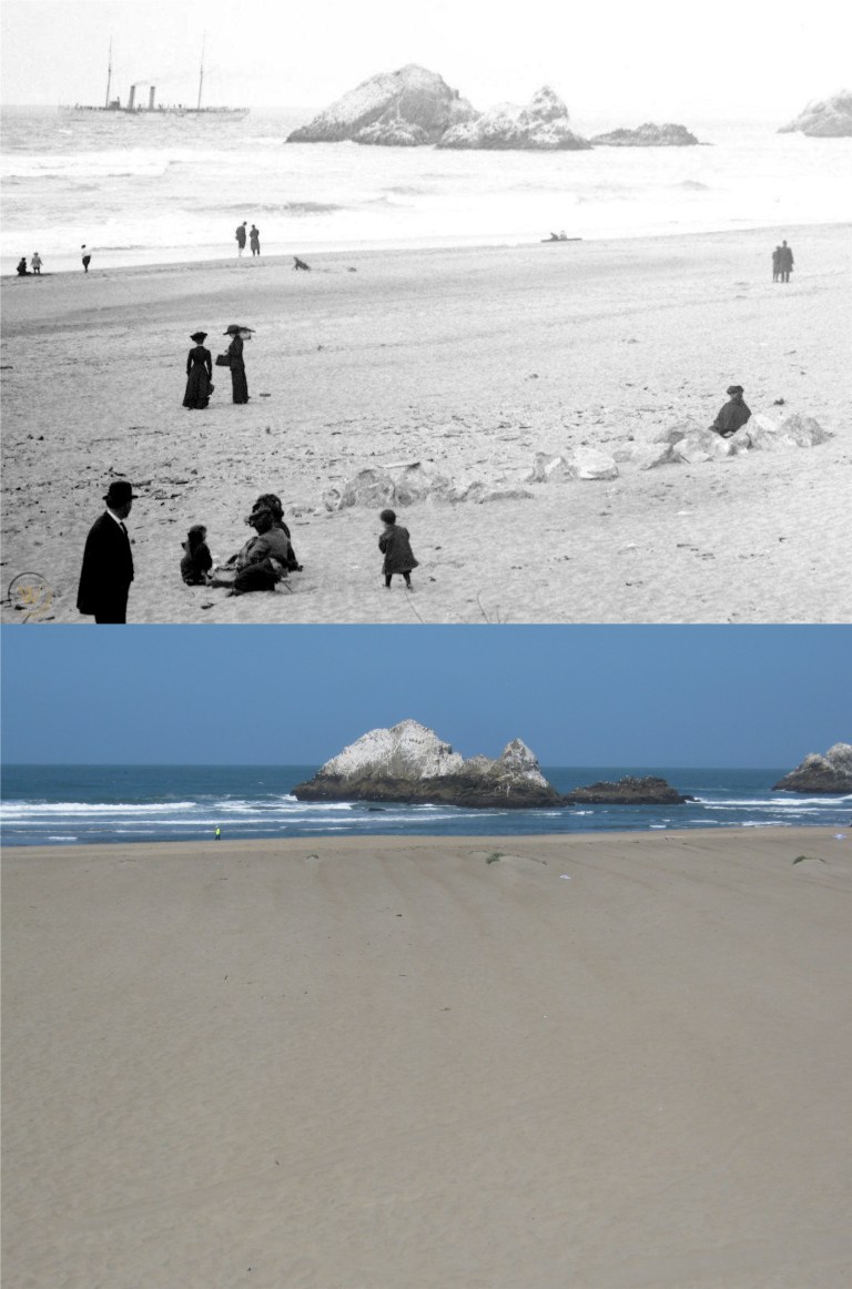 Families on Ocean Beach with Seal Rocks in the background in the late 1800s:(Worthpoint.com)
 So 1970s! They removed the steps on the seawall by the 1980s. (Pinterest and ebay)
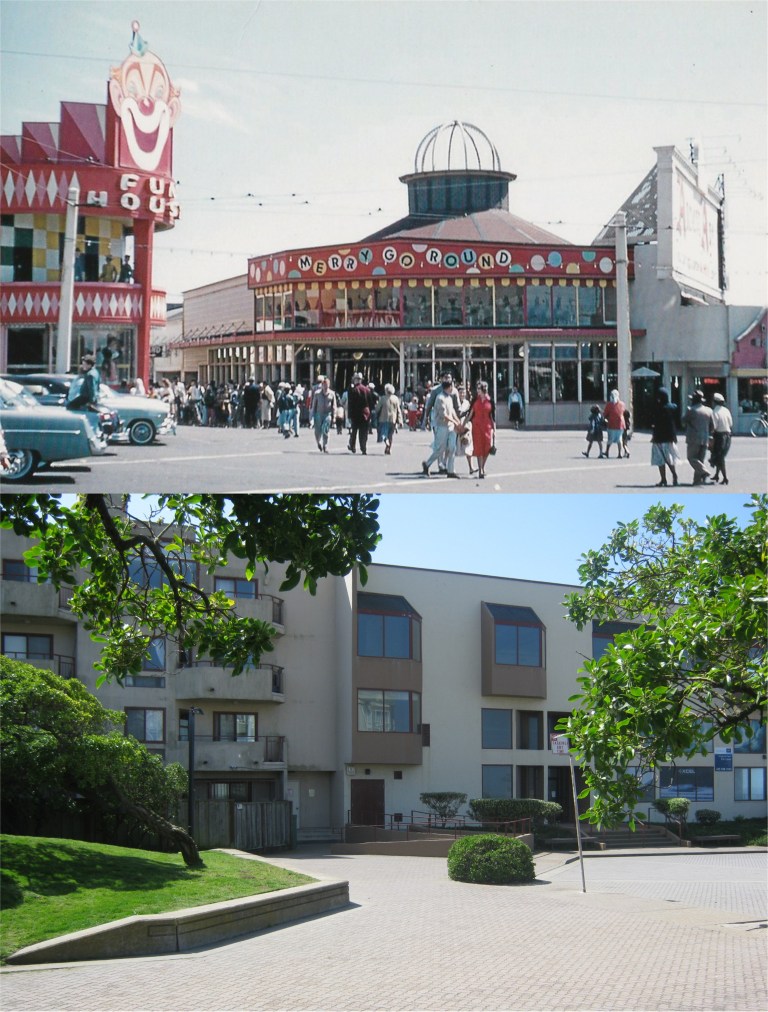 For those who remember Playland-at-the-Beach, and I do, the Funhouse was on the left behind where the grass embankment is now, the merry-go-round was in the center where the condo is. (Flickr)
 Looking down the end of Taylor Street toward Pier 45 in 1975: (Peter Stratmoen)
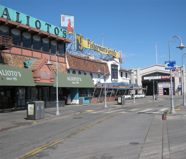
 Looking toward the #9 Fishermen’s Grotto Restaurant in 1960: (opensfhistory.org)
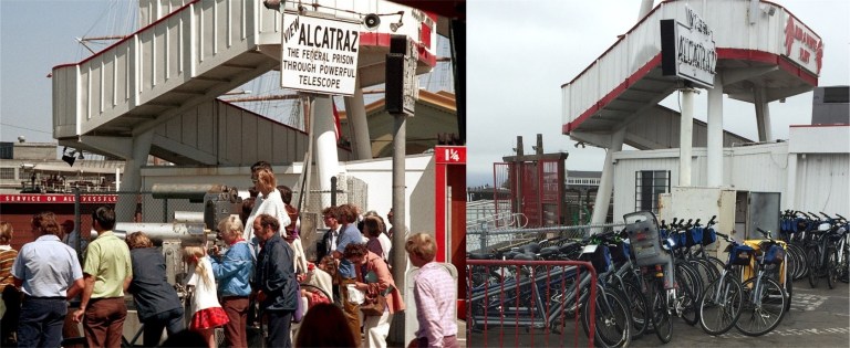
 Tourists viewing Alcatraz Island through telescopes near Pier 43 ½ in the 1970s:
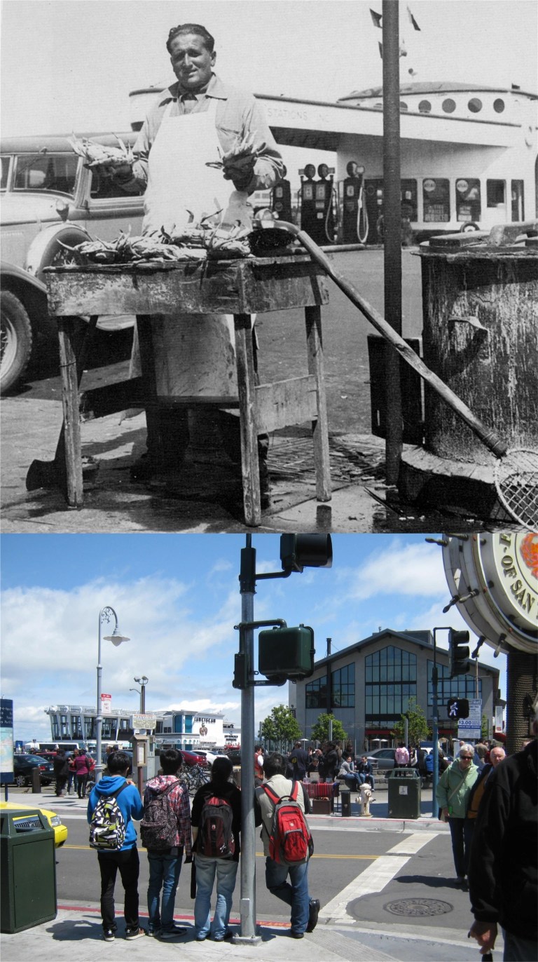
 Looking east from the northwest corner of Jefferson and Taylor Streets in the 1930s: The gas station across Taylor Street that was still there until the 1970s was originally designed to look like a ship. (National Maritime Museum at San Francisco)
 WACs and soldiers working up an appetite in front of #9 Fishermen’s Grotto, looks like during the 1950s:
 Lee Remick crosses Jefferson Street at Taylor to a taxicab that will take her to Candlestick Park for the denouement of the 1962 film ‘Experiment in Terror’.
 Looking toward Ghirardelli Square from Hyde and Jefferson Streets in 1975 in a Peter Stratmoen photo: Hey, they’ve removed all of the trees that were in the updated picture I did in 2016.
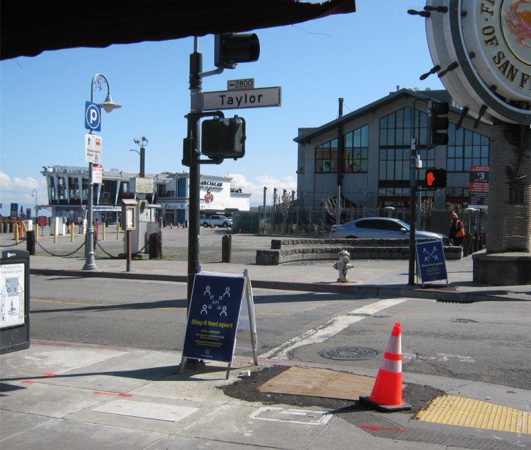
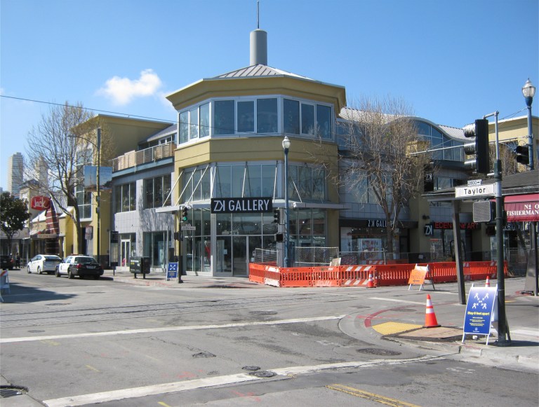
 Looking south along Taylor Street across Jefferson in the 1950s; The Wharf was still packed when I did my first update in December of 2018.
 I observe very little “social distancing” at Ocean Beach in 1948. (opensfhistory.org)
 The Cliff House closed up tight and there’s still little parking in front. That’s because the Ocean Beach Parking Lot has been closed off and people are still going to the beach.
 The Beach Chalet on the western edge of Golden Gate Park in 1963; now closed and quiet. (San Francisco Chronicle)
 Alamo looking northeast toward the “Painted Ladies” after the 1906 Earthquake: (Vintage photo from the California Academy of Sciences)
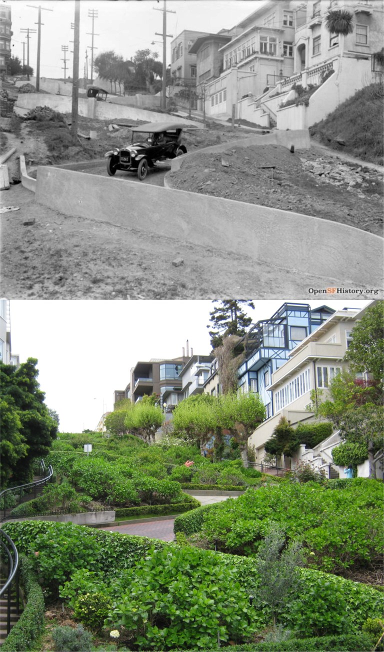 The famous Lombard Street, between Hyde and Leavenworth Streets, is still open to traffic, but there are few cars or people visiting the tourist site. (opensfhistory.org)
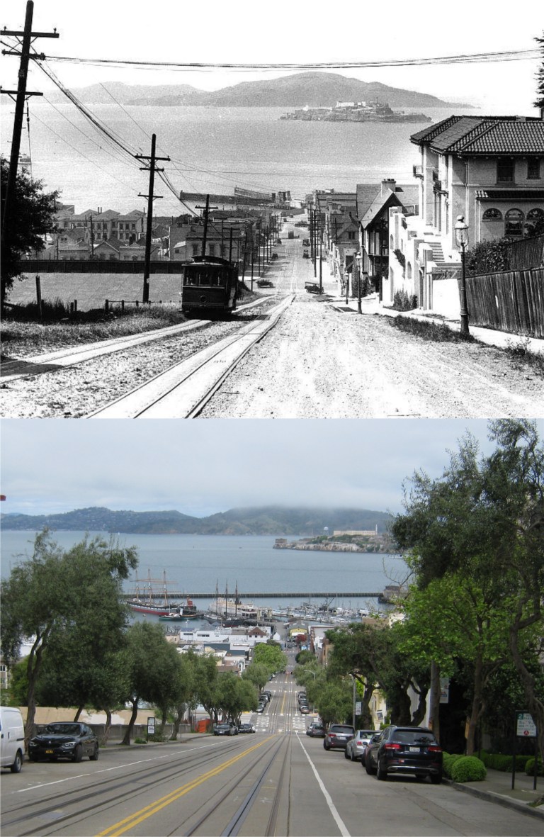 The Hyde Street Gripless! The best portion of the entire cable car system looks even quieter than the old 1920s photo.
 A closed and empty Golden Gate Bridge Promenade last Friday and in June of 1987 with me and some of my family: This area has changed a lot since then.