
b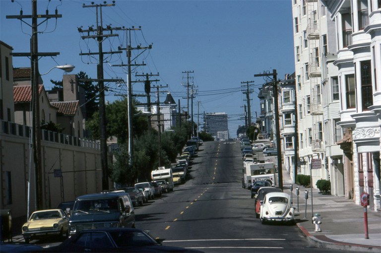

 I took a lot of slide pictures around San Francisco during the 1980s and I’ve posted a number of them here on my site. Most of my slides I remember where they were taken or the locations are easy to identify, but these top four slides from 1985 I couldn’t place where they were taken at. I put the pictures on a Facebook page called San Francisco Remembered and asked if anybody recognized the spots. Many of the members of San Francisco Remembered know the city better than anyone I know, and there’s always someone in the group who can identify a San Francisco street or area. Well, the San Francisco Remembered group members didn’t help me locate where my pictures were taken; they identified the spots right down to a T. I also learned from where members said that the pictures were taken that I probably took them all on the same day.
 This was taken from Market Street, looking north where Hermann and Laguna Streets meet. I think my old picture would have been from aboard the MUNI Boat Tram that I probably was riding along Market Street on as we passed by. The wall and buildings on the left have been remodeled and new ones built since 1985.
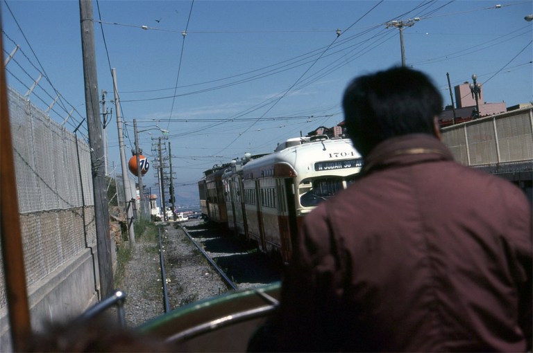
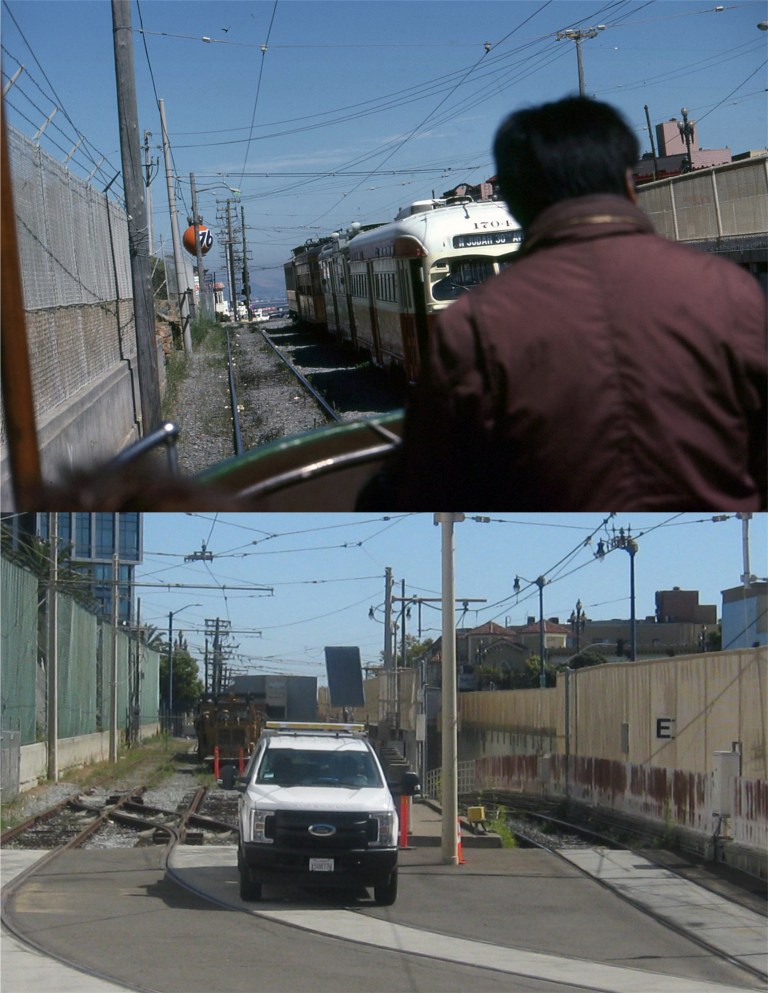 I thought we must have been going into a tunnel on this one. MUNI started running old streetcars along Market Street around 1984 or 1985; this was before the F and E Lines of old streetcars running along Market Street and the Embarcadero today were placed in service. It looks like I was riding at the back of the number 228 Boat Tram from Blackpool England when I took my picture. Turns out I was on Duboce at the bottom of the U. S. Mint, which was on my left. This was close as MUNI officials would let me get yesterday to get my update.
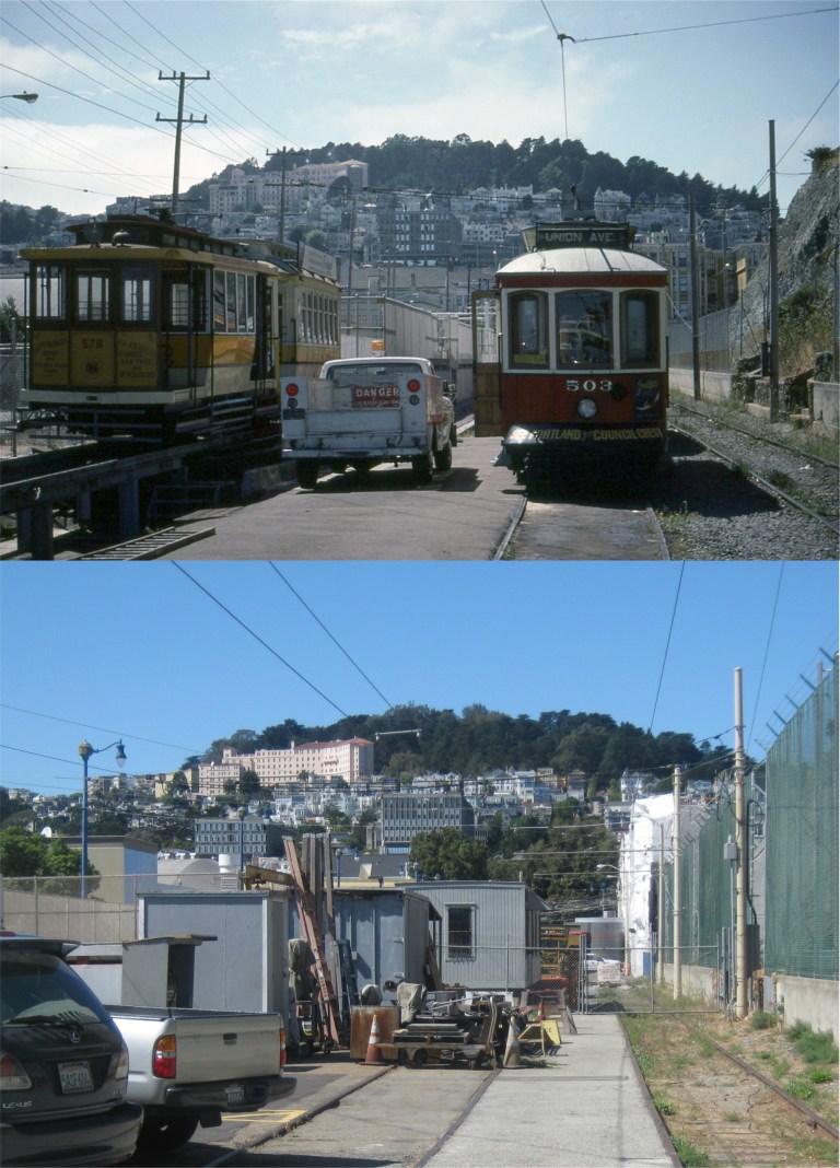 This looks like it must have been the end of the line for the Boat Tram ride. The street car can’t turn around so I wonder how I got back! Actually, there was a turn around and you can see where the tracks were in the update I did of the previous picture. This is looking west toward Buena Vista Park in the opposite direction from the previous picture. The mountain that the U.S. Mint sits on is on the right. The little “Dinky” on the left they were working on in 1985 still runs along Market Street and the Embarcadero occasionally.
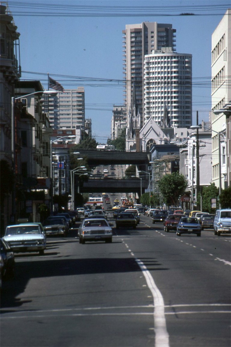
 Now, this one I should have known! I know that San Francisco had two double-deck freeways in 1985, both gone now, the Embarcadero Freeway and the Central Freeway. I also knew that my older picture couldn’t have been taken anywhere along the Embarcadero Freeway. It had to be looking toward the Central Freeway, but I couldn’t place the street. The church at right central in the old photo would have been one of the best clues and I should have studied it closer. This is Gough Street from Market Street looking north. I was using my Minolta X700 zoom lens for the old picture as we rolled by. The church was Saint Paulus’ Lutheran church, seen in a number of movies, such as ‘Greed’, ‘The Man Who Cheated Himself’ and ‘Vertigo’. The church burned down in 1995. The Central Freeway, like the Embarcadero Freeway, was demolished after the Loma Prieta Earthquake of 1989.
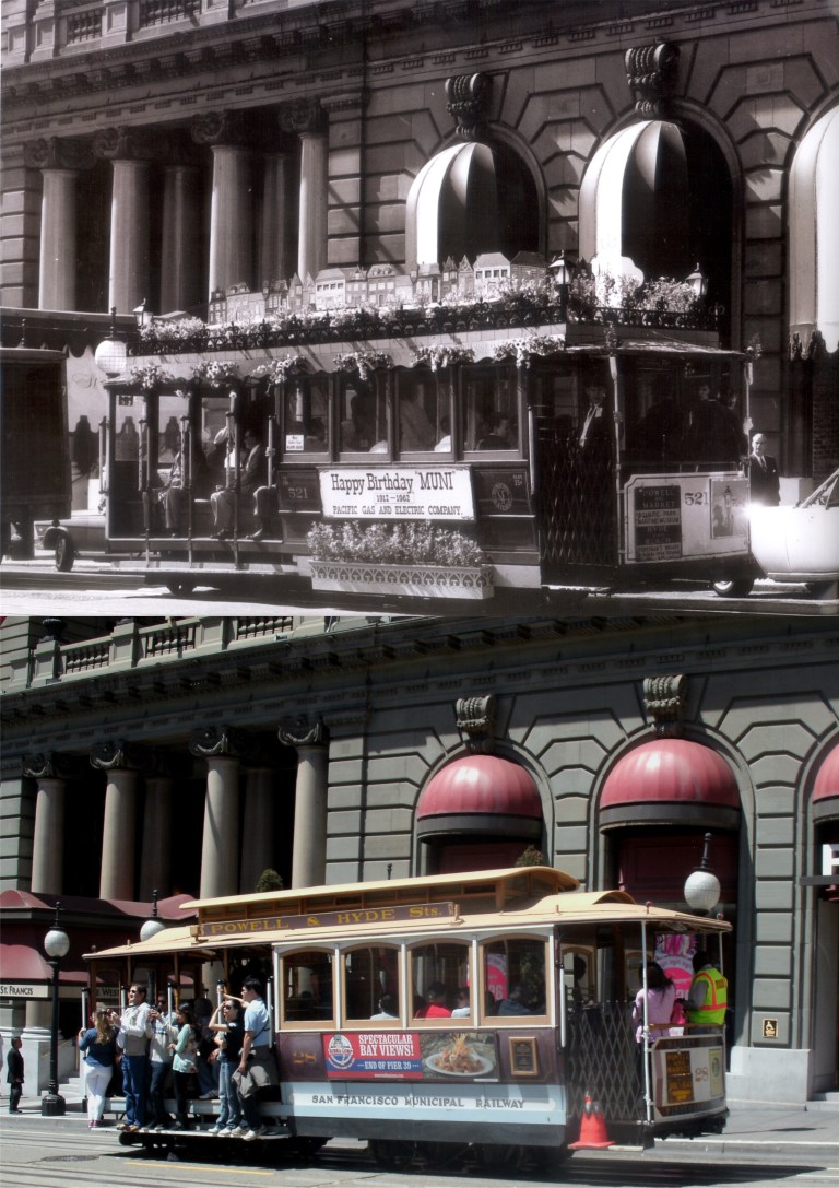 Pacific Gas and Electric salutes MUNI on its 50th anniversary in front of the St. Francis Hotel in 1962: This might have been where Beach Blanket Babylon got their idea. Beach Blanket Babylon will be closing its 45 year run at the end of 2019. (Mike Phipps & Don Holmgren)
 A lonely little cable car heads up Castro Street in the 1930s: The Castro Line ran from Market Street to 26th Street. (Mike Phipps & Don Holmgren)
 A cable car heads up Sacramento Street past Joice Alley between Powell and Stockton Streets in the early 1900s:
 Powell and California Streets looking toward the old Crest Garage in the 1940s: The Crest Garage was demolished in early 2018.
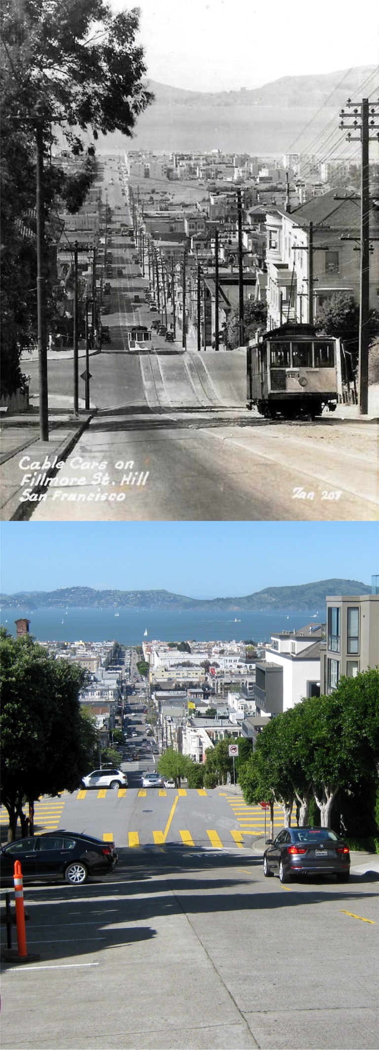 Cable cars used to run up Fillmore Street from the Bay once too:
 The loneliest of the five cable car boarding and ending points, California Street at Van Ness, looking east up Nob Hill. The vintage picture is from the 1950s.
 Looking west up Nob Hill from California and Drumm Streets where the eastern beginning / ending of the California Street cable car line is in the late 1950s or early 196’s:
 A cable car approaches Taylor Street along Jackson Street in the 1950s: The cable car in the vintage is number 515; there are only 40 of them today. (Fred Lyon)
 Riding along on the “Hyde Street Grip”:
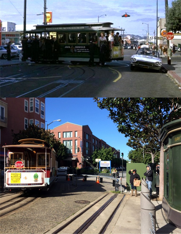 Jack Lemmon races his Thunderbird past the Bay and Taylor cable car turnaround in the 1964 film ‘Good Neighbor Sam’. Although you can’t see it in my photo, that 76 gas station on the right is still there.
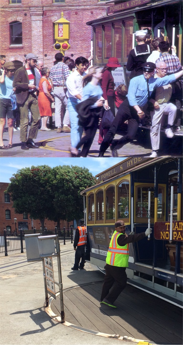 The cable car turnaround at Aquatic Park in the 1960s: This is a great picture, right down to the grip man with cigarette in his mouth! (Glenn Christiansen)
 California Governor Ronald Reagan and Mrs. Nancy Reagan on a cable car heading up Powell Street just past Post Street in 1966: (buzzfeed.com)
 A zoom in looking down California Street toward Powell in the 1970s: (Minerva)
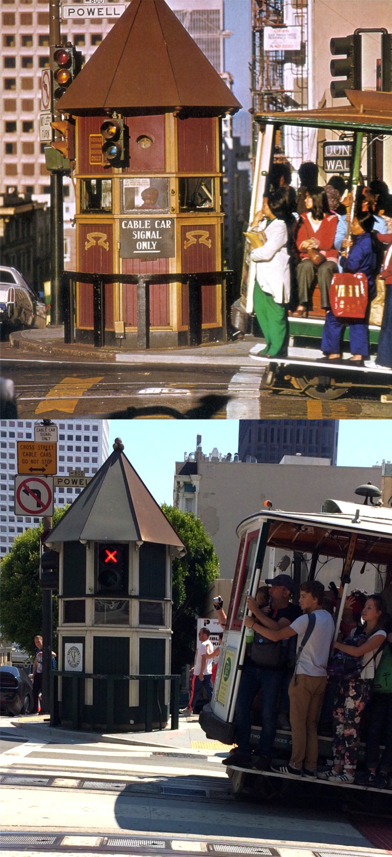 A cable car approaches the signal box on the southeast corner of California and Powell Streets in the 1970s: (Minerva)
 Well, now look at that, the cable cars were down for awhile in the 1970s too! This is at the Powell and Market Streets turnaround.
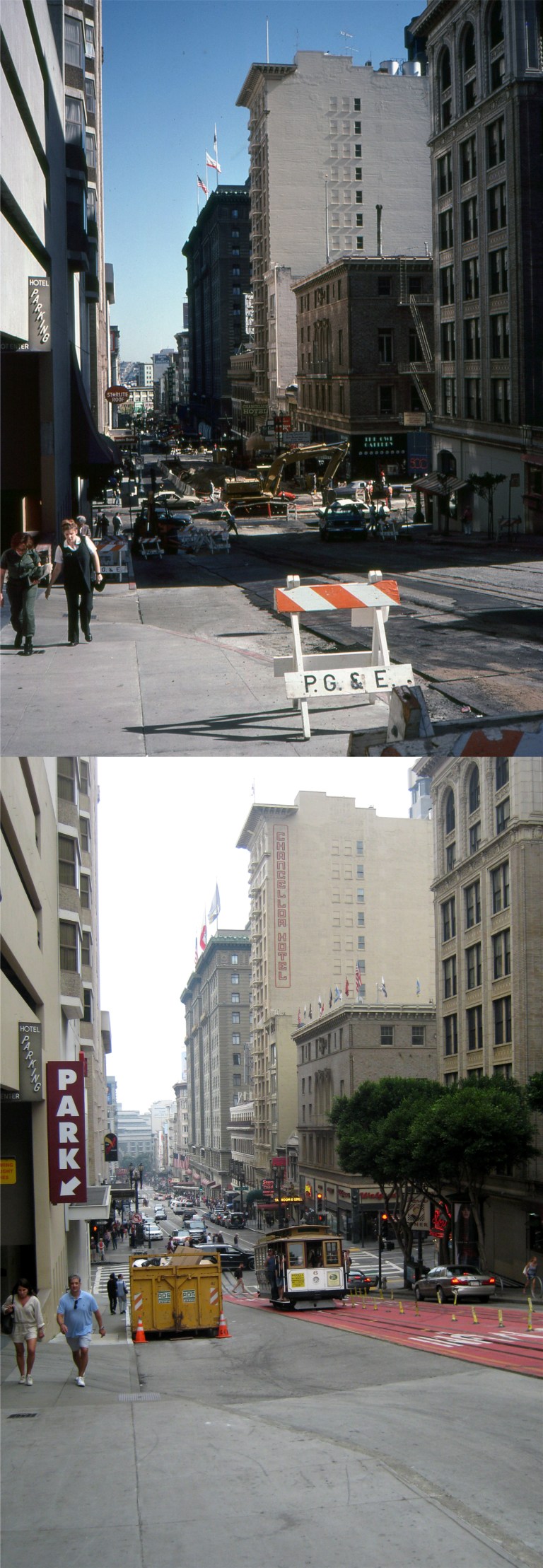 Cable cars were definitely down from 1982 until 1984 for a complete repair of the system. This is a redo of a slide picture I took in 1983 on Powell Street north of Sutter. The entire San Francisco cable car system was shut down.
 This is another slide photo I took in 1983 on California Street up from Grant Ave. You can see the construction work on the cable car line down California Street.
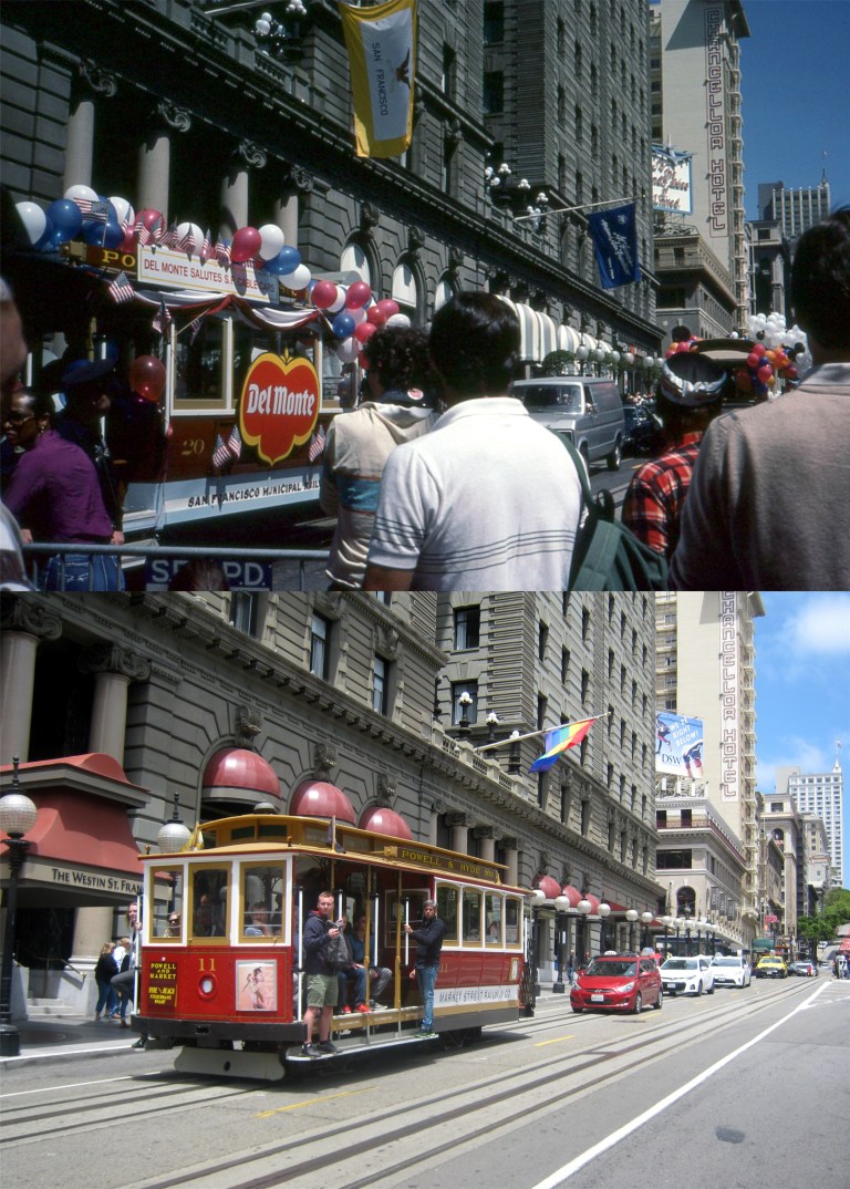 This slide I took was in June of 1984 in front of the St. Francis Hotel. San Francisco was celebrating the reopening of the cable car system.
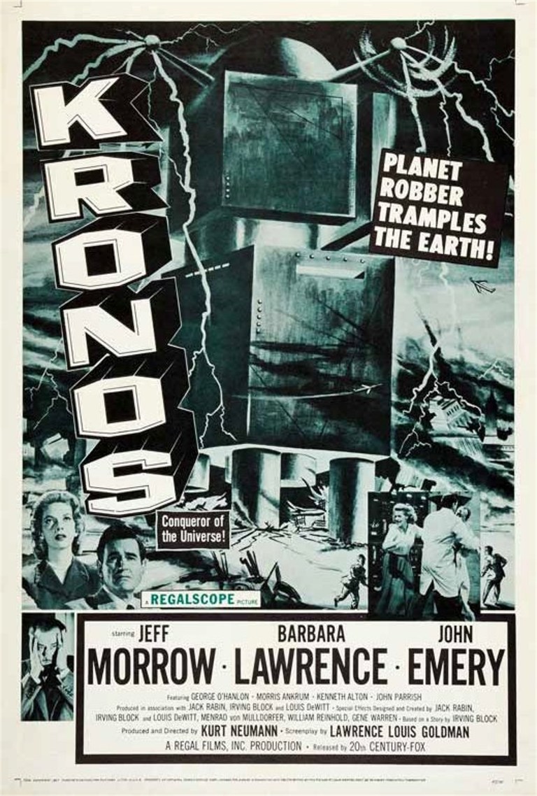 As the story goes, and I believe it, when the 1960s skyscraper boom in San Francisco erupted and the pile drivers were heading north and destroying everything in their path, like ‘Kronos’ the Planet Robber did, the people living on Telegraph Hill got together and forced City Hall to approve an ordinance that stopped new buildings from being built north of Market Street that would block Telegraph Hill from its view of the Ferry Building. So, Kronos turned south and the result is today’s SOMA, South of Market Street, once known as “South of the slot” in reference to the cable car line that used to run down Market Street. I took a walk and bus ride around SOMA last Saturday to take some pictures, and I was also granted an audience with Emperor Joshua A. Norton. His Highness was at the new Salesforce Transit Center to rededicate a marker that was originally installed in his honor at the old Transbay Terminal Building in 1939.
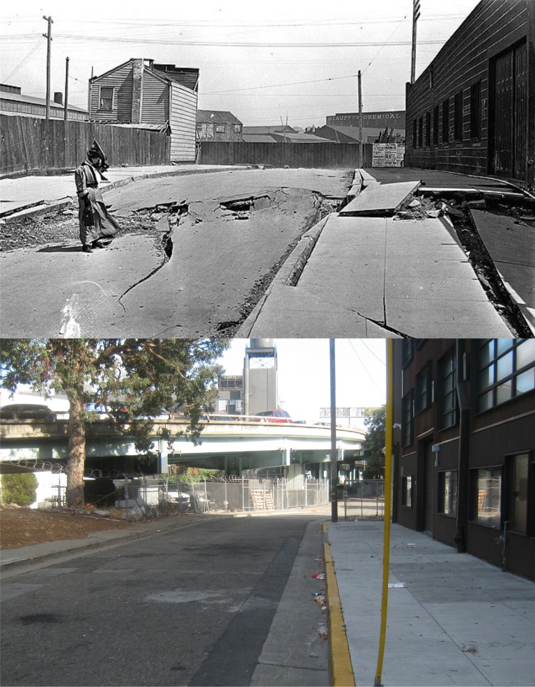 Hidden away south of Market Street is the southern end of lonely Dore Street, looking south from Bryant, just after the 1906 Earthquake. (On Shaky Ground)
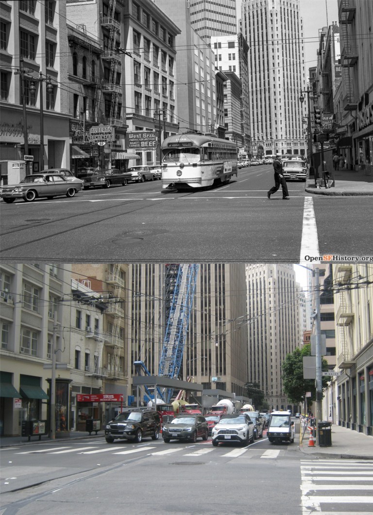 Looking north along 1st Street from Mission Street in 1962: These pictures were taken from where the Salesforce Tower is today. (opensfhistory.org)
 Looking down 1st Street from Harrison Street in 1973: This was a close of a comparison picture as I could get nowadays, trees block the view from further up 1st Street now. That Union 76 gas station in the old picture survived until just recently. The building on the far right in both pictures is the Sailors’ Union of the Pacific Hall. (opensfhistory.org)
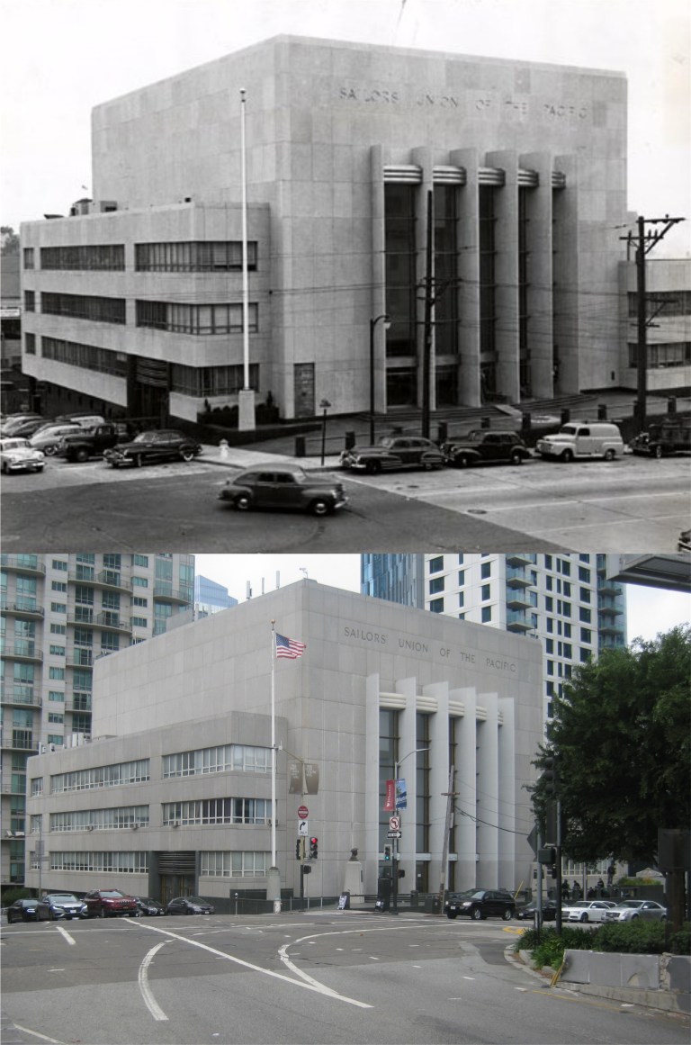 The Sailors’ Union of the Pacific Hall in the 1950s: The building was built in 1950. (FoundSF)
 The lobby of the Sailors’ Union of the Pacific Hall: This building is a gem compared to some of the buildings they’re slapping up around here today.
 Howard Street near 6th St. in 1980, before the SOMA boom started. (Janet Delaney)
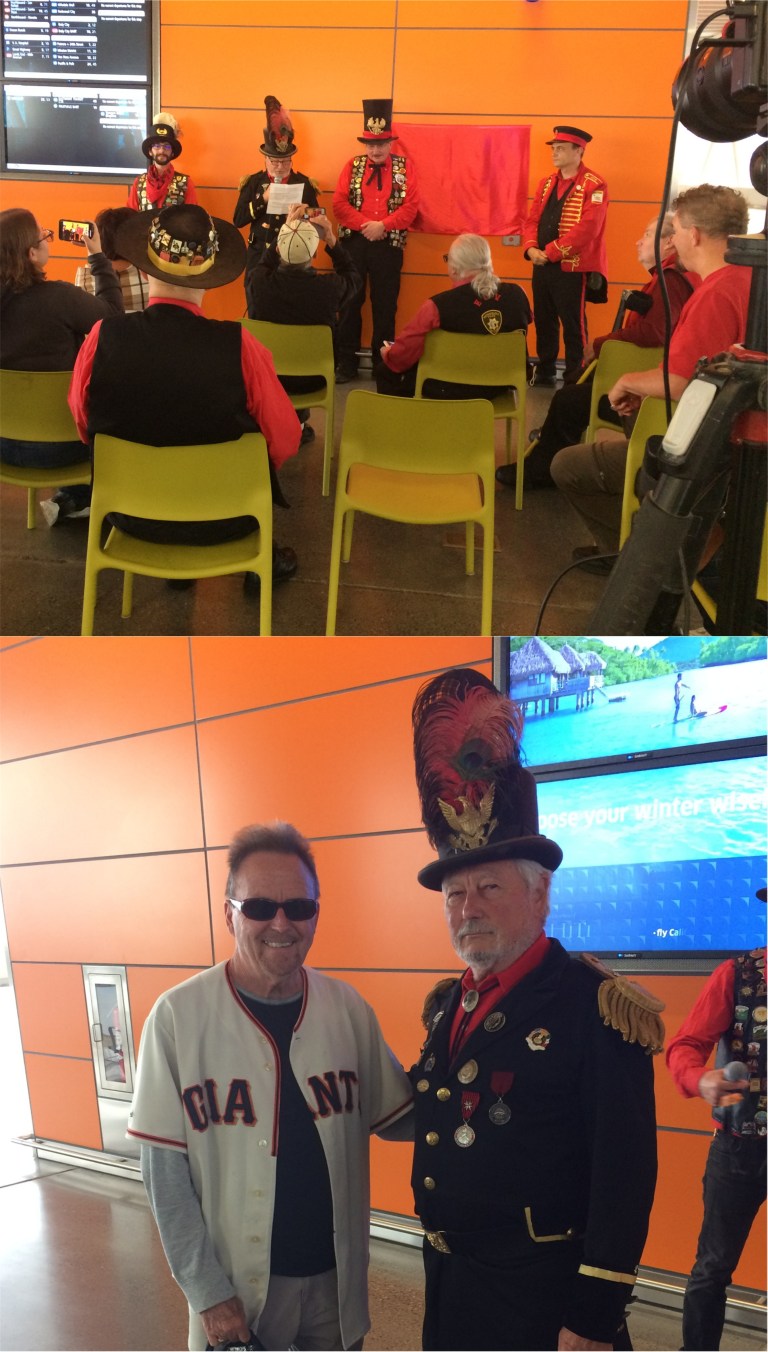 Emperor Joshua Norton at the ceremony in the new Salesforce Transit Terminal rededicating a marker that was placed in his honor in 1939 at the old Transbay Terminal, demolished in 2010: Emperor Norton was a whimsical lunatic, (maybe, or maybe he was just pretending) who came to San Francisco in 1859 proclaiming himself to be the Emperor of the United States, and San Francisco honored him as such until he died in 1880. He was one of the most colorful characters from San Francisco’s history. One of his proclamations decreed that two bridges were to be built someday, one from San Francisco to Oakland, and one from San Francisco to Marin County. San Franciscans must have really got a kick out of that, but guess what……
 The Emperor Norton marker placed in the Transit Center on Saturday. Those streaks are from an expensive bottle of champagne used for the Christening.
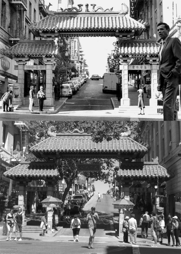 There are many streets to enter Chinatown by, but most visitors prefer the entrance gate at Grant Avenue and Bush Street, seen here around 1969 when it was built.
 I usually like to take the Number 1 Muni up Sacramento Street to Stockton Street, cross over to California Street and walked down to Grant Avenue; less uphill walking. In the vintage picture from the 1950s you can see the old Fireman’s Fund Insurance Company Building, built to look like Philadelphia’s Independence Hall. Now, why did they get rid of that? (ebay.com)
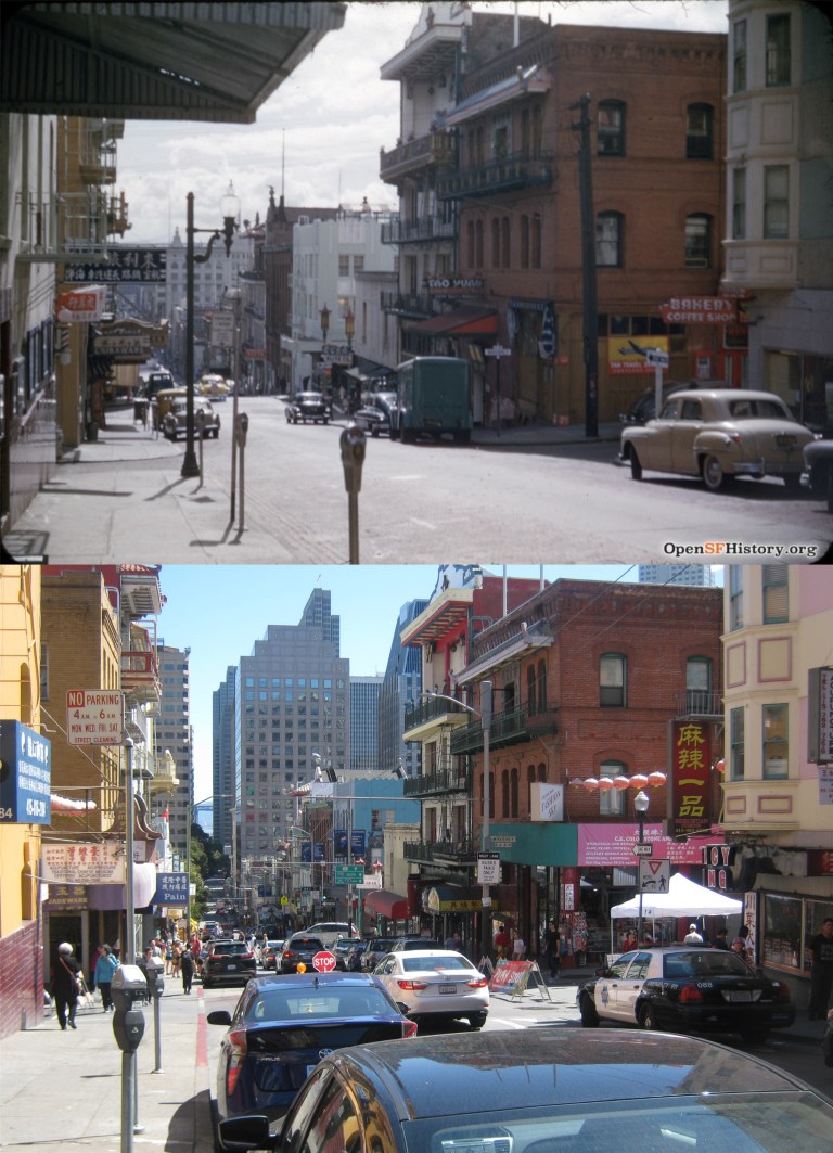 Looking down Clay Street toward Waverly Place in 1954: (opensfhistory.org)
 This was the street festival in Waverly Place being set up that I mentioned earlier. The top photo is looking north from Clay Street to Washington, the bottom one is looking south from Clay to Sacramento Street. I think that eventually was going to be a dragon in the bottom photo.
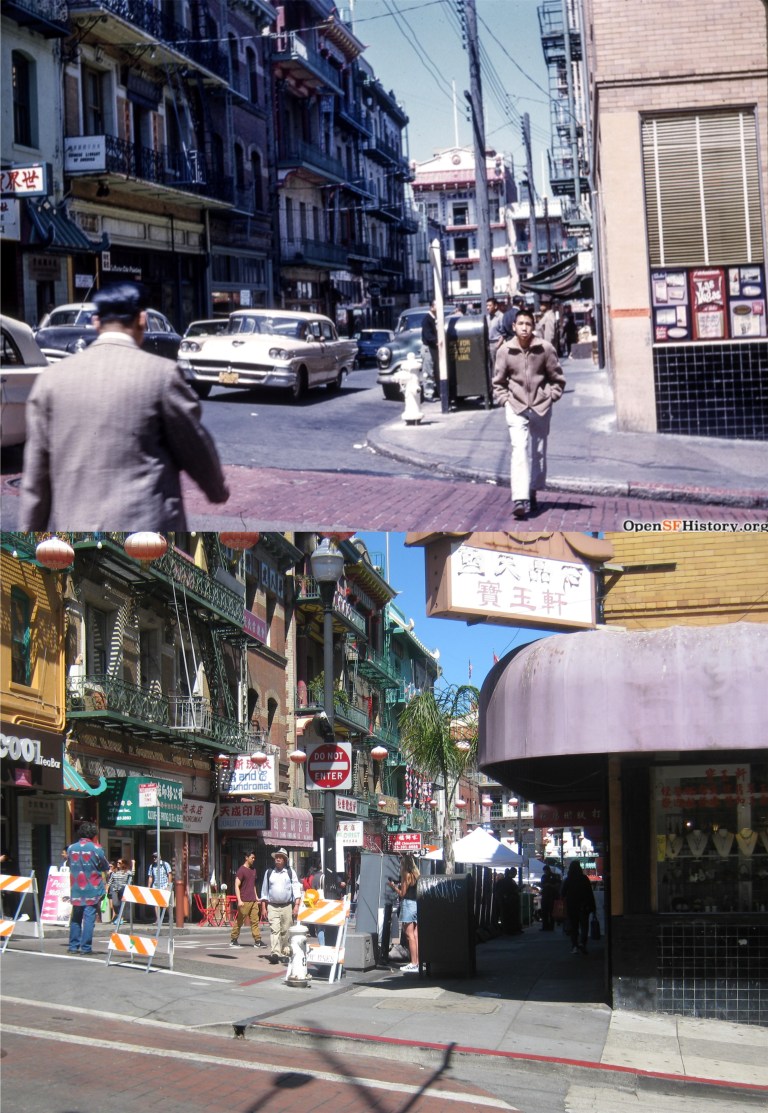 Waverly Place looking toward Washington Street in 1962, and last Sunday as the festival was getting started: (opensfhistory.org)
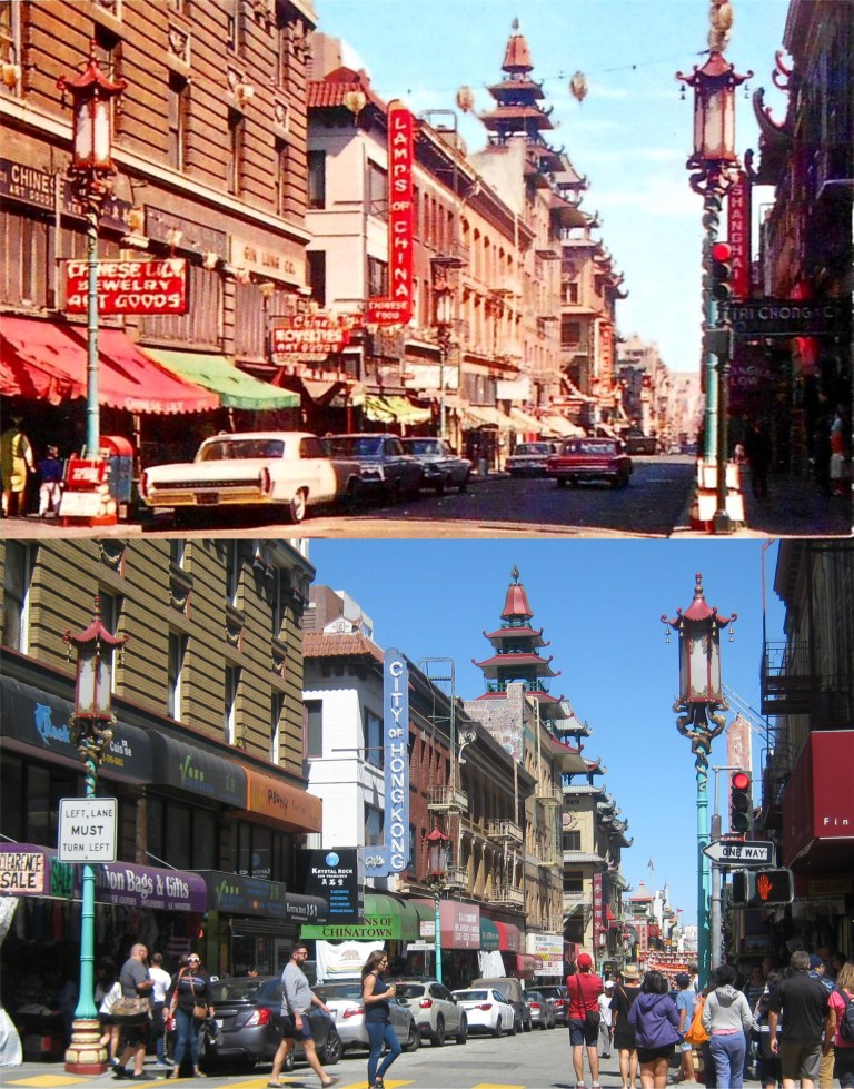 If you do head up Grant Avenue from Bush Street, you’ll come to Pine Street, seen here in an old postcard from the 1960s. The signs for the Lamps of China Restaurant, and Shanghai Low’s, both long gone Chinatown institutions, can still be seen. (Deviant Art)
 Another look at Grant Avenue and Pine Street from the 1940s: (Curbed SF)
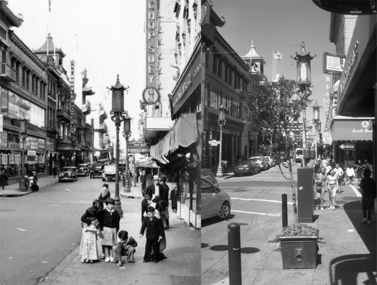 Children playing on the sidewalk on Grant Avenue near Sacramento Street in the 1930s, around the time that the quaint lampposts were installed: (Curbed SF)
 Grant Avenue looking north from Washington Street on a rainy 1930s day: The Rice Bowl Football Game was a benefit in the late 1930’s to raise funds for relief to the people in China suffering from a famine at the time, and also from the country’s invasion by Japan. (FoundSF)
 We’ll start with an old 1906 postcard showing a Labor Day parade on Market Street. Although it’s dated 1906, if Labor Day was observed in September back then, the parade must have been in 1905, as most of this area was destroyed by the 1906 Earthquake and Fire in April of that year. The Emporium Building on the right in the old photo was gutted by the fire and rebuilt. The Call Building in the background of the postcard survived the earthquake and was remodeled in the 1940’s. It’s behind the domed Humboldt Building that’s above the girl in the white hat. The Humboldt Building was built in 1908. (picryl.com)
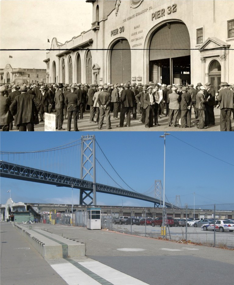 A stevedore strike in 1933 in front of Piers 30 and 32 on the Embarcadero south of the Bay Bridge: Piers 30 and 32 have been demolished now, but you can still see Pier 28 in the far background on the left in the vintage photo and in my picture. (FoundSF / San Francisco History Center)
 California Street at Van Ness, looking west in 1957: Wow, construction work on Van Ness! How novel is that today? Just kidding; I’m sure that their doing the best they can. This was another one where I could have got a better comparison with a long-focus lens, but that wouldn’t fit in my pocket as well as my digital day-tripper does. (SFMTA)
 A detour at Market and 5th Streets in 1968: The detour was caused by the construction of BART under Market Street. (SFMTA)
 Dock workers relaxing near Pier 24 in the 1940s in a comparison picture I did a few years ago: Pier 24, demolished now, used to run right out to the Bay Bridge tower.
 16th and Illinois Streets looking east in 1925: The vintage picture was taken from the top of the 3rd Street viaduct that carried streetcars past here back then. “Via duck? Vi not a chicken?” You’d have to be a Marx Brothers fan to remember that one. That’s the Chase Center on the left, the new home of the Golden State Warriors, that the workers are finishing up on. Chase Center, where the LOOP sign was in the vintage picture, is scheduled to open September 6th this month. (opensfhistory.org)
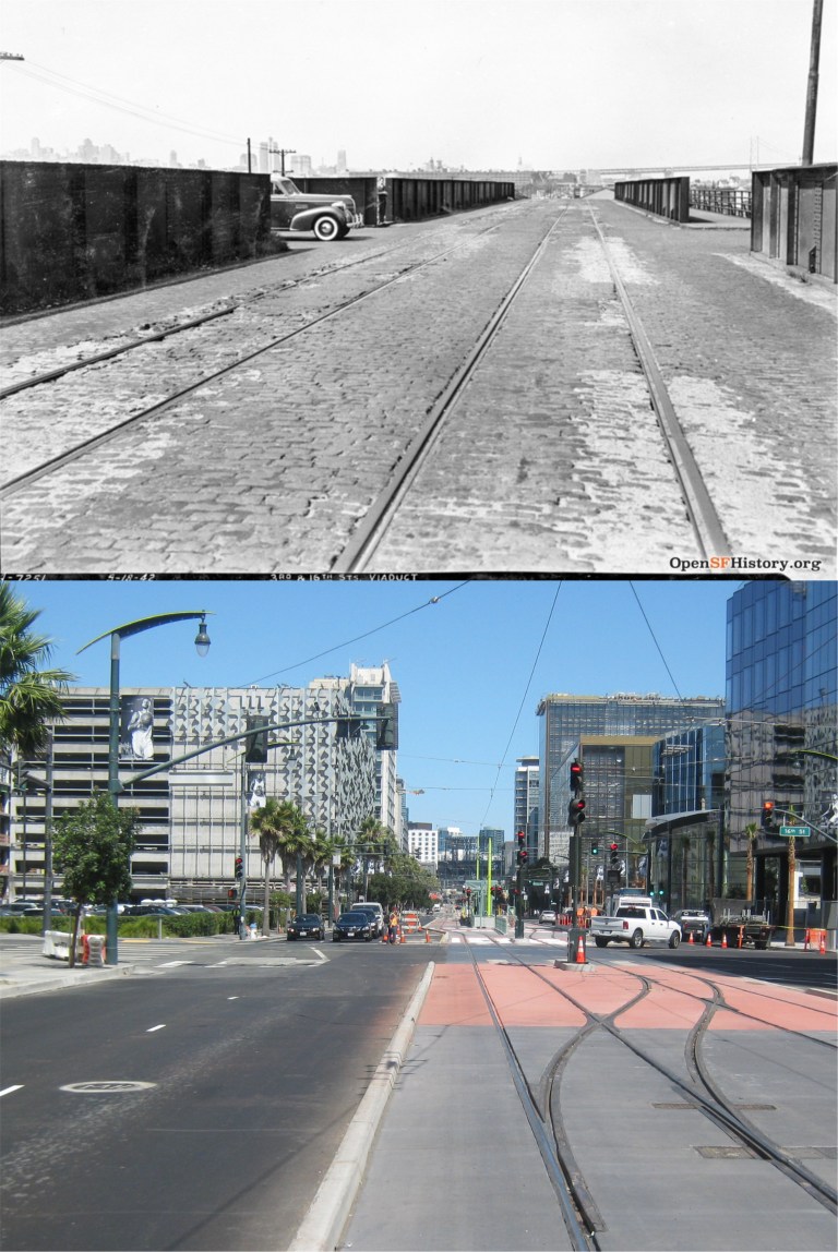 3rd at 16th Streets on the streetcar viaduct, just west of where Chase Center is now, looking north in 1942: What a change! (opensfhistory.org)
 A war bonds drive in front of Commodore Sloat Elementary School at Junipero Serra Blvd. and Ocean Ave. during World War Two: “We’re all in this together.” Sometimes, that applies to nowadays, as well; I hope! You can see some of the houses in the vintage picture across Junipero Serra Blvd. behind the eucalyptus trees in my picture. (commodoresloat.com)
 A closer look at some of the houses across Junipero Serra Blvd. seen in the previous vintage picture: These are what a lot of people go to work for. It would be nice to buy one for what they would have cost in the old photo.