
When the brilliant photographer Arnold Genthe braved the odds and ventured into the streets and alleys of San Francisco’s Chinatown at the end of the Nineteenth Century to take pictures it was not a safe area. Tong wars were rampant, Shanghaiing was practically an industry, indiscreet opium dens were everywhere, and sex slave trafficking flourished. When his pictures were published San Franciscans were intrigued by what they saw, and began visiting the area regularly. It’s safe to say that the quaint tourist destination that Chinatown is today owes a lot to Arnold Genthe. I went over there last Sunday to take some pictures, not near in the league of Genthe’s photographs, but fun to do. There was also a street festival in Waverly Place being set up that I couldn’t get a lot of information about. It wasn’t the Chinatown Autumn Moon Festival, that’s happening this coming weekend, but it was colorful and drew a nice crowd. Let’s take a trip back to Chinatown’s past after the 1906 Earthquake and Fire destroyed the old area and a reborn, flavorful, traditional, and safer Chinatown emerged.
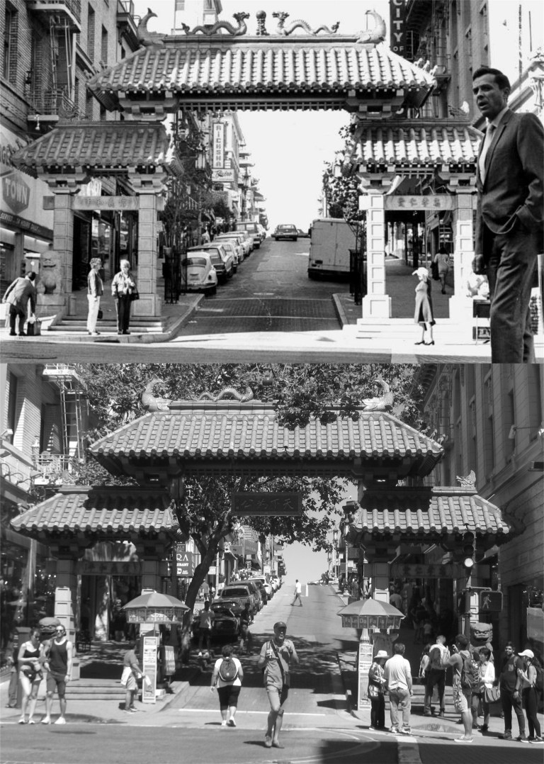 There are many streets to enter Chinatown by, but most visitors prefer the entrance gate at Grant Avenue and Bush Street, seen here around 1969 when it was built.
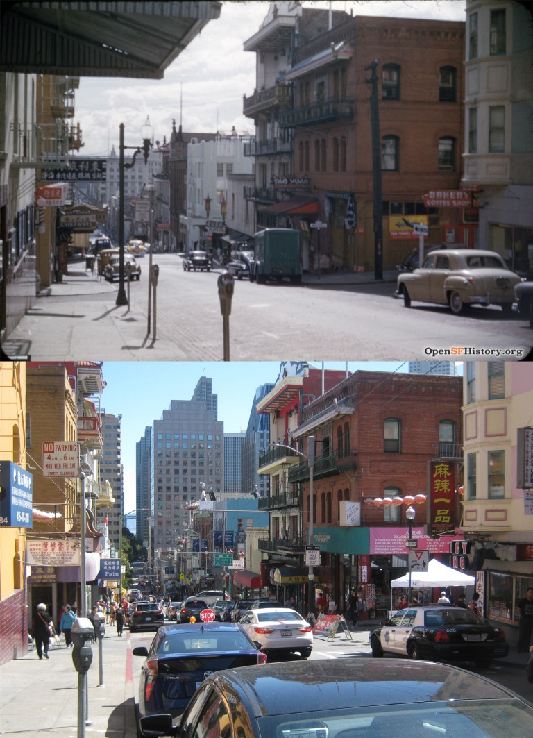
 I usually like to take the Number 1 Muni up Sacramento Street to Stockton Street, cross over to California Street and walked down to Grant Avenue; less uphill walking. In the vintage picture from the 1950s you can see the old Fireman’s Fund Insurance Company Building, built to look like Philadelphia’s Independence Hall. Now, why did they get rid of that? (ebay.com)
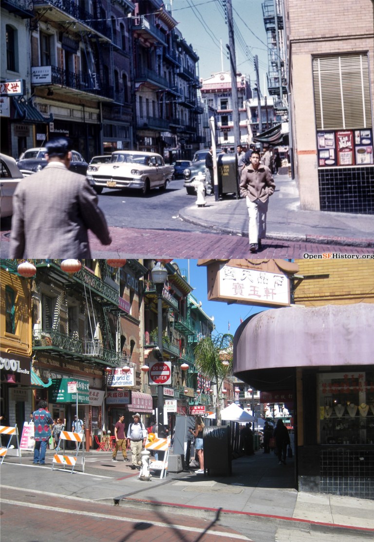
 Looking down Clay Street toward Waverly Place in 1954: (opensfhistory.org)
 This was the street festival in Waverly Place being set up that I mentioned earlier. The top photo is looking north from Clay Street to Washington, the bottom one is looking south from Clay to Sacramento Street. I think that eventually was going to be a dragon in the bottom photo.
 Waverly Place looking toward Washington Street in 1962, and last Sunday as the festival was getting started: (opensfhistory.org)
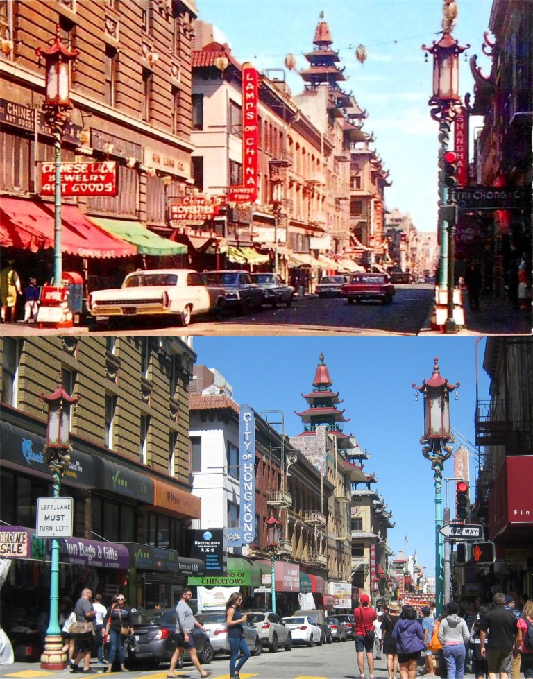 If you do head up Grant Avenue from Bush Street, you’ll come to Pine Street, seen here in an old postcard from the 1960s. The signs for the Lamps of China Restaurant, and Shanghai Low’s, both long gone Chinatown institutions, can still be seen. (Deviant Art)
 Another look at Grant Avenue and Pine Street from the 1940s: (Curbed SF)
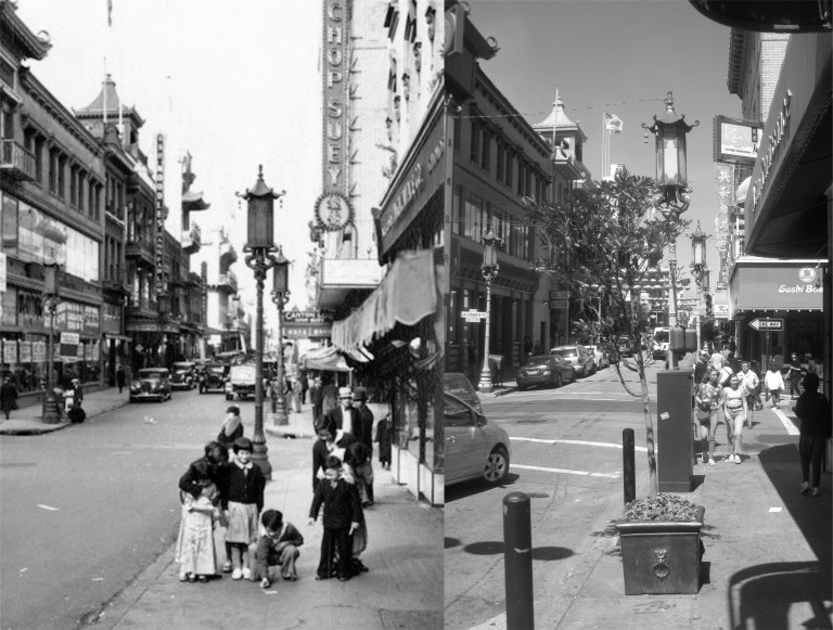 Children playing on the sidewalk on Grant Avenue near Sacramento Street in the 1930s, around the time that the quaint lampposts were installed: (Curbed SF)
 Grant Avenue looking north from Washington Street on a rainy 1930s day: The Rice Bowl Football Game was a benefit in the late 1930’s to raise funds for relief to the people in China suffering from a famine at the time, and also from the country’s invasion by Japan. (FoundSF)

Waverly Place looking toward Washington Street; someone had to go and plant a cheap queen palm. How cliche. They don’t look good in San Francisco on a good day. They prefer warmer climates.