
These are updates from a September, 2015 collection I posted.
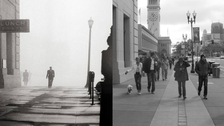 The fog obscures the Ferry Building in this noir like picture at Pier 1 on the Embarcadero. Put on your trench coats, slip a bottle of inexpensive whisky in the pocket, light up a cigarette, and follow me while we explore a little more San Francisco Film Noir.
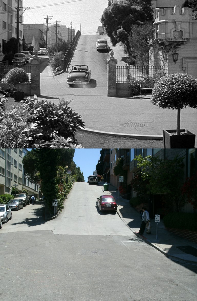 The best place to start is the beginning of an attempted murder. Valentine Cortese leaves her home on Telegraph Hill heading south on Montgomery Street little realizing that her husband, Richard Basehart, has tampered with the brakes on her car in the 1951 film ‘House on Telegraph Hill’.
 When her brakes fail, Cortese skillfully navigates her car down just about every steep street on Telegraph Hill, turning here on Calhoun Terrace before crashing block behind this location at Union and Montgomery Streets.
 Another noir looking picture from the 1950’s of the view down Clay Street, although, this isn’t from any movie. (skyscrapercity.com)
 Ann Sheridan, along with Dennis O’Keefe, searching for her missing husband up at the Coit Tower Parking lot in the 1950 film ‘Woman on the Run’. This movie has many terrific film locations in San Francisco from the 1950’s. Save your money on the telescopes here today; you can see almost nothing of the once beautiful view from here now because of the overgrown Cypress and Monterey pine trees. It is rumored that this is because trimming them would be harmful to the trees. My horticulturist friend Tonytomeo would know more about that than I would. (Movie image, reelsf.com)
 A “safe house’ for Communist saboteurs in the 1948 film ‘Walk a Crooked Mile’: This is another interesting crime thriller with great off beat San Francisco locations. My images are from a DVD copy in need of restoration that may still be the only DVD of the movie available.
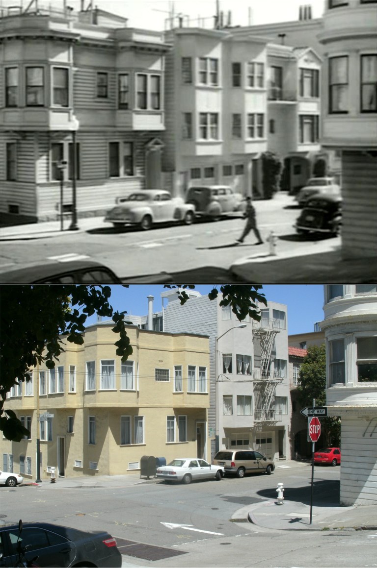
 The house is on the corner of Mason and Clay Streets. That’s a nice touch; a mother and her children out for a stroll not realizing that they’re passing a house occupied by enemy insurgents.
 However, the F.B.I. is on to these guys. They keep surveillance on the house waiting for a chance to go in for evidence. As the last “Commie” leaves from the steps of the building for lunch, they search the apartment.
 The SICA, (Secret Insurgent Communist Agent) crosses the intersection while the government agents wait for him to leave.
 The agents sneak into the apartment to gather evidence.
 This is a weird scene! As the spy approaches Grant Avenue at Sacramento Street, there seems to have been an unrelated taxicab accident on the corner. The bad guy, caring little for humanity, passes by unconcerned. I don’t know if this was staged or if it really happened, and they filmed around it.
 As the infiltrator heads back to the house along Grant Avenue after his lunch, a telephone signal is made to our heroes rifling the house, enabling them to make a getaway and crack down on the gang shortly after.
 We’ll start where I did looking south along the west coast of San Francisco from Sutro Heights. This is one of the oldest pictures from this viewpoint that I’ve seen. I couldn’t get a date on the vintage photo, but it was taken before Playland-at-the-Beach, and the Golden Gate Park Windmills, the Dutch Windmill, built in 1903, and the Murphy Windmill, completed in 1908, haven’t been put up yet. (Bold Italic)
 We’ll walk down to the Cliff House from the Sutro park. Walking down to the Cliff House from here is easy, walking back to Sutro Heights, well….. This is a 1920’s picture looking down Point Lobos Road to the famous restaurant. The CIGARS shop with the ‘R’ missing was where the glass entrance to the Cliff House is now. (cliffhouseproject.com)
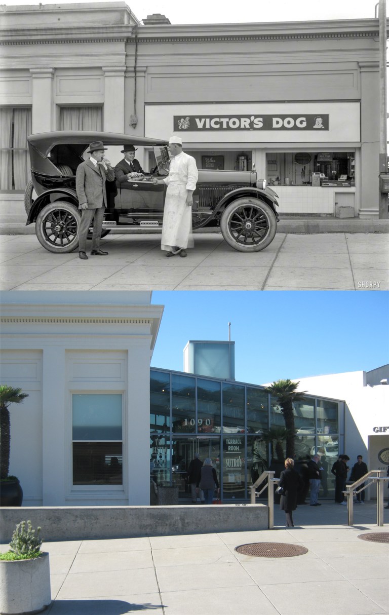 The cigar store in the previous vintage photo was updated later in the 1920’s to selling hot dogs, probably a more profitable enterprise considering the location. (The Shorpy Archive)
 There were “Dangerous Waves” warnings all along Ocean Beach yesterday, and a number of beach locations were closed. My picture was taken from right behind the Cliff House.
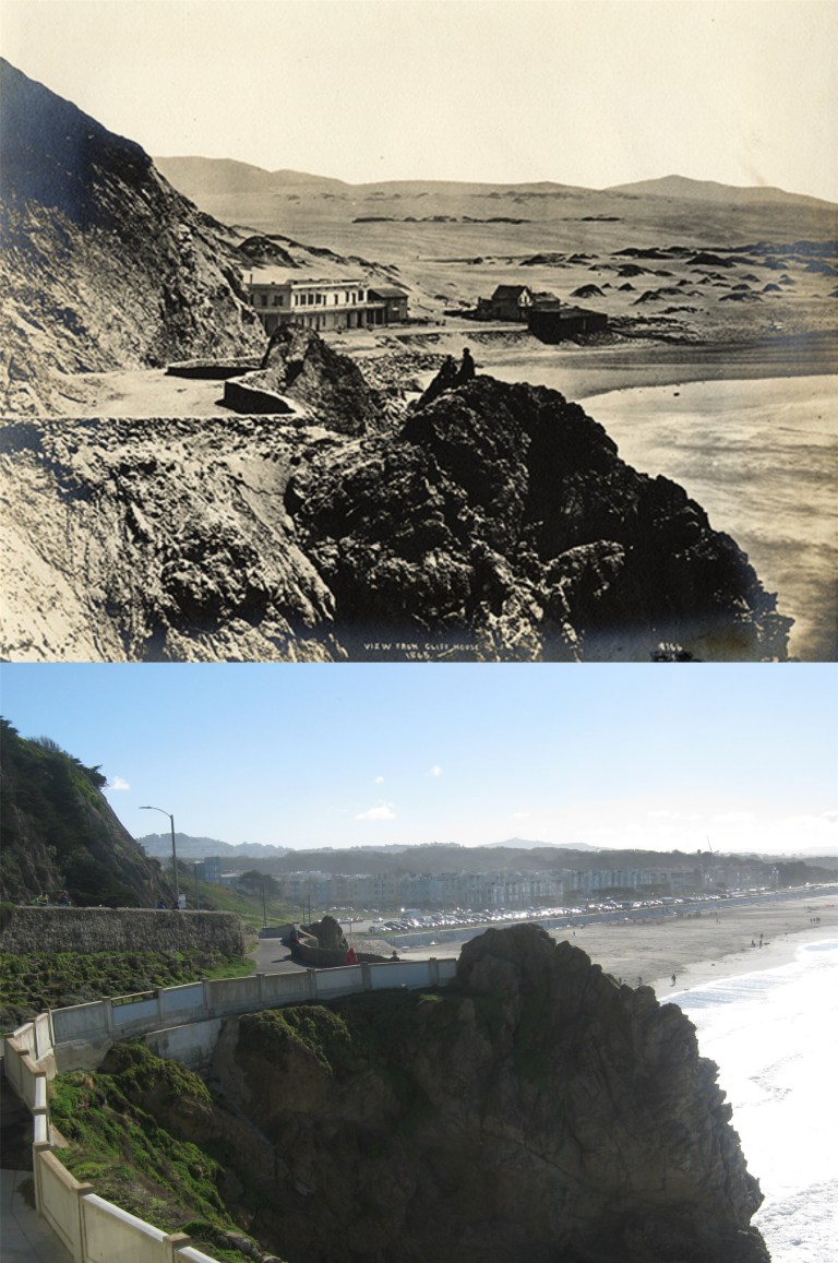 The view along the coast south of the Cliff House in 1865: You can see the two peaks in the ridge that runs down to the beach from here in both pictures.
 The view down Point Lobos Road looking toward Playland-at-the-Beach during the 1940’s:
 Playland in 1949 and all that’s left of Playland-at-the-Beach today, the historical marker: (SF Gate, SF Chronicle)
 The northern most portion of Playland shortly before it closed in 1972. My picture is just about where the vintage photo was taken. (SF Gate, SF Chronicle)
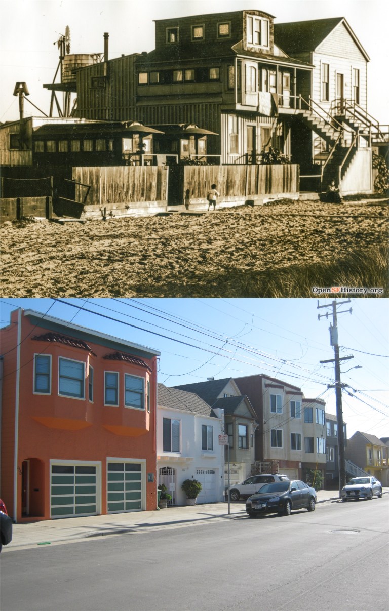 There’s some interesting San Francisco history you can read about just south of Golden Gate Park on La Playa between Irving and Judah Streets. At the beginning of the Twentieth Century some discarded horse drawn streetcars were being sold to families who moved them out to this location and renovated them to live in. The area became known as ‘Carville’. The eastern side of La Playa, here in my picture, is where Carville was. (sfhistory.org)
 I think that the only known survivor of Carville is in the center top of my picture on the Great Highway between Lawton and Moraga Streets. Those are two old streetcars side by side in the frame of that building behind the garage.
 You know, it’s always sad to see old time “moms and pops” grocery stores like this one from the 1950’s on 48th Avenue gone from this area forever. Oh, wait a minute, it’s still there! Never mind. (Images of America)
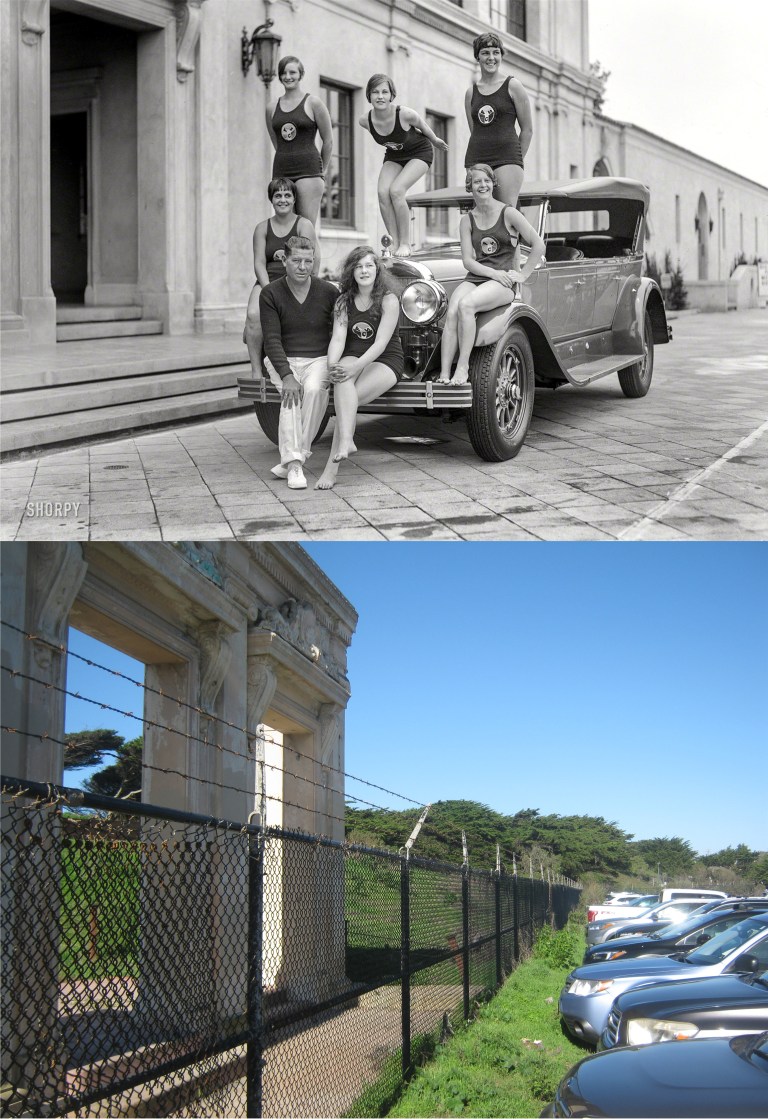 Bathing cuties in front of the pool house at Fleishhacker Pool in 1927: All that’s left of the swimming pool today is the entrance to the pool house that the girls were in front of. They were about where the cars parked on the right are in my picture. (Shorpy Archive)
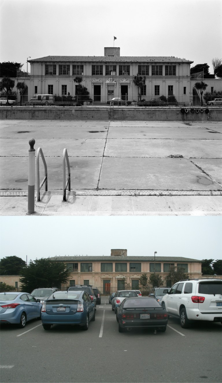 The pool, built in 1924, closed in 1971, when the vintage picture here was taken, and was filled in. It’s now beneath the parking lot to the San Francisco Zoo. I took my picture of the pool house in September of 2012, just before it burned down in a fire caused by homeless people living in the abandoned building.
 We’ll start out on Mason Street next to the Mark Hopkins Hotel in the 1950’s. Parking here doesn’t look like an option in the 1950’s, but I see a couple of spots today that had better be grabbed quickly. (Hemmings.com)
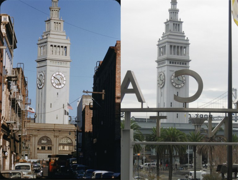 Parking doesn’t look good here at all on Commercial Street near the Ferry Building in the 1950’s, and it’s impossible today; Commercial Street stops at Battery Street now because of the Embarcadero Center. Commercial was one of only two streets in San Francisco that ran straight to the Ferry Building, the other being Market Street. (The Cushman Collection)
 Parking in front of the Cliff House is “catch as catch can” as well, especially on holidays. The vintage picture is from the late 1950’s when the Cliff House was dressed in red. You can see the Sky Tram Cable Ride that ran through the 1950’s and into the 1960’s at the lower left of the vintage photo. (Flickr)
 Union Square in the 1960’s: You can drive around there for hours today, and probably back then too, looking for parking if the Union Square Garage is full.
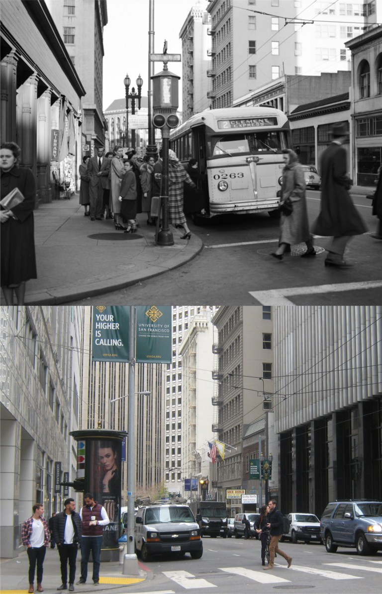 Of course, if you get tired of driving around looking for parking, you can always take the bus like these people here are doing at the corner of Montgomery and Sutter Streets in the 1950’s. The two old buildings with the fire escapes on the right are still there. (Vintage Everyday)
 Green Street, where it meets Columbus Avenue and Stockton Street in the 1940’s: I took my picture while passing by from a bus on the Number 30 Muni Line coming back from Fisherman’s Wharf last October.
 Candlestick Park and its parking lot in the early 1960’s before it was enclosed to accommodate the 49ers in the 1970’s: My picture is looking across the parking lot toward an empty and lonely Candlestick Park in October of 2014 just before it was demolished. I went out there one last time to say good bye to a place filled with wonderful memories for me going back to childhood; memories of my family, especially my parents, and my friends, and all the wonderful times we had there. I felt as lonely as Candlestick Park on that last visit. (OldMotor.com)
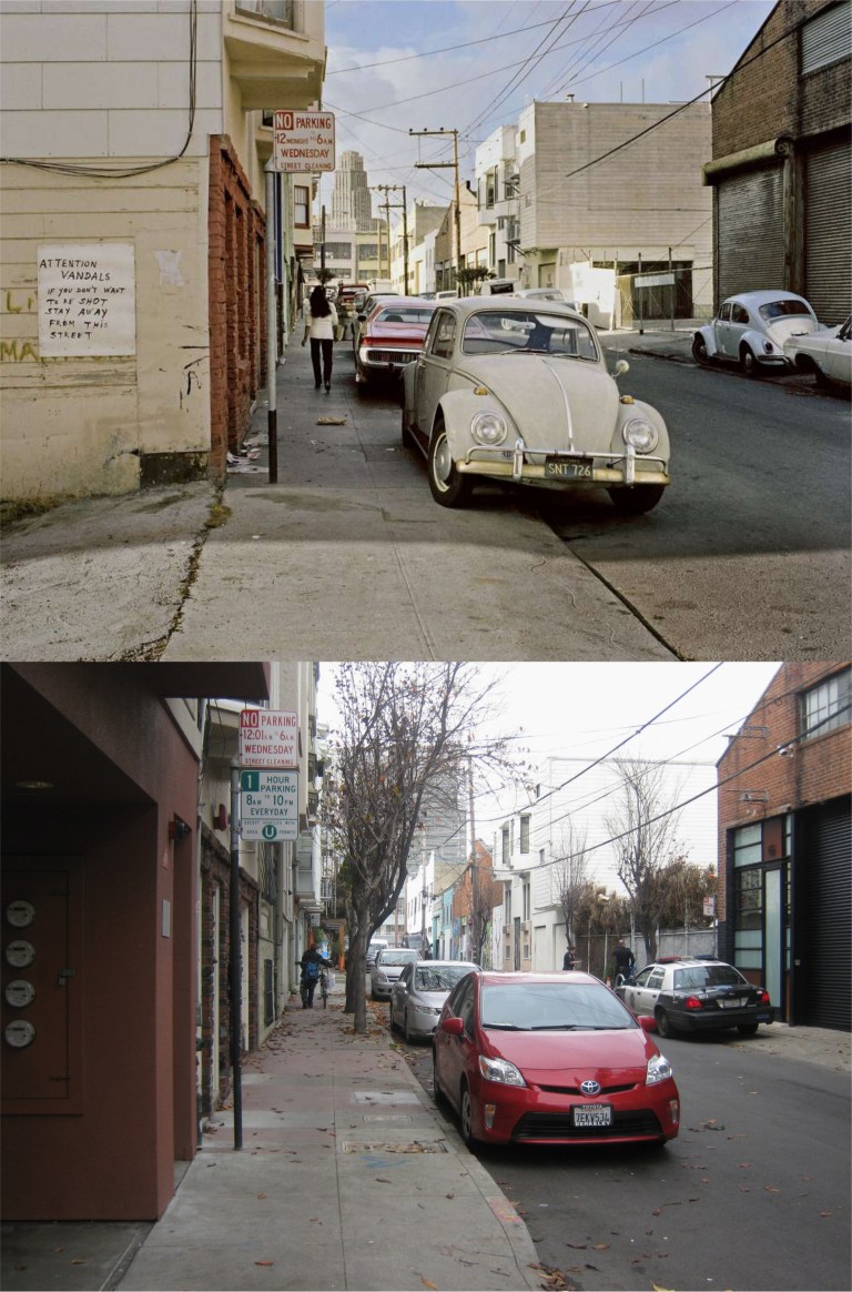 Langton Street near Folsom in the 1970’s: It looks like they give you an extra minute on that Wednesday parking nowadays. That’s the old Empire Hotel Building in the background of the 70’s picture. “ATTENTION VANDALS – IF YOU DON’T WANT TO BE SHOT STAY AWAY FROM THIS STREET” Well, it appears like there may have been another case of “frontier justice” today in my picture. Another building has been put up next to the wall where they used to shoot vandals. (Janet Delaney)
 Market Street at Stockton Street in the 1960’s: I got a “in the right place at the right time” on this one; those two old streetcars are almost identical! (Charles Cushman Collection)
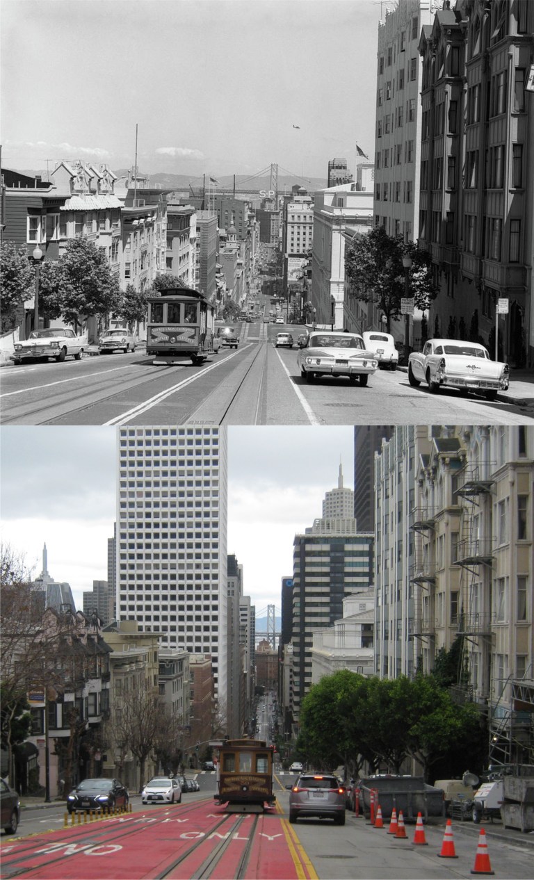 Looking down California Street from Powell in the 1960ss: I would rather to have gotten a cable car coming up instead of heading down, but you can’t stand in this spot too long without getting honked at or worse!
 Although, that didn’t seem to bother this cutie an awful lot!
 Sacramento Street looking down from Powell Street: It’s a long way from the spring of 1983 to January 5th 2019 when I took these two pictures.
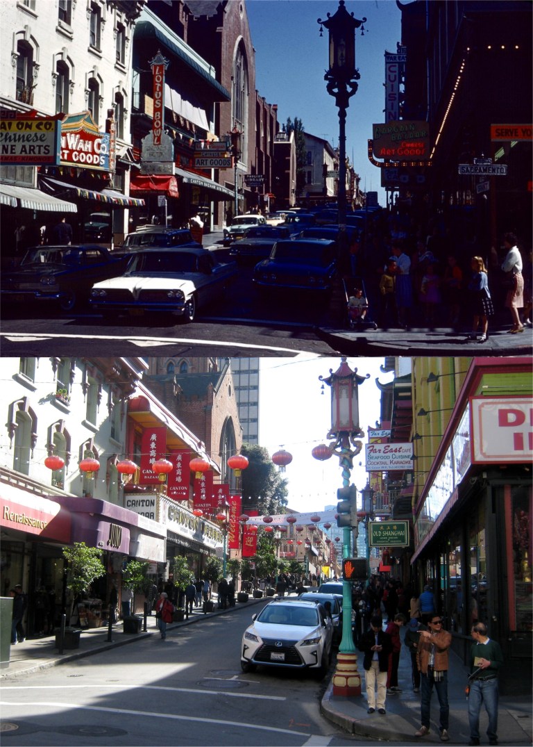 Two images of Grant Avenue at Sacramento Street in 1968: These were taken last week toward the end of December. It was still sunny out, but you needed a jacket. Old St. Mary’s Church is on the left side of Grant Avenue in the four pictures. (skyscrapercity.com)
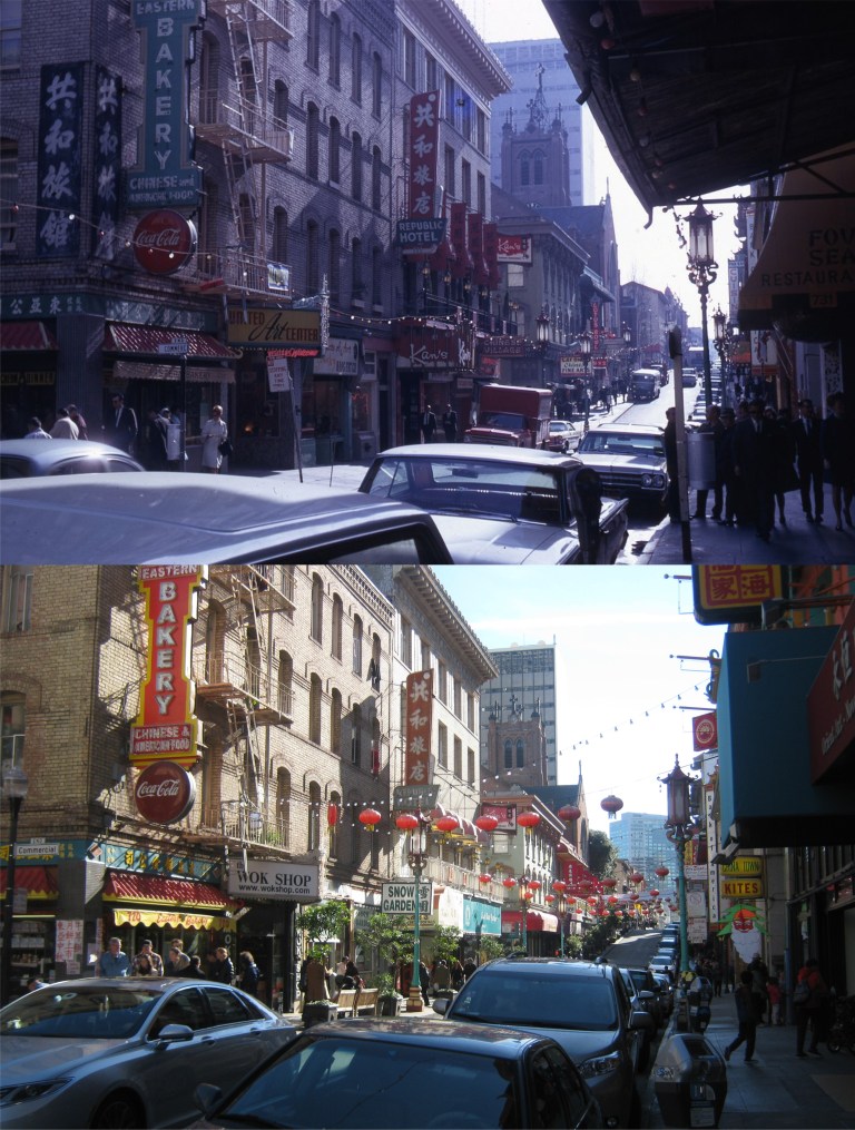 A little further north on Grant Avenue at Commercial Street in 1968: (skyscrapercity.com)
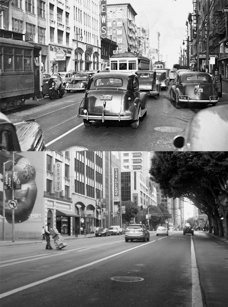 Mission Street between 4th and 5th Streets looking east in the 1940s: No personalized license plates, no “SHIT HAPPENS” bumper stickers, and a lot more traffic. Probably every building in the vintage photo is gone now except the building with the Denny’s Restaurant and the building with the arched windows to the right of the Denny’s building. (oldmotor.com)
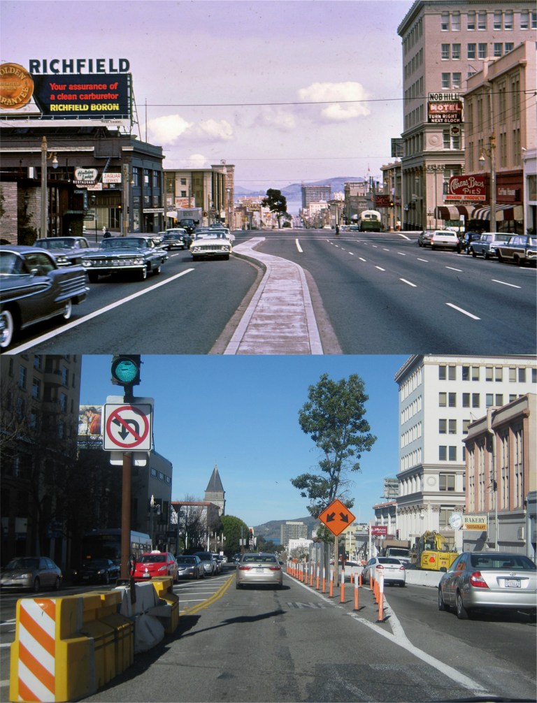 Van Ness at Jackson Street heading north in 1964 and New Year’s Day, 2019: It’s a mess driving along Van Ness nowadays! ‘RICHFIELD BORON’, I had to look boron up. It’s a chemical element with the symbol B and the atomic number 5, produced by cosmic ray spallation and supernovae, and not by stellar nucleosynthesis. Hey, I knew that! (skyscrapercity.com)
 We’ll open up with a 1939 map of the 49 Mile Scenic Drive from the San Francisco Downtown Association, and a current map of the Scenic Drive that shows where the route varies from the original drive today. It also shows that map drawers today show less creativity.
 Dorthea Lange was a photographer famous for her pictures taken during the Great Depression of the 1930’s. In 1939 she took a number of pictures in San Francisco, including this one from the ramp of the First Street exit off of the Bay Bridge, now called the Fremont Street exit. You can see Coit Tower, the Shell Building, the Standard Building, and the Russ Building among other landmarks in her picture, none of which are visible from here today.
 In another Dorthea Lange photo taken on the same day in 1939 as the previous picture, you can see the Key System train tracks along with a train that ran from the East Bay across the Bay Bridge and into the Transbay Terminal. The Fremont off ramp, seen in my picture, follows the same path as it did in 1939. Dorthea would have taken her picture near where the Fremont and Folsom street signs are in my picture.
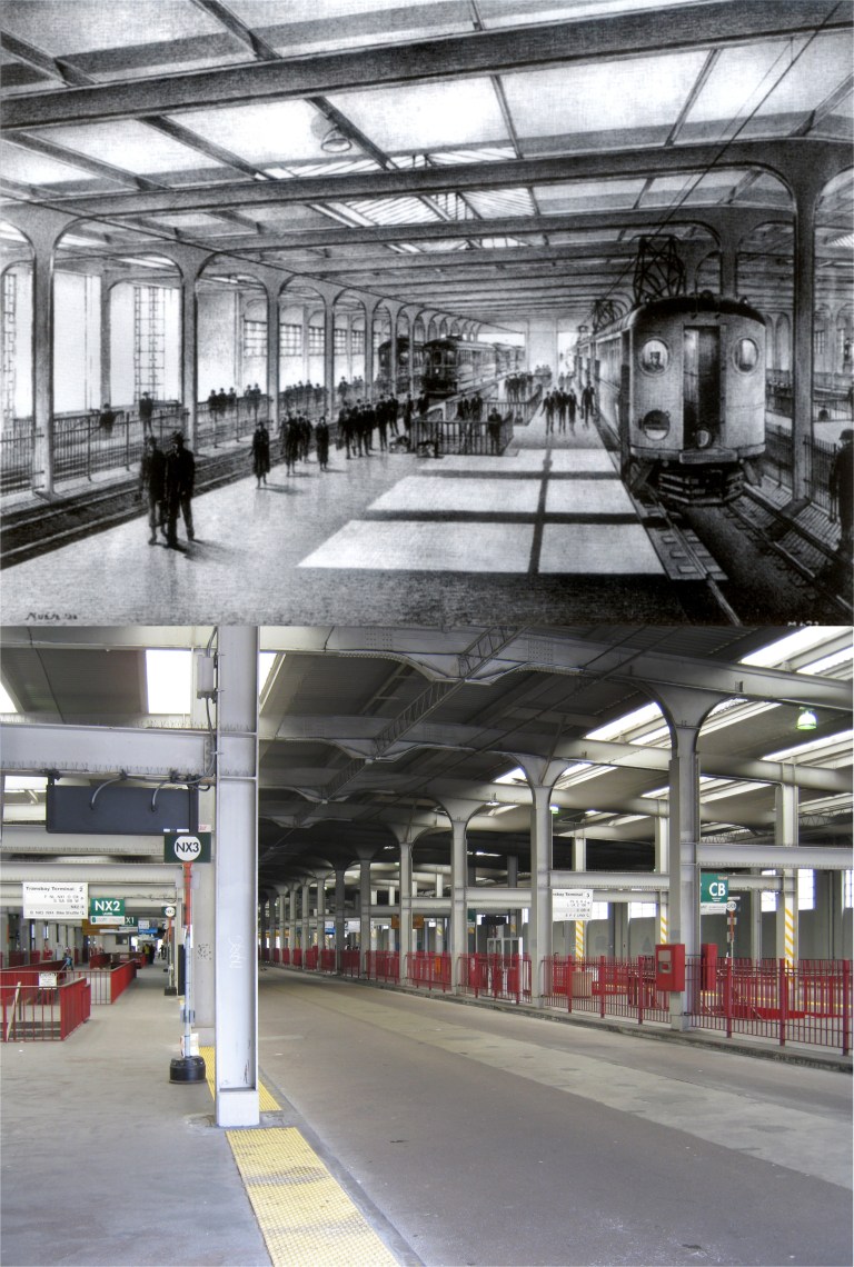 An artist’s rendition of what the Transbay Terminal that opened in 1939 would look like, and the Transbay Terminal on the last day before it closed forever in August of 2010. The Transbay Terminal lasted for over 70 years. The Transit Terminal, that replaced it and opened in 2018, lasted a little over 7 weeks before it closed indefinitely.
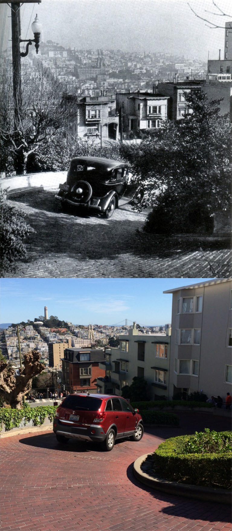 An auto navigates the portion of Lombard Street know as the “Crookedest Street in the World” in 1939.
 Two 1939 cuties swimming at the Maritime Museum in Aquatic Park: The Maritime Museum opened in 1939. (Edwin Rosskam)
 A family enjoying a day at Ocean Beach near Seal Rocks and the Cliff House in 1939: Boy does that vintage picture look posed! (Moulin Studios)
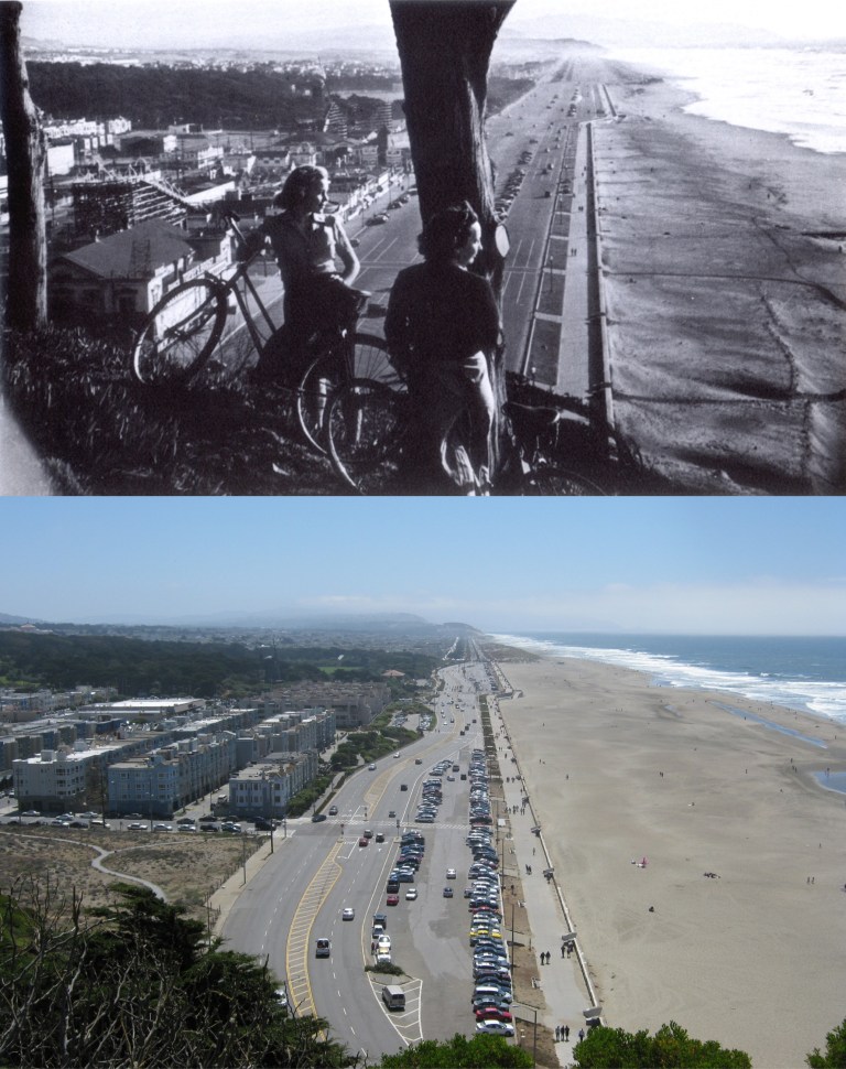 A couple more 1939 free-spirits riding their bicycles up to Sutro Heights above Playland-at-the-Beach:
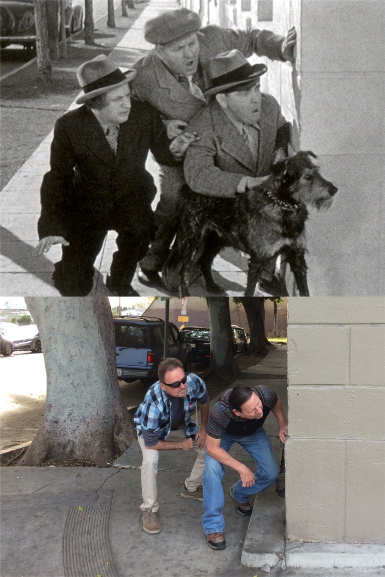 The Three Stooges were at their peak in 1939 in their short film here, ‘Calling all Curs’. This scene was filmed at Fernwood Street and North St. Andrew’s Place in Los Angeles. (Columbia Pictures)
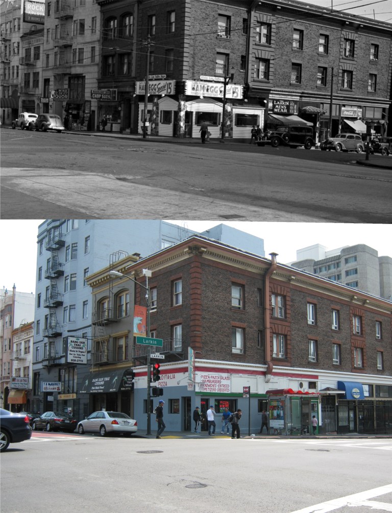 The Tenderloin, seen here at Larkin and O’Farrell Streets in 1939, may have been a little more “tender” back then than it is today. (HuffingtonPost.com)
 A lady waiting for an auto, bus, streetcar or cab at on Market Street at Jones in 1939. I don’t know if that coat, whatever it was made from, would go over too well nowadays.
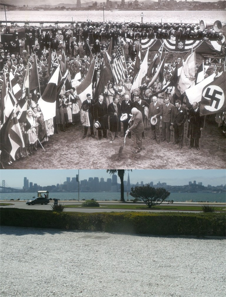 Groundbreaking for the Golden Gate International Exposition on Treasure that opened in 1939: Notice the flags of Japan and Germany; fifteen months after the Fair closed in September of 1940, America would enter World War Two to fight these two countries.
 The road that leads from Yerba Buena Island to Treasure Island showing the Treasure Island Fair that ran from February of 1939 through September of 1940: (FitzPatrick Traveltalks)
 Hollywood visited the Treasure Island Fair in the 1939 film ‘Charlie Chan at Treasure Island’ with Sidney Toler playing Charlie Chan. The Cantilever Bridge that ran from Yerba Buena Island to Oakland is in the background across “Clipper cove’ in both pictures. Clipper Cove got its name from the Pan Am Clipper Seaplanes that took off and landed here during the Fair. The new Eastern Span, still being constructed in my picture, opened during the summer of 2013.
 ‘Charlie Chan at Treasure Island’ has a scene that features a fly over of Treasure Island showing the Fair from a Clipper plane and some landmarks like the Sun Tower and the Administration Building.
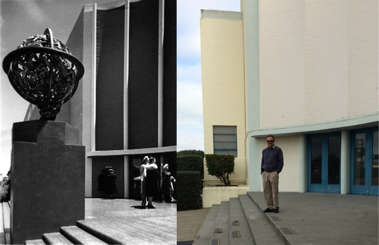 The Administration Building, an airplane hanger, and the Palace of Fine and Decorative Arts Building, seen here, are the only three surviving structures from the Fair.
 I have a few mementos from the Treasure Island Fair that I picked up at a museum sale over 50 years after the Fair closed; a coaster and an official tour book.
 However, most dear to me was that my mother, as a teenager, took a train from Grand Forks, North Dakota to spend the summer of 1939 in San Francisco. She stayed with her aunt at this house on the corner of Anza Street and 24th Avenue in the Richmond District. My mom, on the left, is sitting with her cousin Frances. I remember my mom telling me how close she and Frances were, but by the 1990’s they had lost touch with each other forever.