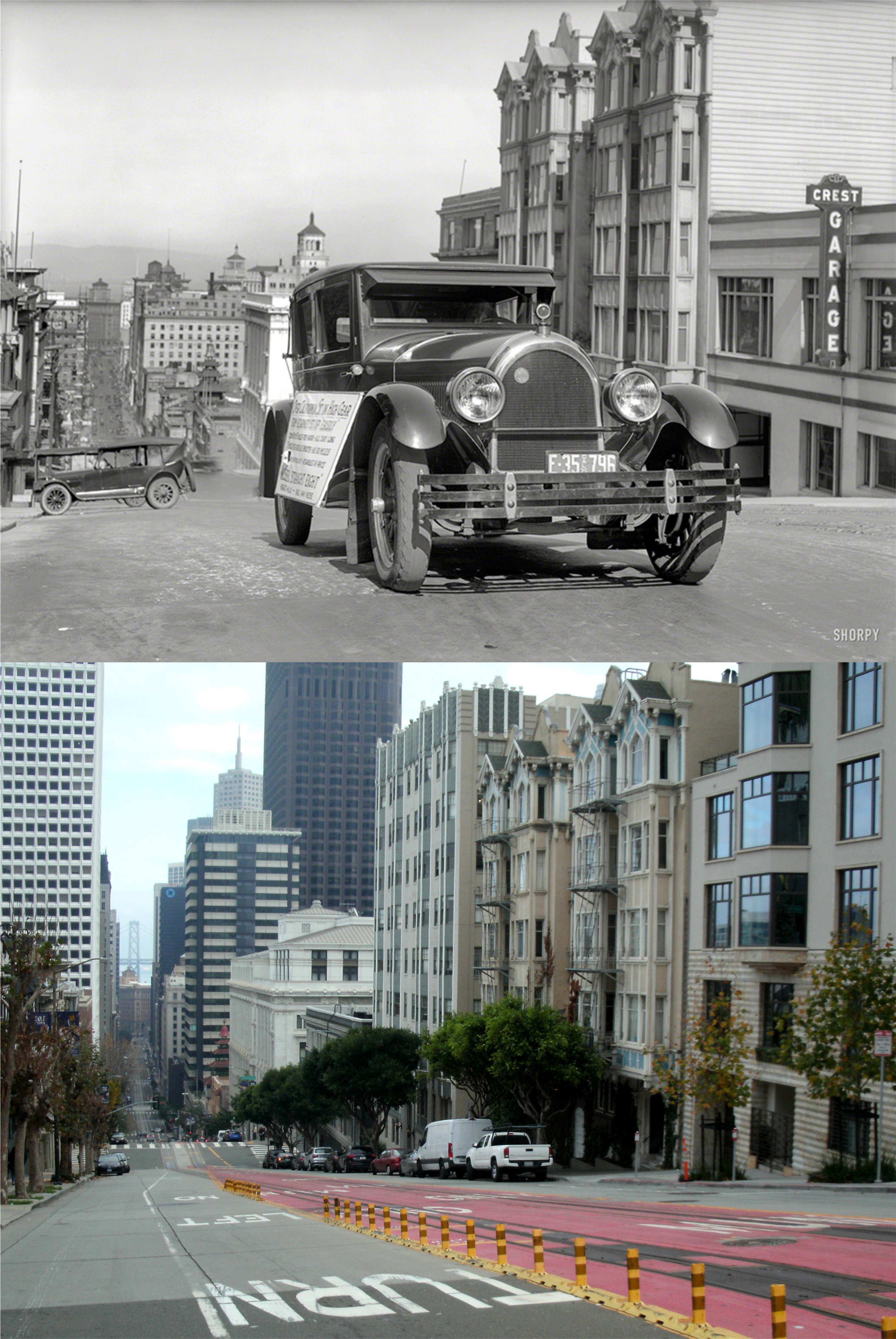
My brother sent me a link to another one of those old San Francisco film clips, posted occasionally on YouTube by NASS Video Restoration. The film features fine, although sometimes protracted, vintage San Francisco locations during the 1940s, and for me, a surprise I didn’t see coming. The clip features scenes in Chinatown, North Beach, Civic Center, and Sutro Heights among some of the locations. (Thumbnail images)

The opening scene is at Grant Avenue at Washington Street: This is one of the protracted scenes with people coming and going; some of them kind of sinister looking.
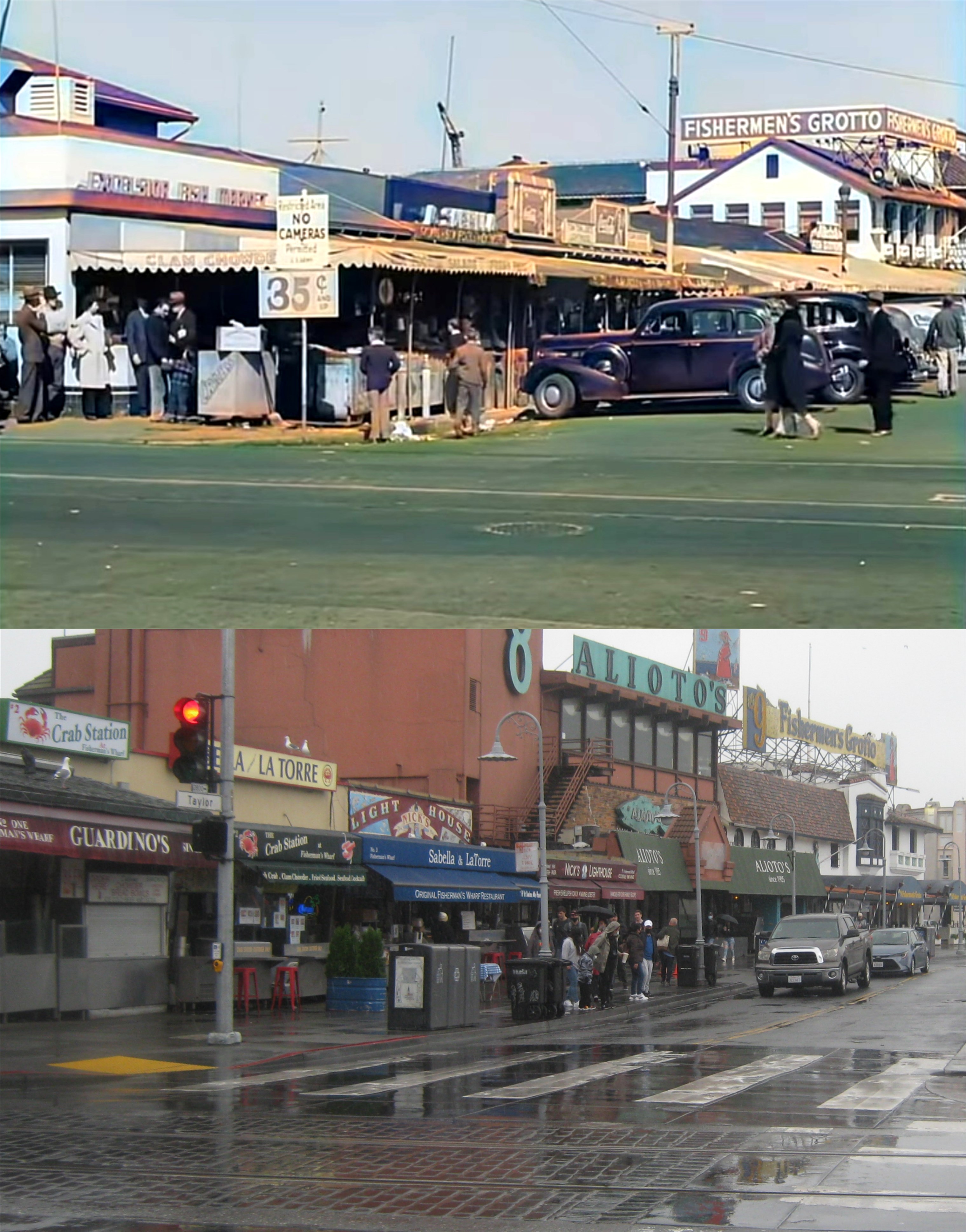
Jefferson and Taylor Streets, Fisherman’s Wharf:

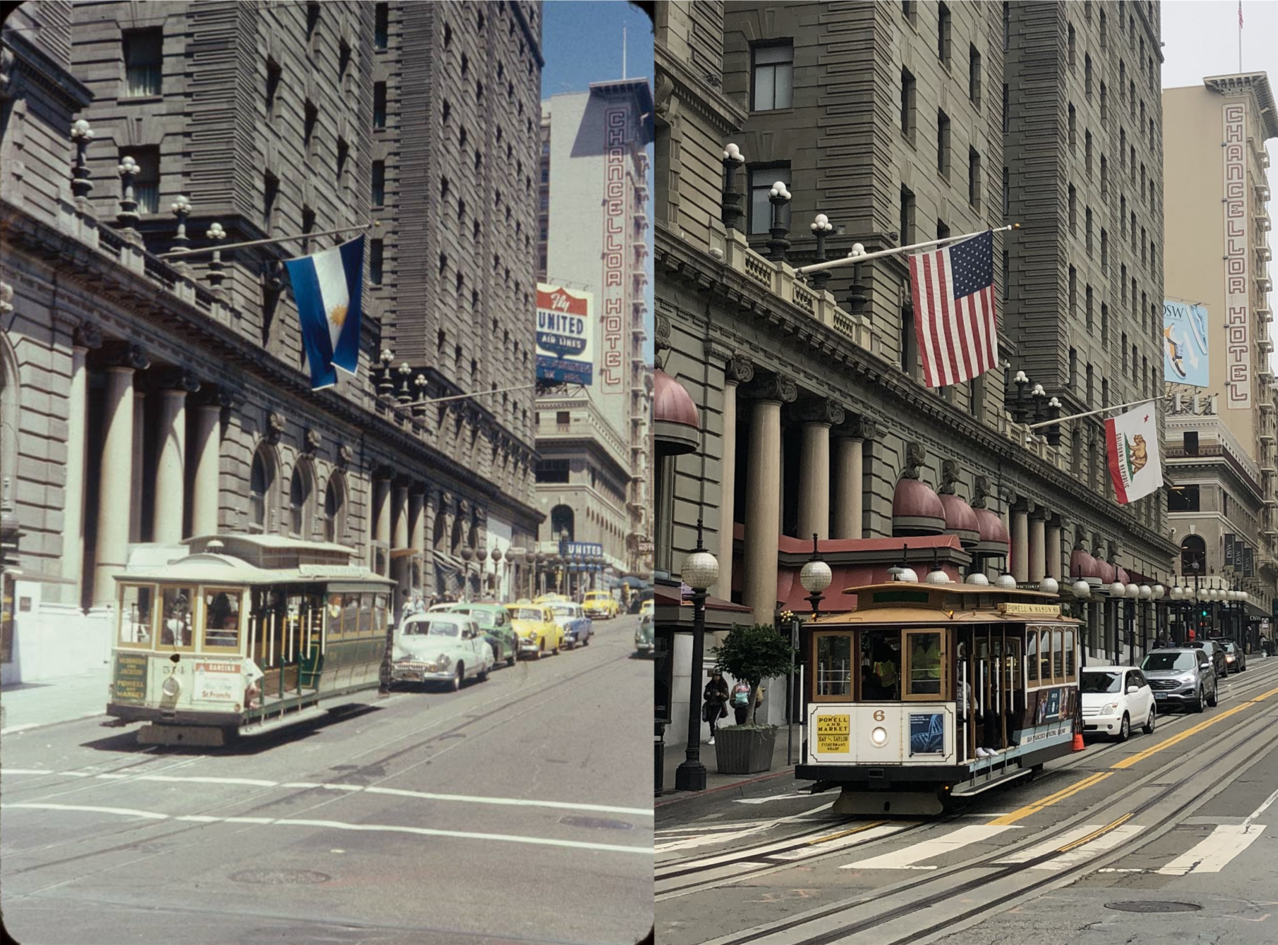
Looking down California Street from Stockton Street toward Chinatown:

I was able to get a shot of a cable car going down California Street from here, as well.

The view of Playland-at-the-Beach, Golden Gate Park and the Great Highway from Sutro Heights: The statues, urns and cannon of Adolph Sutro are gone now, and so is a lot of the view because, like Coit Tower, they simply will not trim the trees here.
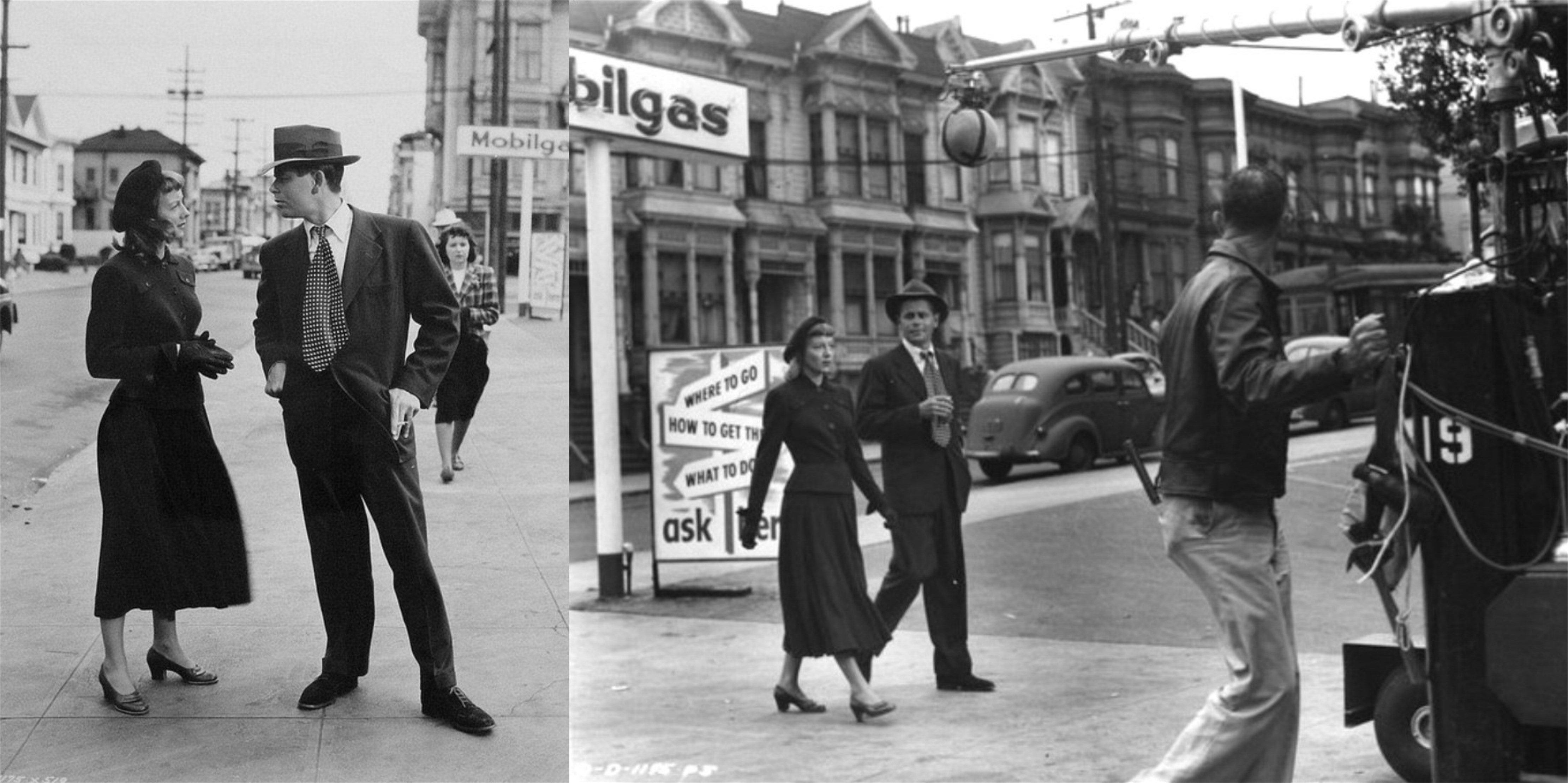
Now to the reason for the title to this post: These are movie stills from the 1949 film ‘Mr. Soft Touch’, starring Glenn Ford and Evelyn Keyes. The movie has many San Francisco locations, such as North Beach, the Lefty O’Doul Bridge, and a service station at this unidentified corner. I’ve been curious for some time as to where this corner was at, but hadn’t been able to locate the spot. My guess was that it was in the Western Addition somewhere, and all of the old houses in the background of the second picture have been demolished. (Not a bad guess)
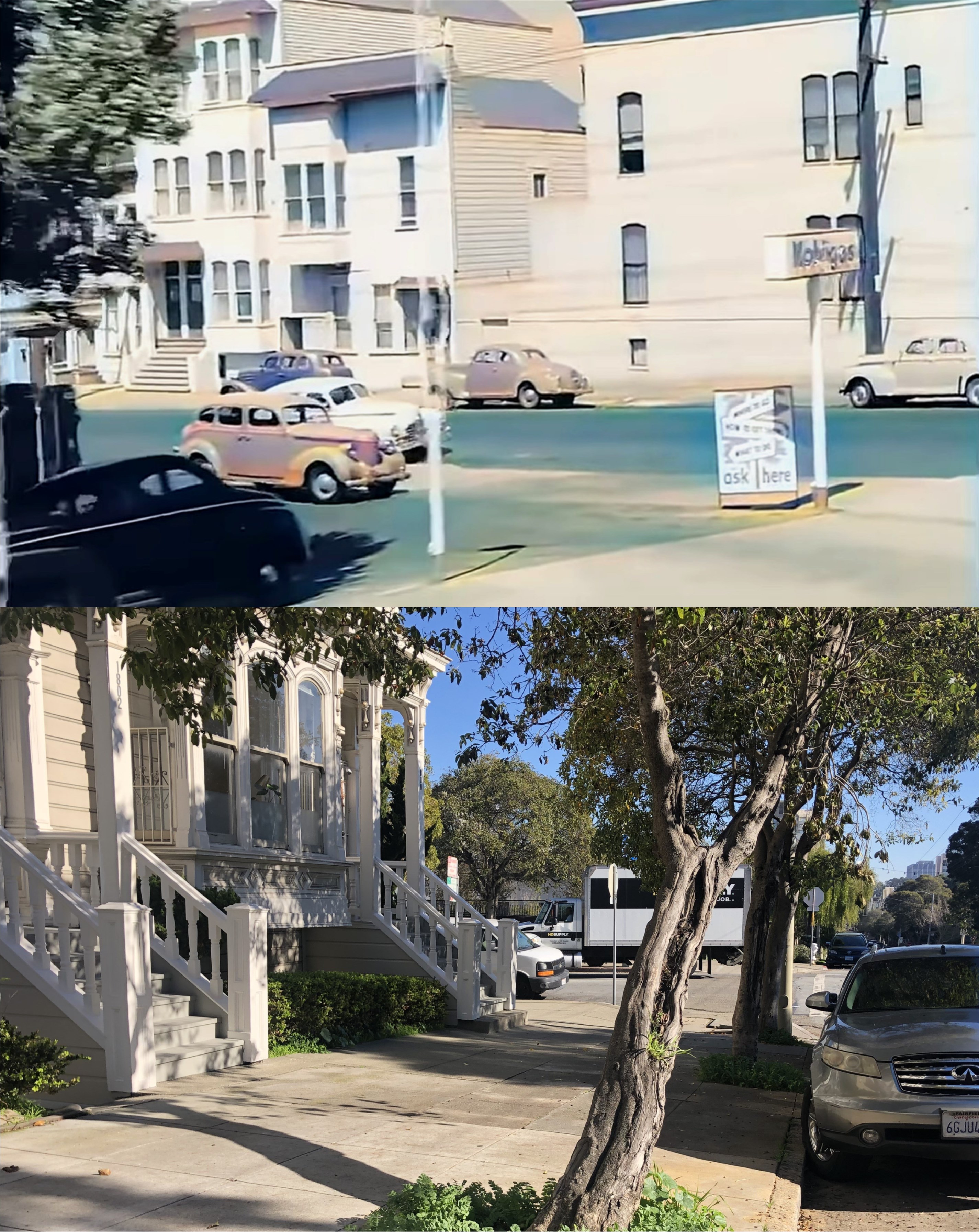
So when I came to this scene in the NASS clip, I was fascinated, to say the least! It was the same corner, the same Mobile Station, and the same advertisement sign as the corner in ‘Mr. Soft Touch’ I rewound the film clip several times looking for a street sign or a building I could recognize, but I didn’t have any luck. I consider myself pretty good at finding San Francisco locations, but I also know my betters. I went to the experts; I posted it on the San Francisco Remembered Facebook page asking for assistance, and by nice detective work, a group member named Judy H. located the corner. After several blind alleys, such as old telephone book listings of gas stations in San Francisco from that period, by studying the film, and using street view maps and old city directories, Judy correctly identified the corner as the northwest corner of Eddy and Scott Streets.

The location of the 1949 film stills today: Well done, Judy! The gas station is gone now, and an old Victorian house may have been relocated to the corner in the 1970s, or Scott Street has been widened since then.

Many of the houses in the NASS clip, like these two, are still around.

The columned building, seen just before the clip moves to Fisherman’s Wharf, is now the Macang Monastery on Eddy Street.
Here’s the YouTube link to the NASS clip.