A “Throwback Thursday” for Thanksgiving, 2020

I spent most of Thanksgiving week updating vintage 1906 Earthquake pictures around Downtown San Francisco. This doesn’t have much to do with current events, except that the COVID-19 Pandemic of 2020 has changed life in San Francisco more than anything in the history of the city since the 1906 disaster; with the possible exception of World War Two. Anyway, April of next year will be the 115th anniversary of that nightmare, so I may as well get an early start on the commemorating. Hopefully, things will be more back to normal by April of 2021, and San Francisco can look back at COVID-19 as a sad memory from the past, as well. Stay with me awhile as we rummage around the ruins of 1906 San Francisco. (Thumbnail images)


We’ll start out with an Arnold Genthe photograph of the ruins of William Randolph Hearst’s Examiner Building at 3rd and Market Street. The modern picture is the building Hearst rebuilt after the earthquake and fire. (The Art Institute of Chicago)


Looking south from Kearny, you can see the Hearst Building, in between the Chronicle Building on the left and the Call Building on the right, being dynamited. The remodeled Call Building is right center in the modern photo, and you can just see a portion if the red Chronicle Building on the left. (Monovision)


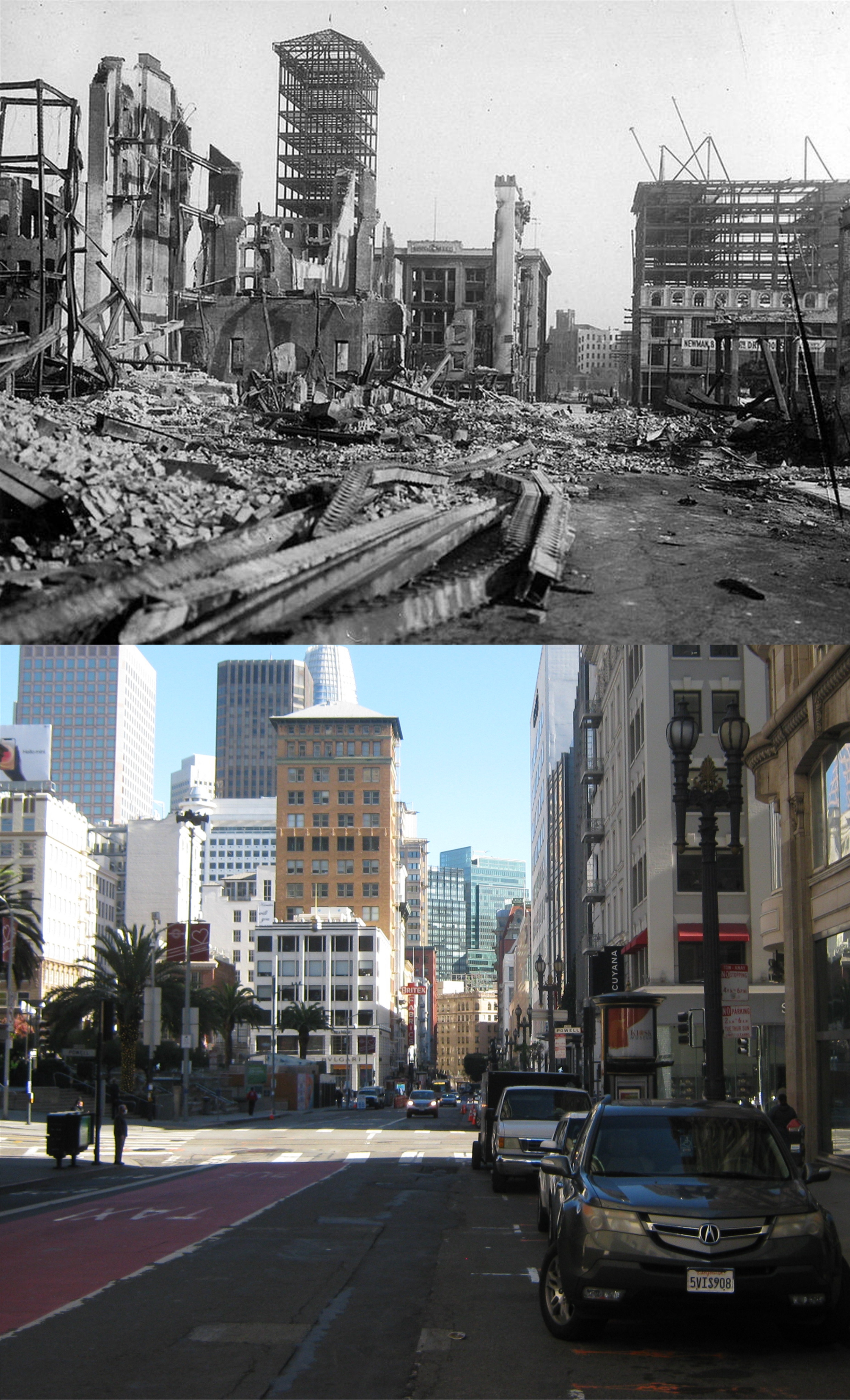
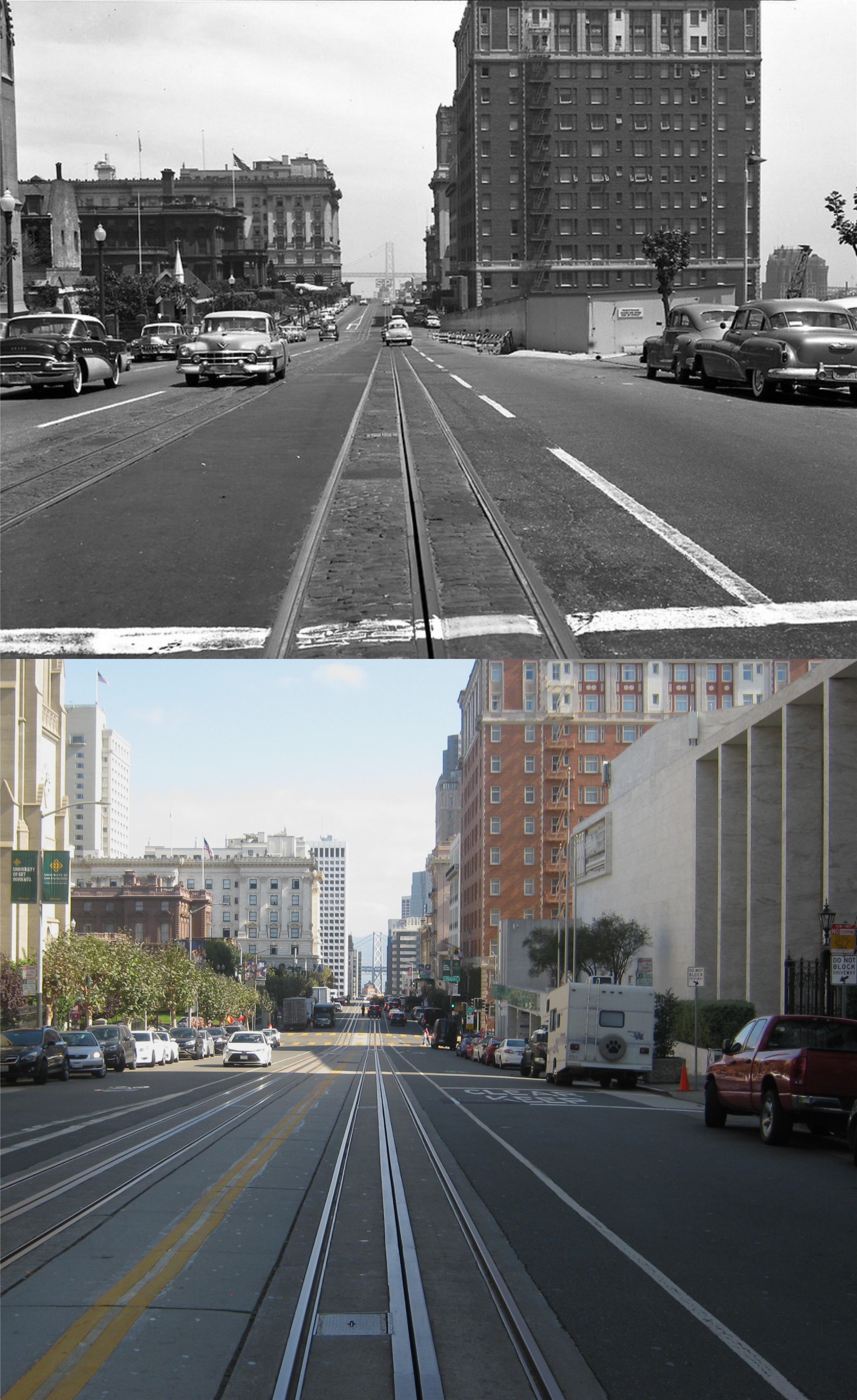
Looking east along Market Street from Stockton Street:  The Gothic looking Mutual Savings Bank Building in the center and the Call Building on the right, are in both photos.


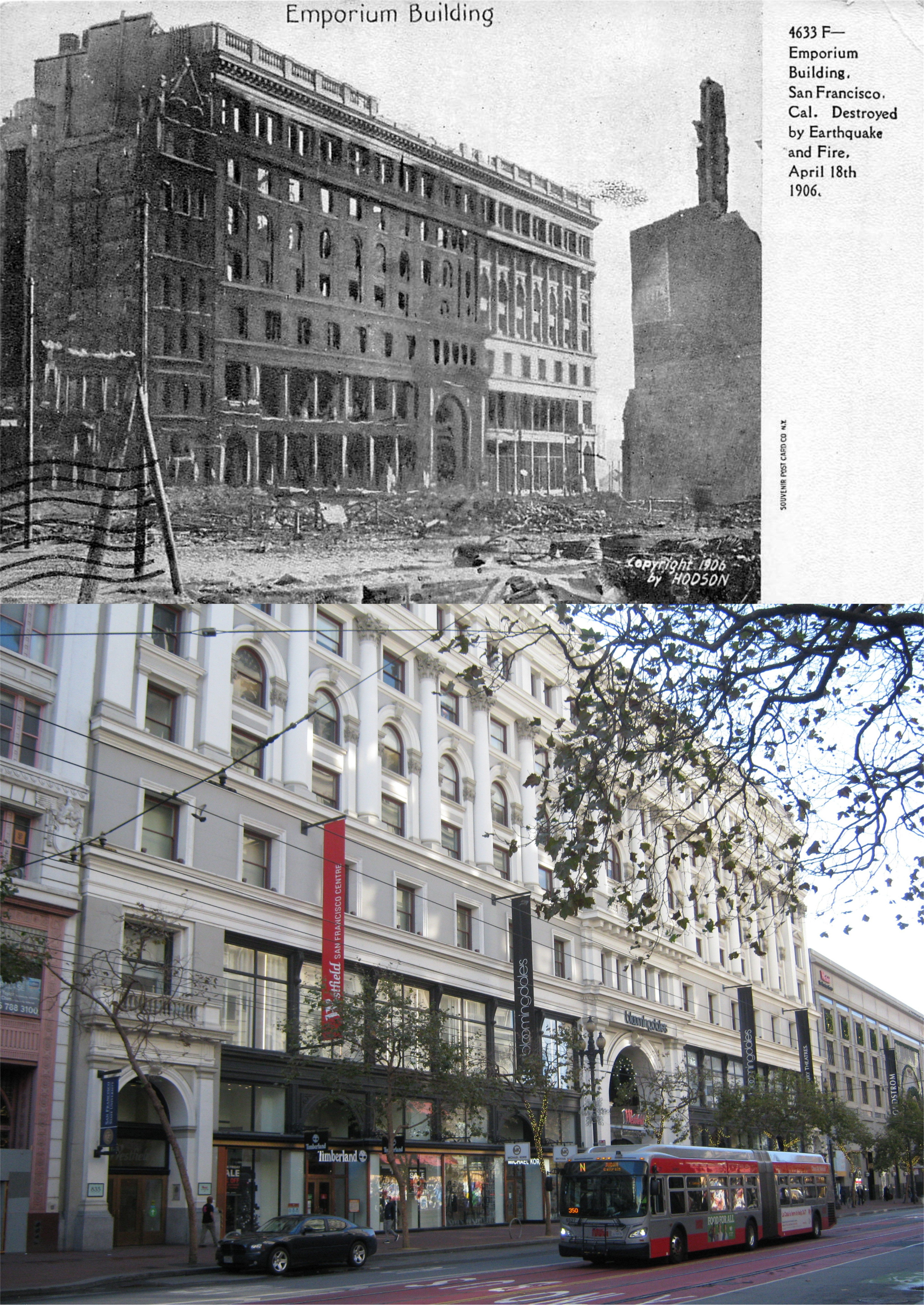
An old postcard of the ruined Emporium Building, now the Westfield Centre:

Looking west along Post Street from Kearny Street: (The Library of Congress)

Looking east along Market Street from Kearny Street; this one turned out better in black in white because of the Market Street Canyon shadows. On the right are the old and new Palace Hotel, on the far left is the Chronicle Building. (The Library of Congress)


Looking east down Pine Street toward Montgomery Street: (rarehistoricalphotos.com)


The old Hall of Justice Building across Kearny Street, (spelled wrong in the vintage picture) from Portsmouth Square: The new Hall of Justice Building, built to replace the one destroyed in 1906, can be seen in many films and several television shows. Demolished in 1968, a Hilton Hotel where the pedestrian bridge crosses Kearny Street is was where the Hall of Justice Buildings stood.  (Monovision)


Looking east down Sacramento Street from Chinatown: You can see the Ferry Building in the background of the vintage picture. (rarehistoricalphotos.com)


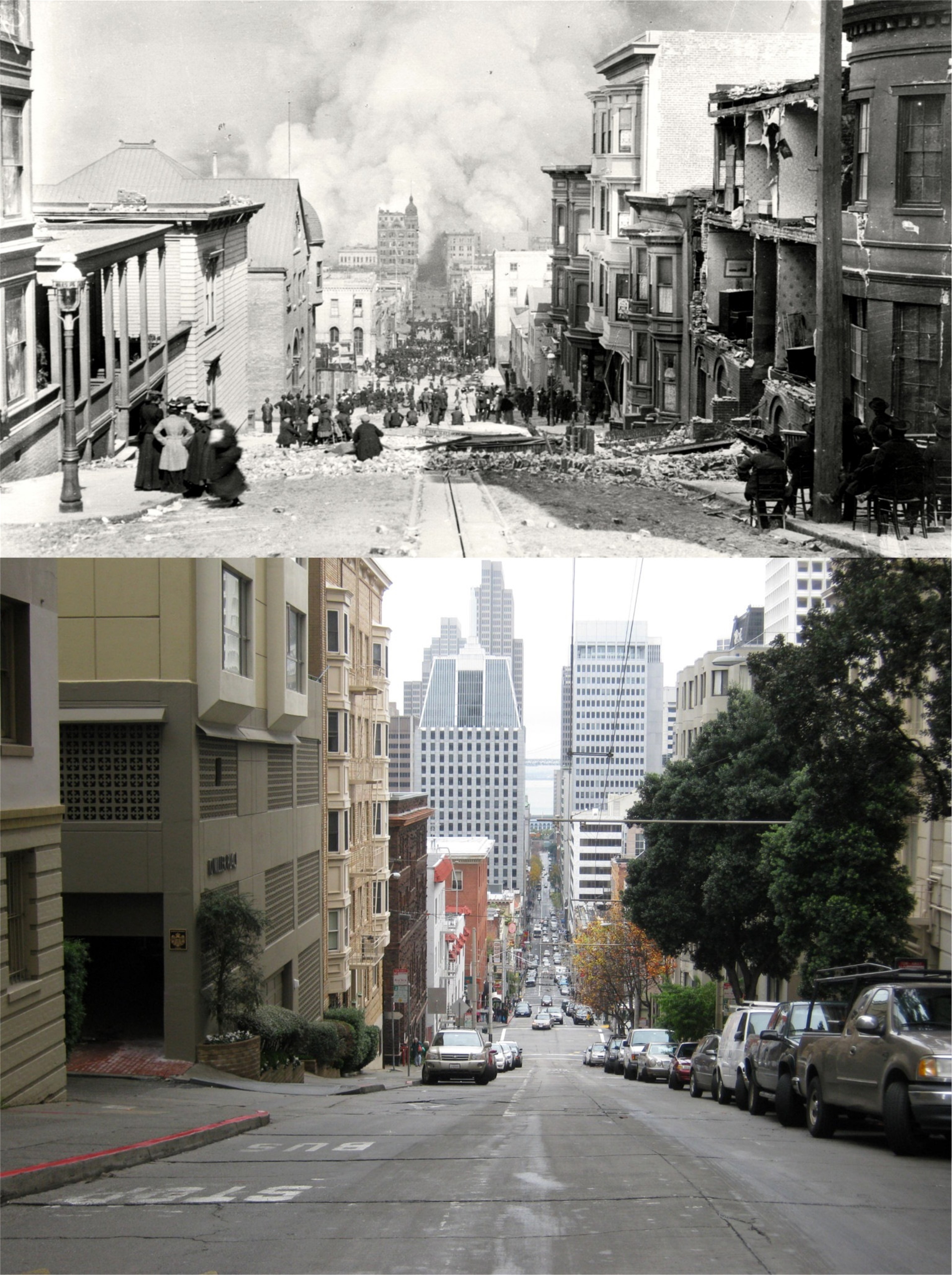
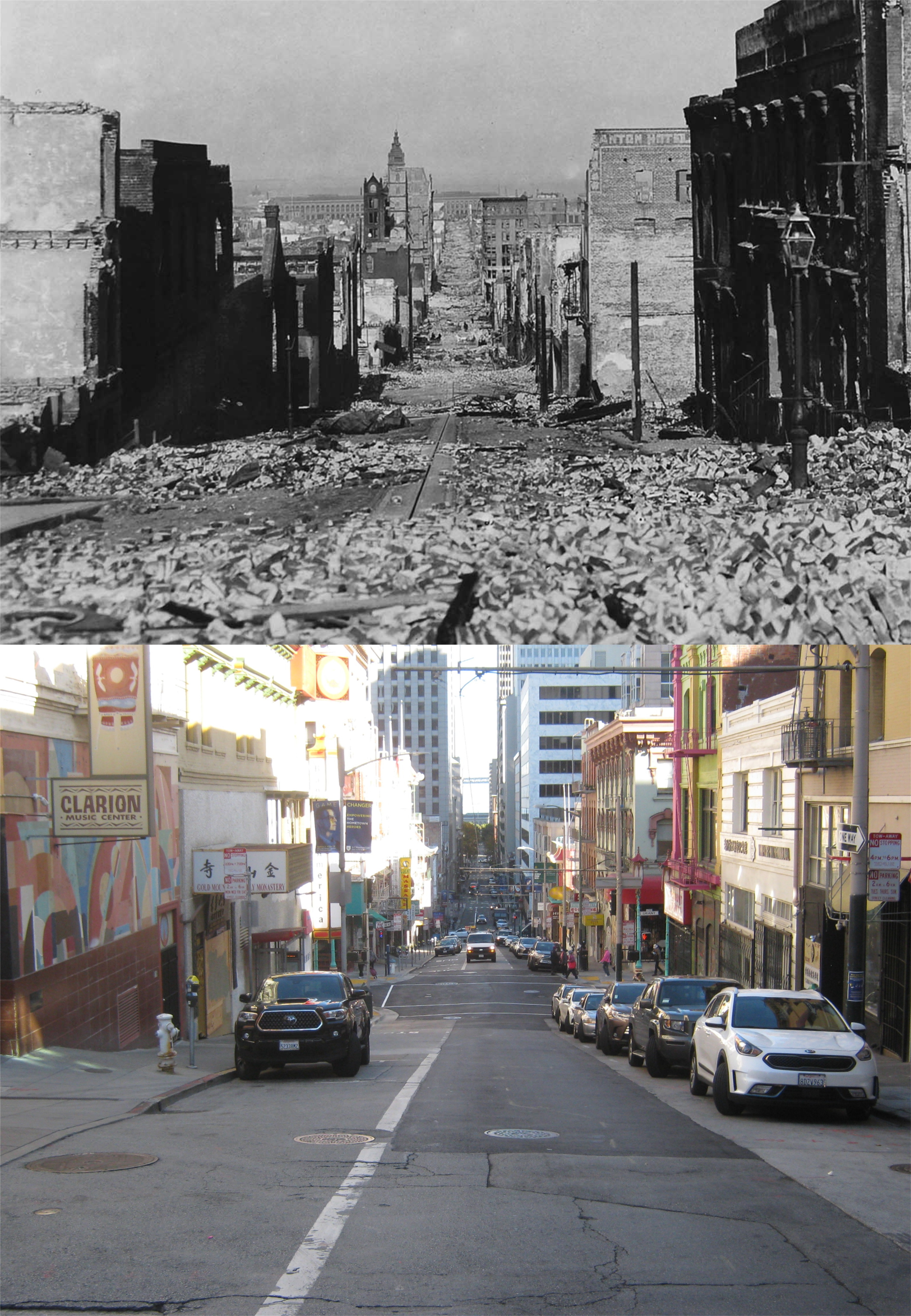
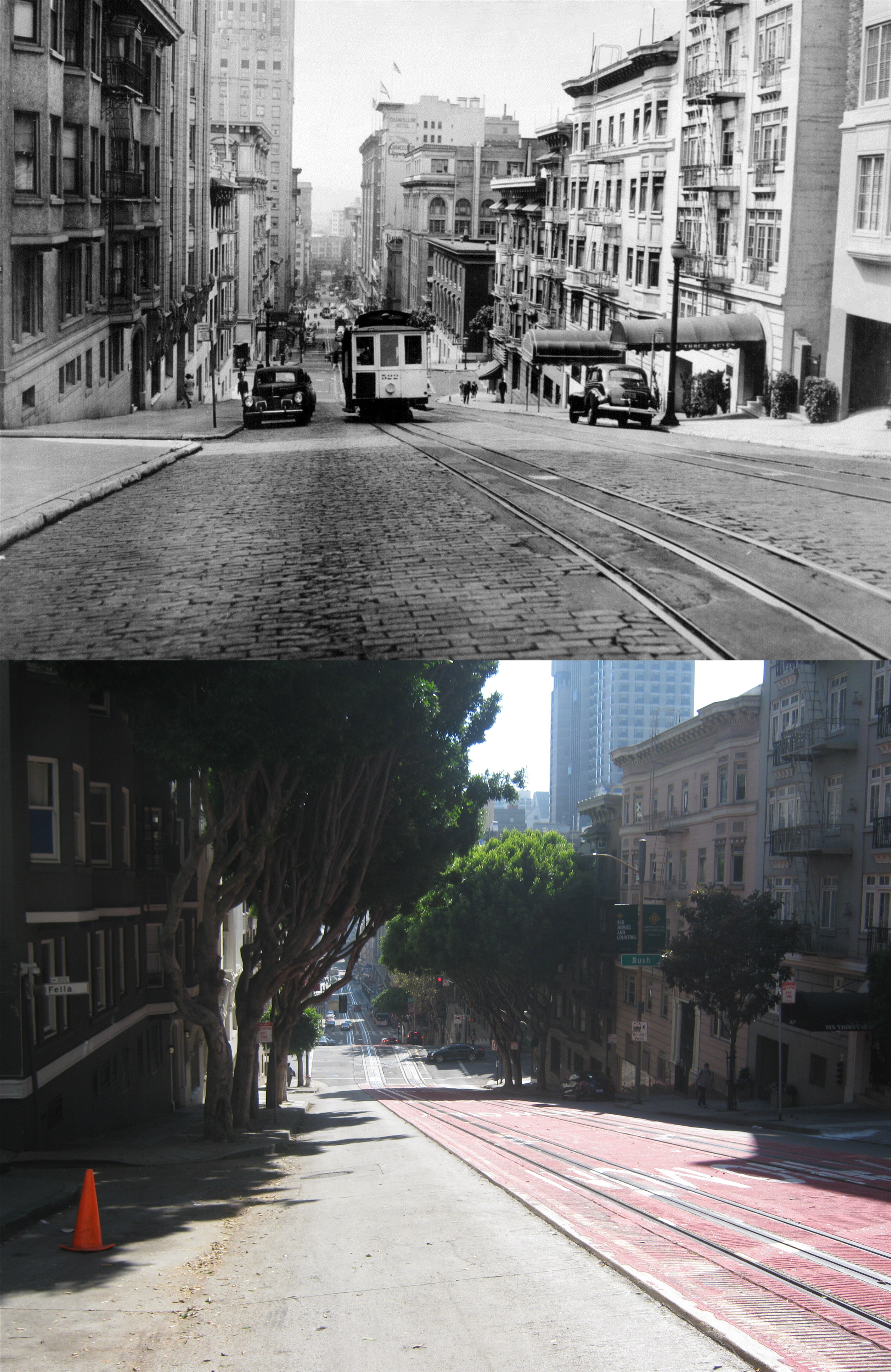
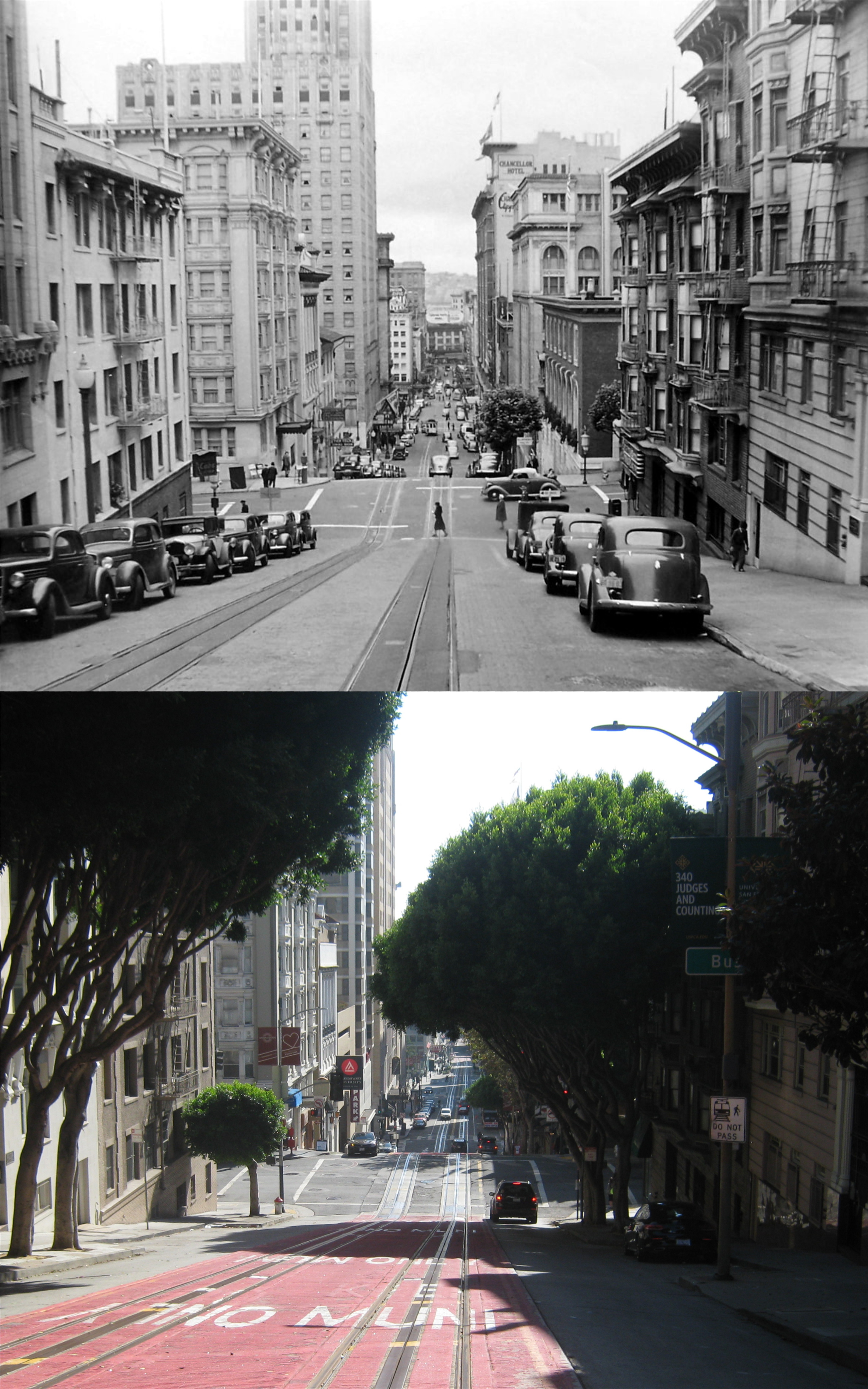
Two blocks up Nob Hill from the previous picture at Sacramento and Powell Streets is where Arnold Genthe took his famous picture of San Franciscans watching their city being destroyed. This picture of his makes it on many lists as being one of the greatest photographs of all time.


Looking east on Geary Blvd past Union Square toward Stockton Street:


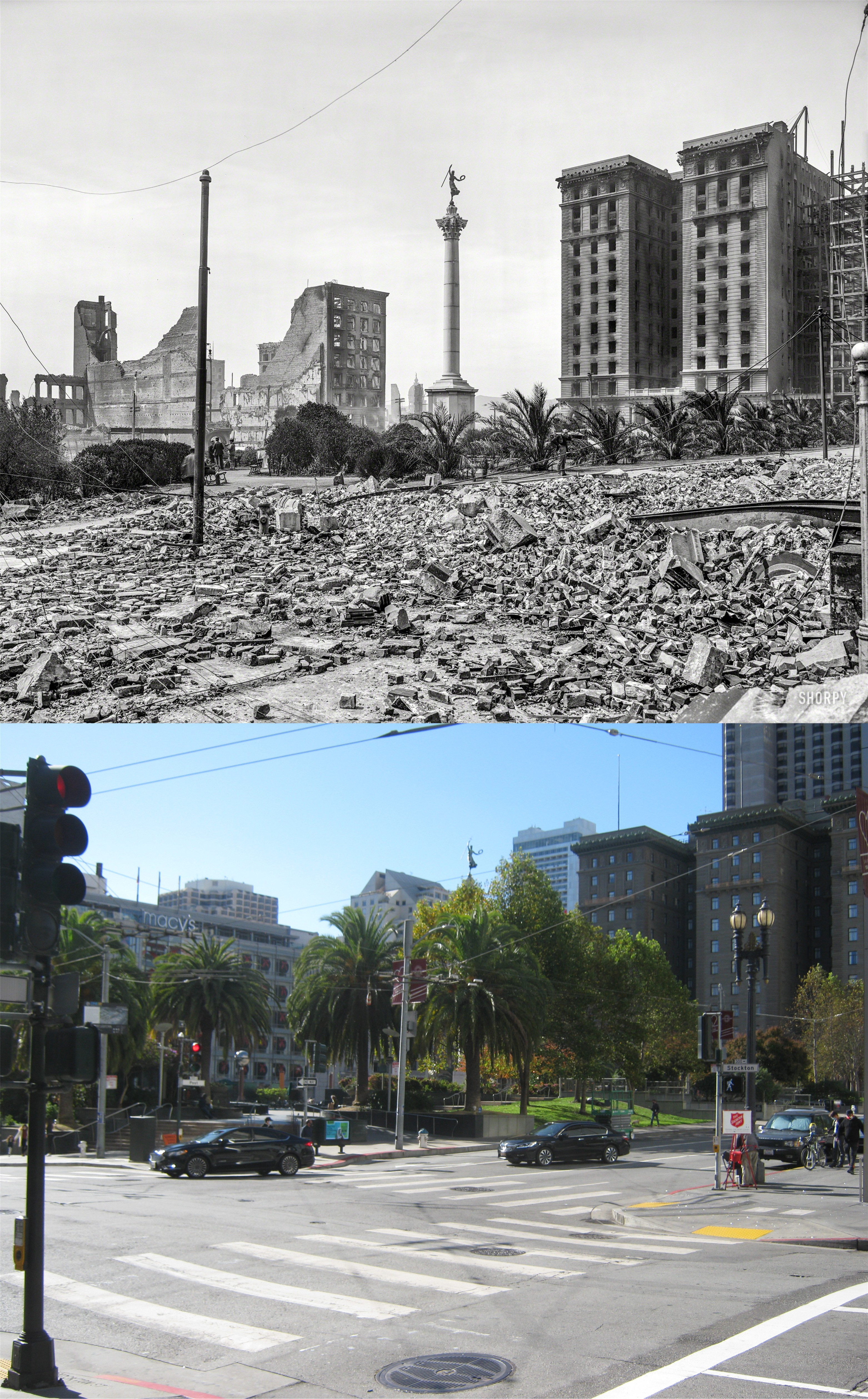
Union Square and the Dewey Monument looking toward the St. Francis Hotel before the northern wing was built: Normally, Union Square would be crazy tomorrow on “Black Friday”, but that won’t be the case this year. (Shorpy Archives)

Taking in the town the easy way (For Carrie Ann)

Last week, one of my nieces bought me an expensive electric bike as a surprise gift, and had it delivered from Texas. What a sweetheart, and what a blast I’m having! Last Sunday and today, I decided to ride around San Francisco hogging the camera and having nothing but fun; bicycling around all day without getting any exercise. Hey, don’t shake your heads; I’ve paid my dues around those SF hills on a regular bike many times in the past! (Thumbnail images)

California and Powell Streets, one of my favorite spots: Even taking a bus up here sometimes tires me out, but not today.


Bush Street and Grant Avenue at the entrance to Chinatown: (opensfhistory.org)


Relaxing awhile with Janis at the Palace of Fine Arts:


The Embarcadero, south of the Ferry Building in 1987, and about the same spot today: The little tyke in the purple skirt on my right in the picture was the one who bought me the bike.

A visit to Pier 45

This the first time I’ve been back here since the tremendous fire May 23rd 2020 destroyed Shed C of Pier 45 where the World War Two Liberty Ship, the Jeremiah O’Brien was docked. (Thumbnail images)


Looking toward Telegraph Hill from near the end of Pier 45:


Work clearing away the debris from the fire has uncovered some of the old Belt Line Railroad tracks.


Passengers, including me, waiting for the gates to open for the Fleet Day Cruise in October of 2017: The bottom picture of the gates now reminds me of the Portals of the Past out in Golden Gate Park

.  

The view from the top of the Jeremiah O’Brien looking over Pier 45 toward Telegraph Hill and Downtown San Francisco was stunning!


Looking out over the top of Pier 45 toward the Golden Gate Bridge during the Parade of Ships for Fleet Week, 2018:


I took the top photo looking through the closed gates toward the Jeremiah O’Brien on March 21st 2020, four days after the shelter-in-place order of March 17th shut down the Liberty Ship indefinitely. Nobody could have imagined the inferno that would hit this portion of the pier just two months later.

“Hey, fella! What happened to the ship that was here?”

Actually, the Jeremiah O’Brien is tucked away at Pier 35 right now, but the crew is hoping to bring the ship back to her spot here at Pier 45 by next year.


“It ain’t over till it’s over.”

That idiom from Yogi Berra could apply to the upcoming election, the COVID19 Pandemic, or 2020. I think we’re all waiting for any of these developments to be over. I closed out October taking a few “walkabouts” around Nob Hill, thinking about some of the issues I was going to have to decide on this Tuesday. Even in pre-pandemic days, Nob Hill is a peaceful area to try and pull my thoughts together, something I seem to find harder and harder to do nowadays, and decide on some of the voting choices. In the end, as usual, I’ll probably make my decisions at the last moment, and leave the polling place wondering why I chose some of the selections I did. Now back to Nob Hill; if you map it out just right, you can walk around the entire hill without having to do too much uphill walking. (Thumbnail images)


The trick is to take the MUNI #1 bus up Sacramento Street to the top of Nob Hill and gradually wind your way back down the hill.  Under the circumstances, #1 was a little more crowded on this day than I would have liked.


The view east along California Street from Jones Street in 1956: The Huntington Hotel is on the right, and on the left are the Pacific Union Club Building and the Fairmont Hotel.  On the far right where a vacant lot was in 1956 is the Masonic Auditorium. This was where the mansion with the doorway that’s now the Portals of the Past site in Golden Gate Park was destroyed in the 1906 Earthquake leaving only the entrance standing. Cable car lines dissect Nob Hill like nowhere else in San Francisco, and when they’re running it’s almost impossible not to encounter one when on the hill. Cable car lines run on the California, Mason, Washington, Jackson, and Powell Streets portion of Nob Hill. You’ll see a lot of cable cars in the vintage pictures, but sadly, none in my pictures. (SFMTA Archives picture from the San Francisco Pictures blog)


Looking up Jones Street from California Street past the west side of Grace Cathedral in 1952 from the Charles Cushman Collection: No, we’re not going this way, the hill looks too steep and I’m getting tired just looking at it. We’ll head over to the Fairmont Hotel.

The Sacramento Street side of the front of the Fairmont Hotel in April of 1949: I was as lost in thought as the lady here appears to be when I passed by where she was sitting.

“I wonder why I voted for Dewey last November?” (opensfhistory.org)


One block west on Sacramento Street, and three blocks north downhill brings us to Jackson and Taylor Streets, looking west in 1952 in another picture from the Charles Cushman Collection. I don’t like the looks of that climb either, we’ll head the other way.


Looking east down Jackson Street from Mason Street in 1962: From here, we’ll head one block south on Mason to Washington Street.


We’ll turn east on Washington Street and head down hill to Powell Street. Looking west in the vintage photo and mine, you can see the cable car barn and museum on the right. (SFMTA Archives)


I didn’t get off entirely easy from Powell and Washington Streets to get back over to California Street; there’s an uphill grade this way, but either it goes by easier or I’m in better shape than I thought I was in. From California Street I headed into the sun and down Powell Street near Fella Alley where this 1940’s picture was taken just south of Pine Street.


We’ll cross Powell Street from where the previous pictures were taken and a view toward Bush Street in another cool picture from the 1940s that I found on Reditt.  We’re getting close to the bottom of Nob Hill and my destination. See that blue awning on the left just in front of the Academy of Art University? That’s the Roxanne Café, open for business again and glad to see me. A plate of ham, eggs over-easy, and seasoned potatoes were a perfect end to my lazy man’s Nob Hill adventure.


I passed the Mark Hopkins Hotel while I was up on the top of Nob Hill and thought of the Top of the Mark, temporarily closed. This vintage picture from 1927 when the hotel opened is looking east. Look at San Francisco from the Top of the Mark now, and then look back to 1927: The view is between California and Pine Streets and I squeezed two of my pictures together to make a reasonable comparison. At the far right in both pictures is the old Pacific Telephone Building, the tallest building south of Market Street up until the 1980s. Looking left toward the Hobart Building you can see the Hunter-Dulin Building on Montgomery and Sutter Streets under construction. Sam Spade from the Maltese Falcon would open up his detective practice in this building when it was completed. Looking left toward the Ferry Building, which is blocked from today’s view, almost all of those old buildings on Montgomery Street are gone now. In the center, and looking like something from the Parthenon in the vintage picture, is the Ritz-Carlton Hotel. The building was built in 1909 for the Metropolitan Life Insurance Company. Among other notables still visible on the left side of both pictures are Old St. Mary’s Church and the green roofed Federal Reserve Building. So look again at San Francisco from the Top of the Mark now and back in 1927. It might not be far-fetched to say that San Francisco has changed more in the past eight months than it did from 1927 to 2020. (opensfhistory.org)