
Even more frustrating than driving around San Francisco sometimes is parking in San Francisco most of the time. These are a collection of pictures pertaining to parking around Downtown San Francisco.
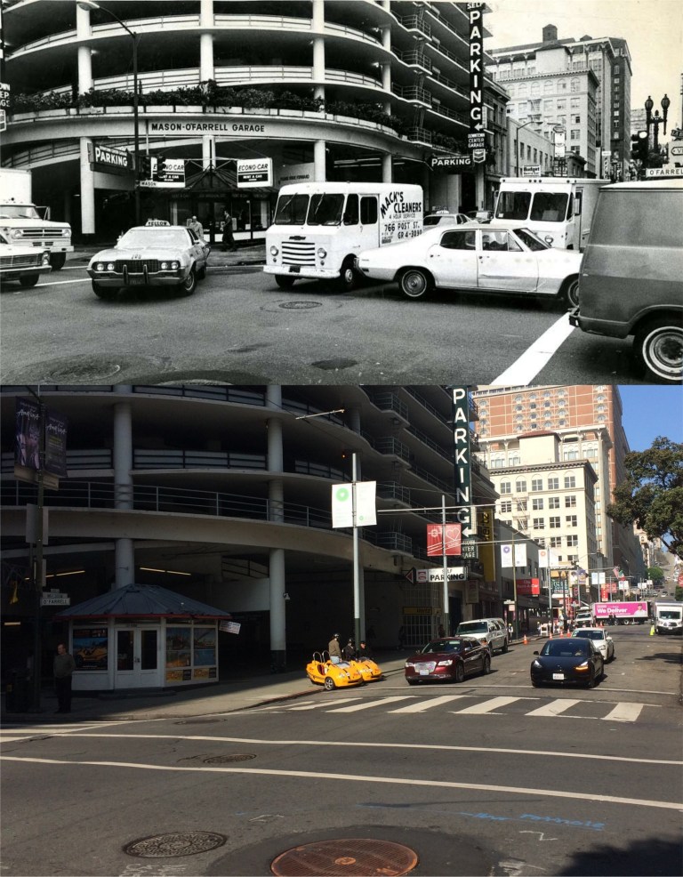 There are all kinds of driving infractions taking place at the Mason and O’Farrell Streets Garage in 1973; gird locking, signal jumping, near collisions, and probably a lot of honking. (San Francisco Pictures)
 Parking anywhere along Powell Street south of Nob Hill, seen in the vintage picture from 1958, is only a memory today. (Pinterest)
 Mason and Pine Streets, down from the Mark Hopkins Hotel, in 1964: There were still a few parking spots available here on Mason Street back then. KYA Radio brings back memories of when I was a kid in the 1960s. I’ll bet I heard my first Beatles song on KYA. (San Francisco Pictures)
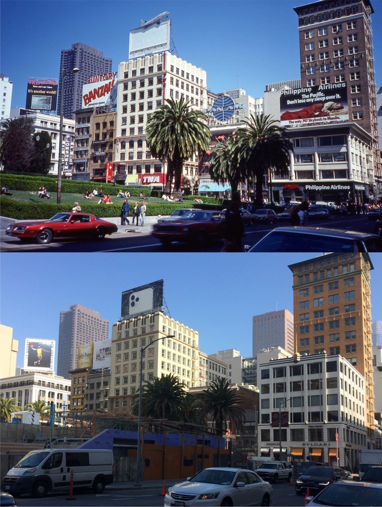 Union Square with its parking garage under the Square seen in 1980 from Geary Blvd.: I’ve never parked in the Union Square Garage. Herb Caen used to say that people who try parking there during a busy day in Downtown San Francisco are a “Sorry / full lot”. (flickr)
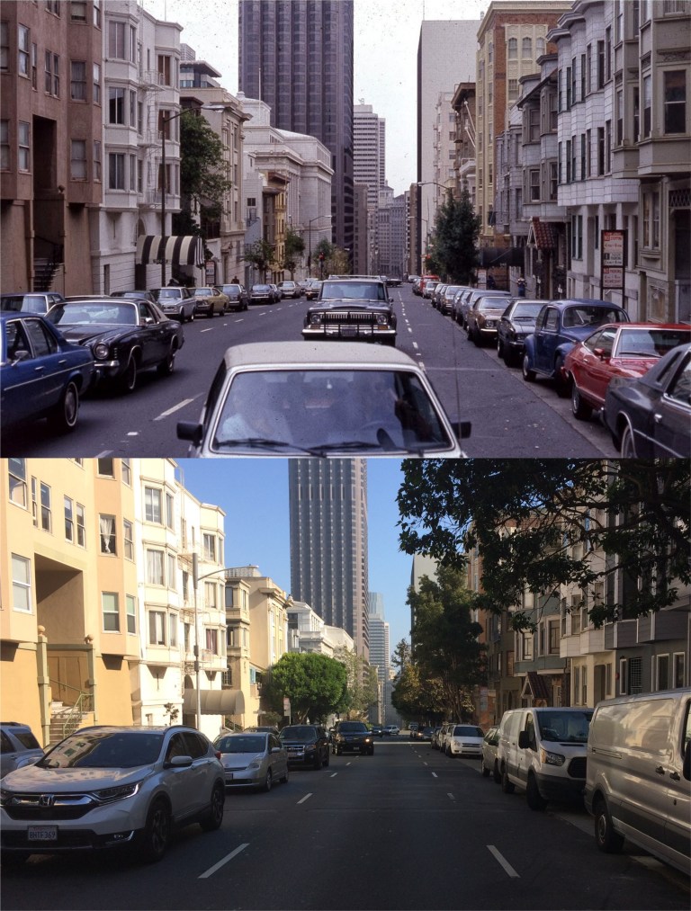 Pine Street east of Powell Street in 1982: This is probably not where you want to go to practice your parallel parking skills. (San Francisco Pictures)
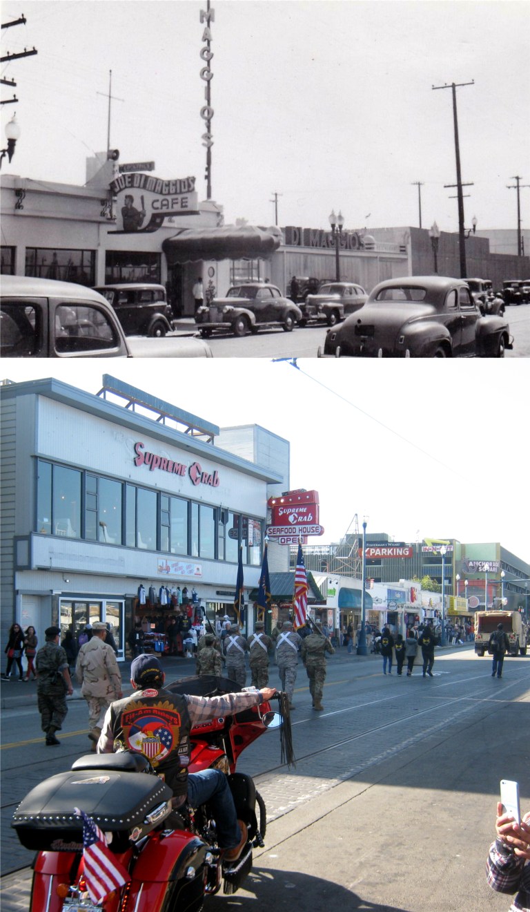 “Excuse me. Can you tell me where DiMaggio’s Restaurant is?”
I guess “Joltin’ Joe” didn’t want anybody to have a hard time finding his place on Jefferson Street at Fisherman’s Wharf. DiMaggio’s, built in 1937, was where the Supreme Crab is today. The DiMaggio letters on the right in the vintage picture were above the entrance to the parking lot of his restaurant and were behind where the PARKING sign on the right in my picture is. My photo was taken this Sunday morning during today’s Veterans Day Parade along Jefferson Street. (ebay)
 Twenty years later, in 1957, the letters above the DiMaggio Restaurant parking lot were still there, and can be seen in a 1957 episode of the television show ‘Harbor Command’. Here, a thug “on the spot” is trying to hide from the bad guys in the DiMaggio parking lot. The scene is looking across Jefferson Street toward the Fisherman’s Wharf Boat Lagoon. DiMaggio’s parking lot, seen in the bottom picture, is still there but blocked from Jefferson Street by buildings now.
 Parking in Fisherman’s Wharf can often be an expensive nightmare unless you have connections. I don’t have the clout of San Francisco’s Mayor London Breed, but I have a brother who works on the World War Two Liberty Ship, the Jeremiah O’Brien, and when I go to the Wharf I can usually get a pass to park in Pier 45 where the ship is berthed. That came in handy today to view the 2019 Veterans Day Parade. The vintage picture is Pier 45 in 1960. (opensfhistory.org)
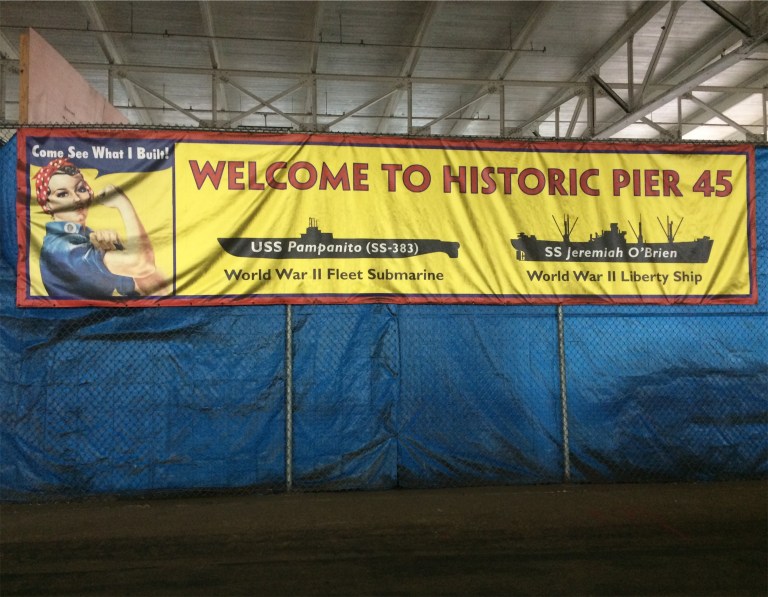 Built in 1926, Pier 45 with its two sheds was the largest pier in the world when it was built. Commandeered by the army during World War Two for moving troops to the Pacific Theater of fighting, Pier 45 is indeed historic. Two survivors of World War Two, the Liberty Ship the SS Jeremiah O’Brien and the submarine the USS Pampanito are berthed here.
 A wonderful picture looking down California Street from above Powell Street during the 1940s: Ah, look at the old cable car signal box and the Crest Garage on the right in the old photo. The Crest Garage Building was demolished at the beginning of 2018. (Ebay)
 I probably should have left this one out, mine wasn’t a very good picture, but what the heck; the vintage one is a picture of the old Crest Garage during the 1960s when it was called Rolls Garage. All that’s left of the Crest Garage right now is scaffolding around a building going up and portable bathrooms. (Vintage Everyday)
 A foggy Fred Lyon gem looking toward Grant Avenue from Pine Street during the 1950s:
 In my last post I showed a picture of two ladies from the late 1950s making a telephone call from a phone booth next to Old St. Mary’s Church that was designed to look like a telephone booth in Chinatown should look. This picture taken in the early 1960s is the only other picture I’ve seen yet of that old telephone booth with the red roof on the far right. The telephone booth was just behind where the cement potted tree is in my picture.
 Looking north on Grant Avenue from Sacramento Street in 1958: I’ve seen pictures of that Bakery sign in the center of both pictures that go back to World War Two, and it still lights up in neon at night. (KathieKemp.com)
 I’ve written in the past that this blog isn’t about my pictures, but the vintage photos. I don’t pretend that any of my pictures have any lasting quality, but a picture like this one from by Fred Lyon taken during the 1940s certainly does. What I do take a small pride in is often being able to locate where vintage pictures were taken when the location isn’t described. However, probably anyone with any knowledge of San Francisco history might be able to track this spot down too. Bail Bond businesses were located all around the old Hall of Justice Building on Kearney Street like this one on Clay Street, just east of Kearny. The old Hall of Justice Building was demolished in 1967 for some stupid reason and a Hilton Hotel now occupies the spot. Films like ‘The Lady from Shanghai from 1947, ‘Impact’ from 1949, and ‘The Man Who Cheated Himself’ from 1950 filmed scenes at the old Hall, as well as television shows like ‘The Lineup’ and ‘Ironside’.


 Clay and Powell Streets in the 1970s: When those cable cars rattle by at a rocketing nine miles an hour, sometimes I just miss clicking the shutter for a perfect lineup with the vintage picture. (Lindsaybridge2)
 Golden Gate Park, looking southeast toward the Francis Scott Key Monument in the 1890s: “I see dead people.” (SF Chronicle)
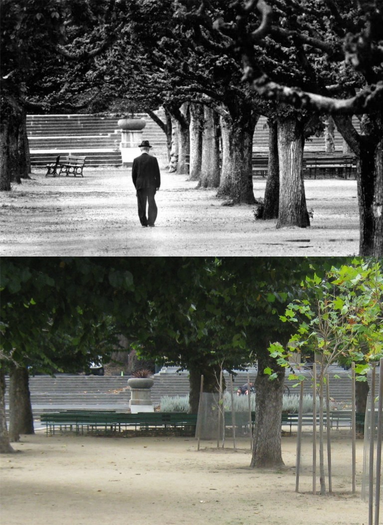 A lonely looking picture to me of a gentleman walking toward the Band Concourse in Golden Gate Park in the 1950s: They’re replanting some of the trees gone now. (SF Chronicle)
 The Robert Emmet Statue in Golden Gate Park, minus the Irish lass from the 1950s: That’s the old Academy of Sciences Building behind her, demolished in 2005. (SF Chronicle)
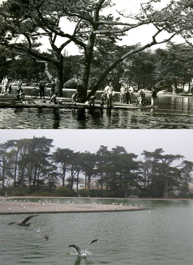 This San Francisco Chronicle vintage picture taken May 24th 1954 doesn’t identify where this spot in Golden Gate Park was, but I think it was Spreckels Lake, and if so, this spot here. There’s two asphalt patches on the peninsula that may have been where the trees were back then. Besides, it looks like nobody ever came back to get one of the cars from the old picture still there in my shot! I should have cropped my picture more at the bottom to match the vintage photo but I didn’t want to cut out that gull doing a perfect belly flop.
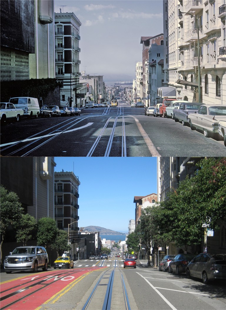 Powell Street between California and Sacramento Streets in the 1960s: (Marty Bernard)
 Maiden Lane from the old Stockton Street entrance to the Union Square Garage in the 1950s: I’ve been waiting a long time for them to clear the Stockton Street Muni construction so I could do this one. The Stockton Street garage entrance is gone now. I’ll bet the girl in blue by the Maiden Lane gate was asking to the people approaching her, “Are you guys doing that Abby Road crosswalk thing for that guy up there taking the picture?” (Phil Palmer)
 With a number of earthquakes hitting the Bay Area recently, special attention was paid to the October 17th 1989 Loma Prieta Earthquake anniversary yesterday. I myself decided to be at the exact same spot at the exact same time as I was when the earthquake struck; the Ginsberg’s Pub on Mason and Bay Streets. A lot of people will remember where they were that night, many with sadness over loved ones and friends lost, and although for me it was one of the greatest adventures of my life, it pales in comparison to what happened to them. Here’s my Loma Prieta Earthquake story: A friend of mine named Mike Shanley and I decided to go to Candlestick Park to try to buy tickets for the fourth game of the 1989 World Series between the Oakland Athletics and the San Francisco Giants at Candlestick Park. We hooked our bicycles to the back of a little four-wheeler I had at the time and headed to San Francisco. We drove through the lower portion of the Cypress Freeway to the Bay Bridge. The Cypress Structure collapse was what caused most of the deaths that day. We crossed the eastern cantilever span of the Bay Bridge and parked at Pier 48 near where Giants Stadium is today. From there, we rode out bikes down 3rd Street to Candlestick Park, but the scalpers wanted more money for tickets than we had, which wasn’t much in those days. I remember seeing the Oakland A’s team arriving at the park in a bus followed by Jose Canseco in a Porsche. I told Mike that I knew of a place up by Fisherman’s Wharf where we could watch the game comfortably, so we rode our bikes back up 3rd Street to the car, drove to Francisco Street where we parked the four-wheeler, and walked a block to Ginsberg’s Pub. We had just gotten a pitcher of beer and a hot dog each when at 5:04 the earthquake hit. I remember saying “I think this is the “big one” to Mike, in reference to the inevitable earthquake everyone in the Bay Area had been foretold was coming. (It wasn’t, and that one is still on the way) I actually felt more relieved than frightened because we were finally getting that one over with and nothing had fallen down on us. We stayed in the building until the shaking stopped, but some customers ran out outside, like they say you’re not supposed to do but what I probably will do next time. When I walked outside the first thing I saw was a terrified dog running north on Mason toward the Bay, There was an eerie stillness, and when I looked toward Nob Hill I realized the power was out. We didn’t realize that the entire city of San Francisco and much of the Bay area was without power. All telephone lines were dead too. Mike and I had decided to get gas for the car after the game on the way home not before and that was a big mistake; we were near empty. We decided to risk crossing the Bay Bridge with what little gas we had. We got onto the Embarcadero Freeway, but when we approached the Ferry Building traffic came to a stop, and police were directing people away from the bridge. We headed south down Highway 101, but when we were near Candlestick Park I told Mike we were on empty and had to get some gas. We got off at the Paul Street exit and learned then that the power was off over the entire city and no gas was available. We got back on 101 heading south and decided to turn off at the San Francisco Airport before we ran out of gas. Although the airport was on backup electricity, all flights in and out of SFO were cancelled. Back then there was a grass embankment between in and out traffic to and from the airport terminals and I drove the four-wheeler up on the embankment. We made I sign that read, “Out of gas. Don’t tow” and walked into the airport terminal. It was there we learned that the Cypress Structure and part of the Bay Bridge had collapsed, and the Marina District was on fire. Also all bridges were shut down. We stayed at the airport and I kept trying to call my mom and dad who lived across the Bay in Castro Valley throughout the night, but telephone service where we were at was still down. Finally, at daylight, they announced that they were letting people across the Bay on the San Mateo Bridge, and Mike and I decided to once again drive as far as we could until we ran out of gas. There used to be a Chevron Station on the road leading out from the airport and they were on the same emergency power system as the airport apparently, because although all traffic had been diverted away from the airport, the gas pumps there were working and we were able to get gas. We crawled across the San Mateo Bridge along with other traffic, and when we reached the East Bay we found that telephone service was working there. I called my mom and dad to see if they were okay, and I can still hear my mom letting out her breath as if she had held it in all night saying, “Are you all right?” They hadn’t heard from me since the previous day and they knew I had gone to San Francisco. They feared the worst news that some other mothers did get that morning. Well, that’s my Loma Prieta Earthquake story. I kept that “Out of gas. Don’t tow” sign for years and years, but I couldn’t find it when I wanted to take a picture of it for this post. Like the Cypress Structure, the cantilever span of the Bay Bridge, Candlestick Park, the Embarcadero Freeway, Ginsberg’s Pub, and my mom and dad, that’s gone now too.
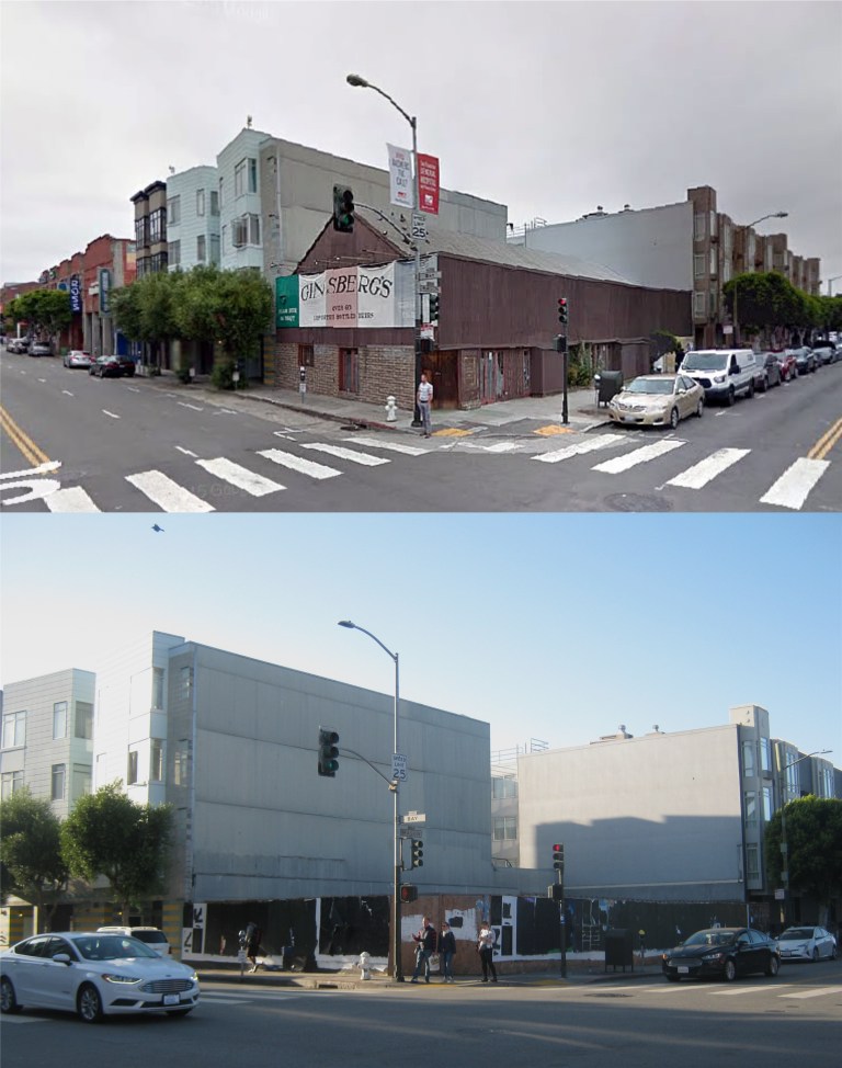 Ginsberg’s Pub closed a number of years after the Loma Prieta Earthquake, and remained empty for many years before it was demolished about two years ago. This socketsite.com picture at the top looks like it was taken from Google Maps.
 The Mason Street side of the pub where I stepped out and first noticed the extent of the disaster: (sfcurbed.com)
 This picture from blogspot.com is how I remember what Ginsberg’s Pub looked like inside. It’s also of interest to me because where the two people talking to the bartender on the left were was the exact spot Mike and I were sitting when the earthquake struck!
 I took this picture from my truck in 2013 on the last time that I crossed through the cantilever section of the Bay Bridge. The bridge was deemed unsafe because of the Loma Prieta Earthquake, but wasn’t replaced for over twenty four years. The picture isn’t the clearest, but if you look at the faded section of the roadway just before the cantilever starts, that’s the portion of the bridge that collapsed on October 17th 1989 killing two people.
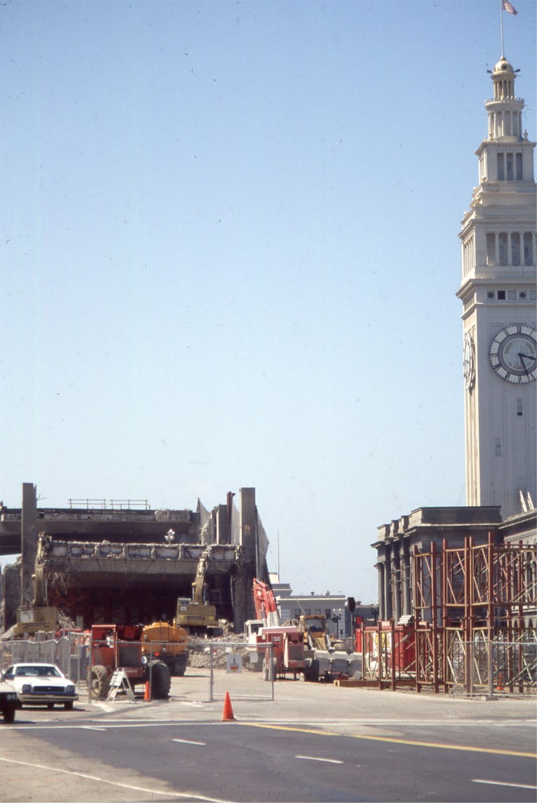 In August of 1991 I took this slide picture of the Embarcadero Freeway being demolished. It closed days after the earthquake and never reopened.
 Gone too is Candlestick Park, seen here just after it was demolished in 2015.
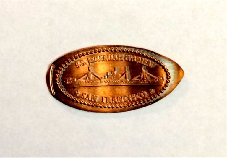 I know, you see them in attractions all over and maybe they’re pretty silly, but when you see the face of a three year old light up when she sees her penny get crushed in a penny presser machine, well….. Last Thursday I got a chance to take visiting relatives from Virginia around San Francisco, including the three year old who I had never met.
 We started out at the Children’s Playground in Golden Gate Park.
 The Children’s Playground in the 1890s: The Sharon Building is on the left and the merry-go-round is on the right. The Sharon Building was remodeled after being damaged in the 1906 Earthquake. That merry-go-round is never running when I take visiting kids there! I don’t even know if it runs at all, anymore! (San Franciscodays.com)
 The Sharon Building at the Children’s Playground in the 1890s: Either that lady on the right in the vintage picture had the measles or that’s a scarf around her face. (opensfhistory.org)
 Kids still love any of the slides in Golden Gate Park, just like the picture from the SF Chronicle of the kid in the 1930s, taken at the Children’s Playground. I know, “I’ll bet she has a pair of shoes just like that at home.” Actually, they sell kids different color shoes nowadays. What a square I was to Alice when I told her I didn’t know that.
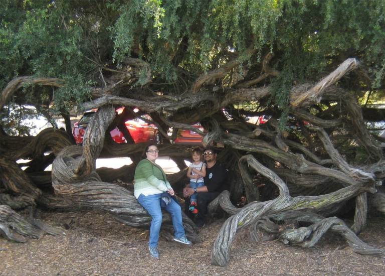 These may be of interest to my arborist friend, Tony; they’re called twisted tea trees, and they’re all over Golden Gate Park.
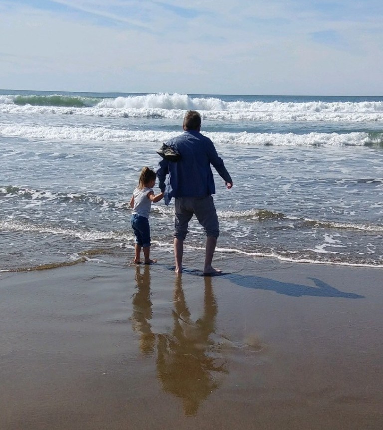 Do you know hard it is to get a kid to move on to the next location of the tour on a beautiful day at Ocean Beach?
 The obligatory trip to the Golden Gate Bridge: I read somewhere that the Golden Gate Bridge is the most photographed man-made object on the planet, and I believe it, but it wasn’t all that crowded on Thursday. (Shorpy Archives)
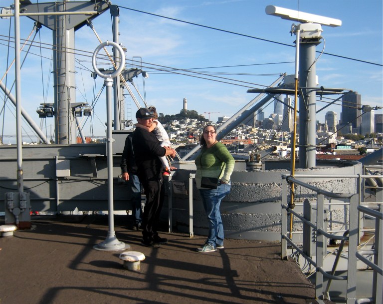 By late afternoon we were on top of the World War Two Liberty Ship the SS Jeremiah O’Brien watching the Blue Angels practicing for their Fleet Week Show on Saturday and Sunday.
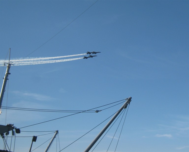
 They practice a lot longer than the actual shows and it’s just as impressive.
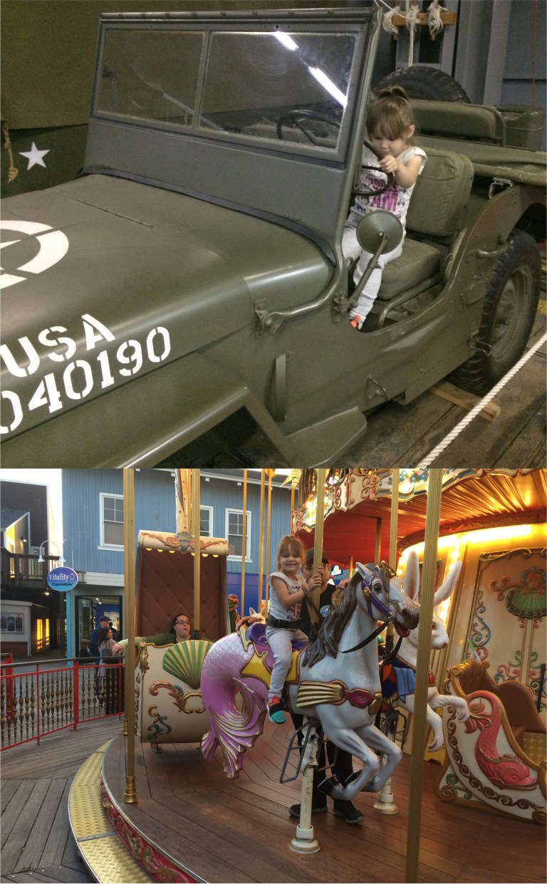 By the end of the day, that little tyke had stolen my heart, and all of my energy.
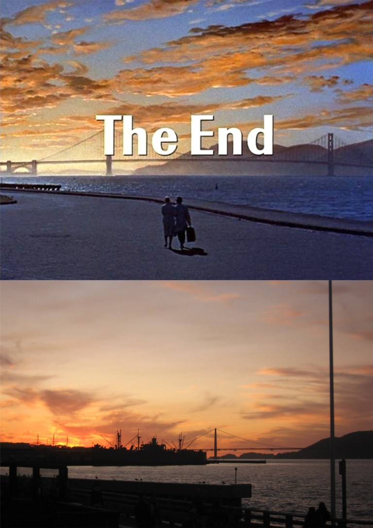 Sunset from Pier 39: Maybe not as majestic as in the closing scene in the 1957 film ‘Pal Joey’ with Frank Sinatra and Kim Novak, but that one was special effects and mine was real. That’s the silhouette of the Jeremiah O’Brien to the left of the Golden Gate Bridge in my photo. The three masts of the old sailing ship the Balclutha at the Hyde Street Pier are on the left.
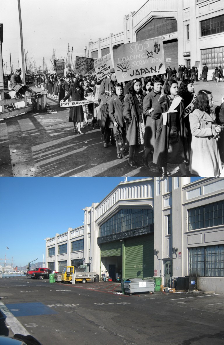 A protest at Pier 45 in Fisherman’s Wharf by the Chinese community in 1937: The protesters were calling for an end to the United States importing materials to Japan after the Japanese Empire invaded China. (museumca.org)
 In my September 9th 2019 post about ‘SOMA’ I mentioned a group of Telegraph Hill dwellers who forced City Hall to stop skyscrapers from being built in San Francisco any further north than they are today. These people here on the Polk Street side of City Hall in 1959 were no less heroic in their effort to stop San Francisco from building any more freeways like the Embarcadero and Central Freeways. (Collector’s Weekly)
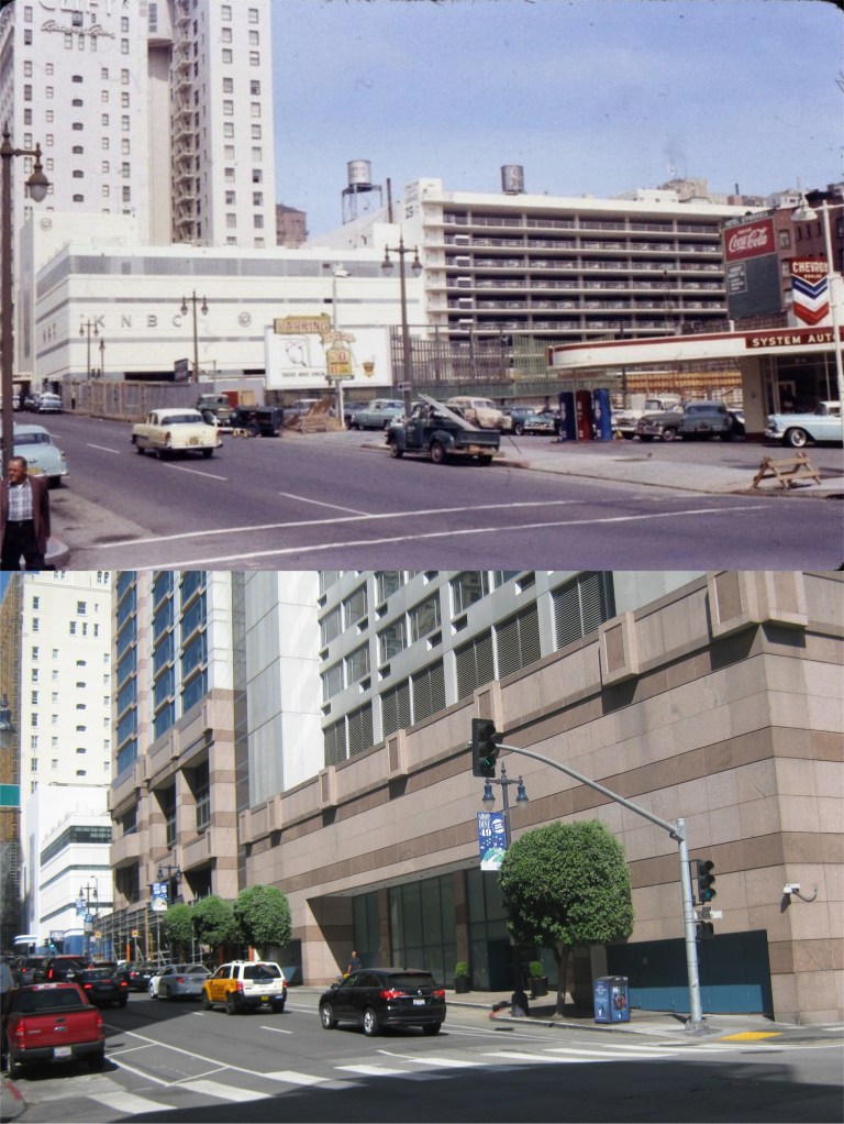 I’m old enough to remember when there were a number of gas stations in and around the Downtown and North Beach area of San Francisco. (Not this one though) There was one right in the middle of Fisherman’s Wharf across Taylor Street from Alioto’s Restaurant, one on Bay Street at the Embarcadero, one on Pacific Ave. at Columbus, one on the west side of the Embarcadero near the Ferry Building, one on Washington Street at Columbus, all gone now. One of the last holdouts was the 76 Station at 1st and Harrison Streets that was still there in 2018, but recently demolished. The one in this photo was on the northeast corner of Ellis and Taylor Streets. The enormous Hilton Hotel is there now. I’ll bet the owner of the station held out for a lot of money. Well, if eliminating all of the convenient gas stations in Downtown San Francisco is your cup of progress, then it’s a good thing. (Vintage Everyday)
 They don’t sail ships like that into McCovey Cove these days! Sometimes progress gets it right. McCovey Cove, named after the baseball slugger Willie McCovey, was originally called China Basin when this three mast ship in the vintage picture was docked there in 1922. Near the end of the Twentieth Century this spot was basically an area of run down docks. All that changed when the new baseball park for the San Francisco Giants opened in 2000. The docks behind the old ship were where the ballpark is today. My picture was taken on the last day of the 2019 regular season as fans begin to pour into the ballpark to honor the end of the Bruce Bochy Dynasty era. The Giants skipper who led the Giants to the 2010, 2012, and 2014 championship retired on this day. (opensfhistory.org)
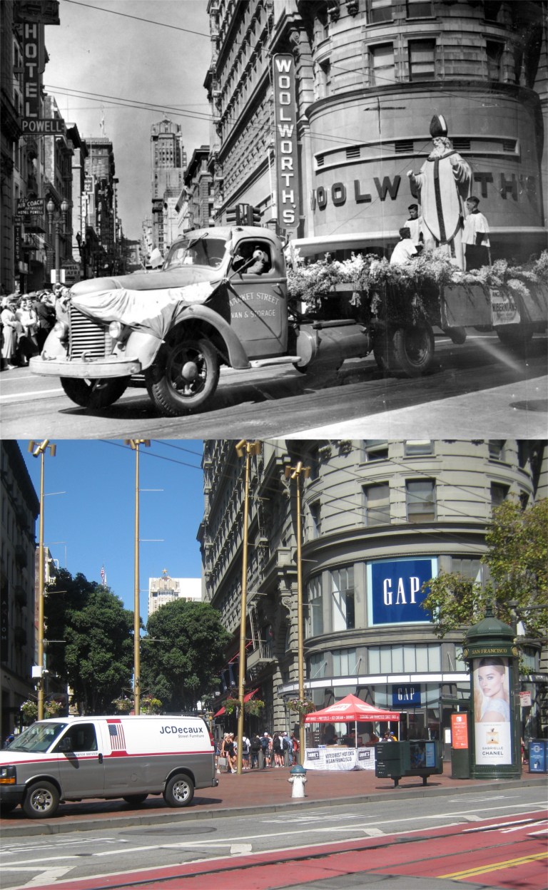 The St. Patrick’s Day Parade passes Powell Street along Market on March 17th 1954: This shows a sign of changing times; leprechauns, shamrocks, and pretending to be Irish when you’re not is okay on St. Patrick’s Day. However, although the day and festivities are named in his honor, St. Patrick himself is seldom invited to participate anymore. I suppose he’s considered as politically incorrect as using the word Christmas is nowadays. (SF Chronicle)
 On July 23rd 1969 the United States President and First Lady Richard and Patricia Nixon were in San Francisco to greet the returning astronauts of Apollo 11 that landed the first humans on the moon. They stayed at the St. Francis Hotel at Union Square. (SF Chronicle)
 A mainly friendly crowd gathered at Union Square across Powell Street from the St. Francis Hotel. (SF Chronicle)
 They weren’t all supportive of President Nixon. (SF Chronicle)
 Mr. and Mrs. Nixon leaving the main entrance of the St. Francis Hotel: (SF Chronicle)
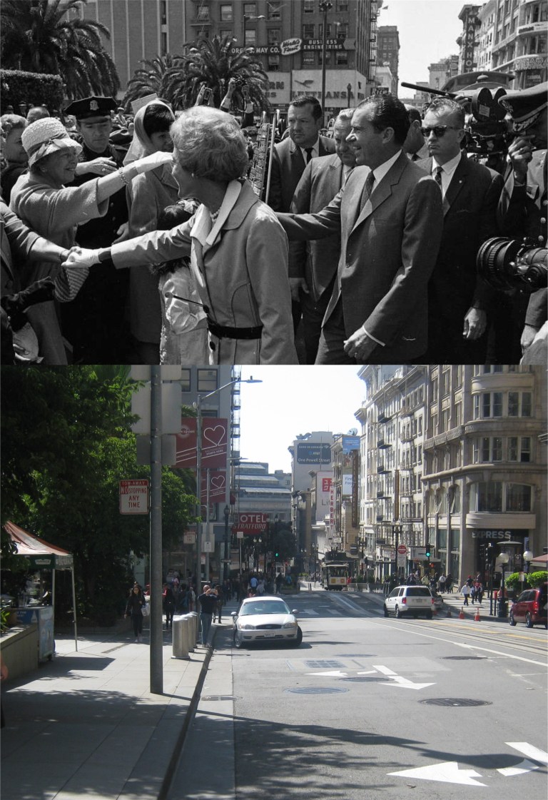 The President and First Lady crossed Powell Street about here to great supporters. (SF Chronicle)
 Not everybody was on the same side but they got along, and that’s not a bad example. (SF Chronicle)
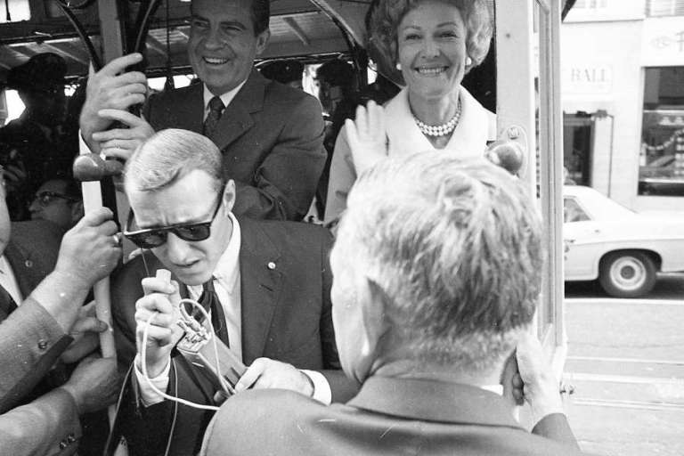
 The Nixons climbed on a cable car and headed up Powell Street to start their tour of San Francisco before flying out to the aircraft carrier USS Hornet vie Air Force One and the Marine One helicopter to greet the returning astronauts. (SF Chronicle)
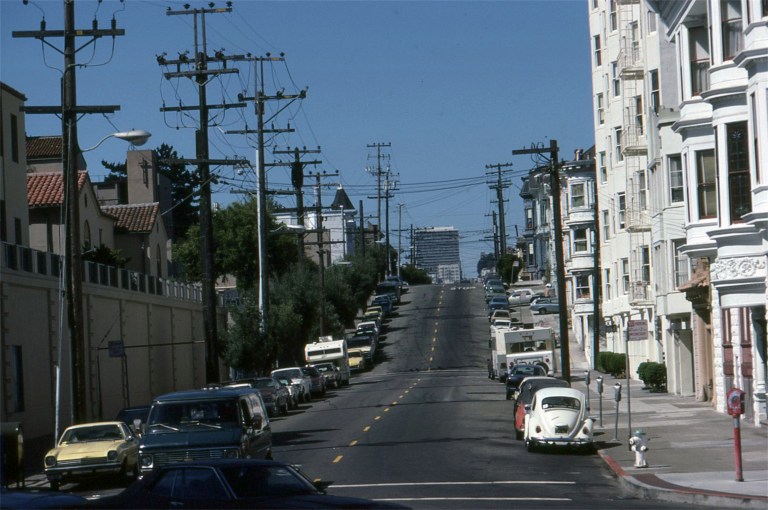

 I took a lot of slide pictures around San Francisco during the 1980s and I’ve posted a number of them here on my site. Most of my slides I remember where they were taken or the locations are easy to identify, but these top four slides from 1985 I couldn’t place where they were taken at. I put the pictures on a Facebook page called San Francisco Remembered and asked if anybody recognized the spots. Many of the members of San Francisco Remembered know the city better than anyone I know, and there’s always someone in the group who can identify a San Francisco street or area. Well, the San Francisco Remembered group members didn’t help me locate where my pictures were taken; they identified the spots right down to a T. I also learned from where members said that the pictures were taken that I probably took them all on the same day.
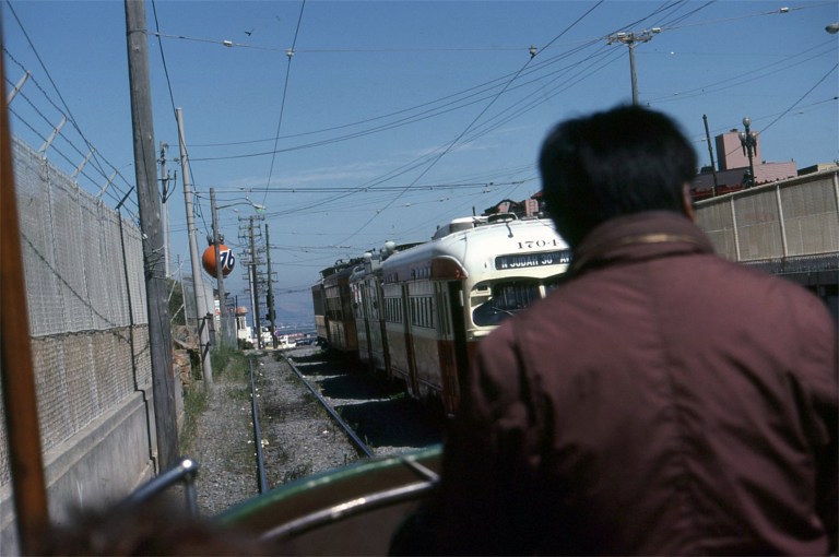
 This was taken from Market Street, looking north where Hermann and Laguna Streets meet. I think my old picture would have been from aboard the MUNI Boat Tram that I probably was riding along Market Street on as we passed by. The wall and buildings on the left have been remodeled and new ones built since 1985.
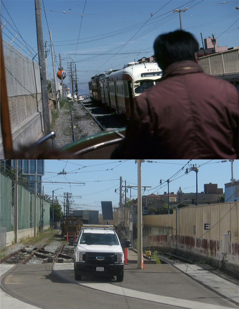 I thought we must have been going into a tunnel on this one. MUNI started running old streetcars along Market Street around 1984 or 1985; this was before the F and E Lines of old streetcars running along Market Street and the Embarcadero today were placed in service. It looks like I was riding at the back of the number 228 Boat Tram from Blackpool England when I took my picture. Turns out I was on Duboce at the bottom of the U. S. Mint, which was on my left. This was close as MUNI officials would let me get yesterday to get my update.
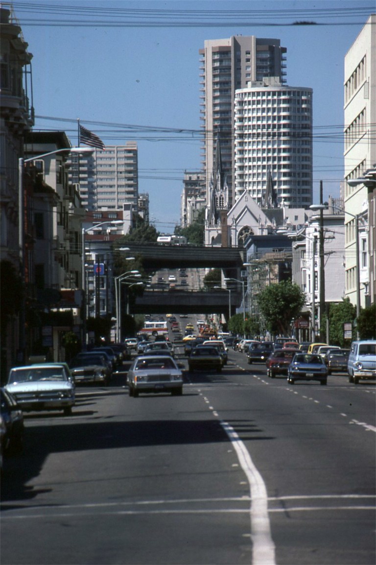
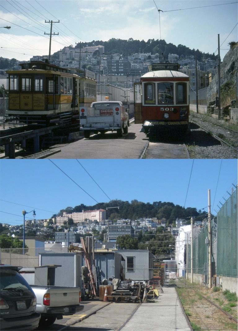 This looks like it must have been the end of the line for the Boat Tram ride. The street car can’t turn around so I wonder how I got back! Actually, there was a turn around and you can see where the tracks were in the update I did of the previous picture. This is looking west toward Buena Vista Park in the opposite direction from the previous picture. The mountain that the U.S. Mint sits on is on the right. The little “Dinky” on the left they were working on in 1985 still runs along Market Street and the Embarcadero occasionally.
 Now, this one I should have known! I know that San Francisco had two double-deck freeways in 1985, both gone now, the Embarcadero Freeway and the Central Freeway. I also knew that my older picture couldn’t have been taken anywhere along the Embarcadero Freeway. It had to be looking toward the Central Freeway, but I couldn’t place the street. The church at right central in the old photo would have been one of the best clues and I should have studied it closer. This is Gough Street from Market Street looking north. I was using my Minolta X700 zoom lens for the old picture as we rolled by. The church was Saint Paulus’ Lutheran church, seen in a number of movies, such as ‘Greed’, ‘The Man Who Cheated Himself’ and ‘Vertigo’. The church burned down in 1995. The Central Freeway, like the Embarcadero Freeway, was demolished after the Loma Prieta Earthquake of 1989.
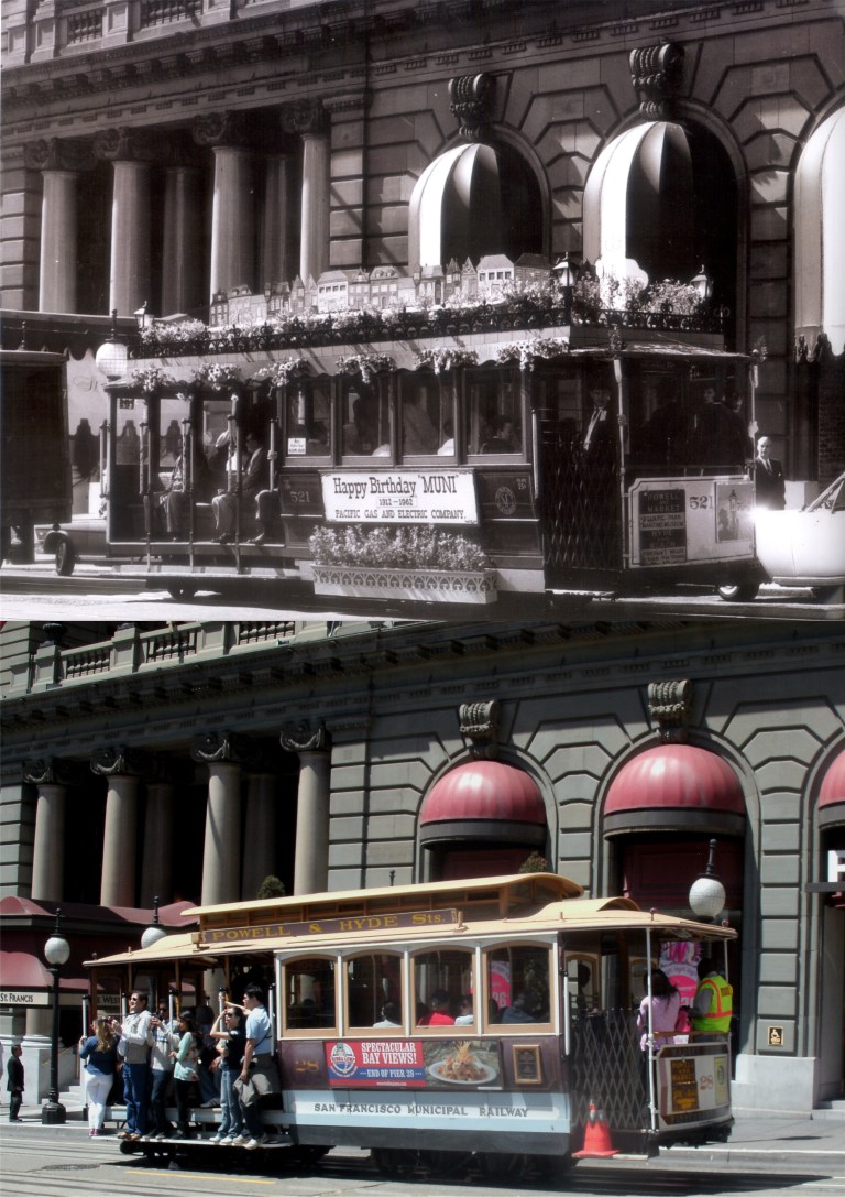 Pacific Gas and Electric salutes MUNI on its 50th anniversary in front of the St. Francis Hotel in 1962: This might have been where Beach Blanket Babylon got their idea. Beach Blanket Babylon will be closing its 45 year run at the end of 2019. (Mike Phipps & Don Holmgren)
 A lonely little cable car heads up Castro Street in the 1930s: The Castro Line ran from Market Street to 26th Street. (Mike Phipps & Don Holmgren)
 A cable car heads up Sacramento Street past Joice Alley between Powell and Stockton Streets in the early 1900s:
 Powell and California Streets looking toward the old Crest Garage in the 1940s: The Crest Garage was demolished in early 2018.
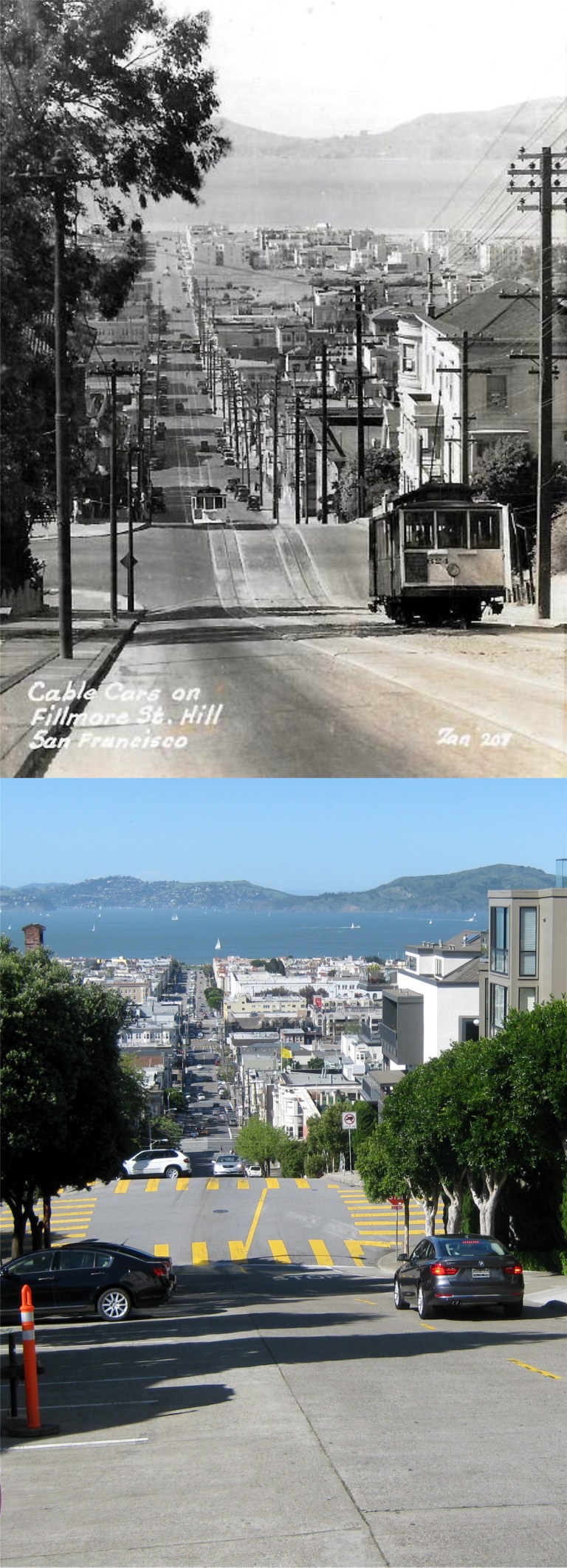 Cable cars used to run up Fillmore Street from the Bay once too:
 The loneliest of the five cable car boarding and ending points, California Street at Van Ness, looking east up Nob Hill. The vintage picture is from the 1950s.
 Looking west up Nob Hill from California and Drumm Streets where the eastern beginning / ending of the California Street cable car line is in the late 1950s or early 196’s:
 A cable car approaches Taylor Street along Jackson Street in the 1950s: The cable car in the vintage is number 515; there are only 40 of them today. (Fred Lyon)
 Riding along on the “Hyde Street Grip”:
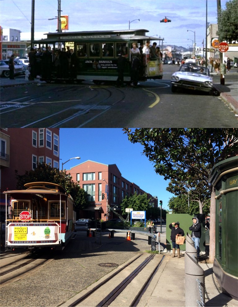 Jack Lemmon races his Thunderbird past the Bay and Taylor cable car turnaround in the 1964 film ‘Good Neighbor Sam’. Although you can’t see it in my photo, that 76 gas station on the right is still there.
 The cable car turnaround at Aquatic Park in the 1960s: This is a great picture, right down to the grip man with cigarette in his mouth! (Glenn Christiansen)
 California Governor Ronald Reagan and Mrs. Nancy Reagan on a cable car heading up Powell Street just past Post Street in 1966: (buzzfeed.com)
 A zoom in looking down California Street toward Powell in the 1970s: (Minerva)
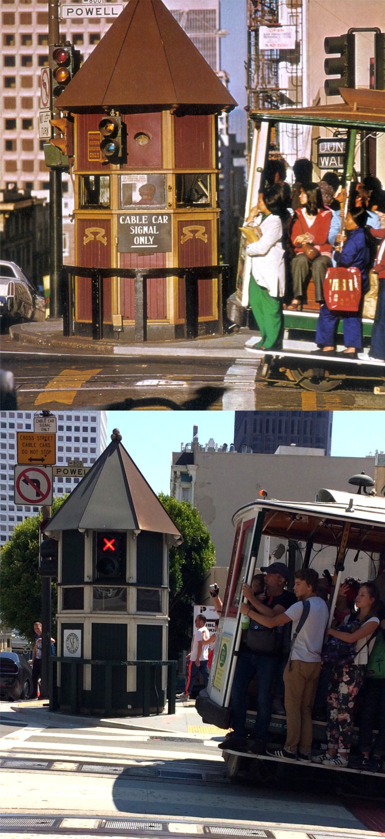 A cable car approaches the signal box on the southeast corner of California and Powell Streets in the 1970s: (Minerva)
 Well, now look at that, the cable cars were down for awhile in the 1970s too! This is at the Powell and Market Streets turnaround.
 Cable cars were definitely down from 1982 until 1984 for a complete repair of the system. This is a redo of a slide picture I took in 1983 on Powell Street north of Sutter. The entire San Francisco cable car system was shut down.
 This is another slide photo I took in 1983 on California Street up from Grant Ave. You can see the construction work on the cable car line down California Street.
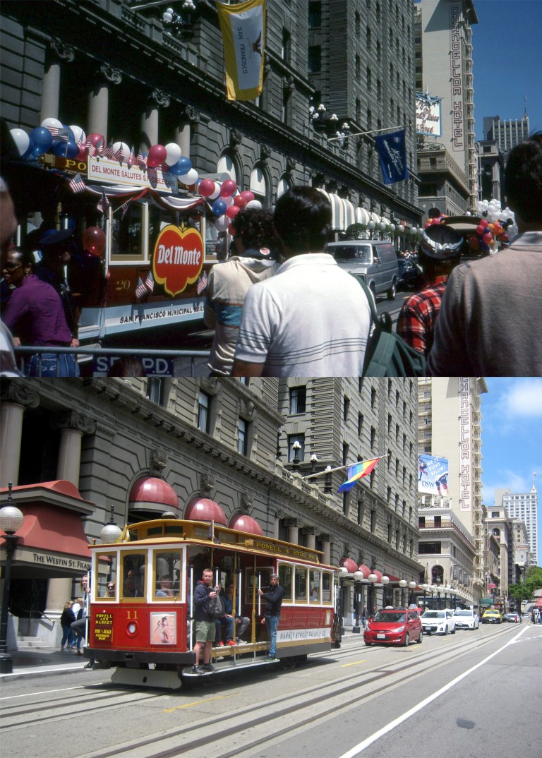 This slide I took was in June of 1984 in front of the St. Francis Hotel. San Francisco was celebrating the reopening of the cable car system.
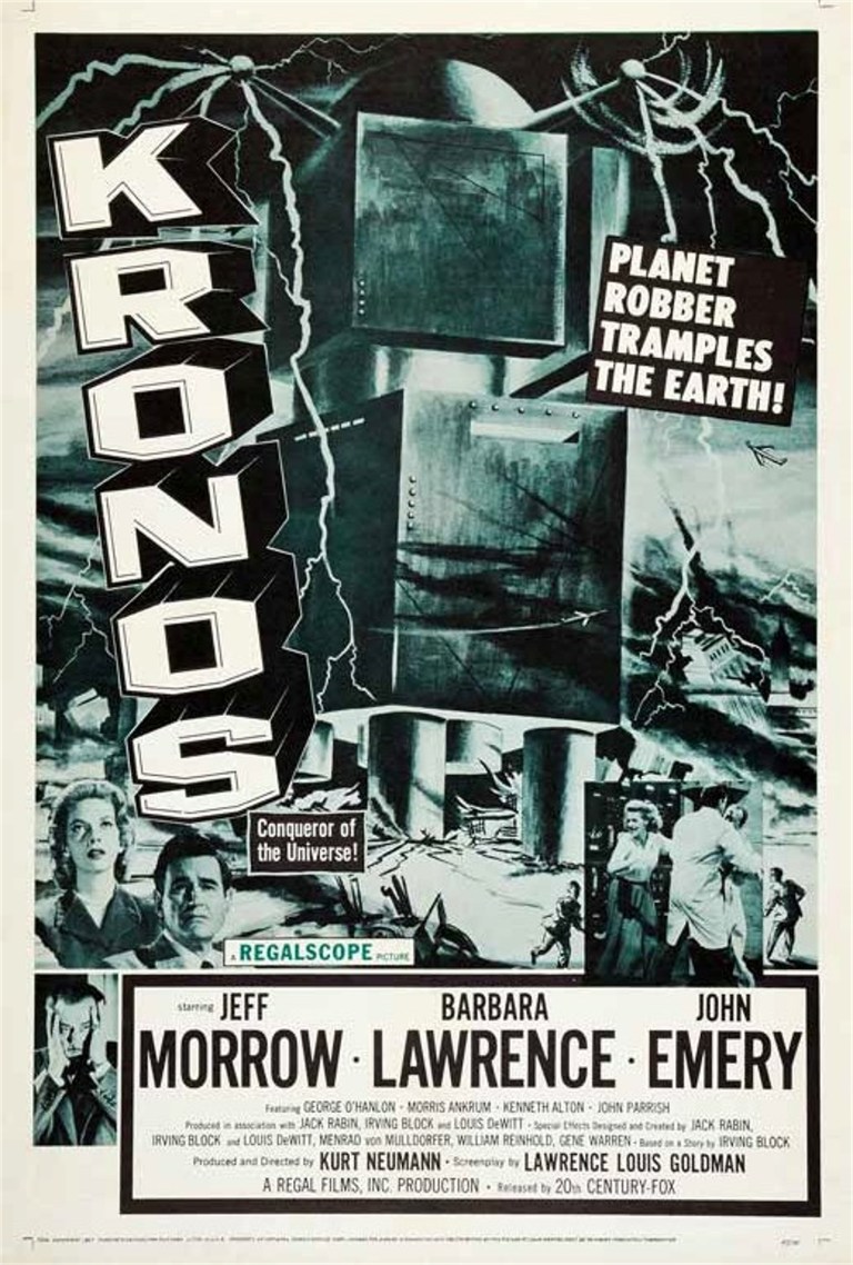 As the story goes, and I believe it, when the 1960s skyscraper boom in San Francisco erupted and the pile drivers were heading north and destroying everything in their path, like ‘Kronos’ the Planet Robber did, the people living on Telegraph Hill got together and forced City Hall to approve an ordinance that stopped new buildings from being built north of Market Street that would block Telegraph Hill from its view of the Ferry Building. So, Kronos turned south and the result is today’s SOMA, South of Market Street, once known as “South of the slot” in reference to the cable car line that used to run down Market Street. I took a walk and bus ride around SOMA last Saturday to take some pictures, and I was also granted an audience with Emperor Joshua A. Norton. His Highness was at the new Salesforce Transit Center to rededicate a marker that was originally installed in his honor at the old Transbay Terminal Building in 1939.
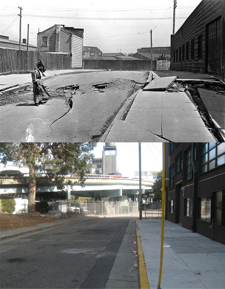 Hidden away south of Market Street is the southern end of lonely Dore Street, looking south from Bryant, just after the 1906 Earthquake. (On Shaky Ground)
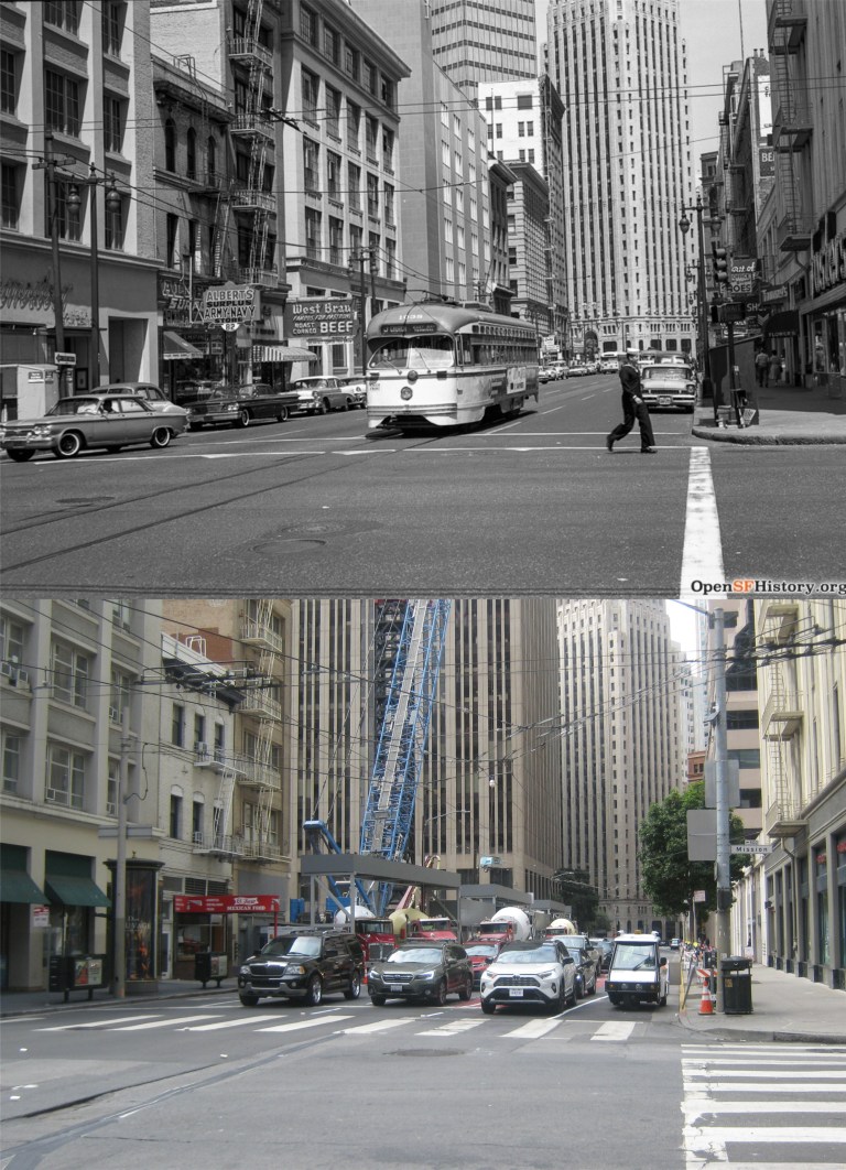 Looking north along 1st Street from Mission Street in 1962: These pictures were taken from where the Salesforce Tower is today. (opensfhistory.org)
 Looking down 1st Street from Harrison Street in 1973: This was a close of a comparison picture as I could get nowadays, trees block the view from further up 1st Street now. That Union 76 gas station in the old picture survived until just recently. The building on the far right in both pictures is the Sailors’ Union of the Pacific Hall. (opensfhistory.org)
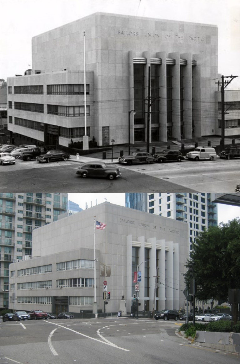 The Sailors’ Union of the Pacific Hall in the 1950s: The building was built in 1950. (FoundSF)
 The lobby of the Sailors’ Union of the Pacific Hall: This building is a gem compared to some of the buildings they’re slapping up around here today.
 Howard Street near 6th St. in 1980, before the SOMA boom started. (Janet Delaney)
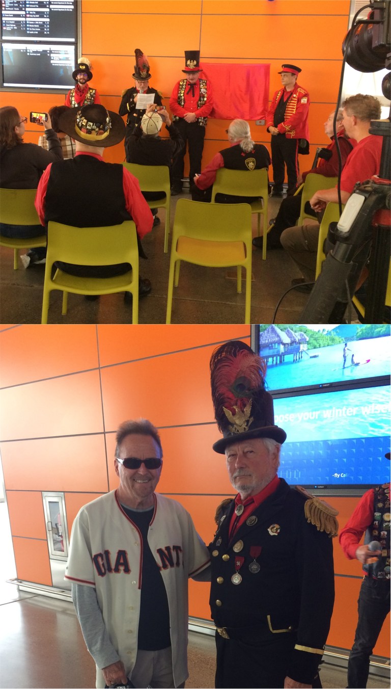 Emperor Joshua Norton at the ceremony in the new Salesforce Transit Terminal rededicating a marker that was placed in his honor in 1939 at the old Transbay Terminal, demolished in 2010: Emperor Norton was a whimsical lunatic, (maybe, or maybe he was just pretending) who came to San Francisco in 1859 proclaiming himself to be the Emperor of the United States, and San Francisco honored him as such until he died in 1880. He was one of the most colorful characters from San Francisco’s history. One of his proclamations decreed that two bridges were to be built someday, one from San Francisco to Oakland, and one from San Francisco to Marin County. San Franciscans must have really got a kick out of that, but guess what……
 The Emperor Norton marker placed in the Transit Center on Saturday. Those streaks are from an expensive bottle of champagne used for the Christening.