
Click on the links below the film then and nows for a YouTube film link about each movie.
 ‘Sudden Fear’ (1952) Joan Crawford discreetly sneaks into the Tamalpais Apartments at Hyde Greenwich Streets on Russian Hill to try to learn how Jack Palance plans to kill her.
 ‘Patty Hearst’ (1988) Patty Hearst during the 1974 Hibernia Bank robbery she participated in located in the Sunset District, and Natasha Richardson who portrayed Hearst in the film during the robbery scene.
 ‘Born to Kill’ (1947) Elisha Cook Jr. arrives at the Ferry Building ready to commit murder. However, his plans don’t work out, as you’ll see in the YouTube clip.
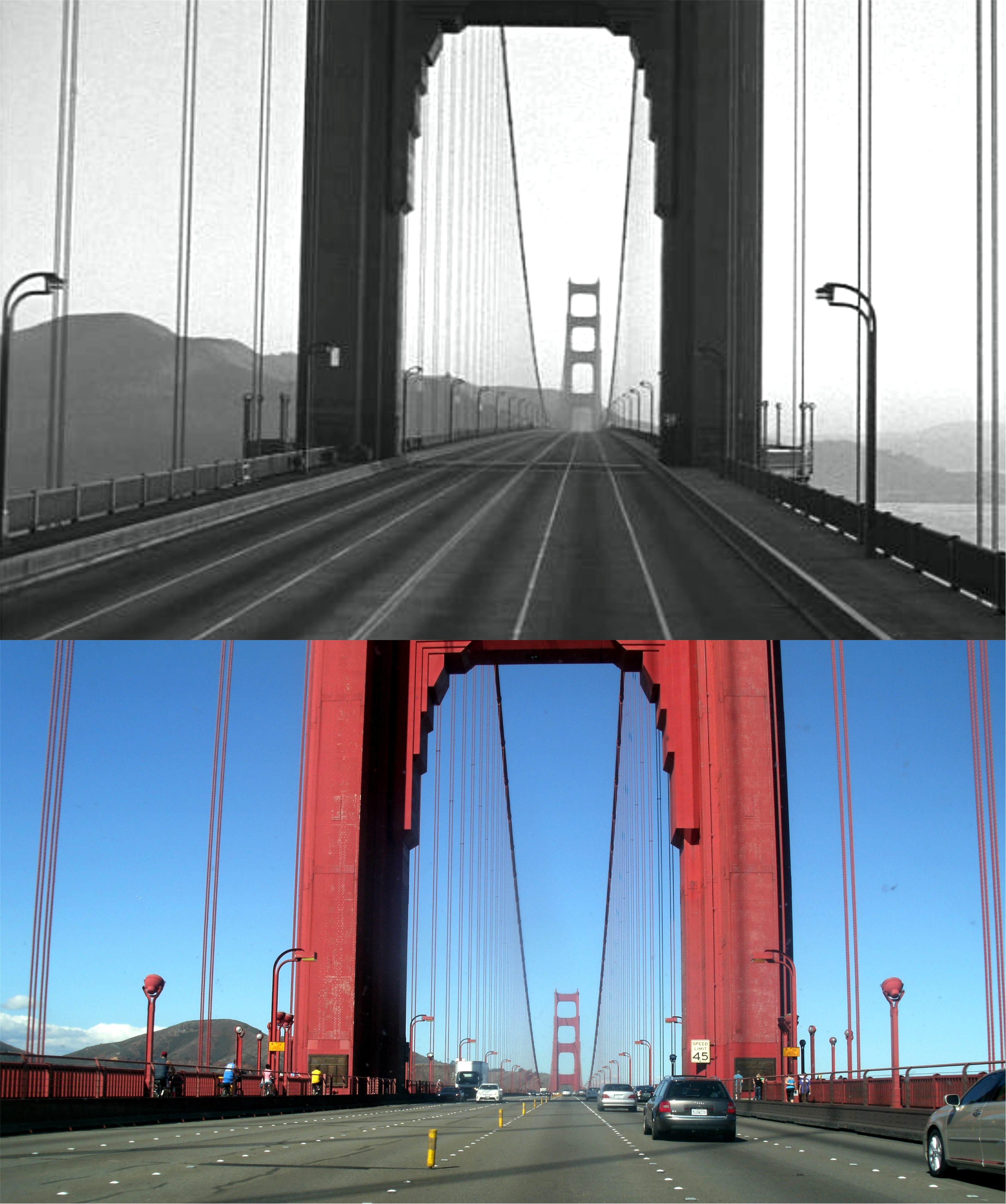 ‘On the Beach’ (1959) In a depressing scene Gregory Peck’s submarine crew arrive in San Francisco from Australia searching for life after a fallout from a nuclear war has killed off most of the world’s population. They find only an empty San Francisco, such as this scene of the Golden Gate Bridge.
 ‘The Falcon on San Francisco’ (1945) Tom Conway (the Falcon) is accused of kidnapping the little girl on the right in front of the Ferry Building early in the film.
 ‘I remember Mama’ (1948) Liberty Street, where the Hanson family lived in the movie. Because it was supposed to be on Russian Hill used special effect for the Bay and Alcatraz, but Liberty Street is actually in the Castro District.
 ‘My Favorite Brunette’ (1947) Bob Hope getting mixed up with spies, murder and lovely Lamour at his baby photographer office on California Street in Chinatown:
 ‘Point Blank’ (1967) After being shot in a conspiracy between his wife and friend and left for dead in a cell on “Broadway”, what the inmates used to call the center cell block isle at Alcatraz, Lee Marvin recovers and seeks revenge.
 ‘Portrait in Black’ (1960) Plotting with Anthony Quinn to kill her husband, Lana Turner begins the first phase of their plan at the old I Magnin Department Store on Geary St. across from Union Square.
 ‘The Towering Inferno’ (1974) Fred Astaire looks up at the special effects building that will eventually catch fire in the film. The dark Bank of America Building on California Street, where some of the movie was filmed, makes a nice comparison when the sun catches it just right.
 ‘What’s Up, Doc?’ (1972) Clumsy Barbra Streisand creates all kinds of trouble for Ryan O’Neal, who she has fallen in love with, like this motorcycle accident she causes by crossing the intersection at Jones and Bush Streets against the light.
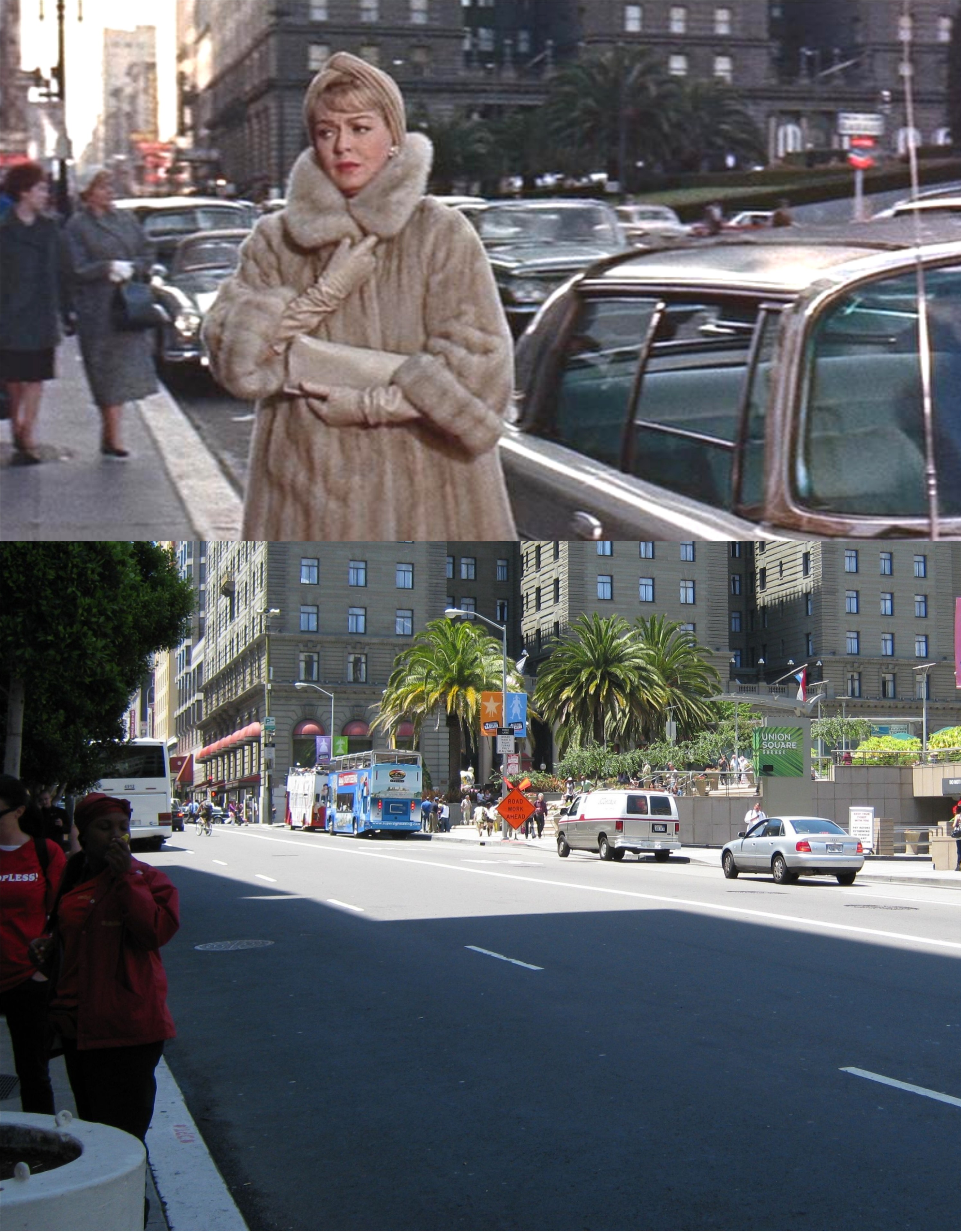
 Union Square looking northeast: The building on the far left has been demolished since 1975 and is now where Saks Fifth Avenue is, but other than that the view hasn’t changed a lot except for Union Square.
 We’ll head into Chinatown looking north toward Pine Street from Bush Street.
 Now we’re looking east down Sacramento Street.
 Grant Avenue at Clay Street: Except for the next picture, you won’t see any major differences in the Chinatown of today and 1975.
 The quaint gas station at Jackson Street and Columbus Avenue has been replaced by a bank now. It’s too bad that couldn’t have been saved. The gas station was on the south side of the old Sentinel Building on Columbus Avenue.
 We’ve moved into North Beach, looking southeast on Columbus Avenue from Chestnut Street. Notice the old Kentucky Fried Chicken on the left when it was still officially called ‘Colonel Sanders’. “Lately, I have been spotted with a Big Mac on my breath; stumbling in to a Colonel Sanders with a face as white as death.” (cf. ‘Junk Food Junkie’) Notice that the cable car tracks ran down the center of Columbus Avenue back then and along the side of the avenue today. This must have been done during the major renovation of the cable car system during 1982/1983 to ease traffic congestion on Columbus.
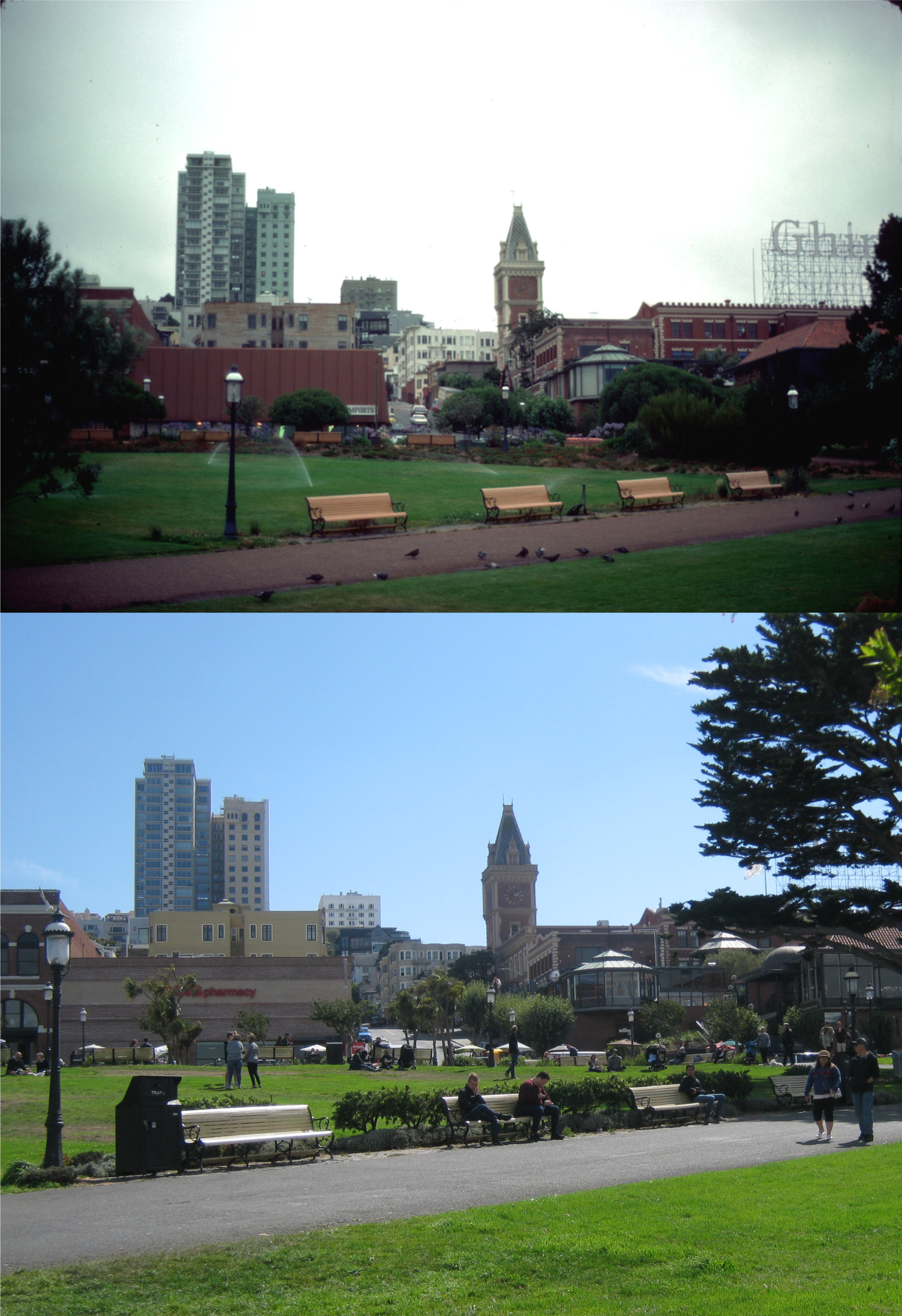 We’ve ended up in Aquatic Park. Why do I always feel like putting on a sweater when I look at Peter Stratmoen’s photos? Not much of a change here, except there was nobody in Aquatic Park; like a scene from ‘On the Beach’. Maybe it was too cold.
 The top photo is heading into the ballpark across the bridge that carries passengers from BART to the Coliseum. When you’re at this point you’re heading straight toward the back of the infamous “Mount Davis”. Mount Davis was the monstrosity that Al Davis, the owner of the Oakland Raiders at the time, had built to accommodate the return of his football team back to Oakland in 1995 and forever changed the baseball field. It also replaced the bleachers that were there up until then and seen in the bottom photo from the 1980’s.
 In evening games long ago, the pretty view of the east side Oakland hills changed colors as the sun went down. Today, you get a golden view of Mt. Davis at sunset. Al Davis bailed out on his Oakland fans in 1981, and then bailed out on his Los Angeles fan base in 1995. Now his son, Mark Davis, will be bailing out on the loyal Oakland Raider fans who forgave his dad 23 years ago. After the Raiders leave for Las Vegas, I think they should blow Mt. Davis up and restore the baseball park to the way it was.
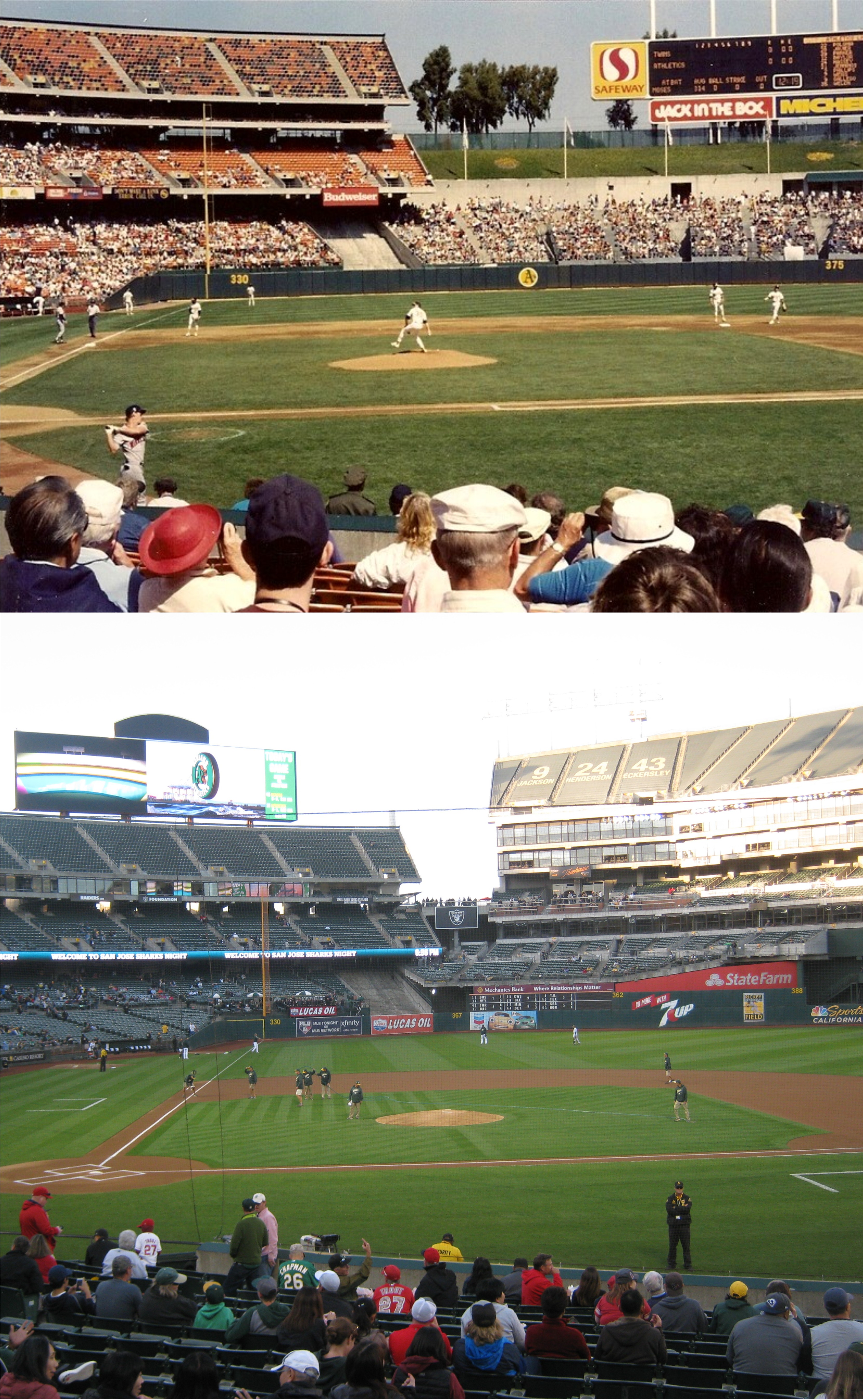 Our seats last night lined up pretty close to this early 1990’s game view. I love AT&T Park, but the Oakland Coliseum is a great place to watch a baseball game for half the price of the Giants ball yard.
 Charles O. Finley, who owned the Oakland Athletics from 1960 to 1980, came up with some of the craziest ideas to promote games, like painting the baseballs used in the game yellow. The top photo was from a 1971 “Hot Pants Day” where girls in “hot pants” got in free. The bottom photo was taken during a “Bald-head Day in the 1970’s when bald or balding men were let in free. That’s Charlie O’s mascot mule. (SF Chronicle)
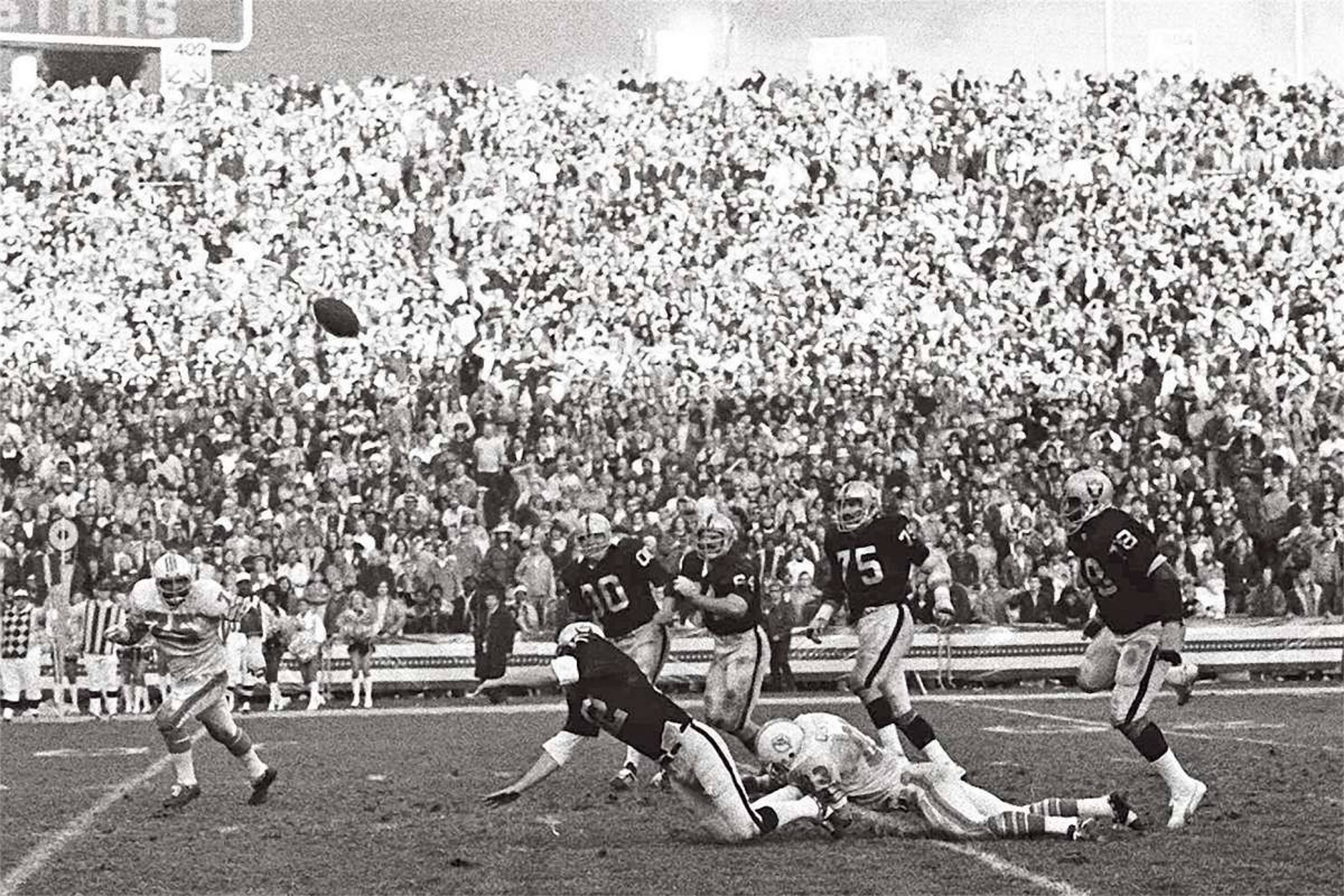 This is a great shot of Ken Stabler throwing a touchdown pass for the Raiders on his way down in a 1974 game against the Miami Dolphins. (SF Chronicle)
 In July of 1978, the Rolling Stones played to a crowd of over 64,000 people for “A Day on the Green” on Mick Jagger’s 34th birthday. (SF Chronicle)
 Balloons being released during the Rolling Stones 1978 concert over the bleachers where Mt. Davis is now: (SF Chronicle.)
 I think MVP Baseball is the best video baseball game. I used to play that for hours. If you get enough points you can play baseball games in classic baseball parks, such as Ebbets Field or the Polo Grounds. Now, I guess, they also have the old Oakland Coliseum before Mt. Davis. Imagine that!
 In 1997, interleague baseball play during the regular season was introduced. I was at the first interleague season game between the San Francisco Giants and the Oakland Athletics held at the Oakland Coliseum. They had played In July that year at Candlestick, but this was the first one in Oakland. On September 1st 1997, I was in Section 218, Row 2, Seat 19, when Barry Bonds hit a foul ball back behind home plate. I was looking around the stadium through mini binoculars and not paying attention to the game when the ball hit me in the stomach. It didn’t hurt much, but it left a bruise larger than the baseball. I remember a ton of people climbing all over me to get the ball that fell down by my feet, but my brother sitting next to me snagged it and gave it to me figuring that I had earned it. I’ve still got the ball and the fading ticket, as well.
 We’ll start out on the eastern side of the park at the McLaren Lodge. That’s a 91 year old John McLaren at the entrance to the lodge in 1937 where he lived until his death in 1943. McLaren was the Walt Disney of Golden Gate Park where he was superintendent for 53 years, and we have him to thank for what’s there today. He looks a little grumpy! Possibly some foolish subordinate was telling him he was too old for the job.
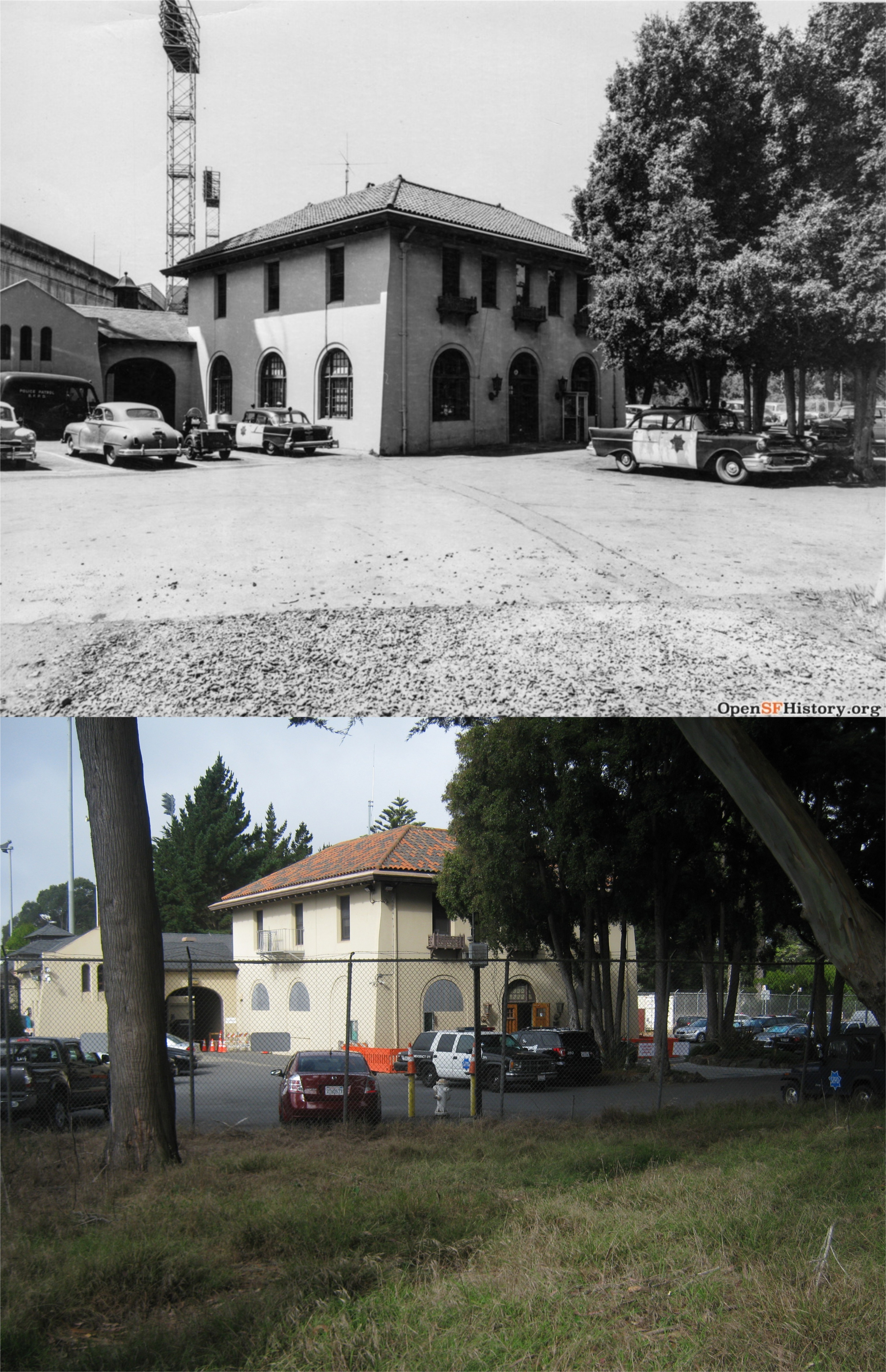 The old Police Station on the southeast side of the park in 1957: I wanted to be carefully quiet when I took this picture; I couldn’t remember if I paid that parking ticket that I got 10 years ago in San Francisco.
 The tunnel that crosses under John F. Kennedy Drive to the Conservatory in the 1890’s when the road was called the North Drive.
 The old Sharon Building and the Sharon Meadow circa 1900: Sharon Meadow was renamed Robin Williams Meadow in September of 2017. Today, while I’m posting this, they are having the 38th annual Comedy Festival in the meadow where Robin Williams performed many times.
 This past Friday, the new sign was unveiled officially completing the name change of Sharon Meadow.
 The 1961 Miss San Francisco beauty contest at the old Music Concourse: That ain’t gonna happen anymore!
 Transverse Drive at North Drive (John F. Kennedy Drive) looking west in 1950:
 There really were elk in Elk Glen Lake once, at least in 1939.
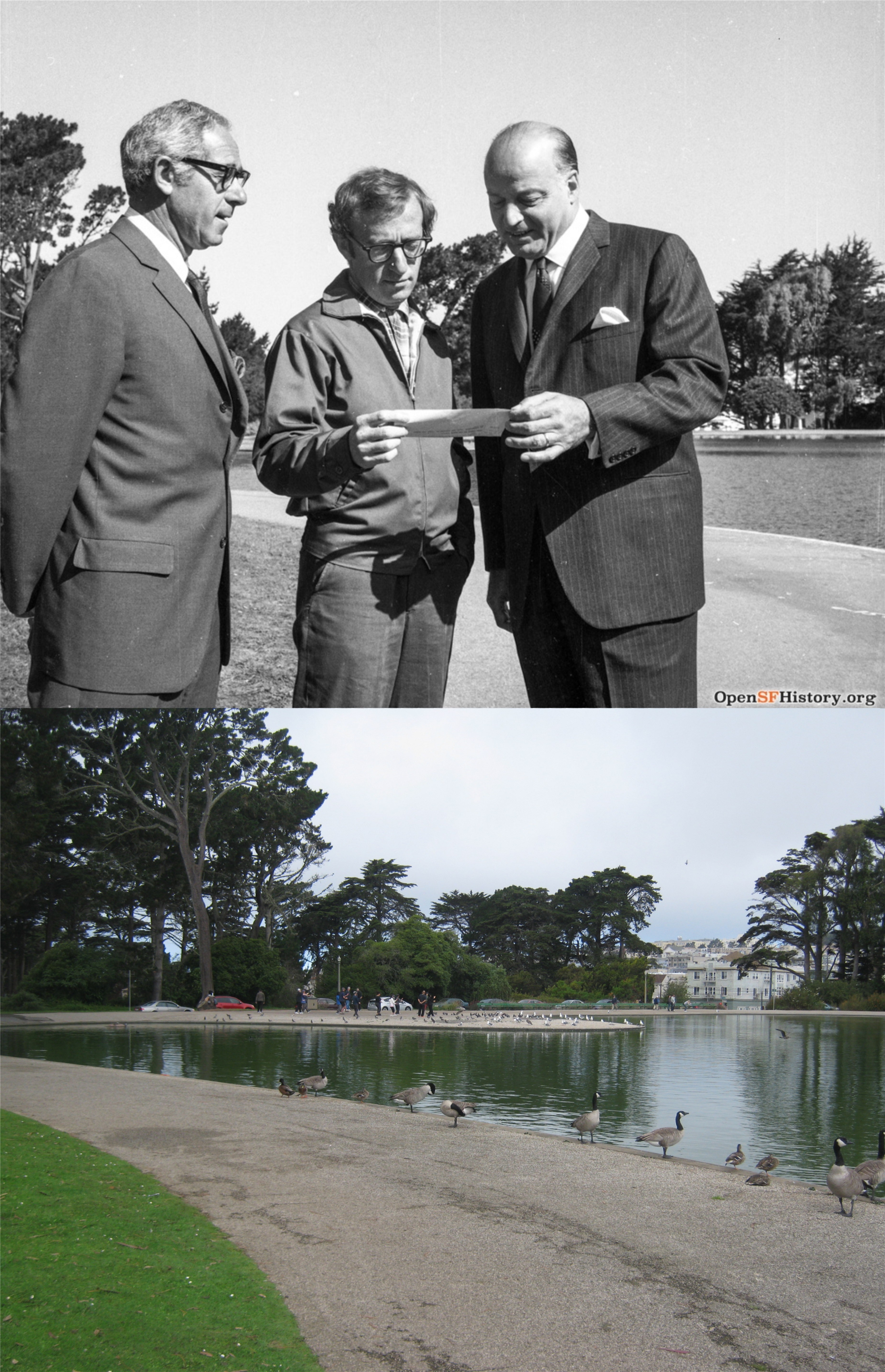 Woody Allen with Mayor Joseph Alioto on his left at Spreckels Lake in 1969: It’s hard to think of anything weirder than that! Woody Allen was in town filming scenes for his movie ‘Take the Money and Run’ at the time.
 “Can you hear me now?”
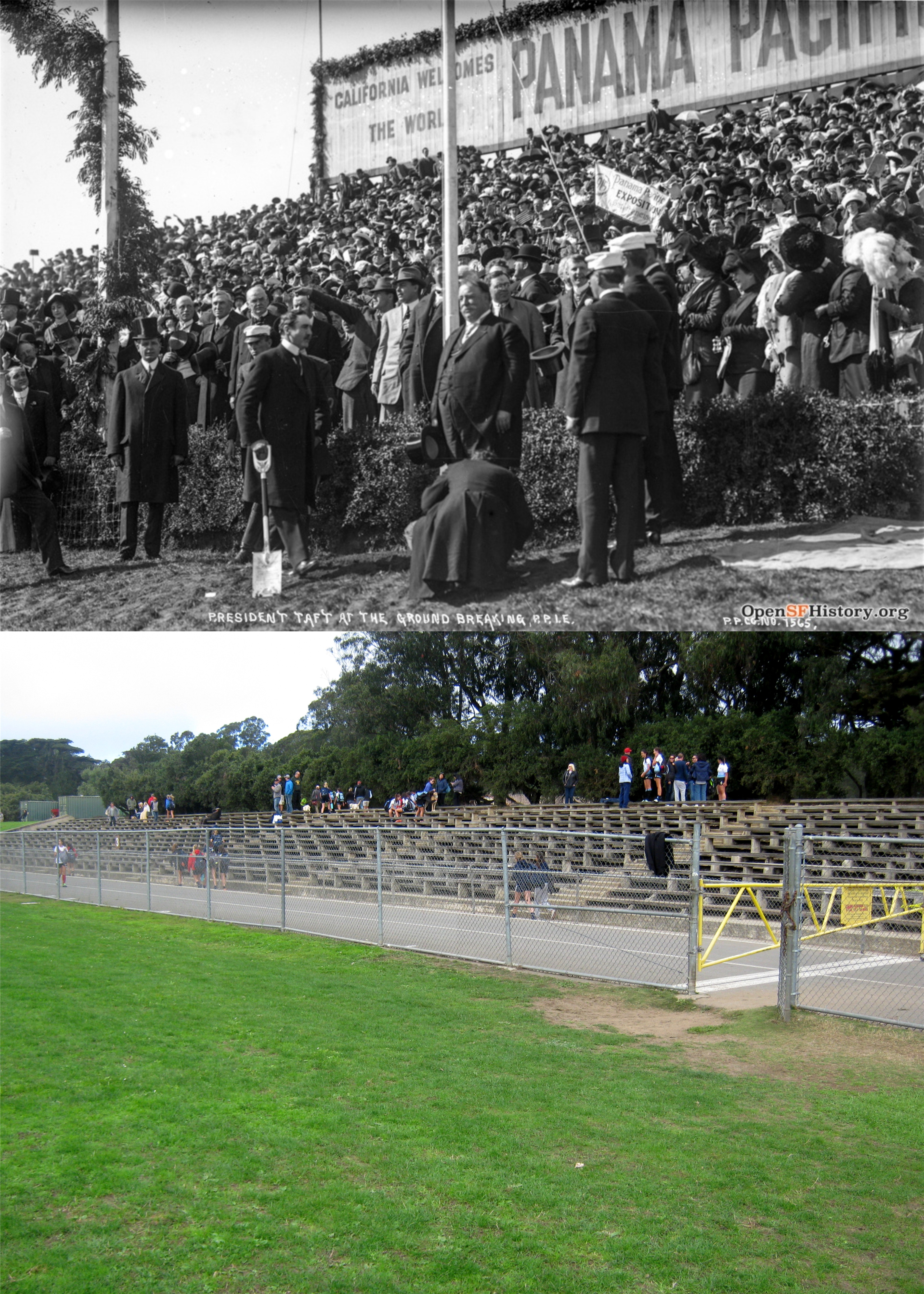 Hey, he really was fat! In 1911 President William Howard Taft broke ground for the upcoming 1915 Panama Pacific International Exposition on the north side of the Polo field in Golden Gate Park. The reason for this was because the official site for the approved fair hadn’t been selected yet.
 And there’s a grim history to the park, as well. In May of 1934, 23 year old Louise Jeppensen (some accounts state age 24) was raped and murdered here at the entrance to the north side tunnel to the Polo Field. An engineer named Millard Hickman was arrested but later acquitted. Her body was found by a caretaker in the park; that may be the caretaker and an investigator looking down at her body. Sadly, in October of 2015 another 23 year old, Audrey Carey, was murdered in Golden Gate Park not far from this spot. Three suspects have been arrested in that case.
 “They (stable) horses, don’t they?” Not anymore at the old horse stables seen here in 1947, although, there still is a small stable for police horses here.
 A 1943 photo looking out from the tunnel that ran under North Drive near the Dutch Windmill as a streetcar passes. That’s the roller-coaster at Playland-at-the-Beach in the background. The tunnel is still there, but Playland and the streetcar line that ran across the west end of Golden Gate Park are gone.
 We’ll end up on the southwestern side of Golden Gate Park with a westerly view of the old streetcar bridge that crossed over South Drive (now Martin Luther King Jr. Drive) near the Murphy Windmill, seen in 1900. The hill behind the tree on the right was where the north side of the bridge was anchored.
 A cable car at O’Farrell and Powell Streets late on a summer afternoon in 1958: (Shorpy Archives)
 Obviously, the most famous San Francisco summer was the 1967 “Summer of Love”. The vintage photo from that year was at the intersection that more than any place in the world epitomized the Summer of Love, Haight and Ashbury.(National Geographic)
 Hippies and, possibly grandbabies of hippies at the northeast corner of the Haight-Ashbury intersection in 1967 and 2018: (Vintage Everyday)
 “Cop’s face is filled with hate. Heavens above he’s on a street called “Love”.
 Hippies on top of “Hippie Hill” in Golden Gate Park during the “Summer of Love” in 1967, and neo-hippies on top of Hippie Hill today: (National Geographic)
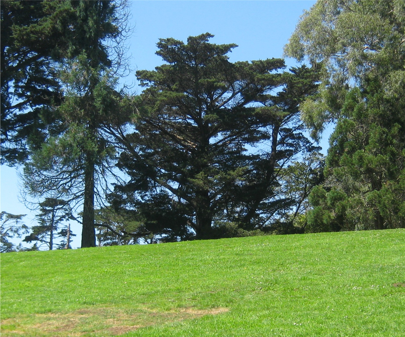 51 years is a long time ago to try and find an exact spot, but the only tree on top of Hippie Hill that remotely matches the one behind where those hippies were sitting in the previous picture is the one in the center of this photo.
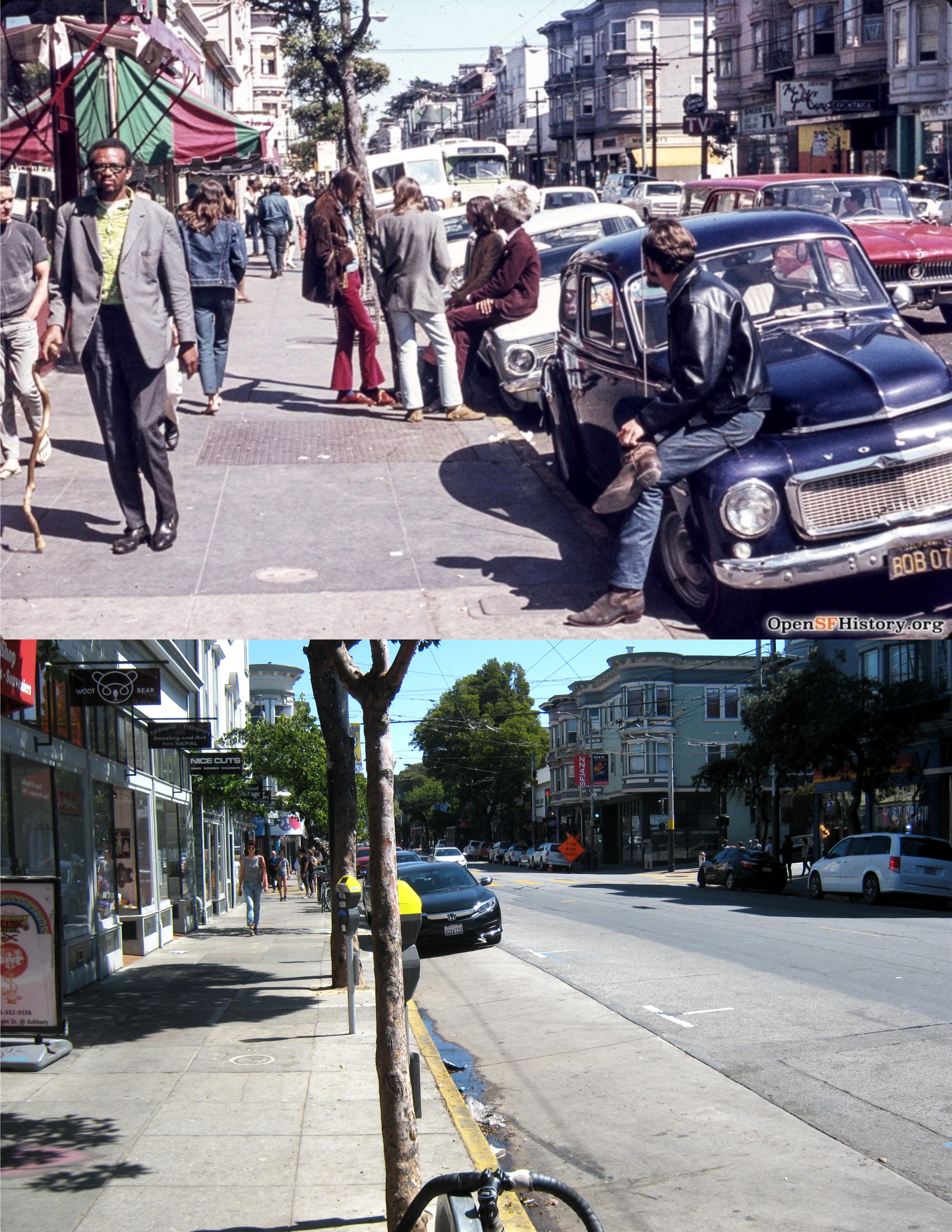 Although still resembling the Summer of Love by the summer of 1969 when the vintage photo was taken, the dream had faded out due to multiple drug overdose problems and a rising crime rate in the area. (opensfhistory.org)
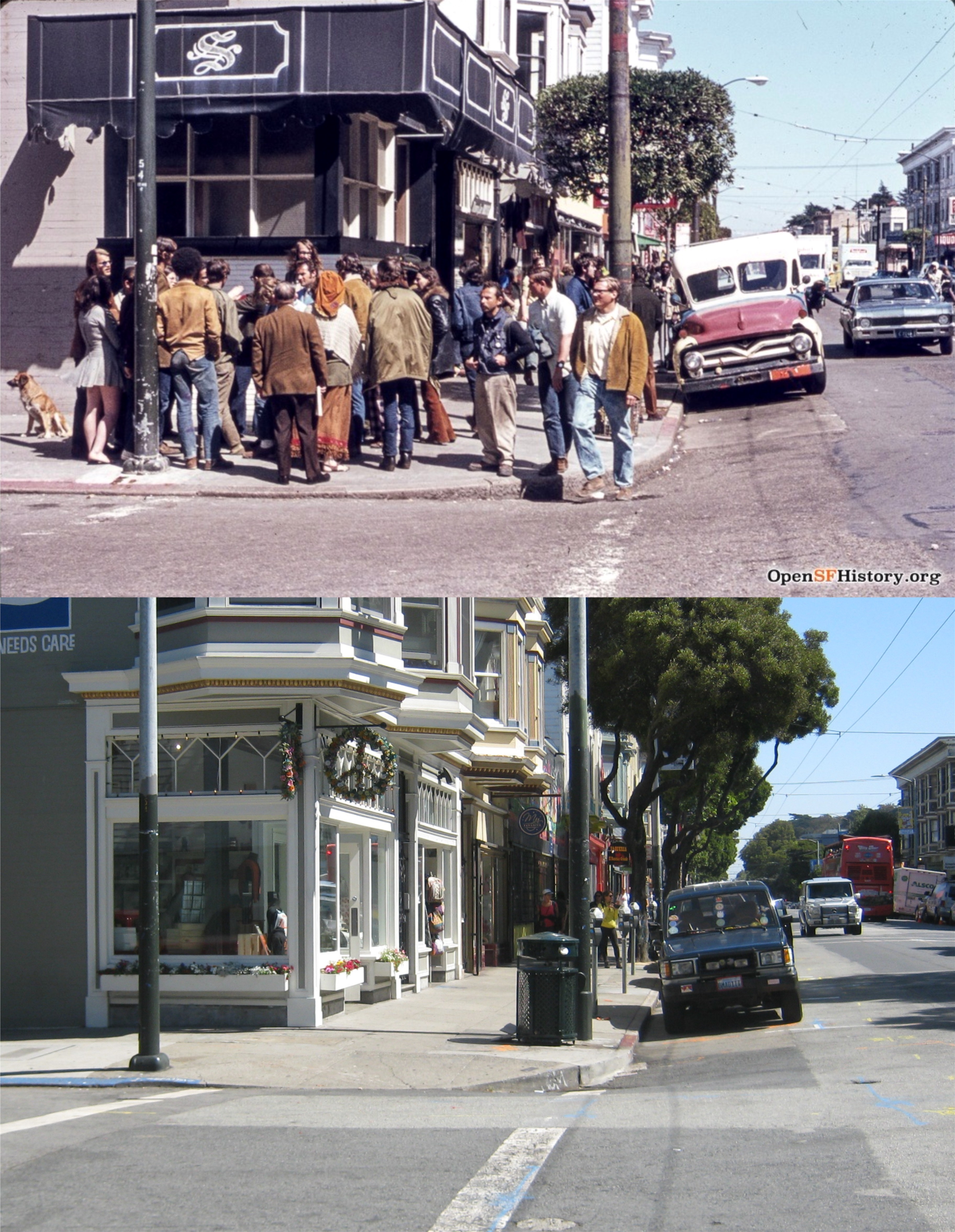 The northeast corner of Haight and Cole Streets in 1969: Wow, dig that groovy peace symbol wreath in the modern picture! Far out! What a trip, huh? #pseudohippie (opensfhistory.org)
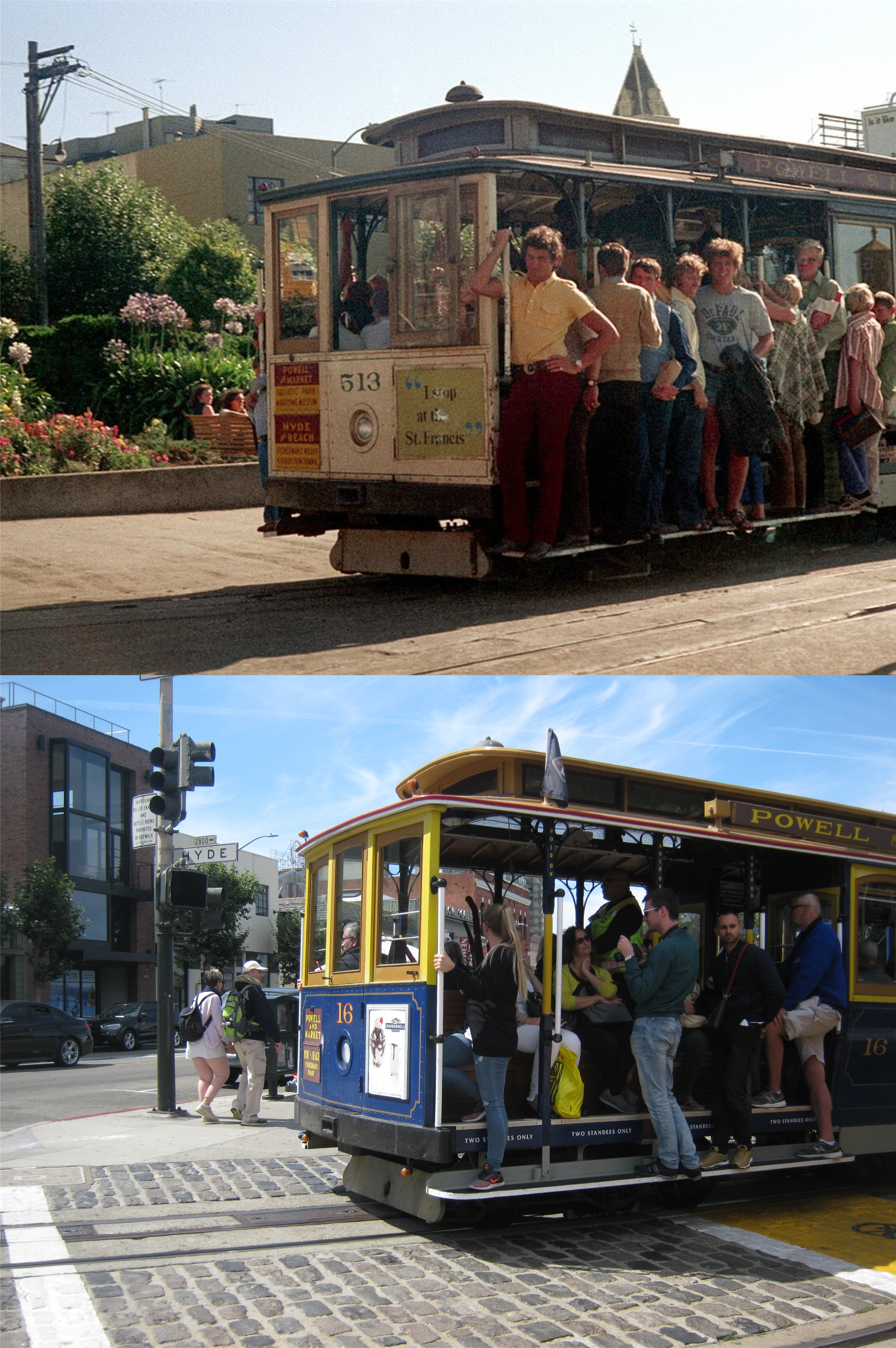 Moving forward to the summer of 1971, a cable car leaves Aquatic Park to climb Hyde Street. That’s the Ghirardelli Square tower behind the cable car in the vintage picture. (Vintage Everyday)
 Children Playing at the Mermaid Fountain in Ghirardelli Square in the summer of 1971: That was 47 summers ago; they’ll all be approaching senior citizenship by now. Oh, well, if I can handle it so can they. (Vintage Everyday)
 The vintage photo from the Huffington Post is dated May of 1939. The “Lubrication Service” Garage has been overhauled now, and the Larkin Theater is now the Century Theater.
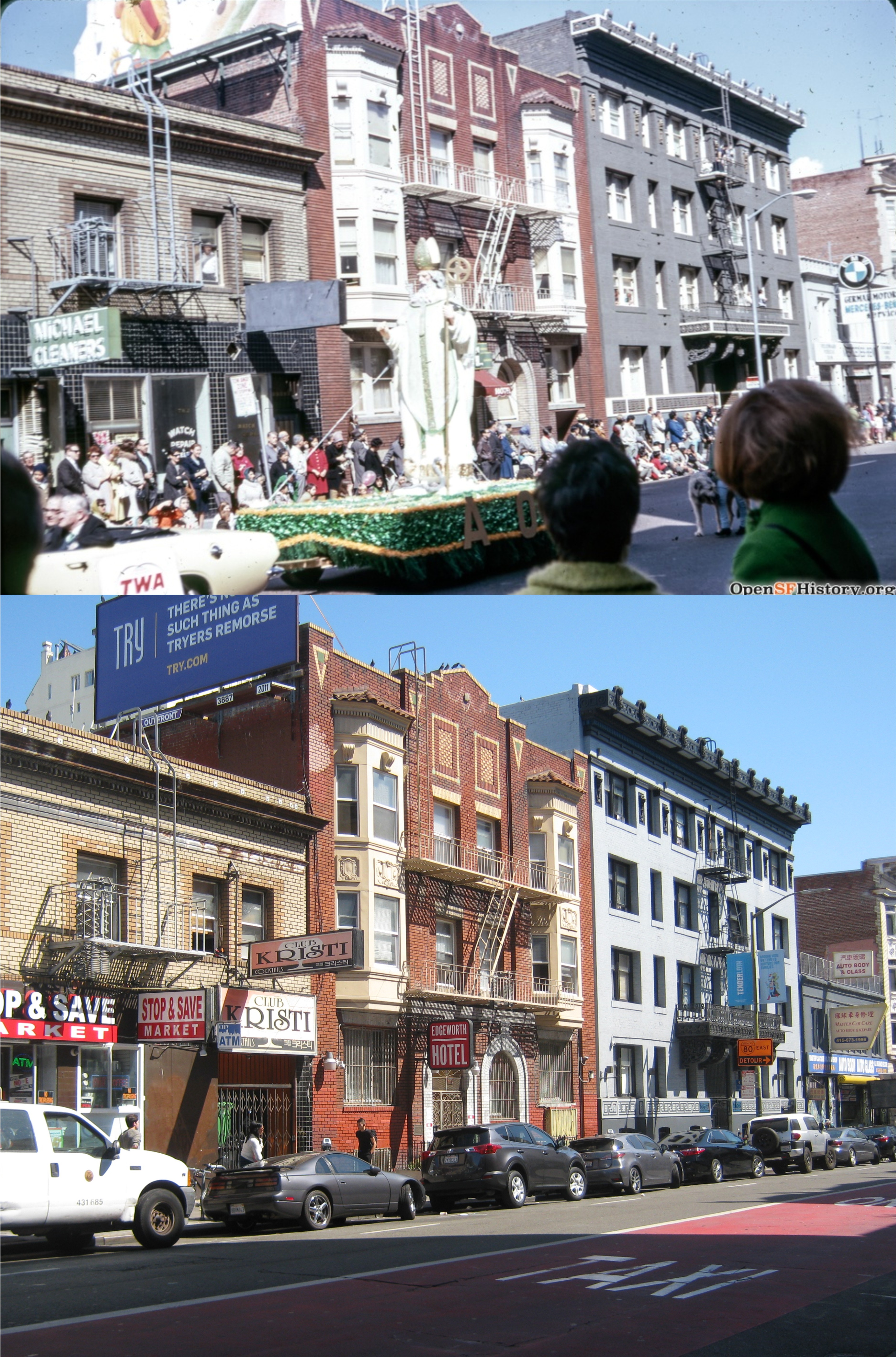 A St. Patrick’s Day parade on O’Farrell Street in March of 1968: Well, Jasper O’Farrell was born in Ireland so it’s fitting, but they don’t hold the parade here anymore. (opensfhistory.org)
 A circa 1958 picture in front of the Alexander Hamilton on O’Farrell Street: It’s interesting that the checkered sidewalk is still there. (opensfhistory.org)
 A cable car from the defunct O’Farrell & Jones cable car line on, appropriately, Jones Street at O’Farrell: The line was closed in 1954. This weekend they are running an old O’Farrell – Jones cable car along Hyde Street. If I can get a picture of it, I’ll update this post. (Market Street Railway)
 O’Farrell Street near Taylor looking east with the old KNBC Building in the background: (Market Street Railway)
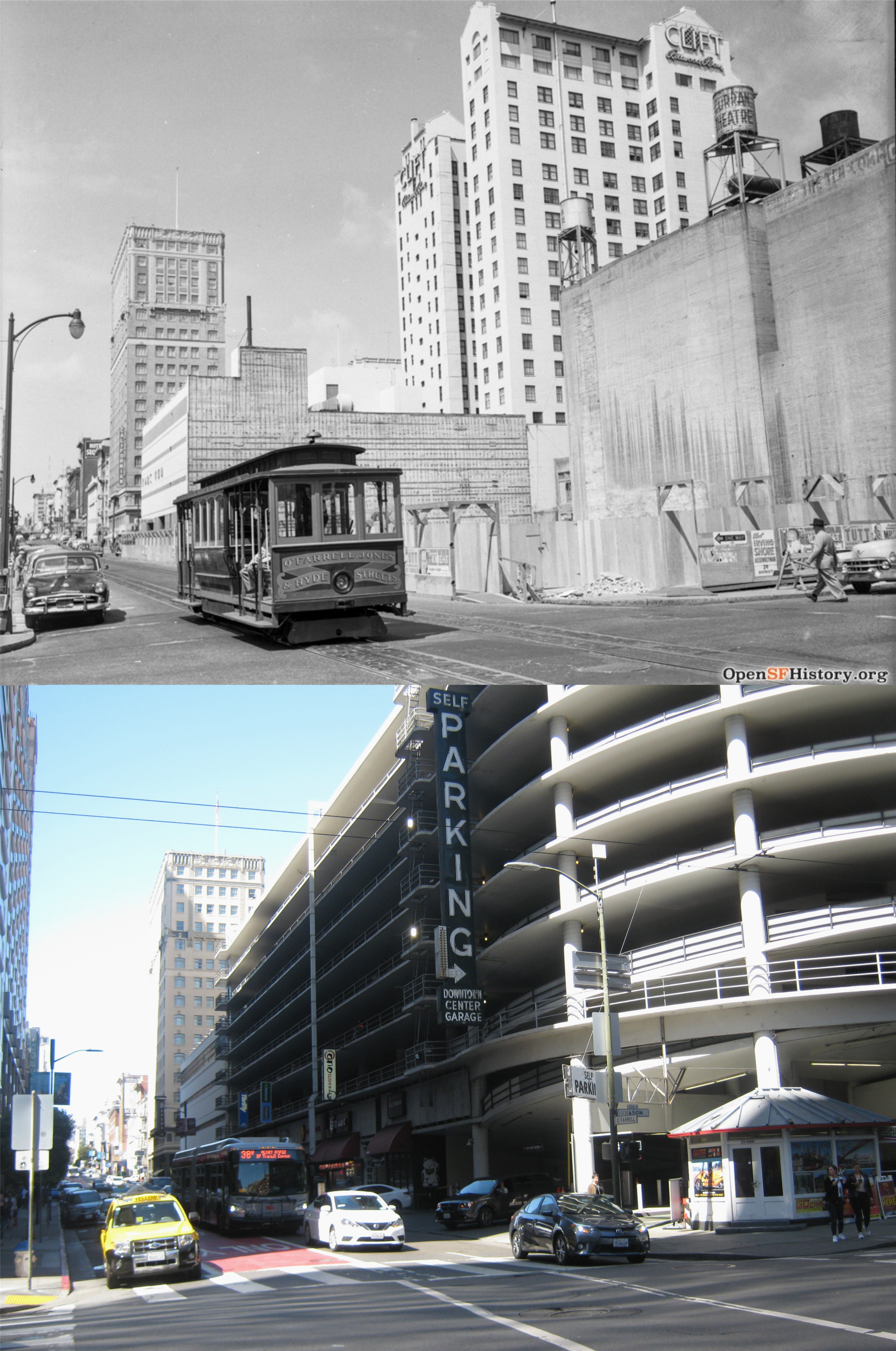 We’re one block east from the opposite picture on O’Farrell and looking west. That construction work on the right would eventually be the O’Farrell and Mason Street Garage. (opensfhistory.org)
 We’ll stop here at Turk and Mason Streets looking west. Tiny’s Waffle Shop, ‘ALWAYS OPEN’ isn’t anymore. You can see from the pictures in this post that the look of the Tenderloin District hasn’t changed much. (SF Gate and opensfhistory.org)
 This is another interesting story from Found SF about the “B-girl menace” in Tenderloin history. B-girls used their “charms” to get male customers to buy overpriced drinks in Tenderloin bars. This girl shown her, Connie Collins, was arrested in May of 1938 for “vagrancy” in an attempt by police to discourage b-girl activity. Today, there are not enough police officers in all of San Francisco to arrest the vagrants in the Tenderloin District. I’ll include the link to the Found SF story about the b-girls below.
 An untrue blue Cliff House in 1947 from the website Everyday Life in the Western United States:
 Quick, where was this taken? You have ten seconds………. If you can zoom in you’ll make out the street sign where the cable car is turning off from as Hyde Street, and if you know the cable car system, you may think of Hyde and Washington Streets. Actually the undated picture is at Pine and Hyde Streets, and has to have been taken before 1954. This was along the Jones – O’Farrell- Hyde Line that was discontinued during that year. You could board one of the cars at Jones or O’Farrell Street where the cable cars would move along Jones Street turning west at Pine Street and then north onto Hyde Street. What a lovely view of the Tenderloin that would offer today! The cars had front and back benches for passengers like the California Street Line. Here’s some interesting history from the Market Street Railway, where the vintage picture is from. The cable car warning sign is because when the cars turned east off of Hyde Street here, they traveled against one-way traffic for two blocks before turning south onto Jones Street.
 The Palace Hotel on Market Street is not red like in this old travel poster, and never was, but I couldn’t resist dimming it red to see what it would look like. I like it!
 A few more people and a lot more sunshine on Ocean Beach, south of the Cliff House, in the 1960’s than on Labor Day Weekend, 2018. There seldom are crowds on Ocean Beach, like in the vintage picture, since Playland-at-the-Beach was demolished in 1972. (Charles Cushman)
 Another bluer than blue photo from Everyday Life in the Western United States of the City Hall in 1947: These were taken looking east from Franklin Street; I couldn’t get a perfect lineup because of construction work on Franklin.
 The intersection of Geary Blvd. and Powell Street from Union Square during the 1940’s:
 Another wonderful vintage picture looking north along Grant Avenue from Sacramento Street in Chinatown during 1957: (Everyday Life in the Western United States)
 There was probably never a more colorful period in San Francisco history than the 1967 “Summer of Love”, and certainly no more suitable of a candidate for the queen of the Summer of Love than Janis Joplin, seen here at the Palace of Fine Arts.
 IF YOU ONLY HAVE TIME TO VISIT ONE ATTRACTION IN SAN FRANCISCO………. then you should have stayed home! Actually the historic World War Two Liberty Ship, the SS Liberty O’Brien should be on top of your list.
 A vintage photo of a radioman on the ship during World War Two getting a message warning of U Boats in the area: Not really, that was my tour guide.
 “Where’s this, Kevin?”
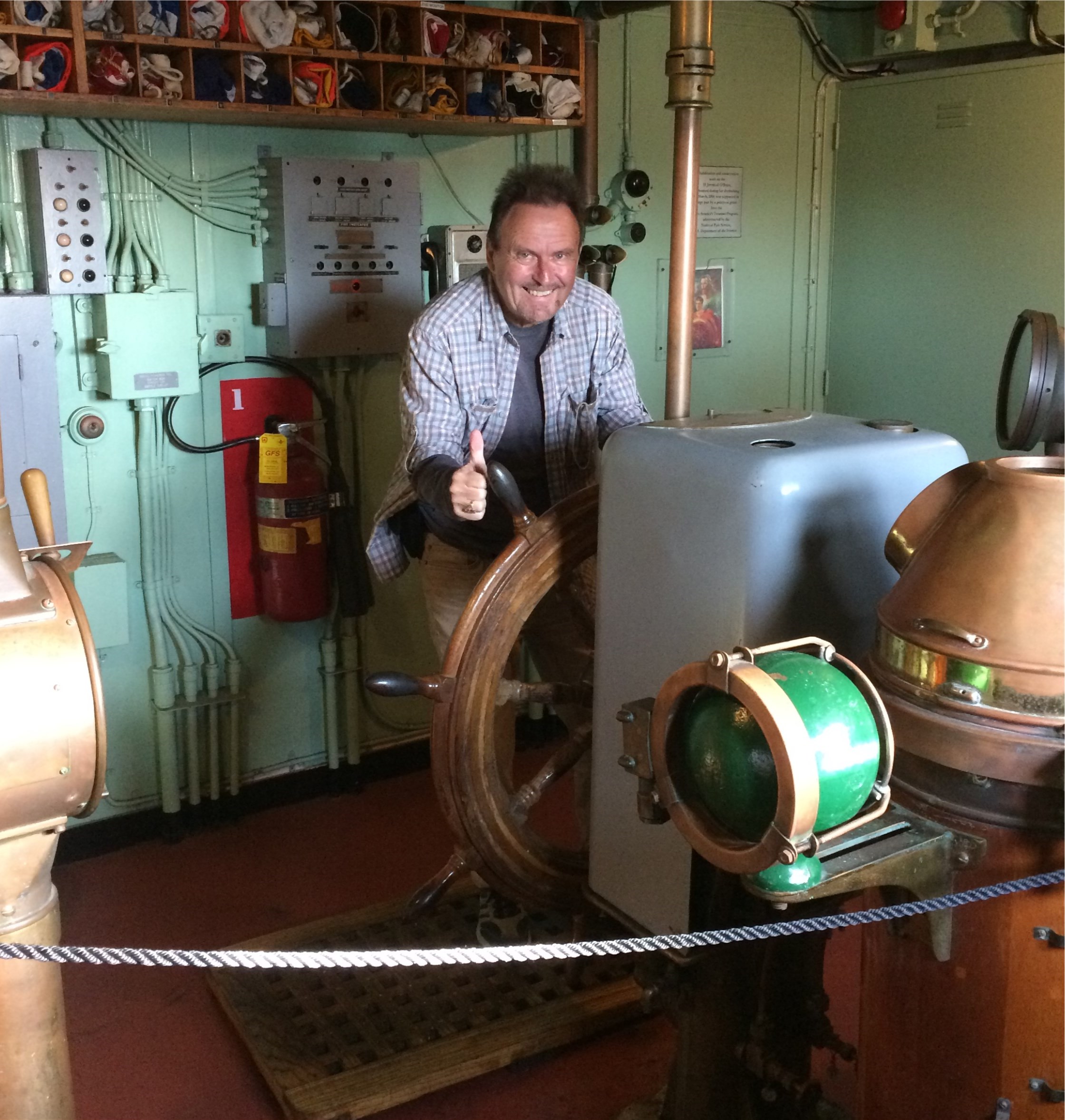 A Saturday Afternoon Mutiny.
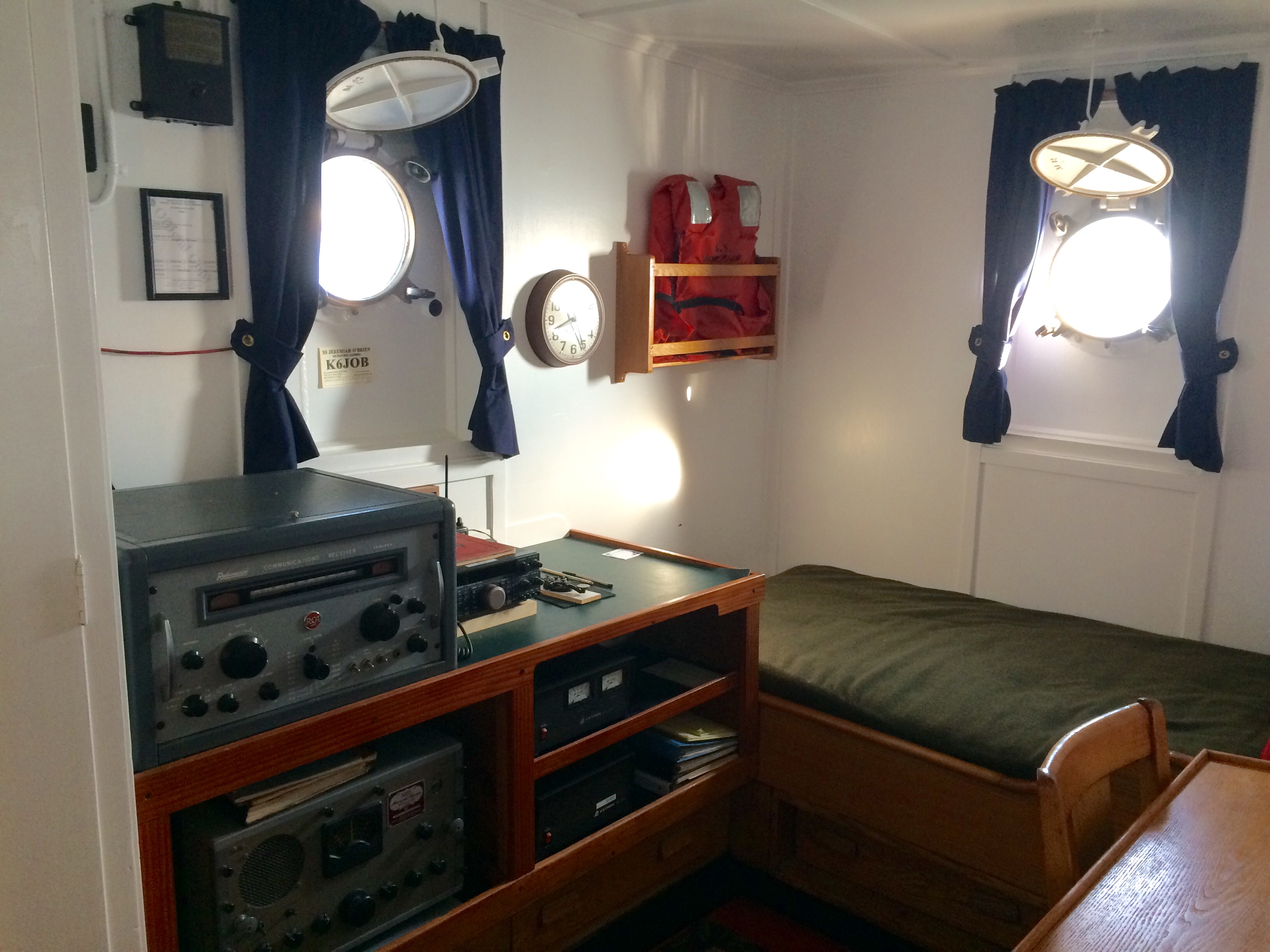 “Who sleeps here, Kevin?”
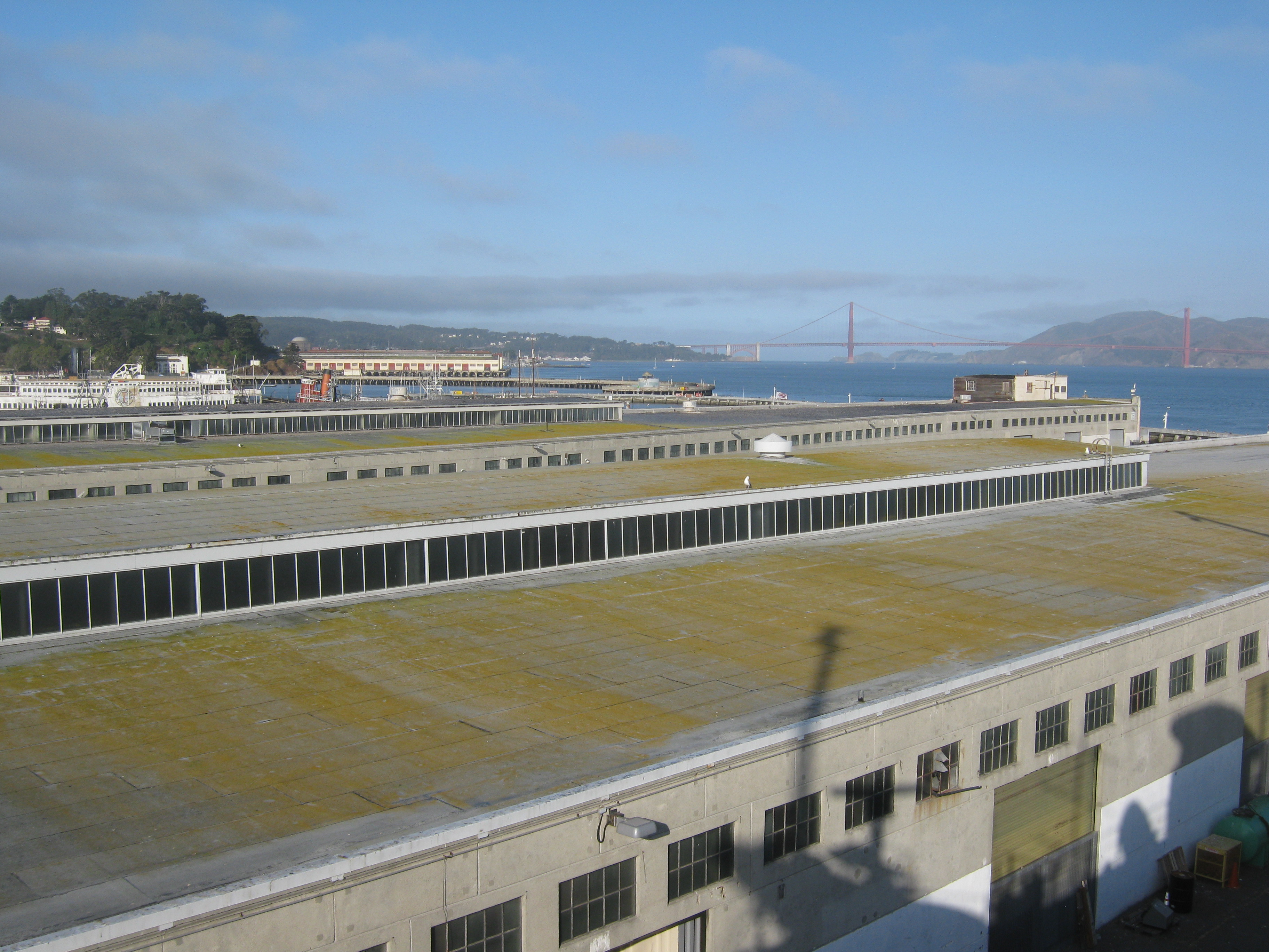 Now, a circular look from atop the ship, starting with a view toward the Golden Gate: They don’t always let visitors up this high.
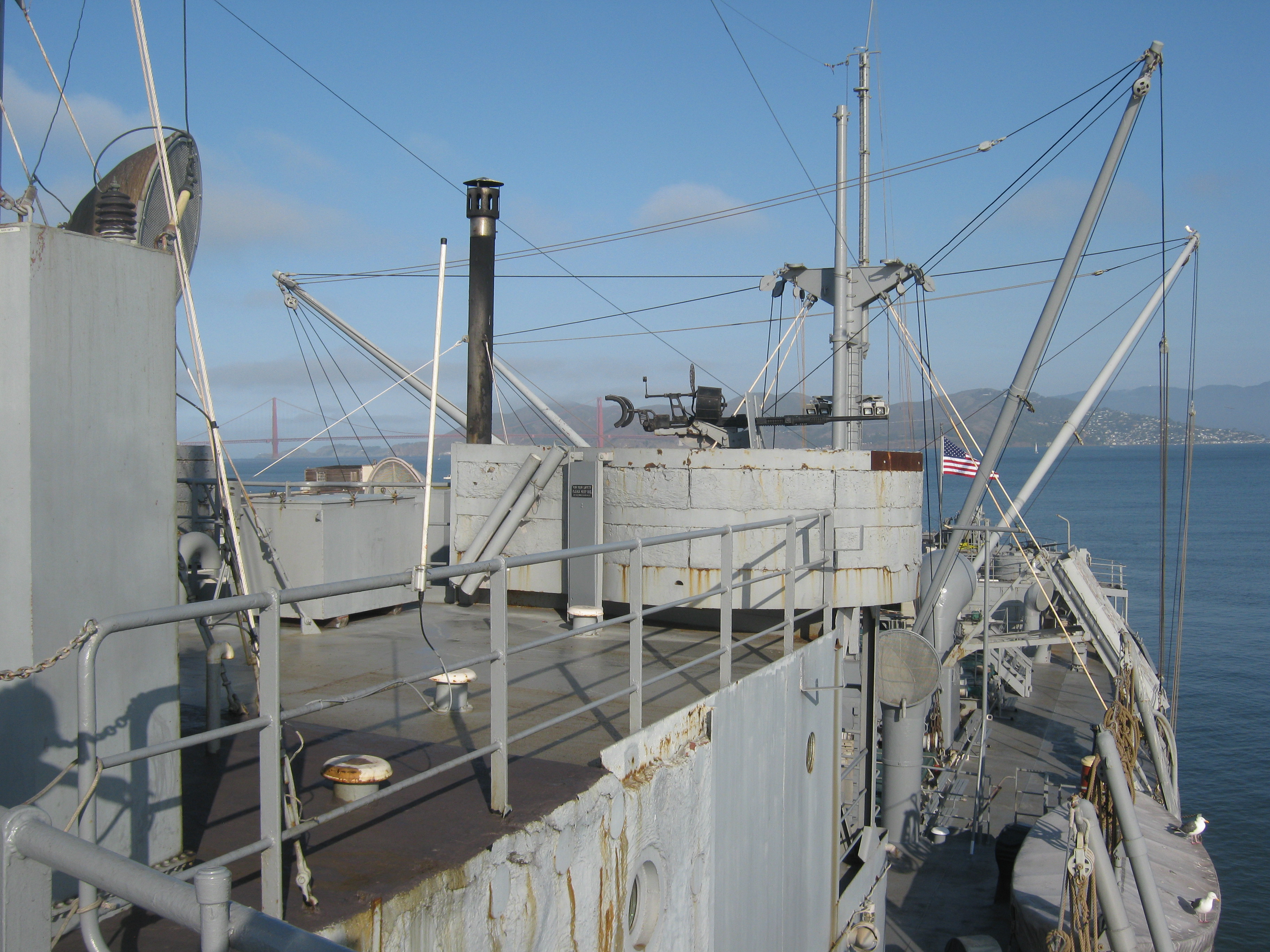 Looking northwest toward the aft of the ship:
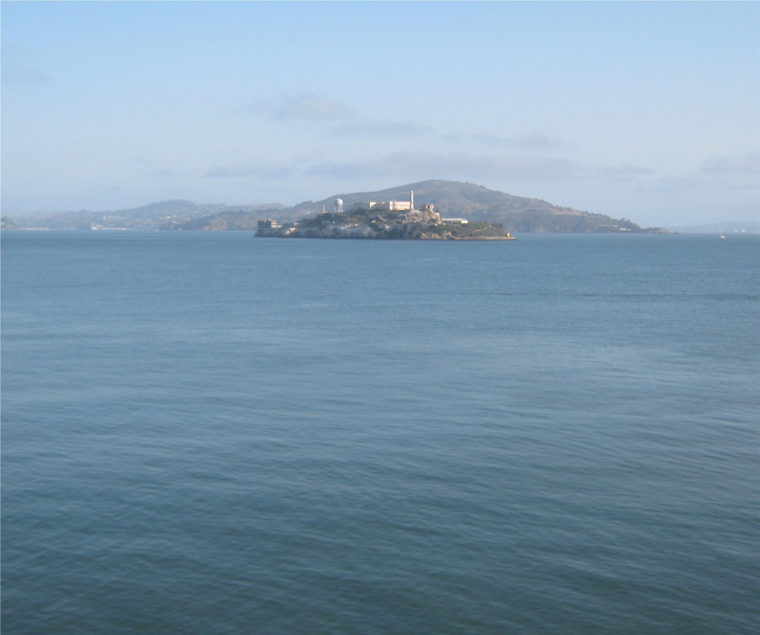 “The Rock”
 Looking toward the forward side of the ship for a view of Telegraph Hill and Downtown San Francisco:
 Looking directly toward Nob Hill over one of the most historic surviving piers on the San Francisco waterfront, Pier 45:
 The view toward Russian Hill:
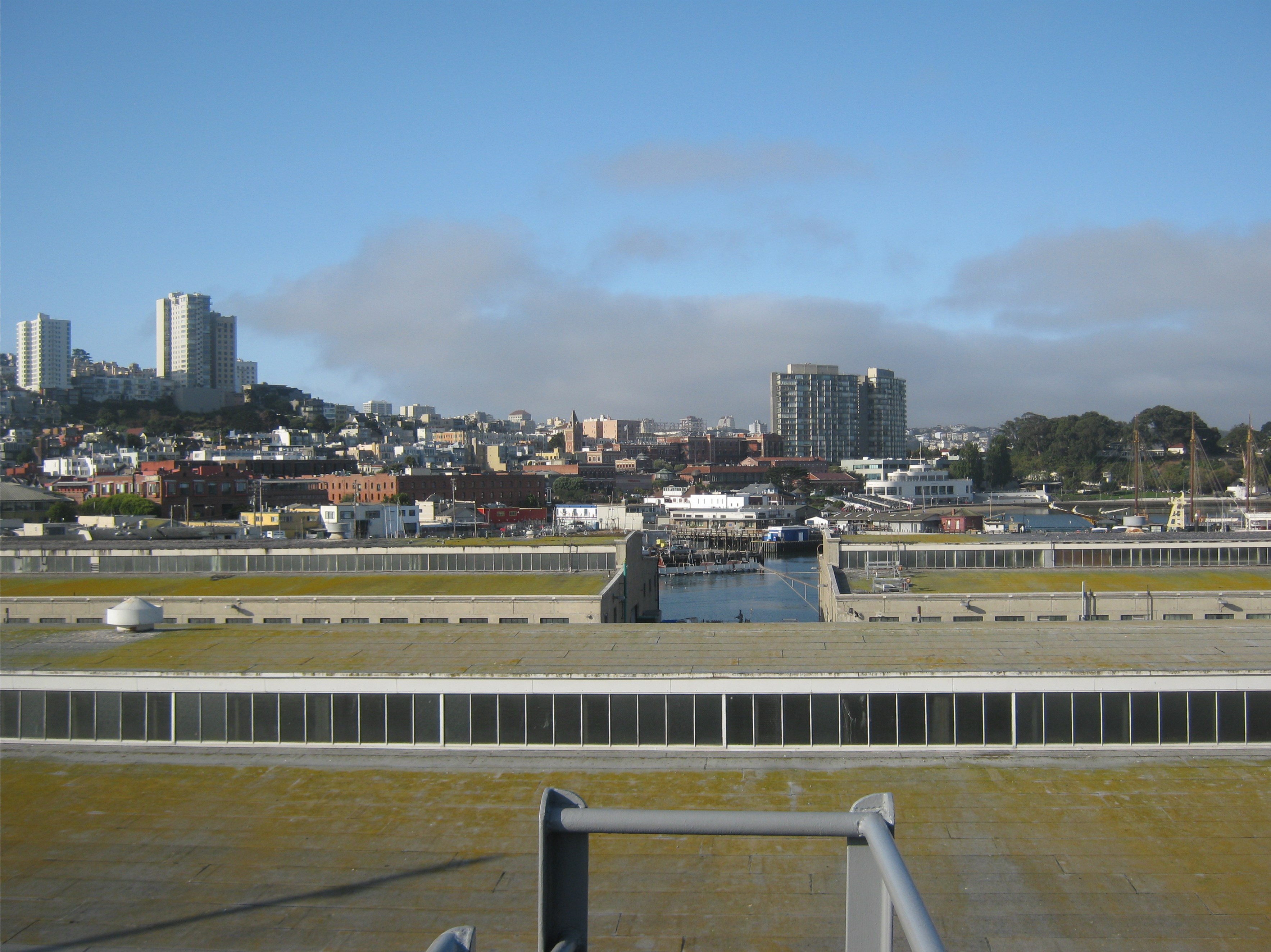 Coming back around again; Ghirardelli Square, the Maritime Museum, and the Hyde Street Pier:
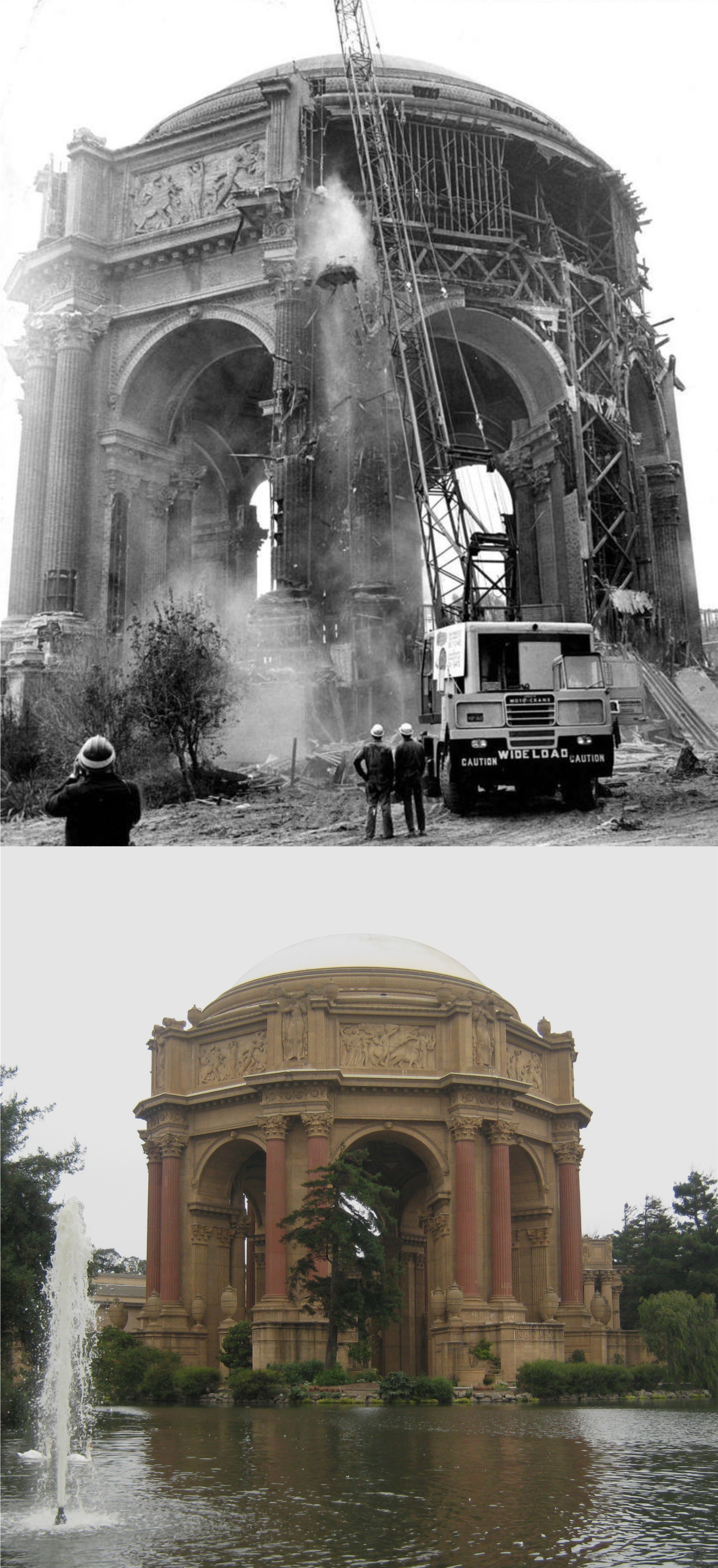 This was a big work order out at the Palace of Fine Arts. In 1964 the 1915 survivor from the Panama Pacific Exposition of the same year was demolished and rebuilt. The moat was drained so the vintage picture is closer to the structure. (SF Gate, San Francisco Chronicle)
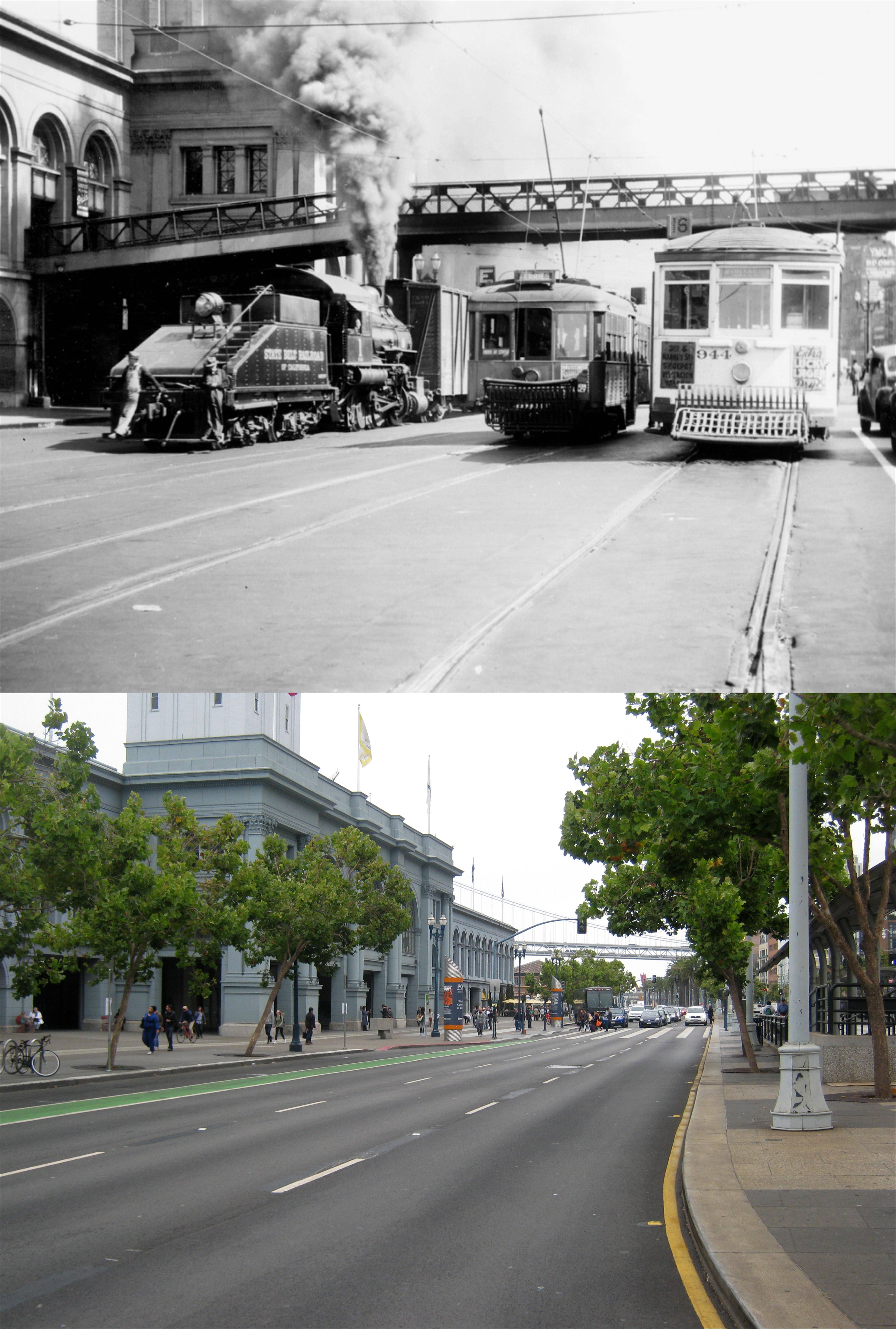 Street cars and a Belt Line Railroad train look like their racing under the pedestrian walkway of the Ferry Building in what must have been a busy work day in the 1940’s. (San Francisco History Center)
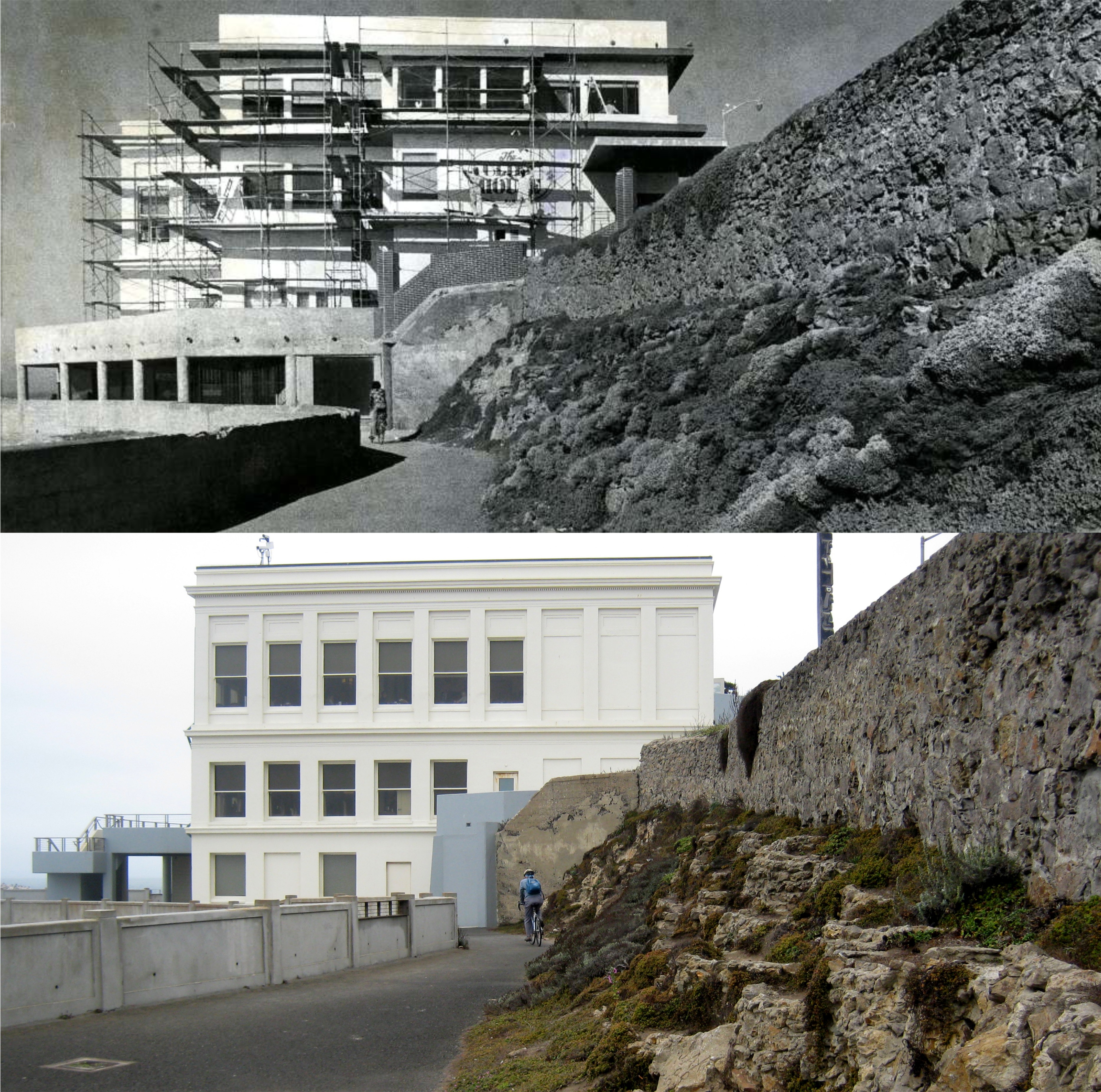 A facelift or maybe just a painting being done on the Cliff House in 1978: This was the Cliff House that I loved the best and have the fondest memories of.
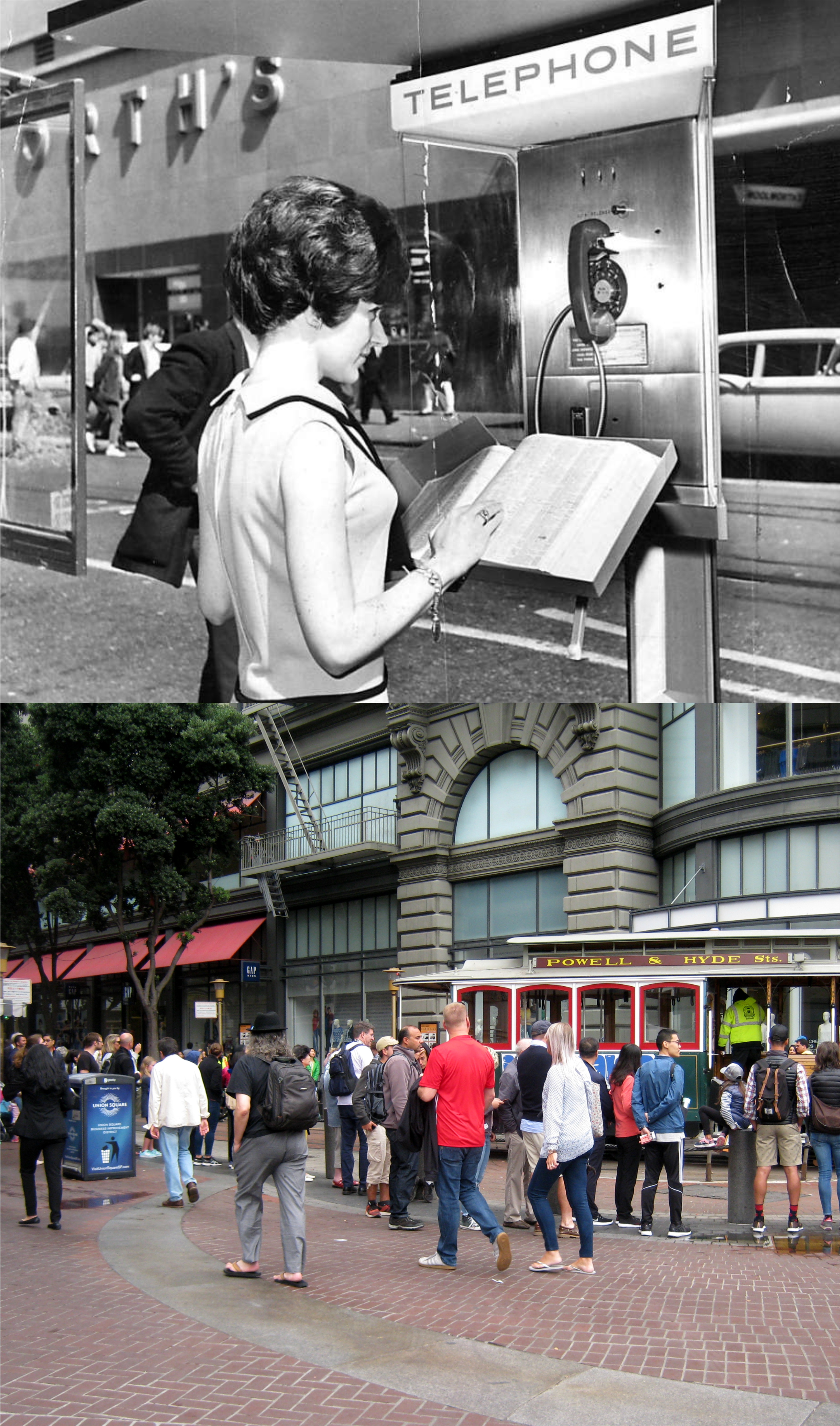 Sometimes, it’s not about working in the City, but about looking for work, which this lady at Eddy and Powell Streets in the 1960’s may have been doing. Or, she may have been looking for the address of an ex boyfriend she was stalking! I’ll give her the benefit of the doubt. Eddy doesn’t cut through to Powell anymore, but stops at Hallidie Plaza. The Flood Building behind her was the location of the flagship San Francisco Woolworth’s Department Store which had covered up the building with some kind of neo-deco look, if there is such a thing, at the time. You can see the Powell Street cable car tracks in the vintage picture but no lines, and the cable cars were only 25 cents a ride then, and a lot of times they didn’t even take your money. (SF Chronicle)
 Fishermen bringing in a haul on an early workday morning at Fisherman’s Wharf in the 1930’s: They go out to sea in the middle of the night and bring in their catch long before the tourists get to Fisherman’s Wharf.
 This picture I took for a previous post of a guy selling crabs at Fisherman’s Wharf makes a nice comparison with this 1940’s photo at Fisherman’s Wharf. (SF Chronicle)
 If you don’t think that was a lot of work stacking up those sand bags in front of the old Telephone Exchange Building on Grant Avenue in December of 1941 then you’ve got a job here with me! This building routed most long distance calls in and out of San Francisco at the time, and was considered so important that the sand bags were piled up to protect it from bomb damage just after Pearl Harbor. There was a real concern at the time that San Francisco would be bombed by the Japanese soon.(SF Chronicle)
 A little further down Grant Avenue near Market Street, probably near the same time as the previous picture, some type of delivery work is being done. Maybe they were putting sandbags in front of the wrong building!
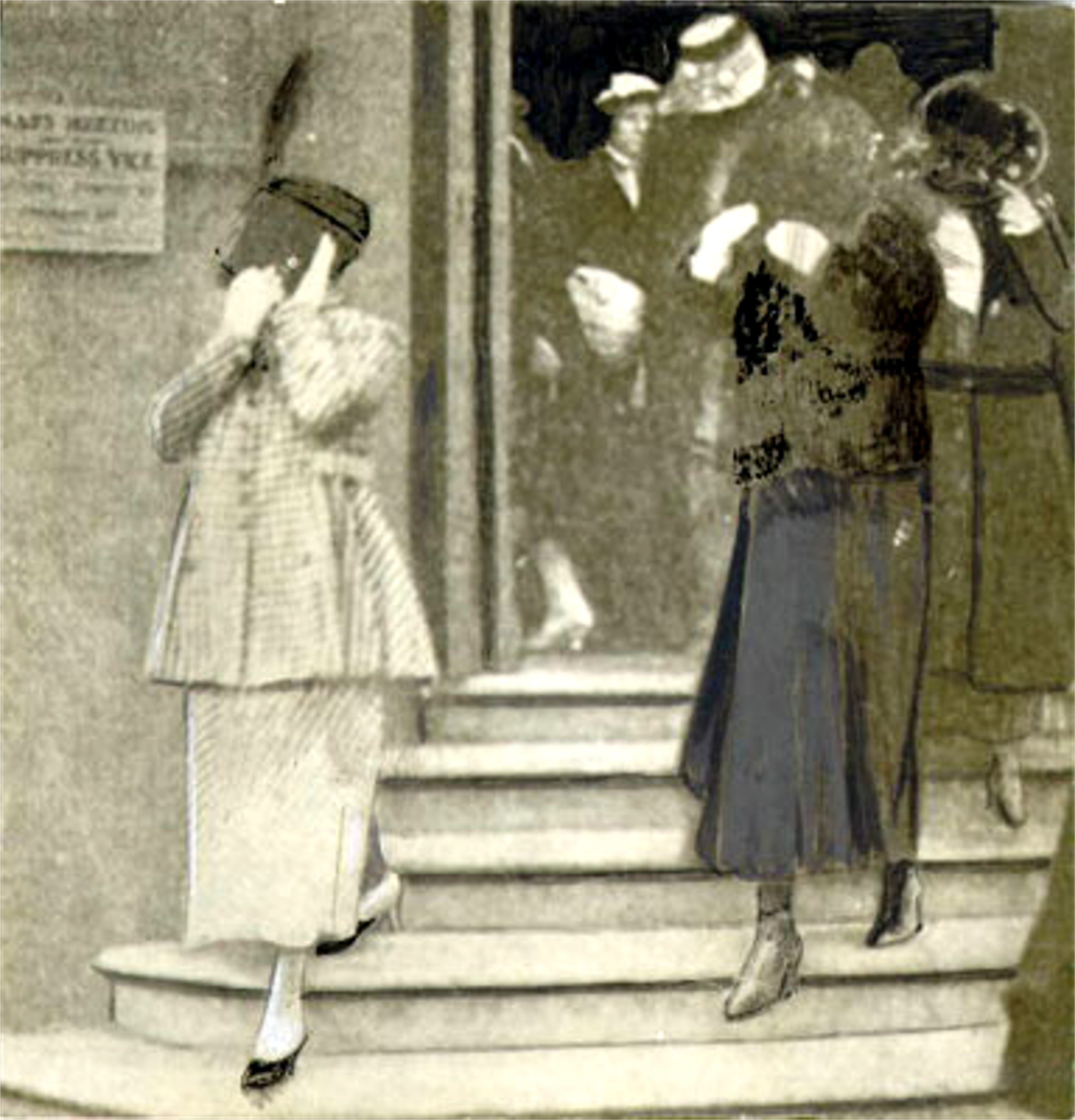
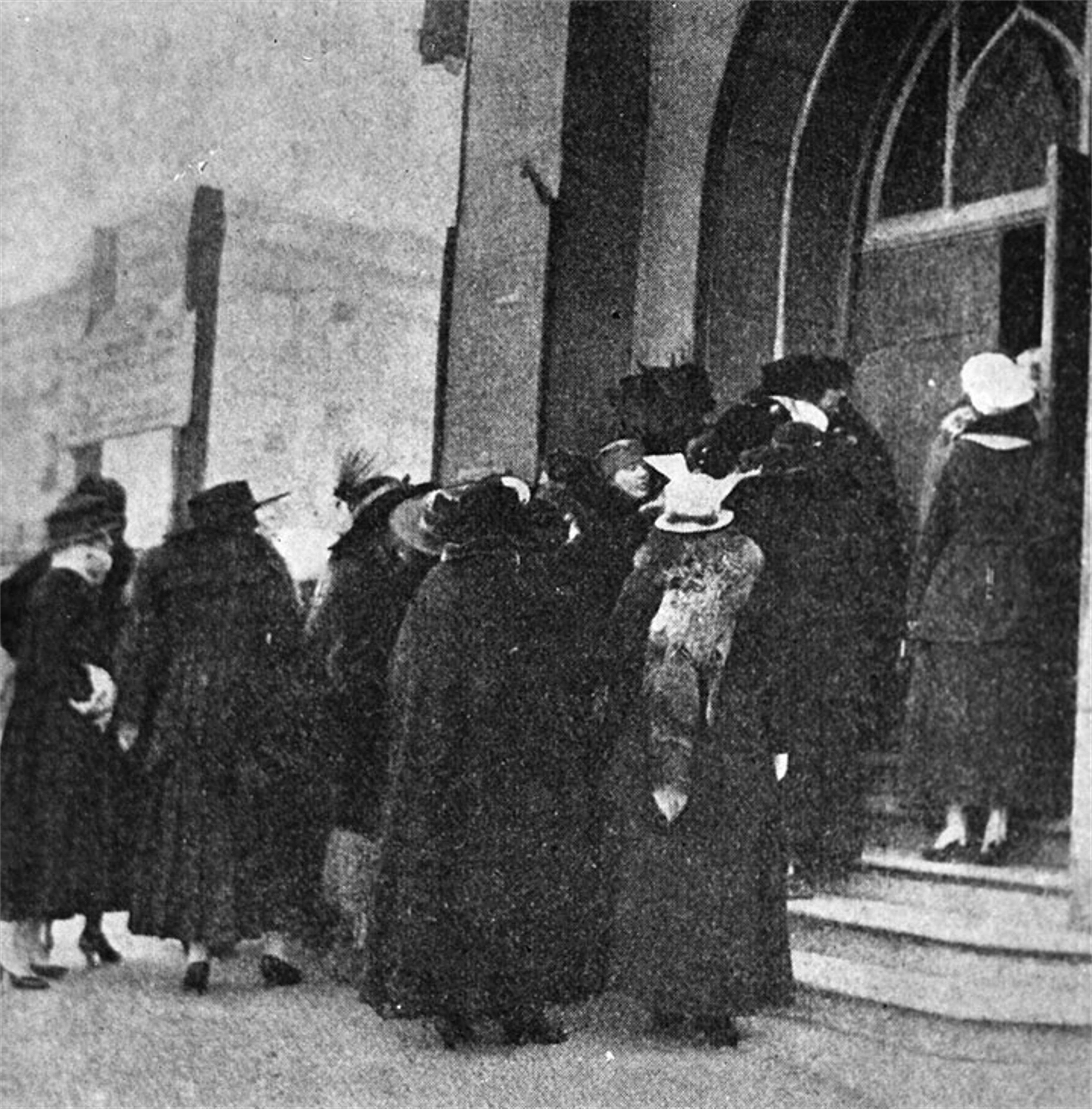 “Working girls” in San Francisco: This is an interesting story I learned of recently. On January 25th 1917 approximately 300 prostitutes stormed the Central Methodist Church at Leavenworth and O’Farrell Streets to confront Reverend Paul Smith, one of the main crusaders against prostitution in San Francisco. “Hell hath no fury like a harlot scorned!” The ladies told the Reverend most of the women needed the money to support their children, and they could not survive on wages they could earn at other work. The confrontation became heated, and also a little fantastic! One of the ladies said that “it was men who were to blame for the prostitutes’ lot in life. It was men who sought out prostitutes and other men who profited from their trade.” When Reverend Smith asked them if they would be willing to do housework, one of the ladies answered, “What woman wants to work in a kitchen?” Although Reverend Smith appeared to be sympathetic, he wasn’t a “forgiving” pastor, and it was clear that the ladies weren’t going to change his mind. A crowd had gathered outside the church as the “fallen angels” stormed out, many of them covering their faces. (Found SF, and the San Francisco Chronicle)
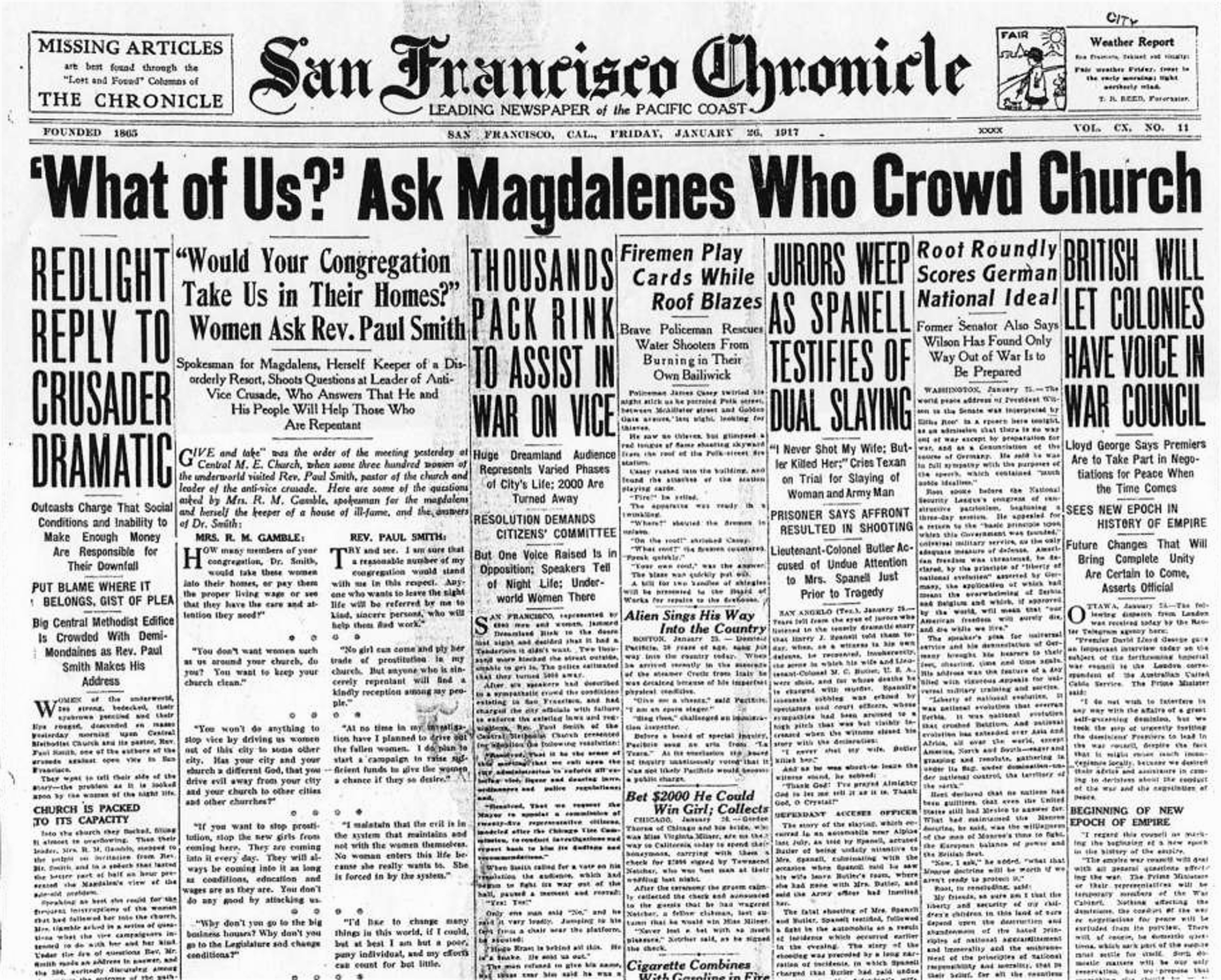
 The San Francisco Chronicle issue of the incident and the “Magdalenes” leaving the church:
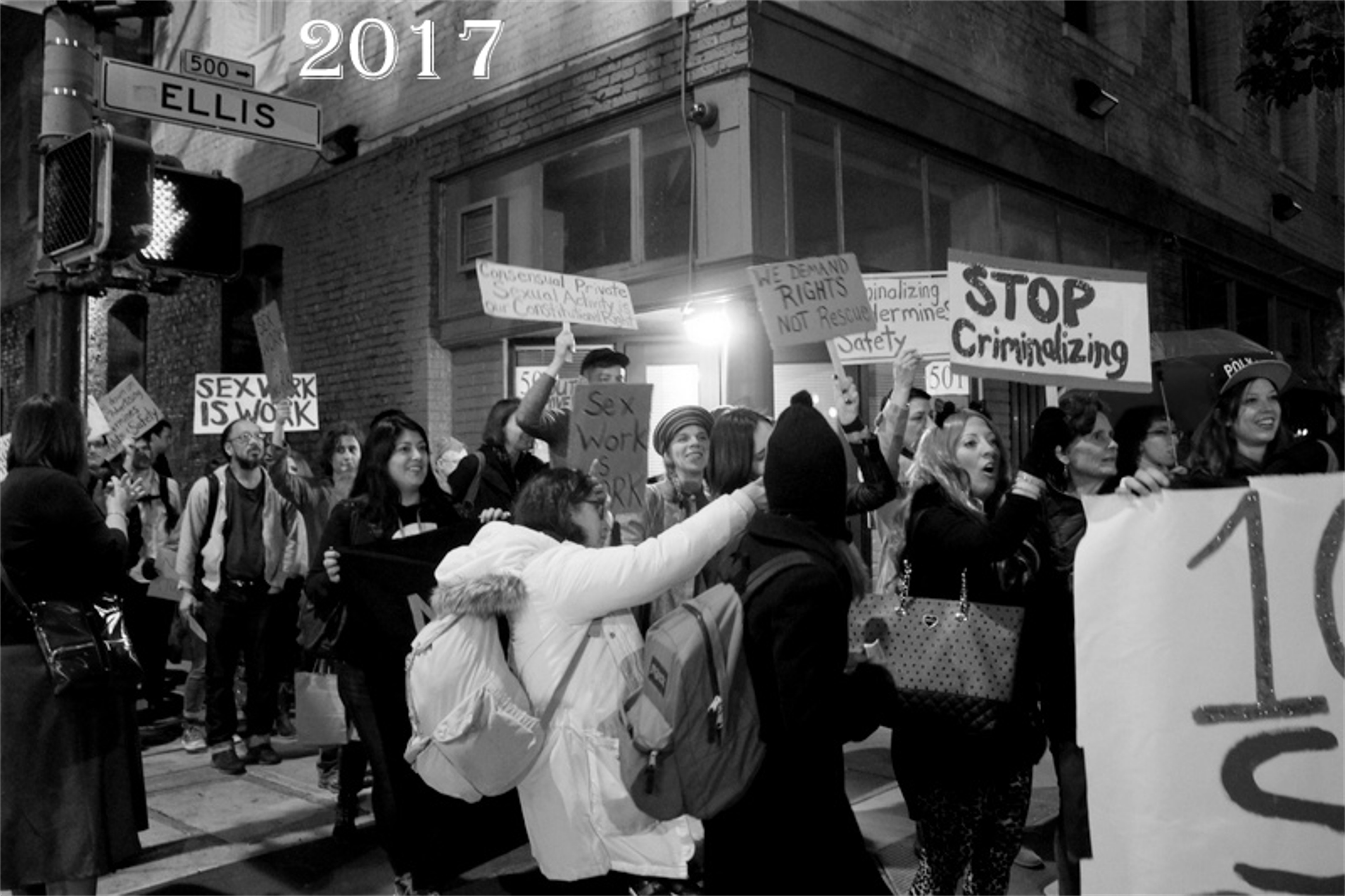 On January 25th 2017, a march was held on the 100th anniversary of the prostitutes’ demonstration. (Nation Reports)
 The demonstrators marched to the intersection of Leavenworth and O’Farrell Streets where the church once stood. (static1.squarespace.com) . Below is a link to the Found SF site and an article about the original demonstration.
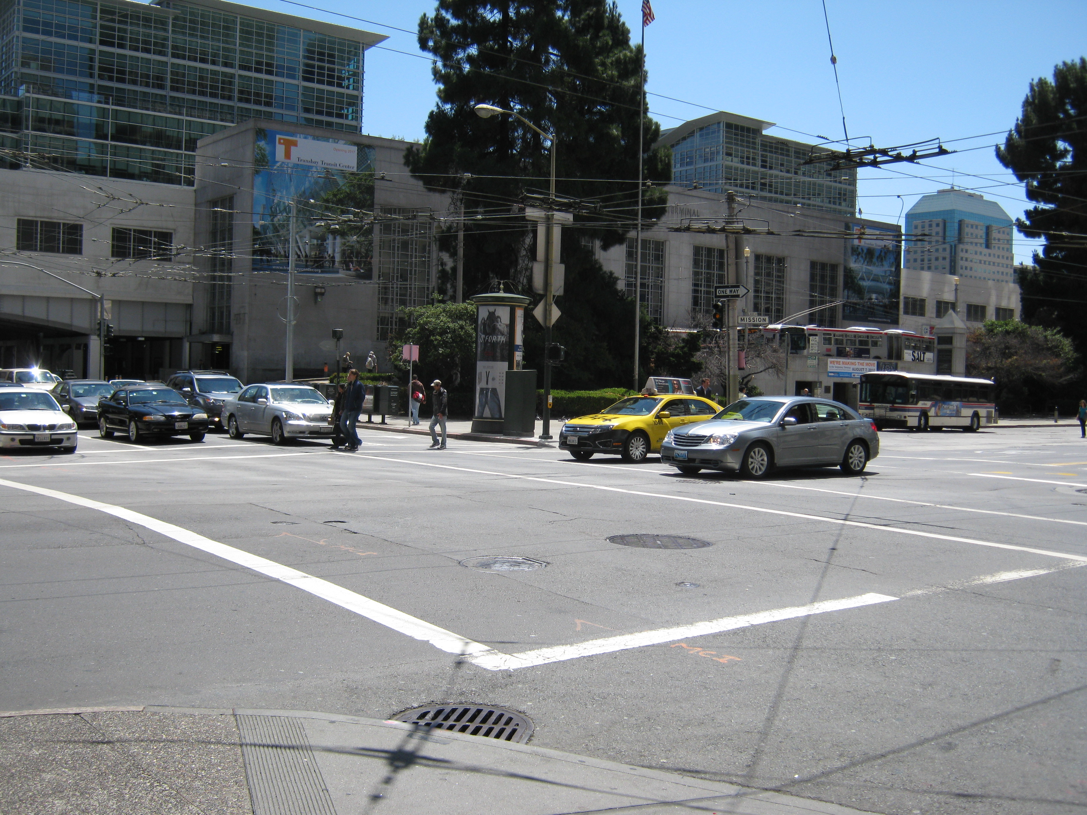
 We’ll start at the northeast corner of Mission and Fremont Streets looking toward the two terminals on closing day in August of 2010 and this weekend, as all of these pictures will be.
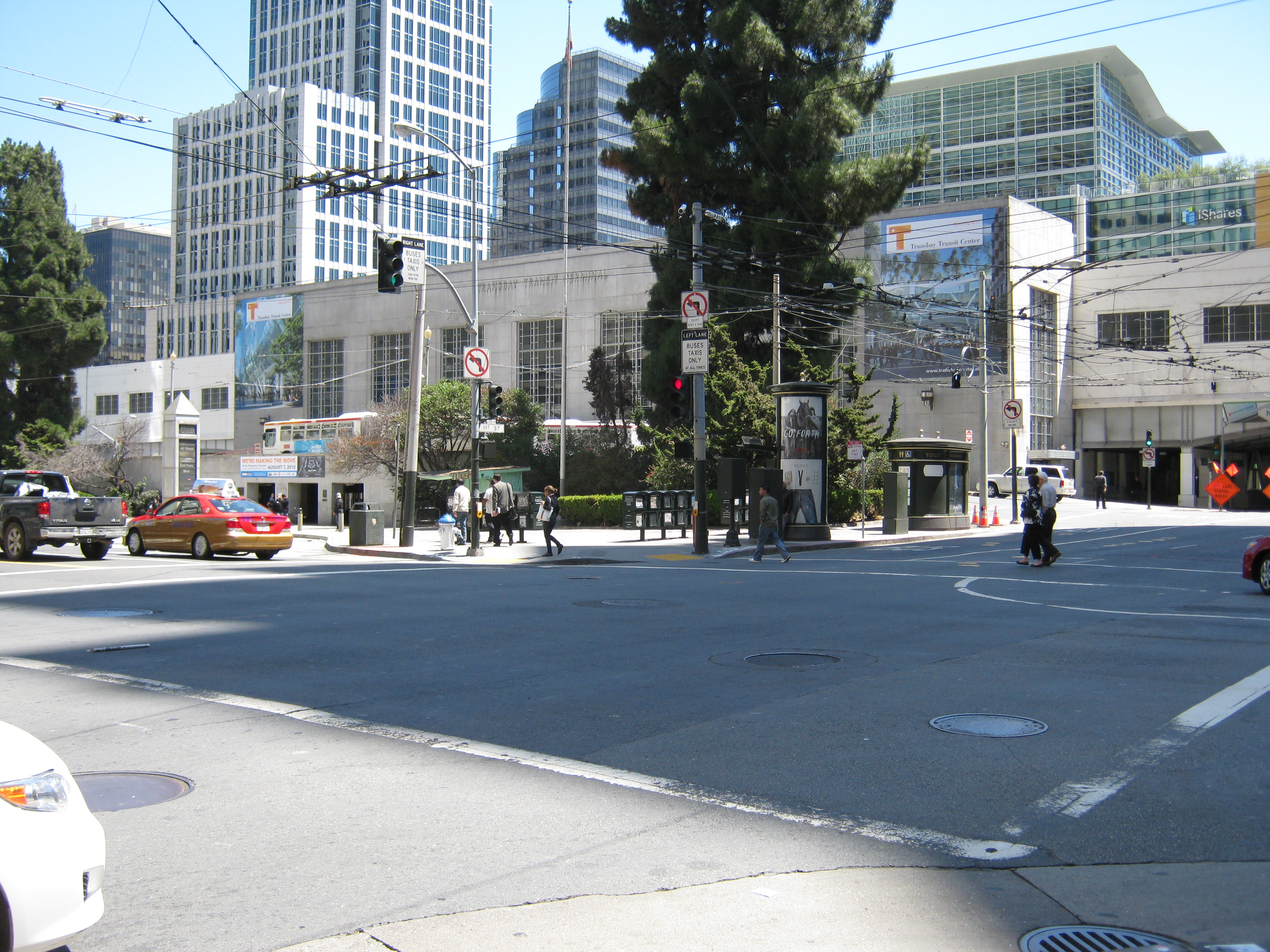
 We’ll move down Mission Street one block to the northwest corner of Mission and 1st Streets.
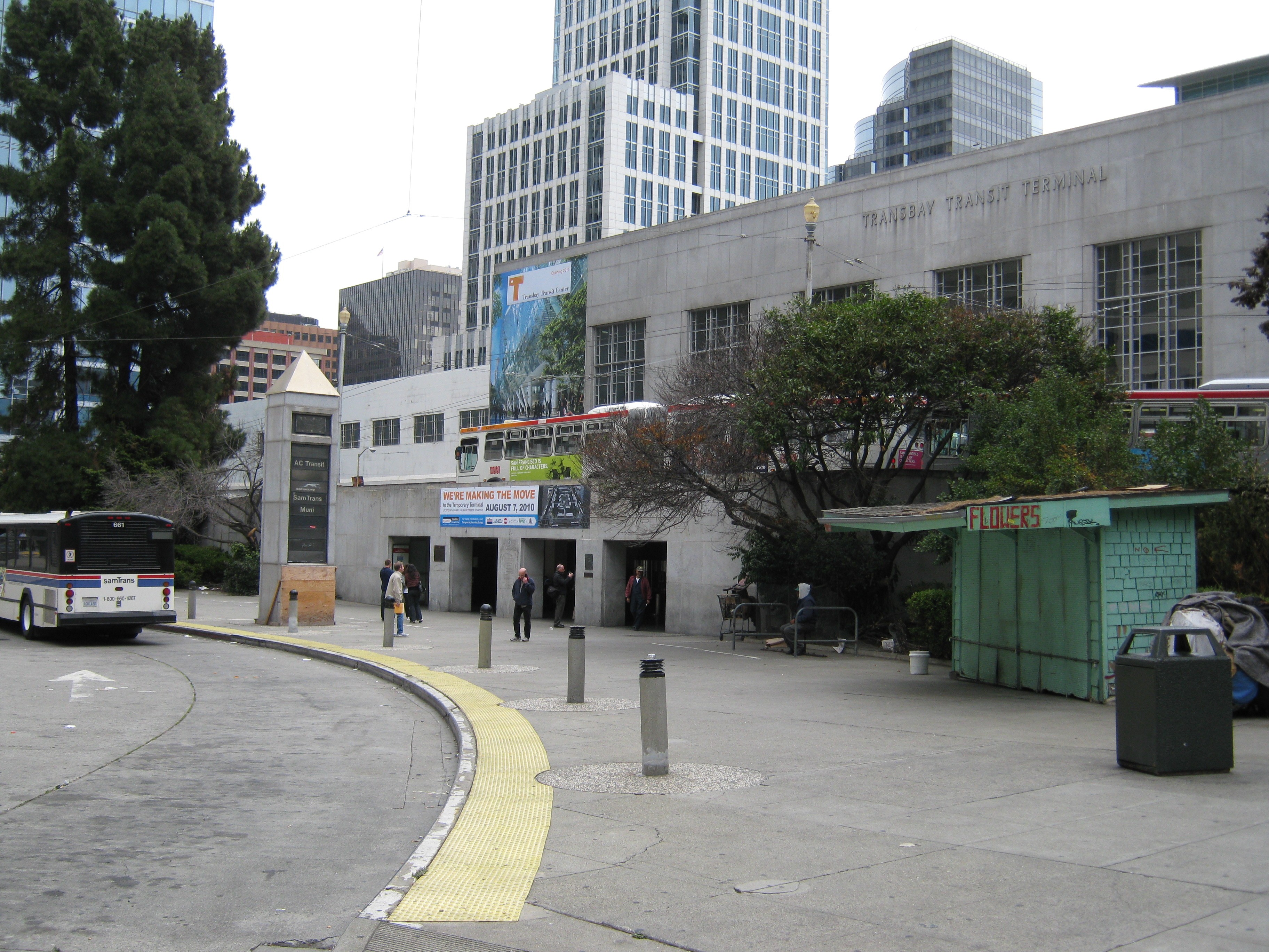
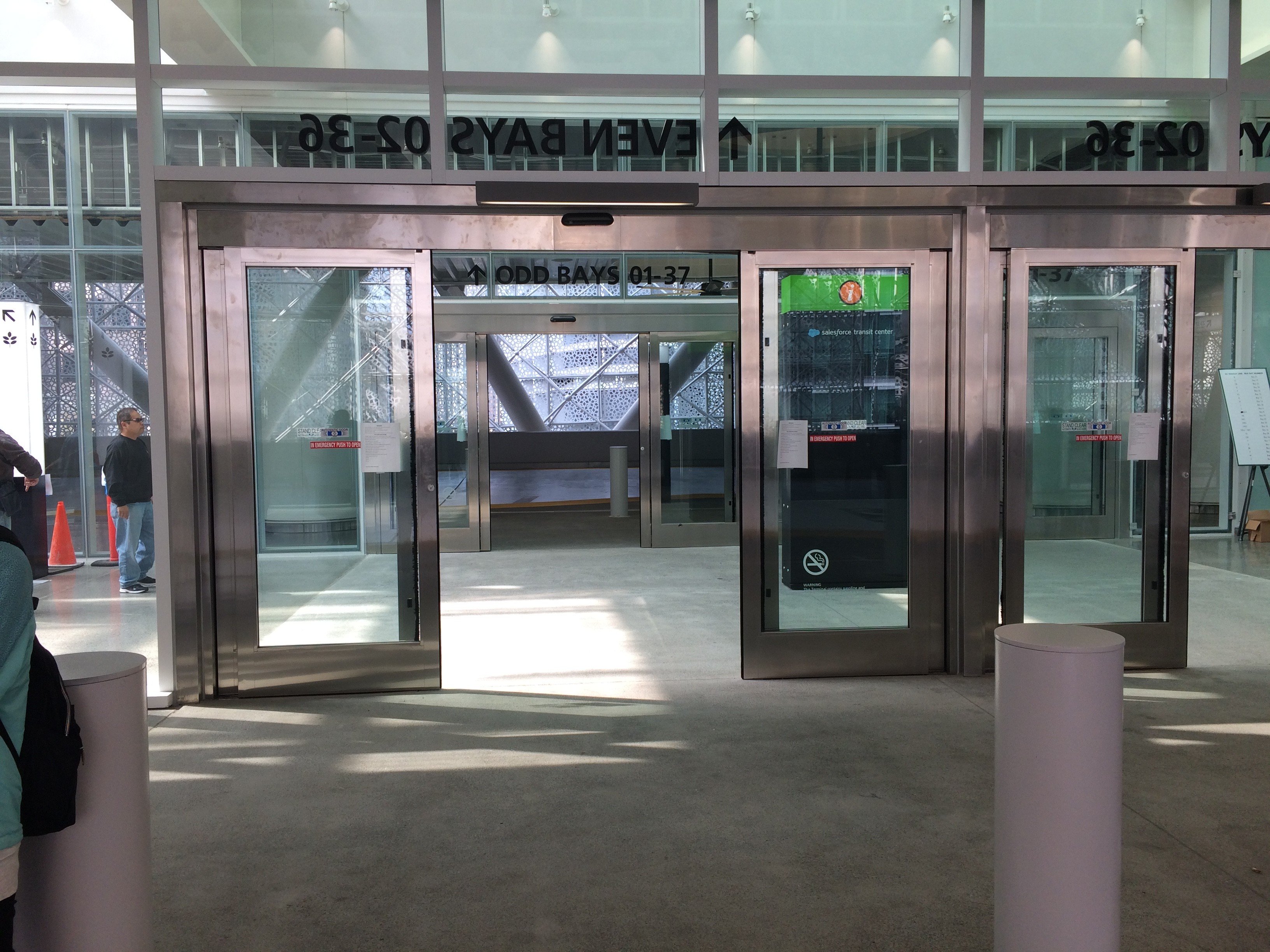
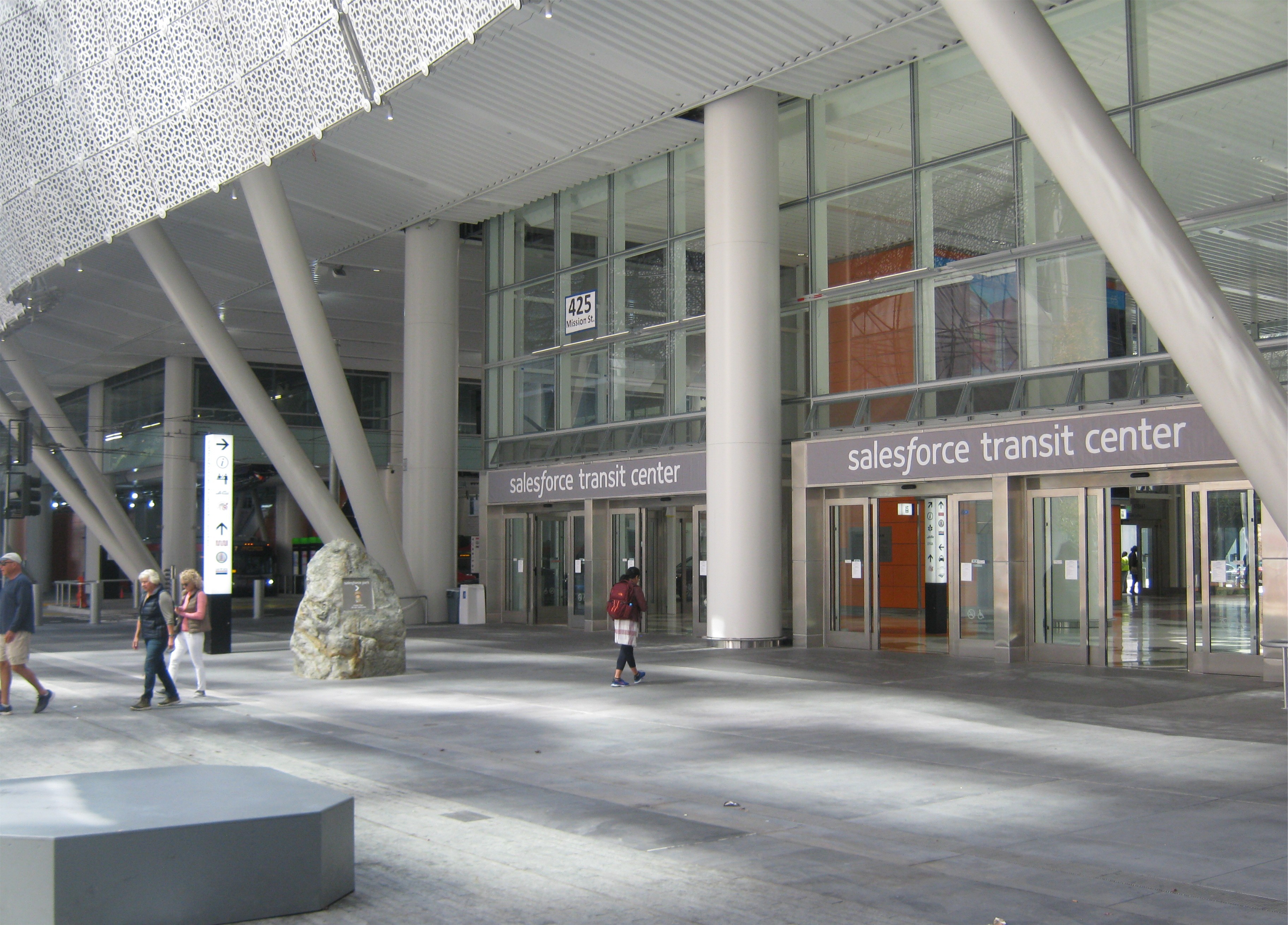 The main entrance to the Transit Terminal then and now: Although the Salesforce Building and Terminal were built where the old terminal was, the entrance to the new building is a little further back from Mission Street and closer to Fremont Street.
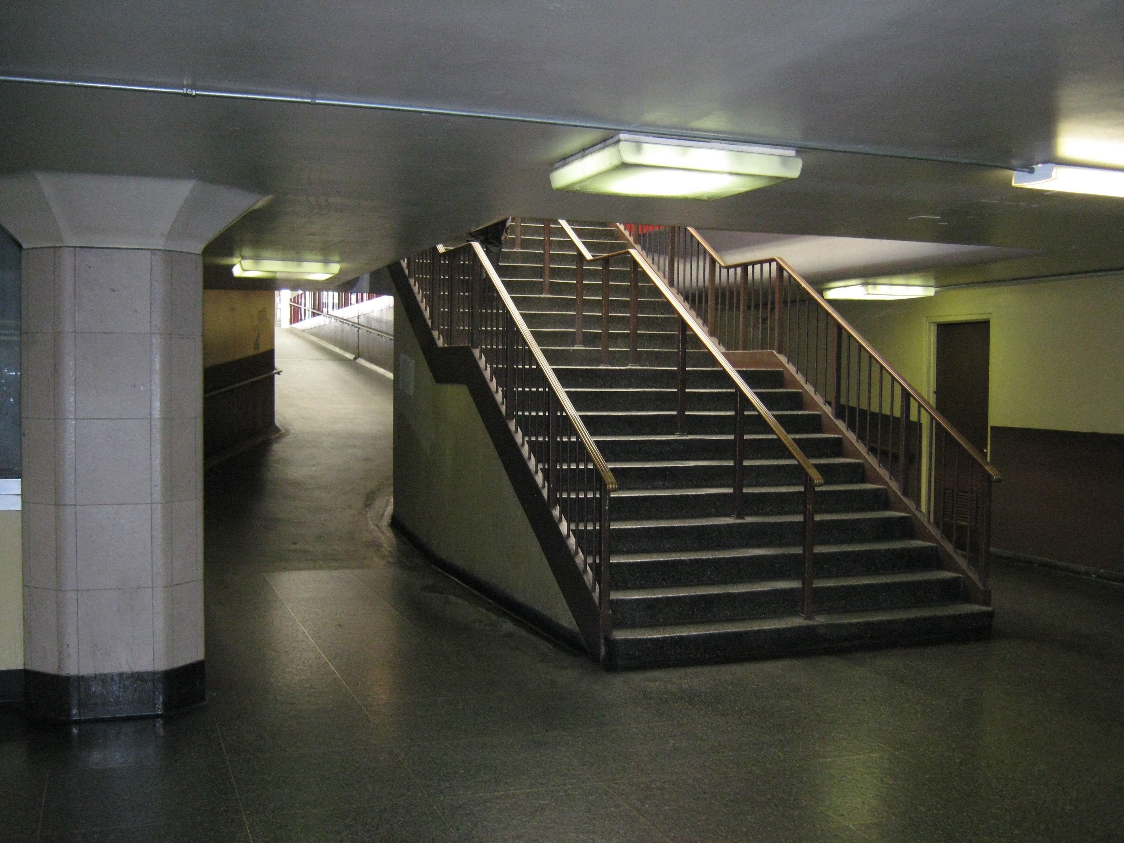
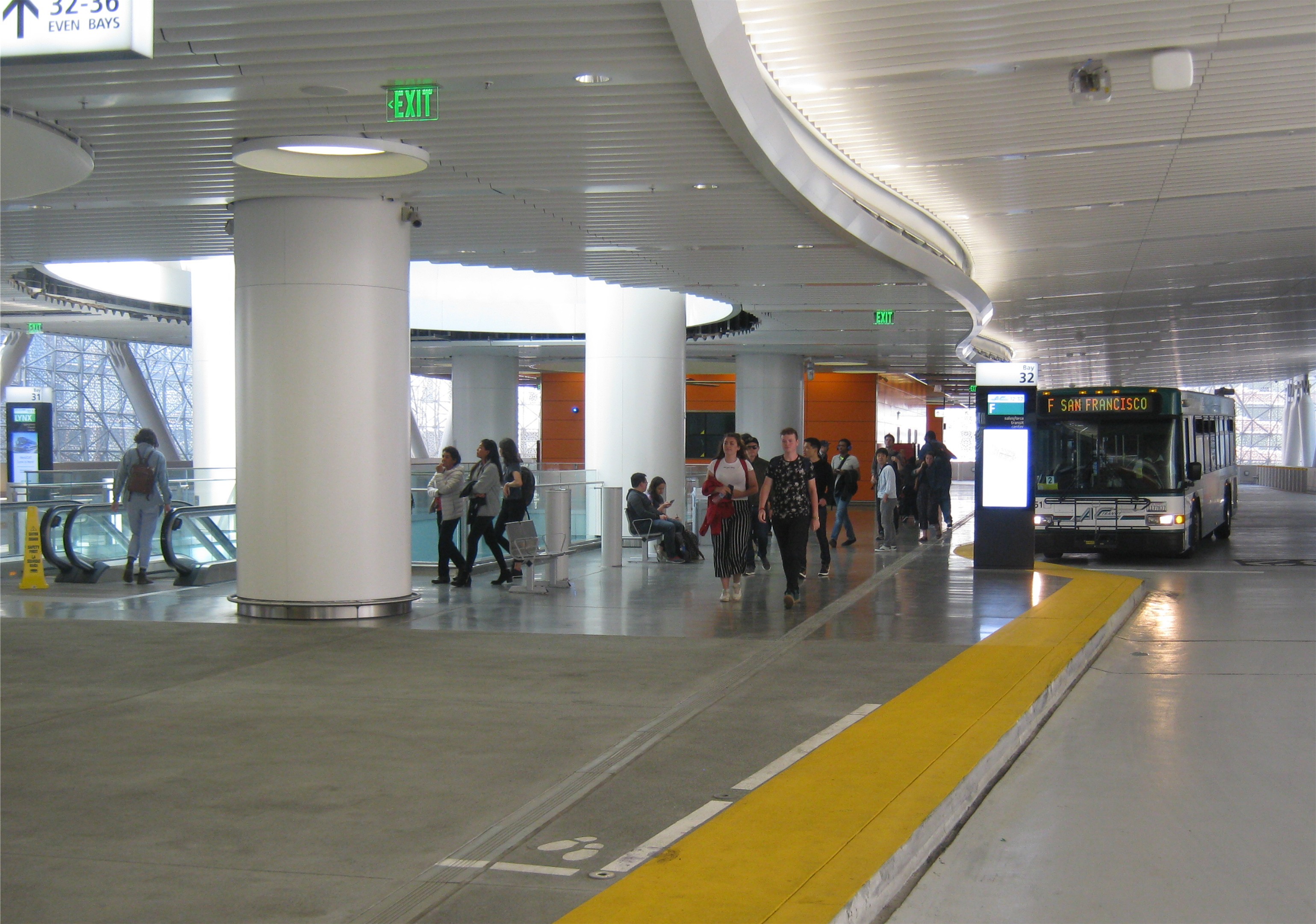
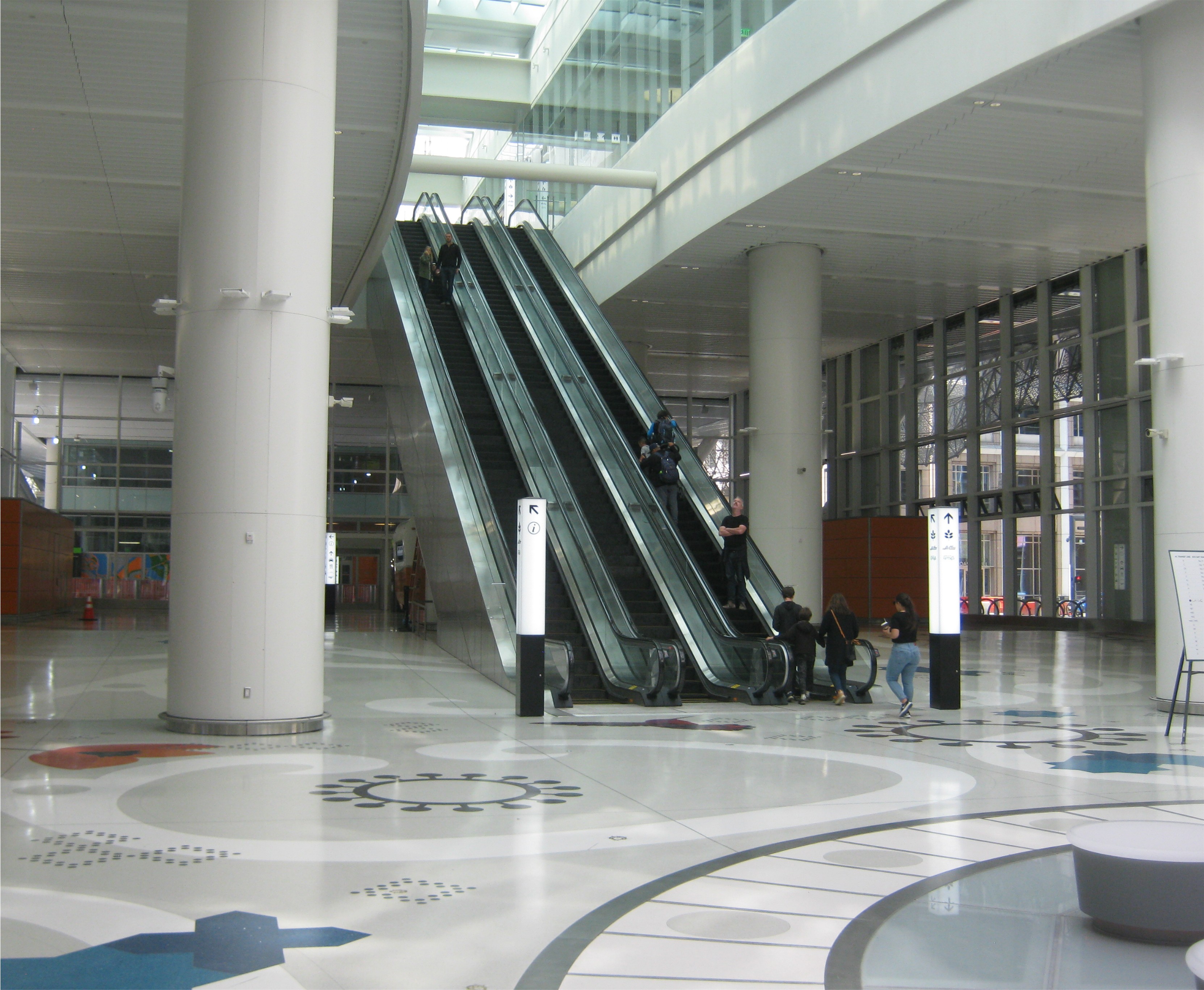 These are one of the old stairs and ramps that went from the second level to the third floor where buses arrived and departed and today’s escalator to the second level where buses travel to and from the Bay Bridge in the new transit center.
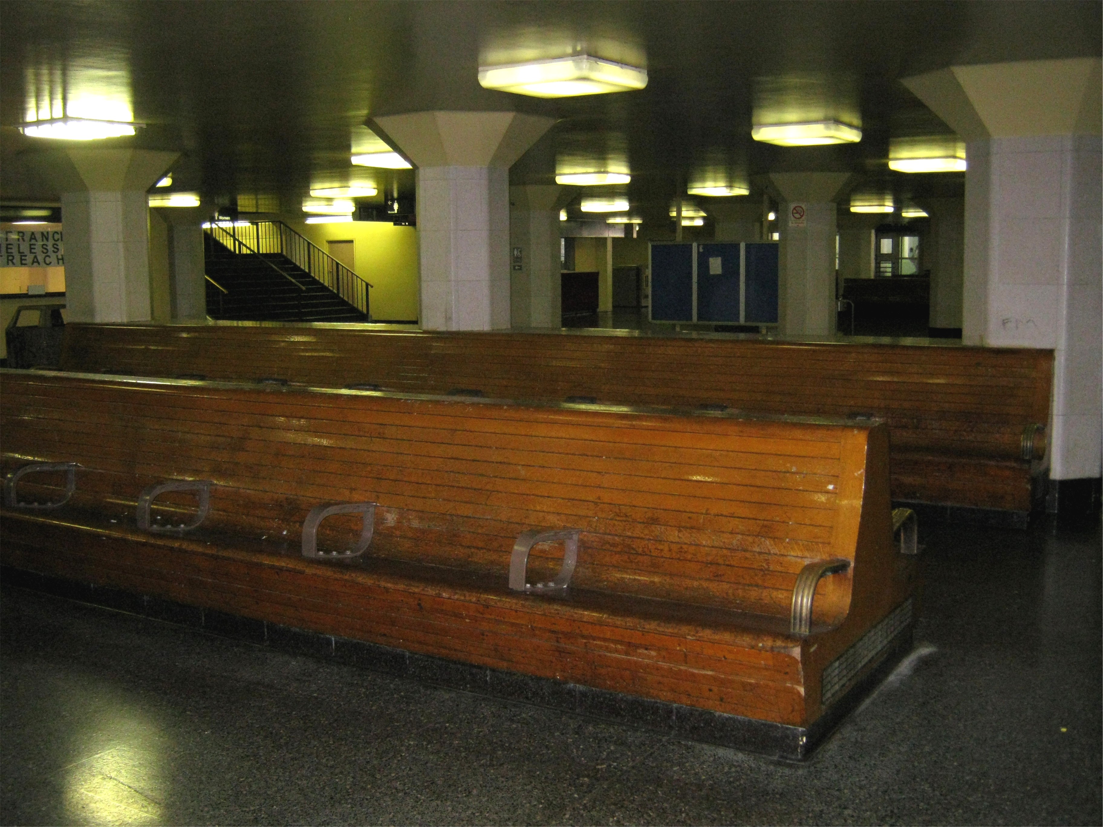
 These were the old benches at street level where you waited for your bus to depart and if you were like me, fell asleep some times and missed it. The stairs in the back took you to the second floor, where you went up to a third level for the buses. The bottom picture is looking down to street level from the escalator that goes to the second level today.
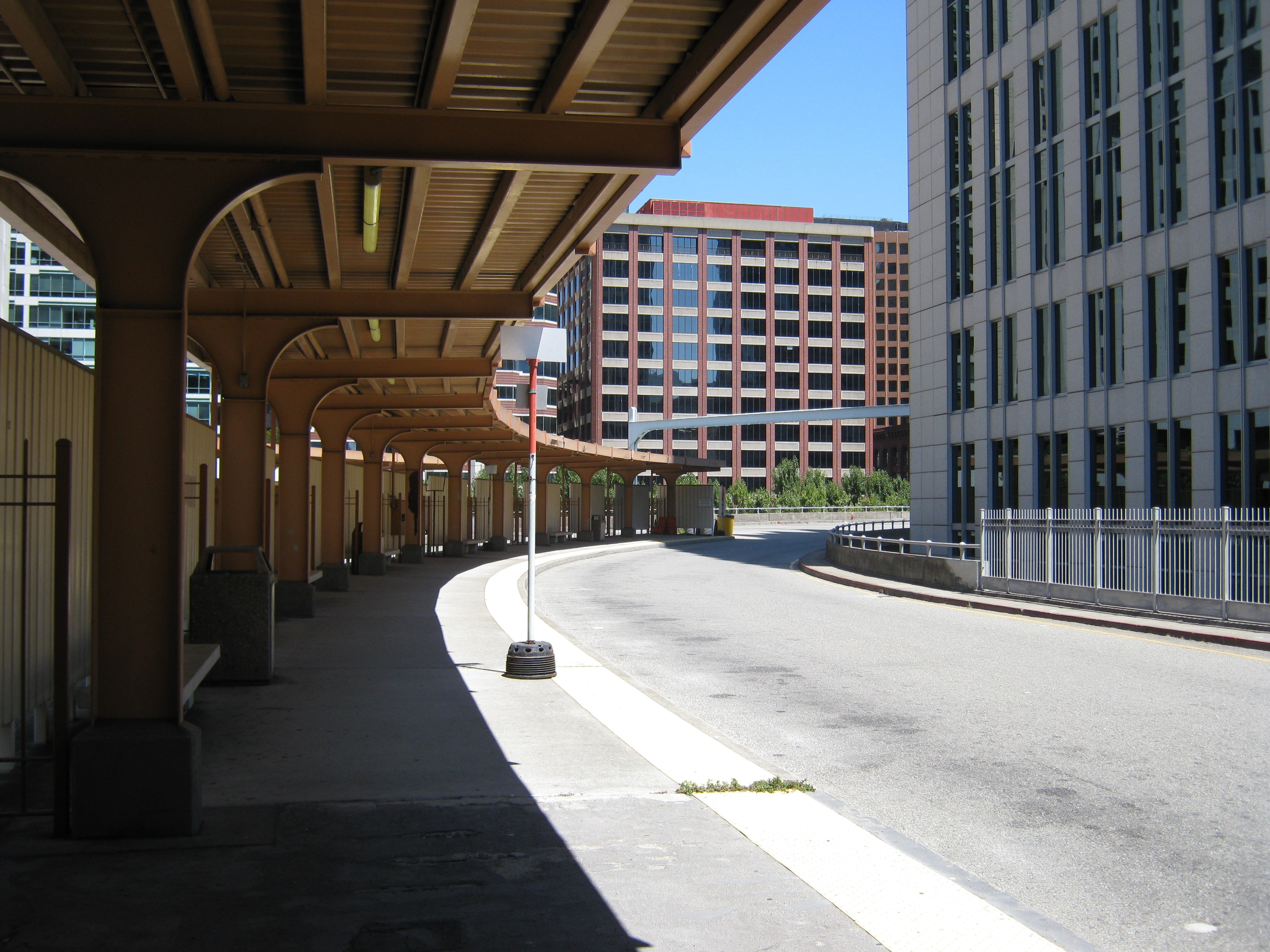
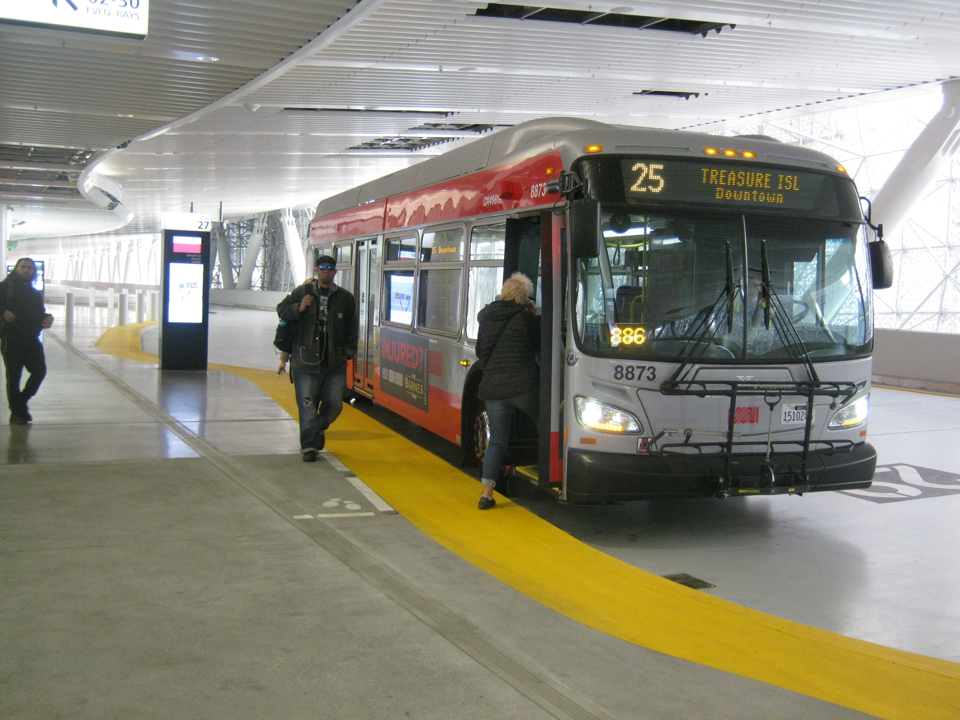
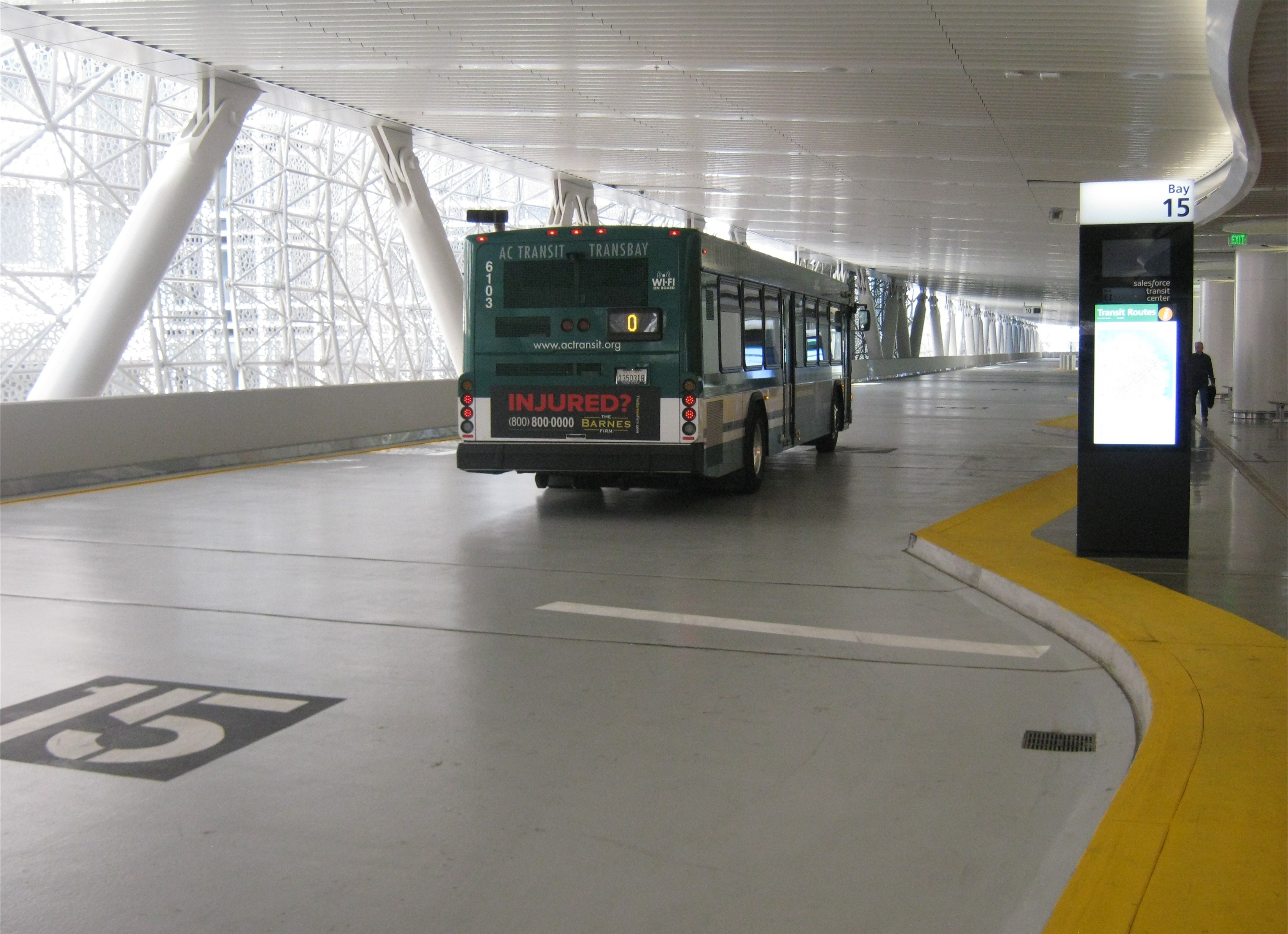
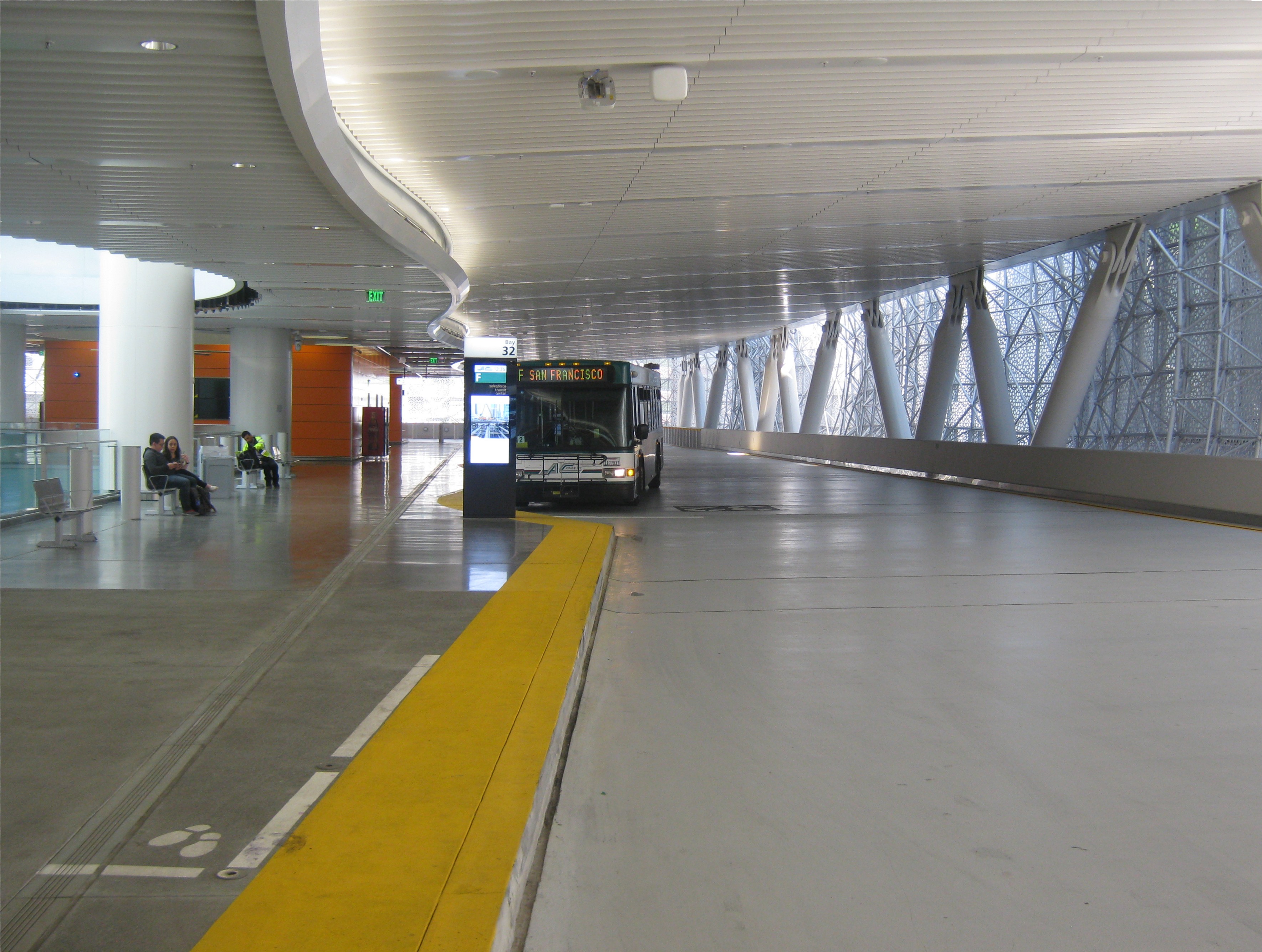
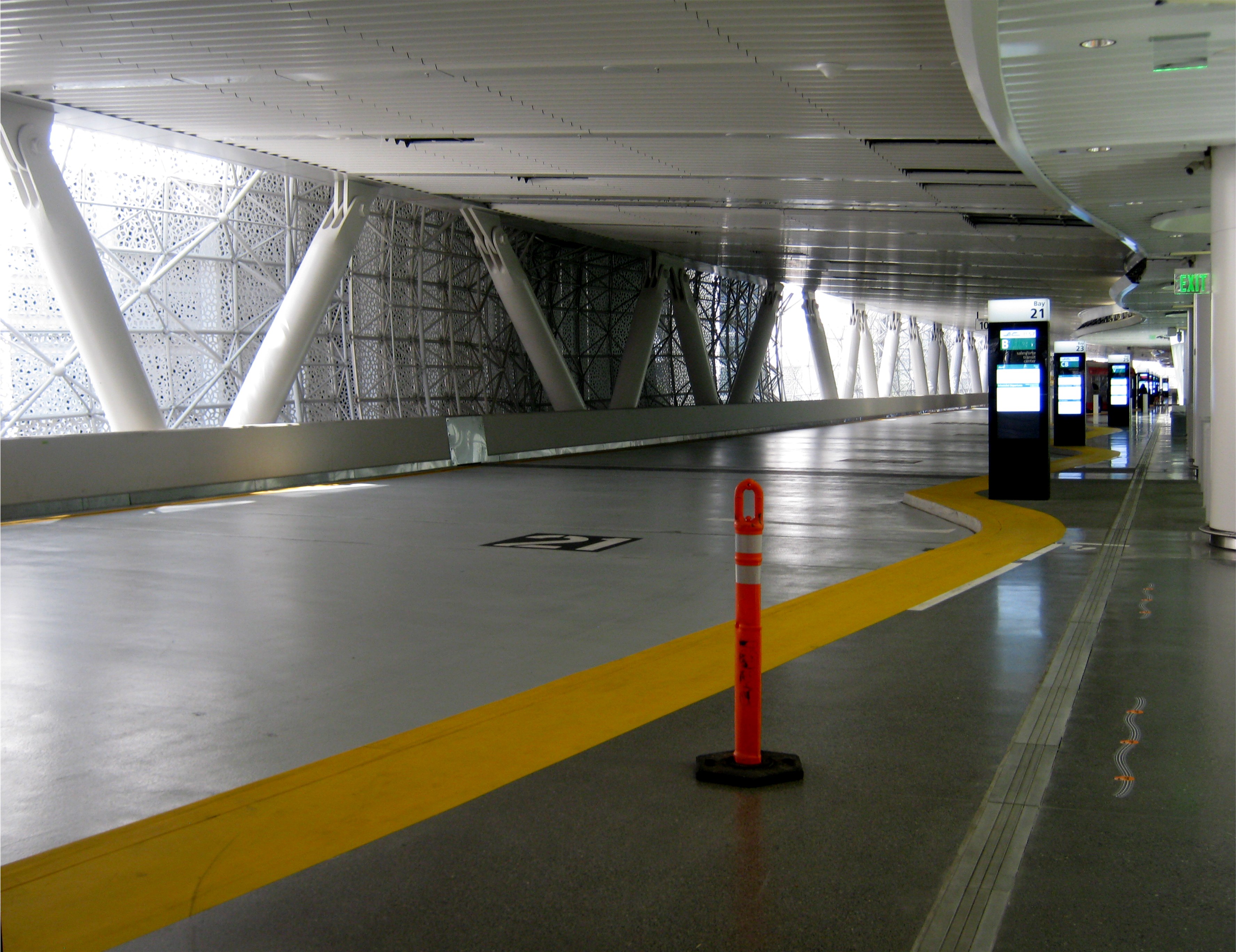
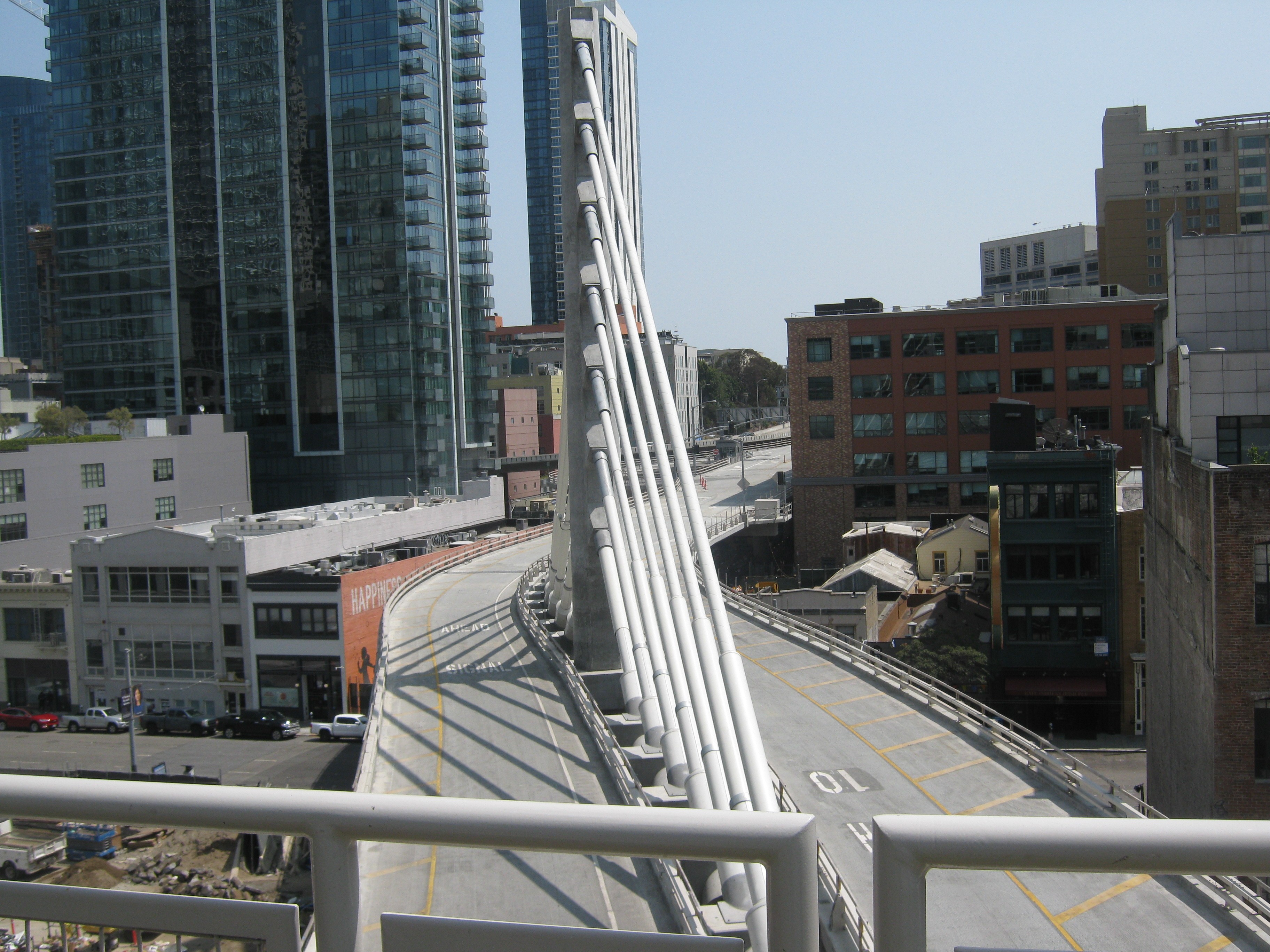 Buses from the East Bay arrived on the eastern side of the terminal here, and left for the Bay Bridge on the western side of the building. Now, buses arrive and leave on the bus bridge to the Bay Bridge on only the west side shown in the bottom photo.
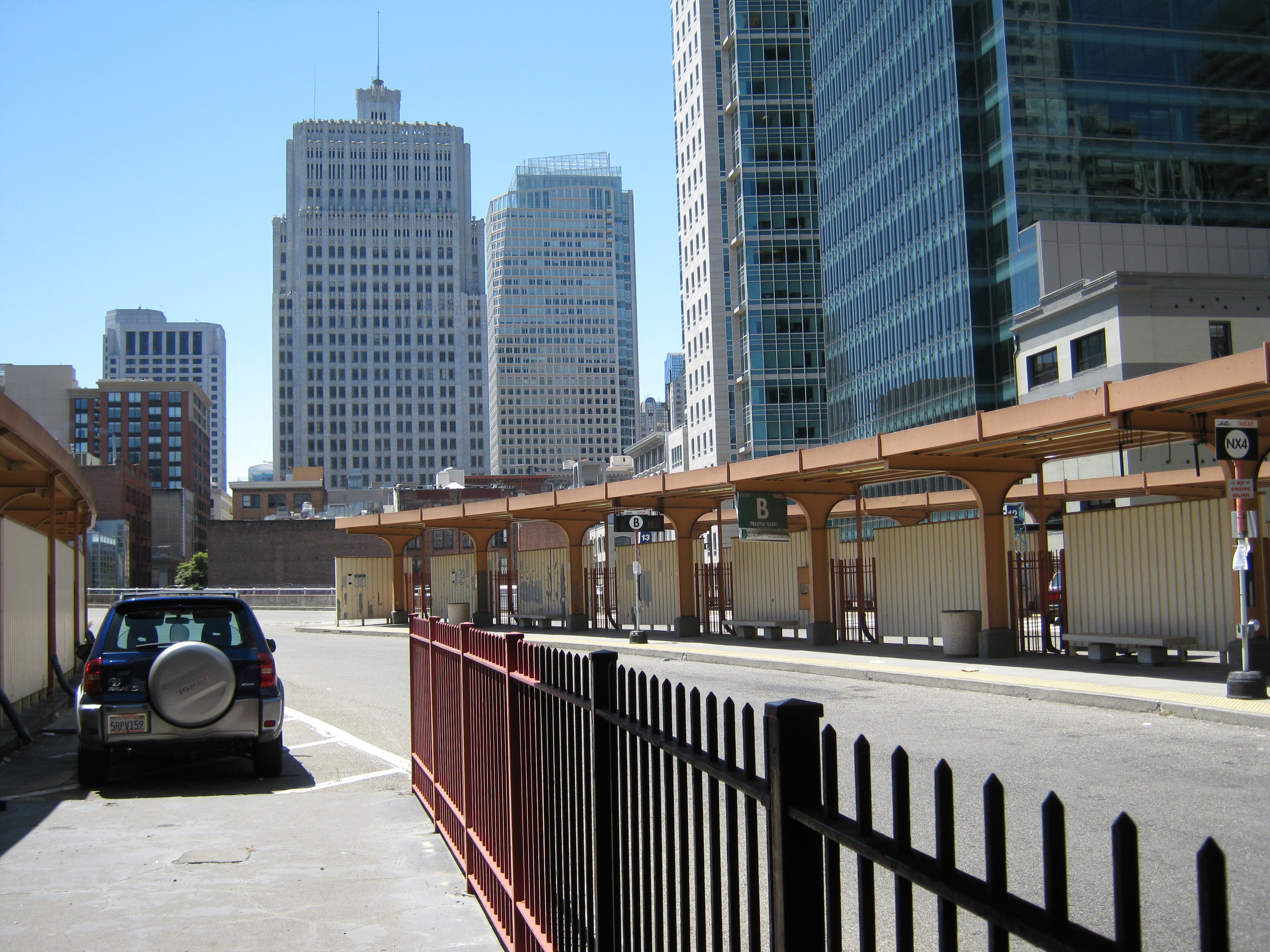
 This is the western side of the old terminal looking toward the Pacific Telephone Building on New Montgomery Street, and from the park on the roof of the Salesforce Transit Terminal.
 There wasn’t as many people leaving by bus in 2010 or this weekend, but there will be eventually.
 Getting ready to depart in 2010 and today:
 Both of these images are looking toward the north side of the two terminals. In the old Transbay Terminal picture on top, this was where passengers used to catch the Key Systems Trains that crossed the lower deck of the Bay Bridge.
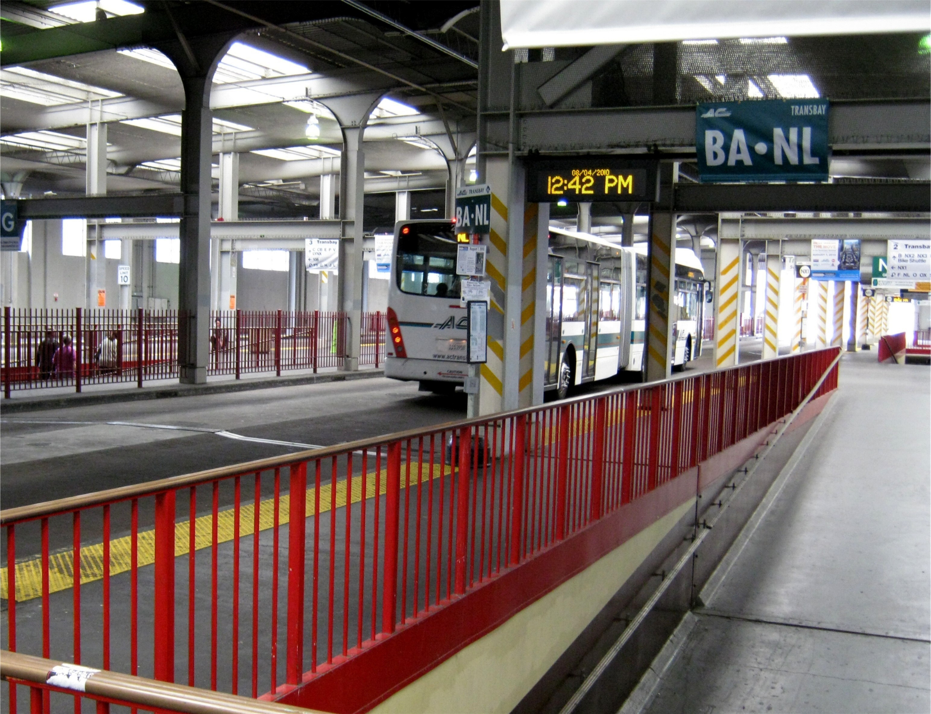
 Two buses off, back across the Bay Bridge:
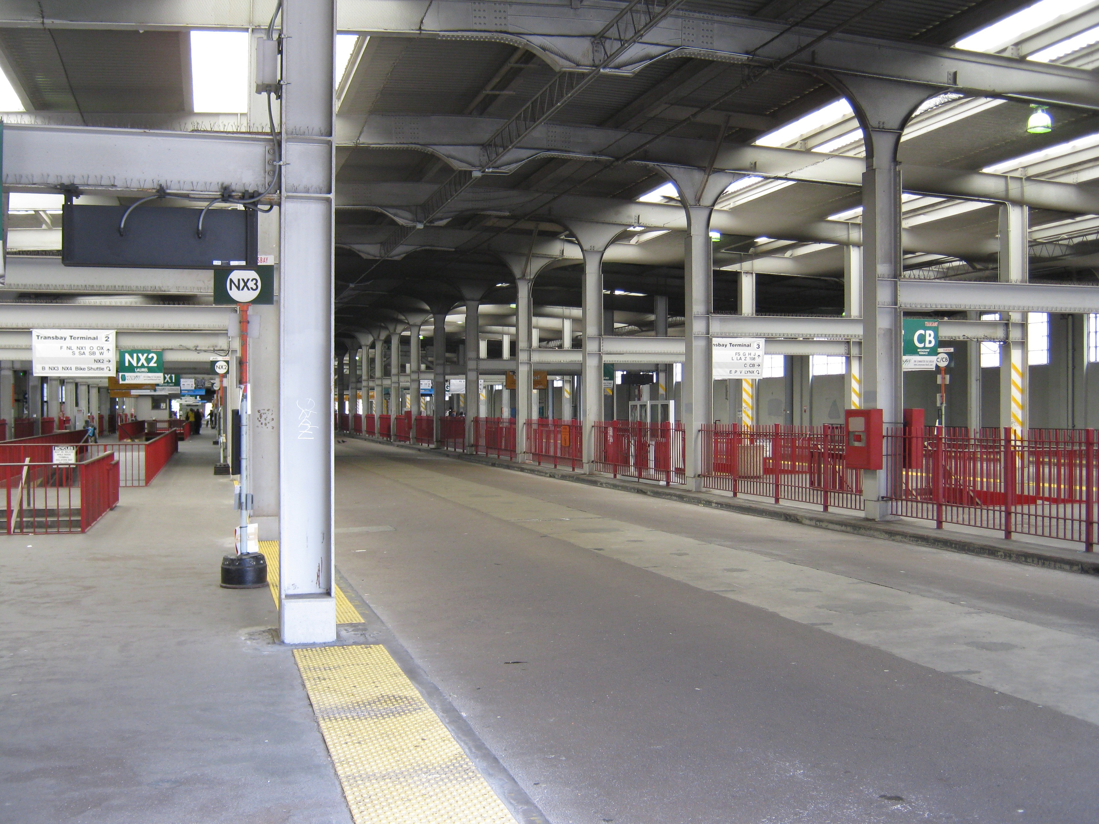
 What was lost and what was gained: I guess the thing to say is that they are and were both beautiful in their way.
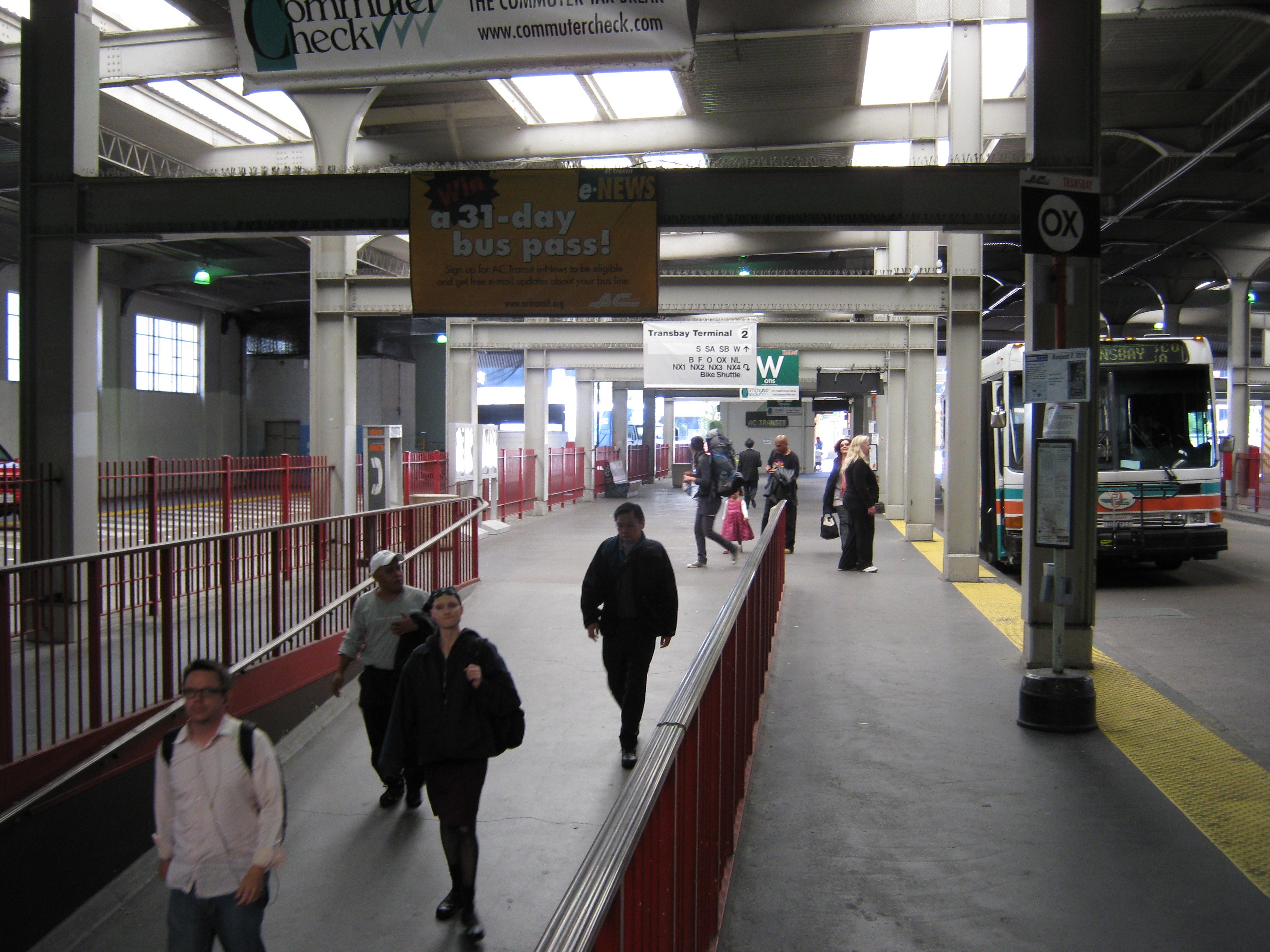
 Happy passengers, I hope, arriving at the terminal then and now.
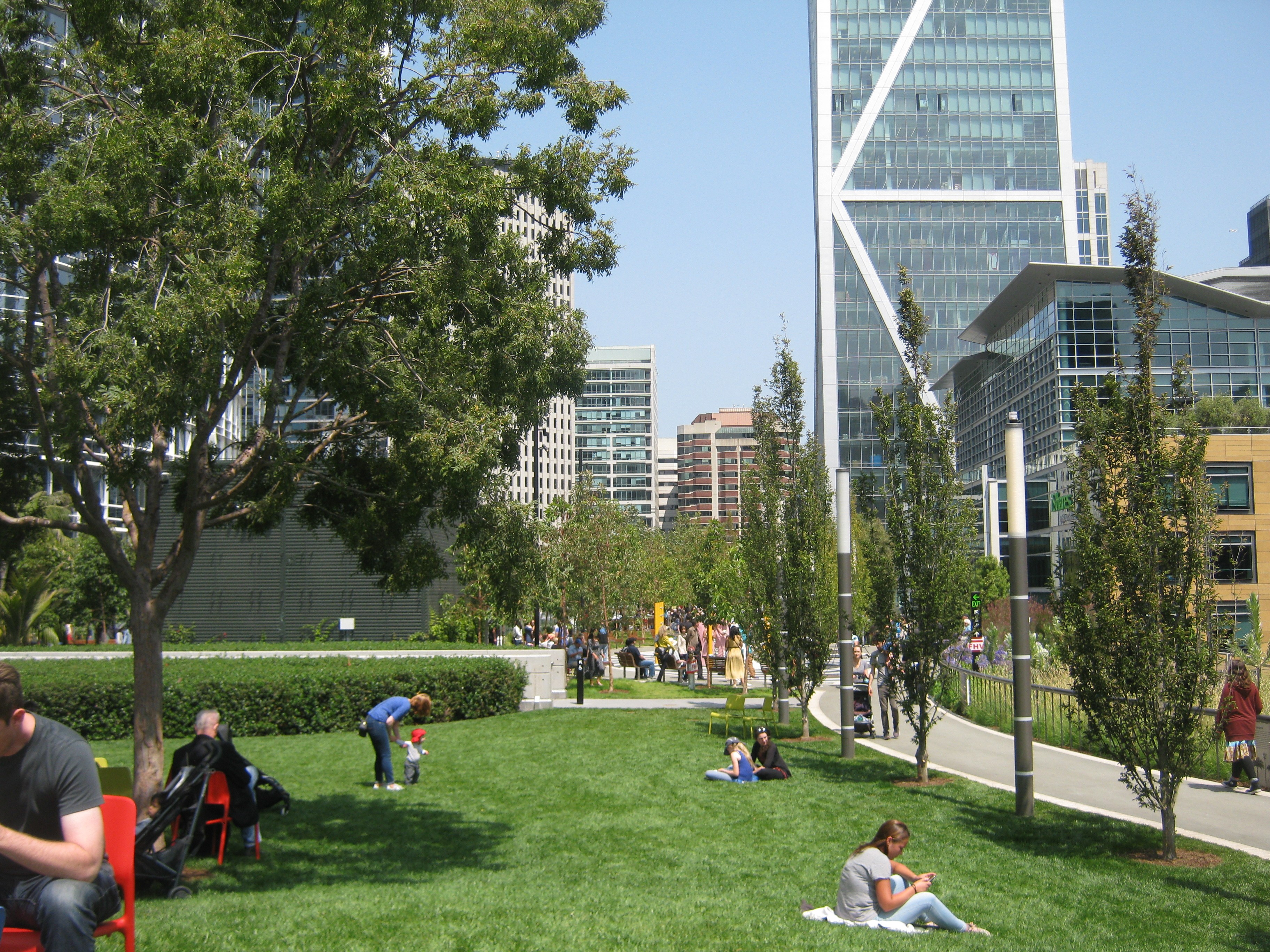
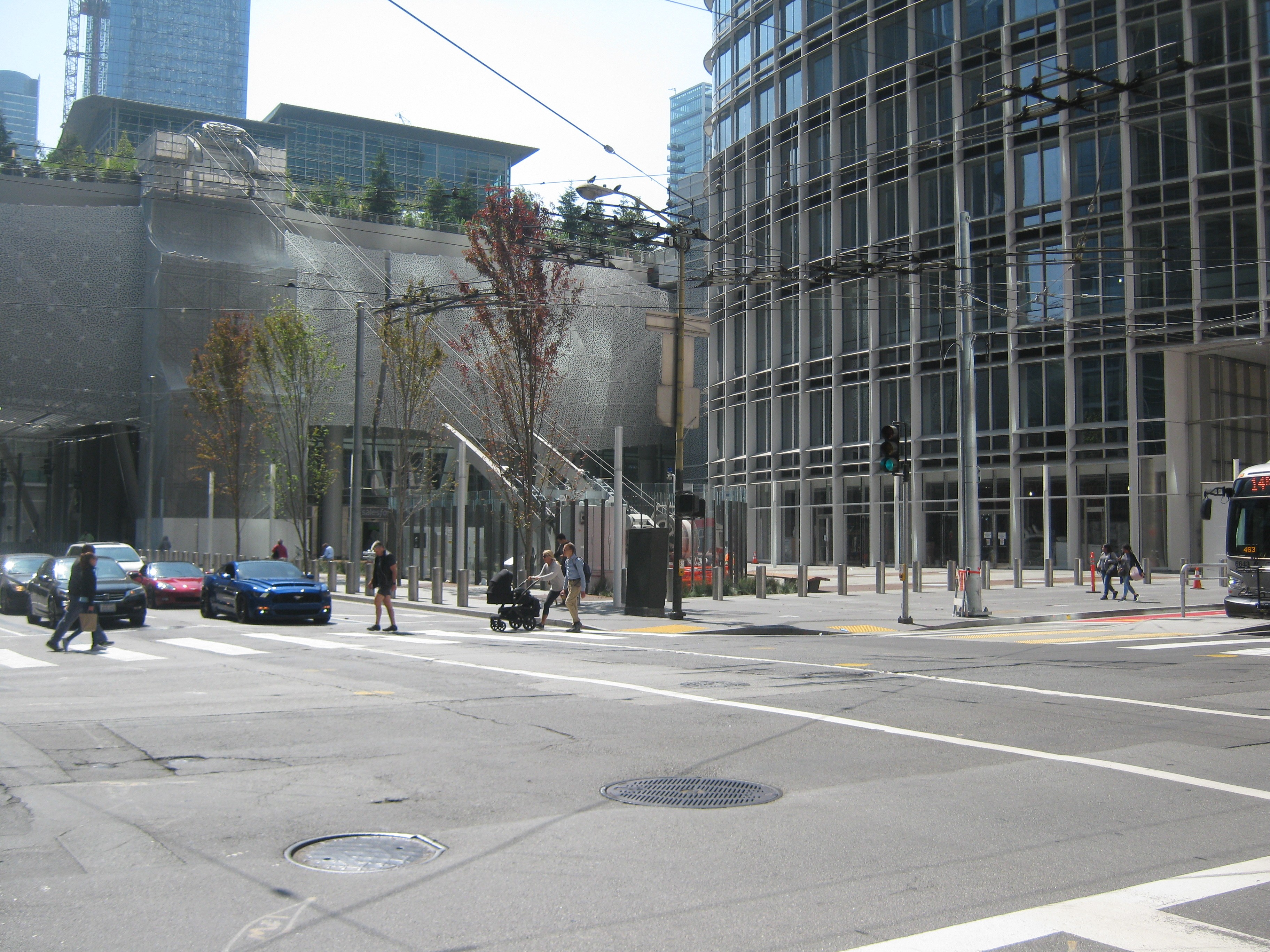
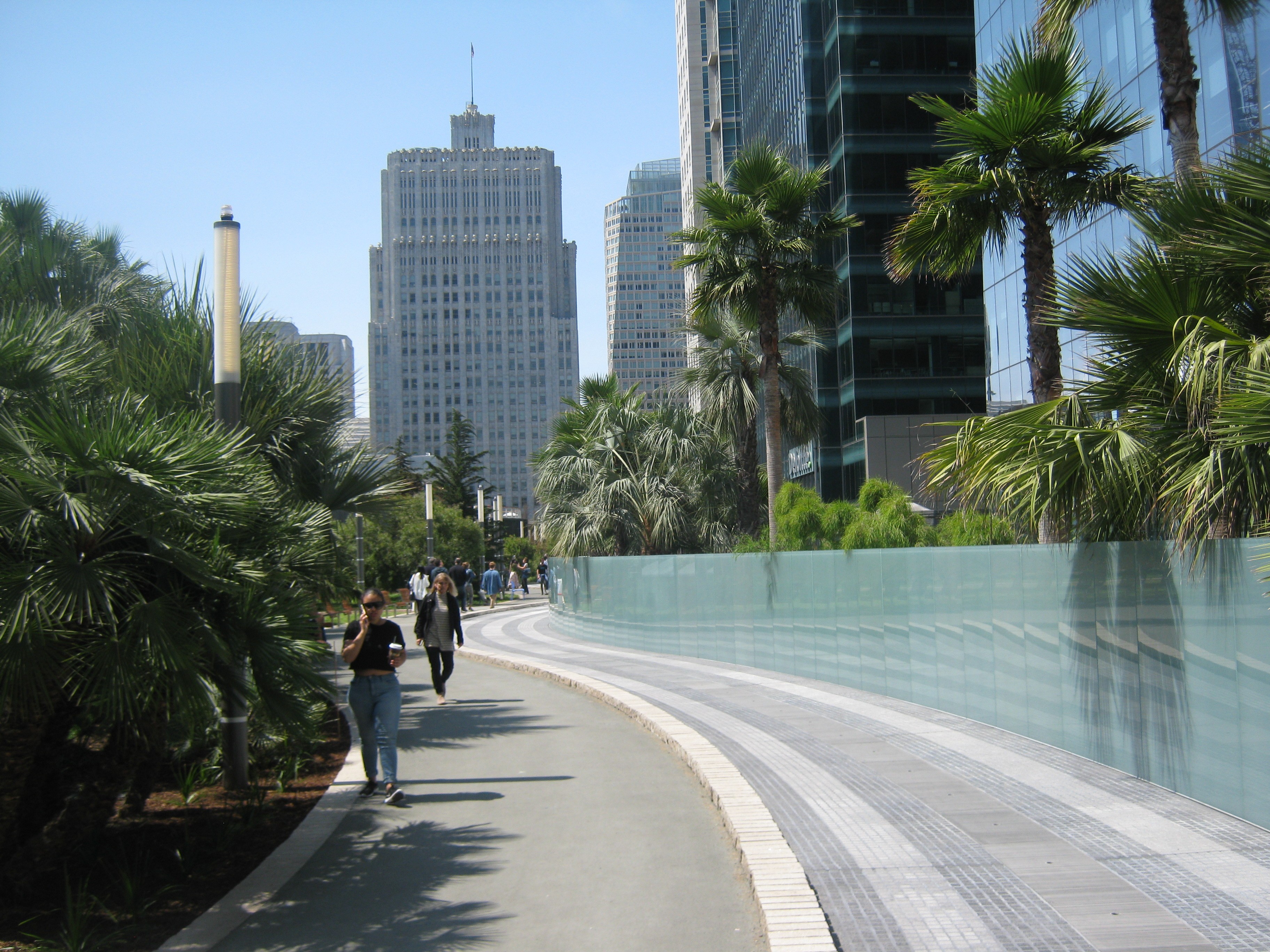
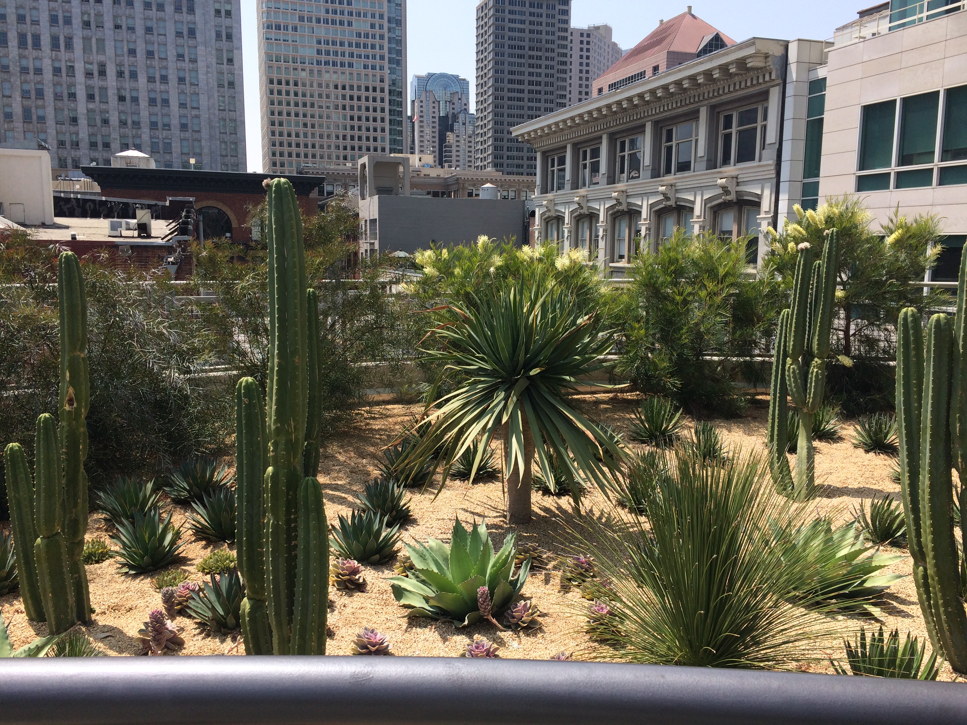 Now let’s look at some of the civic attractions of the two transit terminals. The rooftop park in the new transit terminal is very beautiful, complete with interesting things to see, like the desert garden on the northwestern side of the park.
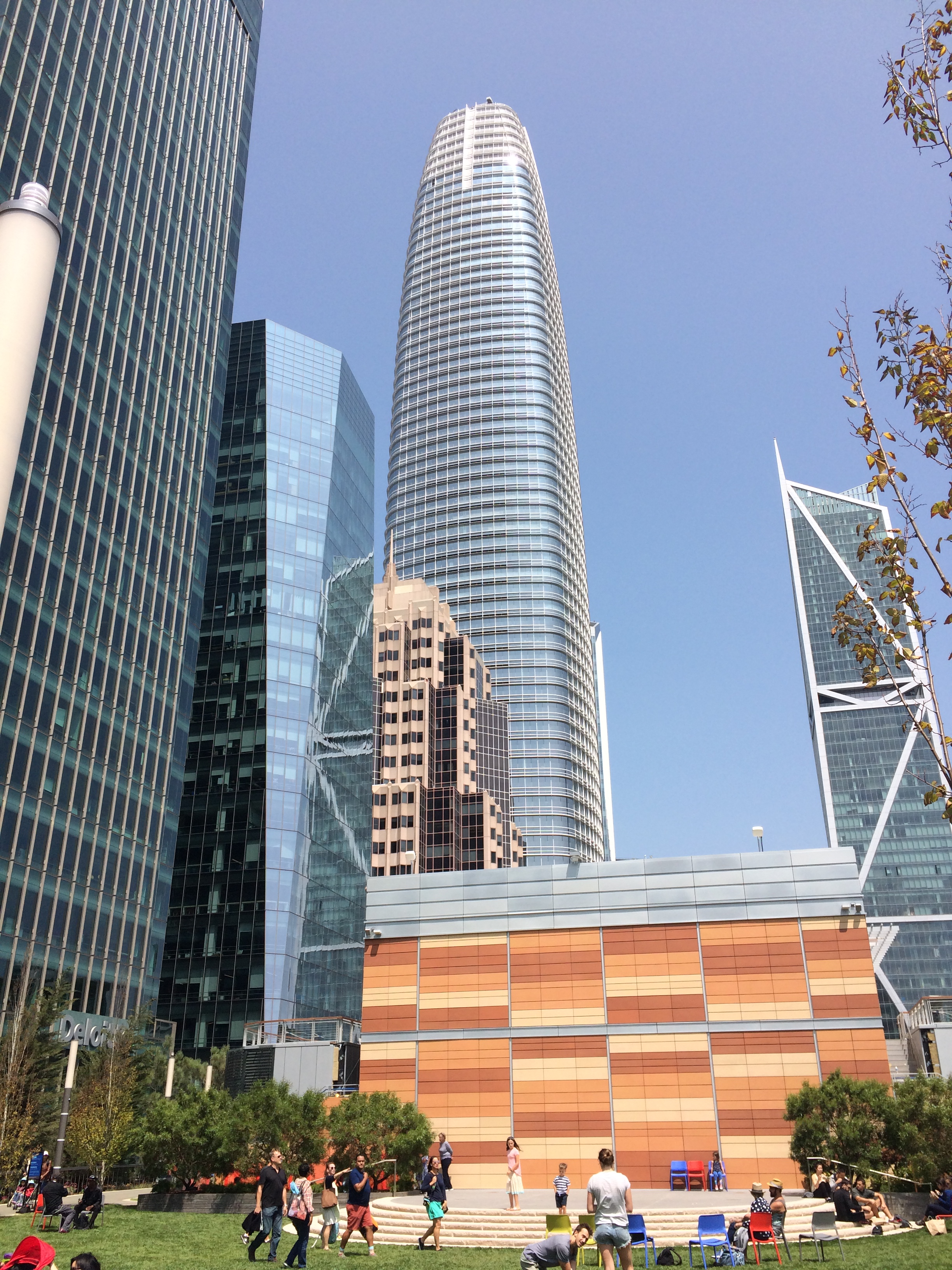 And, there’s the incredible Salesforce Tower.
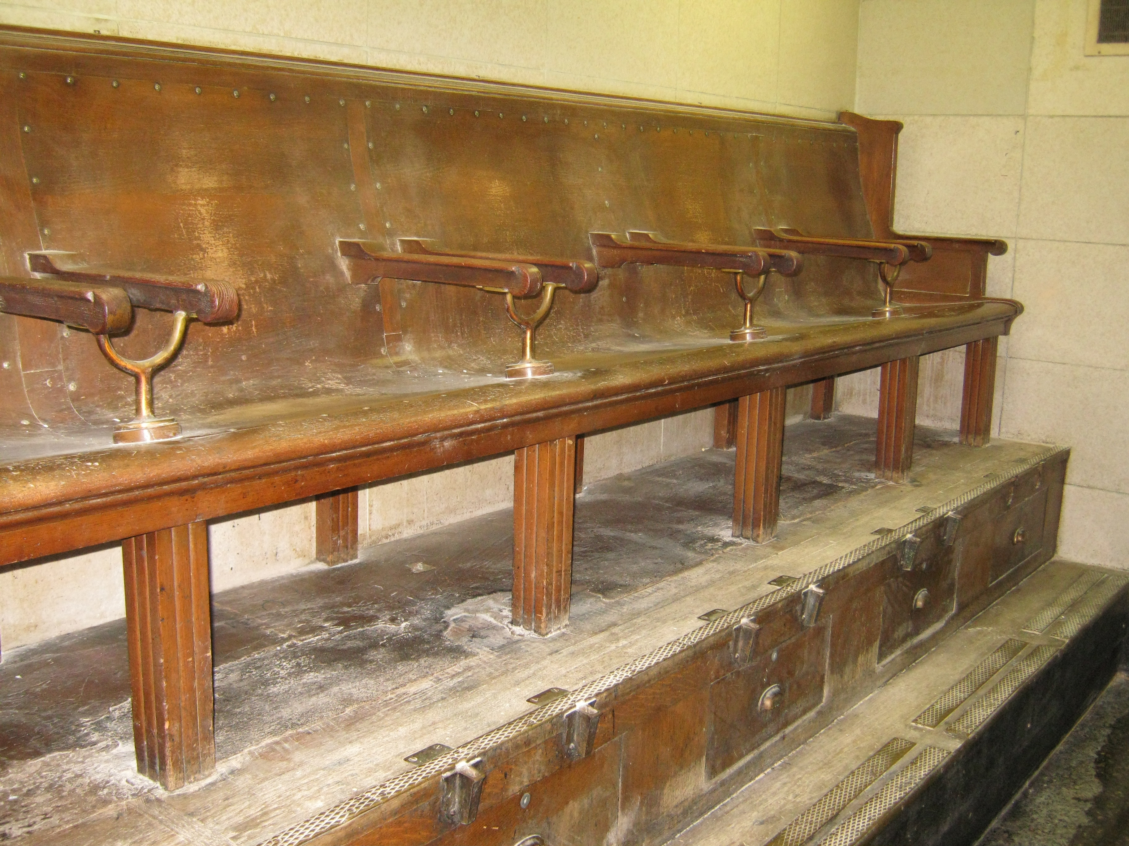
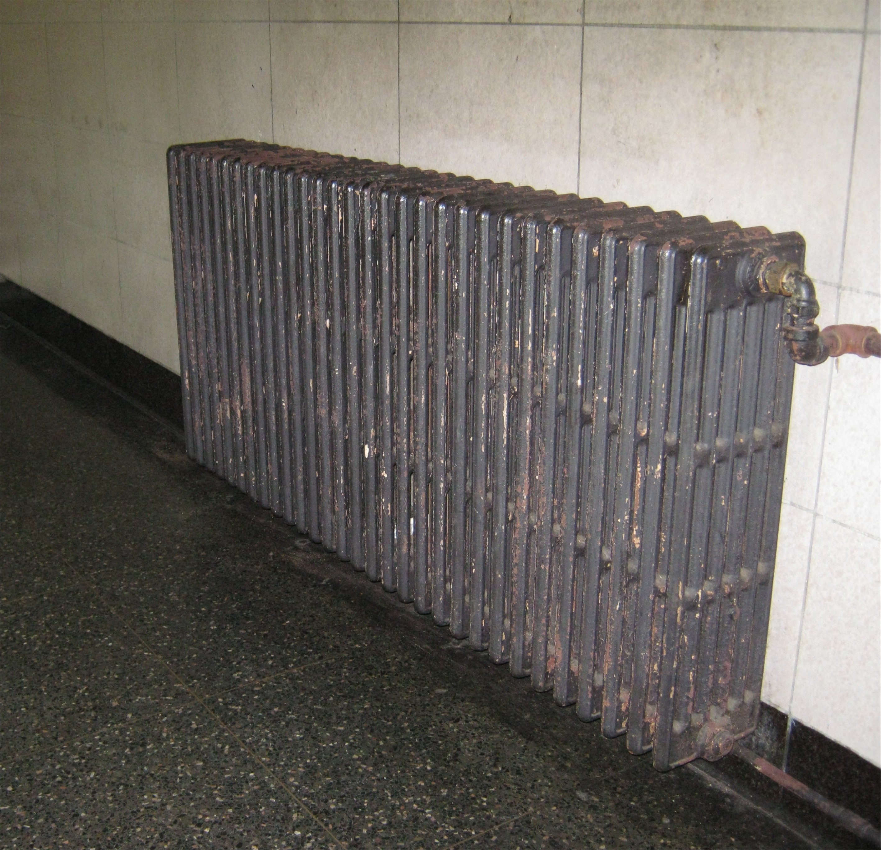 Of course, there isn’t anything today like the vintage shoe shine stand in the old building. I image, however, that they probably have a more efficient heating system today.
 Also, I didn’t see any ticket booths in the Salesforce Terminal like this one, long closed by 2010.
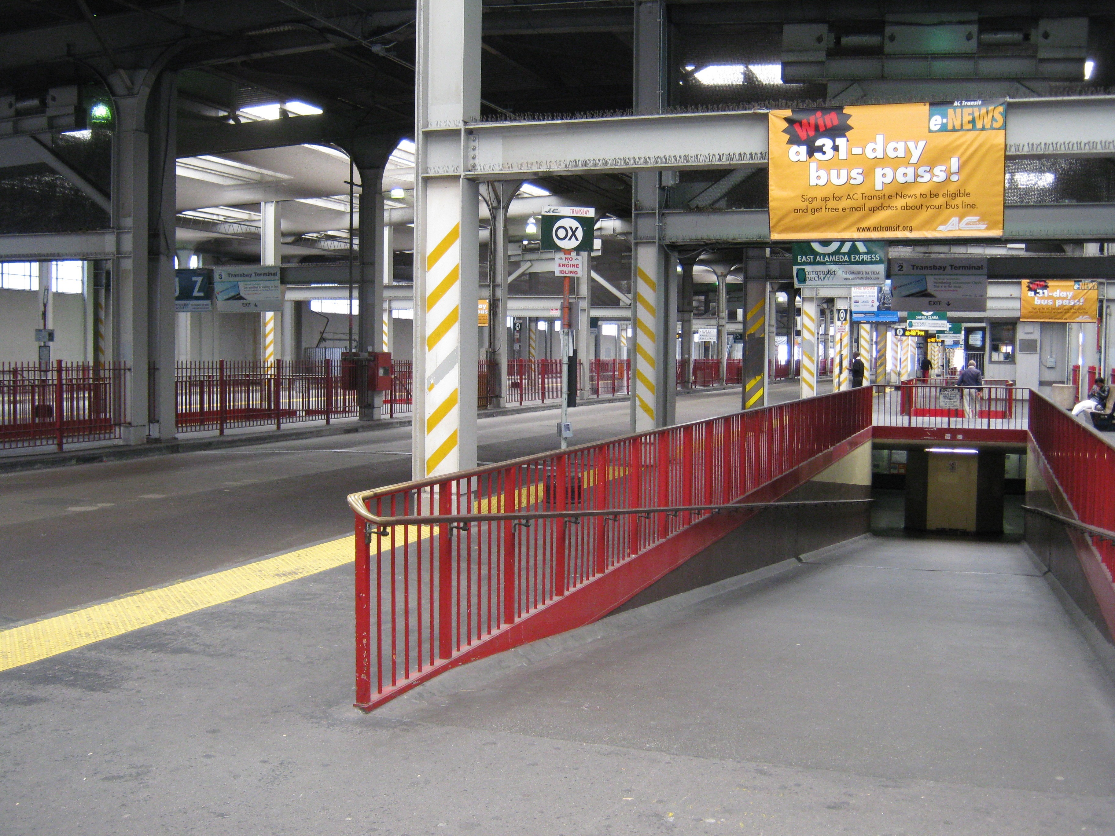
 Let’s take a last look at what was, and what is.
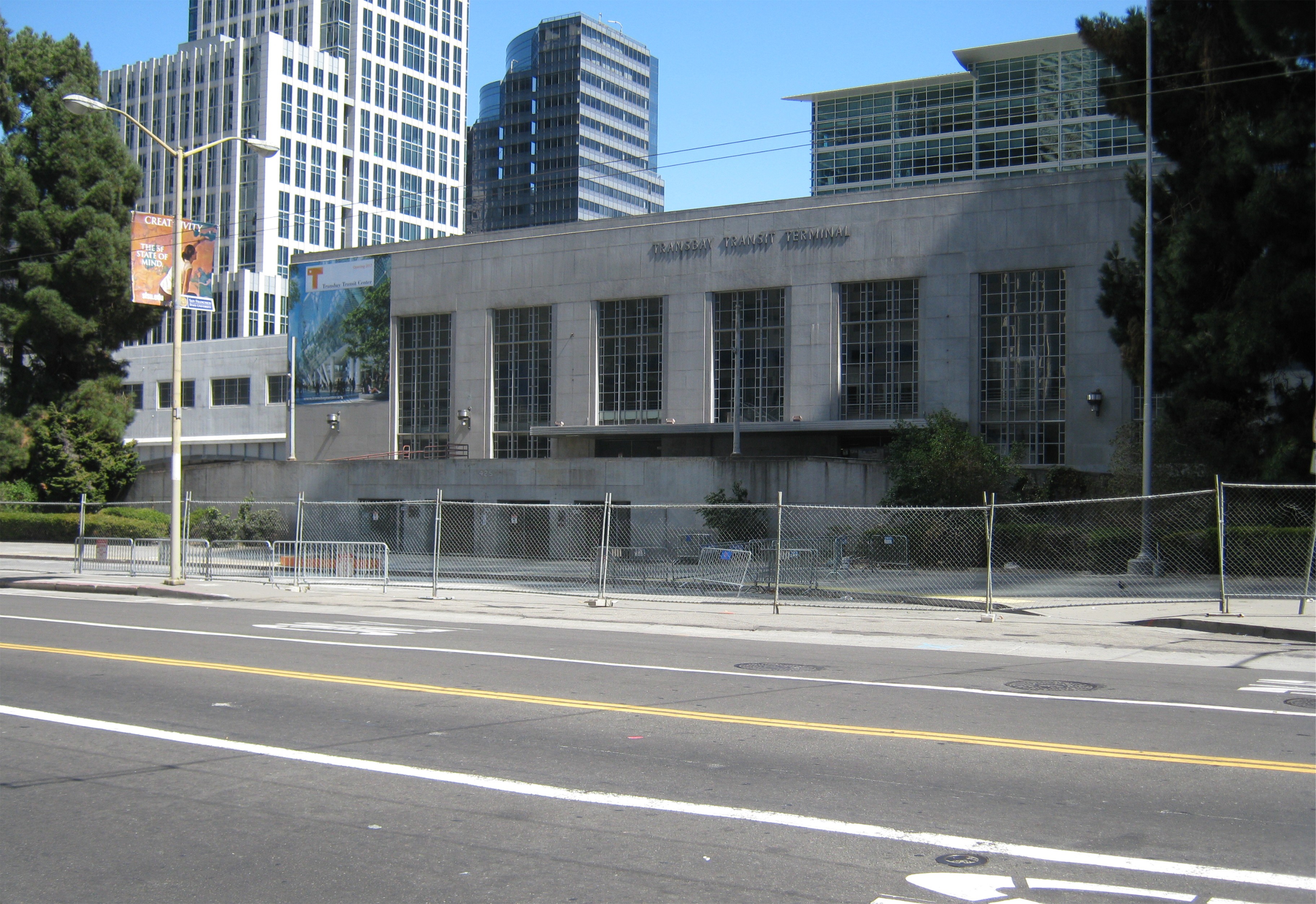
 When I came back a few days later in August of 2010, the old Transbay Terminal was closed up forever.
 I walked up the ramp in 2010 where the old streetcars used to arrive, and looked back to Mission and 1st Streets. I thought about all of the people, including friends and I, who came and went here. Buses are starting to come back here now, and a lot more will.