
So, where will I go in San Francisco on a warm June afternoon? The Shopping District of San Francisco, which has been practically a ghost town since the shelter-in-place was ordered, has been attacked by vandals recently, as elsewhere, and is not a friendly area right now. These are not protesters, they’re not activists, and they are not a movement; they’re just thugs, men and women, all different races. They’re the kind of people that parents hope their children will never grow up to become. Fisherman’s Wharf isn’t a destination, either. Still closed because of the pandemic, an enormous fire in Pier 45 has made situation there even worse, and came close to destroying the World War Two Liberty Ship, the Jeremiah O’Brien. Golden Gate Park is still beautiful at 150 years of age, but because of the fresh air and safe distancing, it’s near about the only place worth visiting in San Francisco right now and sometimes even more crowded than usual. So I went to my getaway place that I’ve been going to since I was 15, Ocean Beach and the Cliff House area. The looters haven’t reached here yet, COVid-19 hasn’t made this a dangerous area, and there have been no major fires here. These are a collection of vintage drawings and postcards I’ve updated while walking around the northern side of Ocean Beach.
 Looking toward Ocean Beach and the Great Highway from the Cliff House in the early 1900s: With some shelter-in-place restrictions lifted slightly at the beginning of June, parking is allowed again at Ocean Beach. You can see the Dutch and Murphy Windmills in Golden Gate Park in the upper right. (Pinterest)
 The Great Highway from Sutro Heights with Chutes-at-the-Beach in the 1920s: (eBay posted on pinterest)
 The fire that destroyed the old gingerbread Cliff House in 1907, seen from Sutro Heights: (gendisasters.com)
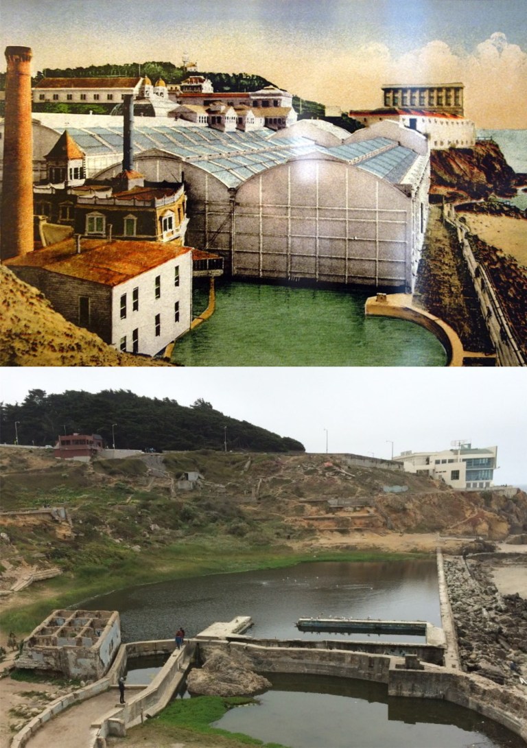 This picture I took a few years back of the Sutro Bathhouse ruins lines up pretty good with the old drawing of what it looked like. The concrete squared ruin in the lower left of my picture was where the pump house, seen with the tall chimney in the vintage drawing, was located. (eventbrite.com)
 The misnamed Seal Rocks from the Cliff House: There were never seals on Seal Rocks, they were sea lions, and they’re gone now. (seeninsanfrancisco.com)
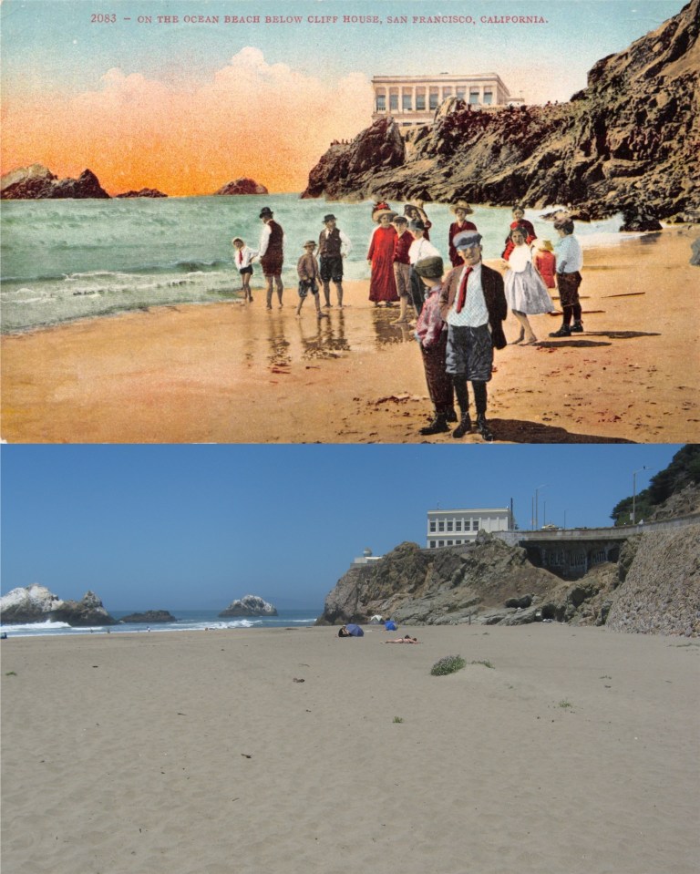 A group of people on Ocean Beach, probably around 1910: That’s the present day Cliff House built after 1907, and people stopped dressing like that by World War One. I don’t like the looks of that little toughie in the front of the crowd.
“So, you don’t like my knickerbockers, huh? Well, what are you gonna do about it?” (hippostcard.com)
 Ocean Beach, Seal Rocks, the Cliff House, and Sutro Heights in the early 1900s: (sanfranciscodays.com)
 This one looked perfect, at first; the gap between the Dewey Monument and The St. Francis Hotel on the left matches up, as does the gap between the monument and the Chancellor Hotel to its right in the picture. The St. Francis Hotel in my photo lines up nicely with the vintage picture, and the angle of the two crosswalks in the photos line up close, although they’re probably not painted today exactly where they were in 1953. However, on a closer look, the Dewey Monument is a little higher up in the vintage picture. Maybe a few steps farther forward might have done it. The 1953 picture from the Charles Cushman Collection was taken at the southeast corner of Geary St. and Stockton Street looking toward Union Square.
 Heading up to Nob Hill, I thought my quest was going to be short and sweet. When I put them together, this 1961 photo looking toward the Pacific Union Club on California looked perfect, until I got to the roof; the remaining cornice on the roof balustrade is out of line with the building in the background in the my picture. (San Francisco Pictures Blog / blogspot.com)
 Walking down Powell approaching Pine Street, I got another one pretty close. The cable car tracks aren’t laid out exactly where they were in the 1970s picture posted on Pinterest, so my picture wouldn’t line up very well standing directly between the tracks, as in the vintage picture. Also, I needed to be closer so it doesn’t count.
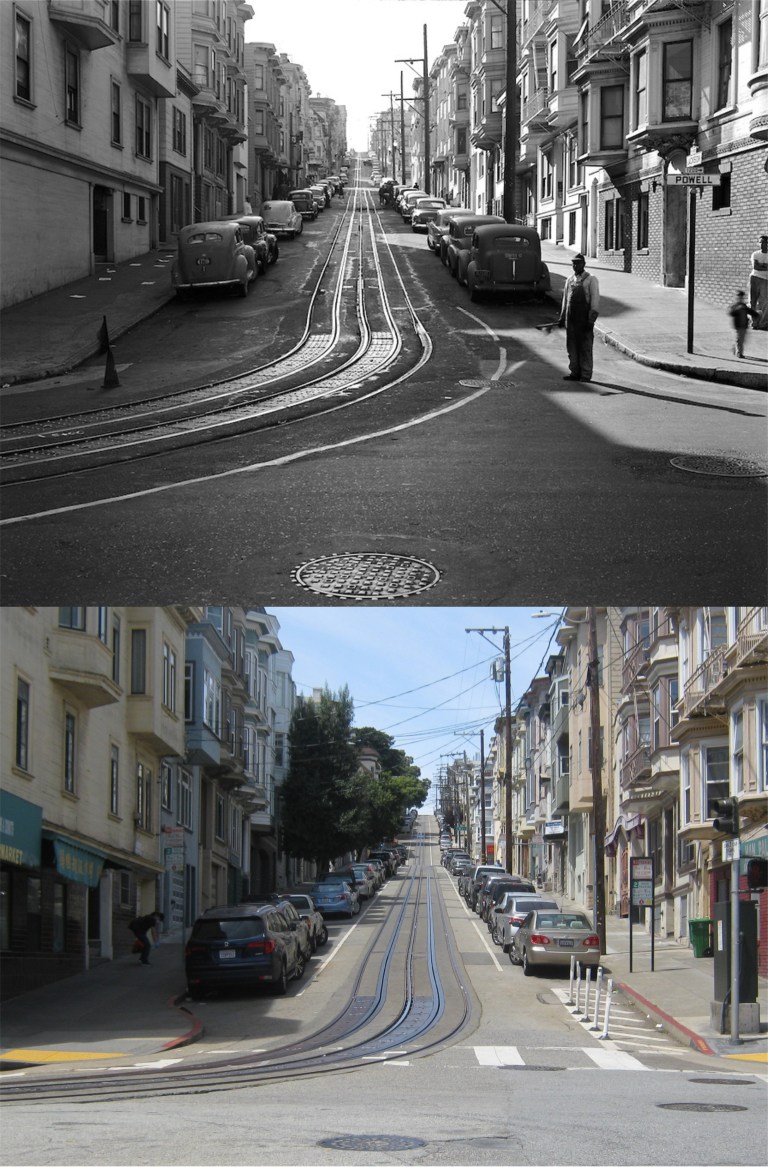
 This 1967 picture is looking back up Nob Hill from Pine and California Streets toward the Fairmont Hotel. I’m close here too. However, if those are the same manhole covers in both pictures, I’m a little off. That’s what people usually say about me anyway. (San Francisco Pictures Blog / blogspot.com)
 I’m back downtown and looking west on Ellis Street from Stockton. Notice the John’s Grill Restaurant in the two photos. Both pictures were taken on the corner of 4th and Markets Streets. The Crocker Anglo Building, remodeled, is still there but the building between it and John’s Grill has been replaced. The angle and width of the Crocker Anglo Building are good and it lines up with the windows on the Flood Building on the background, but the two buildings and John’s Grill in my picture aren’t directly beneath the three buildings in vintage picture. Conclusion, I’m not standing quite in the same spot as the photographer in vintage photo. Duh! (Opensfhistory.org and outsidelands.org)
 Wandering down Market Street to Grant Avenue in the mid 1950: I liked my chances with this one, but it didn’t work out. I tried to get the old Hearst Examiner Building on the right to line up close with the even older Call Building across 3rd Street, but it looks like I was too far back. You can’t see the Palace Hotel in the background from here today through the trees, so I’m safe there. However, back across Market Street where the old Wells Fargo Building on Grant Avenue is, well, like Eli Wallach said to “The Man” in the 1958 film ‘The Lineup’ “that’s where the job went to pieces.” I’m too close! Yet when I moved farther back to get a good angle on the old bank building, the previous mentioned buildings across Market Street were way out of sync. Oh, well.
 I’ll end my journey here because I don’t think I’ll ever get a perfect line up, but this one matches up about the closest. The old blurry picture was taken on the southwest corner of Powell and Sutter Streets in 1949. The Sears Food Restaurant has moved one block behind me between Sutter and Post Streets. (San Francisco Pictures Blog / blogspot.com)
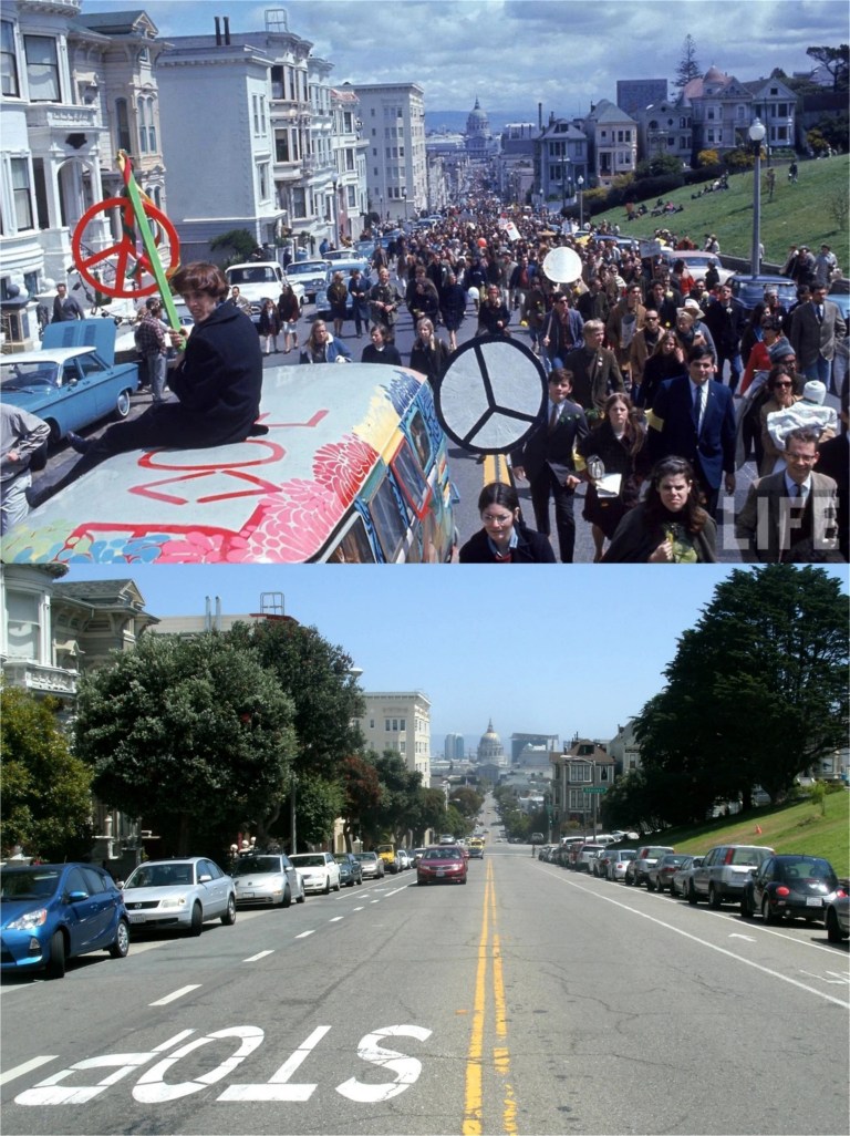 A peace, love, and end the Vietnam War rally passes Alamo Square along Fulton Street in 1967. Demonstrations like this helped to make that war unpopular and may have contributed to its ending, although there were some disasters along the way, such as Kent State, Ohio.
 World War Two wasn’t unpopular in the United States, although, it wasn’t all that welcome, either. Servicemen and women packed San Francisco on their way to, and coming from the battlefronts, as seen in this 1943 photo from LIFE Magazine taken at Mason, Turk, and Market Streets. 71 years later, San Franciscans were united again in celebrating a parade at this spot in honor of the San Francisco Giants third World Series victory. Even rain on the parade didn’t “rain on the parade”.
 In 1937, six years before the previous picture was taken, citizens from the Chinese community in San Francisco demonstrated in front of Pier 45 at Fisherman’s Wharf. They were calling on the United States Government to stop importing products to Japan, after Japan’s invasion of China. (Vintage picture from museumca.org)
 Two years later in 1939, San Francisco invited countries from around the world to participate in the Golden Gate International Exposition on Treasure Island. A few years after the groundbreaking for the fair, the United States would be fighting against some of the countries represented in the vintage photo, such as Nazi Germany and Japan.
 Now, we’ll go back 105 years to when San Francisco celebrated the Panama Pacific Exposition of 1915. In August of 2017, I did a comparison picture of the opensfhistory.org photo taken on Market Street in front of the Ferry Building, when people from around the Bay Area gathered there to view the solar eclipse occurring that day. It never got as dark as my picture implies, I just touched it up a little bit for effect.
 Fast forward back to World War Two, (Does that make sense?) and a community war bond drive at Ocean Avenue and Junipero Serra Blvd. in the Sunset District. “We’re all in this together!” That was true then and now.
 World War Two ended in victory for the Allies and San Francisco celebrated the occasion big-time; although, these nitwits on top of a streetcar on Market Street in front of the Golden Gate Theater, dangerously close to the electrical connection, may have been carry things too far!
 In June of 1984, San Francisco united again to celebrate the return of the cable cars after nearly two years of a shut down for repairs. The current shut down of the cable car system is the longest stretch of non operation since then. The top picture is a slide photo I took on Powell Street in front of the St. Francis Hotel.
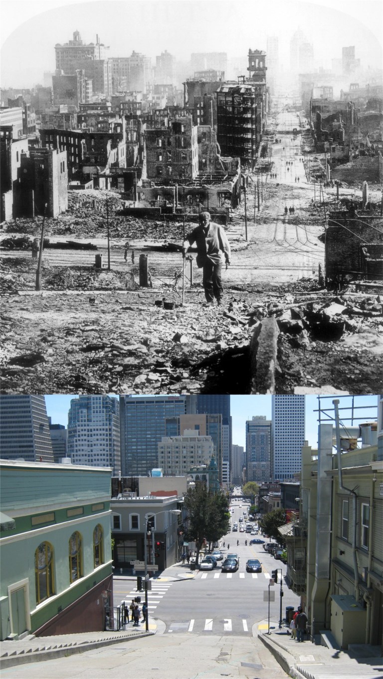 But San Francisco’s greatest collective human endeavor has to be the rebuilding of the city after the 1906 Earthquake and Fire. The vintage picture from the San Francisco History Center was taken looking down Kearny Street toward Broadway.
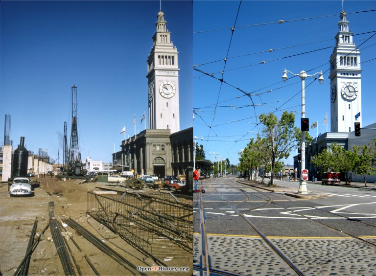 The start of construction on the Embarcadero Freeway that would eventually cut the Ferry Building off from the rest of San Francisco, seen in a November of 1957 picture from opensfhistory.org:
 The old YMCA Building on the Embarcadero near Howard Street in 1928: The building was erected in 1926. This area of San Francisco had become pretty seedy by the 1950s. Eli Wallach, “Dancer”, commits his first murder in this building in the wonderful crime movie ‘The Lineup’ from 1958. (San Francisco Picture Blog)
 The southern portion of the Embarcadero Freeway ended at Howard Street, seen here in the late 1980s. (livablecity.org)
 The northern portion of the freeway stopped at Broadway, seen here in a 1990 picture shortly before it was demolished. Construction on the freeway was originally planned to go all the way to the Golden Gate Bridge, which would have destroyed the entire Bay waterfront of San Francisco. Cooler heads prevailed and stopped that ridiculous idea, eventually. (Flickr)
 The best picture I’ve seen of the automobile underpass that allowed cars driving along the Embarcadero to cross under the streetcar turnaround at Market Street in front of the Ferry Building. This 1935 picture from opensfhistory.org was near where Clay Street entered the Embarcadero. This is a great little picture; the southern wing of the Ferry Building and one of the towers from the Bay Bridge are on the left, and I wonder what that little kiosk was for; possibly, a signal to regulate when the streetcars could proceed.
 The northern wing of the Ferry Building with the passenger footbridge on the right in 1939: The embankment at the top of the Embarcadero underpass is behind the cable car that ran along the Sacramento Street line from the Ferry Building. (opensfhistory.org)
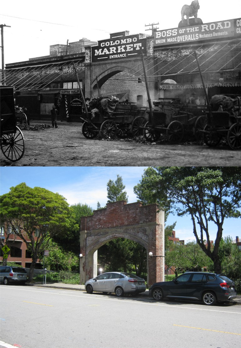 Not far from the Embarcadero is an area once called the Produce District that thrived around the Colombo Market on Front Street and Pacific Avenue. The Produce District and the Colombo Market are gone now, but the archway of the Colombo Market entrance remains. The best look you’ll get on film of the old Produce District is in the 1949 movie ‘Thieves Highway’, starring Richard Conte and Lee J. Cobb. (Skmorton.com and Found SF)
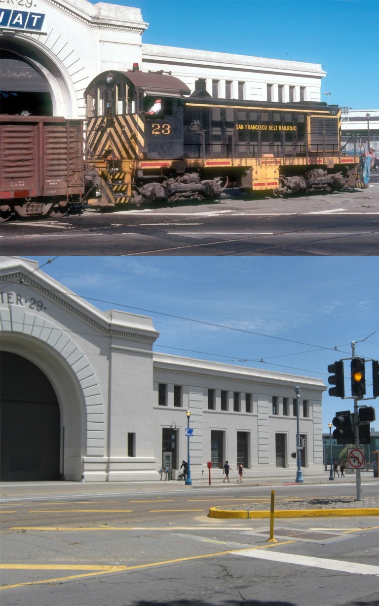 We’ll end our prowl at Pier 29 because I had to walk back and that was good enough for one day. Here, an old Belt Line Railroad engine passes Pier 29 along the Embarcadero in 1977. The railroad line officially went out of operation in 1993. (Railpictures.net)
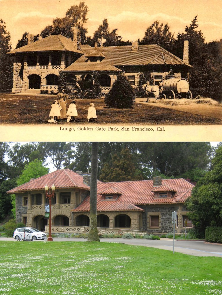 McLaren Lodge in 1907: (eBay)
 Looking south across Kezar Stadium toward the old Polytechnic Gym Building on Frederick Street during a 49ers football game in 1957: Kezar Stadium was demolished in 1989, but the playing field is still there. (An SF Gate photo posted on Pinterest)
 The old Rustic Bridge at Stow Lake, erected in 1893:
 A vintage picture from the Shorpy Collection at Stow Lake with the old Rustic Bridge to Strawberry Hill in the background: Wow, that’s a really classy looking Nissan Versa!
 The lesser photographed bridge that crosses Stow Lake over to Strawberry Hill from the north, seen here in 1955, (the Rustic Bridge crosses over to Strawberry Hill from the south). Boats aren’t available to rent at Stow Lake right now so this was the closest comparison I could get to the vintage picture. (Etsy.com)
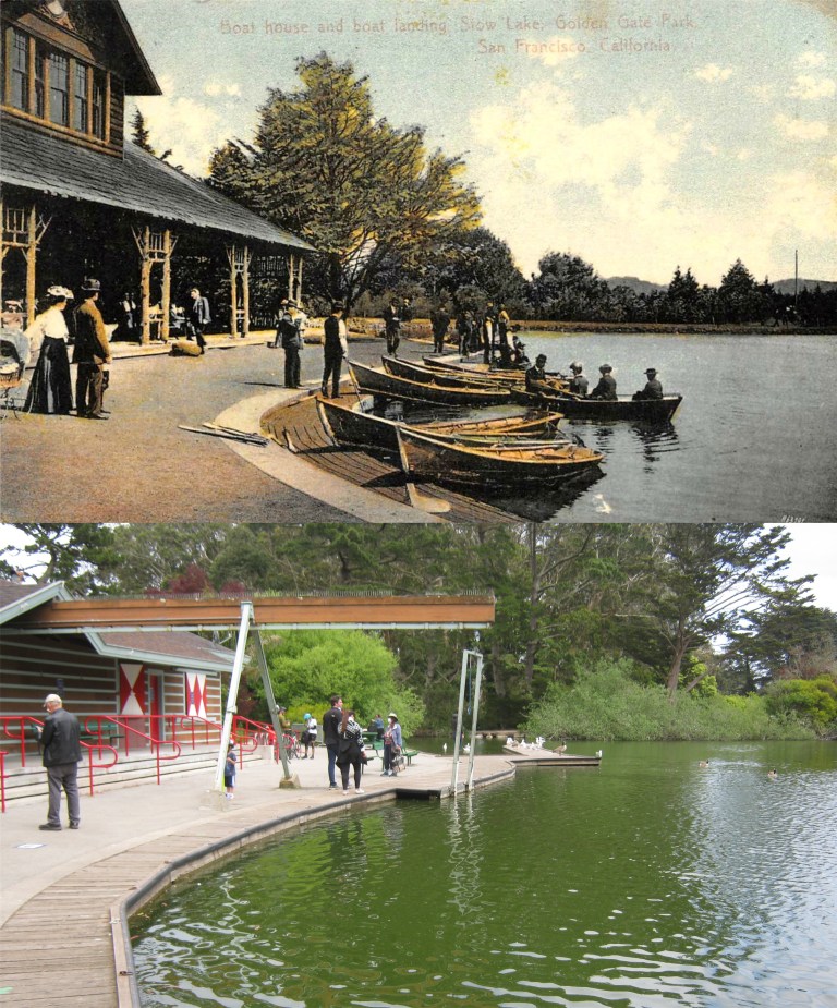 A postcard of the old Boathouse at Stow Lake in 1908 (eBay)
 The Japanese Tea Garden was changed to the Oriental Tea Garden after Pearl Harbor. The name was changed back to the Japanese Tea Garden in 1952. Both pictures are looking toward where the old entrance to the Tea Garden used to be.
 The Children’s Playground after the 1906 Earthquake: The roof of the Sharon Building had collapsed. (SFMTA Photography)
 The fellow with the glasses may not look that imposing, but from the late 1920s through the end of the 1950s he owned The Cliff House, the Sutro Bathhouse and Playland-at-the-Beach. George Whitney poses with his family out the Portals of the Past on Lloyd Lake in Golden Gate Park. (worhtpoint.com)
 The old Murphy Windmill at the southwest corner of Golden Gate Park in disrepair in the 1970s: The restored windmill was reopened in 2012.
 Looking past the children’s playground in the Golden Gate Park Panhandle toward the corner of Oak and Ashbury Streets in a San Francisco Chronicle photo from 1966: The playground is still there, but closed right now due to the Covid-19 pandemic.
 Jackson and Powell Streets, looking west in 1952:
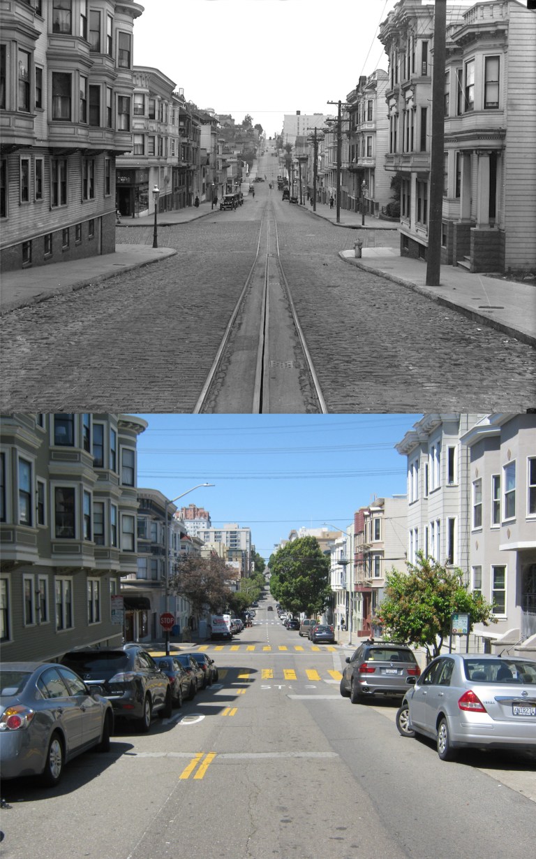 Jackson Street at Larkin, looking west in 1918:
 The exact opposite view from the previous picture of Jackson Street at Larkin, looking east in 1920:
 Looking west down Union Street from Larkin Street in 1948:
 Pacific Avenue, looking south along Hyde Street in 1956: They’re doing lots of road work around San Francisco right now during the coronavirus pandemic, but not here at Hyde Street, like in the vintage picture. That’s obviously work along the cable car track.
 Looking east down Broadway from Taylor Street in 1964:
 Mason Street, looking east along Vallejo Street in 1968:
 Grant Avenue, looking west down Union Street toward Russian Hill in 1966: We were geographically starting to climb Telegraph Hill here.
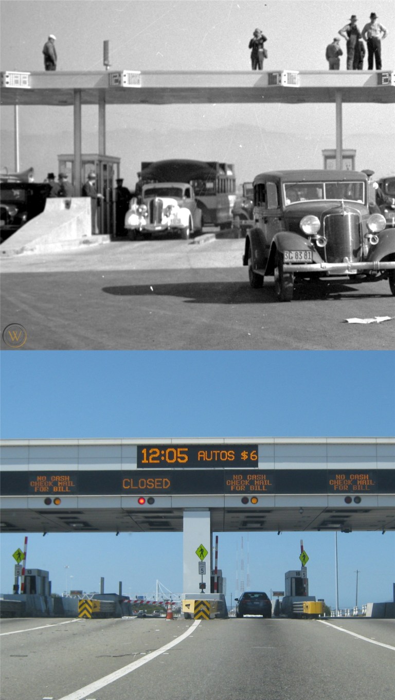 The Bay Bridge Toll Plaza on opening day, November 12th 1936: There was only one camera taking my picture when I crossed the bridge yesterday, and I’ll be getting a pay ticket bill soon. Sadly, this reminds me of a missing man formation; the number 14 toll booth where a lady toll collector was killed in an accident in 2017 is still missing. (Vintage picture, worthpoint.com, posted on Pinterest)
 A view of Playland-at-the-Beach, then known as Chutes-at-the-Beach, looking along La Playa from the south side of Sutro Heights in the 1930s: You can see the Dutch Windmill in Golden Gate Park in both pictures. (worhtpoint.com)
 The Cabrillo Street turnaround at the Great Highway in the 1950s: The Playland Funhouse is in the background.
 Work on the Ocean Beach Seawall near the Cliff House in the 1920s: The Sutro Heights cliffs looked so barren back then. (worhtpoint.com)
 This May 8th will be the 75th anniversary of Victory in Europe, V-E Day. Here, San Franciscans and military visitors are celebrating the news in front of the old Telenews Theater on Market Street. The Telenews was approximately just west of where the corner of Market and Cyril Magnin Streets is now. The roof of the Number One Powell Street Building is in the upper right of the vintage photo. (The San Francisco Chronicle)
 Market Street near 5th in 1966: I’ll redo this one when the vintage F Line Streetcars are running along here again. My picture was taken on another busy day for the police on a Market Street left mostly to vandals and deranged street people during the shelter-in-place. (Pinterest)
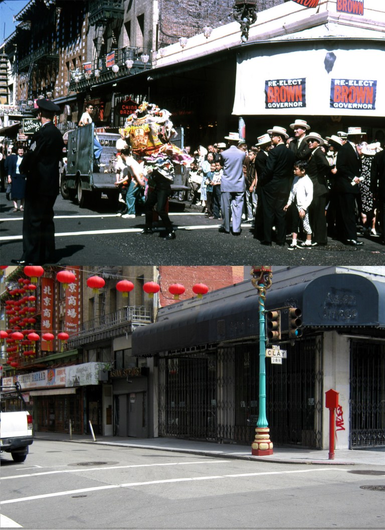 A rally to reelect Governor Pat Brown on Grant Avenue at Clay Street in Chinatown: Well, this is an election year in the United States too. I’m not sure if this was when Brown was elected for a second term in 1962 or when he lost his bid for reelection in 1966 to Ronald Reagan: My picture was taken today in a depressingly empty Chinatown. (Street Scenes of San Francisco)
 Normally, I’d wait for a cable car to come along before updating this 1966 photo on California Street between Stockton Street and Grant Avenue, but not I nor anybody else knows when the cable cars will be running again. (ebay)
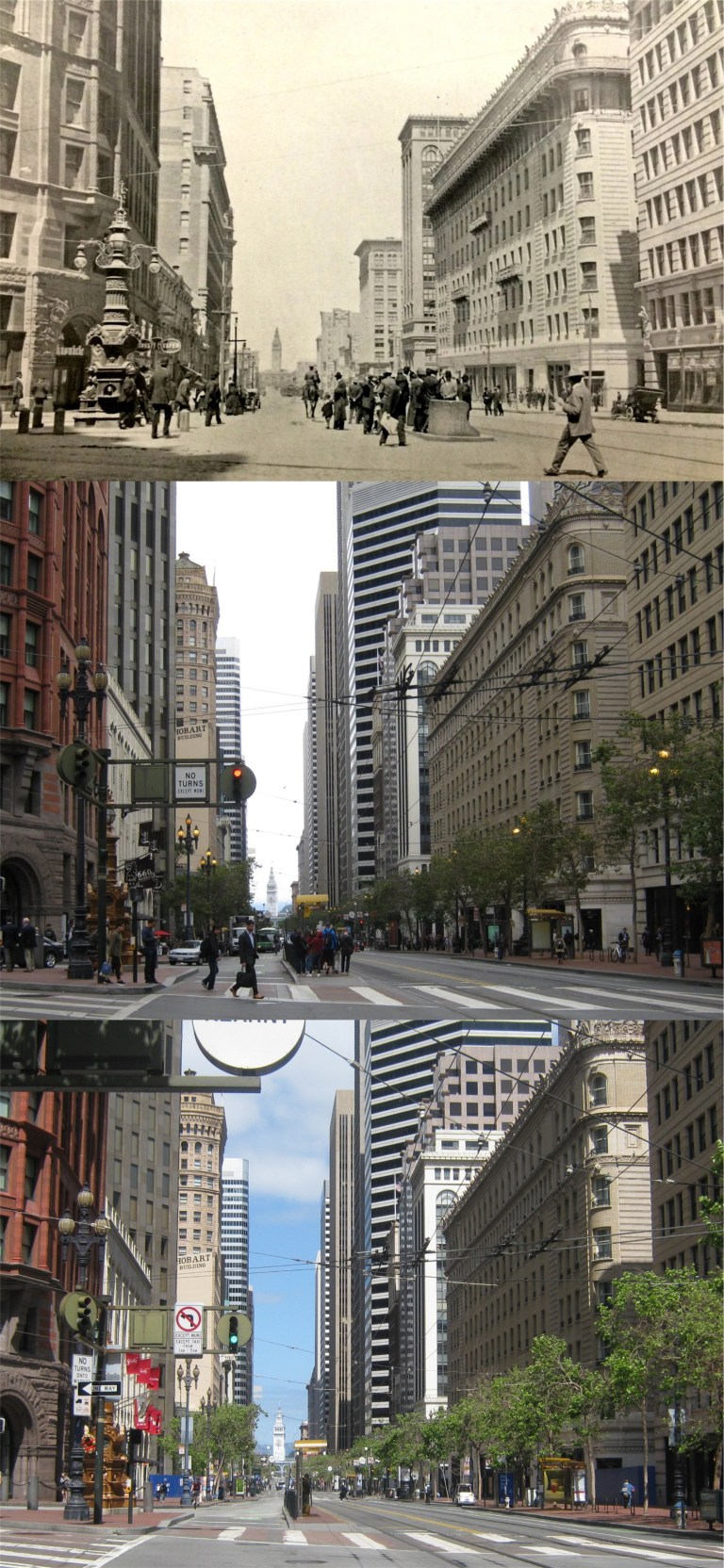 Market Street at Kearny: The top picture from the San Francisco Library History Room is from 1910, the center photo is from 2016, the bottom photo was taken April 18th 2020, the anniversary of the 1906 Earthquake and Fire. For almost one hundred years survivors of that disaster met at Lotta’s Fountain on the left at the exact time and day of the earthquake.
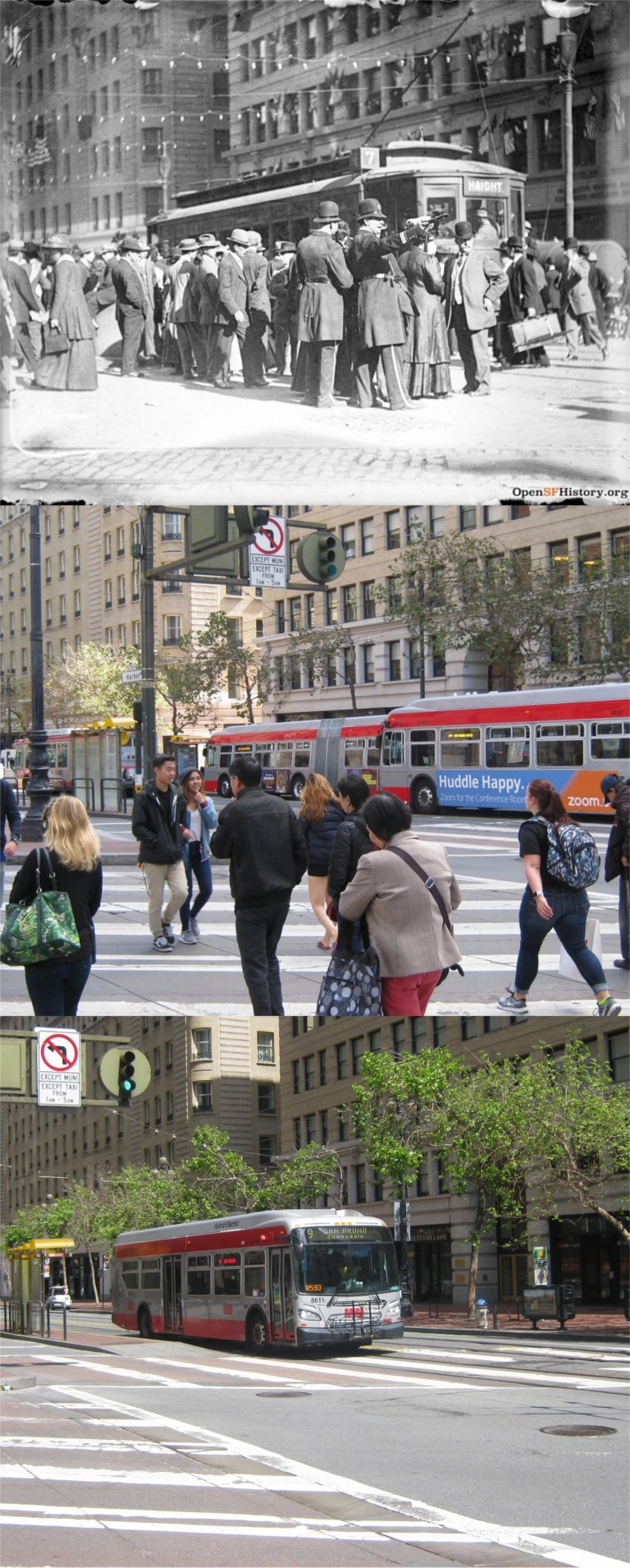 Another picture taken in 1910 at Kearny and Market Streets looking toward the Palace Hotel on the left: The middle picture was taken in 2017. (opensfhistory.org)
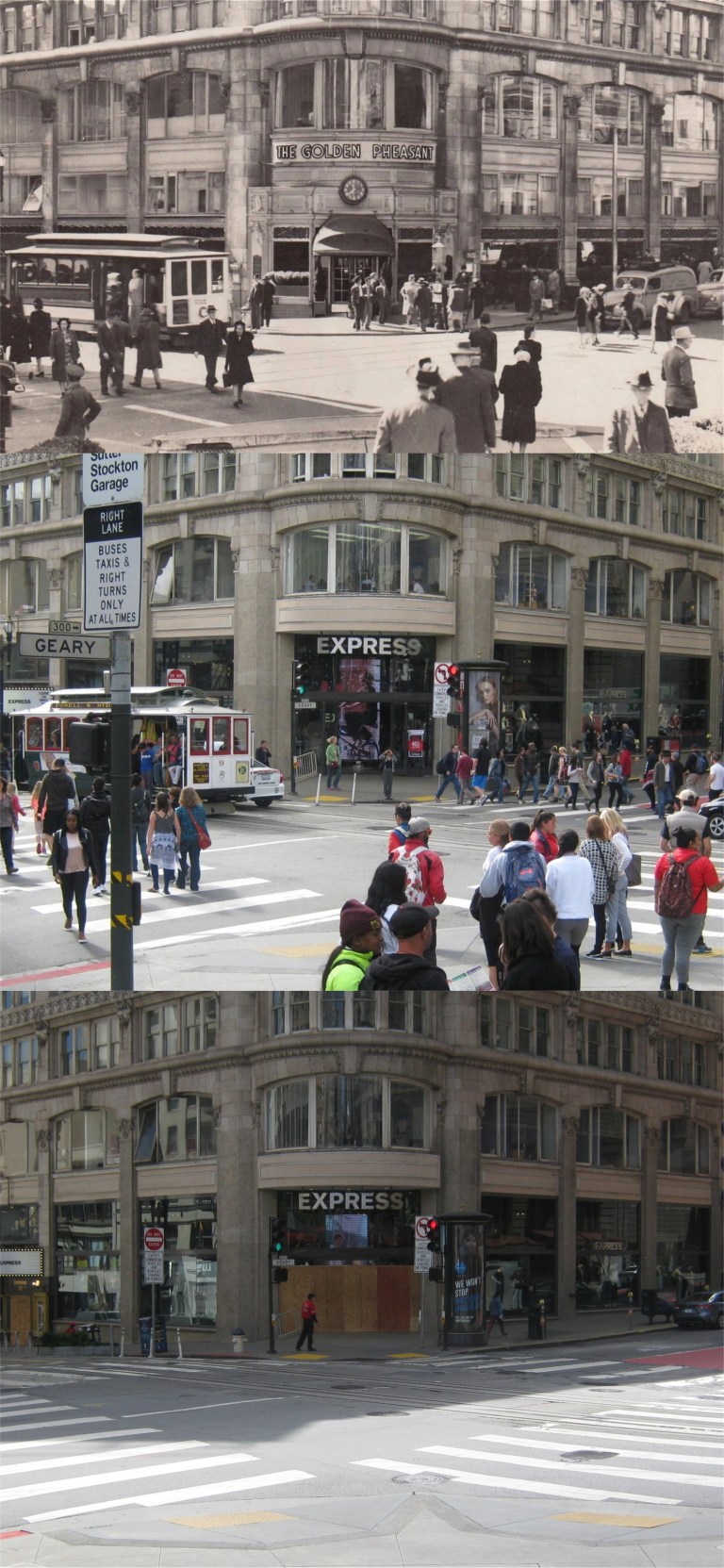 The corner of Powell Street and Geary, looking from Union Square: The top picture is from 1948, the middle picture was taken on Veterans Day, 2016.
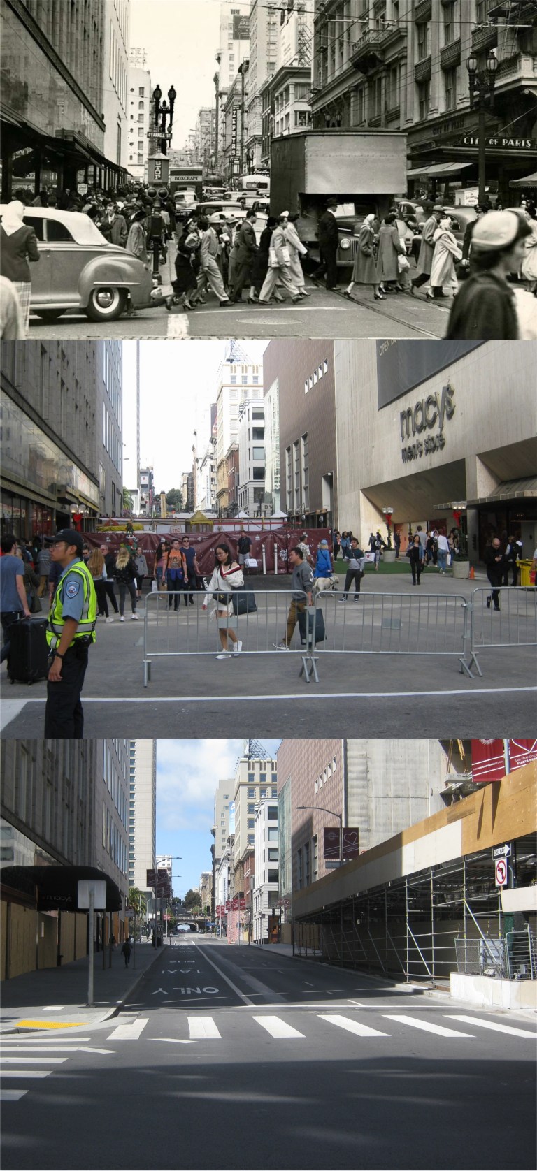 Stockton Street at O’Farrell looking north: The top photo from the San Francisco Chronicle was taken in 1951, the middle photo I took on “Black Friday”, November 24th 2017.
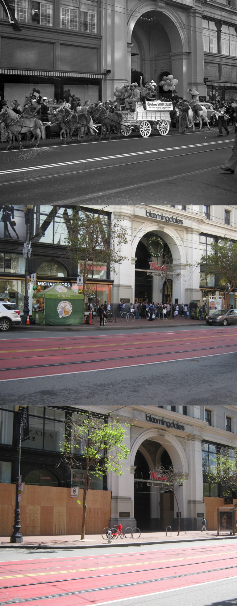 Another photo from the San Francisco Chronicle in front of the Old Emporium Store taken in 1949: My picture in the center was taken on “Black Friday” in November of 2017. Many of the closed businesses along Market Street, like Bloomingdale’s where the old Emporium was, are boarding up their windows during the shelter-in-place order still in effect.
 This August 14th will be the 75th anniversary of VJ Day when Japan surrendered ending World War Two. The top picture is vintage film footage from C. R. Skinner on Market Street at 7th looking east as San Francisco celebrates the end of the war. A tremendous crowd in the background where the streetcars have stopped is surging up toward the cameraman. Also in the background, the Flood Building on the left of Market Street, and the crowned Humboldt Bank Building across Market Street on the right can be seen in all three photos. A million on Market Street was the estimated crowd gathered to celebrate the parade for the San Francisco Giants first World Series victory on November 3rd 2010 when I took my comparison picture in the middle. Although not as important as the end of World War Two, I waited most of my life to see this and I wasn’t going to miss it.
 I had that song stuck in my head when I went over to SF yesterday. I heard that they may be discouraging people from going to Ocean Beach during the pandemic, but there isn’t any problem; people are practicing social distancing, and there were plenty of social distancing police on hand to make sure they behaved.
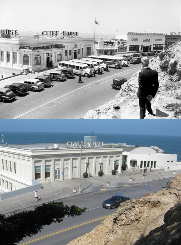 A stranger on the shore on Sutro Heights above the Cliff House: (Pinterest and ebay)
 A view of Playland-at-the-Beach from Sutro Heights in the 1970s near the end of its run: You can see the Funhouse and Merry-go-round in the upper right. The new then Safeway in the upper left is still there. (mksgrist.wix.com)
 Looking down Point Lobos Road past the Cliff House and Sutr0 Heights toward Ocean Beach in the 1940s: (Pinterest)
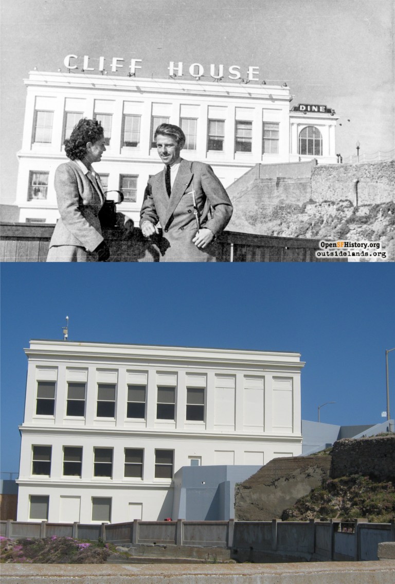 Two strangers on the shore, Although maybe not to each other, at the Cliff House in the 1940s: (opensfhistory and outsidelands.org))
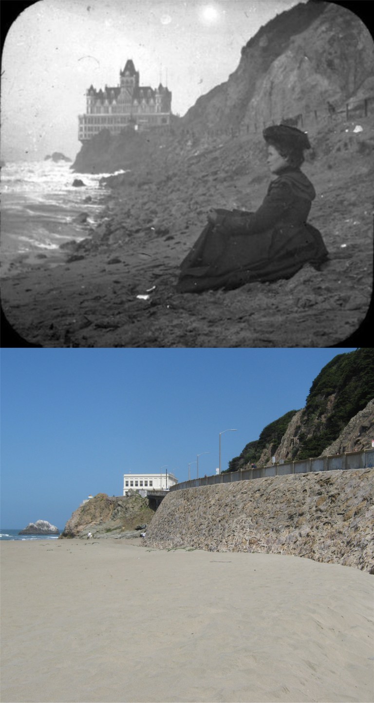 A Victorian stranger on the shore: (Vintage photography)
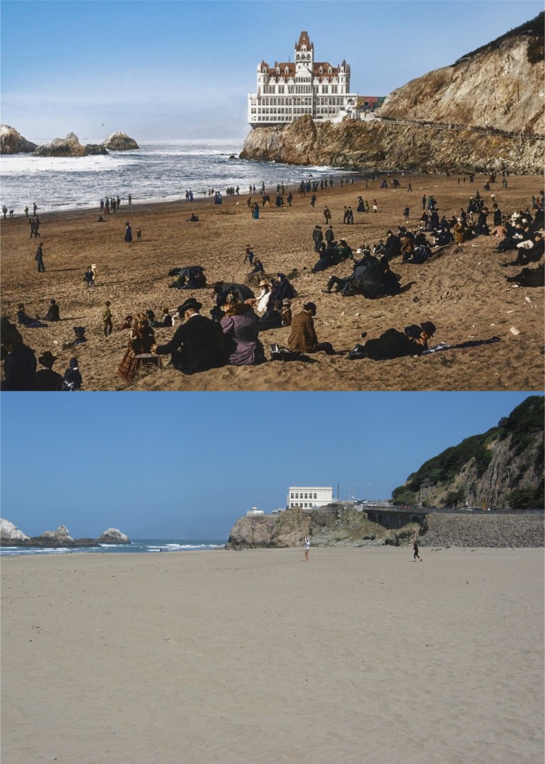 A great colorized picture of Ocean Beach circa 1900: It may be gloomy thinking, but it’s possible that some of the people in the vintage photo died during the Spanish Flu Pandemic of 1918-1919. At any rate, they’re all gone now. (Reddit colorized by Jordan Lloyd)
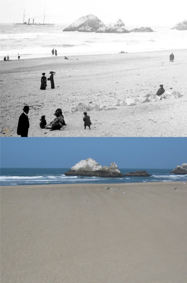 Families on Ocean Beach with Seal Rocks in the background in the late 1800s:(Worthpoint.com)
 So 1970s! They removed the steps on the seawall by the 1980s. (Pinterest and ebay)
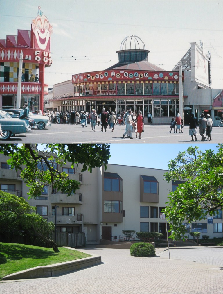 For those who remember Playland-at-the-Beach, and I do, the Funhouse was on the left behind where the grass embankment is now, the merry-go-round was in the center where the condo is. (Flickr)
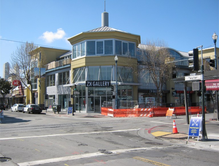
 Looking down the end of Taylor Street toward Pier 45 in 1975: (Peter Stratmoen)
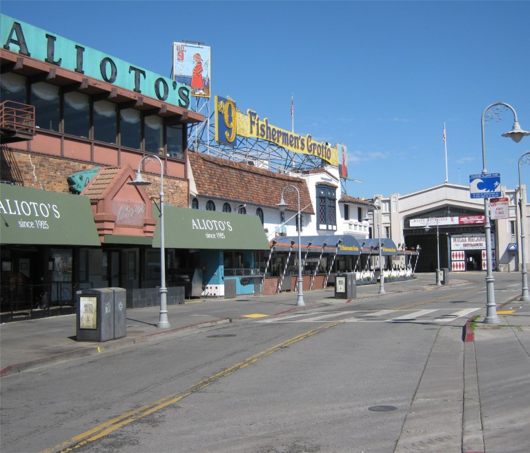
 Looking toward the #9 Fishermen’s Grotto Restaurant in 1960: (opensfhistory.org)
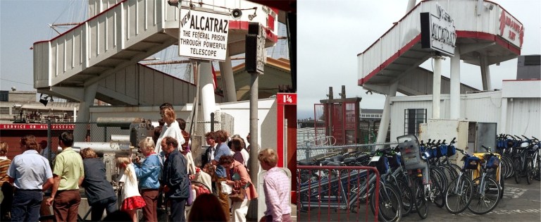
 Tourists viewing Alcatraz Island through telescopes near Pier 43 ½ in the 1970s:
 Looking east from the northwest corner of Jefferson and Taylor Streets in the 1930s: The gas station across Taylor Street that was still there until the 1970s was originally designed to look like a ship. (National Maritime Museum at San Francisco)
 WACs and soldiers working up an appetite in front of #9 Fishermen’s Grotto, looks like during the 1950s:
 Lee Remick crosses Jefferson Street at Taylor to a taxicab that will take her to Candlestick Park for the denouement of the 1962 film ‘Experiment in Terror’.
 Looking toward Ghirardelli Square from Hyde and Jefferson Streets in 1975 in a Peter Stratmoen photo: Hey, they’ve removed all of the trees that were in the updated picture I did in 2016.
 Looking south along Taylor Street across Jefferson in the 1950s; The Wharf was still packed when I did my first update in December of 2018.