
Well, it was four years ago this month that I posted Prowling around the Port, part one, so I guess I’m overdue for a sequel. Friday, I took another walk along the Embarcadero, my favorite street in San Francisco. On paper, it looks like a long walk but it goes by real fast, which is good because the Muni F Line of historic streetcars that run along the Embarcadero and are easy to hop on if your feet run out of gas, isn’t in service at this time due to the COVID-19 pandemic.
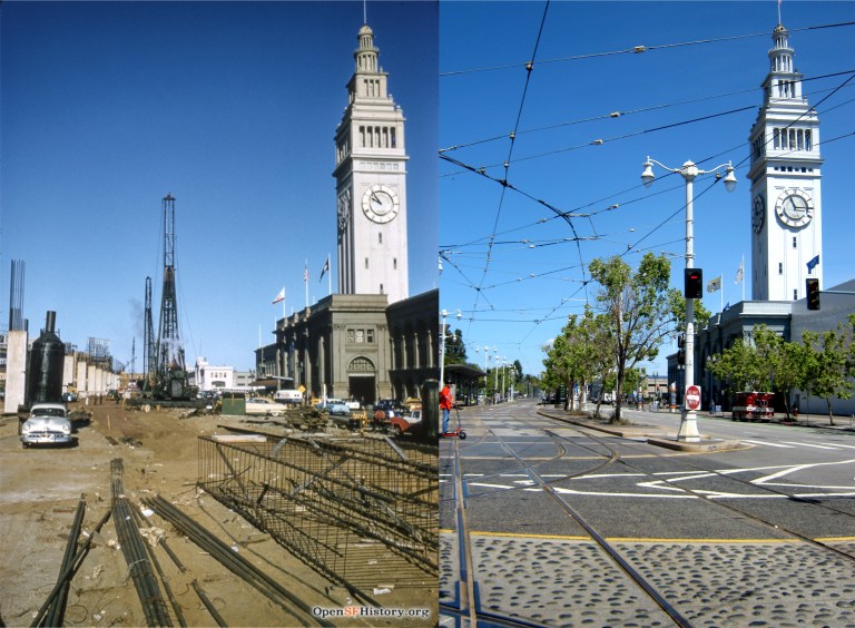 The start of construction on the Embarcadero Freeway that would eventually cut the Ferry Building off from the rest of San Francisco, seen in a November of 1957 picture from opensfhistory.org:
 The old YMCA Building on the Embarcadero near Howard Street in 1928: The building was erected in 1926. This area of San Francisco had become pretty seedy by the 1950s. Eli Wallach, “Dancer”, commits his first murder in this building in the wonderful crime movie ‘The Lineup’ from 1958. (San Francisco Picture Blog)
 The southern portion of the Embarcadero Freeway ended at Howard Street, seen here in the late 1980s. (livablecity.org)
 The northern portion of the freeway stopped at Broadway, seen here in a 1990 picture shortly before it was demolished. Construction on the freeway was originally planned to go all the way to the Golden Gate Bridge, which would have destroyed the entire Bay waterfront of San Francisco. Cooler heads prevailed and stopped that ridiculous idea, eventually. (Flickr)
 The best picture I’ve seen of the automobile underpass that allowed cars driving along the Embarcadero to cross under the streetcar turnaround at Market Street in front of the Ferry Building. This 1935 picture from opensfhistory.org was near where Clay Street entered the Embarcadero. This is a great little picture; the southern wing of the Ferry Building and one of the towers from the Bay Bridge are on the left, and I wonder what that little kiosk was for; possibly, a signal to regulate when the streetcars could proceed.
 The northern wing of the Ferry Building with the passenger footbridge on the right in 1939: The embankment at the top of the Embarcadero underpass is behind the cable car that ran along the Sacramento Street line from the Ferry Building. (opensfhistory.org)
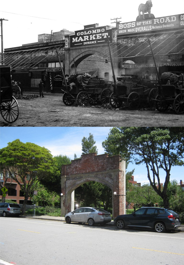 Not far from the Embarcadero is an area once called the Produce District that thrived around the Colombo Market on Front Street and Pacific Avenue. The Produce District and the Colombo Market are gone now, but the archway of the Colombo Market entrance remains. The best look you’ll get on film of the old Produce District is in the 1949 movie ‘Thieves Highway’, starring Richard Conte and Lee J. Cobb. (Skmorton.com and Found SF)
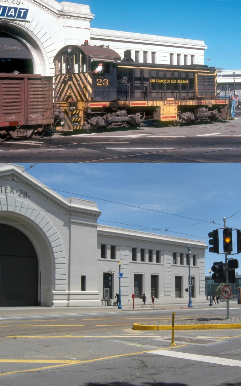 We’ll end our prowl at Pier 29 because I had to walk back and that was good enough for one day. Here, an old Belt Line Railroad engine passes Pier 29 along the Embarcadero in 1977. The railroad line officially went out of operation in 1993. (Railpictures.net)

That first pair of pictures shows how much can change in an hour and twenty minutes between 9:55 and 11:15 in the morning!
Ha! Ha! Very clever!