
If you can remember the 1980s, then you’ve recovered from the 1960s as well as can be expected. Of course, that’s just a play on words from the famous expression, “If you can remember the 1960s, then you weren’t really there.” coined by Paul Kantner, Robin Williams, Richard Nixon or whoever it was. These are slide pictures of mine taken from 1984 to 1987.
 The Embarcadero at Mission Street in 1987: That’s the infamous Embarcadero Freeway at left center.
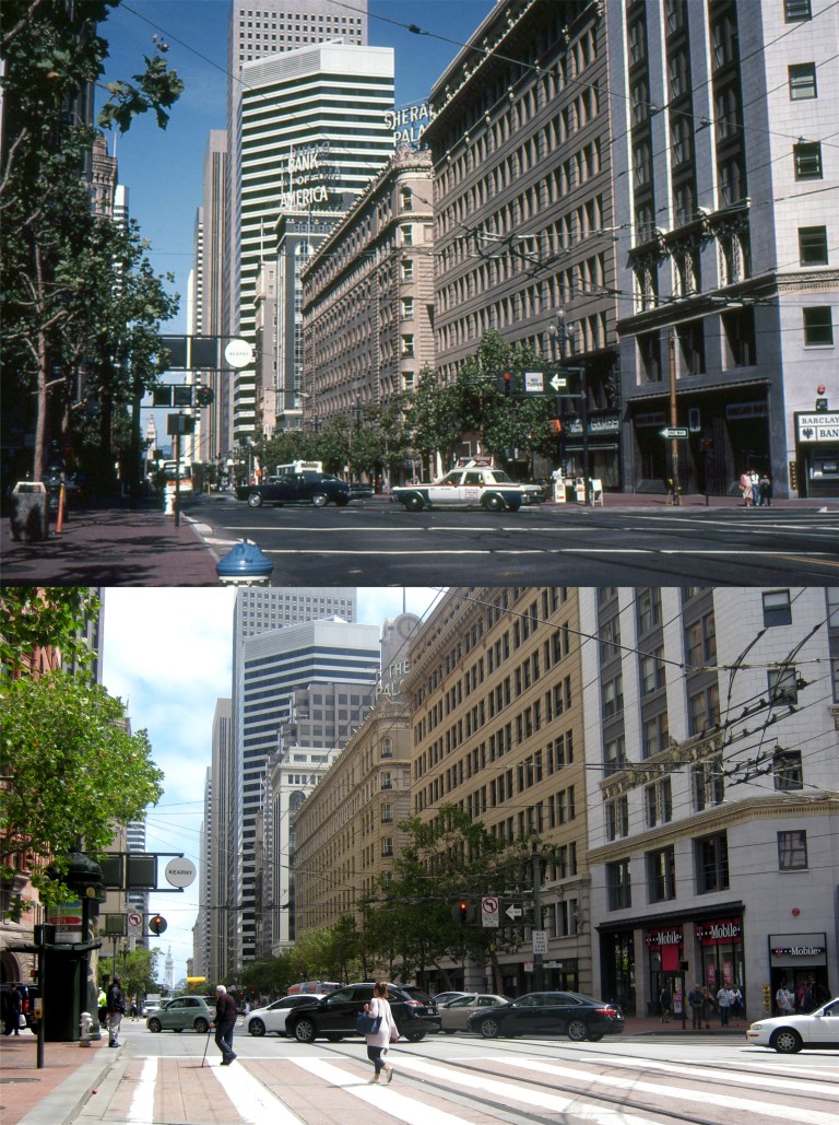 Market Street at Kearny and Third Streets in 1984: I wonder if “Big Brother” was watching me. The Palace Hotel was still the Sheraton Palace Hotel, and Barclay’s Bank is now a T Mobile Store.
 Post Street at Montgomery: “Excuse me, is there a Bank of America near here?” There’s still a Bank of America in the building across Market Street, but they’re not the biggest bank in the world anymore, like they were in 1984, and they don’t advertise as boldly as they did back then.
 Powell at Pine Streets in June of 1987: Those three little girls combined have increased the population of the world by five now, and the mommy is past having any more kids, I hope.
 Market Street at Eighth in 1985: They began running old time streetcars on the F Line on Market around then. That’s the Orpheum Theater on the left.
 Upper Market Street near the U. S. Mint in 1985: That’s the old Highway 101 Central Freeway that crossed Market Street in the background of the 80’s picture. Deemed unsafe after the Loma Prieta Earthquake of 1989, it was demolished in the 1990’s. The Mint Lounge is on the left in both photos.
 During a four day visit from two of my nieces from Texas last Thursday I had a chance to visit some places in California that I haven’t seen for many years; some not at all. Of course, I would have been content to spend all four days in San Francisco, but they wouldn’t go for it. So, these are photos from a four day Odyssey from San Francisco to Half Moon Bay, and Monterey, Carmel, Santa Cruz, and the Napa Valley. Leave it to some crazy nieces to bring out the teenager in me.
 The entrance gate to Chinatown on Grant Avenue: (Vintage picture from timeline.com)
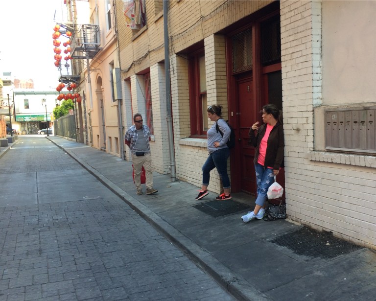 The once notorious Beckett Alley in Chinatown: In 1913 this street had 29 brothels on both sides of the street according to the National Trust Guide to San Francisco. Numbers 8 and 10 here were just two of them. However, passing gentlemen no longer experience encounters with “ladies of the evening” in the alley today.
 Happy memories are made by visiting relatives who embarrass the heck out of you with their clowning.
 This one is for the two nice ladies in the Mission Dolores Gift Shop. At the top is a picture of Alfred Hitchcock in front of the mission during the filming of his 1958 film ‘Vertigo’. Several scenes from the movie were filmed here, and being the oldest building in San Francisco, it’s a very historic place to visit.
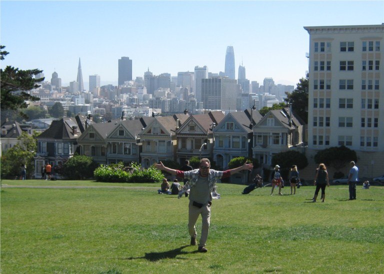 Alamo Square is back open again for fans of ‘Full House’, which I never, particularly, was.
 At the top of Fort Point in June of 1987: The little girl in the center of the 1987 picture is the girl on the right in last Friday’s photo.
 Two moons at Half Moon Bay: Another place I seldom visit, although it’s such a scenic ocean town, Half Moon Bay also has its world famous Pumpkin Festival every Halloween.
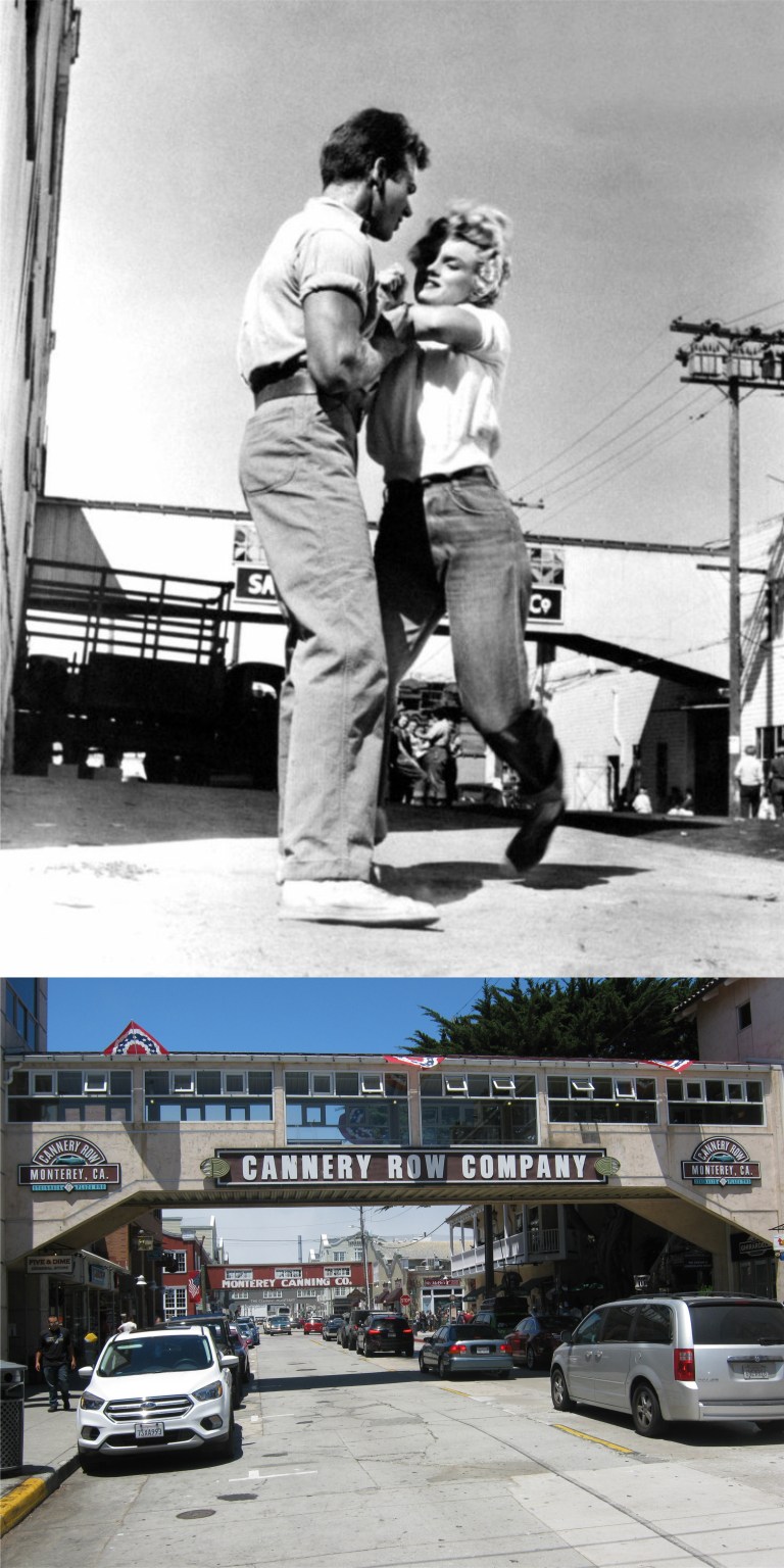 Marilyn Monroe and Keith Andes at Cannery Row, Monterey in the 1952 movie ‘Clash by Night’, also starring Barbara Stanwyck, Paul Douglas and Robert Ryan.
 Cannery Row, Monterey, named for the old sardine canneries located here is an historic and fun place to visit thanks to John Steinbeck and the Monterey Aquarium.
 The 250 year old Lone Cypress Tree in Pebble Beach in painting and in person:
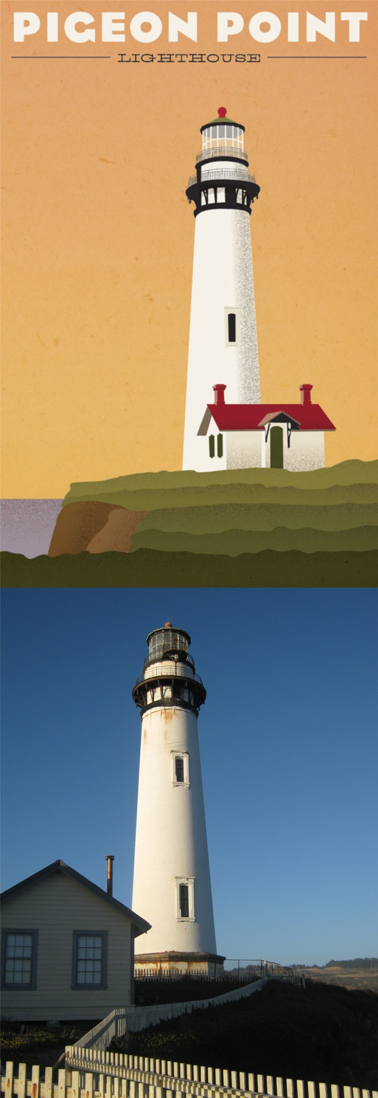 The old Pigeon Point Lighthouse, now closed, is another one of those places in “my own back yard” that I’ve never visited.
 “I wish they all could be California girls!” (that come from Texas)
 Some of the most beautiful scenery in California is in the Napa Valley wine country.
 A cable car climbs Hyde Street at Francisco Street in 1973 celebrating the Centennial of the cable cars invented in 1873:
 Don’t believe everything you read, unless you read it here! When I found this old picture it read that it was a cable car crossing Lombard Street at Hyde in 1936. I didn’t buy it when I read it, and I confirmed it when I got there. Still, I climbed up a stone wall on the corner of Hyde and Lombard to get a comparison picture anyway. I’m a dedicated blogger, especially when the stone wall is only four feet high. The vintage picture was actually taken one block south at Greenwich Street. However, Lombard Street is a lot more alluring, so this is a then and now picture taken at Lombard Street and Hyde of a cable car crossing Greenwich Street and Hyde.
 A Cable car starting the Hyde Street climb at Bergen Alley in the 1970’s: What it is! What it is! Dig those far out 1970’s colors! Are they in your face or what? That sounds like ‘That 70’s Show’!
 ‘Born to Kill’ (1947) Elisha Cook Jr. (Wilmer in the ‘Maltese Falcon’) arrives at the Ferry Building on a mission to kill:
 ‘The Sniper’ (1952) Arthur Franz runs into his house on Filbert Street after shooting another woman to death: The police will capture him here.
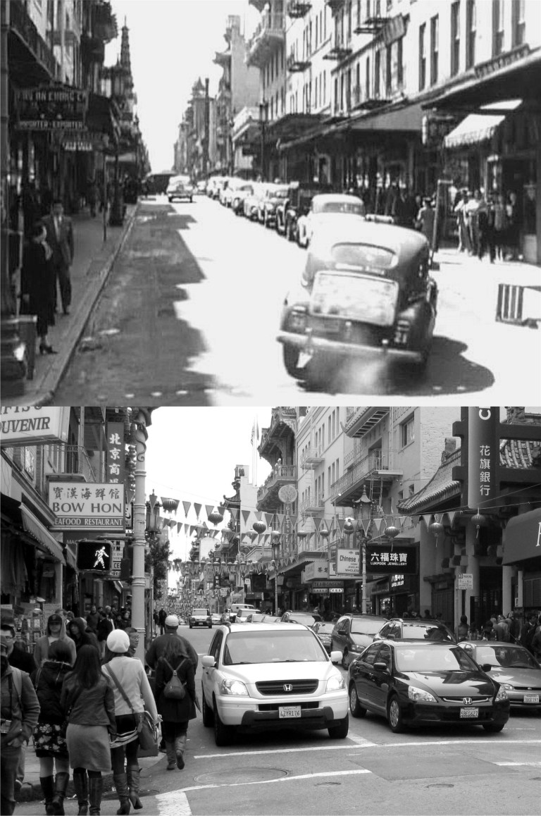 ‘Impact’ (1949) A car chase scene at Grant Avenue and Washington Street in Chinatown with Ella Raines chasing Anna May Wong in one of the coolest chase scenes in a San Francisco movie:
 ‘The Lineup’ (1958) Police close in on Eli Wallach at the Cliff House who has kidnapped a woman and child:
 ‘The Sniper’ (1952) Police close off Filbert Street on Telegraph Hill in pursuit of Arthur Franz:
 ‘Woman on the Run’ (1950) Ann Sheridan searches through San Francisco for her husband who is hiding from the mob: Here she is at the Fisherman’s Wharf boat lagoon with a “friend” who she doesn’t know is trying to kill her. A little fishermen’s chapel is now where the building on the right was. (Movie image, reelsf.com)
 ‘The Lineup’ (1958) A sharp eyed cop spots hit man Eli Wallach in Golden Gate Park near the De Young Museum. The De Young has been rebuilt now, but the two lions in front are still there.
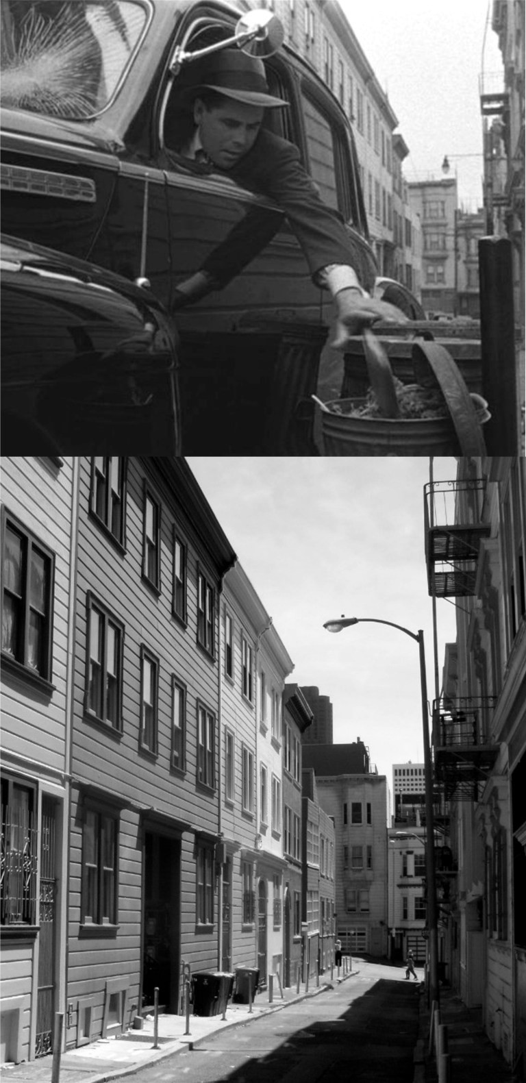 ‘Mr. Soft Touch’ (1949) Glenn Ford stashes money that he stole from the mob in a trash can in Varennes Alley in North Beach:
 ‘The House on Telegraph Hill’ (1951) Valentine Cortese heads up Montgomery Street on Telegraph Hill not realizing that her brakes have been tampered with and that she’ll lose her stopping power when she gets to the top:
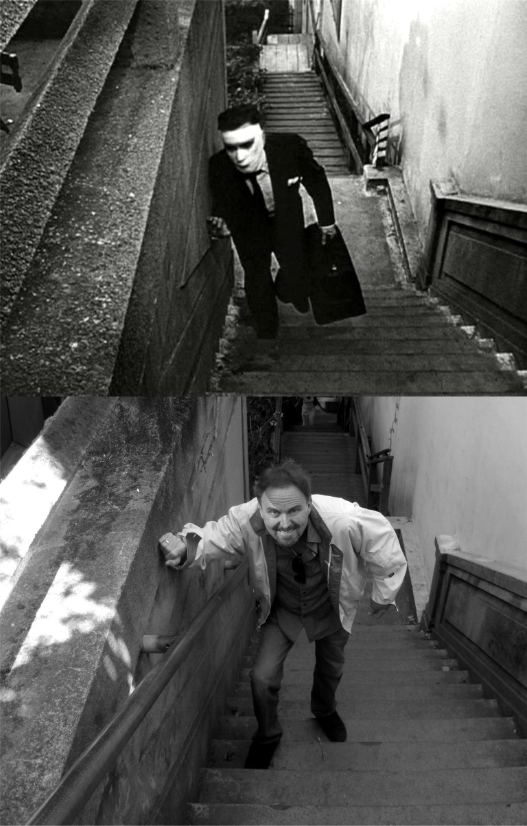 ‘Dark Passage’ (1947) A bandaged Humphrey Bogart after plastic surgery climbs the Filbert Steps on Telegraph Hill to get to his hideout at Lauren Bacall’s apartment. I couldn’t resist!
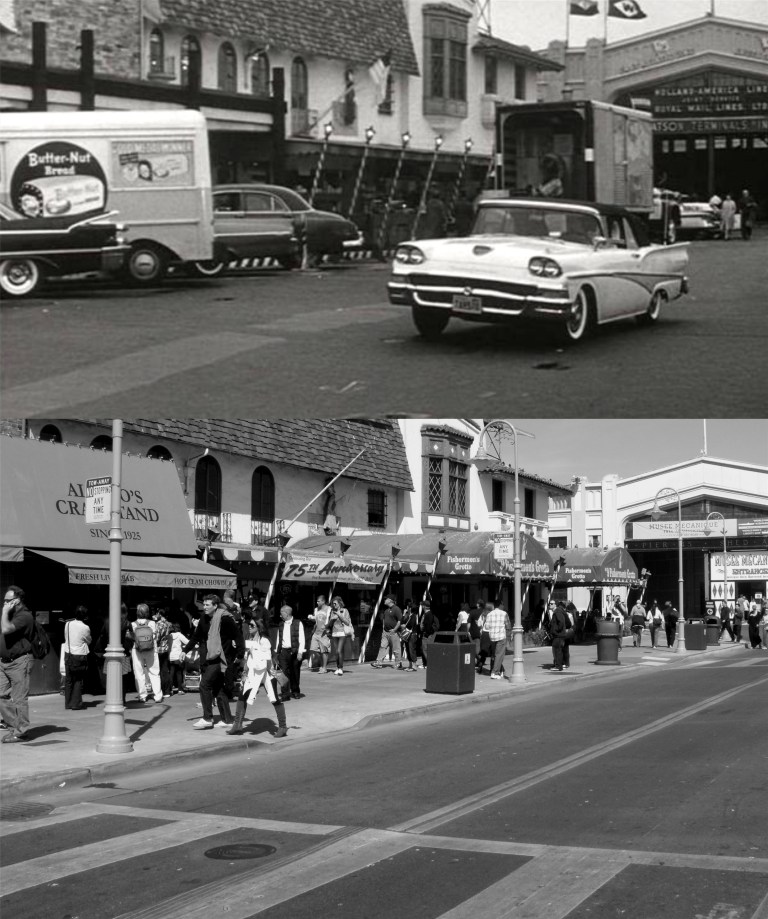 ‘Experiment in Terror’ (1962) Lee Remick parks at Fisherman’s Wharf to await a telephone call on where to deliver ransom money to free her sister Stefanie Powers: Probably the last film noir movie set in San Francisco.
 ‘Star Wars’ at the Coronet Theater on Geary Blvd. near Arguello in 1977: There’s still a gas station on the corner here, but the Coronet Theater is gone and gas isn’t 60 cents a gallon anymore.
 The Palace of Fine Arts: The vintage picture looks like something from a gangster movie. Why is she smiling when she’s being “taken for a ride” by the mob? (SF Chronicle)
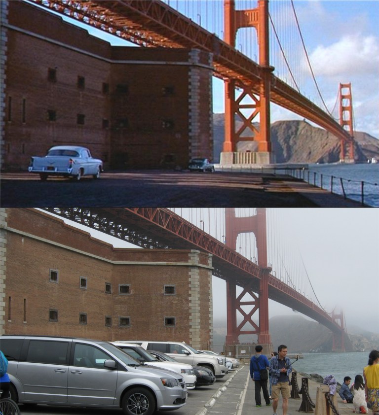 Movie buffs will recognize this scene at Fort Point from Alfred Hitchcock’s 1958 movie ‘Vertigo’ where Kim Novak jumps into the Bay and is rescued by James Stewart.
 The old Murphy Windmill in Golden Gate Park in 1948 and the restored Murphy Windmill today: It’s supposed to be the largest windmill in the western hemisphere, but I don’t know if that’s fair, there probably aren’t a lot of windmills in the western hemisphere.
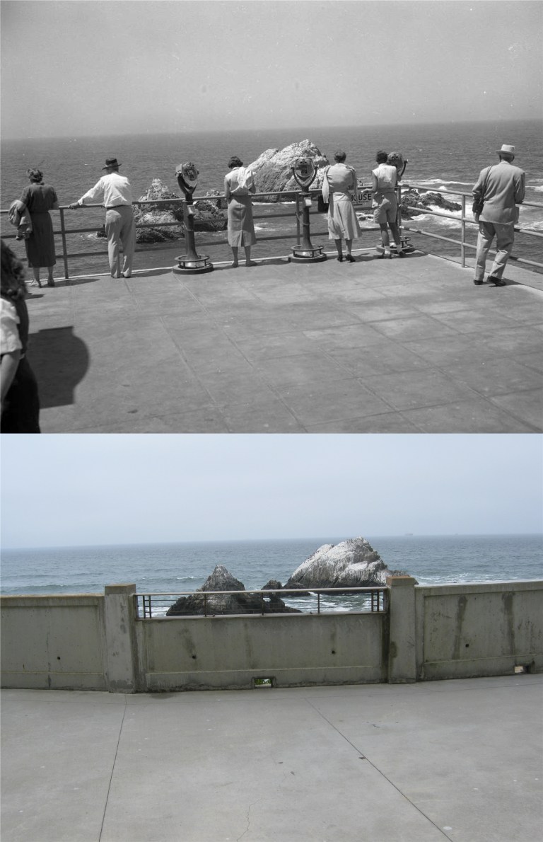 Seal Rocks from behind the Cliff House in the 1950’s: Since the Musee Mecanique and History Room were removed during the 2000 remodeling, there isn’t a lot of traffic behind the Cliff House anymore. (SF Chronicle)
 Another view of the Sky Tram that ran behind the Cliff House from 1955 to 1965: This view is looking from the Cliff House toward Point Lobos. (SF Chronicle)
 A bird’s eye view of Seal Rocks from inside the tram: (SF Chronicle)
 An old postcard of Fleishhacker’s Pool, now entombed beneath the San Francisco Zoo parking lot: The pool house was behind where the double B signs are in the center photo. The only thing left of the pool house since it burned down in 2012 is the entrance to the building in the bottom picture.
 Speaking of 1776, although England and the United States have had long ago differences, (Well, the British did capture Washington DC once, and President Trump hasn’t done that yet) our two countries are as united as any two countries in history, and hopefully that will always be. In the early 1950’s a cross country tour by three of England’s double-decker buses to promote tourism to Great Britain arrived in San Francisco. Here, the buses are traveling east on Market Street at 8th Street. Notice the driver’s on the right side of the bus. Behind the streetcar on the right is the magnificent movie palace the Fox Theater demolished in 1963. (Vintage picture from SF Chronicle)
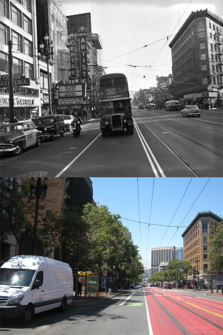 The buses continue on Market past Jones Street. (SF Chronicle)
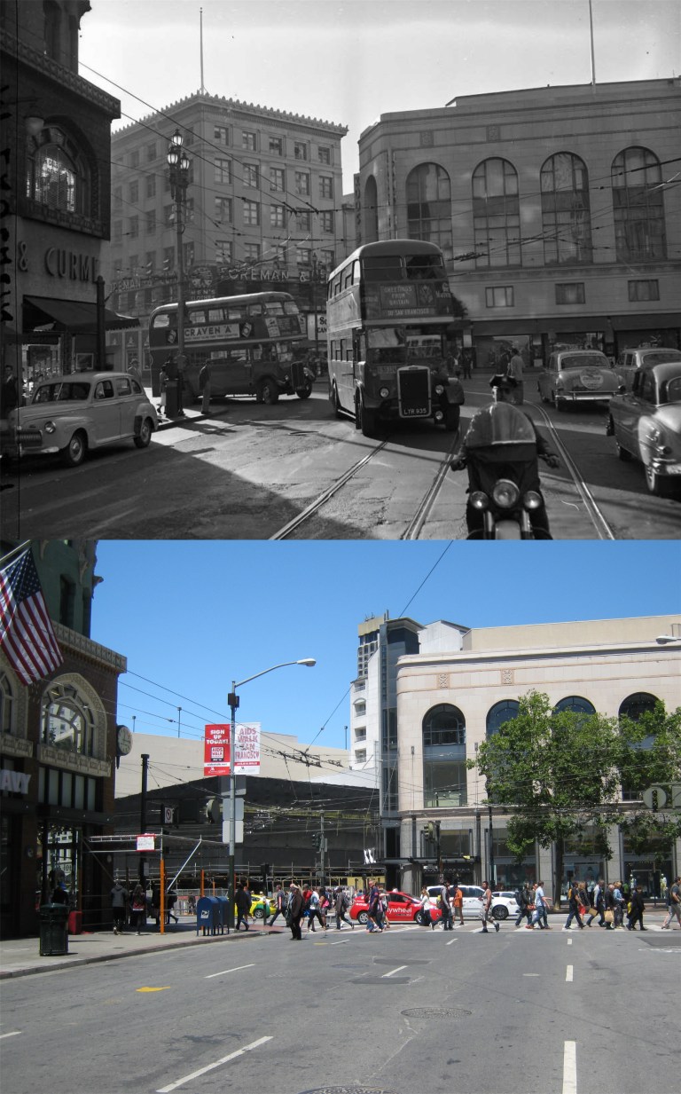 The double-decker buses turn right off Market Street onto 4th St.
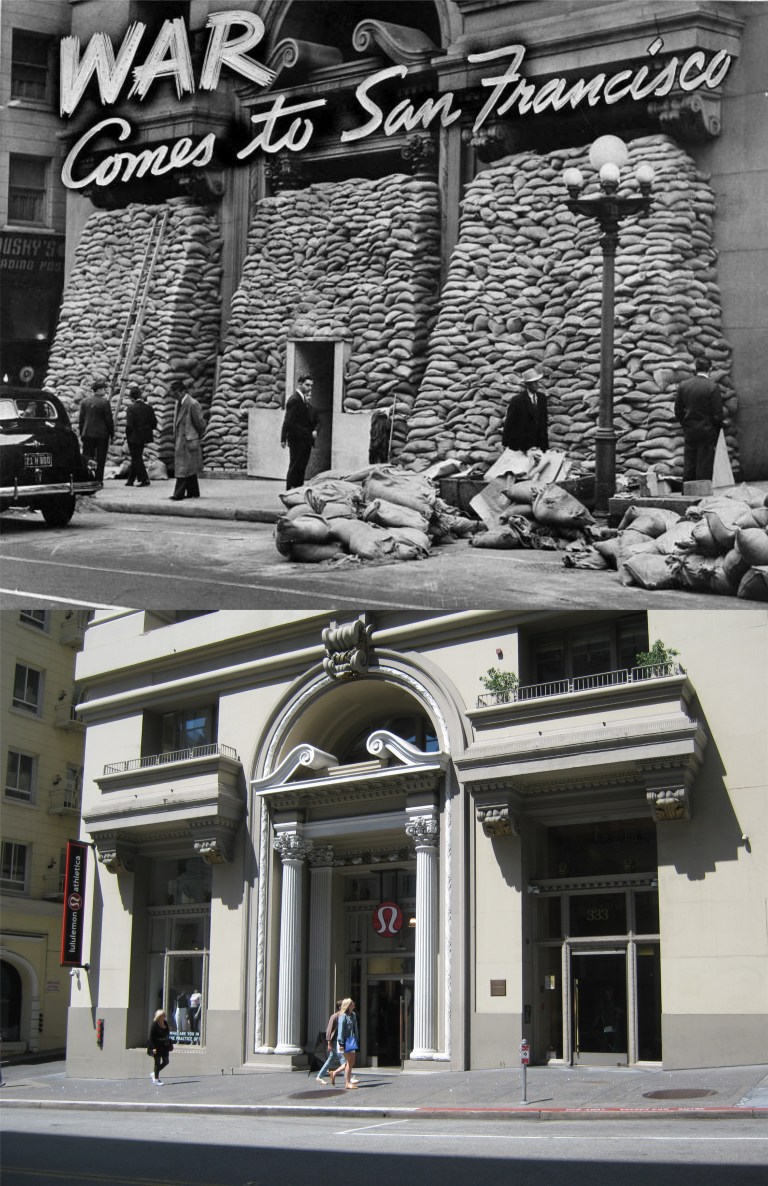 Now we’re over on Grant Avenue during World War Two just after Pearl Harbor. This building, the Telephone Exchange Building at the time, was considered so vital that sandbags were stacked in front of it to protect the structure if the Japanese ever bombed San Francisco, although, I’ve never been able to understand what good those bags would do in the event of a direct hit. (SF Chronicle)
 A view of the Telephone Exchange Building during this period looking south toward Market Street:
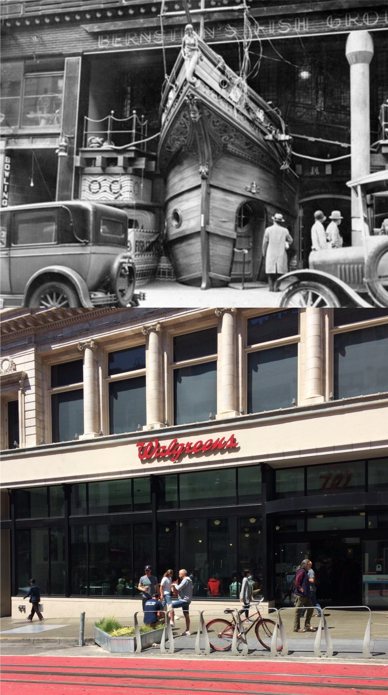 I’m still waiting for my ship to come out! Grooooan! Berstein’s Fish Grotto on Powell Street, famous for its ships bow entrance, was a popular restaurant from 1912 until closing in 1981. A Walgreens Pharmacy now occupies the spot.
 Market Street west of Grant Avenue after the 1906 Earthquake and Fire: The Mutual Bank Building is the Gothic looking building tucked between other buildings in the center of my picture. The dark building just to the right of the Mutual Building and not labeled in the postcard is the old Chronicle Building, the copper colored building in the center of my picture. The old and modernized Call Building is on the right. The Phelan Building, (they spelled it Philan) destroyed in the earthquake and rebuilt in 1908, is on the far left. Well, I hope that George A. Hyde got a date with Miss Hazel!
 The Ferry Building in 1915 and in 2015, both years commemorating the 1915 Panama Pacific Exposition:
 The Fisherman’s Wharf Lagoon during World War Two: I’m not sure why it was a restricted area by the U.S. Army and I wonder if the photographer was arrested. Also, I didn’t notice that little Minnie Mouse like doll on the pier when I took my picture. Good advertising for the sport fishing company that berths here! (Vintage picture from SF Chronicle)
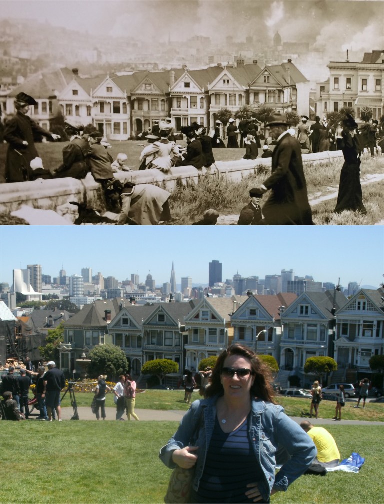 “Painted Ladies” and a pretty lady at Alamo Square: The top picture taken after the 1906 Earthquake and Fire is hanging on the wall near the earthquake exhibit at the California Academy of Sciences.
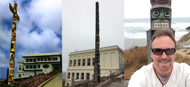 A Totem pole at the Cliff House in 1983: There’s still a totem pole near this spot, but it doesn’t look like the same one, and when a totem pole has a nicer smile than mine I know it’s time to stop taking selfies.
 We’ll stay out at the Cliff House for awhile. This is the old Point Lobos Sky Tram that ran behind the Cliff House and the Sutro Bathhouse from 1955 to 1965. The ruins of the Sutro Bathhouse that burned down in 1966 are on the left. (Vintage picture from SF Chronicle)
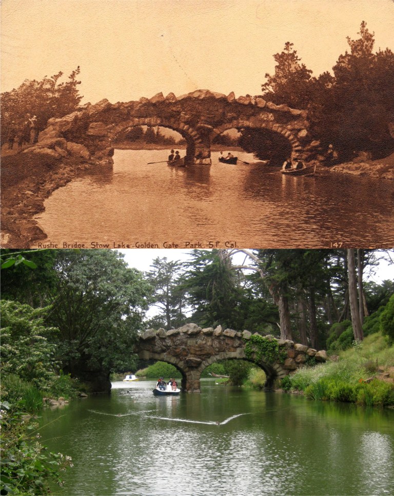 The old Rustic Bridge at Stow Lake in Golden Gate Park was ERECTED AD 1893, and it’s as peaceful of a setting as you’ll find in San Francisco. A couple of movies have filmed scenes here, “Fatty” Arbuckle’s ‘Wished on Mabel’ in 1915, and ‘Scaramouche’ in 1952.
 “Git along, lil dawggies.”
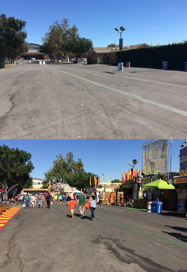 Heading in.
 The Midway: I get dizzy just looking at it!
 The kiddie rides: You know, the ones I can handle.
 I stood here last fall dying for the smell of an Italian Sausage sandwich!
 Two views from the horse racing grandstand.
 The Maritime Museum at Aquatic Park with Ghirardelli Square in the background in 1939: The old and now closed Art Deco restroom and snack bar is on the right. (opensfhistory.org)
 The WPA built Maritime Museum opened in 1936 as a casino. Here it’s seen in a picture from 1955. (opensfhistory.org)
 The steps behind the Maritime Museum with the Hyde Street Pier in the background in 1972: (opensfhistory.org)
 Hyde and Beach Streets in 1971: The Buena Vista Café sign can be partially seen on the right in both photos. (opensfhistory.org)
 As I’ve mentioned in previous posts, in 1939 my 17 year old mother took a train from Grand Forks North Dakota to spend the summer with her cousin Frances. Here they are swimming in the Bay behind the Maritime Museum that summer. My mom is the teenager on the left, She also took a picture of “The Rock” that day. There were still some pretty rough characters out on Alcatraz at that time, including Alvin Karpis from “Ma” Barker’s gang, and “Machine Gun” Kelly.
 Four images of the church: The top photo is Old St. Mary’s before the 1906 Earthquake and Fire. The church survived the earthquake in relatively good shape but was gutted by the fire that destroyed most of San Francisco, as seen in the second picture. The third photo is a rebuilt St. Mary’s in 1951 and the way the church looks today is the bottom picture
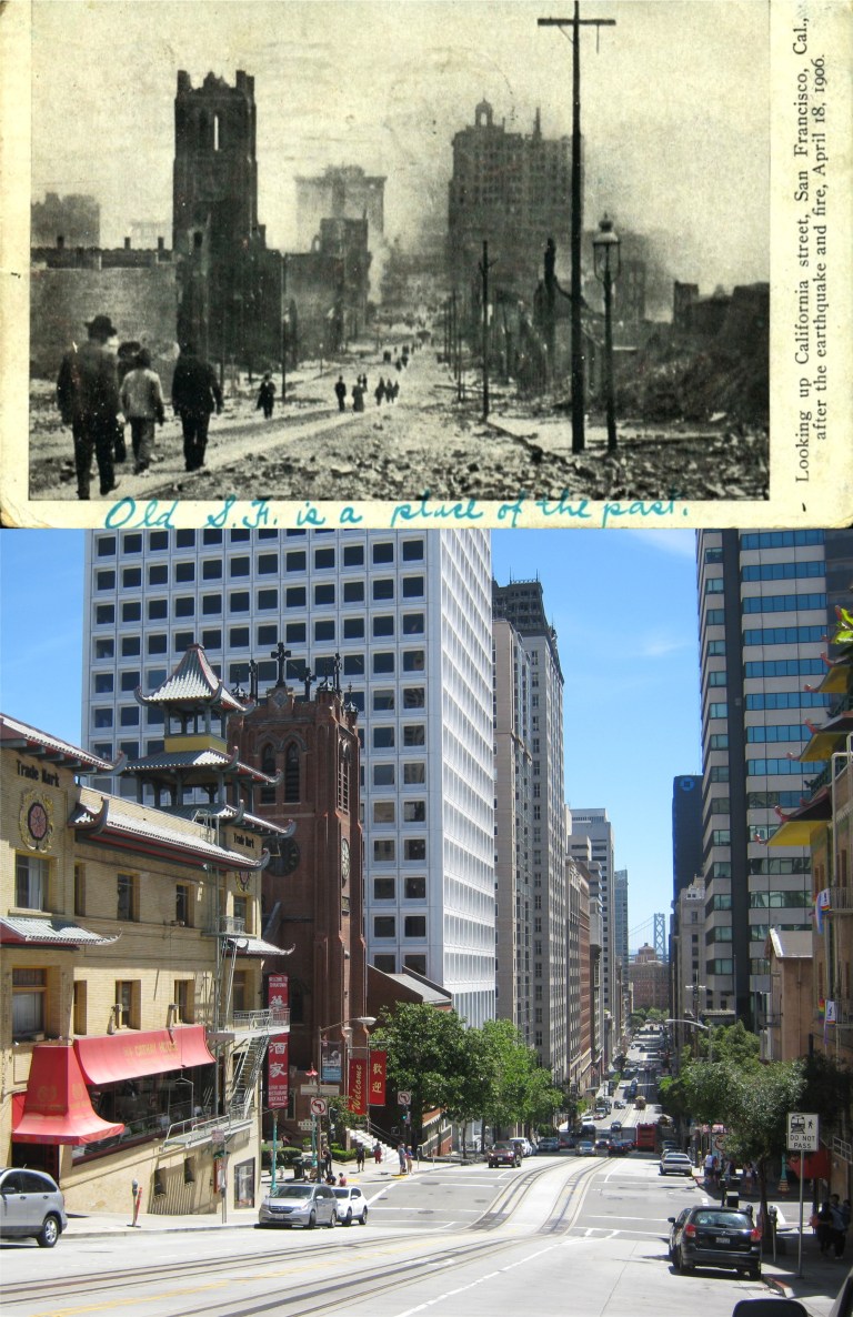 Looking down toward Grant Avenue and a burned out St. Mary’s from the south side of California Street: “Old S. F. is a place of the past.” That was probably true; the tong wars and opium cribs of Chinatown were gone, some of the corrupt politicians that ran the town would be forced out of office or put in jail, and Bank of America was founded by a. P. Giannnini. (I used to work for them so I thought I’d throw that in.) Have you spotted the goof up yet? The picture isn’t looking up California Street, but down California Street.
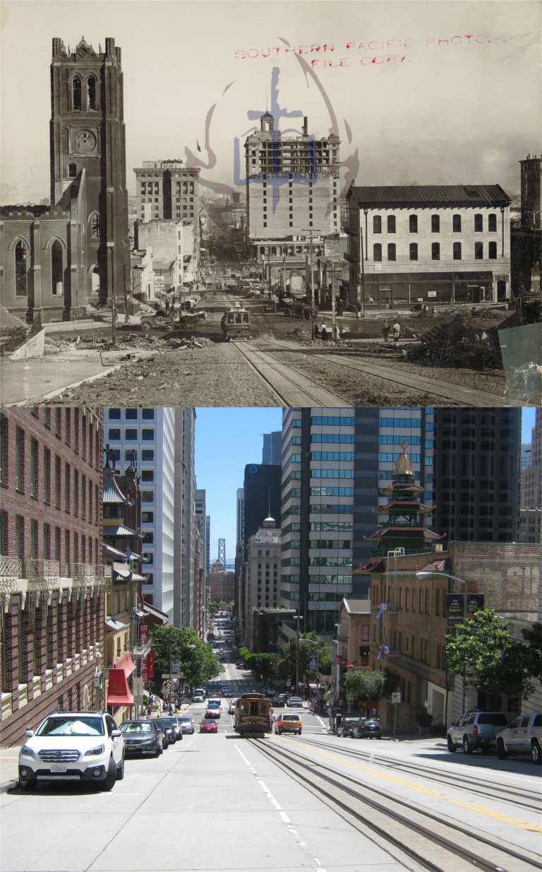 A photo from the Old St. Mary’s Church website shows the beginning of the rebuilding of San Francisco from the north side of California Street, although, St. Mary’s is still in ruins.
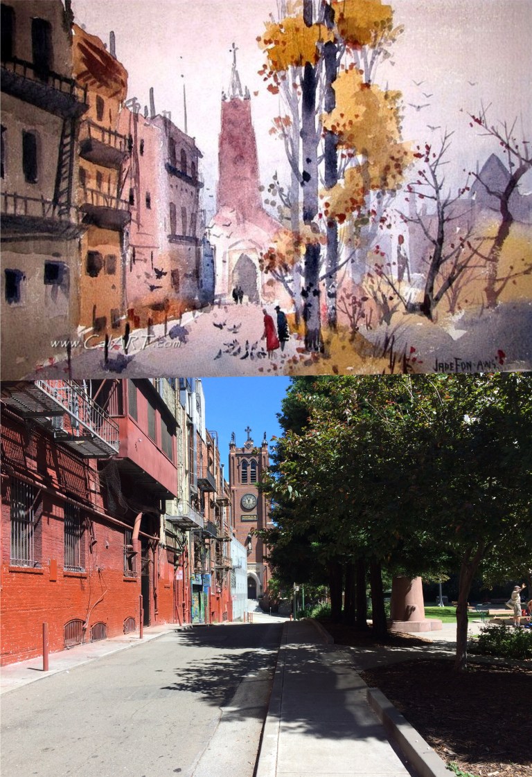 Jade Fon was a artist that I learned of when researching for this blog post. He painted a number of images around Chinatown in the 1940’s and 1950’s, but I haven’t learned the date of this painting from the CalArt.com collection I found on Pinterest. Jade took a little artistic license here with his image of St. Mary’s from Quincy Alley that runs past St. Mary’s Square between Pine and California Streets, but that’s okay. You can see Beniamino Bufano’s statue of Sun Yat-sen in St. Mary’s Square on the right in the painting. Only the pedestal of the statue can be seen through the trees from here today.
 The statue of Sun Yat-sen in 1959 and today: (Vintage photo by Fred W. Clayton)
 One of San Francisco’s legendary figures, “Emperor” Norton collapsed and died during the period of his “reign” In front of St. Mary’s on the corner of California Street and Grant Avenue, (then called Dupont Street) in 1880.
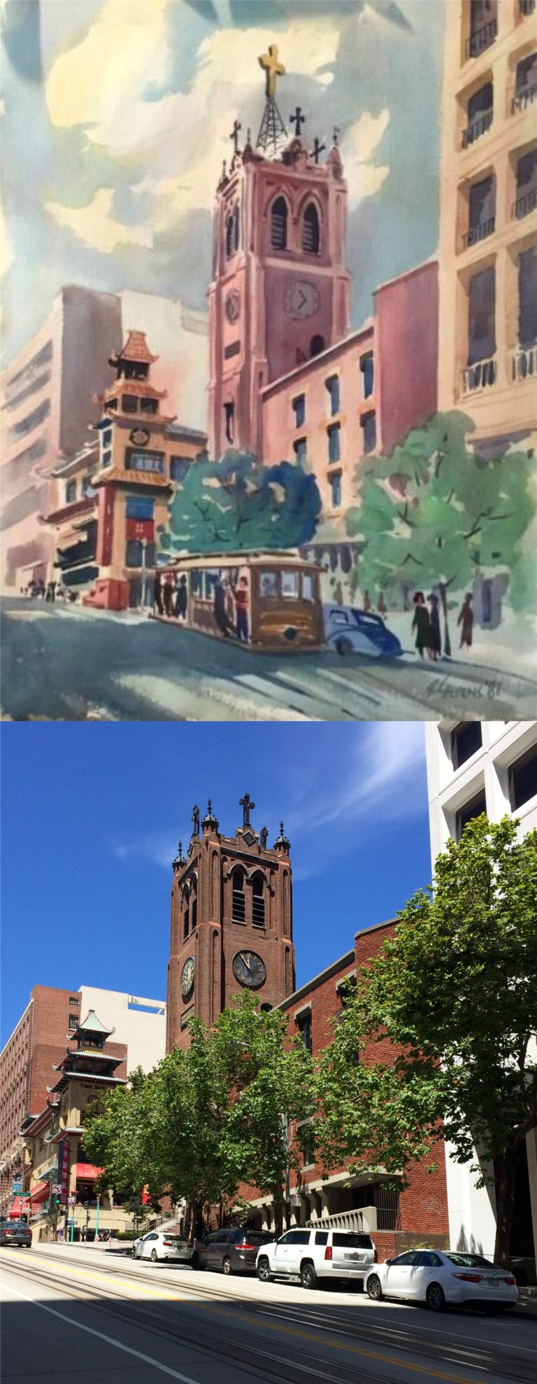 A painting of St. Mary’s Church looking up California Street, (this time we are looking up California Street) from 1981:
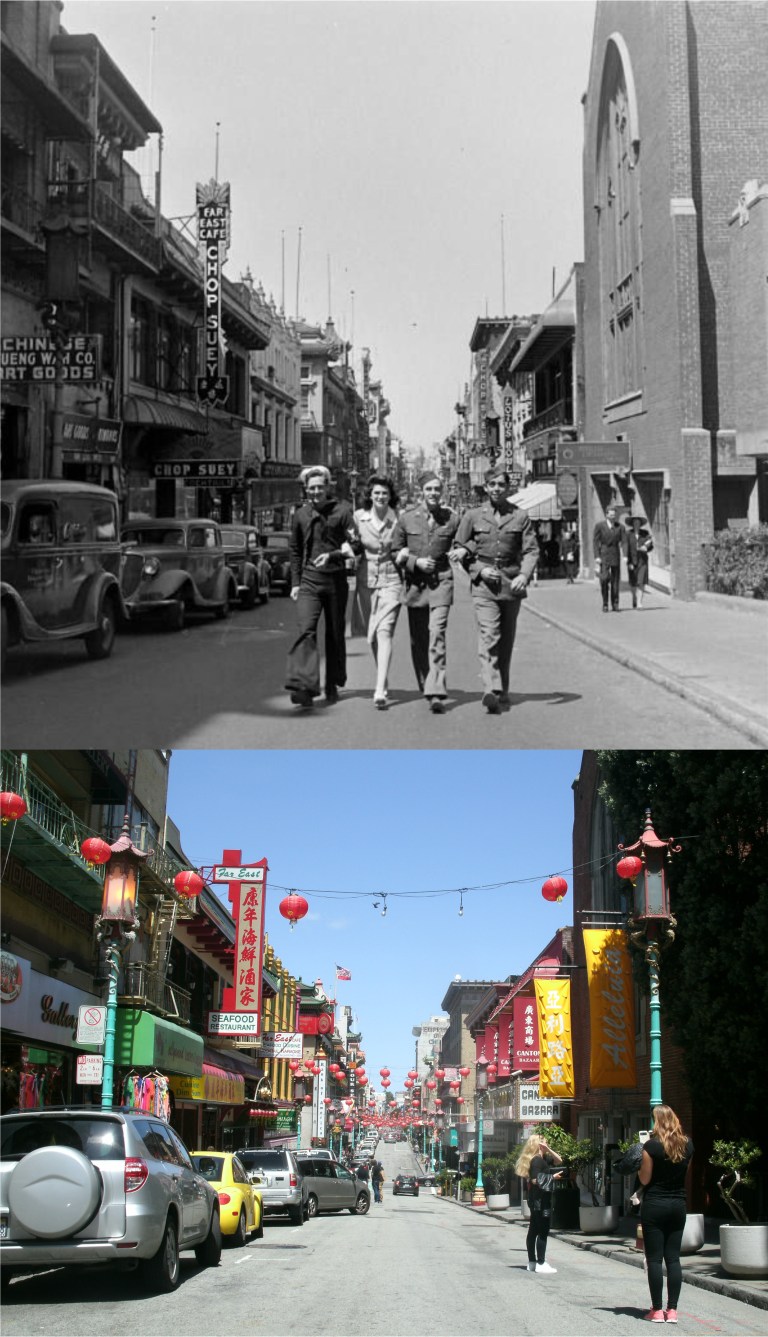 A picture at the west side of St. Mary’s on Grant Avenue taken in 1943 during World War Two from a blog entry I posted in October of 2016:
 Inside St. Mary’s Cathedral in 1927: I couldn’t get a picture from the balcony because it was locked but it’s still just as impressive from pew level.