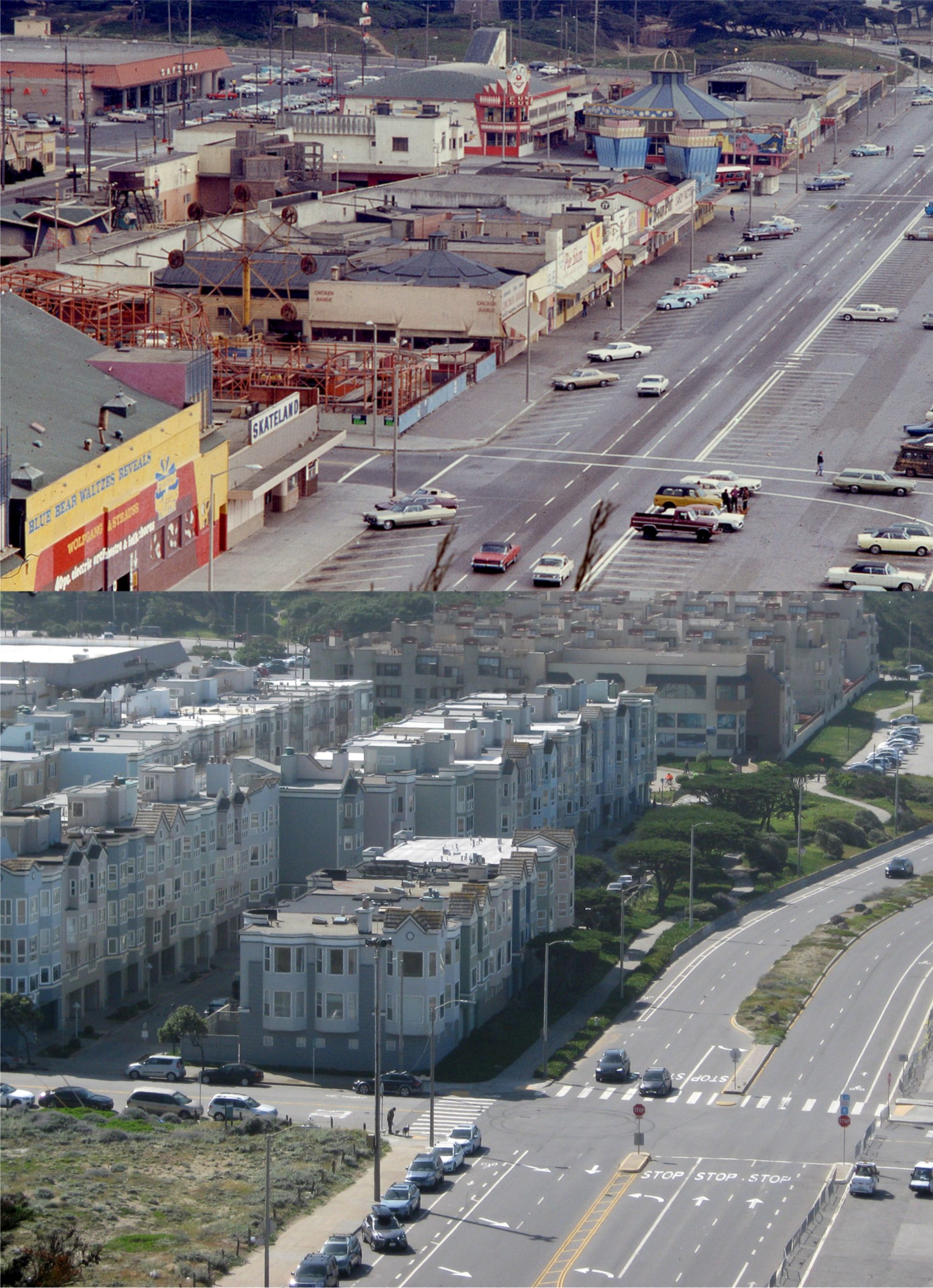
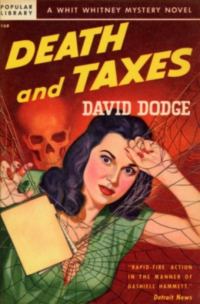
Although, for about the third year in a row the Internal Revenue Service has found a way to postpone the second part of that famous axiom, temporarily. The latest update is that the IRS will not process any tax returns until January 29th 2018. That gives me a little time to catch up on my reading. While perusing through Don Herron’s excellent book ‘The Literary World of San Francisco and its Environs’, I learned about a series of mysteries written by David Dodge from 1941 until 1946 featuring an income tax accountant named Jim “Whit” Whitney. In the first book, ‘Death and Taxes’ written in 1941, Whit and his partner of their accounting firm, George MacLeod, are promised a large bonus if they can gather information concerning an overpayment of taxes four years earlier by a murdered bootlegger, and file an amended return for a refund for overpaid taxes due to the estate. Apparently, people had four years to amend tax returns in 1941, unlike the three years allowed today. After MacLeod is murdered in the 4th Chapter, Whitney becomes a clay pigeon for the murderer himself as he races around San Francisco and other Bay area locations to solve the murder, and also to collect the information he needs to amend the original return for the bonus of $50,000.00 that will now be all his. Whit is a likeable fellow, (well, most tax accountants are lovable characters) but he drinks an enormous amount of booze throughout the book. If I drank as much as Whit does, every one of my clients would be audited! I’ll go through some of the highlights for you without giving away too much information to spoil the ending.
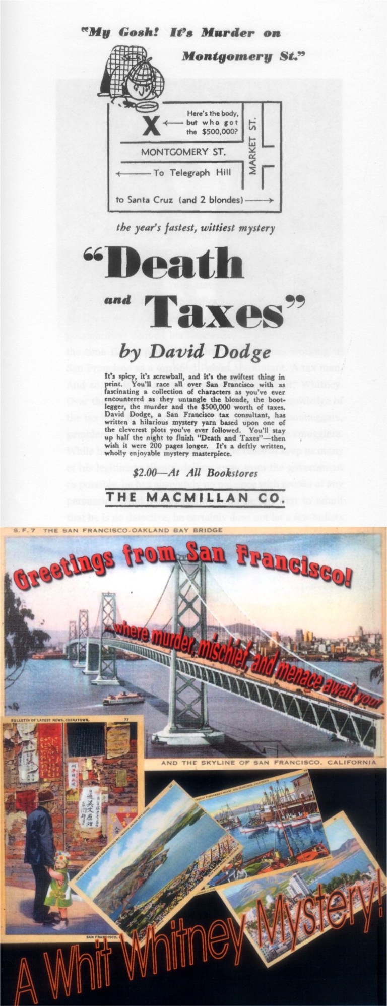 These are two illustrations from the most recent publishing of the book. The top image looks like it may have been from the first edition in 1941. Among the postcards from the back cover is one showing the Bay Bridge. The way the words “where murder, mischief, and menace await you” move across the bridge is prophetic concerning the denouement of the story.
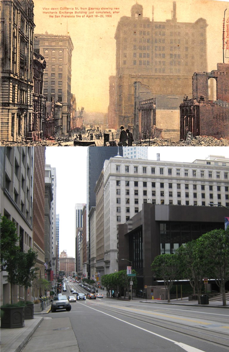 Whitney and MacLeod worked on the eighth floor of the Merchants Exchange Building on the south east corner of California near Montgomery Street. The building is called “The Farmers Exchange Building” in the series. Built in 1904 and a survivor of the 1906 Earthquake and Fire, the Merchant Exchange Building is the tall brown building second from the corner on the right in my photo. The grey building in front of it is 300 Montgomery Street. This may have also been where their office was because the book often refers to its location as being at “Montgomery and California Streets”. Both pictures were taken near Kearny looking down California Street.
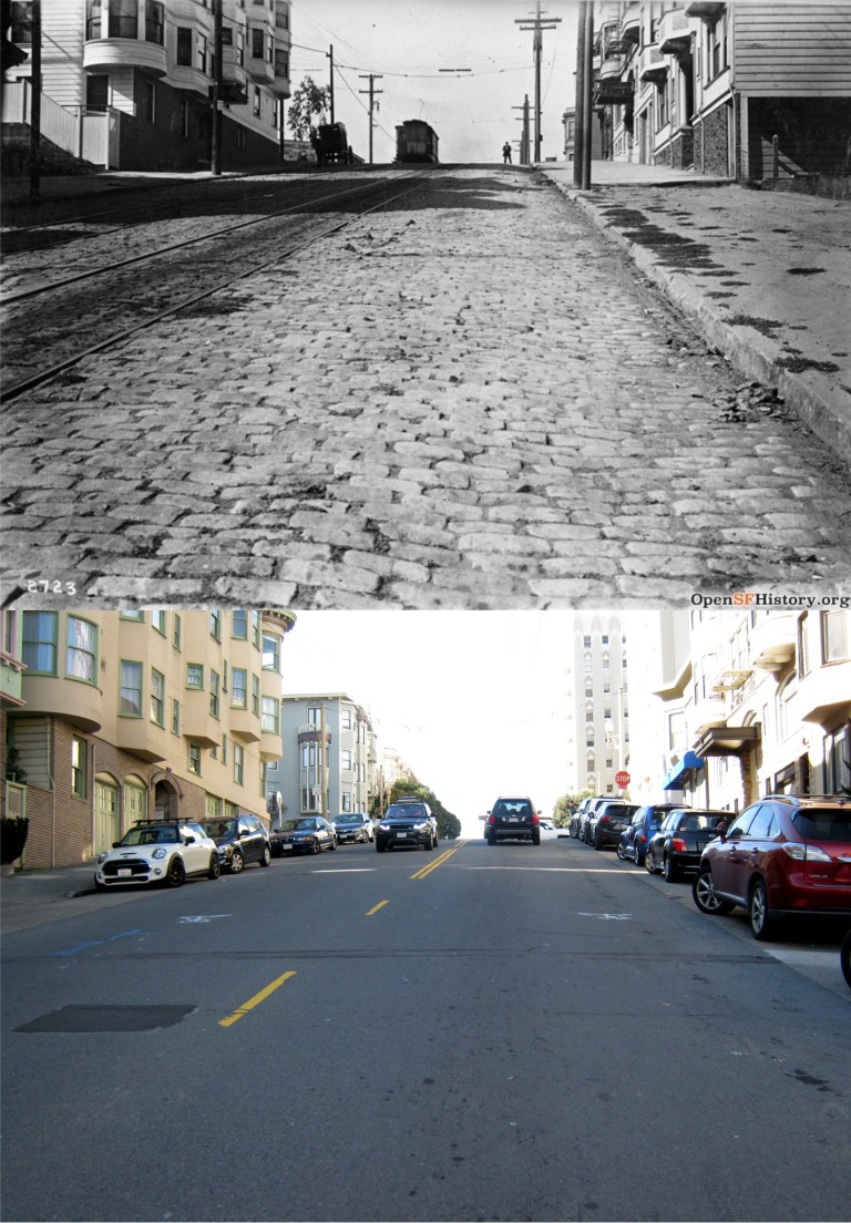
 In the second book in the series, ‘Shear the Black Sheep’ written in 1942, Whitney catches a cable car at Montgomery and California Streets heading up Nob Hill. He narrates one of the most descriptive accounts of a cable car ride I’ve ever read! (after ‘The Ballad of the Hyde Street Grip’) I don’t know if you can pack a hundred people on a cable car, but it’s nice to think so.
{A cable car was creaking up California Street. Whit stepped off the curb, dodged a delivery truck, broad-jumped a pool of water and caught the car as it rattled by at a steady six miles an hour. The Saturday afternoon exodus from the financial district was in full blast, and he had to squeeze to find standing on the step that ran the length of the open car. A hundred people clinging to the straps, railings and protuberances of a vehicle designed to accommodate forty left not much room for the next man, but Whit was an old cable car rider and managed to get a handhold and both feet planted on the step. By keeping all of his muscles tensed he could hold his head far enough inside the car so that the rain dripping from the edge of the roof hit the back of his coat instead of his face. In that familiar position he hung on as the car crawled up the thirty degree slope of Nob Hill, while the wind played merry hell with his coat-tails.}
The vintage picture was taken where Whit caught the cable car around the same period. (OpenSFHistory.org)
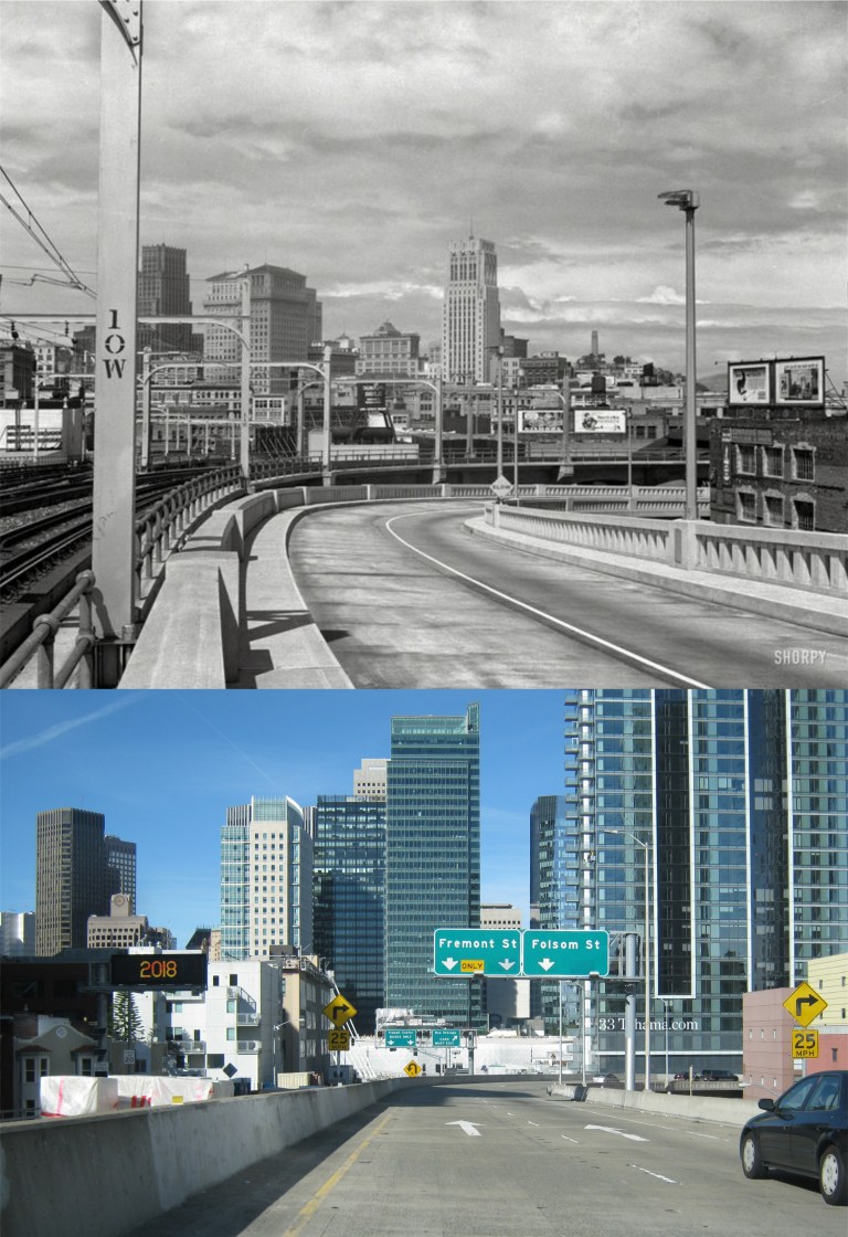 Back to ‘Death and Taxes’ and more of the story: In one of their trips back across the Bay Bridge from the East Bay in search of clues, Whit and the police exit at the First Street off ramp, now the Fremont Street off ramp.
{The police car turned down the First Street ramp, and its tires sang as the driver pulled it around the curb. At the bottom of the ramp they turned left, crossed Market and started up Front Street.}
In the vintage picture taken by Dorothea Lange you can see the Russ Building, the Standard Building, the Shell Building and Coit Tower, none which can be seen from the exit today.
 Whitney is assigned a bodyguard by the police named Larson. After a dinner in North Beach they drive up Union Street to Russian Hill to visit Marian Wolff, one of the main characters and suspects in the book. Heading up Union Street they turn left onto Leavenworth. As they park at Marian’s apartment a passing car fires a shot into their car seriously wounding Whitney. The vintage photo is looking west on Union street where they turned left onto Leavenworth taken in 1910. You can see some of the wooden boards on the building with the bay windows in the upper left in the current photo. (OpenSFHistory.org)
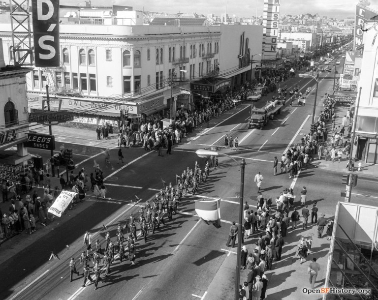 One of the highlights of the novel is a gunfight involving a car full of bad guys and police in the intersection of 22nd and Mission Streets. Lieutenant Webster in a car with Whitney riding along are tailing a car with suspects as it approaches 22nd along Mission from the north. A third car pulls along side of the car the police are following it enters the intersection. Suddenly, the number one suspect, an airplane pilot named Carpenter is spotted standing in front of a drugstore on the corner of 22nd and Mission by Webster.
{Webster held a gun in his lap and waited for a break. When the Buick was halfway across 22nd he saw the aviator standing in front of the drugstore. He said, “Jesus, it’s Carpenter” kicked open the door of the sedan and jumped into the street.” “The Buick was opposite the drugstore and as the gunman in the rear seat leaned forward to shoot at Carpenter, the brown touring car speeded up and hit the Buick’s rear bumper. The bullet shattered the drugstore window two feet beyond Carpenter. The aviator pulled a gun from under his arm, fired twice at the Buick, and ducked back around the corner. He was running diagonally across Twenty-Second Street when Webster took careful aim and shot him in the leg.}
A long descriptive gun battle follows in the 22nd and Mission Street intersection between the cops and bad guys leaving smashed up cars and one of the hoodlums dead. The vintage picture from OpenSFHistory.org shows traffic heading into the intersection at 22nd Street coming north from Mission in the 1940’s. Another OpenSFHistory.org picture at 22nd and Mission Street taken in 1961 shows that there was a drugstore on the corner of the intersection once.
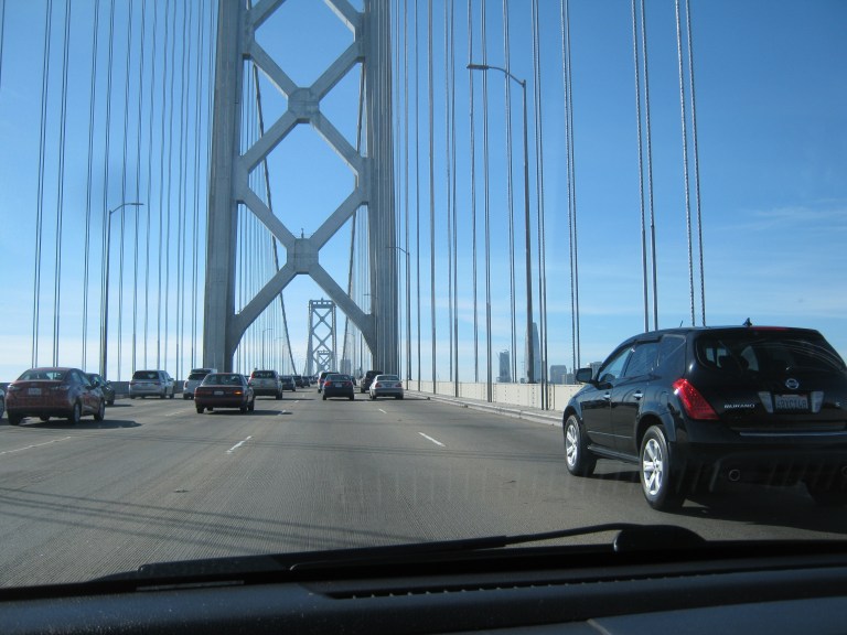 The finale of the book involves a chase between police and the murder (or murderess, I’m not giving anything away) east along the Bay Bridge. That was what I was referring to earlier about the old San Francisco postcard with the words racing across the upper deck of the bridge. They would be heading toward where I’m driving here, but on the left side because the upper deck was two-way traffic in 1941.
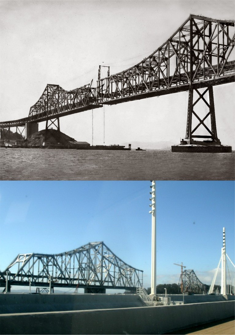 The chase moves into the old cantilever span of the Bay Bridge heading toward the toll gates on the east side of the bridge. The vintage photo is of the cantilever bridge nearing completion in 1936, and a photo I took from the new eastern span of the bridge when they were demolishing the old section.
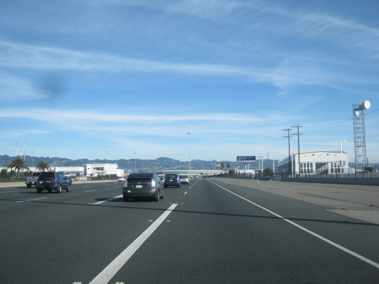 The chase ends at the toll gates on the Oakland side of the bridge. Back then cars paid a toll when they entered the Bay Bridge from Oakland and again when they left the bridge returning to Oakland about where I’m approaching.
{The siren wound up to an ear-splitting shriek. Men moved quickly at the toll-gate and a bar across one of the entrances swung away.” “Whit looked at the narrow passageway between the concrete pillars of the gate and closed his eyes. The siren howled, the car bucked suddenly and they were through. Whit swallowed and opened his eyes again. He looked back to be sure the gate was in one piece.}
I’d better close it off now before I reveal too much, but needless to say Whit ends up celebrating with a lot of highballs and a pretty girl.
 We’ll start at the southwest corner of Golden Gate Park and the old stone streetcar bridge that used to span what is now Martin Luther King Jr. Drive, circa 1910. Behind the bridge is the Murphy Windmill. The bridge was anchored into the hill on the left in my photo. Charlie Chaplin filmed a scene driving under this bridge in his 1915 comedy ‘Jitney Elopement’. (Vintage photo, C. R. Collection)
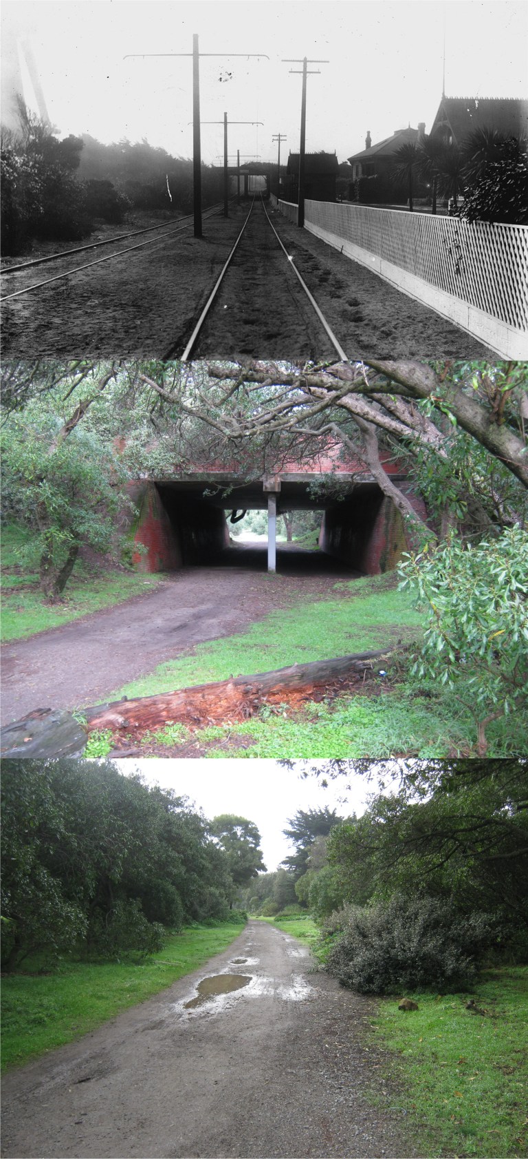 The streetcar line ran along the western side of Golden Gate Park and passed through a tunnel under what is now John F. Kennedy Drive. The vintage photo is looking north toward the tunnel from the tracks in 1903. To the left can be seen the Dutch Windmill at the northwest side of the park. The buildings on the right side of the tracks are gone now. You have to get closer to see the tunnel from where the tracks ran today, as in my middle picture. The third picture at the bottom is looking back along where the streetcar line ran. (Vintage photo, C. R. Collection)
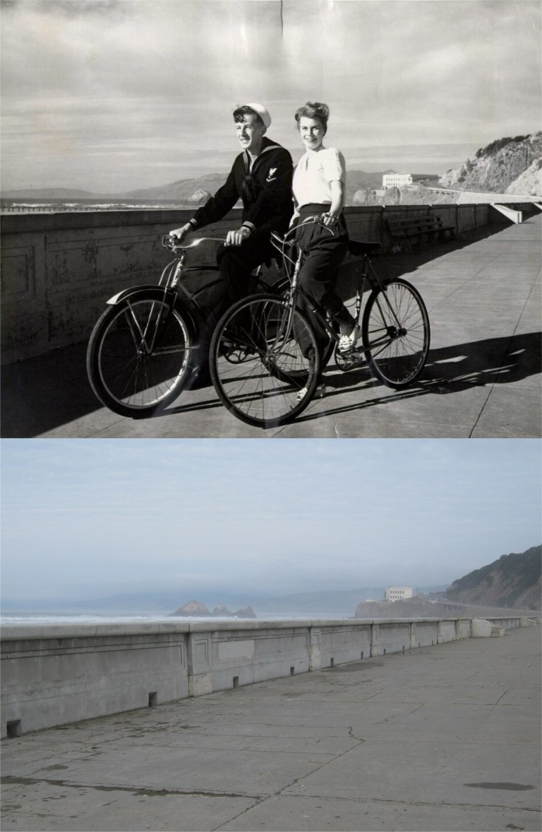 Hey, those are two-built-for-bicycles! They were riding along the sand barrier between Ocean Beach and the Great Highway in 1955 just down from the Cliff House.
 This picture is looking north down Fillmore Street from Broadway in 1903. It’s still a breathtaking view today. (Vintage photo, C. R. Collection)
 One of the historical essays on FoundSF.org is about a sit-down demonstration by military prisoners in the Presidio stockade during October of 1968 that became known as the “Presidio Mutiny”. After a suicide-by-armed-guard by one of the prisoners that was classified as being justified, twenty seven of the stockade prisoners participated in a peaceful demonstration outside of the stockade. FoundSF points out that many of the prisoners were misfits who should never have been in the army, but their treatment by the guards was undoubtedly brutal. Here, one of the prisoners reads a list of their demands. Behind him is the old Fort Winfield Scott, seen from the stockade today in my picture. (Vintage photos, Steve Rees)
 The vintage photo here is of the prisoners being given orders to end their demonstration. This is the spot where the “Presidio Mutiny” took place. Three things can be seen in both pictures; the stairs, the Golden Gate Bridge, and the stockade building on the right.
 In the end the prisoners were dragged back to the cells by other army soldiers. Some were given additional prison sentences ranging from six months to sixteen years. Over a year later their convictions were overturned and their sentences reduced to time served.
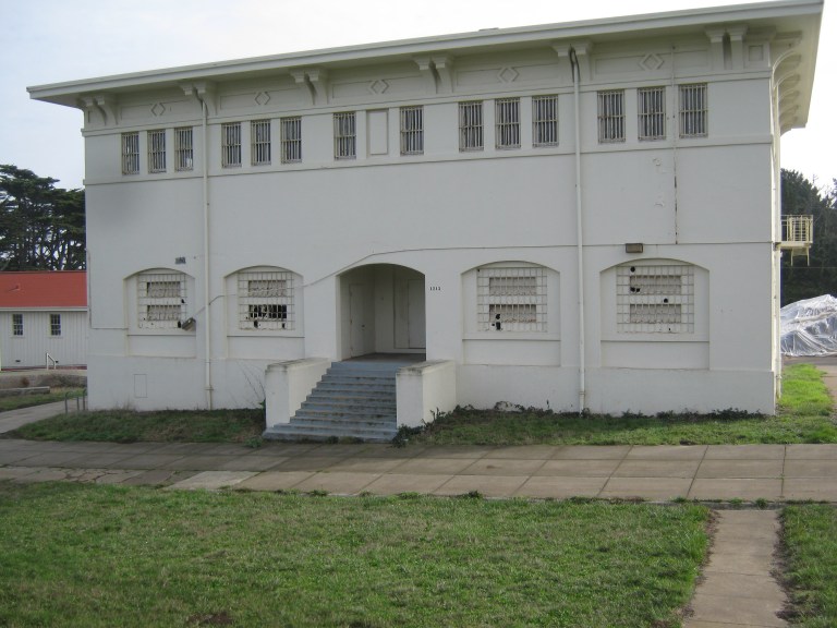 The Presidio stockade today, building 1213, empty and spooky to walk around:
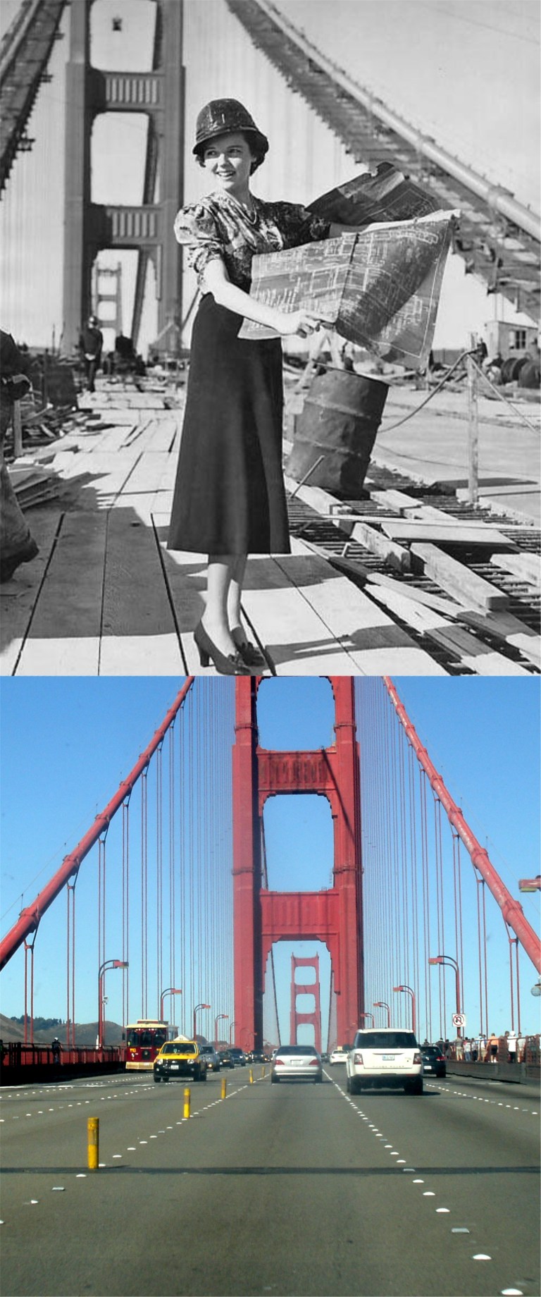 Actress Jane Wyatt pitches in on construction work for the Golden Gate Bridge in a publicity photo from 1937. She did a good job! (Pinterest)
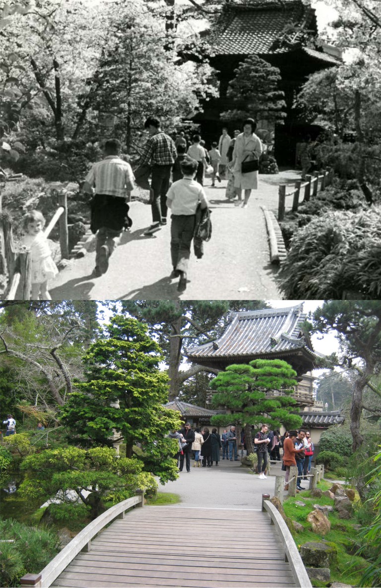 The main entrance to the Japanese Tea Garden from inside the attraction in March of 1966: (SF Gate, SF Chronicle)
 They still sail boats at Spreckles Lake in Golden Gate Park like they did in the 1930’s, but most of the boats aren’t as well crafted as those in a vintage picture from the Shorpy Collection.They’ve smoothed out the shoreline of the lake now, but I think it looked more natural before.
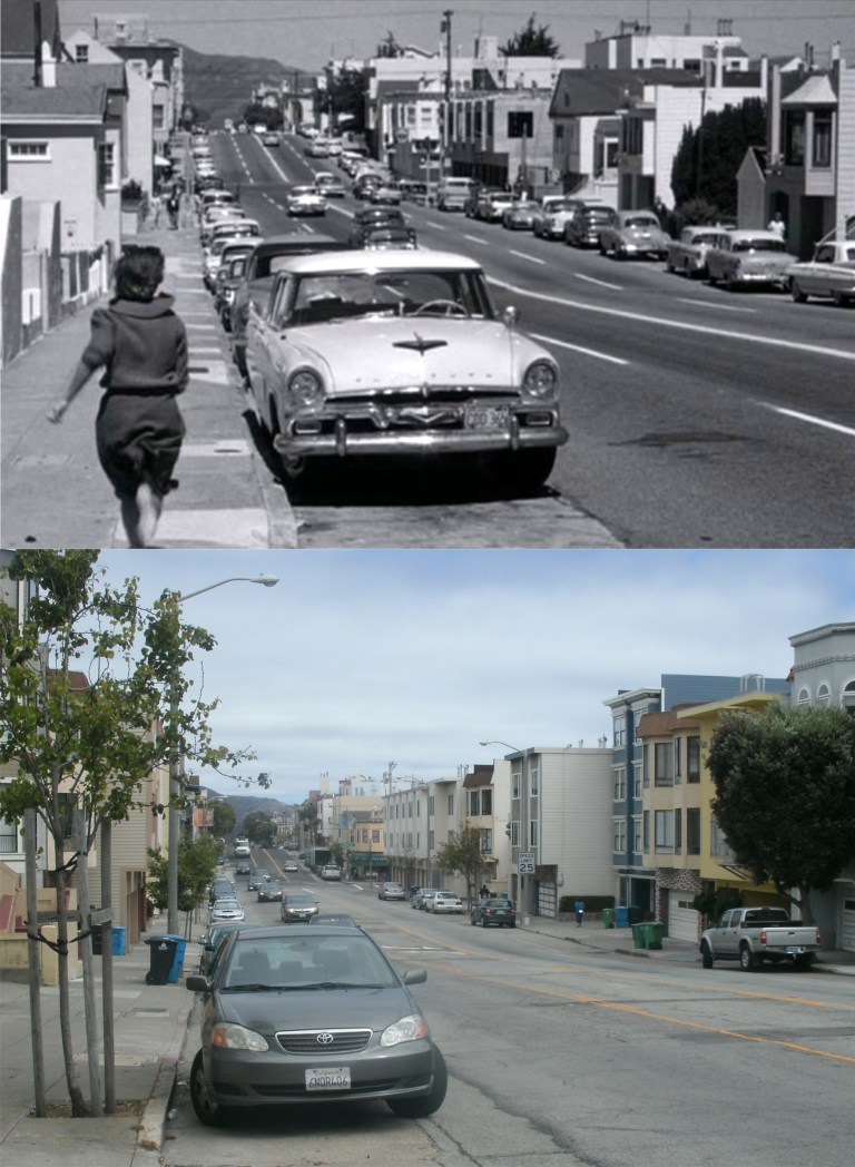 Stefanie Powers has fallen right into Ross Martin’s trap as she races down 25th Ave. toward Clement Street in the Richmond District in the 1962 thriller ‘Experiment in Terror’. Powers believes that her sister played by Lee Remick has been hurt. When she nears Clement Street Martin kidnaps her.
 Kim Novak taking a break during filming of the Fort Point attempted suicide scene from the 1958 film ‘Vertigo’. One used to be able to get to the exact spot where the scene with Kim Novak jumping into the Bay was, however, since 9/11 the Golden Gate National Recreation Area doesn’t let visitors get that close to the Golden Gate Bridge anymore. (Cinephiliabeyond.org)
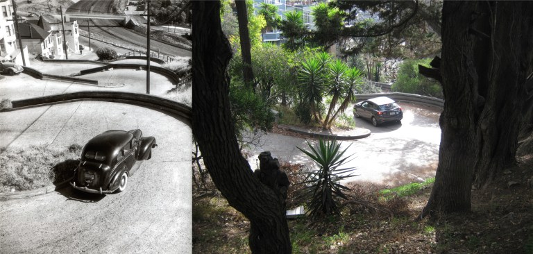 We’ll start out at the crookedest of crookedest streets in the world, Vermont Street on Potrero Hill. This street has tighter turns than the more famous Lombard Street on Russian Hill. I drove down Vermont for the first time Christmas day and you do have to drive slower than when on Lombard. The vintage picture is by photographer Fred Lyon.
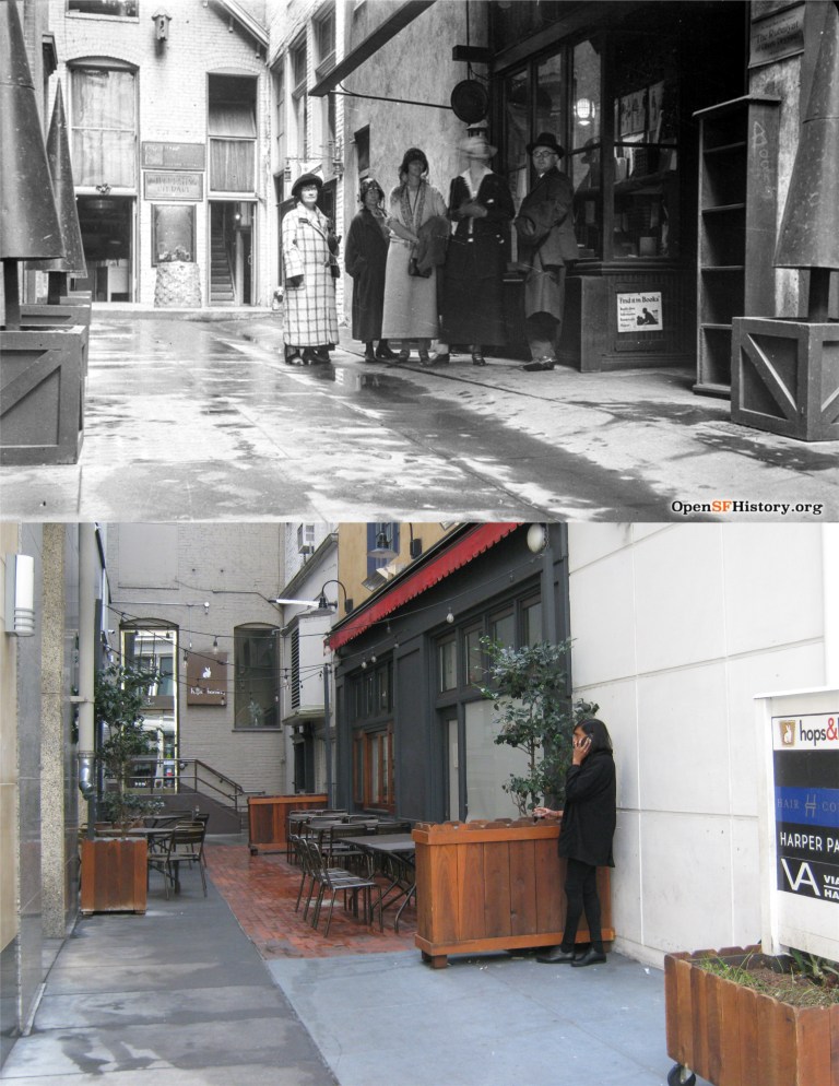 Tillman Place, off Grant Avenue circa 1925: I’ll bet I’ve walked past this alley a hundred times and never paid attention to it. It’s interesting how they had crate-like stands in the vintage picture and fence-like stands today. (OpenSFHistory.org)
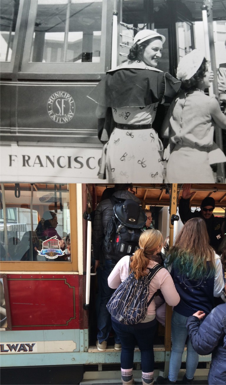 Young ladies hopping on a cable car in the 1930’s and these days: The hair styles and color may be a little different.
 The Moon Bridge in the Japanese Tea Garden in Golden Gate Park, probably near when the attraction opened in 1894: Three of those four Victorian ladies were really pretty! Well, let’s face it, the one on the right wasn’t. She’s like one of those blind dates you get when friends describe your date as “She (or he) is really nice!”
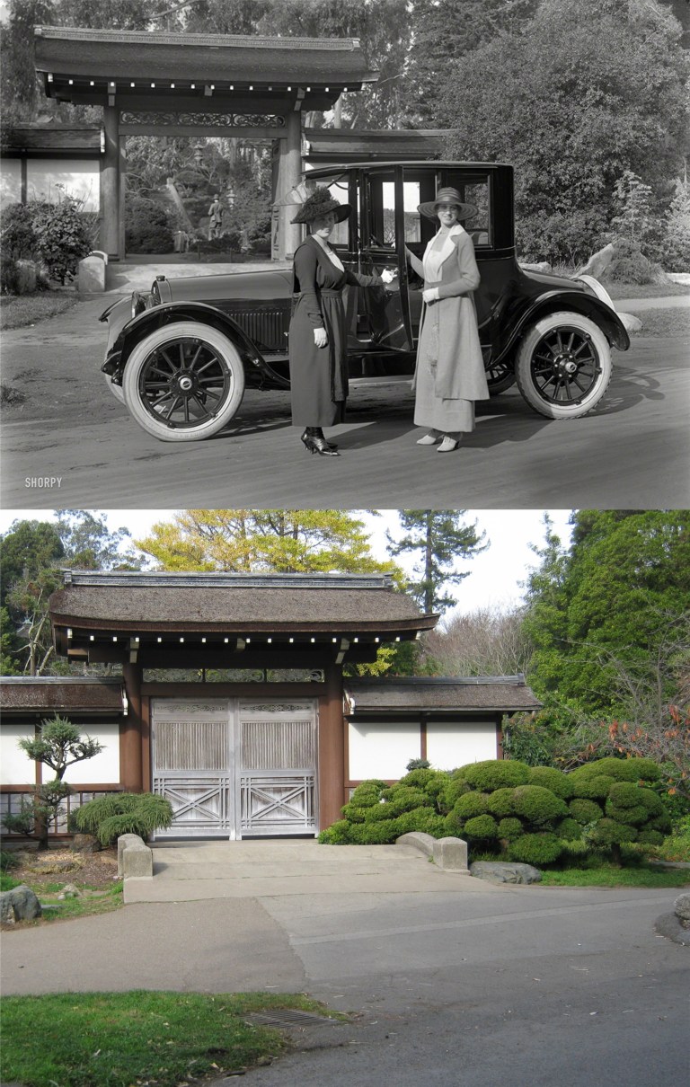 Speaking of the Japanese Tea Garden, here are a couple of ladies from the 1920’s in front of the old and now closed off entrance to the attraction in a photo from the Shorpy Photo Archive. I could easily spend time doing nothing but then and nows on the terrific pictures from the Shorpy collection!
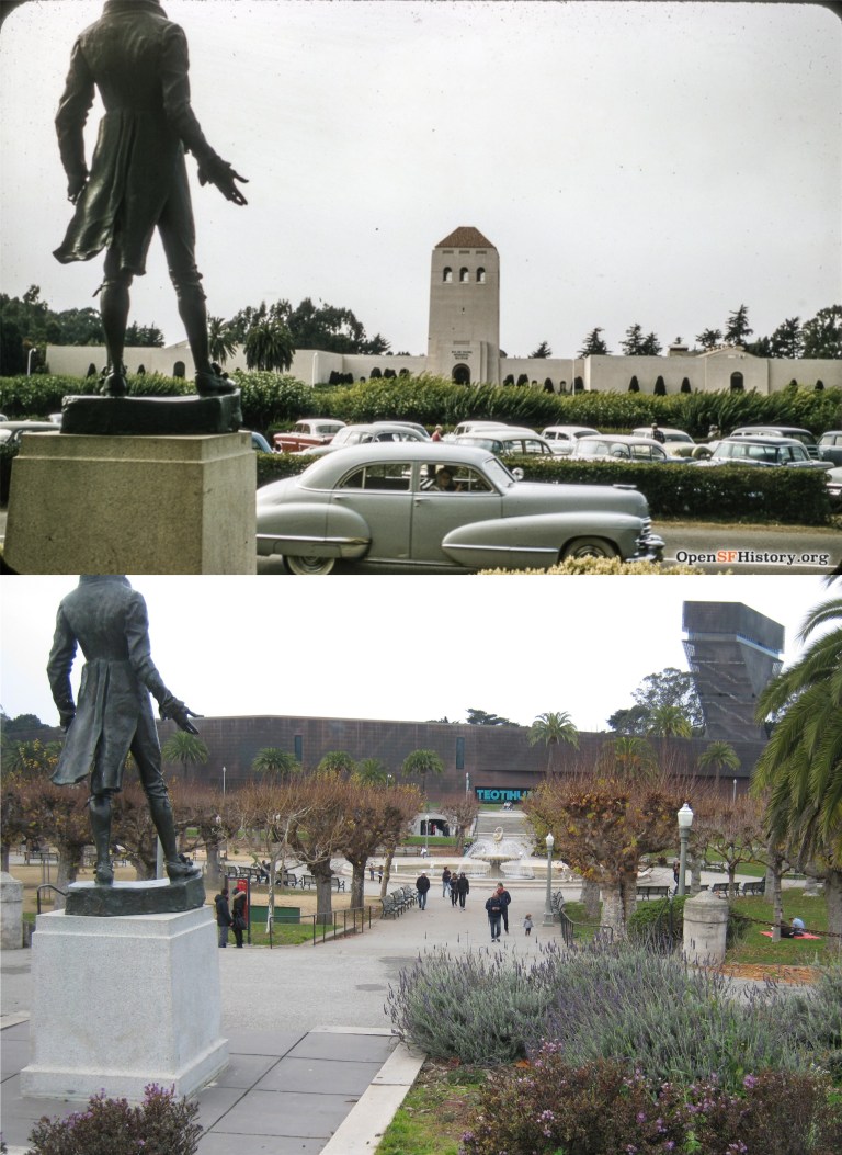 An OpenSFHistory.org photo of the old de Young Museum taken from the California Academy of Science circa 1954: I could easily spend time doing nothing but then and nows on the terrific pictures from the OpenSFHistory.org collection! Oh, wait, I already said that about the Shorpy Archive in the previous picture. The statue the two pictures were taken behind is of Robert Emmet, an Irish patriot executed in Dublin in 1803.
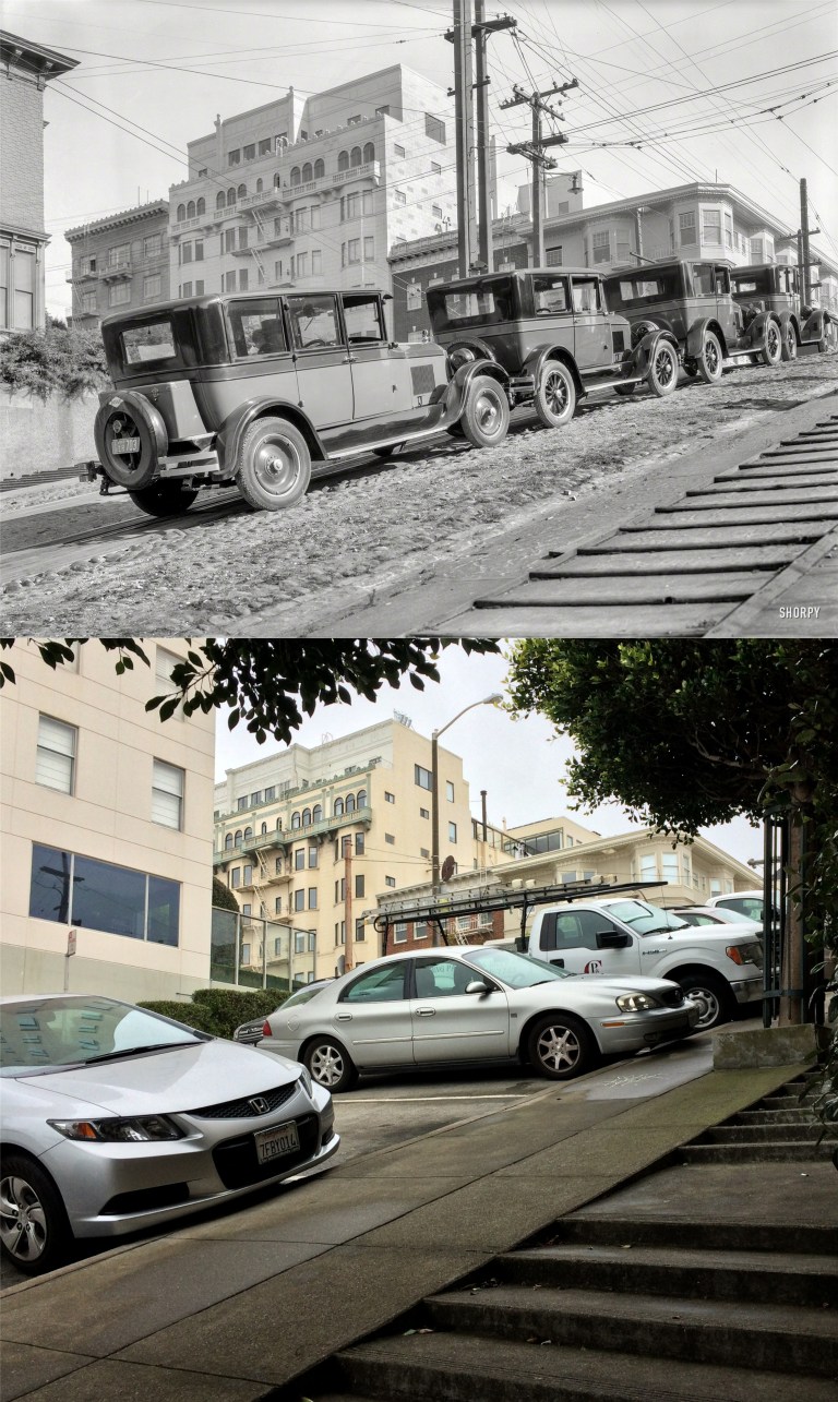 Here’s another picture from the Shorpy Archives on Broadway near Fillmore Street. What intrigues me about the vintage picture most is how would the two cars in the middle have gotten out if the cars behind them didn’t leave first?
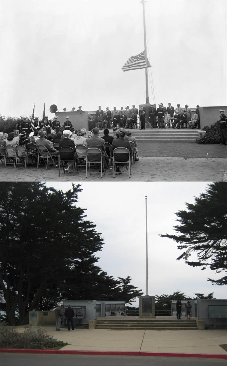 On a more solemn note, at Lands End near the Cliff House is the shell blasted part of bridge of the cruiser the USS San Francisco. In November of 1942 during a naval battle at Guadalcanal, Rear Admiral Daniel Callaghan and 76 other officers and sailors were killed aboard the San Francisco by shelling from ships of the Japanese naval force. The USS San Francisco made it back to port for repairs and the wings of the damaged bridge are now part of the memorial at Lands End. They point directly toward Guadalcanal. The vintage picture from the San Francisco Chronicle is of a ceremony at the memorial in 1956. You can see holes from shell damage to the bridge to the left of the flagpole in my photo.
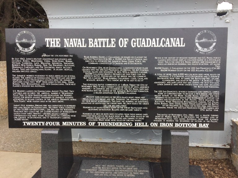 Here’s the story about the USS San Francisco on a marker at the site.
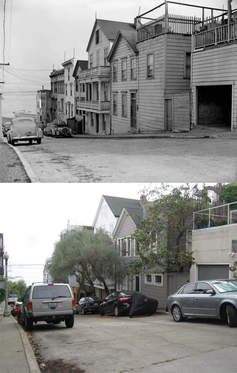 Here are some of the old houses on Alta Street that were saved from burning after the 1906 Earthquake and Fire. Legend has it that many of the houses on Telegraph Hill were saved from the fires by residents who poured wine on them to dampen them before the flames approached. These may be a few of them.
 Union Street just off of Montgomery in the 1940’s: Margaret Parton moved into the second house from the left and spent a year writing about her adventures in San Francisco just before Pearl Harbor in her book ‘Laughter on the Hill’. You can still see that house just behind the stairs in the center of the current picture. I posted a story about her book in my September 6, 2016 post. (Vintage photo from the Charles Cushman Collection)
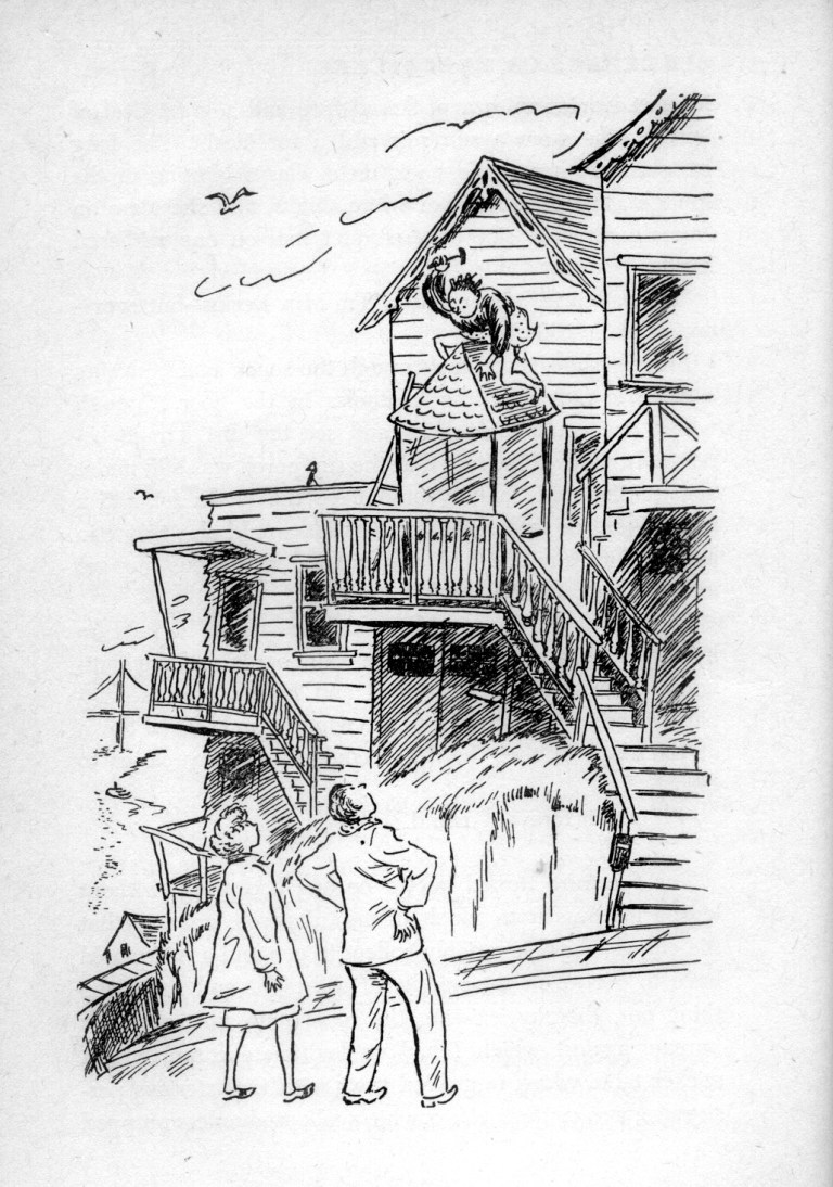 Here’s a cartoon from ‘Laughter on the Hill’ of Margaret Parton deciding if she’s going to move in.
 A film noir looking picture of Montgomery Street looking south toward Union Street in the 1950’s: I’m not positive but this might be a Fred Lyon picture. His pictures are usually clearer than this, but I found it on Pinterest and it is probably a copy of one of his pictures.
 This 1930’s picture is looking the opposite way from the previous picture, north along Montgomery from Union, during the 1930’s.
 The classy looking Neautra-Kahn Apartment on Calhoun Terrace in the 1940’s: You don’t turn around when you drive into this street, you back up, and you do it very carefully or you may end up driving off Telegraph Hill!
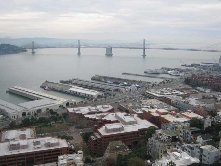 Now I’ll offer you the closest thing I can get to a virtual tour of San Francisco from the air. They open many of the windows now at the top of Coit Tower so you can get fantastically clear pictures of San Francisco when you look out the openings! (Just don’t look down) We’ll start by looking southeast across the Embarcadero to the Bay Bridge.
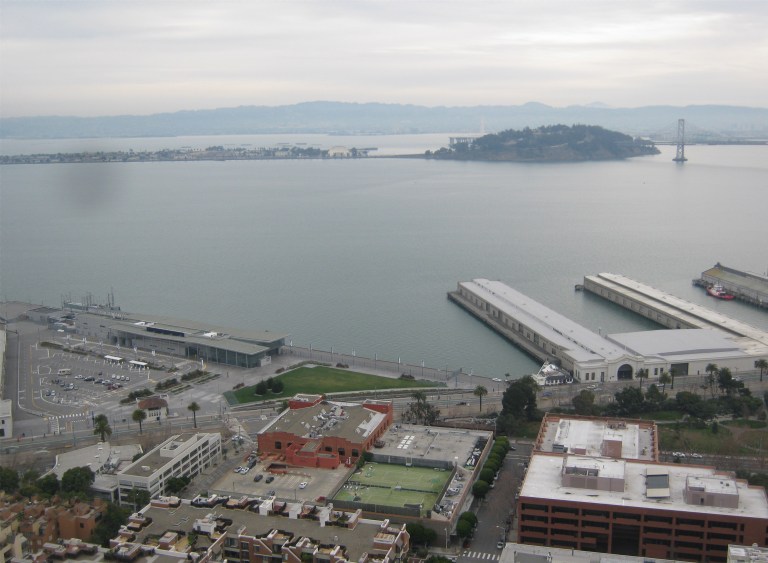 Moving counter clockwise we’re now looking east toward Yerba Buena and Treasure Island.
 Looking northeast we get a great view of Pier 39, Alcatraz, and Angel Island.
 Looking roughly north is Fisherman’s Wharf, too good not to zoom in on. The two ships from World War Two berthed at Pier 45 are the submarine the USS Pampanito, and the Liberty Ship the SS Jeremiah O’Brien.
 Looking northwest you’ll see the Golden Gate Bridge and Russian Hill. At the top of the second street from the left coming down Russian Hill is Lombard Street, “The Crookedest Street in the World”, if you don’t count Vermont Street on Potrero Hill.
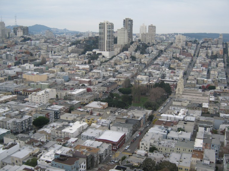 Looking west is the heart of North Beach with Washington Square and Saints Peter and Paul Church.
 Southwest is Nob Hill.
 Directly south is Downtown San Francisco. That little cluster of buildings on the right is Chinatown.
 We’ll end up where we started from and a terrific view of the Ferry Building.
 The “Hyde Street Grip” at Chestnut Street on Russian Hill, looks like in the 1960’s: I snapped my picture a split second too soon for a perfect comparison, but the cable cars were running slow and it was too cold up there today to wait for another one heading downhill. (Vintage Everyday)
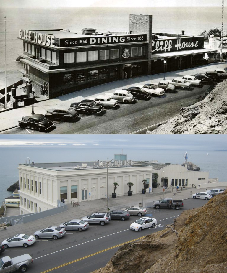 The Cliff House in the 1950’s: I haven’t been able to get a full frontal of the restaurant from Sutro Heights since I’ve been taking pictures because of the trees that block the view today. However, in November I found a walking trail that winds along the Sutro Heights mountainside that allows hikers to get a clear view if the Cliff House like long ago.
 The Powell and Market Street cable car turnaround in the late 1960’s: December’s cold weather in San Francisco made the cable car passenger line even lighter this week than in the 1960’s. (Vintage Everyday)
 The San Francisco Skyline from the Bay in the mid 1970’s and during Fleet Week, 2017:
 San Francisco Bay looking east from Telegraph Hill in 1880: No Treasure Island, no piers, and no Bay Bridge.
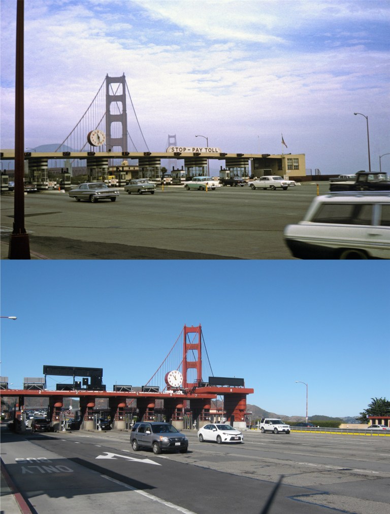 The art deco Golden Gate Bridge Toll Booths in the 1950’s: Although they’re obsolete now, I hope they keep them; they’re as much a part of the bridge as the famous span is. (Vintage Everyday)
 A suitor on a scooter! This is near the approximate spot he was chugging up in the Life Magazine picture, Lombard Street, just down from “The Crookedest Street in the World”, but a little further down the street in order to get the view today. The building behind his left shoulder is the building the couple are walking past in my photo. In the background is Telegraph Hill with Coit Tower and the two spires of Saints Peter and Paul Church in North Beach.
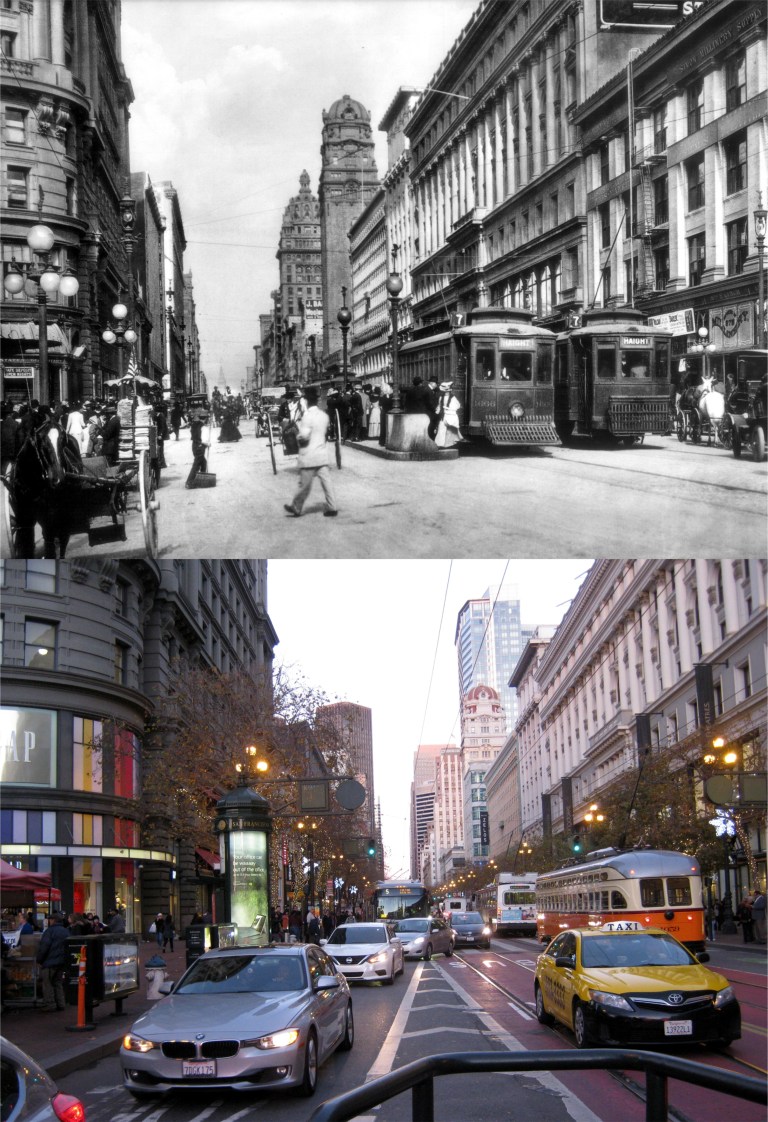 Market Street at Powell circa 1908: On the left is the Flood Building, across Market Street in the center are the towers of the Call and Humboldt Buildings, and on the right is the Emporium Building. (Charles C. Pierce)
 Powell and Ellis Streets at twilight in the 1950’s: (Vintage Everyday)


 Mason and Market Streets looking north toward Nob Hill: (Vintage picture from Monovisions.com)
 Looking east along O’Farrell Street: The domed Call Building in the center was the tallest building west of the Mississippi River at the time. You can see the remodeled Call Building, now called Central Tower, in the center of my photo. (OpenSFHistory.org)
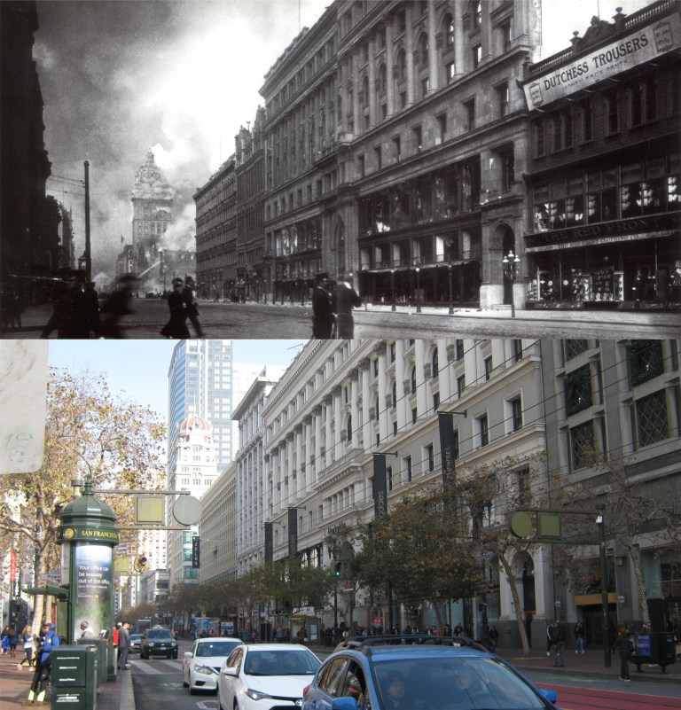 San Franciscans crossing Market Street toward the Emporium Department Building as the fires head up Market Street.: The Call Building is already on fire in the background. (Moulin Studios)
 3rd Street at Mission Street looking north: You can see the Call Building (Central Tower) peeking out on the left in my picture. The old gothic Mutual Savings Bank Building, another survivor, is in the center of both pictures.
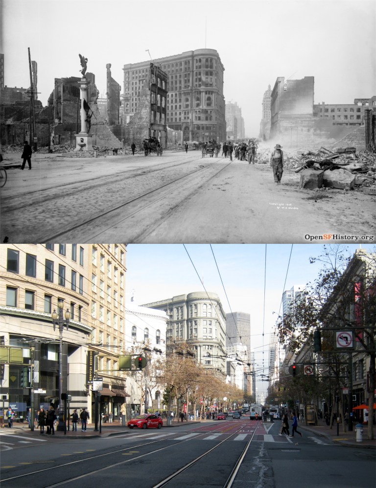 Mason, Turk, and Market Streets looking east: The Admission Day Monument on the left in the vintage picture is now on the corner of Montgomery and Market Streets. (OpenSFHistory.org)
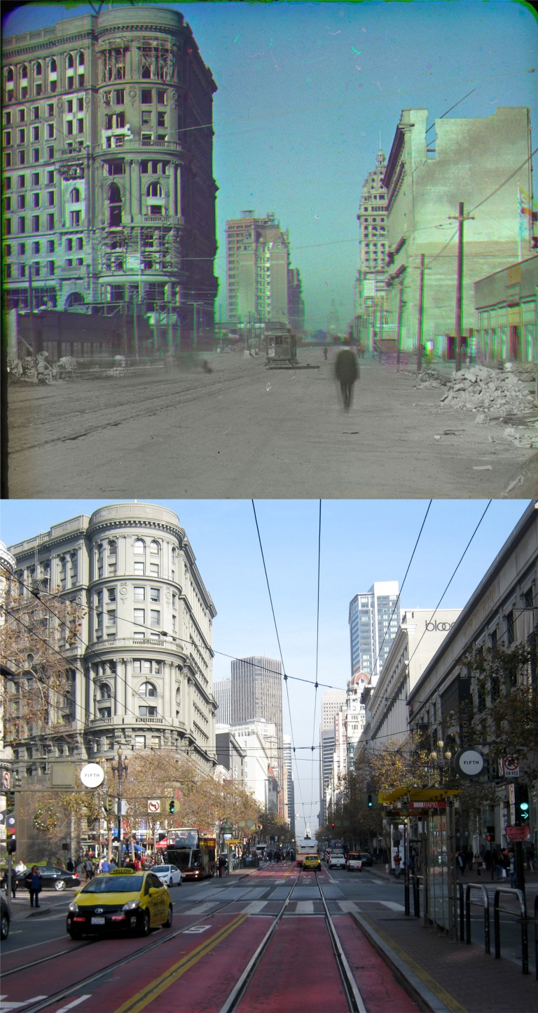 This is a rare early color photo of the San Francisco ruins by Frederick Eugene. On the left is the Flood Building, center is the Mutual Savings Bank, and on the right is the Call Building. (The Smithsonian Museum of American History)
 The Orpheum Theater at Hyde and Market Streets was completely destroyed and has been rebuilt. (Monovisions.com)
 The west side of San Francisco didn’t get off easy, either. The Sharon Building at the Children’s Playground in Golden Gate Park was heavily damaged. The domed Carousel Building is on the left. (SFMTA Photography)
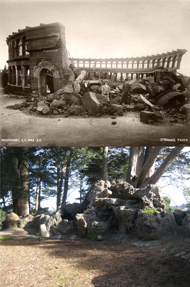 Some things were never rebuilt. At the top of Strawberry Hill in the middle of Stow Lake in Golden Gate Park was where the Sweeney Observatory once stood. It collapsed during the earthquake and is seen here in a picture taken shortly after the disaster. The ruins of the observatory are still up there and can be seen in my picture. It’s always a pleasure to meet people and talk with them when I’m working on these pictures. I met a really nice Park Ranger on top of Strawberry Hill named Ed, and I enjoyed talking about San Francisco history with him for a little while. (Monovisions.com)
 I seem to be going down to Disneyland a lot lately; I think it’s known as “escaping from reality”. I haven’t been down there at Christmas time though since the top photo was taken in 1986.
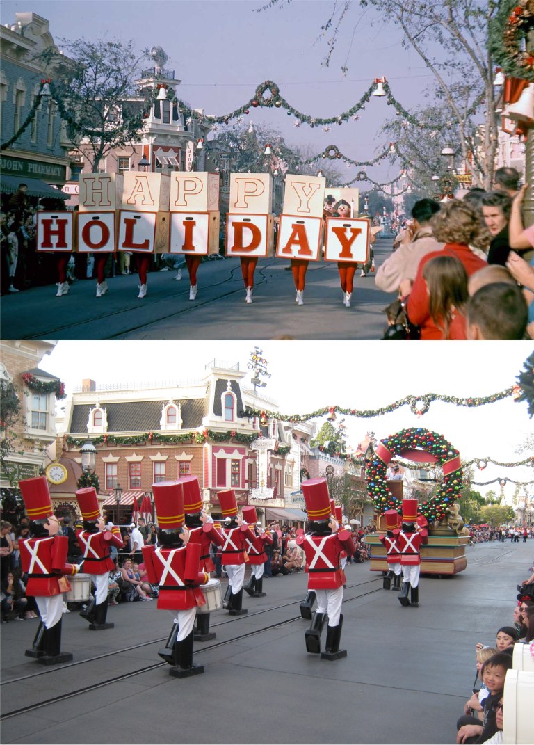 A Christmas Parade in 1961 and a Christmas Parade in 2017: (Vintage picture from Gorillas don’t Blog)
 No Christmas Star on top of the Matterhorn today, like in 1968: You can still see the old People Mover tracks today. (Pinterest)
 The entrance to Frontierland from a slide picture I took in 1983: They’re letting the place get overgrown!
 Another 1983 slide showing Tom Sawyer Island and the Mark Twain Steamboat: They finally reopened Tom Sawyer Island, (now called the Pirate’s Lair) and the Mark Twain is sailing around the island again too.
 The Mark Twain from the Tom Sawyer Island – Pirate’s Lair in 1983 and 2017: I haven’t been out to that island in I don’t know how many years!
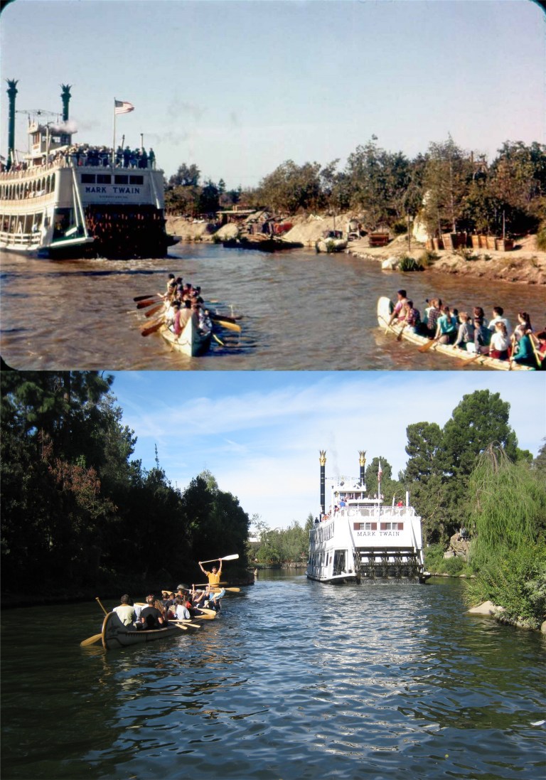 The Indian Canoe Ride following the Mark Twain in the 1950’s: This looks like a photo from the Charles Cushman Collection.
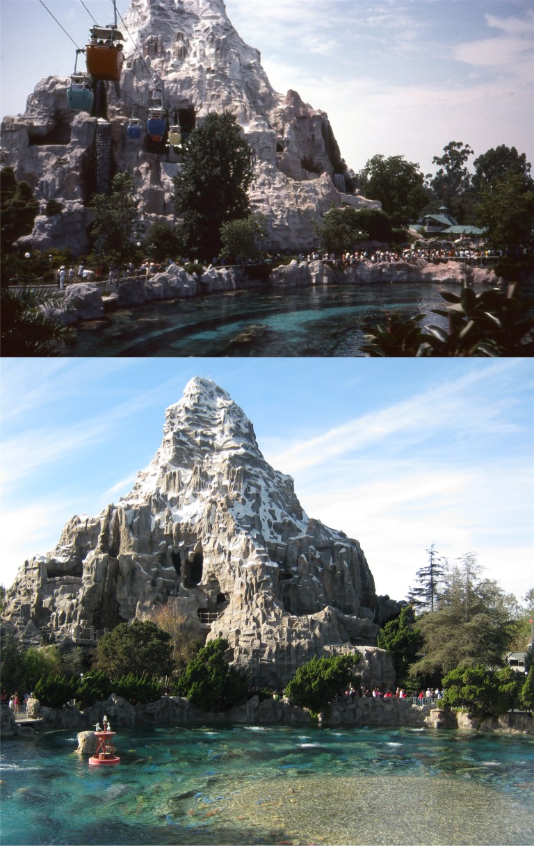 The Matterhorn Skyway in another 1983 slide: I miss the Skyway ride.
 Where the ‘America the Beautiful in Circle Vision’ movie was: I remember seeing that for the first time when I was 16 and thinking that was the coolest thing I’d ever seen! (Duchess of Disneyland)
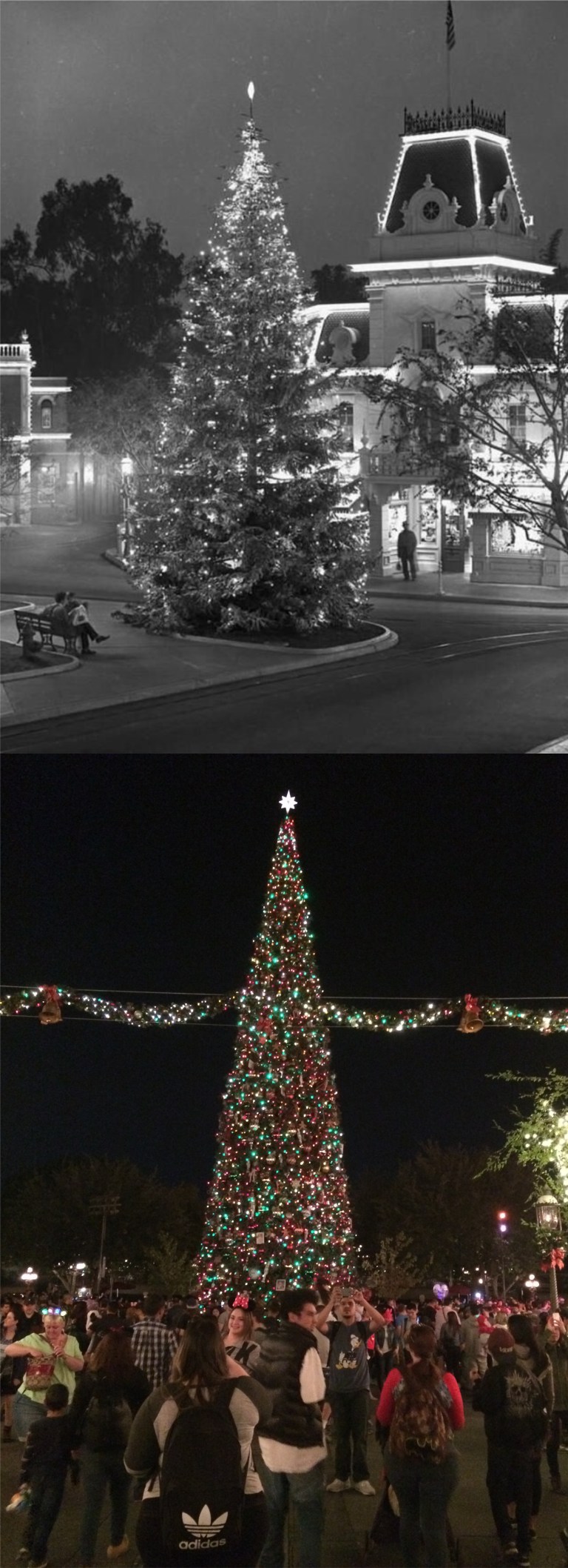 The Christmas Tree on Main Street in 1955, when Disneyland opened, and in 2017:
 Of course, I couldn’t get down there for a visit if it wasn’t for the brave firefighters battling all the L A Fires, and they’re not like the Three Stooges! My brother Kevin and I stopped in Hollywood on the way back to track down a few Three Stooges filming locations that I read about in Jim Pauley’s book about filming locations used by the Stooges. In ‘False Alarms’ from 1936, the Stooges are firemen. Curly gets the bright idea of rolling out the fire hoses across North Larchmont Street at Melrose where they cut by a passing streetcar. Moe’s not going to like this. This is the spot today. (Columbia Pictures)
 Yeah, Moe didn’t like it! (Columbia Pictures)
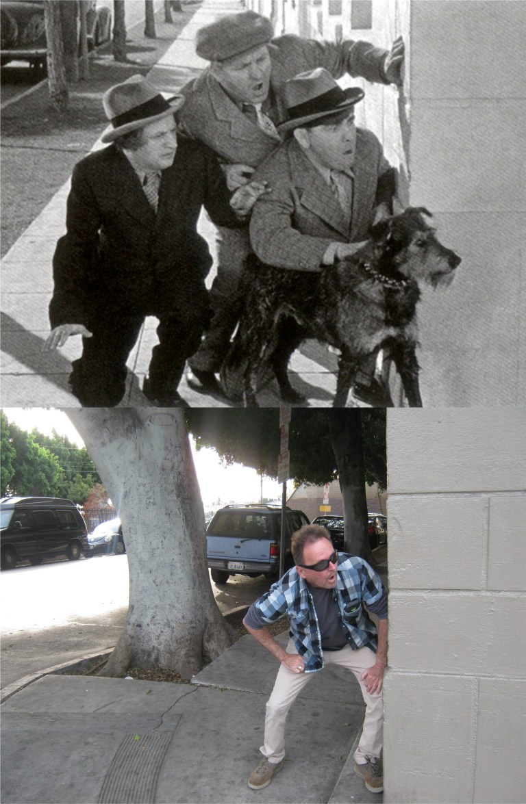 In ‘Calling all Curs’ from 1939, the Three Stooges are peeking around the corner of Fernwood Street and North St. Andrew’s Place trying to find a lost dog named “Garcon” they were in charge of that was dognapped. Those trees sure have grown since the Stooges were there! We met a very friendly security guard at this location named Crisco, and he enjoyed learning that the Three Stooges filmed a scene at his location. (Columbia Pictures)
 Long-ago people from the 1920’s at the Father Junipero Serra statue in Golden Gate Park: (OpenSFHistory.org)
 “Do I have to stop this car?”
 A vintage picture from the Shorpy Collection at Stow Lake with the old Rustic Bridge to Strawberry Hill in the background:
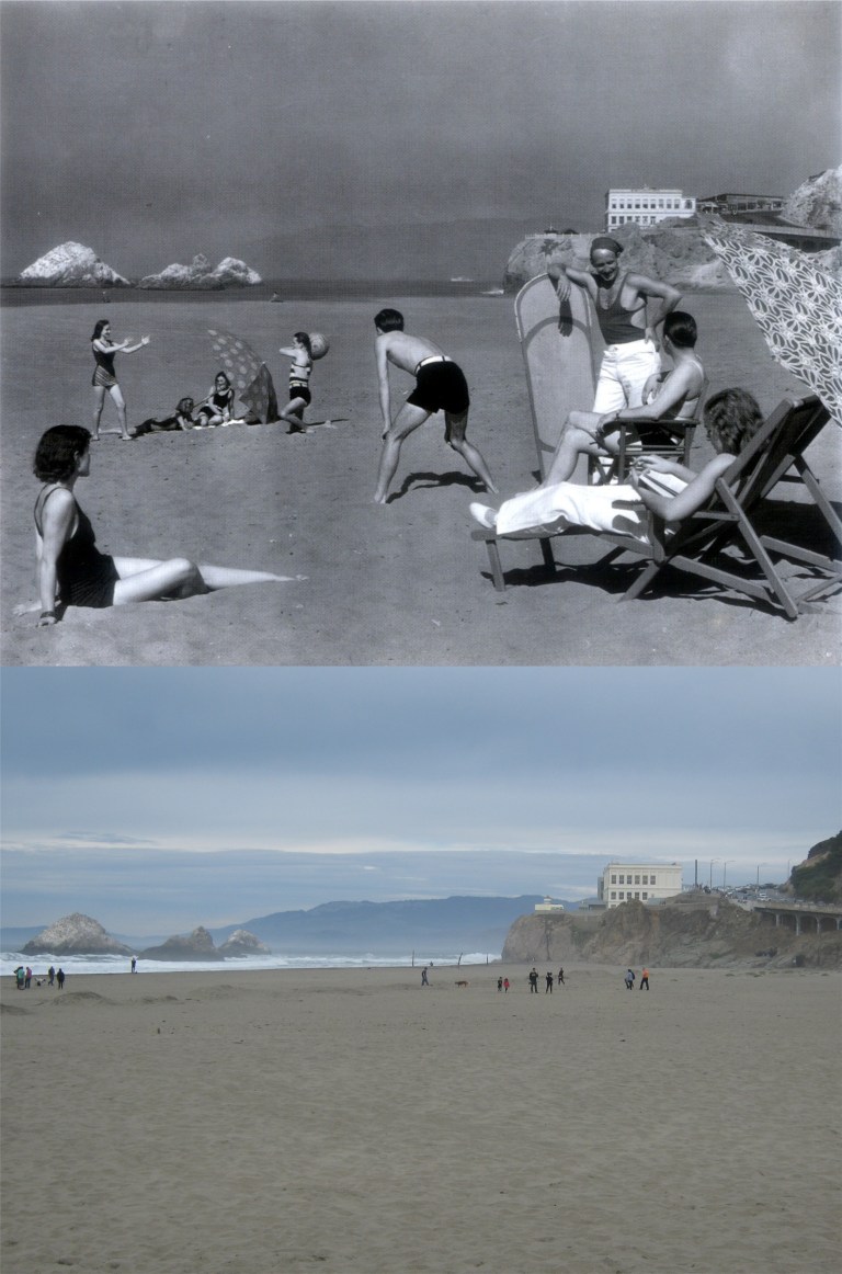 A long-ago family enjoying Ocean Beach in 1939: (Moulin Studio)
 Pedestrians on the Golden Gate Bridge on opening day in May of 1937: Obviously, you can’t walk on the road anymore, (although, I did once in May of 1987 for the 50th anniversary of the bridge) so this is as close of a comparison as I could get. (Moulin Studio)
 Long-ago cars with long-ago people in them: This is on 5th Street between Market and Mission Streets near the old Mint Building. The Pickwick Hotel was where Sam Spade hid the Maltese Falcon before turning it over to the “Fat Man”. The Chronicle Building is in the background on the right. (SF Chronicle, SF Gate)
 Montgomery Street at Sutter looking toward Market Street in the early 1950’s: I tried to compare the people in the old picture from today’s crowd, but the group in the vintage picture all look like people from a film noir movie, and the people in the current picture all look like something from ‘Invasion of the Body Snatchers’ to me. (SF Chronicle, SF Gate)
 Maiden Lane in the early 1960’s and long-ago people who may still be with us, except for the old man on the right: They reopened the old Xanadu Building in September of 2017, the only building in San Francisco designed by Frank Lloyd Wright, after being closed many years. It’s now an Isaia Clothing Store. That’s an interesting suit that fellow on the motor scooter was wearing; it’s like you are looking at it through 3D glasses. (John Whinham Doss)