That’s another quote from Herb Caen. He often referred to San Francisco as a “town”. To me a town is more like Mayberry, Bedford Falls, Midwich Village or something like that. Still, when I went over to the City, I mean the Town, to take these pictures today, I thought about how easy it is to get around San Francisco…… if you’re not driving. Most of the locations here are an easy walk or short Muni ride from each other.
 We’ll start on the southwest corner of Mission at 1st Streets. Across from where I’m standing a Walgreen’s Drug Store now occupies the spot in the building where a Foster’s Restaurant once was located.
 A short ride on the #1 Muni Line from the previous picture will take you up Sacramento Street to Joice Alley between Powell and Stockton streets in Chinatown. Cable cars don’t climb Nob Hill up Sacramento Street anymore like in the vintage picture from the early 1900’s, but Muni # 1 does, and is about the easiest way to get up Nob Hill.
 Half a block up Sacramento from Joice and two blocks left down Powell and you’re at the intersection of Powell and Pine Streets where this picture from the 1950’s was taken. It’s a lot easier walking DOWN Nob Hill! (Americathebeautiful.com)
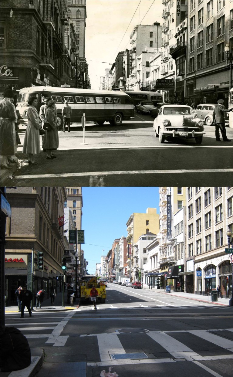 Powell Street heading south down Nob Hill flattens out at Sutter Street where this 1951 picture looking west along Sutter from Powell was taken. The Hotel Cartwright is still there. (SF Chronicle, SF Gate)
 If Bonnie and Clyde would have reached retirement age: (They were jaywalking) This picture is looking west along Mission Street toward 5th Street. The building with the clock in the background is the San Francisco Chronicle Building on the southwest corner of Mission and 5th Streets. (SF Chronicle, SF Gate)
 A block and a half back to Powell and you can catch a cable car for a late afternoon lunch at Fisherman’s Wharf, although I took this picture in March. The cable car line at Powell and Market Streets wasn’t long at all on this “helluva” nice spring day today!
 Well, the 2018 tax season ends today. I’m thinking of dying my hair to cover up the additional gray that developed since January. The computer system of the Internal Revenue Service Department crashed yesterday, so the tax season was extended to today, April 18th, the one hundred and twelfth anniversary of the 1906 Earthquake and Fire in San Francisco. There’s probably significance here, the IRS shakes up a lot of people too. Now I can get back to doing something that’s more fun than telling people, “I’m sorry, you’re not going to get a refund this year!” and that’s blogging. In honor of the occasion, I headed over to Market Street to do a couple of 1906 Earthquake pictures.
 This photo is at Market and Battery Streets looking west. The damaged Call Building and the destroyed Palace Hotel are at the left center. You can still see the rebuilt Palace Hotel and the remodeled Call Building, now called the Central Tower, from here today. (Vintage photo, SF Chronicle)
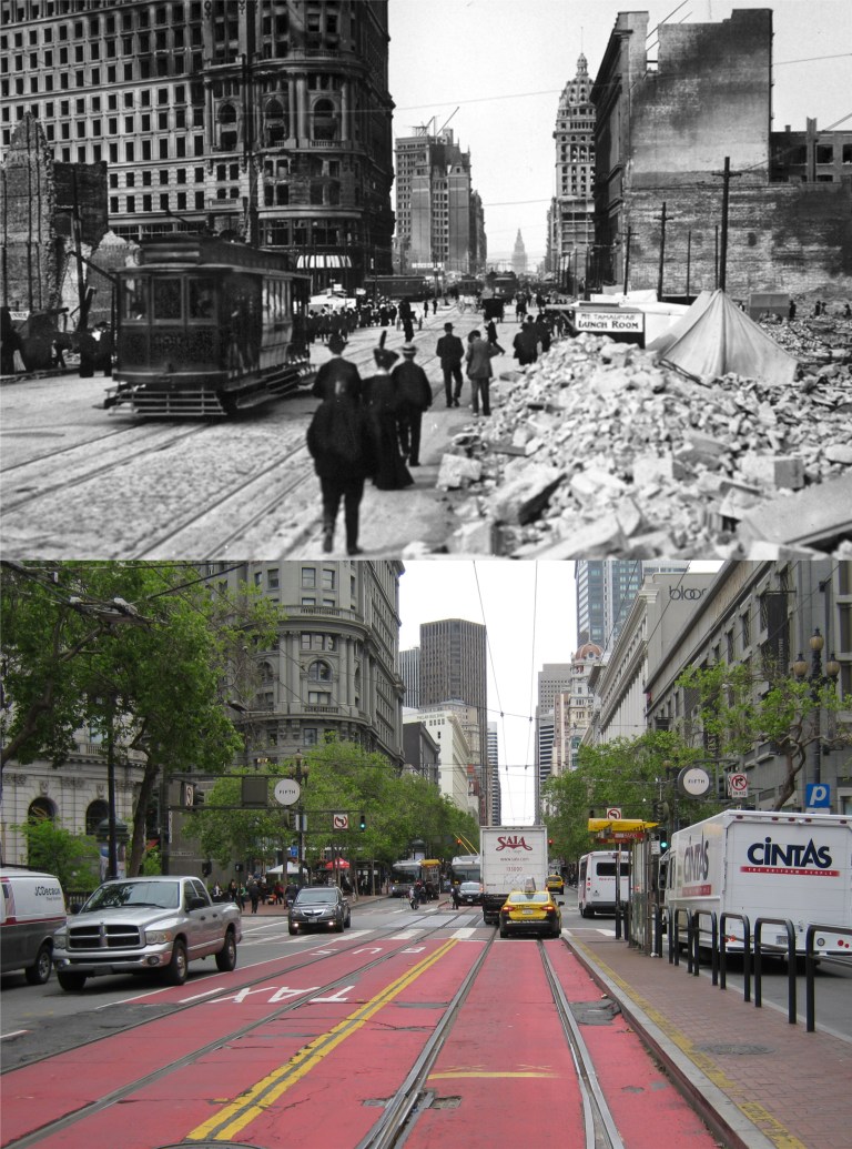 This is looking east on Market Street near 5th. The Flood Building at Powell and Market Streets is at left center. The Call Building on the right, prominent in the vintage photo, is behind the domed Humboldt Building built after the earthquake. The Ferry Building, seen in the old picture, is blocked out by the white freight truck in my photo. (SF Chronicle)
 Recently, I unrolled an old poster that I’ve kept in various closets since Gerald Ford was President. I remember when I bought it long ago I was impressed by the novelty of how all of the buildings in the Downtown San Francisco area had been drawn into it. If you can zoom in on it close there’s a lot of interesting things to see on the difference between San Francisco today and in 1974. At the lower right near the Ferry Building is the Vaillancourt Fountain in Justin Herman Plaza. Notice that only two buildings of the Embarcadero Center had been built then. The Embarcadero Freeway can be seen. Moving along Market Street from the Ferry Building so many new buildings have gone up in Downtown San Francisco since then. The Bank of America Building and the Transamerica Pyramid, the two tallest buildings back then, can be seen. Union Square was mostly covered by grass. The old Belt Line railroad still ran along the Embarcadero to Fisherman’s Wharf. Major tourist attractions like Coit Tower and Lombard Street are easily found, and to the right of Fisherman’s Wharf Pier 43 with the Balclutha docked to it was still there. Pier 39 had not been turned into a tourist attraction yet.
 Turk, Mason and Market Streets after the 1906 Earthquake and Fire:
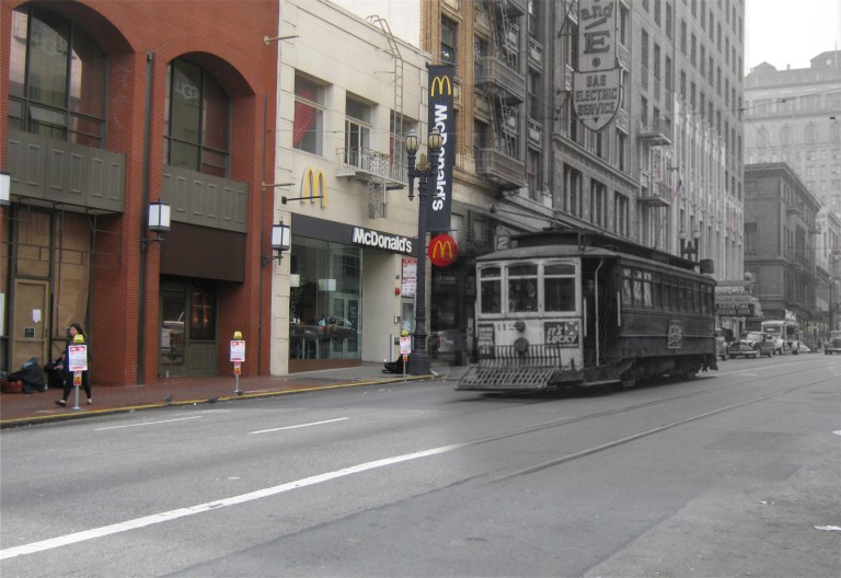 Sutter Street between Powell and Stockton Streets in the early 1950’s:
 Grant Avenue at California Street during World War Two with Old St. Mary’s Church on the right:
 Downtown San Francisco during the 1906 Earthquake and Fire:
 It always amazes me that Charlie Chaplin stumbled down these exact steps on Alice Street in Oakland one hundred and three years ago in his movie short ‘A Night Out’ from 1915.
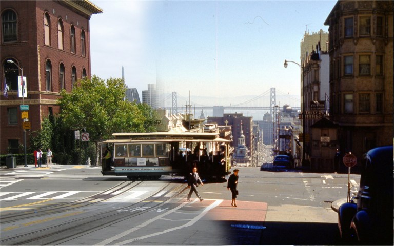 California and Powell Streets during the 1950’s:
 Grant Avenue at Filbert Street in the 1952 movie ‘The Sniper’:
 Humphrey Bogart on Hyde Street at Greenwich in the 1947 film ‘Dark Passage’:
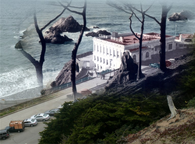 The Cliff House from Sutro Heights in 1949: Actually, you can barely see the famous restaurant from here anymore because of the overgrown trees.
 Powell Street at O’Farrell Street during the 1950’s:
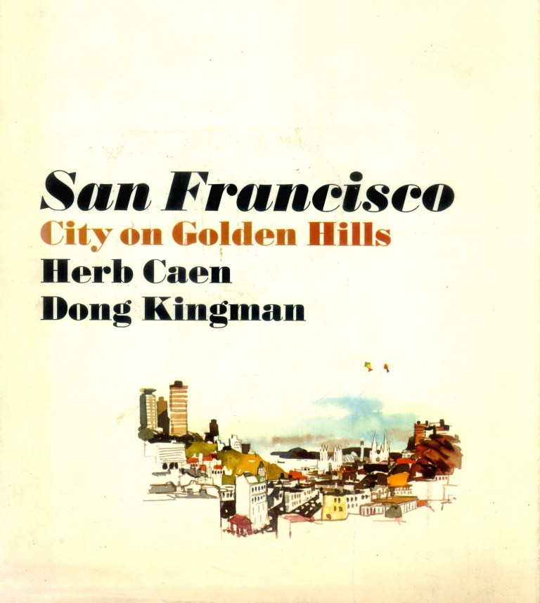 Dong Kingman was a Chinese American artist who first gained recognition as a Works Progress Administration painter during the 1930’s. Wikipedia writes of him as “one of America’s leading watercolor masters.” In 1967, “Kingman”, as he preferred to be called, co-created a book about San Francisco along with columnist Herb Caen entitled ‘San Francisco – City on Golden Hills’. In the preface Caen writes, “It is entirely appropriate that Don Kingman should be my collaborator on this book, for San Francisco – the city of his heart and mine – has been spiced and enriched by the strong flavor of China ever since it came of age as a world metropolis.” The text by Herb Caen is accompanied by paintings from Dong of a modern San Francisco, many that now seem nostalgic. Dong Kingman died in May of 2000. These are then and nows of some of his paintings from the book.
 California Street, looking down toward Chinatown and Old St. Mary’s Church before the skyscraper boom of the late 1960’s:
 Maiden Lane, looking toward Stockton Street and the St. Francis Hotel: Dong has the Dewey Monument in Union Square a little closer to the south side of Maiden Lane than reality, but that’s art.
 Market Street at the Embarcadero across from the Ferry Building looking south: Some of the structures in the background are the Bay Bridge, the Embarcadero Freeway, and the YMCA Building. The block of buildings where the Ensign Café was at were demolished at the end of the 60’s.
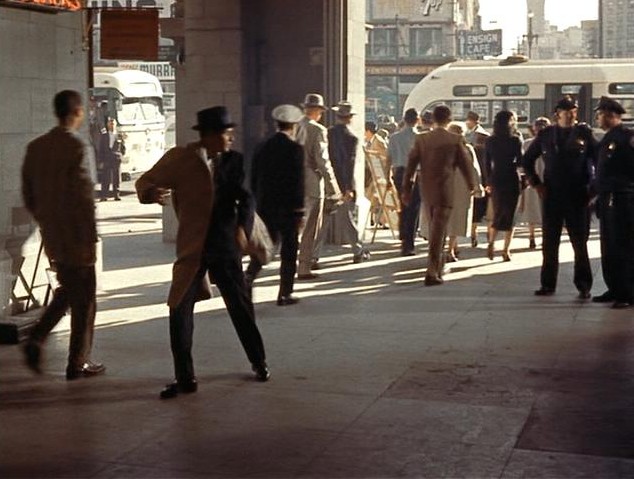 You can see the Ensign Café in a scene from the 1957 film ‘Pal Joey’ where Frank Sinatra dodges from the police across the street at the Ferry Building.
 Candlestick Park before it was enclosed in 1971 to accommodate the San Francisco 49ers football team moving in:
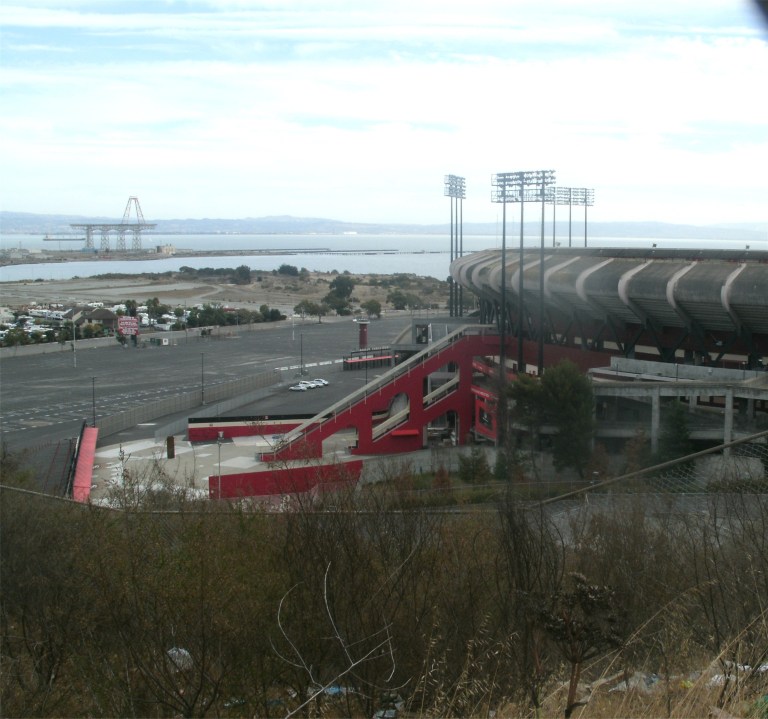 Another view of Candlestick Park from the hill behind it taken during the year it was demolished in 2015. Ah, what fun we had at that place, family and friends!
 When you stand on Hyde Street between Chestnut and Bay Streets looking toward the Bay and Alcatraz Island, you’re looking at one of the most beautiful views in San Francisco.
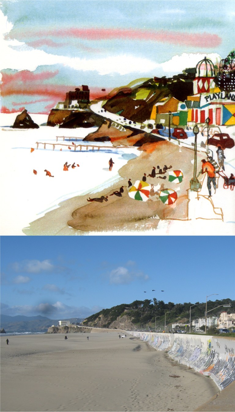 Ocean Beach at the Great Highway, looking toward the Cliff House and the long gone Playland-at-the-Beach: Playland was where the condominiums on the tight are today.
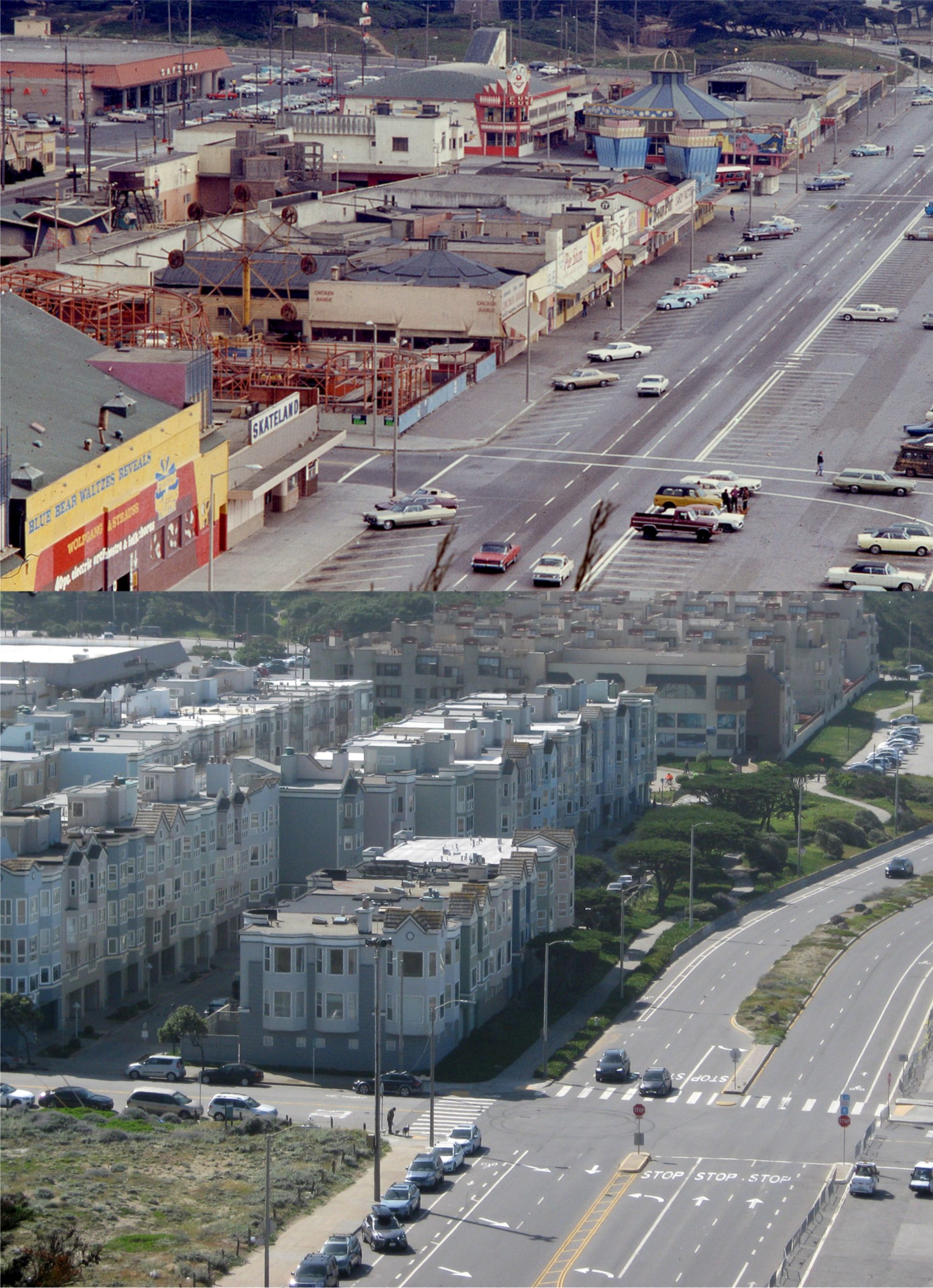
 The eastern side of the now remodeled Broadway Tunnel on the edge of Chinatown: That’s a Mason Street cable car, a line that still exists, passing by on the right in Kingman’s painting.
 Flat Stella at the Cliff House: She got kind of messed up when I threw her in the Pacific Ocean, but she was better later on after she stopped coughing.
 Stella in Chinatown: I told her that the Chinese are very big on paper ornaments so if she didn’t behave herself, I’d sell her into paper slavery.
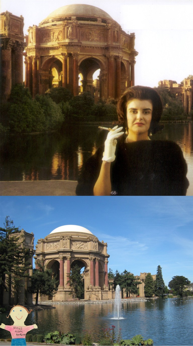 Stella at the Palace of Fine Arts: Stella said to me that the lady in the old picture was weird looking. I said to her “People who live in glass houses shouldn’t throw stones.”
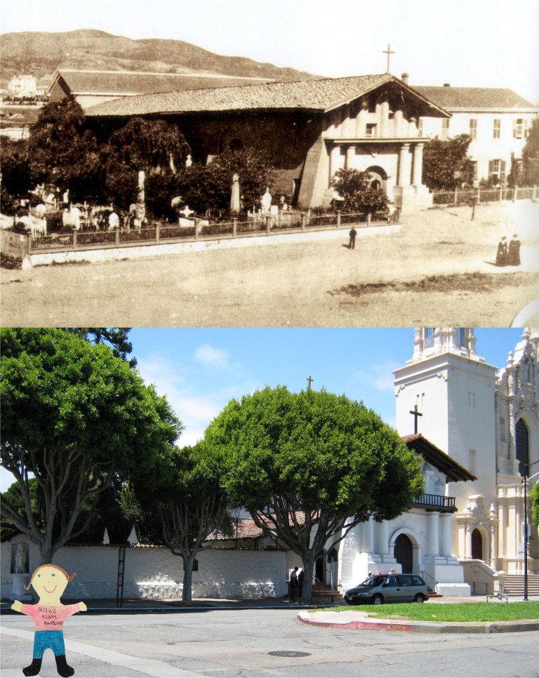 Stella at the oldest church in San Francisco, Mission Dolores: Stella asked me who Dolores was. I just told her that she was Father Junipero Serra’s big sister.
 Stella at the Golden Gate Bridge: Stella was really impressed with the bridge, and she asked me if it was real. Everybody started laughing at her, and I kind of felt sorry for her!
 Karl Malden played Inspector Michael Stone and Michael Douglas played Inspector Steve Keller. They got along just as well with each other as Napoleon Solo and Illya Kuryakin did in The Man from U.N.C.L.E. and saved each other’s life about as often. Here they are at the old Rustic Bridge at Stow Lake in Golden Gate Park. In the dialog at this point Malden is saying, “It’s so peaceful, we should come here more often.” This is about one of the most peaceful spots in San Francisco. The path is different and there are more trees here now.
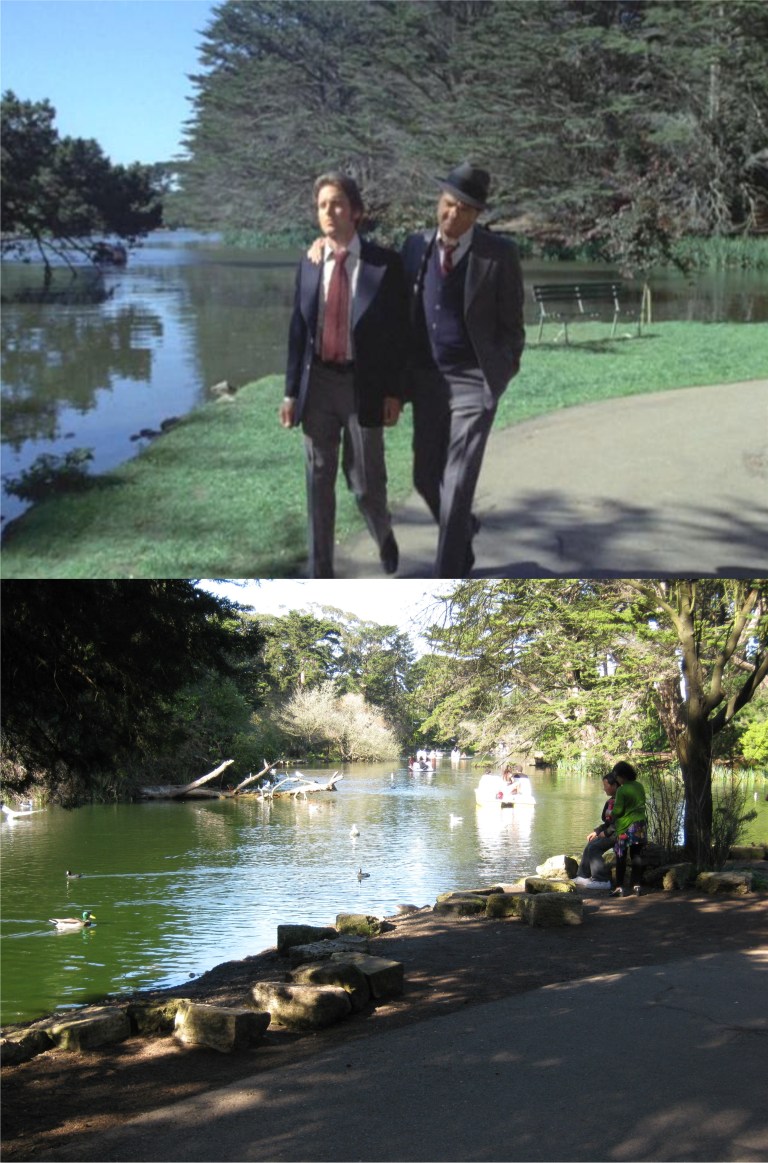 They walk along Stow Lake past the bridge for awhile.
 In one episode Steve Keller actually sleeps with one of the costars. That was a rarity! However, they didn’t live happily ever after. The girl he’s sleeping with, Brenda Vaccaro, turns out to be a hit lady for the mob who’s killed at least ten people. Somehow, that’s not a turn off to me! Maybe, it’s a “guy thing”. At the end of the episode, she goes to the Palace of Fine Arts to make another “whack”.
 This was about where she was sitting.
 Keller confronts her after the killing at the Palace, and finds out who she is. He hesitates shooting her. Well, that’s love!
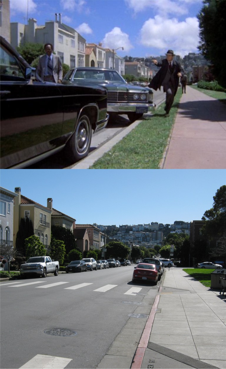 Papa Cop, Stone, pulls up here on Baker Street just in the nick of time.
 Stone prevents her from spoiling every good memory Keller had of her, and she’s off to jail.
 Now, off to Mission Street and the Embacadero under the old Embarcdero Freeway where there’s Salvation Army Band playing music to the winos in the area. This may have been one of the corny moments I was telling you about.
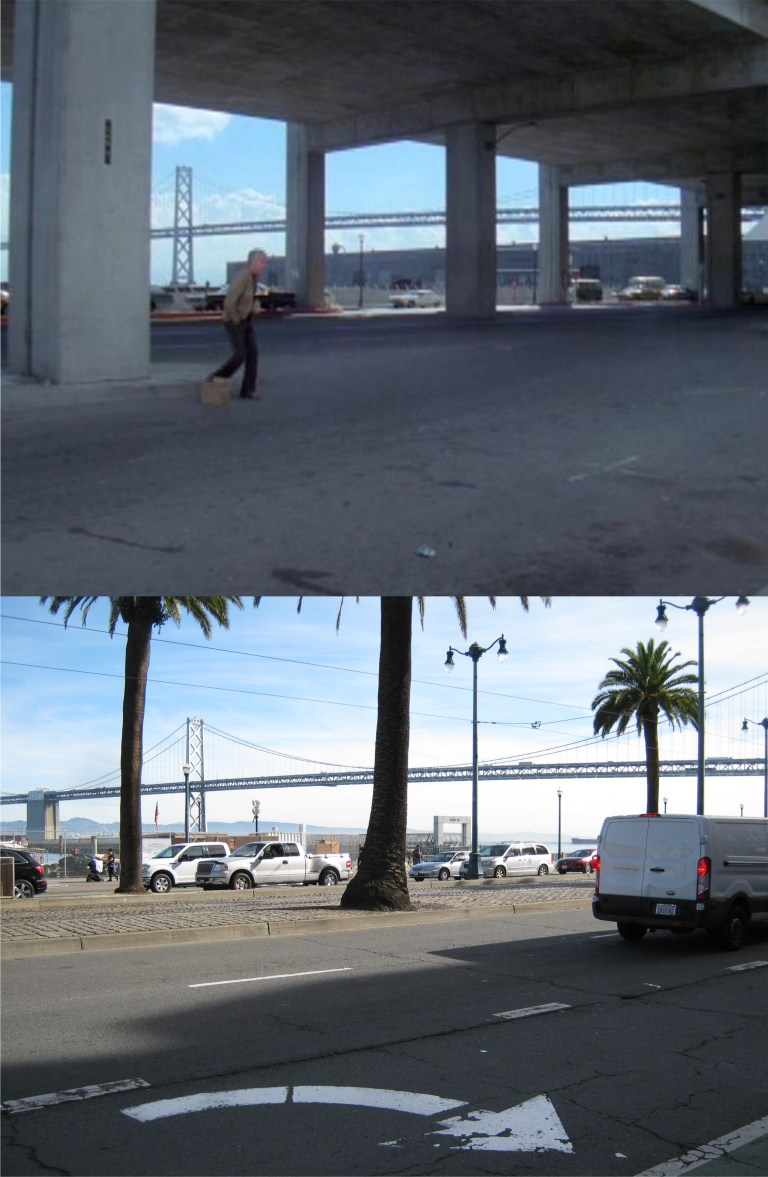 A miserable drunk stumbles across the Embarcadero. Oh, wait, that’s not polite! I mean, an intoxicated homeless person finds comfort in the bottle while living on the streets.
 Why, it’s Leslie “Don’t call me Shirley” Nielsen! Nielsen plays an alcoholic cop who accidentally gets his partner killed while drunk on the job.
 “Well, time for a little R&R!” They sure tidied this spot up today. That’s the old YMCA Building in the background.
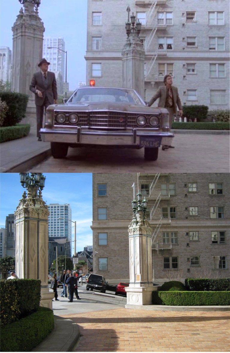 Hot on the scene of another murder, the boys pull into the old Brocklebank Apartments on the northeast corner of Mason and Sacramento Streets, Nob Hill. The entrance to the Brocklebank is very similar to the entrance of the Mark Hopkins Hotel.
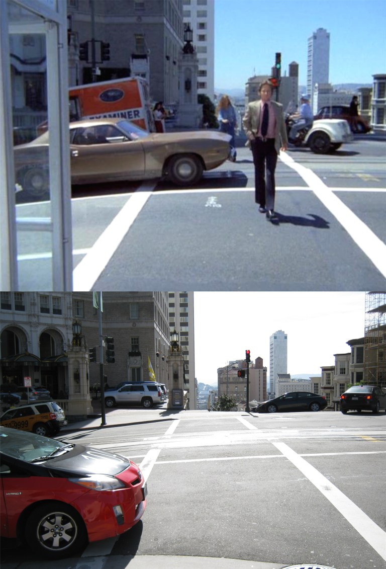 Keller heads across California Street from the Mark Hopkins Hotel to a telephone booth.
 “Welcome to Tenderloin Travel.”
 There was some type of busy terminal here once but it couldn’t have been an airport. The “Airlines Terminal” sign may have been doctored for the episode. There’s a Hilton Hotel here now.
 As the boys say goodbye to Stefanie, we’ll say goodbye to the boys. Karl Malden is dead now, and I don’t read much about Michael Douglas’s health nowadays. I hope he lives as long as his dad has.
 One of the best pictures of the Crest Garage, and also one of my favorite vintage San Francisco pictures, as two cable cars from the California and Powell Street Lines cross the intersection in the 1940’s. The Crest Garage can be seen behind the cable car on the right in my picture.
 Here’s another then and now of the Crest Garage from the 1940’s that I posted in November of 2016.
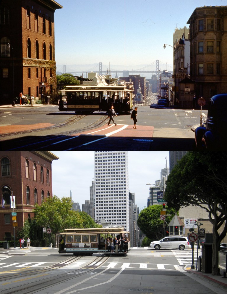 In another picture, this one from the early 1950’s just across California Street from the previous picture, the Crest Garage is on the far right in the old photo from Vintage Everyday and with the arrow sign on it in my picture. The apartment building between the garage and Powell Street was demolished by the 1990’s.
 In the 1964 movie ‘Good Neighbor Sam’, Jack Lemmon races his Thunderbird past the Crest Garage which by that time had become a Flying A Service Station.
 In a 1968 episode of the television show ‘Ironside’ starring Raymond Burr, the Crest Garage had by then become a parking garage. My picture of the garage behind the cable car signal box taken in August of 2017 was the last picture I took of the building.
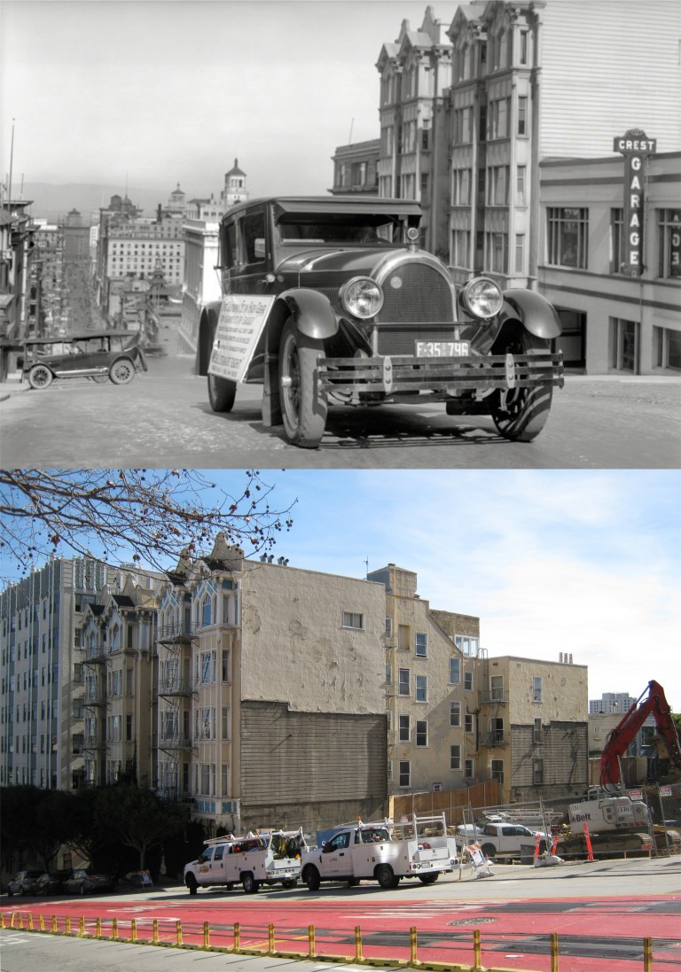 The oldest picture I’ve seen of the Crest Garage dating from the 1920’s; I’m not sure but it might be from the Shorpy Picture Archive. The bottom photo is all that’s left of the garage today. You can see the imprint of where the Crest Garage leaned against the old Apartment building on California Street since the 1920’s.
 The Powell Street Cable Car Line: Pretty girls are pretty girls no matter what century.
 Chinatown in the 1940’s:
 The Golden Gate Bridge Promenade in the 1940’s:
 Maiden Lane in the 1950’s:
 Clipper Cove at Treasure Island: When I took the recent picture of the new eastern span of the Bay Bridge the old cantilever bridge hadn’t been demolished yet.
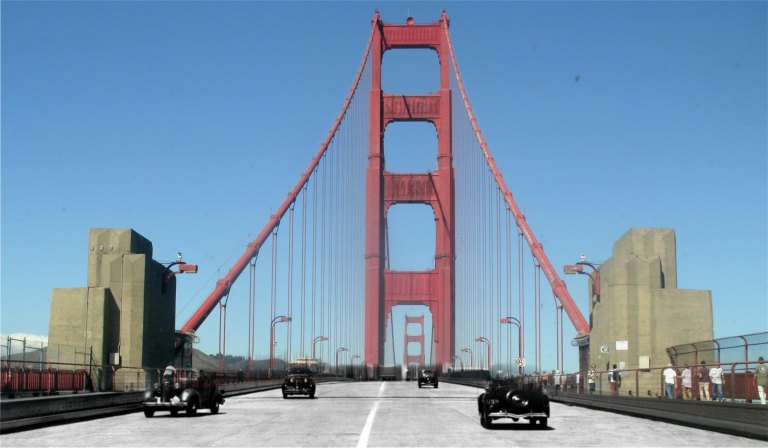 The Golden Gate Bridge in 1940:
 When trains and streetcars roared under the Ferry Building Pedestrian Bridge
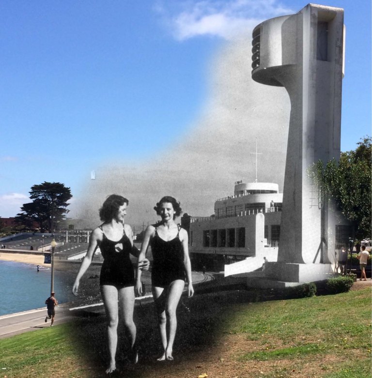 Bathing Beauties at Aquatic Park in 1939:
 Danny and I at Ocean Beach, I think it was around 1898. I’m a lot older than I look!
 I like the breakfasts at Tad’s Steakhouse on Powell Street just north of Ellis and often get an early start on the day there when get off at the Powell Street BART Station. The vintage picture from OpenSFHistory.org was taken roughly at the same area looking back toward the Flood Building during the 1906 Earthquake and Fire.
 It wasn’t a hangout of mine, but just up from Tad’s in the green building in the center was the world famous ‘Omar Khayyam’s’ Restaurant. The vintage picture from OpenSFHistory.org was taken in the early 1950’s. The restaurant was destroyed by a fire in the 1980’s.
 The top two pictures were taken at the southeast corner of Powell and Bush Streets. Right on this corner, just up from Union Square is Roxanne’s Café. They not only serve good breakfasts, but I often take advantage of their spaghetti and meat balls when I’m in the area. It’s nice to watch the cable cars clanging up and down Nob Hill while I’m having lunch there. The bottom photo is from my usual table when I stop there. The vintage picture from OpenSFHistory.org was taken in 1958.
 Sometimes, I’m only in the mood for a fistful of French fries in one hand and some chicken nuggets in the other. I usually stop in at the McDonald’s here on Sutter Street between Stockton and Powell when that urge hits me. It’s often crowded, but there’s seating upstairs, and sometimes it’s all I’ll need to make it to dinner. The Sir Francis Drake Hotel is on the corner at the right. The vintage picture from OpenSFHistory.org was taken in October of 1948.
 I used to go to #9 Fishermen’s Grotto for lunch when I was at the Wharf, but when they closed down for so long because of a change in ownership. I started going regularly to Alioto’s; either way you’ll do okay. The Grotto has recently reopened, but I haven’t checked it out yet. (Vintage photo from Foundsf.org)
 It was sad to drive by Mason and Bay Streets on Christmas Day and learn that they finally tore down the old Ginsberg’s Pub. What fun we had there during the 1980’s and 1990’s! In fact, I was in there at 5:04 PM on October 17th 1989. A buddy named Mike and I drove through the old Cypress Structure, crossed the Bay Bridge and headed to Candlestick Park to try to buy tickets from scalpers for the third game of the 1989 World Series. As I remember the lowest price was $300.00 dollars each, which was more than we had at the time. So, we headed for Ginsberg’s Pub. We had just settled in with a hot dog and pitcher of beer when the Loma Prieta Earthquake struck. I went outside of the pub after the shaking stopped and the first thing I saw was a dog running in panic north on Mason Street. Then I looked around at the eerie stillness at twilight of San Francisco with all of the power out. After that, was one of the longest nights of my life trying to leave San Francisco. All of the bridges were closed, I was out of gas, and San Francisco had no electricity. I’ll always think about that night when I pass this corner. I took the top photo on October 17th 2009 after Ginsberg’s had closed.
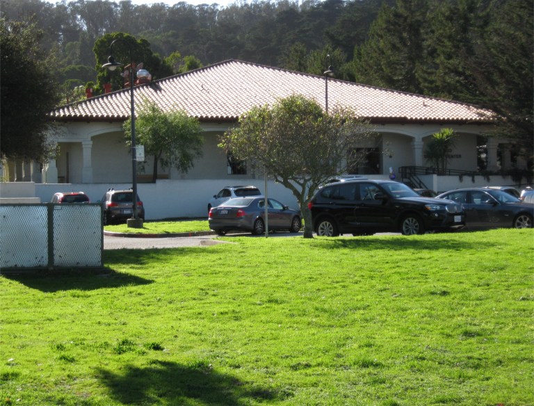
 Another “quick fix” place I enjoy is the Presidio Bowling Alley. They serve a pretty good hamburger and a ton of fries at the grill there, and healthy stuff too! The bowling alley sits at the southern end of the parade ground of the old historic Montgomery Barracks. I took the top photo looking toward the barracks in December of 2009. That black Mitsubishi pick up truck is mine. It has close to 220,000 miles on it to date and I still drive it. I had a chance to talk with two more nice people here when I took the current picture, Kim and Nate, who work at the Presidio. It was great to listen to them talk about some of the history of the Presidio as well as some of the future plans for the historic army base.
 I enjoy the area of the Cliff House Restaurant and I go there as often as I can. Although I love the Cliff House, more often I’ll have breakfast or a burger at the Louis’ Restaurant just up Point Lobos Road from the Cliff House. The views of the Pacific Ocean and the old Sutro Bathhouse ruins are just as good as you can get from the more famous restaurant. The vintage photo was taken in 1966 the day that Sutro’s burned down.