
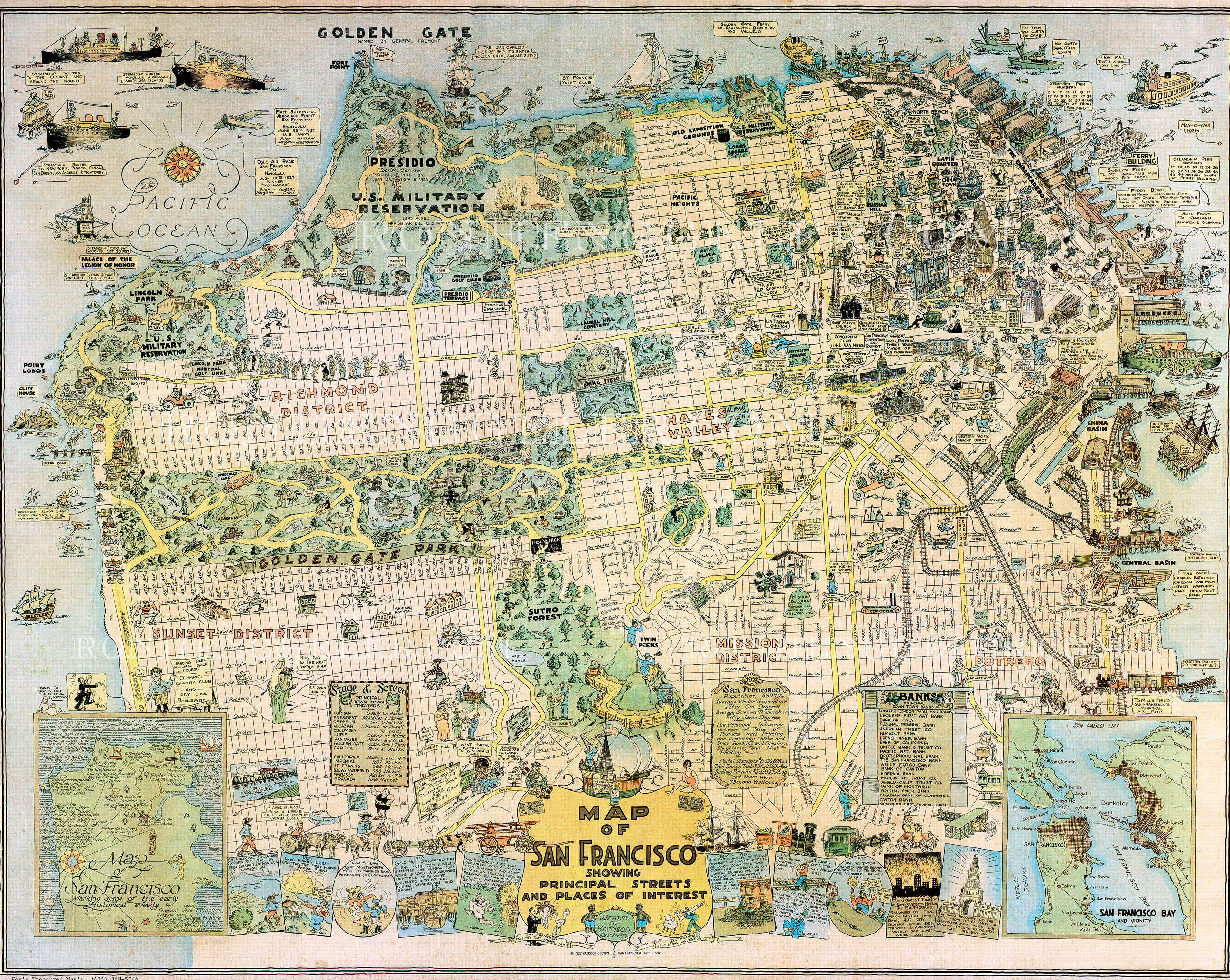
Click on the image below for a wonderful 1927 map of San Francisco that can be zoomed in for a close up view. (ronhenggler.com)
Click on the photo below for a zoom in look at George Lawrence’s incredible kite photograph of San Francisco after the 1906 Earthquake.

 Click on the link below for Muni’s moveable map to the old streetcars running on the F and E Lines.
 Click on this link below, and it opens up to David Rumsey’s terrific version of a map that you can zoom in on for a great look at 1912 San Francisco. Although, it navigates better on a PC. Alright, so they spelled Fisherman’s Wharf wrong, who’s gonna notice!

I’ve saved the best for last. Click on the link below to open the David Rumsey Map Collection 1938 aerial photo composite of San Francisco. You can zoom in pretty close for a wonderful view from above of what San Francisco was like back then.
