
These are pictures from the Transbay Terminal, which opened in 1939, taken on the day that it closed in August of 2010, and of the Salesforce Transit Center this week when it opened. The old Transbay Terminal was my gateway to San Francisco when at age 15 the City became my favorite place in the world. It was already getting run down by then, but it will always hold a special place in my heart. Back in high school when most of my friends and I didn’t have a car, and up through college when, if we could afford a car it probably was so cheap it wouldn’t make the 30 or so miles to San Francisco, we took buses to the Transbay Terminal. From there we explored San Francisco and discovered places like Chinatown, Fisherman’s Wharf, the Cliff House and Golden Gate Park, places I still visit regularly today. When BART opened the Transbay Tube I never took a bus there again, but often stopped in when I was in a nostalgic mood. When I heard it was closing in August of 2010, I went there for one last time and took as many pictures of the building as I could. This week I visited the new Salesforce Transit Center, and I must say that, in my opinion, it is and will continue to be, if security can keep the riff-raff out, a magnificent transit hub. I was in awe walking around it, and to hear the noise of buses arriving and departing took me back to a special long-ago time.

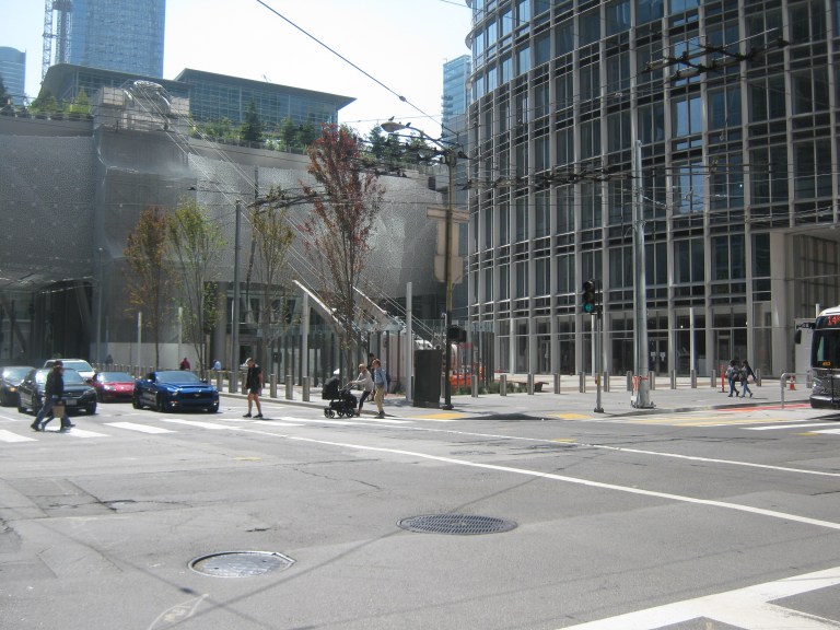 We’ll start at the northeast corner of Mission and Fremont Streets looking toward the two terminals on closing day in August of 2010 and this weekend, as all of these pictures will be.
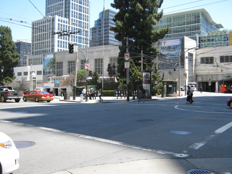
 We’ll move down Mission Street one block to the northwest corner of Mission and 1st Streets.

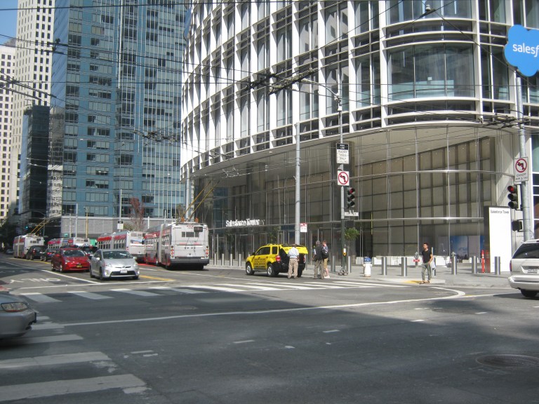
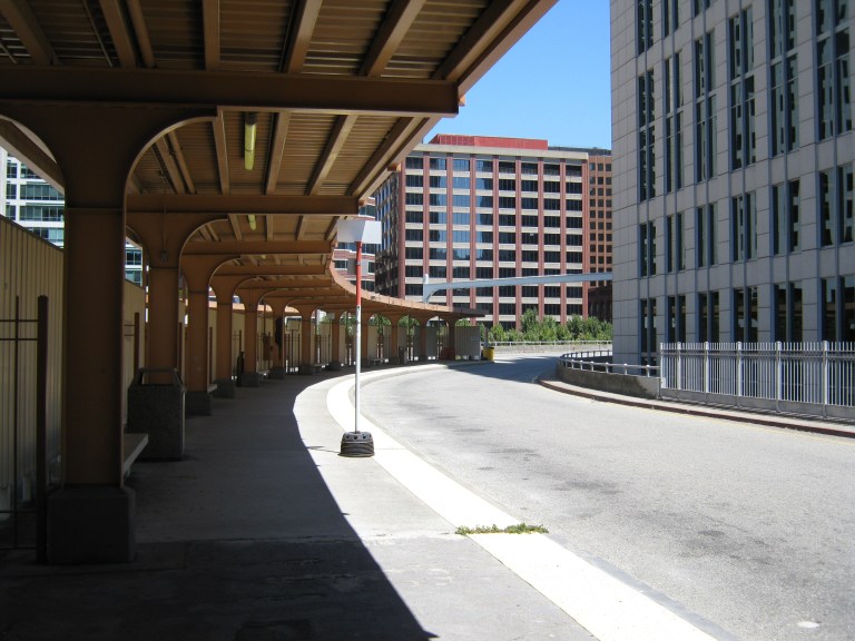
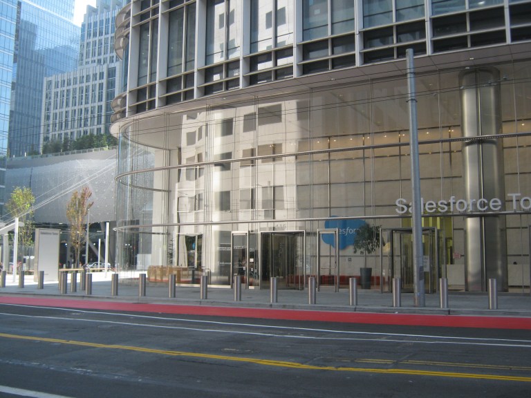
 The main entrance to the Transit Terminal then and now: Although the Salesforce Building and Terminal were built where the old terminal was, the entrance to the new building is a little further back from Mission Street and closer to Fremont Street.
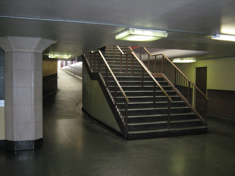
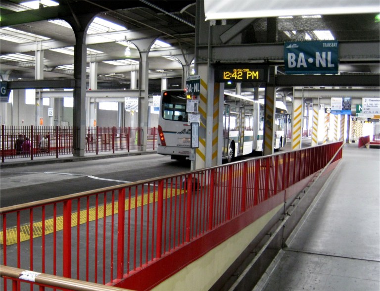
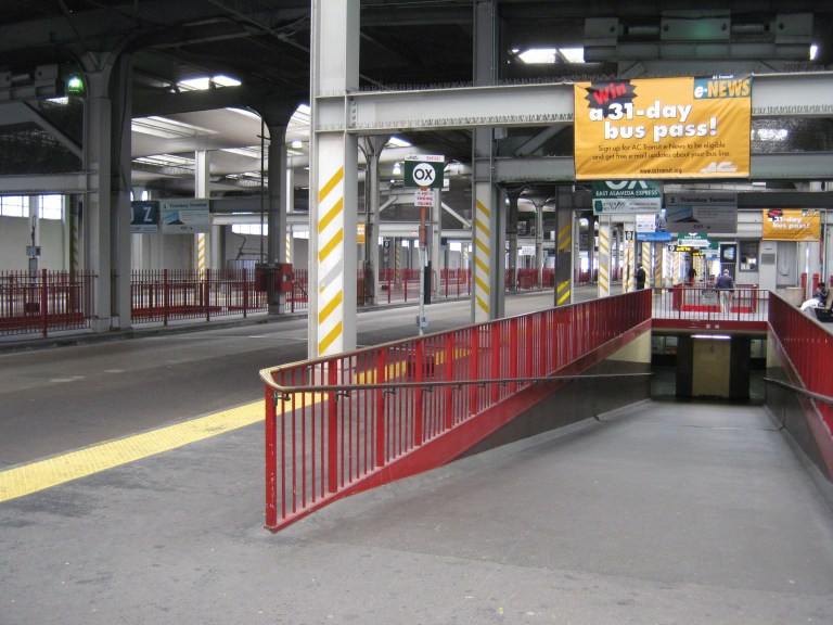
 These are one of the old stairs and ramps that went from the second level to the third floor where buses arrived and departed and today’s escalator to the second level where buses travel to and from the Bay Bridge in the new transit center.

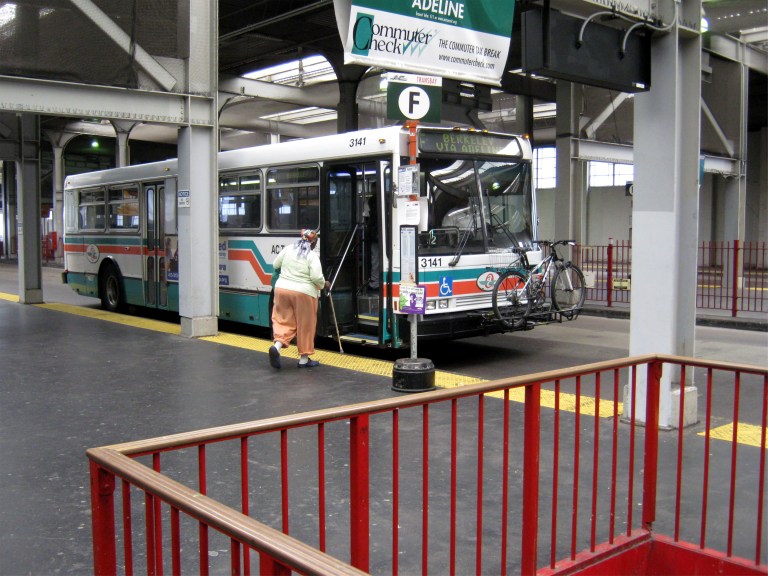
 These were the old benches at street level where you waited for your bus to depart and if you were like me, fell asleep some times and missed it. The stairs in the back took you to the second floor, where you went up to a third level for the buses. The bottom picture is looking down to street level from the escalator that goes to the second level today.
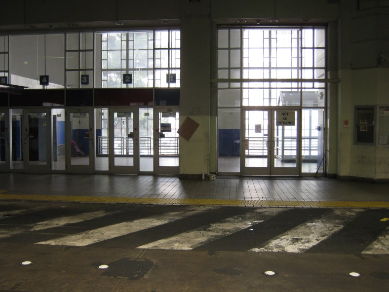
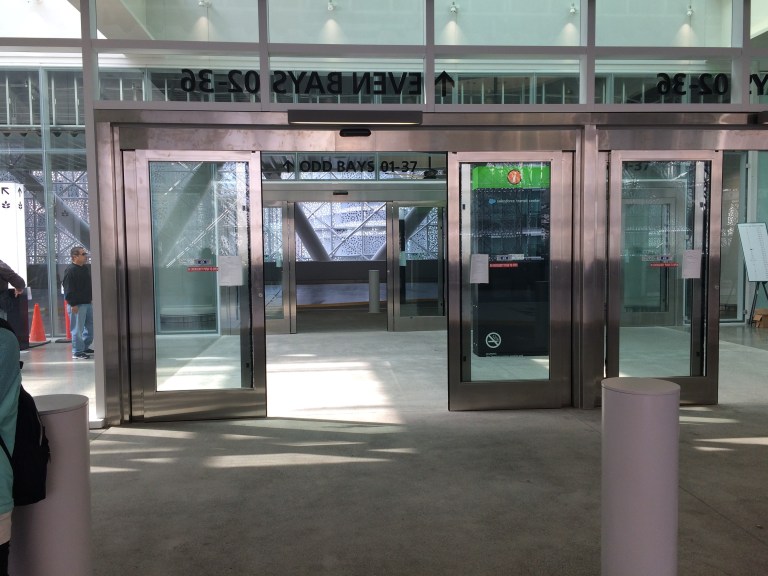
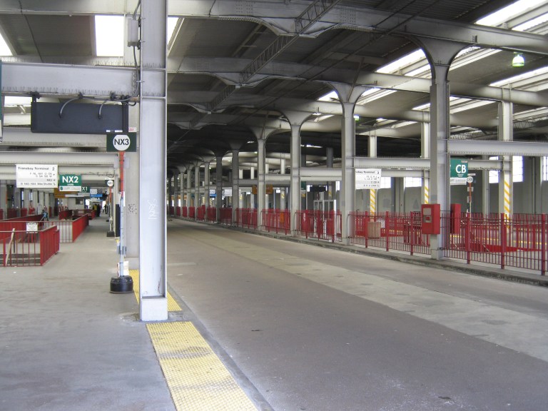
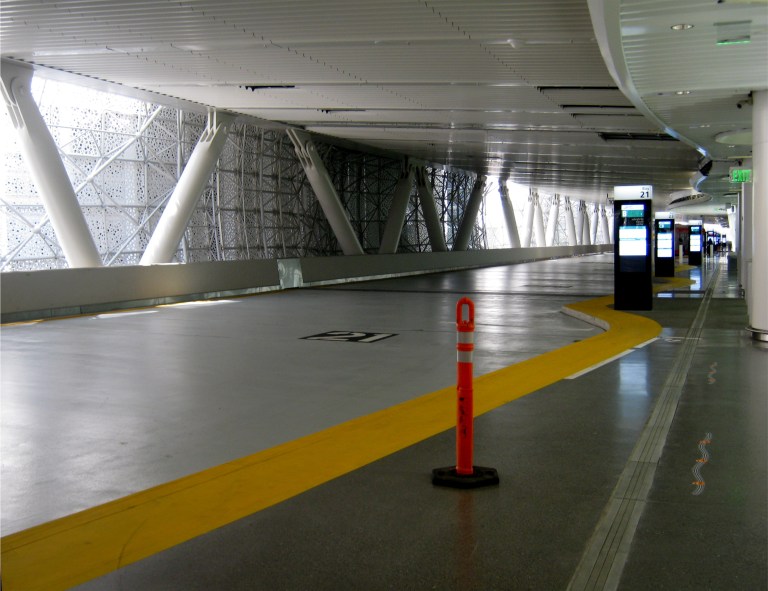
 Buses from the East Bay arrived on the eastern side of the terminal here, and left for the Bay Bridge on the western side of the building. Now, buses arrive and leave on the bus bridge to the Bay Bridge on only the west side shown in the bottom photo.

 This is the western side of the old terminal looking toward the Pacific Telephone Building on New Montgomery Street, and from the park on the roof of the Salesforce Transit Terminal.
 There wasn’t as many people leaving by bus in 2010 or this weekend, but there will be eventually.

 Getting ready to depart in 2010 and today:
 Both of these images are looking toward the north side of the two terminals. In the old Transbay Terminal picture on top, this was where passengers used to catch the Key Systems Trains that crossed the lower deck of the Bay Bridge.
 Two buses off, back across the Bay Bridge:
 What was lost and what was gained: I guess the thing to say is that they are and were both beautiful in their way.

 Happy passengers, I hope, arriving at the terminal then and now.

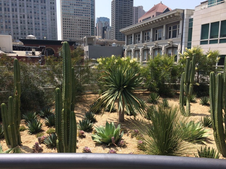 Now let’s look at some of the civic attractions of the two transit terminals. The rooftop park in the new transit terminal is very beautiful, complete with interesting things to see, like the desert garden on the northwestern side of the park.
 And, there’s the incredible Salesforce Tower.
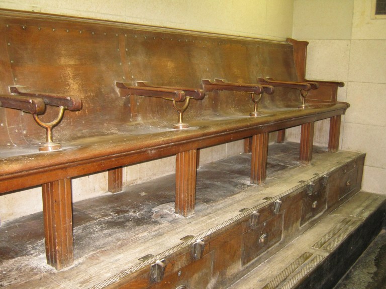
 Of course, there isn’t anything today like the vintage shoe shine stand in the old building. I image, however, that they probably have a more efficient heating system today.
 Also, I didn’t see any ticket booths in the Salesforce Terminal like this one, long closed by 2010.
 Let’s take a last look at what was, and what is.

 When I came back a few days later in August of 2010, the old Transbay Terminal was closed up forever.

 I walked up the ramp in 2010 where the old streetcars used to arrive, and looked back to Mission and 1st Streets. I thought about all of the people, including friends and I, who came and went here. Buses are starting to come back here now, and a lot more will.
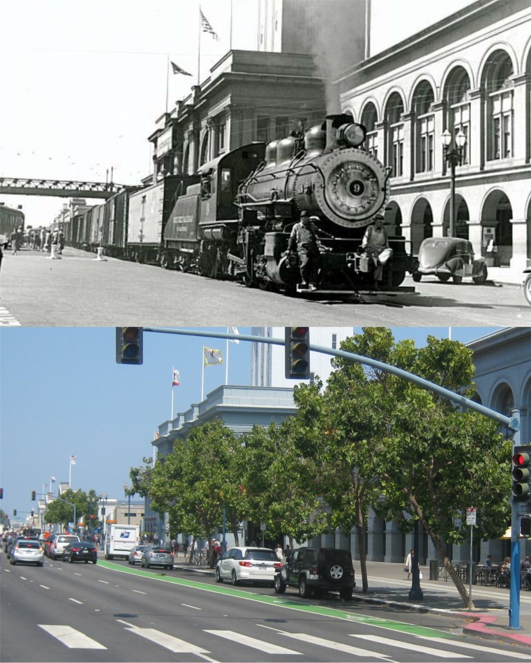 This is at the Ferry Building, where this old Belt Line Rail Service train was passing in the 1940s. It seems so antiquated nowadays! I’m used to the normal traffic you see here these days, like on Naked People on Bikes day. (Vintage picture from SFGate)
 This is looking northeast toward Sansome Street from Market during the 1940s. This is a great picture from Market Street Railway. The blue-green curtained Crown Zellerbach Building blocks out the view of the Shell Building from here today. The building behind the one with the TYPEWRITERS sign in the vintage picture has been remodeled and is the copper colored building behind the Zellerbach Building. The Ferry Building can be seen at the far right in both photos.
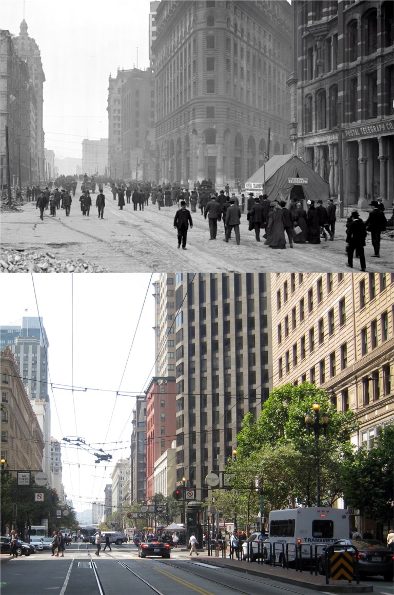 This is Market Street looking west near Montgomery Street just after the 1906 Earthquake and Fire. The damage looks light because the fire that destroyed most of San Francisco hadn’t spread yet. The crowned Call Building and old Palace Hotel are on the far left. The Palace Hotel was destroyed in the fire, but the Call Building survived. The rebuilt Palace Hotel and remodeled Call Building are on the left in my photo, as well. (San Francisco Library History Center)
 This is on 3rd Street, south of Mission Street near Minna, in 1939. The Call building is in the background in both pictures. The building to the right of the WORK CLOTHES sign is in the center of my photo, as well, and is having some type of facelift now. (retrosnapshots.com)
 A Salvation Army Band is marching along the same spot as the previous photo, and was probably taken on the same day in 1939. The buildings directly behind the band have been demolished and the location is now part of the Yerba Buena Gardens. (retrosnapshots.com)
 Looking west from the north side of Market Street toward the old Humboldt Building in the late 1960s: (Vintage Everyday)
 This is an antiwar protest near Union Square on Post Street, looking east toward Stockton Street, at the end of the 1960s. That was probably a police motorcycle on fire. (Vintage Everyday)
 I parked in Pier 45 at the Wharf. Sometimes I can get a parking pass there, and that’s worth gold in the summer for parking at Fisherman’s Wharf. This is the view from the west side of Pier 45 today and in a rather blurry image from 1935. I probably could have got a perfect line up, but I didn’t want to cut out the Ghirardelli Tower on the right in my picture.
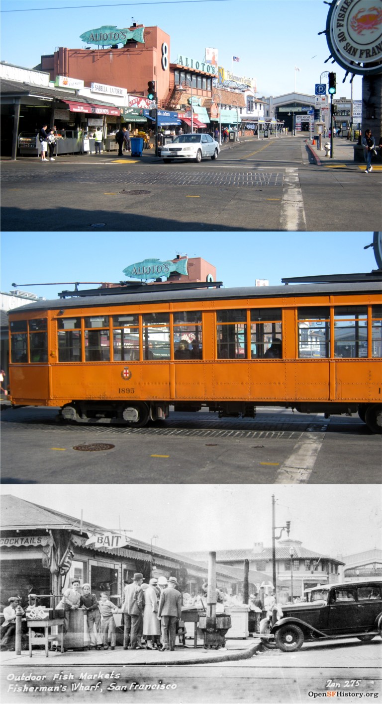 A cable car was my first choice, but it was 8:30 AM when I got to Fisherman’s Wharf, and the cable cars don’t run until 10:00 AM. I was taking a couple of pictures at Jefferson and Taylor Streets when an inspiration from Milan, Italy, the old #1895 streetcar built in 1928, rattled past. The bottom picture is the same spot in 1937.
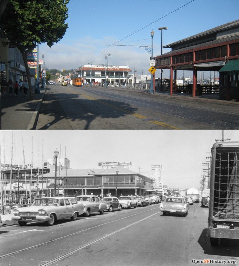 The F Line of vintage streetcars that travel along the Embarcadero and Market Street was running, so I figured that if I ran fast enough I could catch it. This is a reverse then and now looking to and away from Taylor street past the Fisherman’s Wharf Lagoon on Jefferson Street today and in 1960.
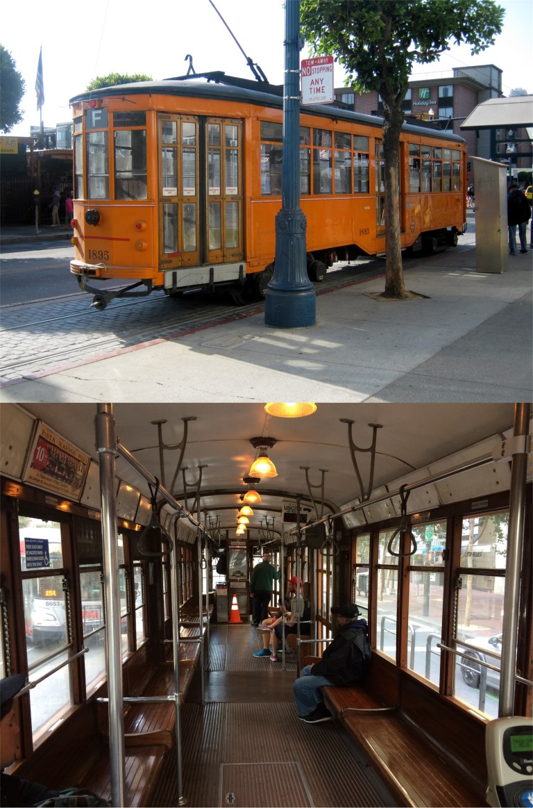 How was I to know that the motorman was going to take a ten minute brake at the stop? Oh, well, good exercise! I stood at the back of the car where the letter F is to get my pictures. You can see from the bottom photo there aren’t a lot of people heading away from the Wharf in the morning. Before long, “Clang, clang, clang, went the trolley.” and I was off, sans a high-starched collar and high-topped shoes like Judy Garland wore.
 This is where Beach Street approaches the Embarcadero today and in 1930. Notice the Eagle’s Restaurant. When Pier 39 was demolished in 1978 for the amusement center that’s there today, they decided to save the old café, which was going to be torn down for a garage, and moved it across the street to the second story of Pier 39. It’s the white peaked building in the right center of my picture.
 We’re rolling down the Embarcadero past Pier 17, where the Exploratorium is now housed. The bottom picture is Pier 17 seen from Telegraph Hill in 1957. (San Francisco Library History Center)
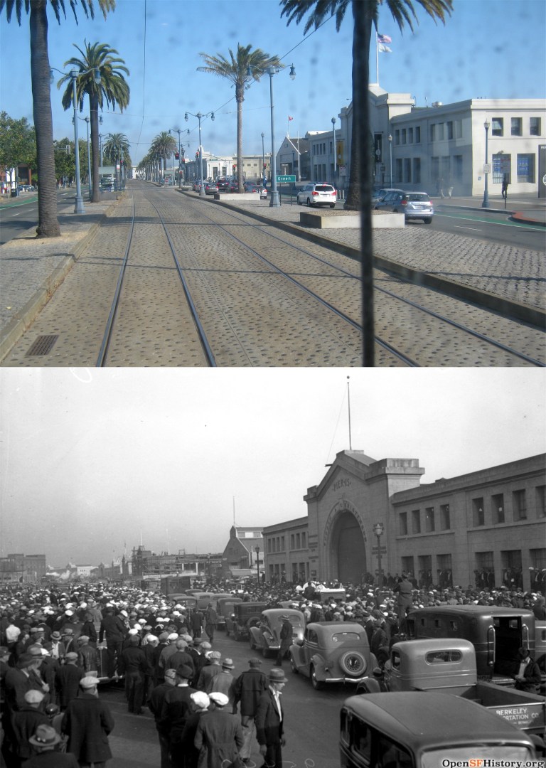 We’ve passed Pier 15 and Green Street, where an organized labor strike was happening in 1937 in the bottom photo.
 This is where Broadway comes into the Embarcadero looking toward Telegraph Hill. The bottom picture was taken just after the 1906 Earthquake and Fire.
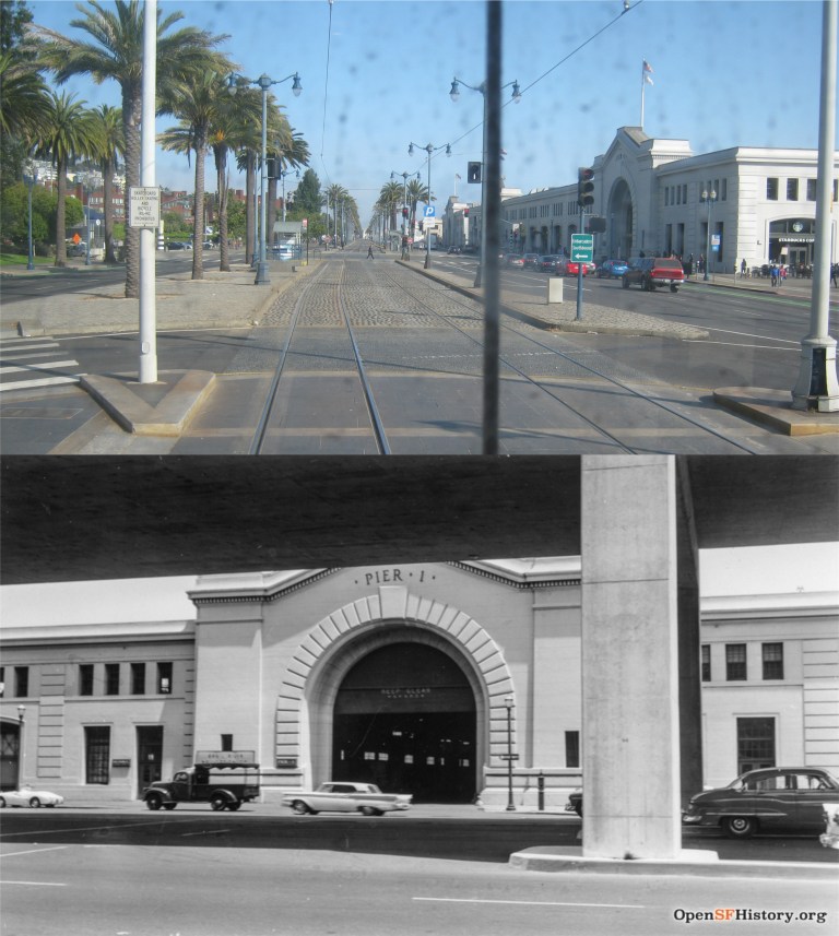 Now we’ve passed Pier 1 as we near the Ferry Building. If we were at this spot in 1960, like in the bottom picture, we’d be directly under the Embarcadero Freeway.
 As we rattled past the Ferry Building, something inside my subconscious mind was telling me to keep my head and arms inside the car. The bottom picture was taken in 1905. Look at all of the streetcars in front of the Ferry Building. They look like cable cars but they’re not; they only have two tracks and no middle slot.
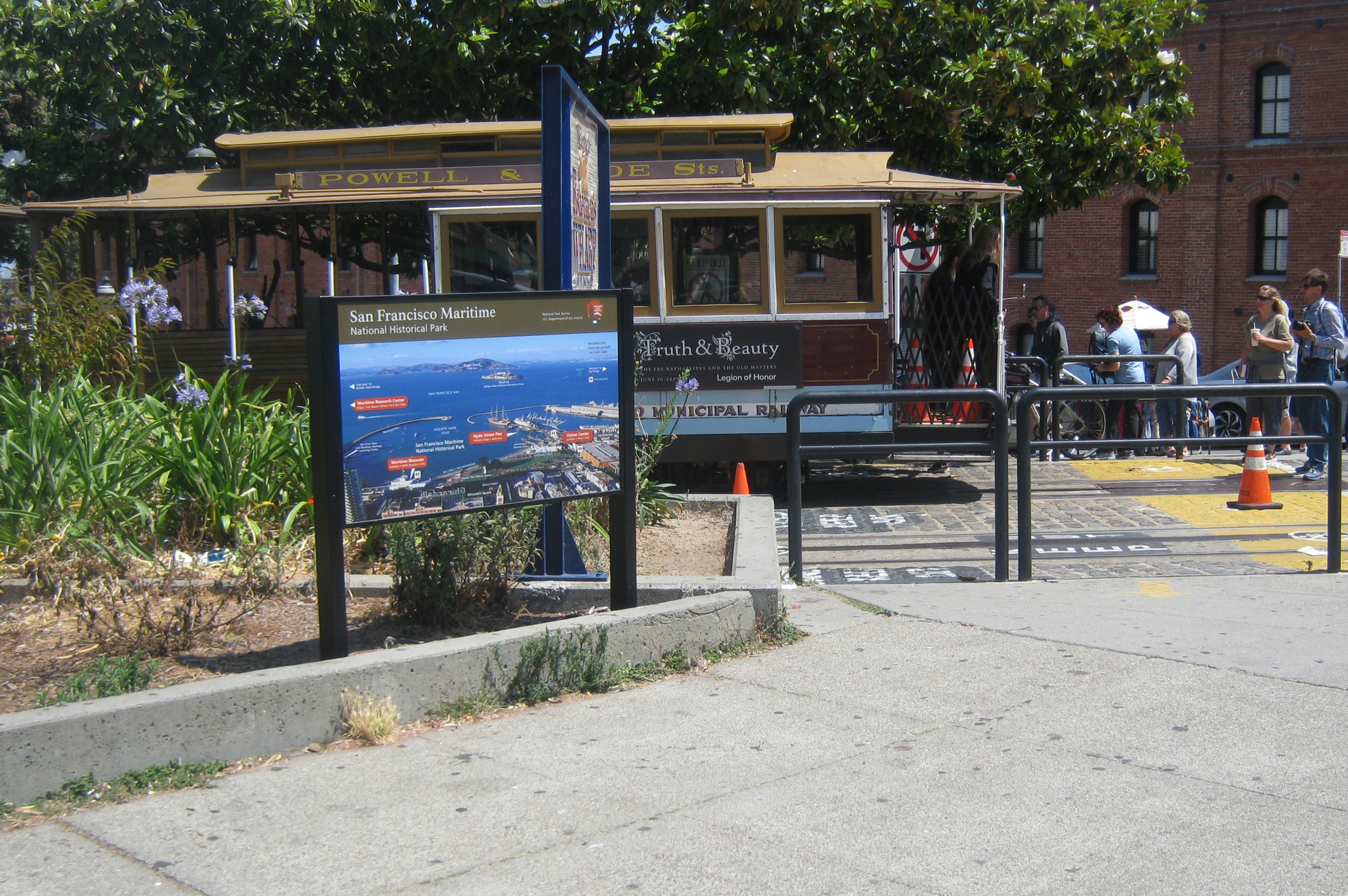
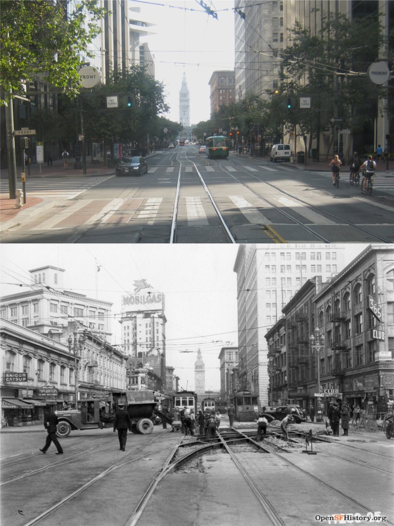 When we rounded the turn to Market Street I got off where Front and Fremont Streets merge into Market to head over to see the new Trans Bay Terminal, but that idea didn’t fly! “There are 894,363 people in the naked city” and every one of them decided to visit the new transportation center too, while all of the out-of-towners were at the Outside Land Concert. I’ll get around to it. The bottom photo was taken at this spot in December of 1938.
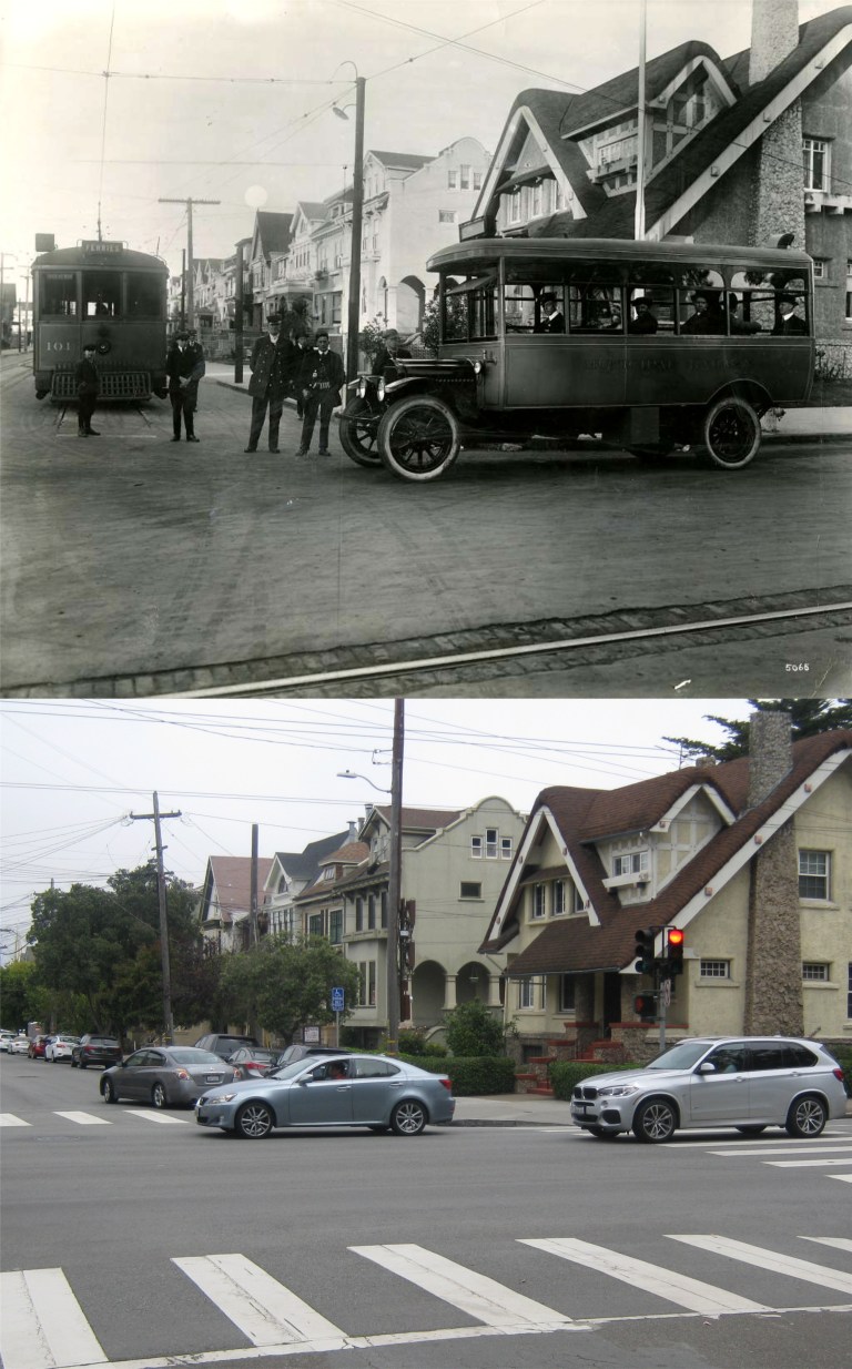 Fulton Street: A streetcar and a motor bus at Fulton and 10th Avenue next to Golden Gate Park around 1920. I’ll bet MUNI would like to have that in their vintage streetcars and buses collection! (SFGate)
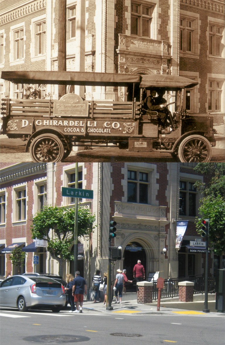 A chocolate truck at the Ghirardelli Building: This was taken at Larkin and North Point Streets, probably around the same time as the previous picture:
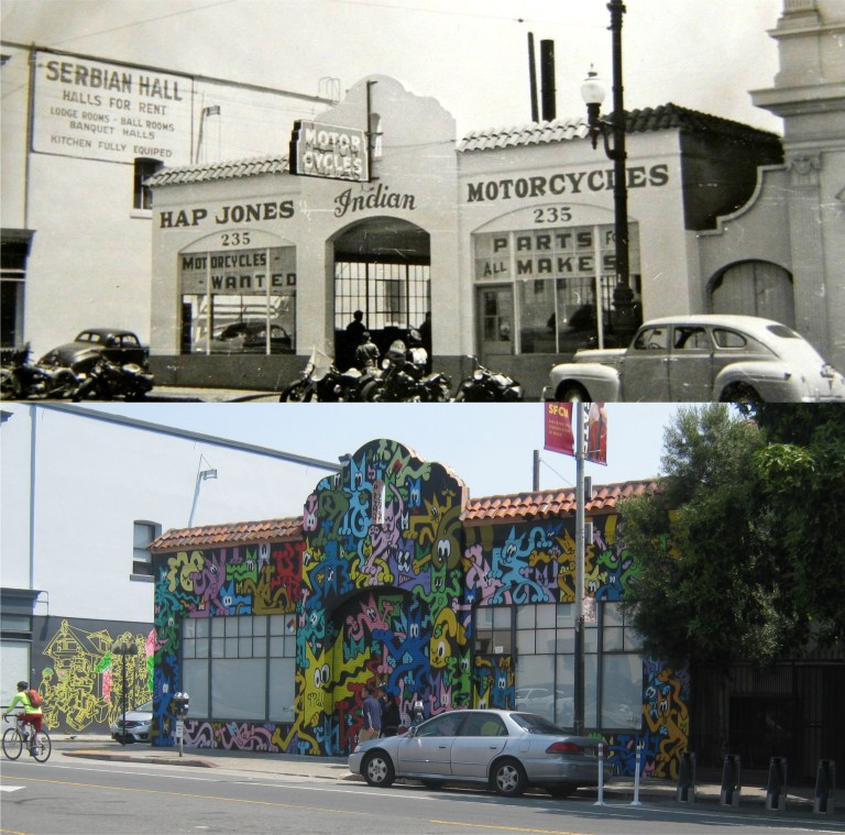 Hap Jones legendary motorcycle dealership on Valencia Street, south of Market Street in the 1940’s. Hap opened his motorcycle sales business here in 1937. The motorcycle shop is gone now, and the building certainly does have a different look today! I hesitate to admit it, but I like it! (Imageshack.com)
 Market Street at Grant Avenue looking east on August 14th 1945: San Francisco celebrates VJ Day ending World War Two. Next week will be the 73rd anniversary of this day. (San Francisco Library)
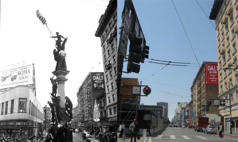 Turk Street Looking west from Mason, August 14th 1945: On the same day as the previous picture revelers climb the Winged Victory Statue that used to be about where I took the modern picture from. The triangle shaped building on the left in the vintage picture has only recently been demolished.
 The Winged Victory Statue is now on the corner of Market and Montgomery Streets.
 A cable car heading north on Mason Street near Greenwich in a Charles Cushman picture taken in 1957:
 Market Street looking east near 4th Street in the mid 1960’s:
 Another view of Market Street looking east in 1967: These were taken between 4th and 5th Streets. That’s a lot of buses! I only got one in mine. (SFGate)
 Polk Street looking north from California Street in 1974: Mug Root Beer ads were on MUNI buses all over town back then, including one in a scene from the 1971 film ‘The Organization’ starring Sidney Poitier. (SFGate)
 Michael Douglas played Inspector Steve Keller. In ‘The first Day of Forever’ he is assigned to be a bodyguard to a call girl played by Janice Rule who has been targeted for murder by one of her “clients”. Keller is cold and distant toward her at first, but eventually develops affection for her. Here they pass the Fisherman’s Wharf Boat Lagoon with Alioto’s and #9 Fishermen’s Grotto Restaurants behind them.
 Karl Malden played Lieutenant Michael Stone. Here he is at Aquatic Park where the Hyde street cable cars turn around in ’45 Minutes from Home’. Hey, that is the cable car you’re looking at, Lieutenant, right? My kind of cop! The corner here has been reconfigured a bit where the cable cars arrive and depart.

 They get into their unmarked patrol car and turn onto Larkin Street pursuing a hot tip; probably another restaurant that serves good chili dogs, they track down a lot of these in the series. They pass by Ghirardelli Square on the right.
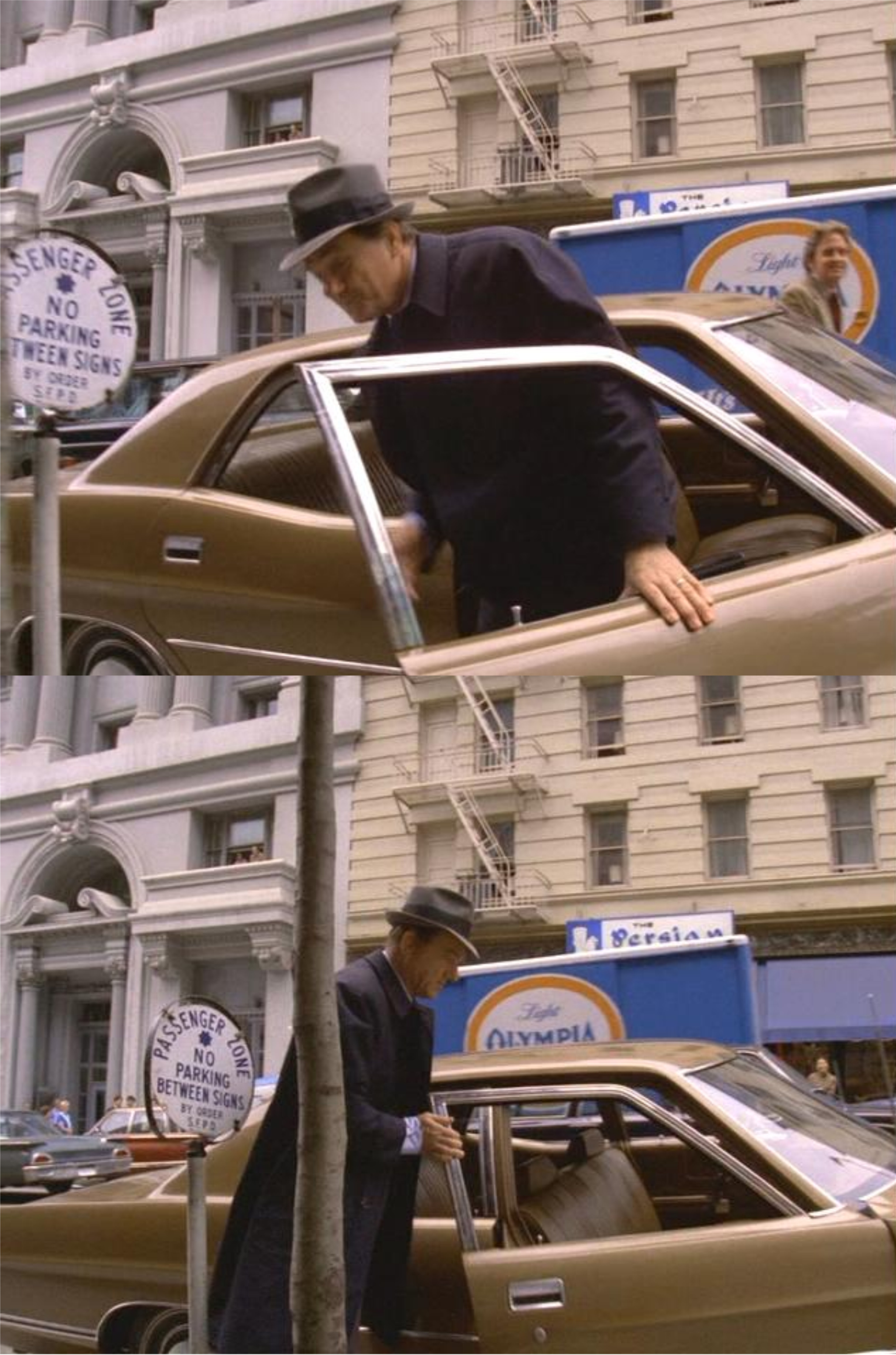
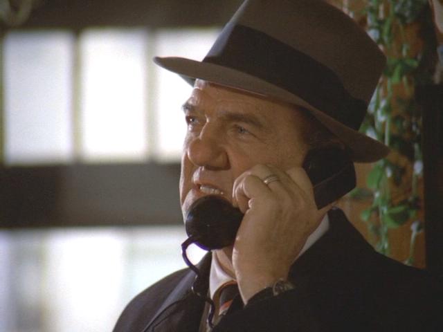
 At the end of ‘45 Minutes from Home’ they park on Grant Avenue and walk into Chinatown. I wonder if they still make Olympia Beer! That’s a historic and forgotten building on the left behind them. During World War Two it was the main telephone exchange center and was considered so important sand bags were stacked at the entrance to protect it from Japanese bombs that were expected to be dropped on San Francisco after the Pearl Harbor attack.
 Here is a vintage picture of the building during World War Two. (SF Chronicle)
 “That was the end of a good case, buddy boy! This coke and burger in exotic Chinatown are on me.”

 Their investigations often led them to ordinary locations that are hard to track down. In this scene from ‘Timelock’ they cross a street and enter into a building with addresses on the entrance of an unnamed street looking for a suspect. I was afraid that I was going to have to do some homework to locate this spot, but Lt. Stone made the job easy with his check-in call. “We’re at 2207 Taylor Street.” Thanks, Lieutenant!”
 The rest of this collection is devoted to ‘In the Midst of Strangers’. As I mentioned at the opening, I think it is one of the best hours the show has to offer. Most of the episode takes place in and around Union Square, albeit a Union Square of a long time ago. The episode shows a vibrant but small location in a big city and creates an atmosphere that probably wasn’t even the way it was in 1972, but should have been. It opens up with a northwestern view of Union Square from the roof of the City of Paris Department Store. This was the way Union Square looked from World War Two until it was remodeled in 2002. My picture was taken from the Cheesecake Factory on top of Macy’s, the closest I could get to a comparison. The plot involves three bad guys staying in a suite at the St. Francis Hotel overlooking the park who systematically rob people passing by or through Union Square after studying their movements by telescope or eavesdropping on them while lingering in the park, to find the ones ripe for the picking. This was two years before Gene Hackman made that kind of activity famous here in the 1974 film ‘The Conversation’.
 David Wayne plays an elderly and popular newspaper salesman who’s friendly with just about everybody who comes to Union Square. His station is here on the northwest side of the square back when one of the entrances to the underground parking garage was still there. Later in the episode Wayne will be robbed by the thugs of three thousand dollars of his savings.
 In one “feel good” scene, a cable car passing by the St. Francis Hotel on Powell Street waits while Wayne sells newspapers to friendly riders on the car. People were just trying to get on a cable car in my picture at the spot, and nobody would have been interested in buying a paper.
 Look at some of the stores on Post Street in 1972, like Gumps, Bonds Suits, and Florsheim Shoes.
 From a robbery to a kill: The crooks spot a victim going into a jewelry store on Post Street and one of the gang played by Robert Foxworth follows him across the intersection of Post and Stockton Streets into the northeast entrance of Union square.
 After buying a newspaper from David Wayne the victim boards a cable car on Powell Street at the front end while Foxworth climbs on the back. Now watch the number 525 cable car as it climbs Nob Hill.
 After passing Sutter Street the cable car changes to number 510. Of course, the one in my picture changed from number 12 to number 7, but I’m not going to pretend it’s the same cable car.
 By the time the victim’s cable car reaches the crest of Nob Hill it’s been demoted to number 509 and the man behind the victim has changed his clothes!
 The victim should have stayed on the magic cable car. When he gets off at California Street he’s hustled into the yellow LTD approaching on the left by Foxworth and driven by his two accomplices. They drive down California Street and turn into Joice Alley. When the man being robbed resists he’s killed by Foxworth. He didn’t even get to read the paper Wayne sold him.
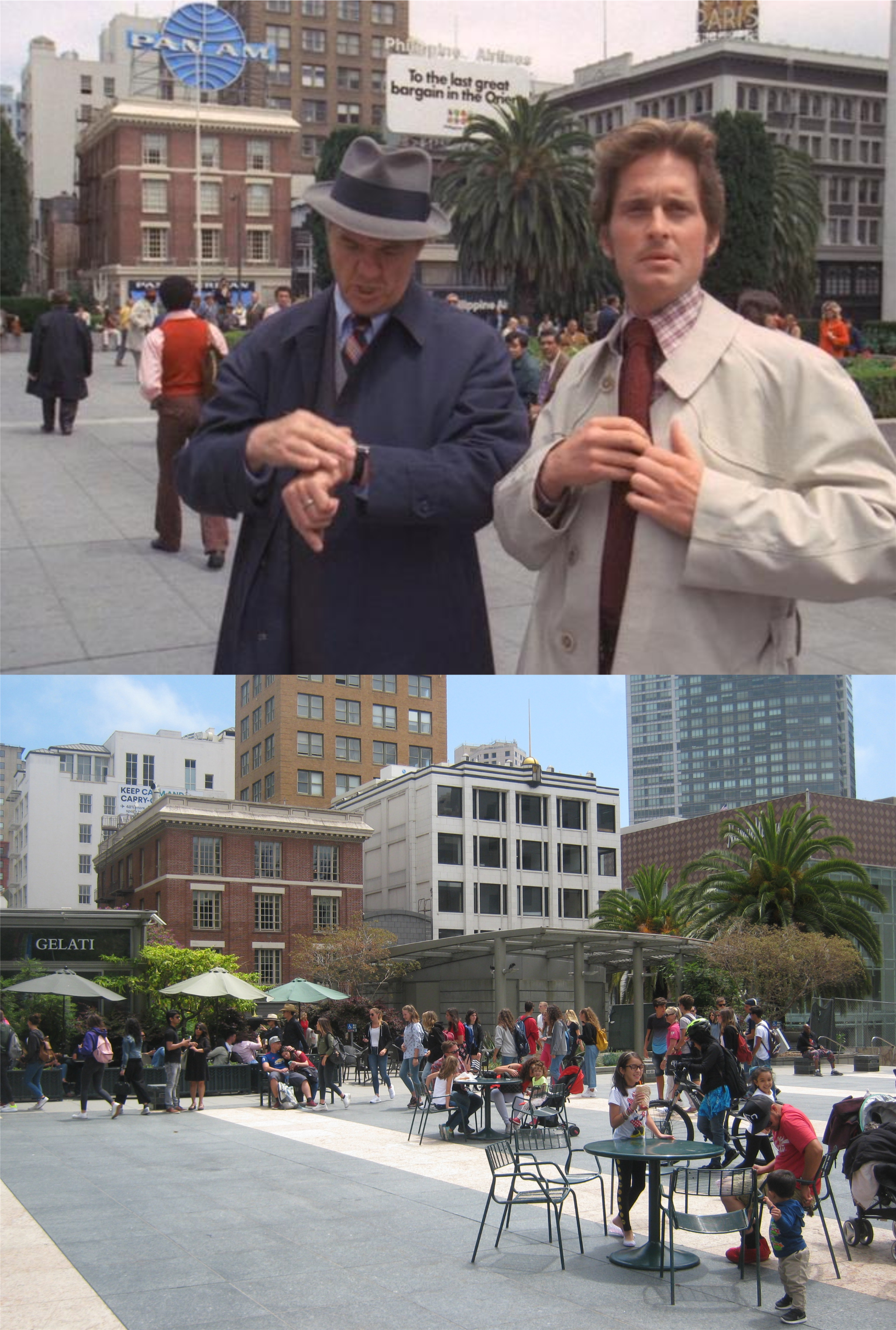 After Wayne is robbed Stone and Keller peruse Union Square looking for clues. Behind them are Maiden Lane and the City of Paris Department Store. The City of Paris was demolished in 1979.
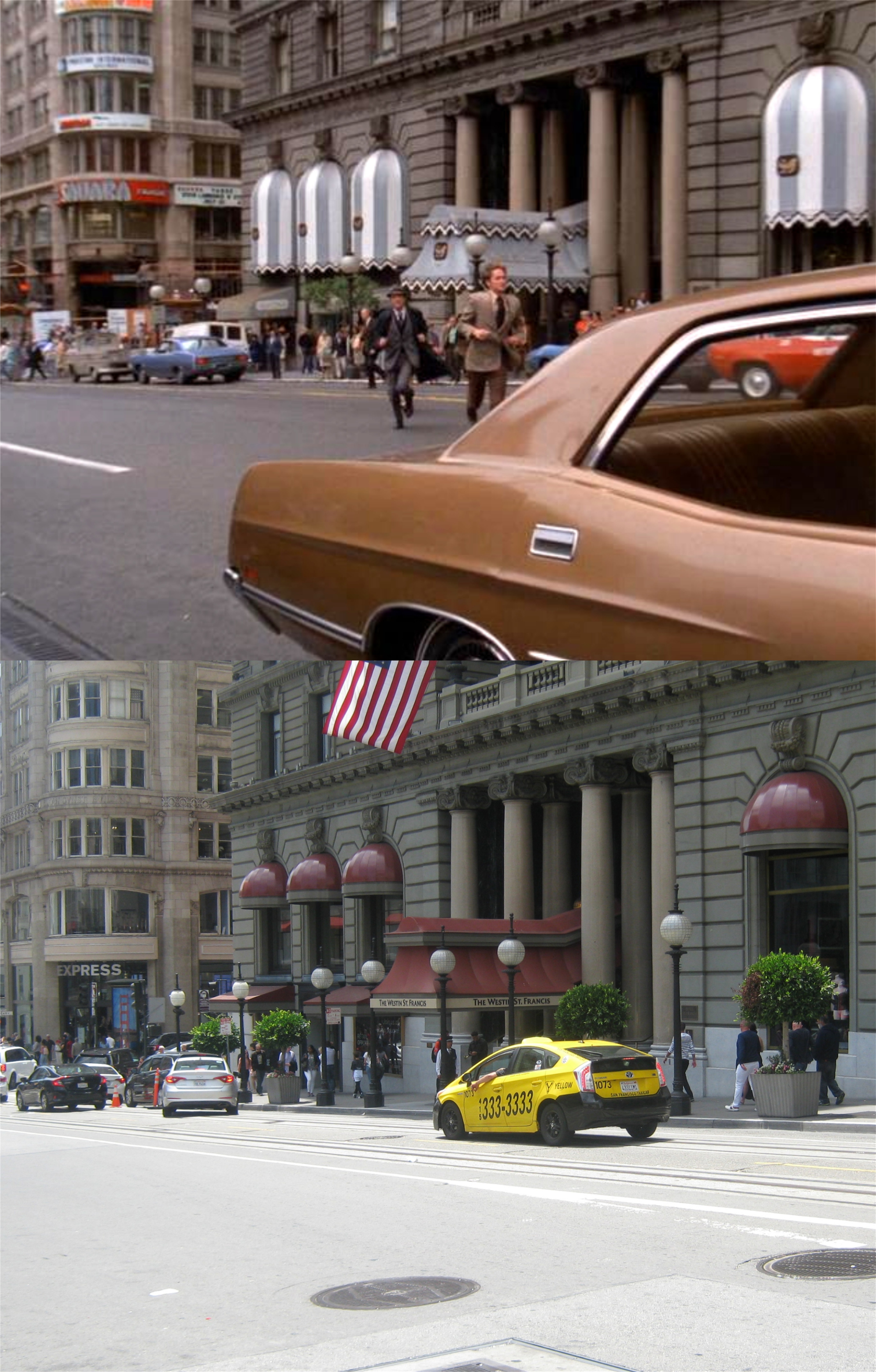 Wayne spots one of the men who robbed him and follows him to the room where the rest of the gang is staying. After nearly getting caught and losing his life he contacts Stone and Keller, but the crooks have left before they can get there. The chase is on.
 After a race through San Francisco the bad guys turn down this street in the Presidio.
 The road leads to Fort Point, built just before the Civil War.
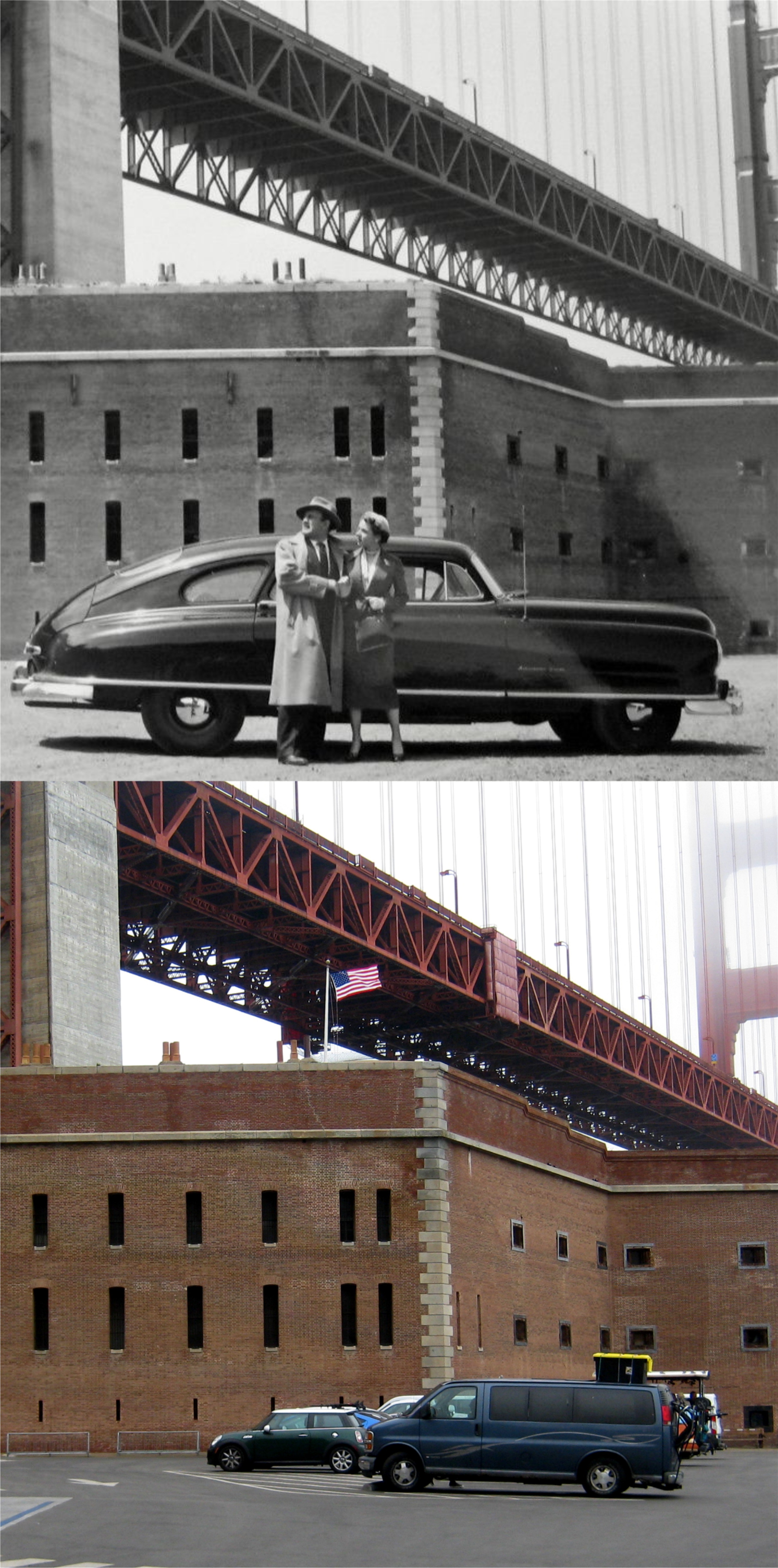 They should have taken a lesson from Lee J. Cobb and Jane Wyatt who tried to hide from the police here in the 1950 crime movie ‘The Man Who Cheated Himself’. There’s no way out from here. (Film image from Rotten Tomatoes)
 The crooks drive into the fort through the main entrance followed by Keller and Stone. The suspects exit their car and begin shooting at the two officers.
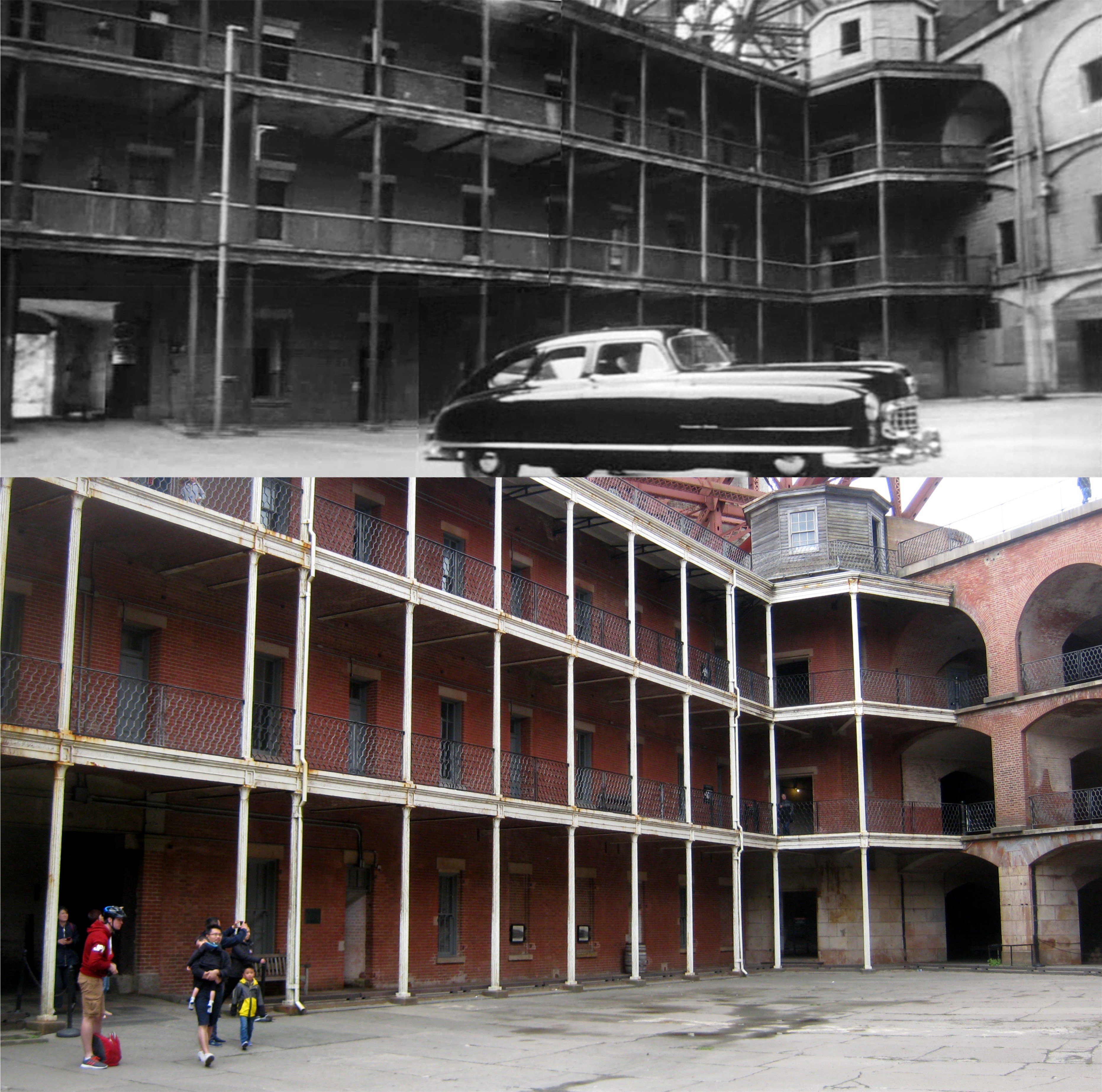 Jane Wyatt and Lee J. Cobb drove into Fort Point here as well. (Film image from backstageweplayers.org)
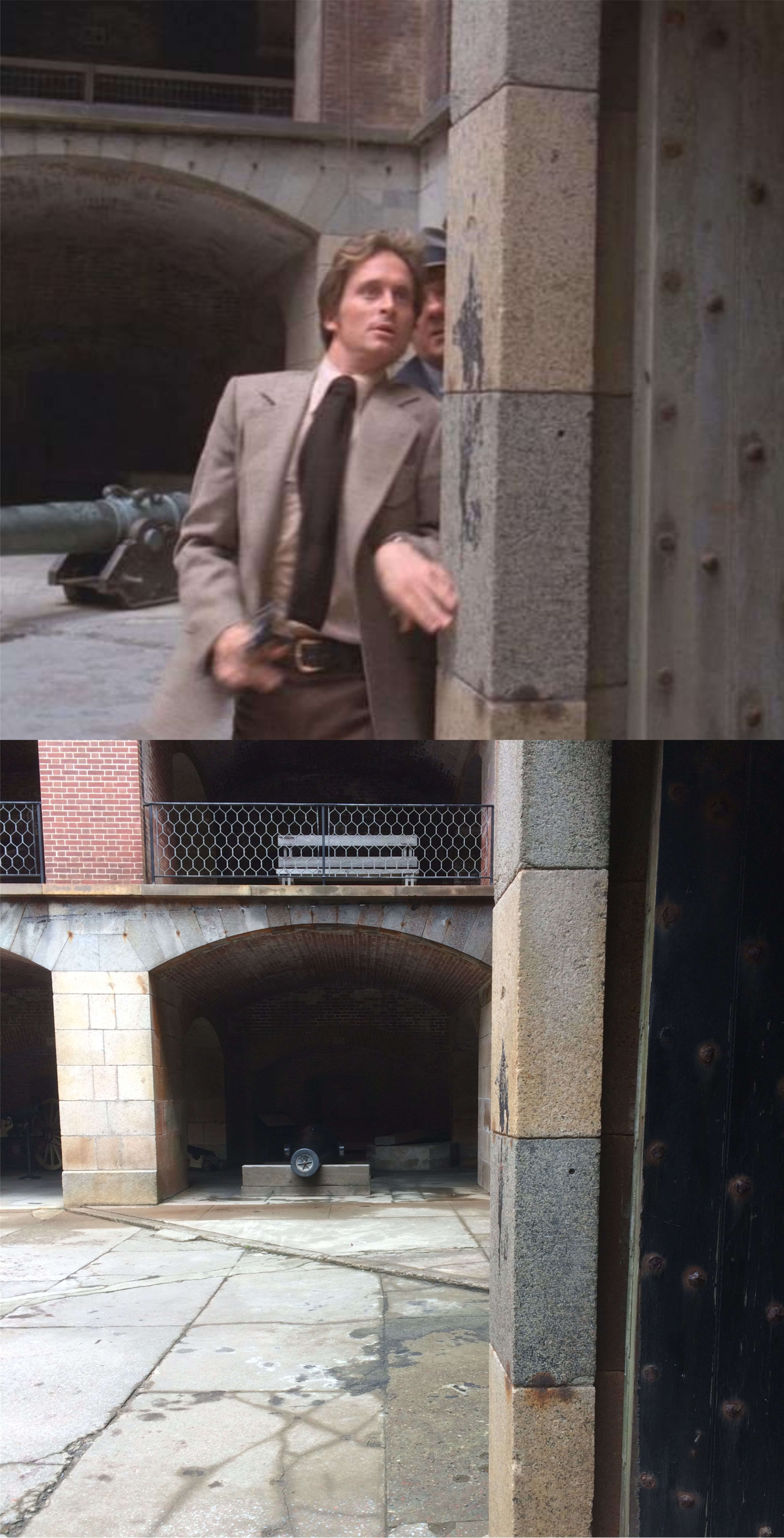 As the villains head up to the roof of the fort, “someone’s sneakin’ ‘round the corrrrrner”.
 A well placed shot takes care of one heading up. They have some kind of ramp on the ground below this spot so I couldn’t get an exact lineup.
 One down and two to go: Stone and Keller follow the rest up to the top.
 Foxworth makes a dash along the roof of the fort. This scene appears to have been filmed late in the afternoon.

 Stone, having to make a tracking shot with the sun in his eyes, fires and down goes Foxworth near the old lighthouse. Two down and one to go. I could have got him myself if my finger was loaded.
 Jane Wyatt and Lee J. Cobb didn’t have any better luck escaping from police when they tried to hide up in the lighthouse in ‘The Man Who Cheated Himself’. (Film image from the Movie Gourmet)
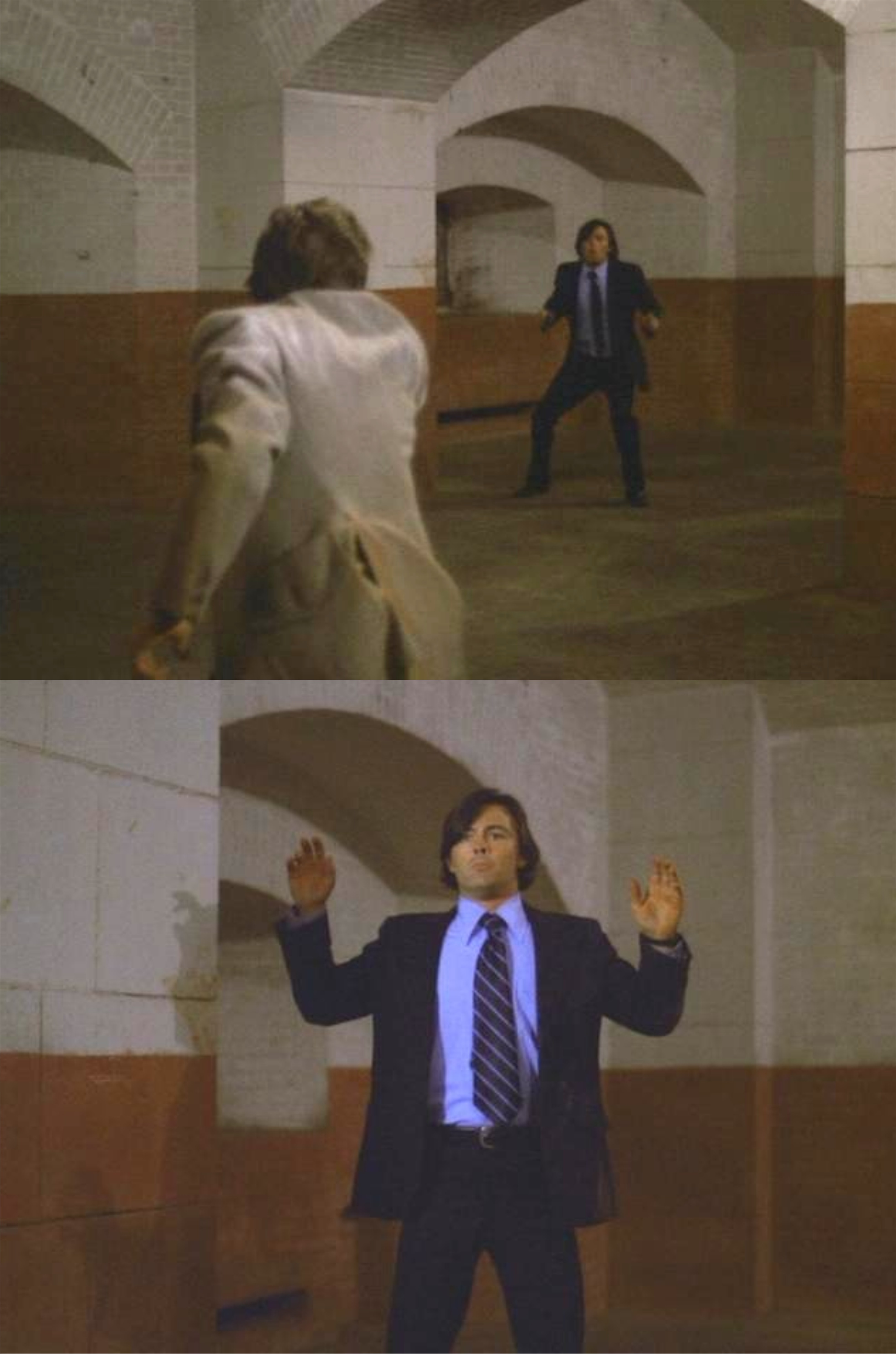 The third suspect wisely decides to give himself up.
 And so Lieutenant Stone and Inspector Keller tidy up another case and head for the nearest chili dog.
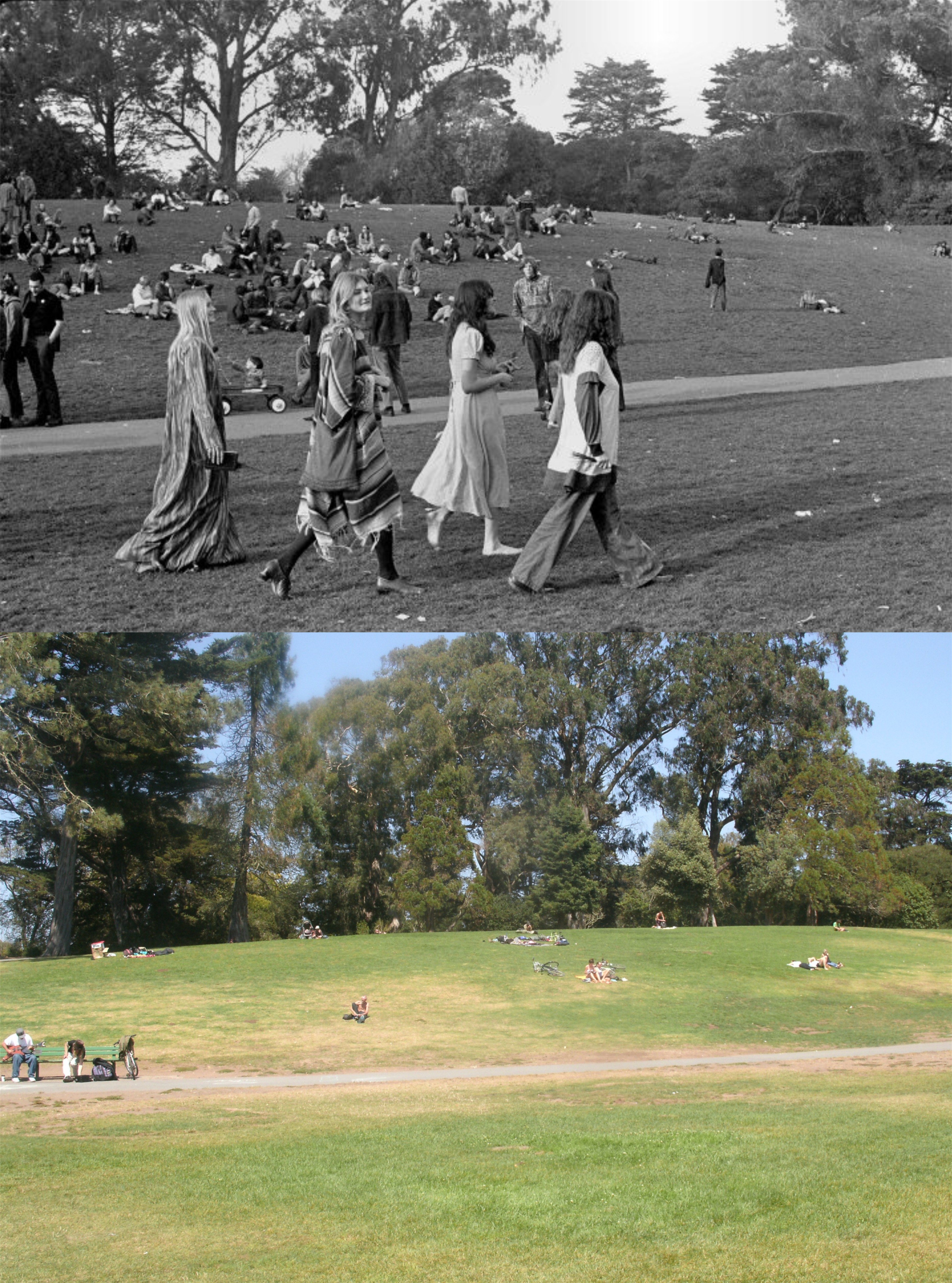 “Hippie Hill” in Golden Gate Park in 1967: “Save up all of your bread, and fly Trans Love Airways to San Francisco U.S.A.” George Harrison and Pattie Boyd sat on this hill while George played a few songs with a borrowed guitar in 1967.
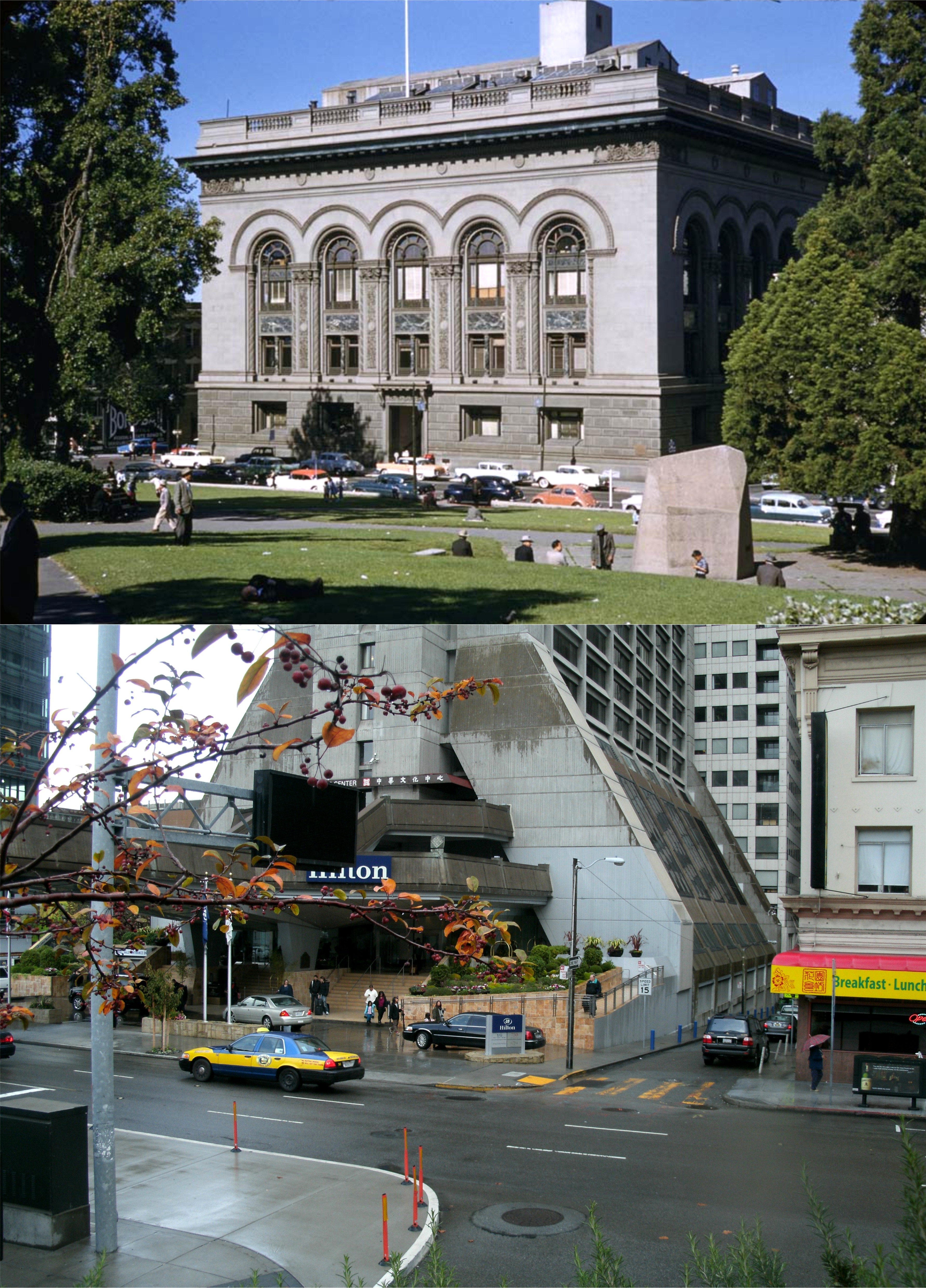 The old Hall of Justice on Kearney Street in 1958 from a Charles Cushman photo: Both pictures were taken from Portsmouth Square. This building appeared regularly in television shows such as ‘Lineup’ and ‘Ironside’, and many crime pictures like ‘Impact’. ‘The Man Who Cheated Himself’ and ‘The Lady from Shanghai’. The old hall was demolished in 1967.
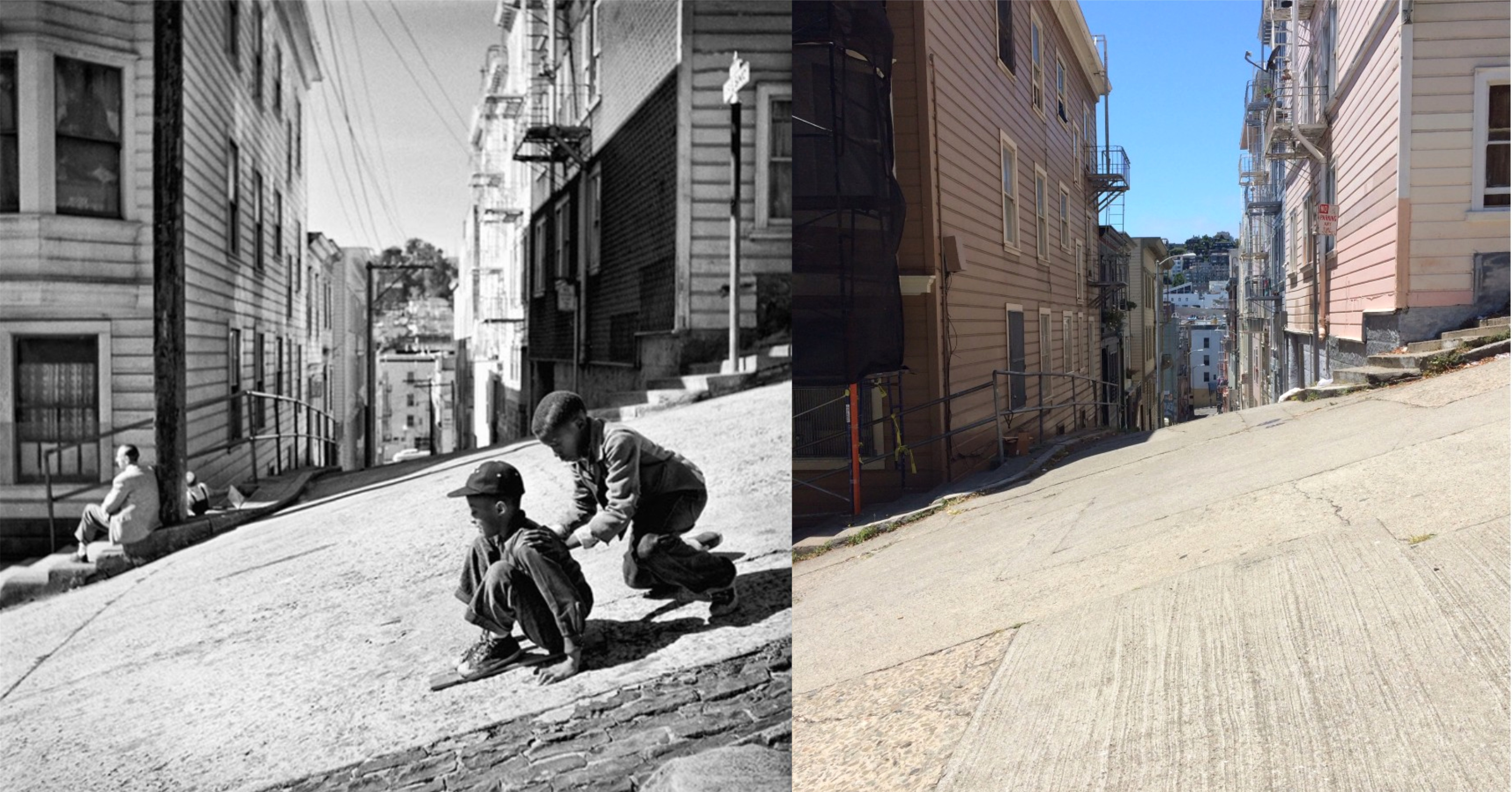 Kearny Street at Fresno Alley as it climbs Telegraph Hill in the 1940’s from a Fred Lyon picture: It’s still quiet around here today, but kids don’t slide down the street anymore and the view that fellow is enjoying is a lot different today.
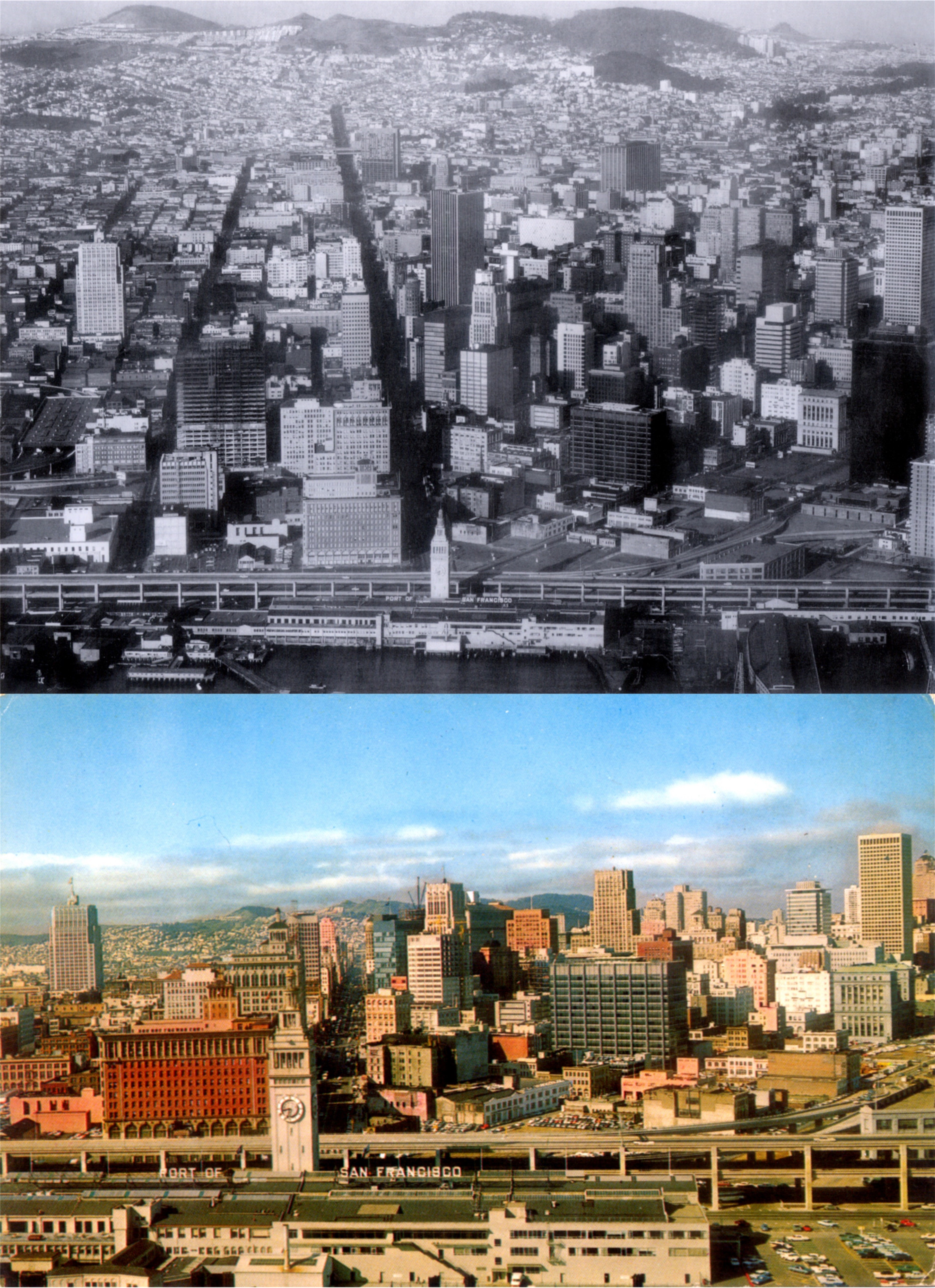 Two aerial views of Market Street from the Ferry Building at the end of the 1960’s: The bottom picture is from a postcard I bought when I was in high school.
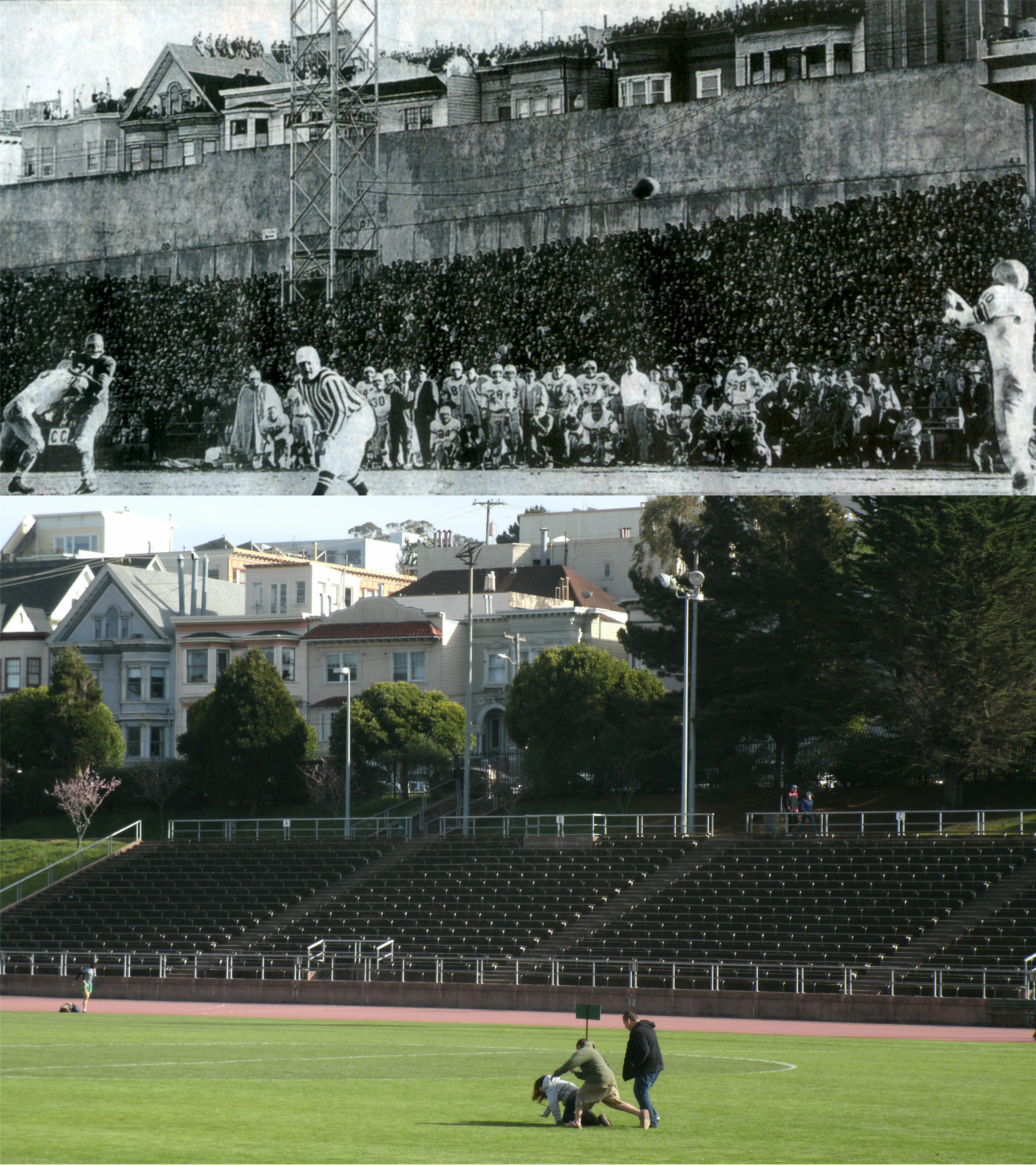 A football game between the Detroit Lions and the San Francisco 49ers at Kezar Stadium in 1957: I hope that was just wholesome fun and not a mugging that I failed to report in my picture. (SF Chronicle)
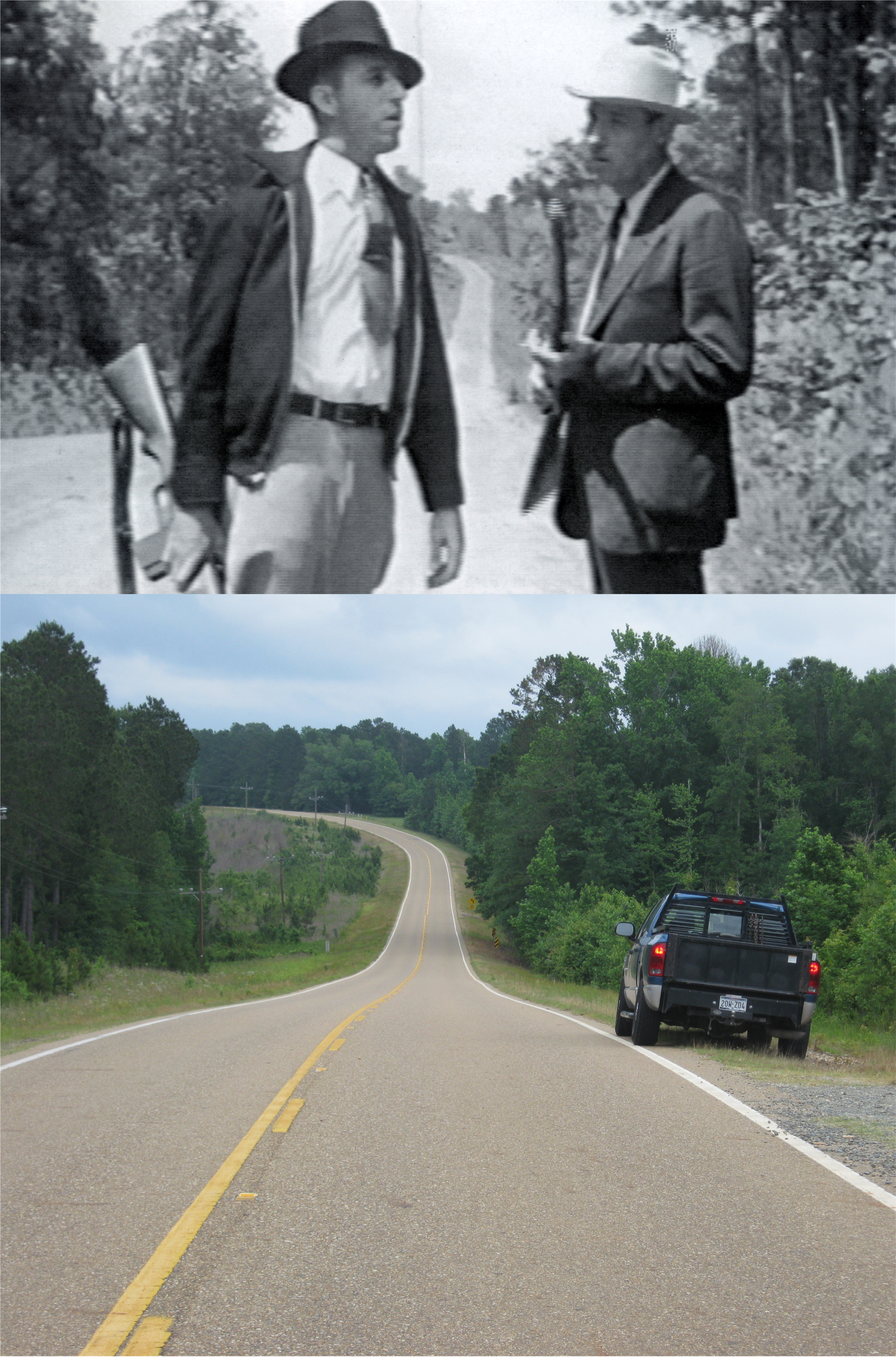 Two members of the posse that shot Bonnie and Clyde to death at this spot earlier that day pose for a picture: This is on a lonely road outside Gibsland, Louisiana. The road winding away behind them is where Bonnie and Clyde drove up the hill to this spot here where they were ambushed.
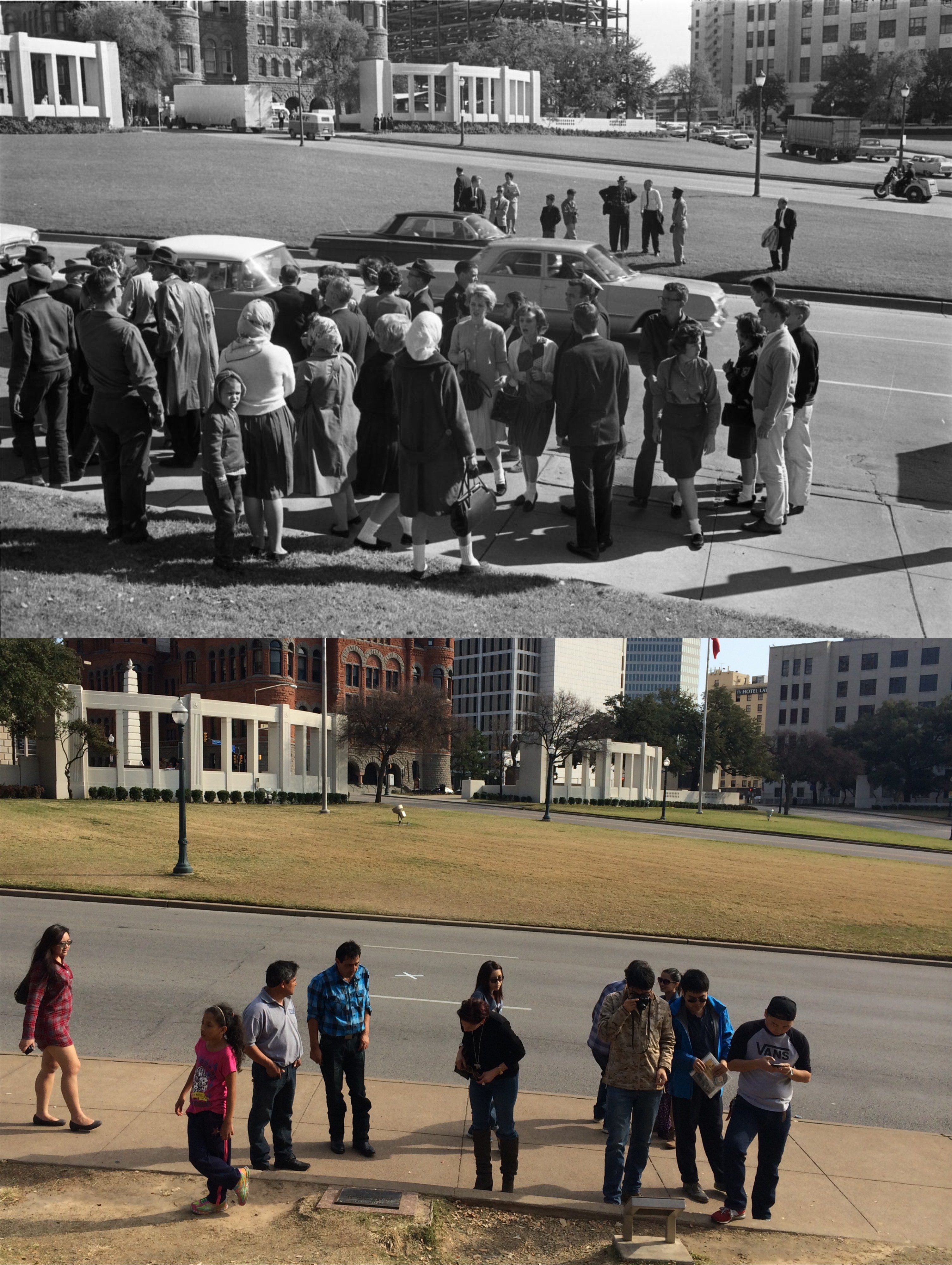 Stunned and confused people at Dealey Plaza in Dallas, Texas on November 22nd 1963, shortly after President John Kennedy was shot passing through here: This November will be the 55th anniversary of that day.
 A one armed officer from the army tries to recruit Harold into joining while shell shocked, crippled and blind veterans pass by up on Sutro Heights in the black comedy from 1971, ‘Harold and Maude’.
 Well, that’s just rude! Ray Harryhausen’s giant octopus gobbles up the Golden Gate Bridge in the movie ‘It Came from Beneath the Sea’ from 1955.
 Candlestick Park in the 1960’s, and on two visits that I made to the old stadium in 2014 and in 2015, shortly after it was demolished.
 The Bride of Frankenstein (Elsa Lanchester) and the Hunchback of Notre Dame (Charles Laughton) at the Main Street Cinema in Disneyland in the 1950’s: (Disneyland, the First Quarter Century)
 Glacier Point in Yosemite National Park: I went out on that rock in July of 2016, but I didn’t go all the way to the edge like this fellow. I like to say that it was because there was no one there to take my picture, but I think it was more than that. As of this writing, Yosemite is being evacuated now due to a major fire.
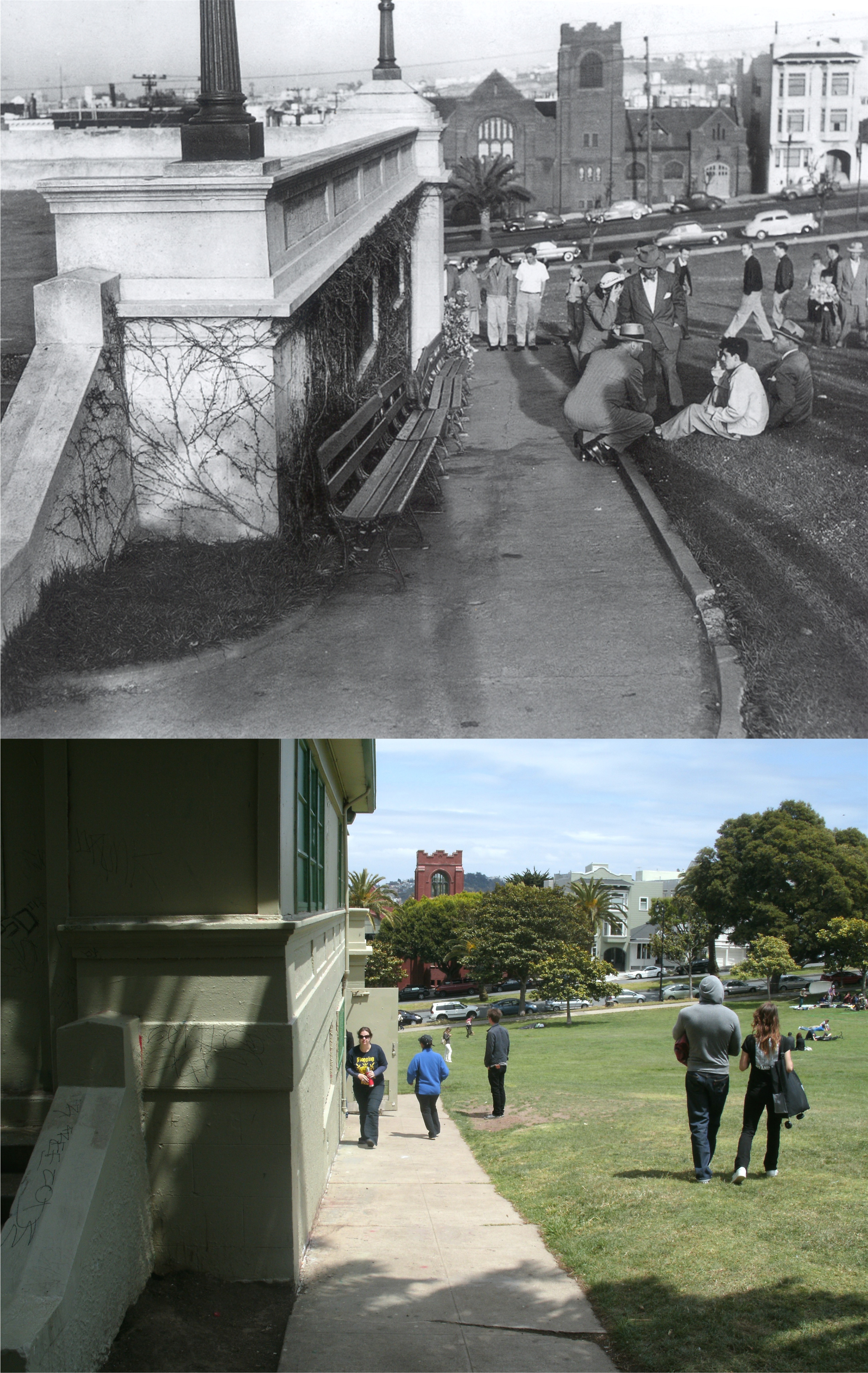 Police question Roman Rodriguez after he murdered Hilda Pagan in Dolores Park in 1952, from Hannah Clayborn’s collection of historic San Francisco pictures. A top portion was added to the building where the murder occurred and was a restroom and snack bar when I took my picture. The building was demolished in 2015. I’ve always wondered if the lady with her hands to her face was Hilda’s mother.
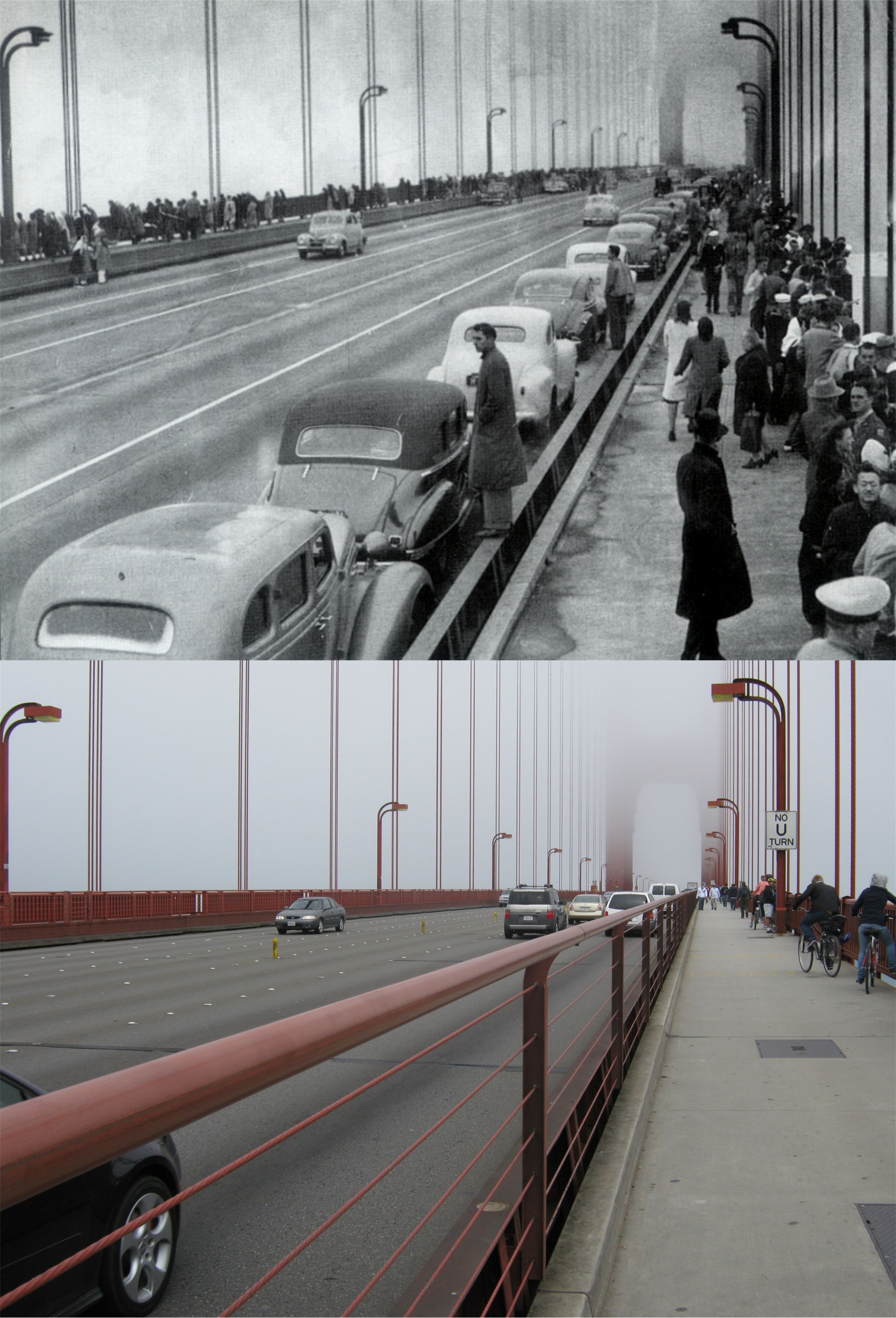 People lining the walkways of the Golden Gate Bridge to watch ships returning home at the end of World War Two in 1945: I was lucky enough to catch a similar looking fog when I took my picture. (Images of America Series)
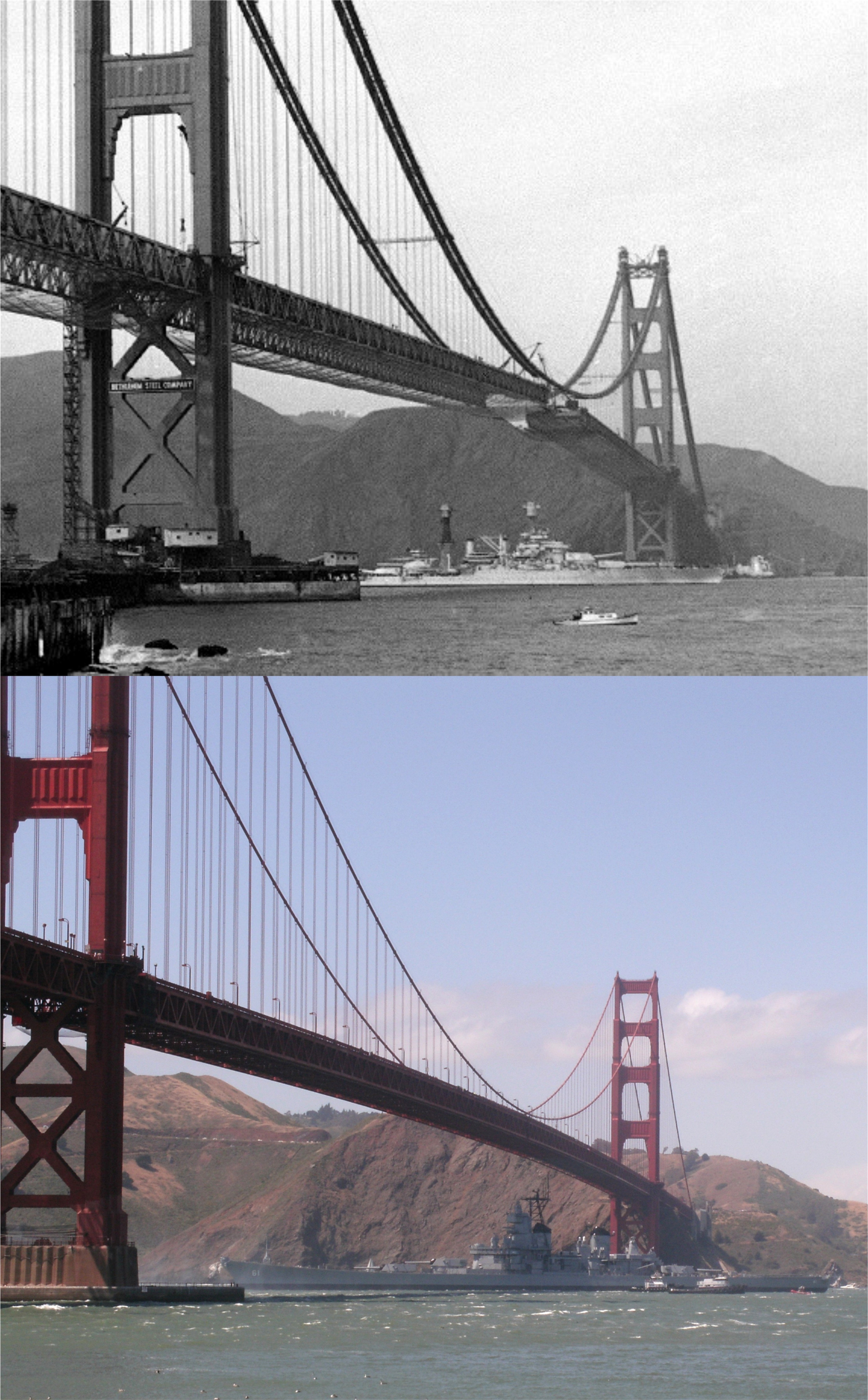 The USS Tennessee sails into the Bay under an unfinished Golden Gate Bridge in the 1930’s, and the battleship USS Iowa sails out to the Pacific Ocean under the bridge in May of 2012: This was almost certainly the last time a battleship will sail under the Golden Gate Bridge.
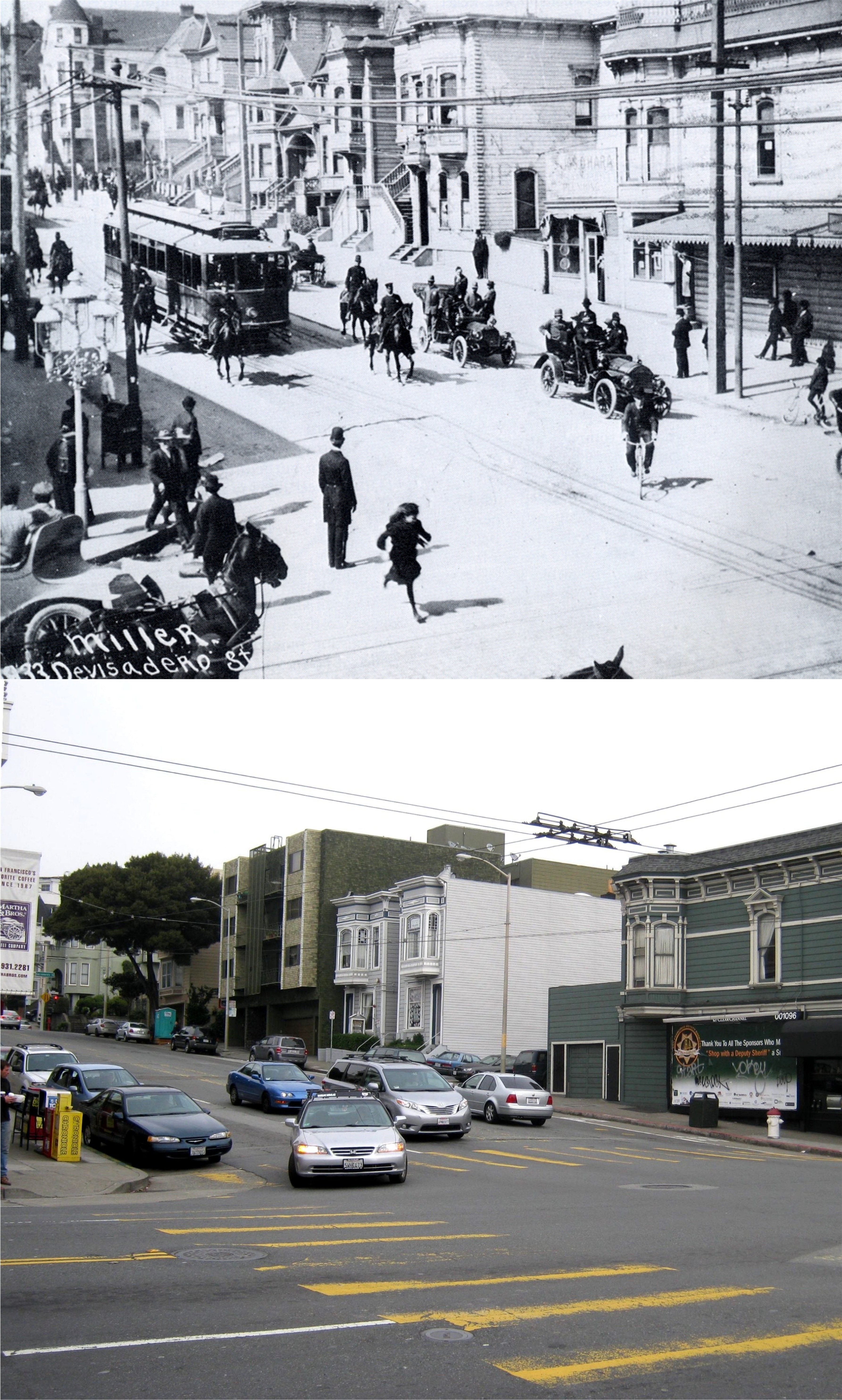 I always liked this bustling picture taken at Divisadero and California Streets in the early 1900’s from the San Francisco History Room collection. They spelled Divisadero wrong, or maybe they spell it wrong today.
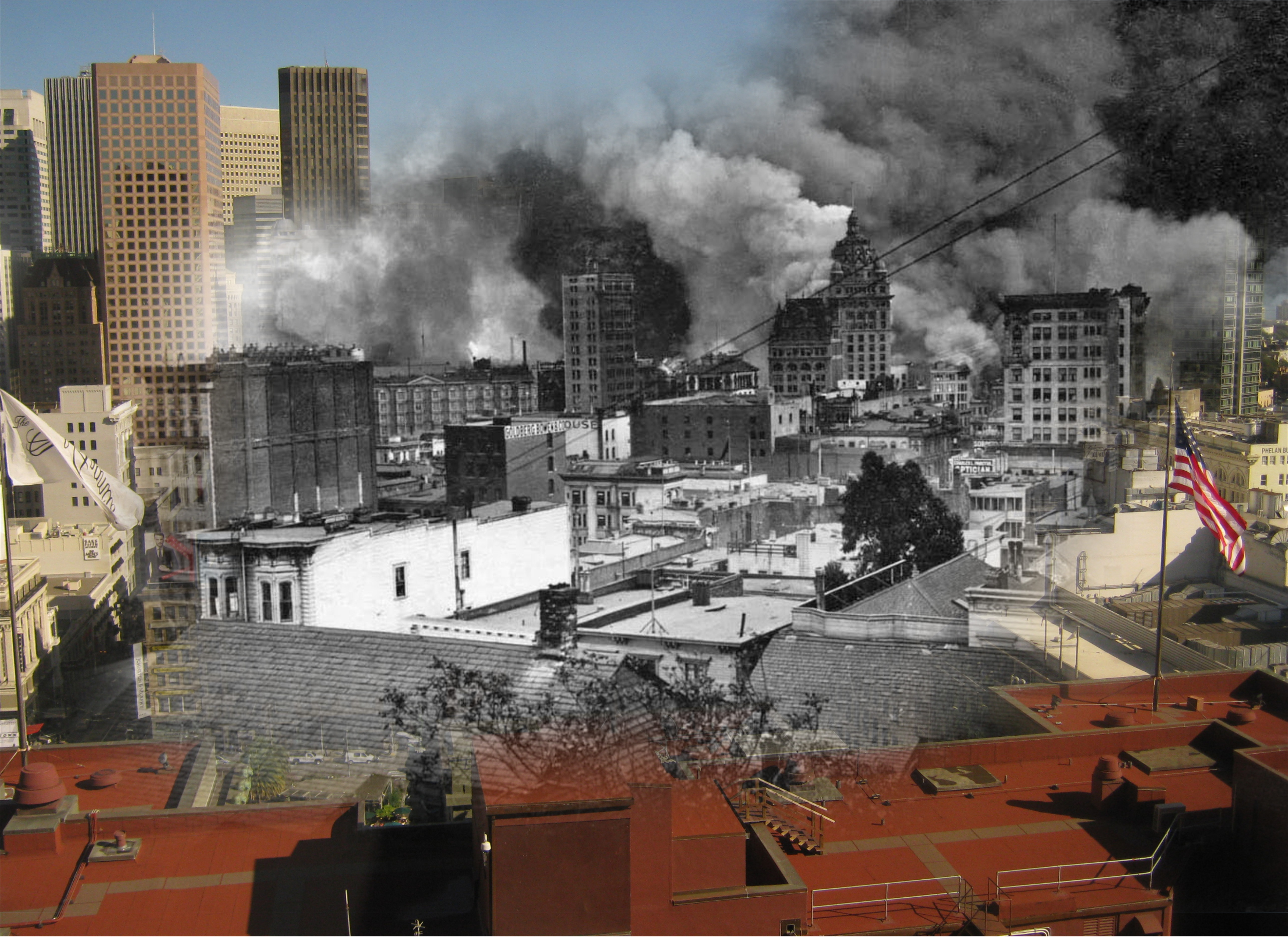 Downtown San Francisco burning during the 1906 Earthquake and Fire: My picture was taken from the St. Francis Hotel.
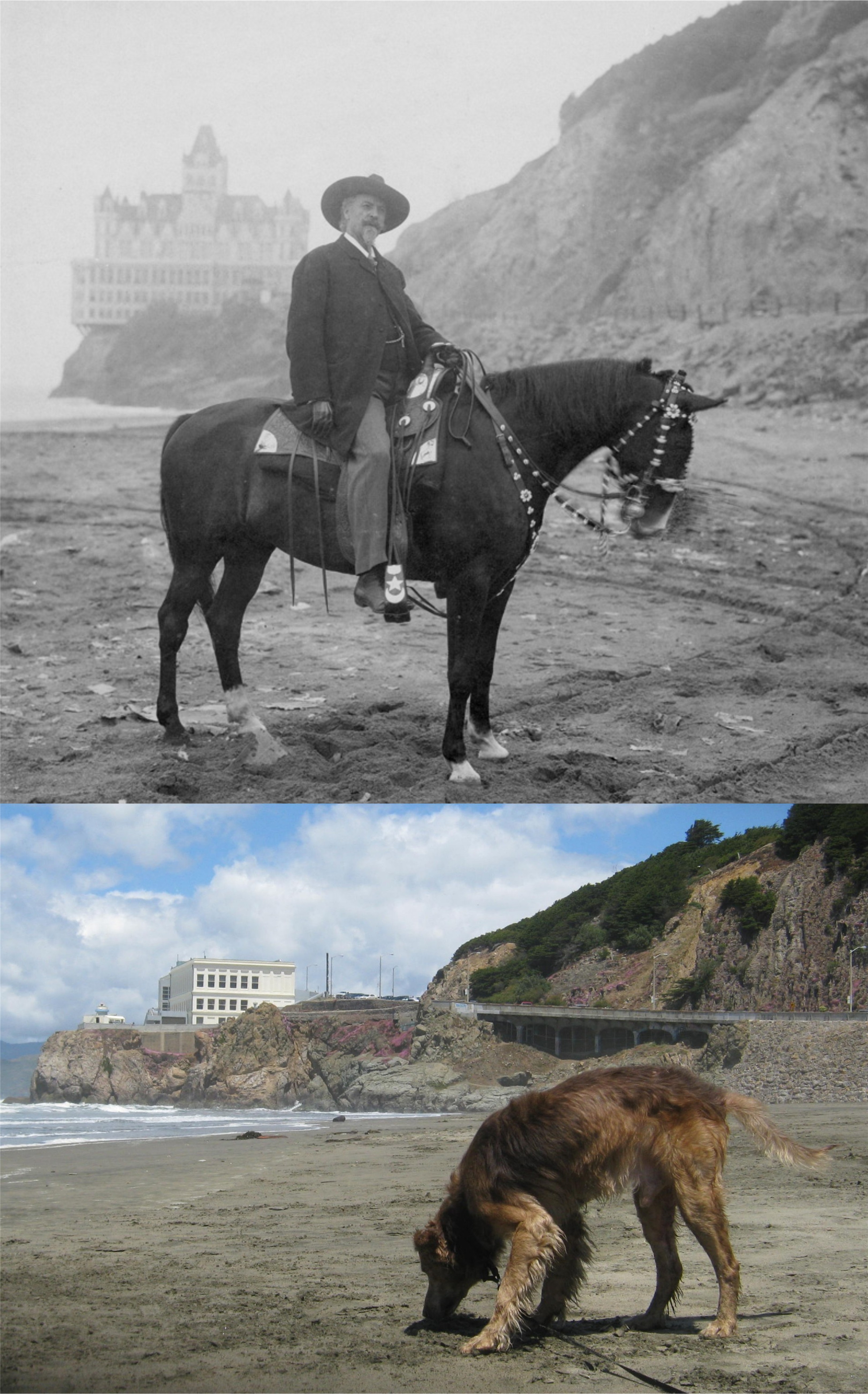 My best friend ‘Danny’ picking up the scent of Buffalo Bill’s horse at Ocean Beach near the Cliff House: (William F. Cody Archive)
 We’ll start out on Market Street near 3rd Street in 1957 looking toward the Ferry Building. The two dominant buildings on the right, the Southern Pacific Building and the PG&E Building, can be seen in my picture peeking out behind the newer Market Street buildings. Like most of Cushman’s photos, there’s a lot to look at, like the long gone Mobile Gas Structure and an old Greyhound Station.
 We’ll head up Nob Hill to the Pacific Union Club on California at Mason Streets in 1952. Sometimes, I think the old cars are the best thing about Cushman’s pictures.
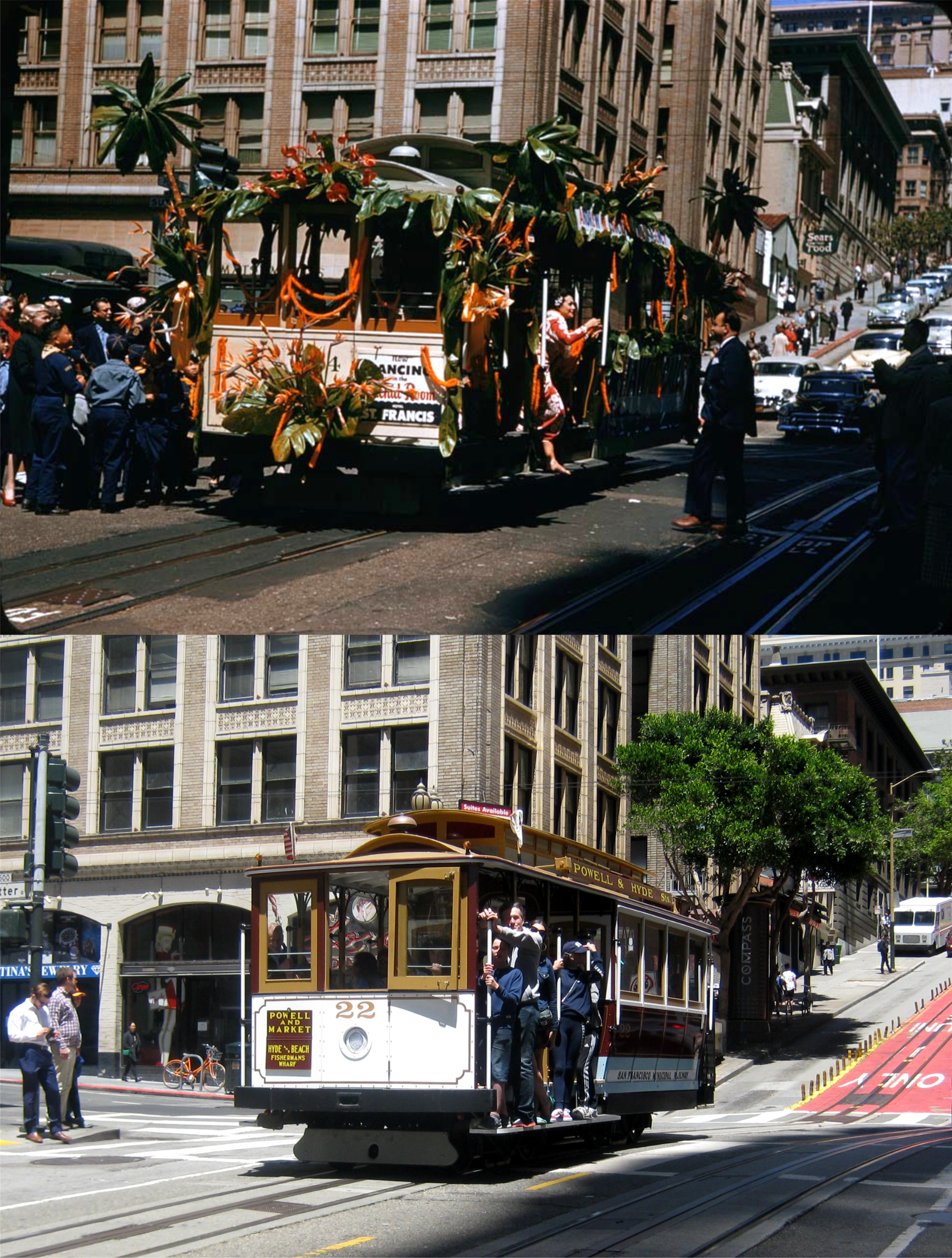 We move down Nob Hill to a cable car festival passing Sutter at Powell Street in 1955. It’s not likely that cable cars will ever be decorated like this again.
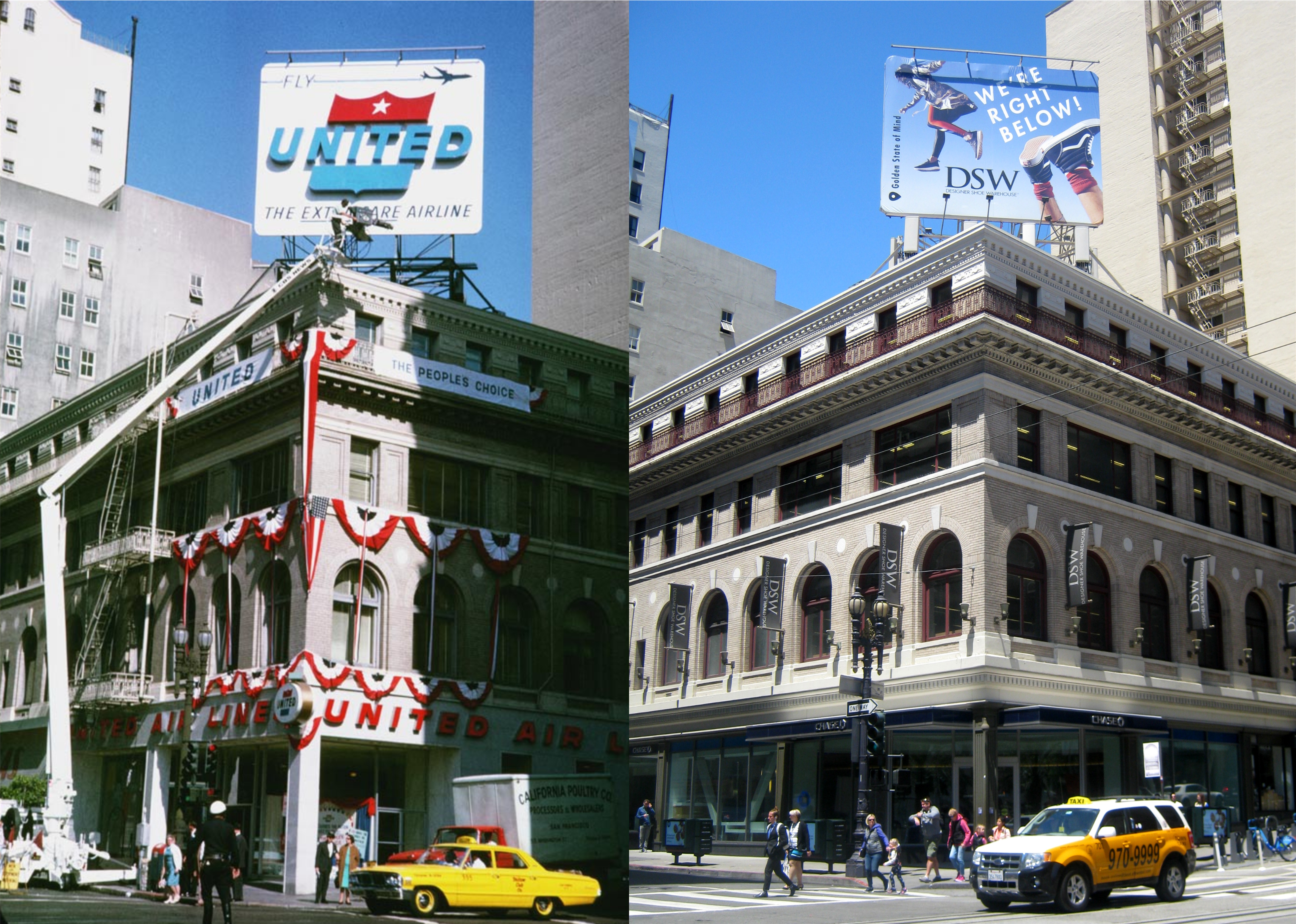 One block south from the previous picture and we’re on the corner of Powell and Post Streets during the Republican Presidential Convention that was held at the Cow Palace in 1964. We’re probably a long way from another Republican Convention hosted in San Francisco, as well.
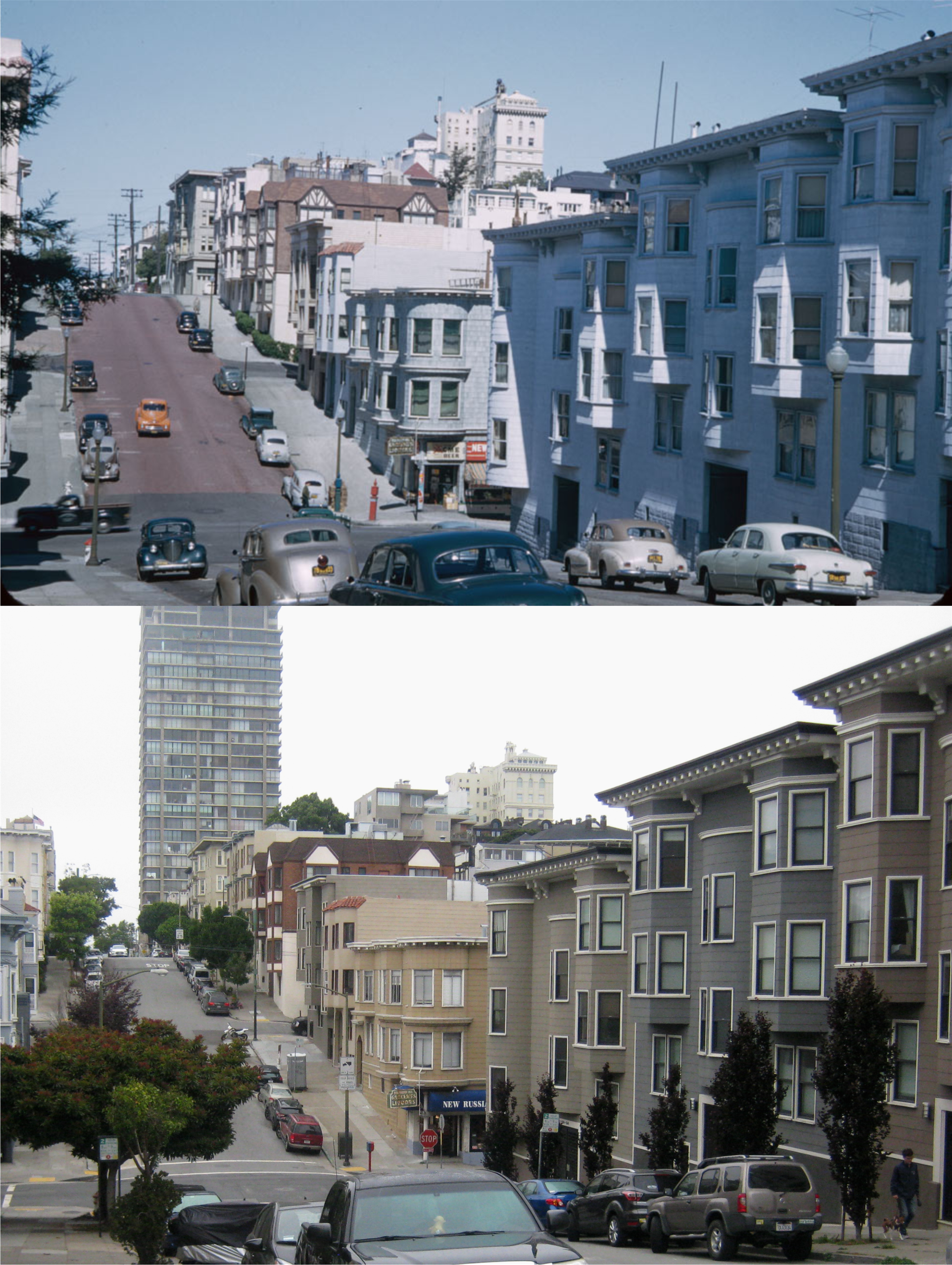 Now we’ll go to a couple of those odd spots Cushman selected. This is on Jones Street looking toward Pacific Avenue and the valley between Nob and Russian Hills in 1952. Notice that the ‘New Russian Hills Market’, which hasn’t been “new” in a long time, was there on the northeast corner of Pacific and Jones in 1952, and still is.
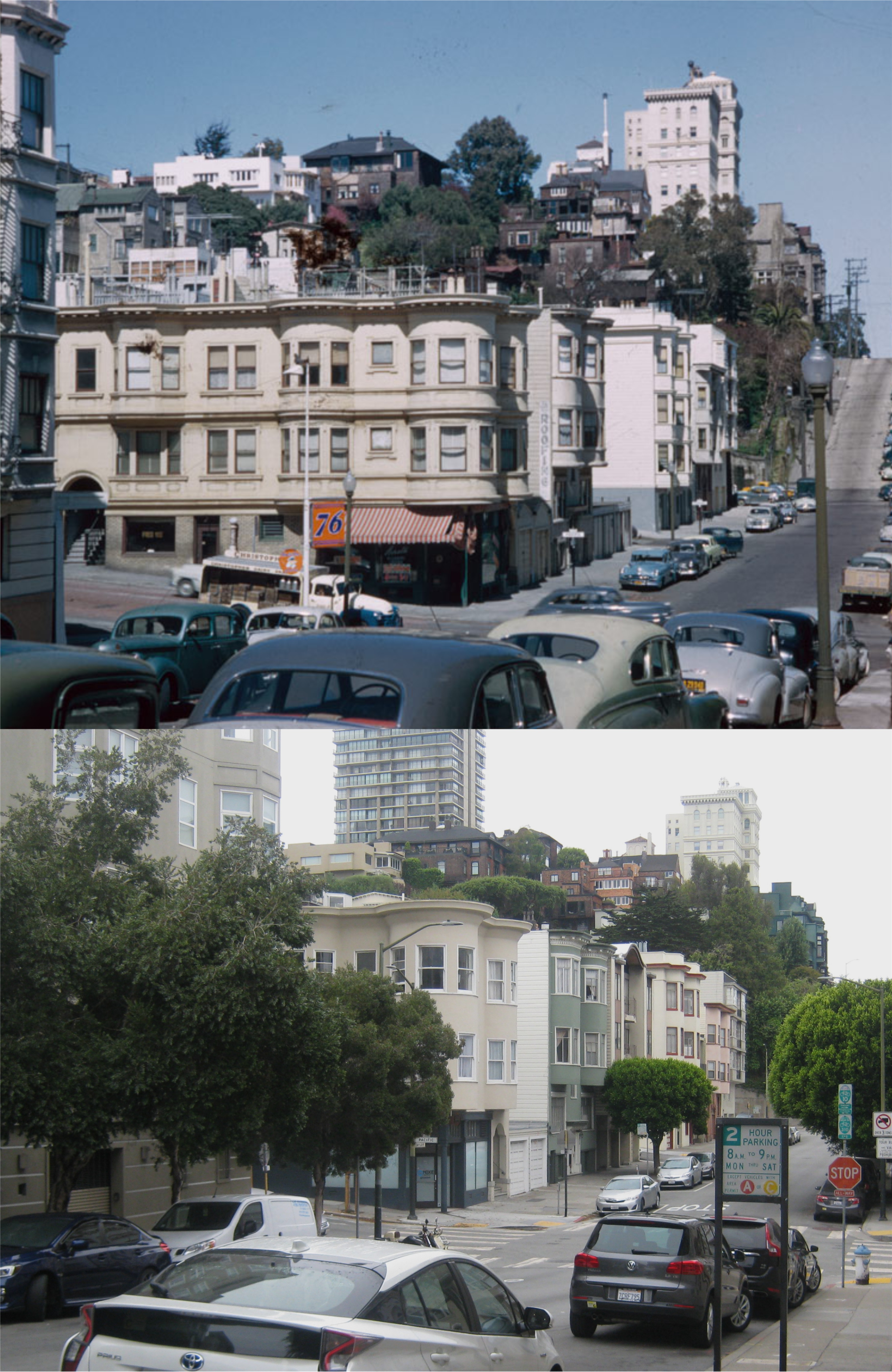 We’ve moved over one block east from the previous picture to Taylor Street looking toward Pacific Avenue in 1952. The 76 Gas Station is gone and a tree hides where Taylor makes its climb up Russian Hill.
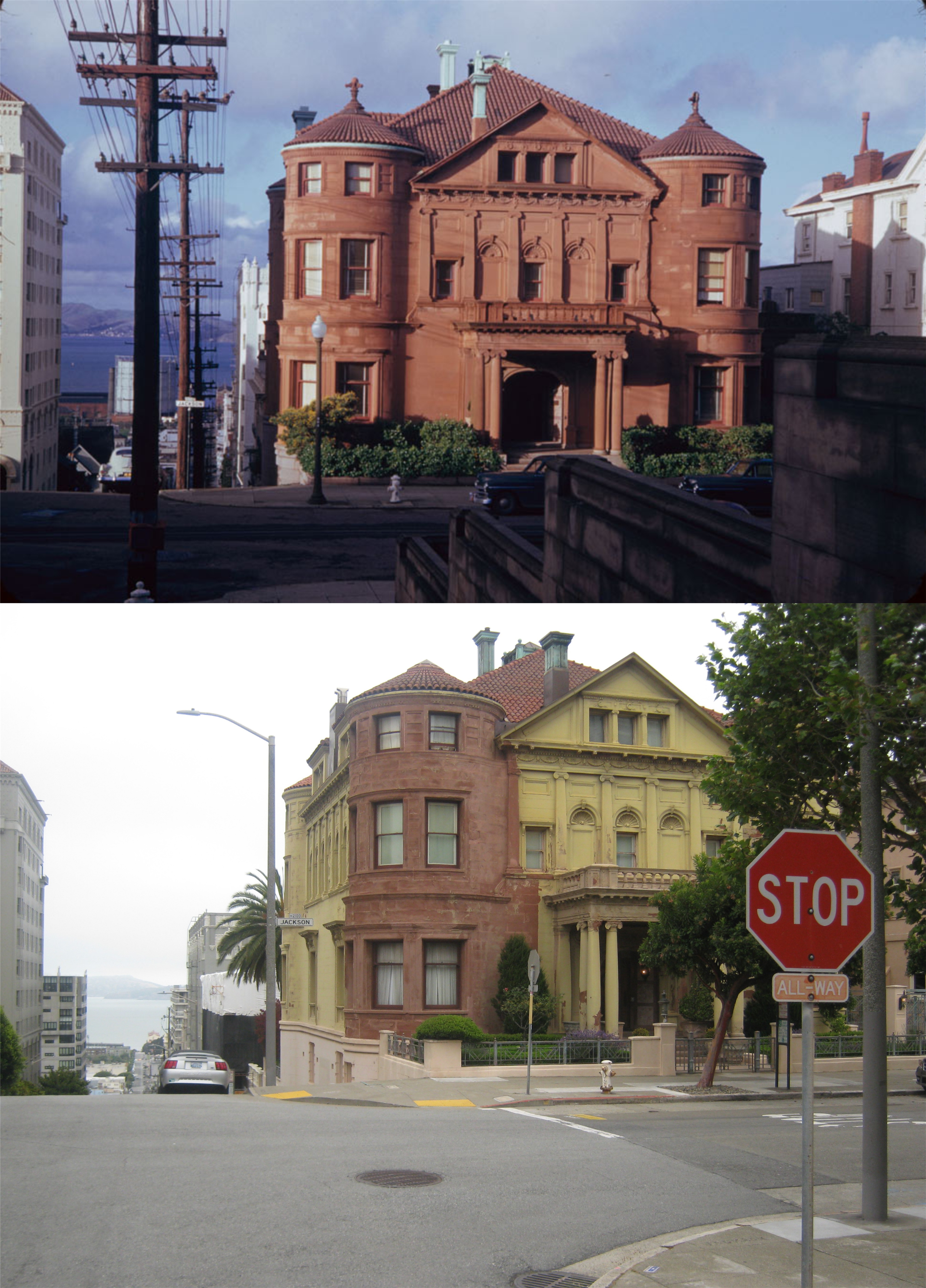 We’re meandering westward now. This is on the northeast corner of Laguna and Jackson Streets in 1952. I did a post on December 5th 2015 that covered the Whittier Mansion seen here. It was the German consulate before the Pearl Harbor attack. After war was declared between USA and Germany, government agents broke in and discovered that they had been spying on shipping movements through a telescope. Also, in 1958, Eli Wallach, “Dancer” killed his second victim in this mansion in the movie ‘Lineup’. PS, it’s also haunted! Well, of course; it would have to be! A building on the southeast corner of the intersection that wasn’t here when Cushman took his picture caused me to move out a little into Laguna Street to get the whole mansion in my picture.
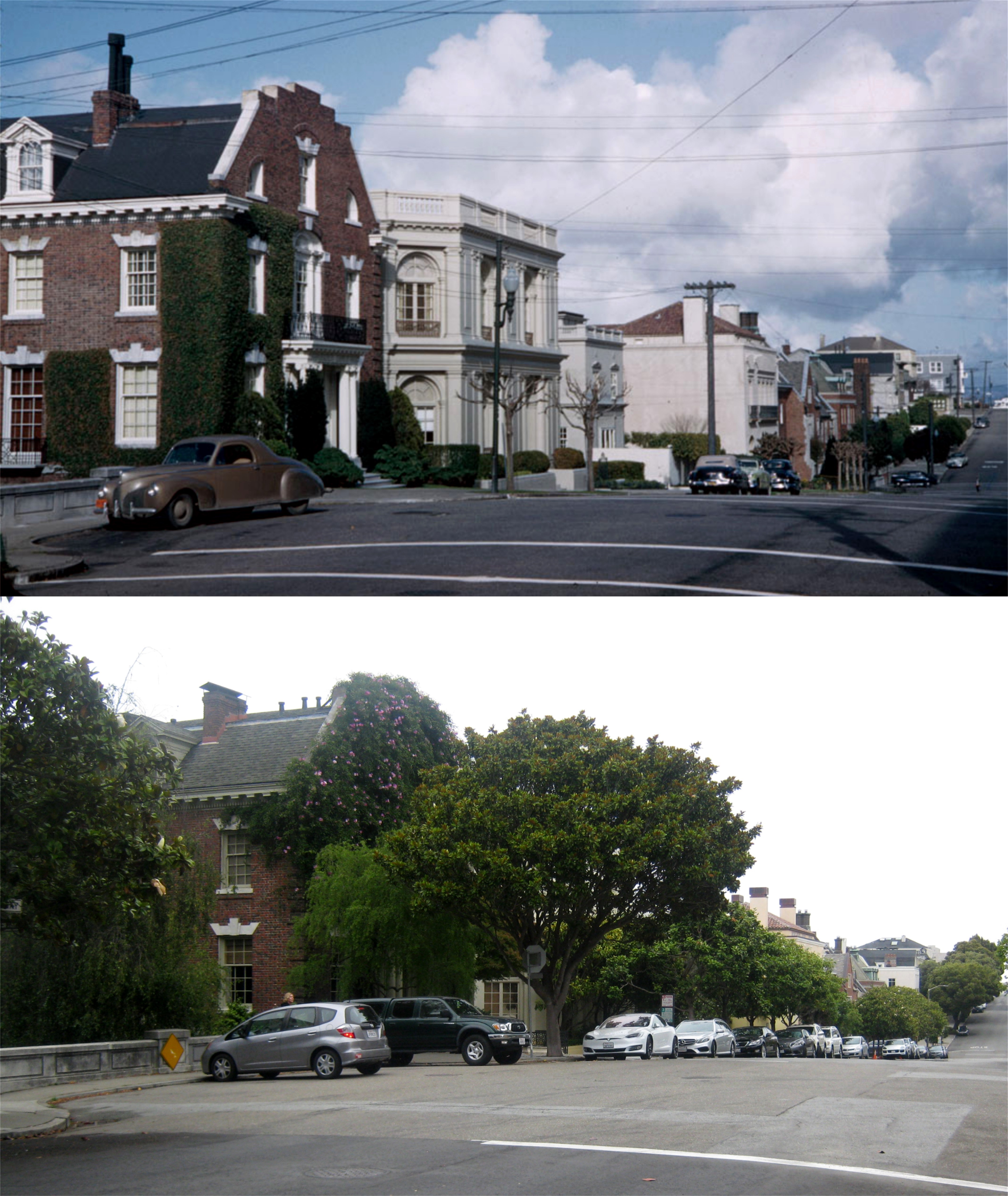 Cushman traveled up to Pacific Heights for this shot looking east along Broadway from Baker Street in 1952. That Colonial looking mansion on the left was where Lana Turner supposedly lived in the 1960 thriller film ‘Portrait in Black’.
 That’s all that’s left of the little cluster of buildings below Sutro Heights along the Great Highway between Balboa Street and the Cliff House. Charles Cushman took this picture in 1952. If you can zoom in on the vintage photo, you’ll see that the last building on the left housed the arcade attractions from the Musée Mécanique. When the buildings were demolished in the 1960’s, the attractions, many of them originally from Sutro’s Bathhouse, were displayed in a small room at the back of the Cliff House. When the restaurant was renovated in the new millennium, the items were moved to Pier 45 at Fisherman’s Wharf, their current home.
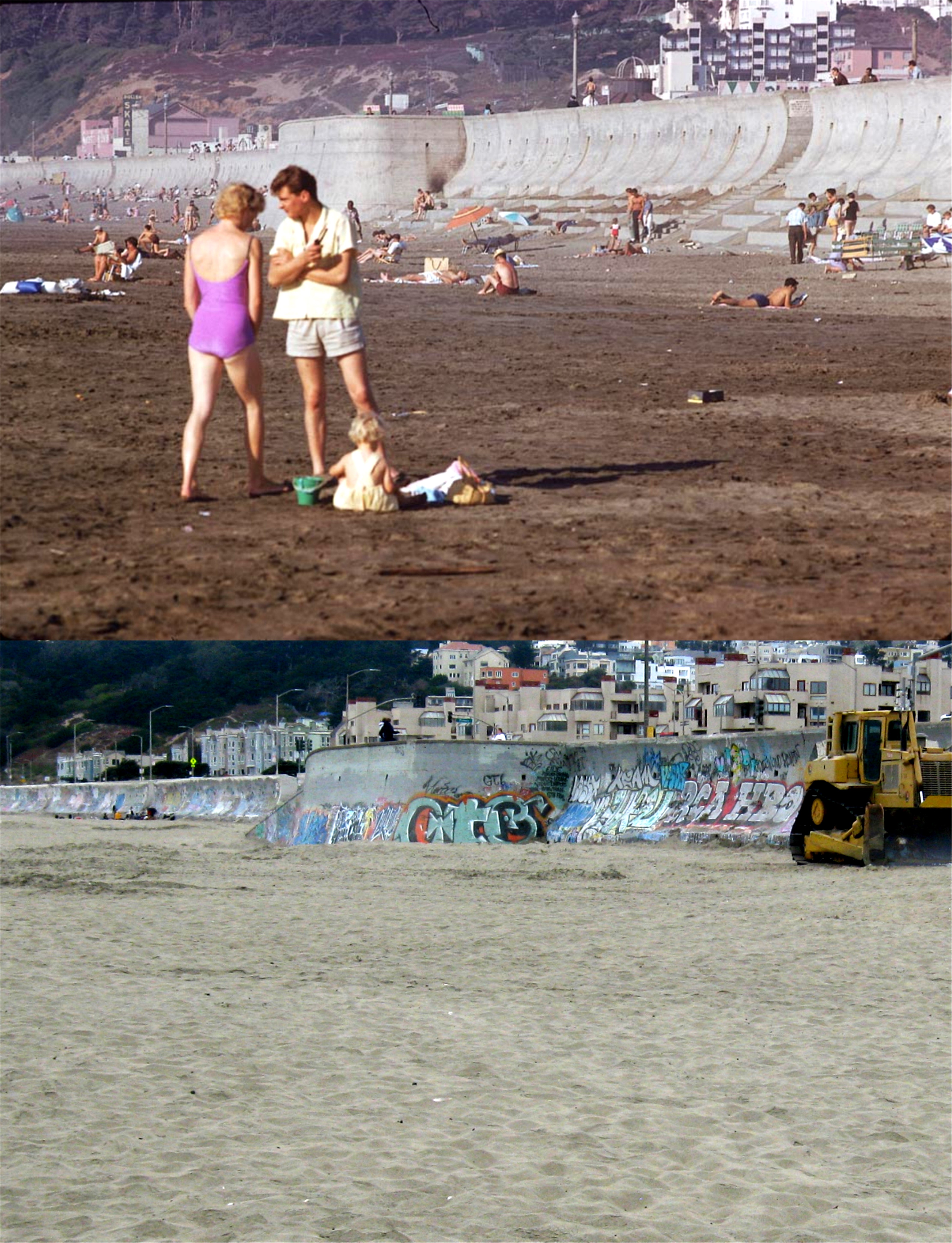 Ocean Beach in 1961: He’s saying, “Don’t be shy, honey. You look great in your scandalously shocking 1961 swimsuit!” The vintage picture was taken looking toward Balboa Street and Playland-at-the-Beach at the Great Highway near where Fulton Street ends. I put the family somewhere around here; that looks like the the seawall ramp behind them. You can just see what looks like the top of a Playland sign peeking out over the seawall on the right. The building with the hoops on the top in the the upper right center of the 1961 picture was where the Playland Merry-Go-Round was. On the far left of the vintage photo picture is ‘Skateland’ in the building that was originally called ‘Topsy’s Roost’. The sitting steps of the seawall were removed by the 1980’s.
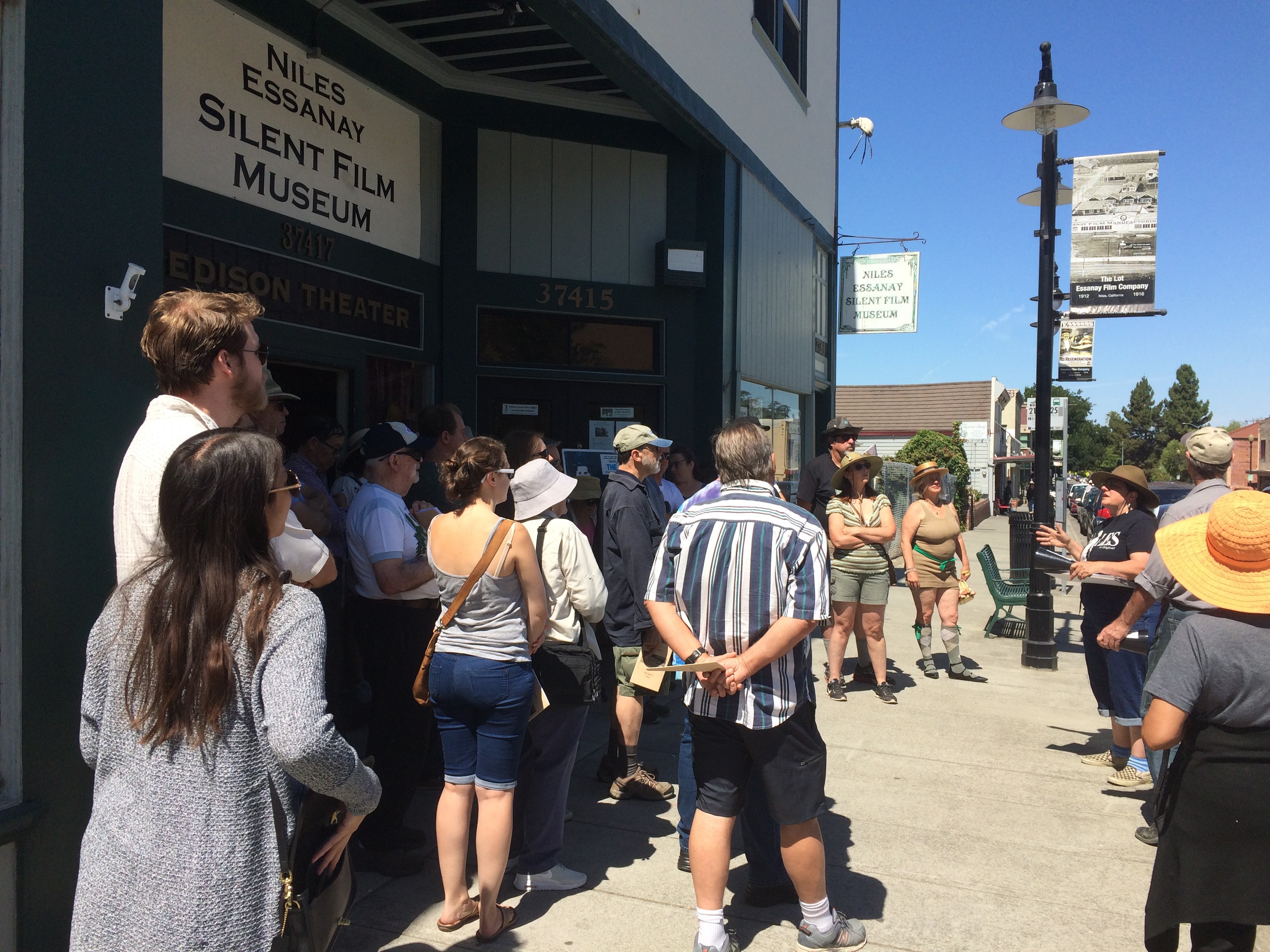 The walking tour group met at 11:00 AM in front of the Niles Museum. This was the same building that Chaplin premiered the five movies he made in Niles in 1915.
 There were plenty of Charlie Chaplins around to take selfies with. Charlie is the one on the right.
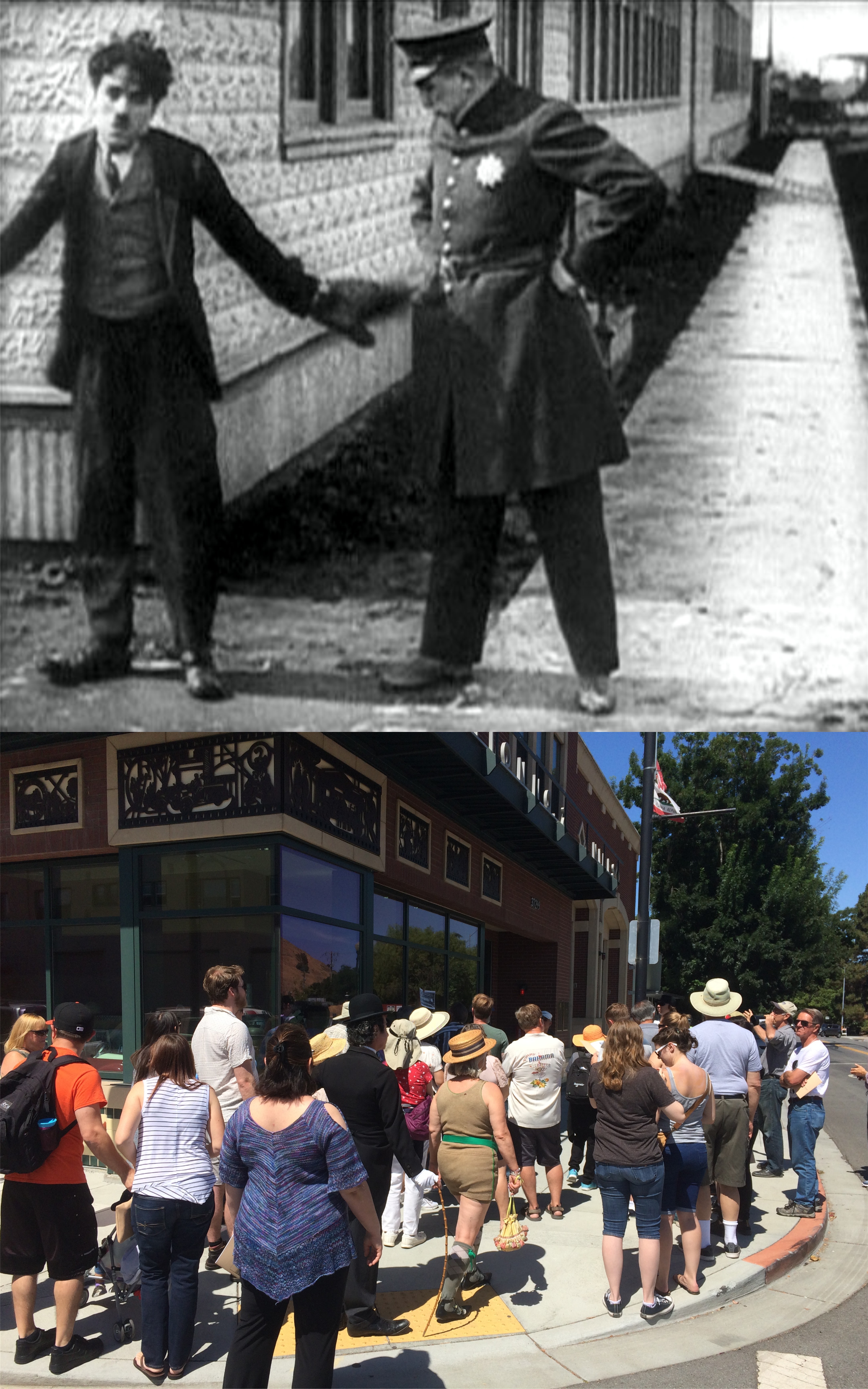 The group headed over to the corner of G Street and Niles Blvd. where the old Essanay Studio used to be. Chaplin filmed a confrontation scene with a cop on this same corner one hundred and three years ago in his silent short ‘The Champion’.
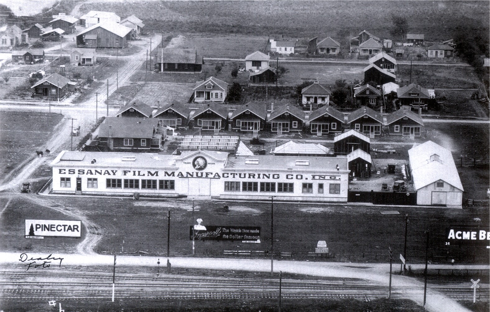 This is an aerial view of the old studio. The houses behind the studio were bungalows built for the stars filming there.
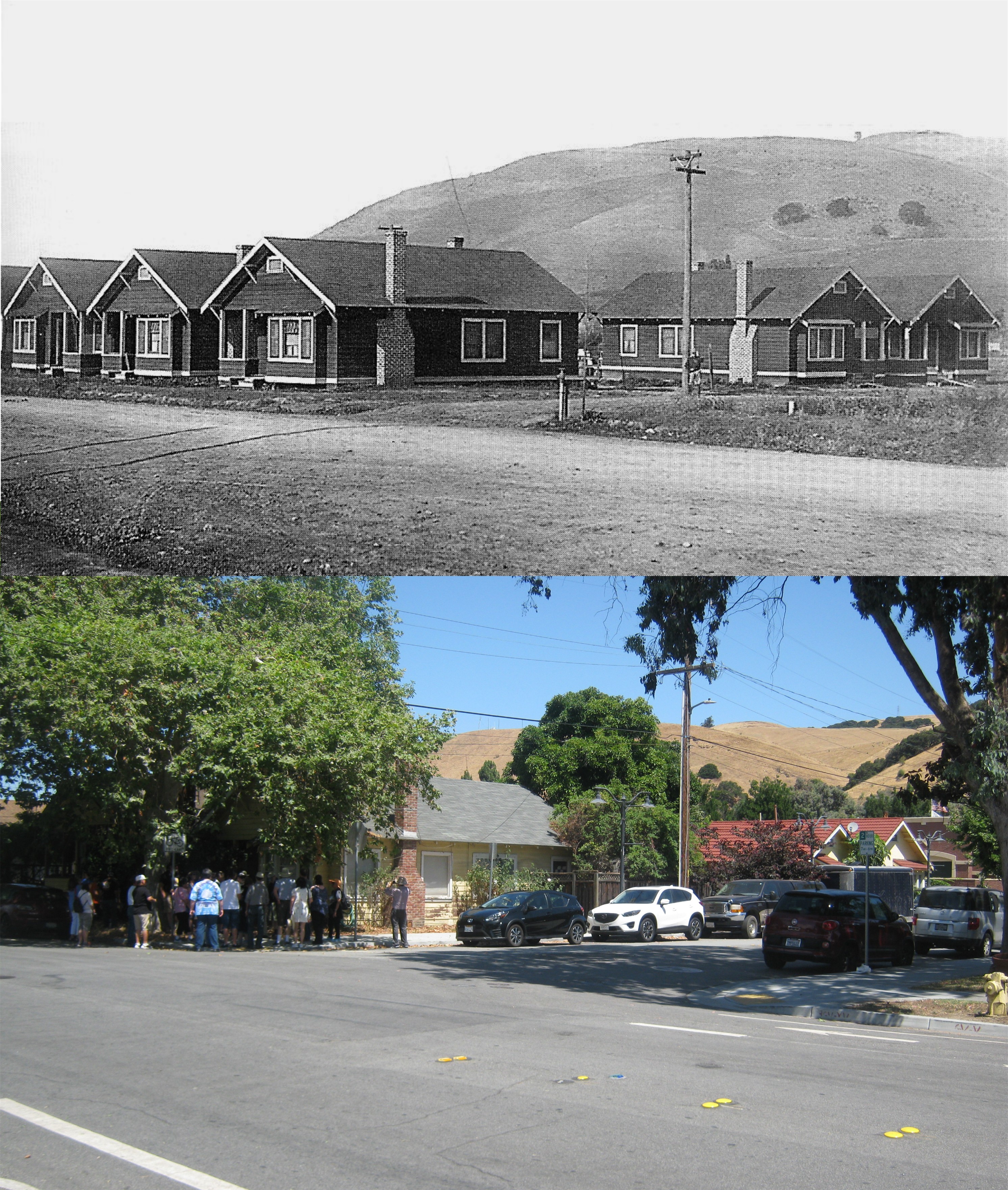 The group stopped on the corner of G and Second Streets where the vintage picture was taken as the tour guide explained the history of the bungalows. Although remodeled, they’re all still there. The two on the far right in both pictures were taken over by “Broncho Billy” Anderson for his office when he was making westerns in Niles.
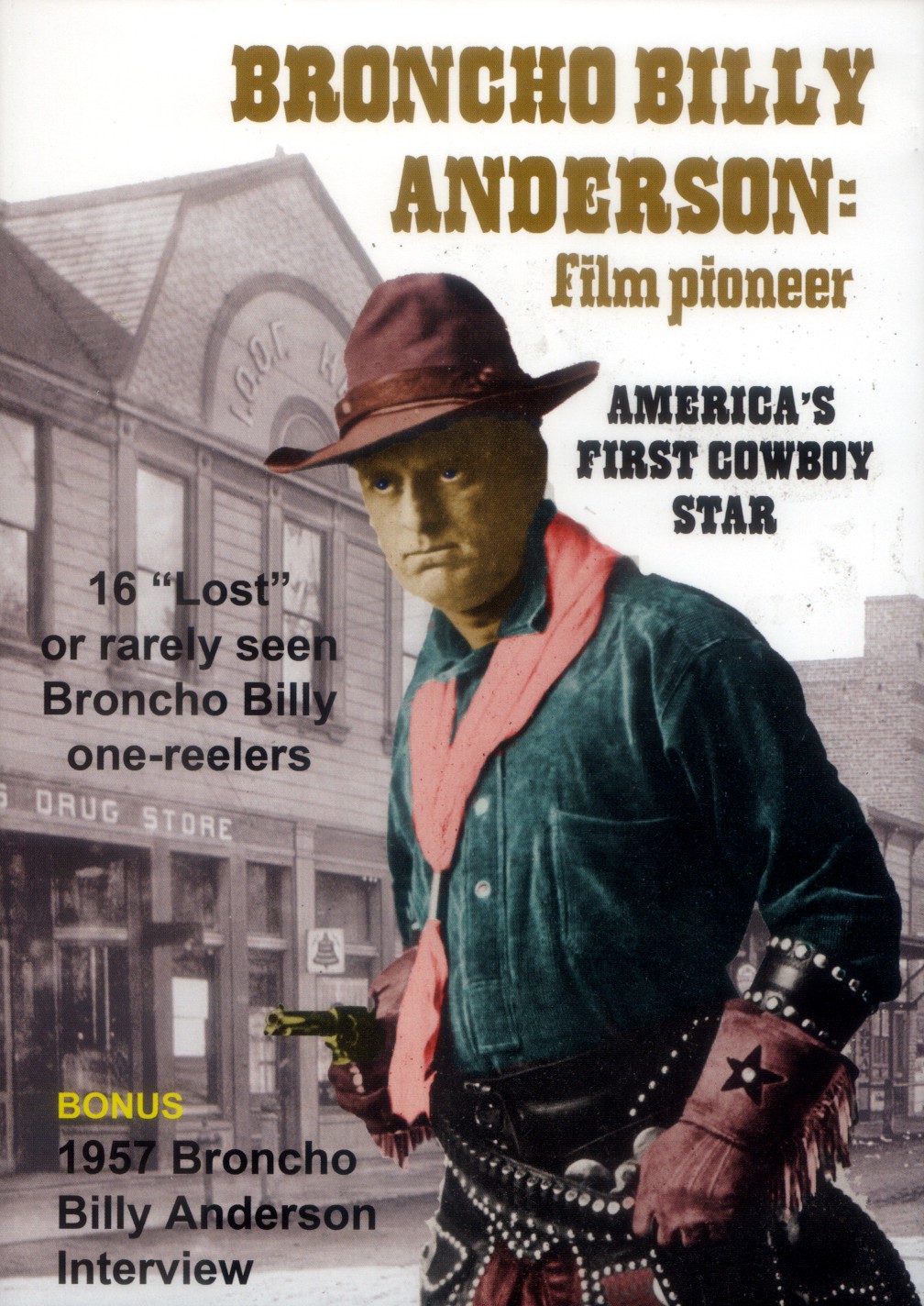 Long before there was John Wayne or Gary Cooper, there was Gilbert “Bronco Billy” Anderson, the movie’s first cowboy star. Anderson made his westerns in Niles from 1911 until 1915.
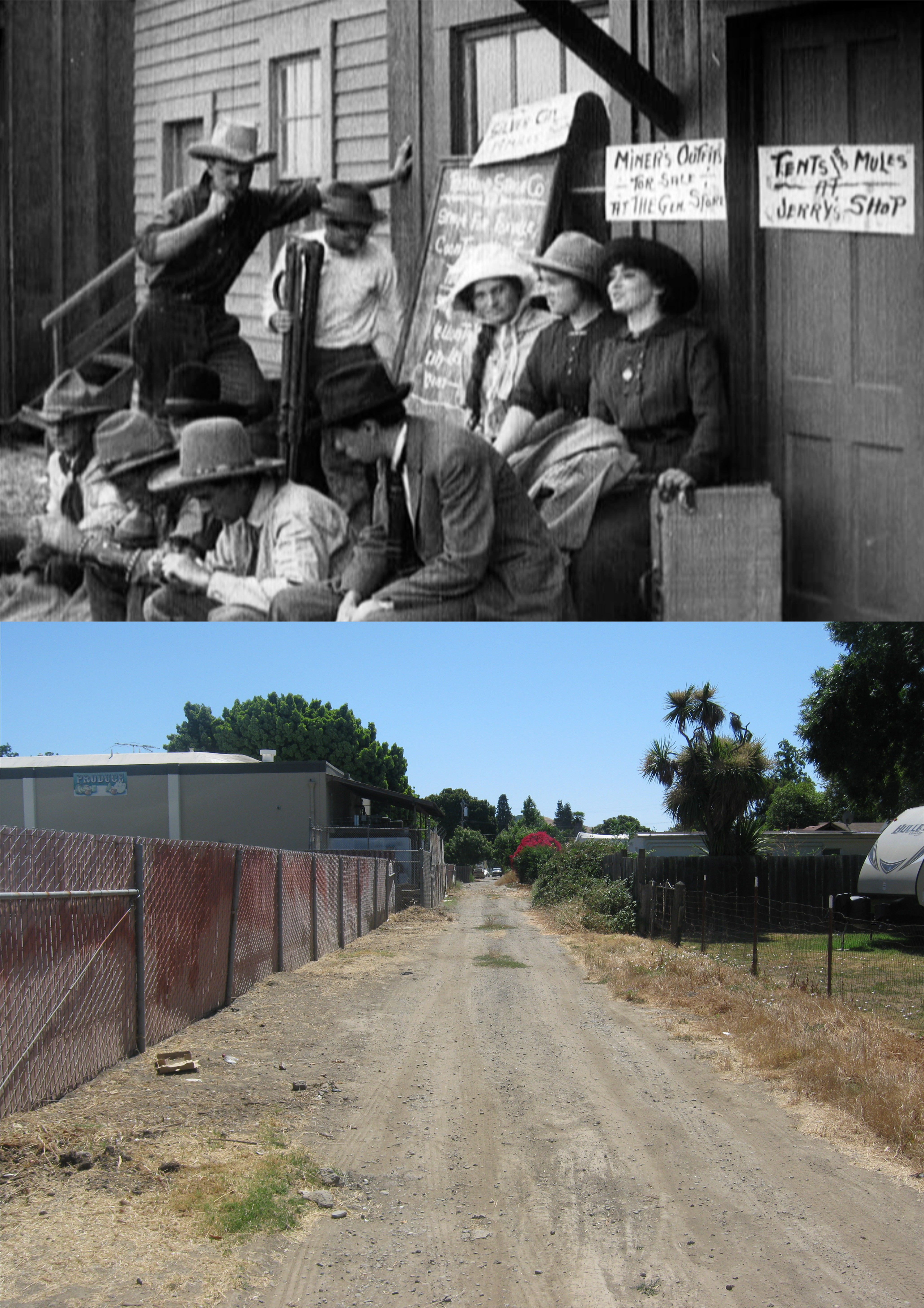 A western street was constructed behind the studio to film outdoor scenes like this one in the top photo from ‘Broncho Billy’s Narrow Escape’ from 1912. The bottom picture was where the western street was located.
 Bronco Billy’s barn survived until 1980 when it was demolished. A lot of gunfights in his films took place here. The barn was across the alley from the other old barn on the left that’s still there. Broncho Billy’s barn was on the right behind the fence where the violets are.
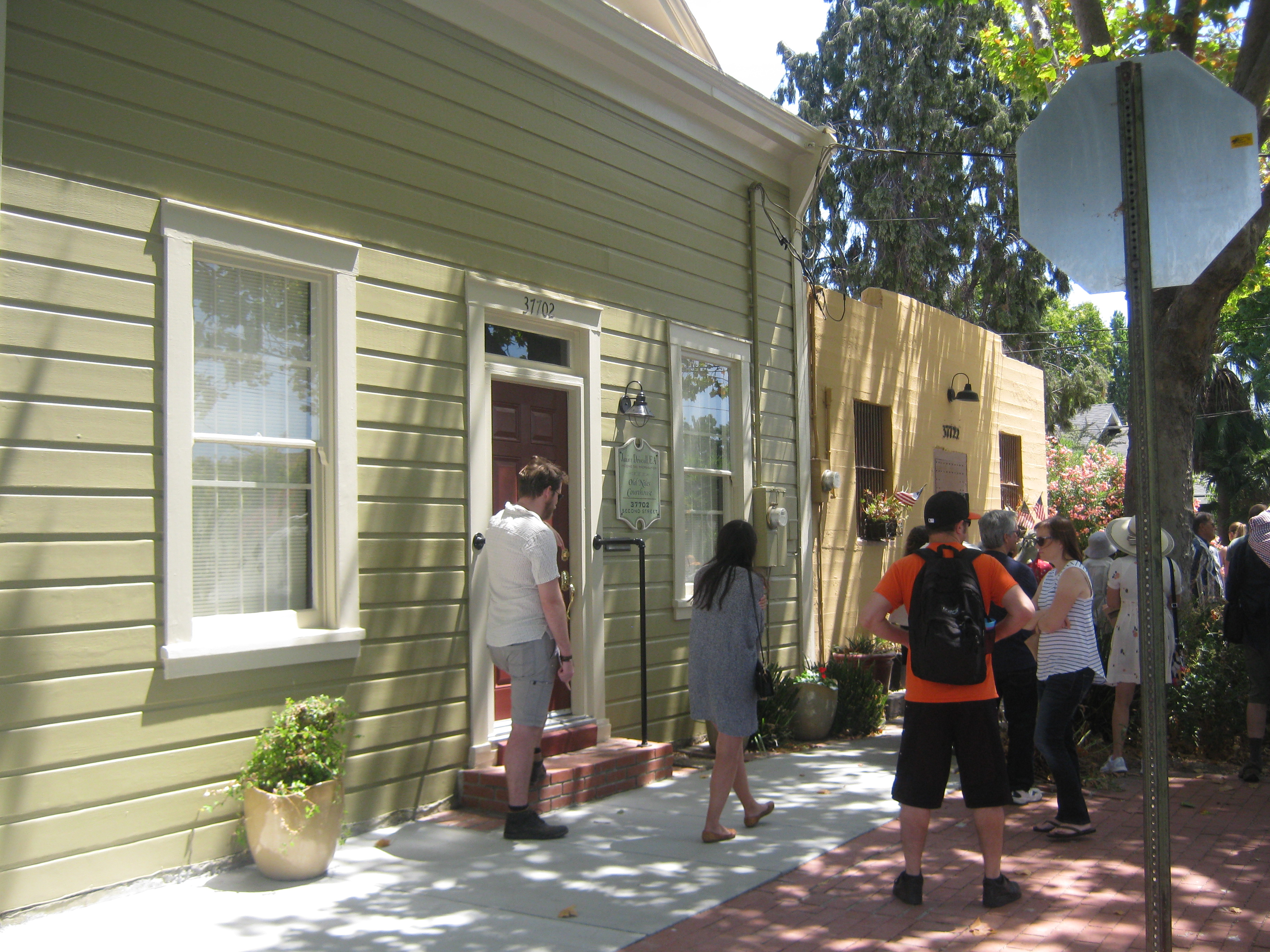 Besides movie locations the tour visited other sites like the old Niles Court House and the convenient Niles Jail next door to it at I and Second Streets.
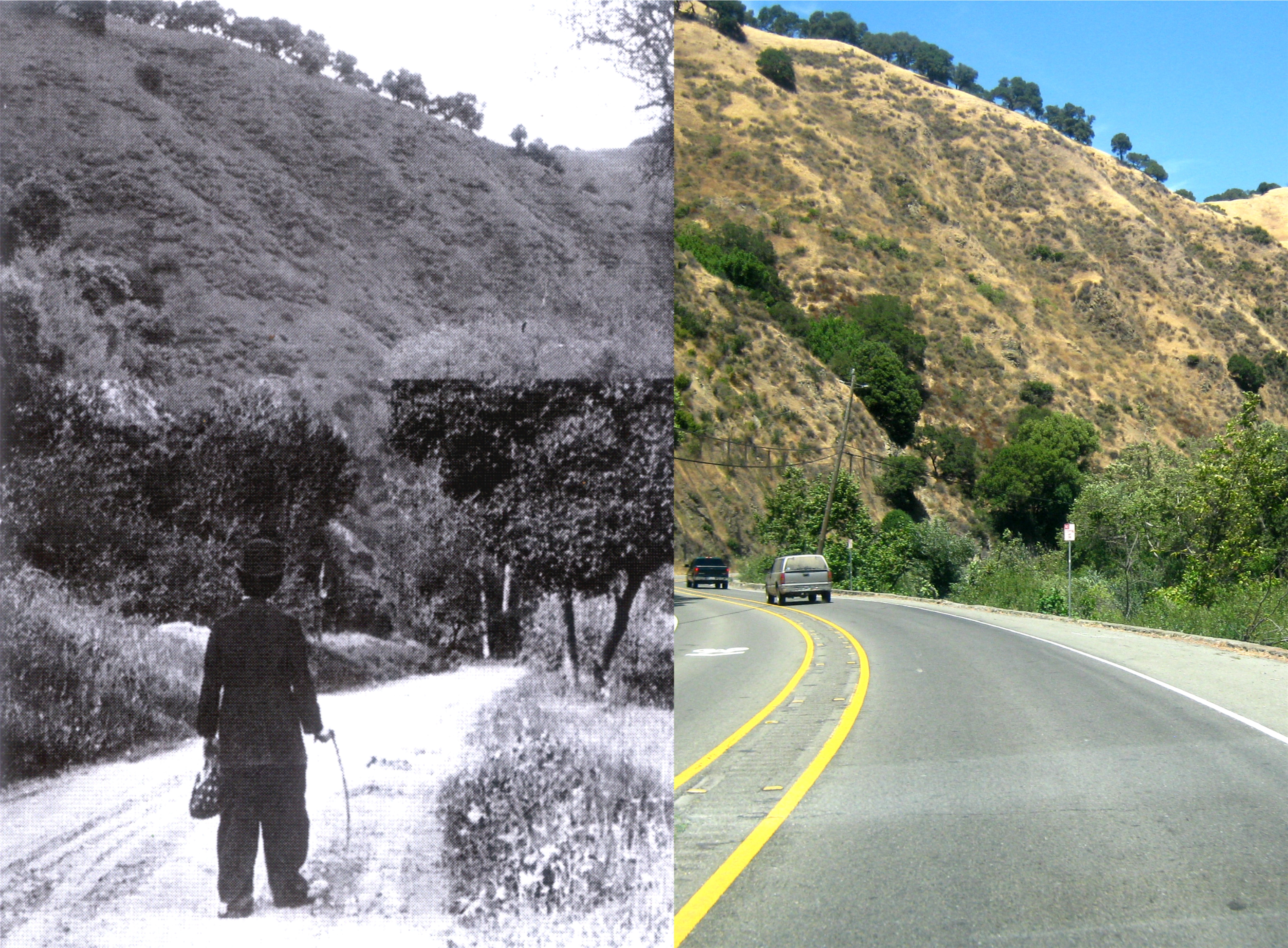 The iconic scene where the brokenhearted little tramp wanders off into Niles Canyon at the end of ‘The Tramp’ from 1915 was filmed 1.8 miles into Niles Canyon from Mission Blvd. or so I was told by the historians on hand. It’s too dangerous to stop on the road, so I took my picture from the car. It looks like the same spot to me.
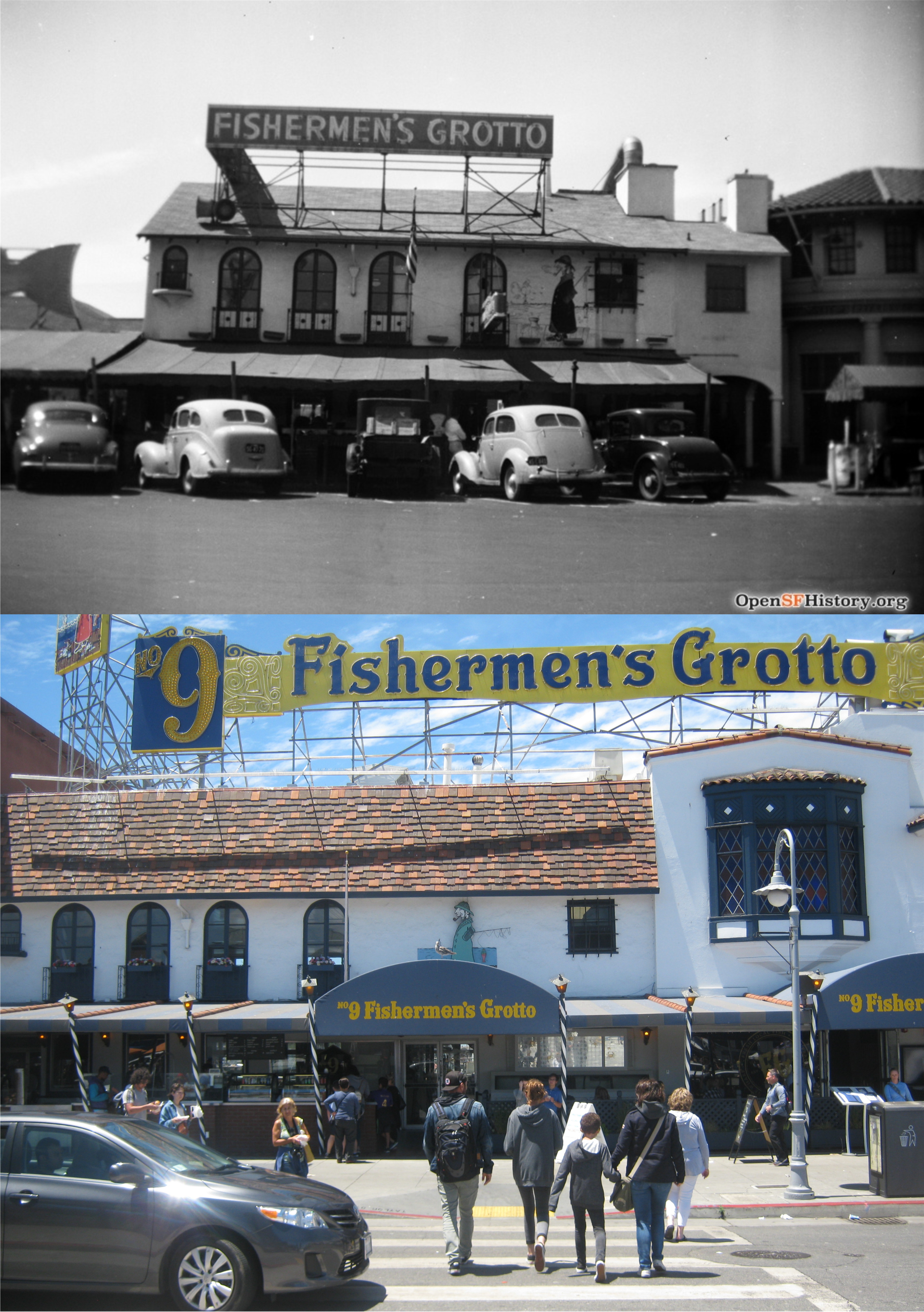 The #9 Fishermen’s Grotto Restaurant certainly looks different than it did here in 1935. The cars looked better back then but I think the building is an improvement today.
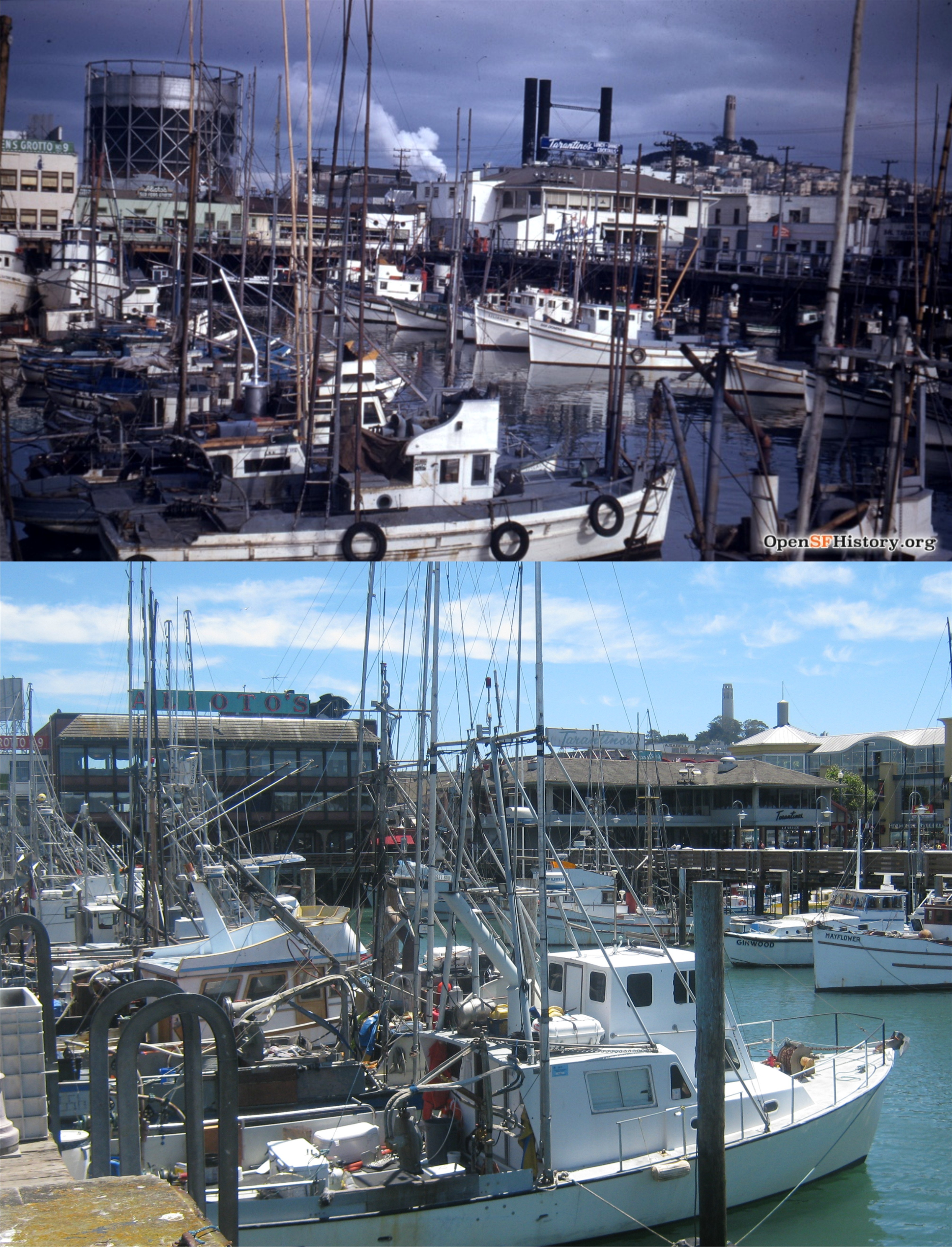 The Fisherman’s Wharf boat lagoon in the 1940’s, looking toward Telegraph Hill and Coit Tower: Every time I see pictures of that enormous gas tank that used to be near Fisherman’s Wharf, it reminds me of what a different era we live in now.
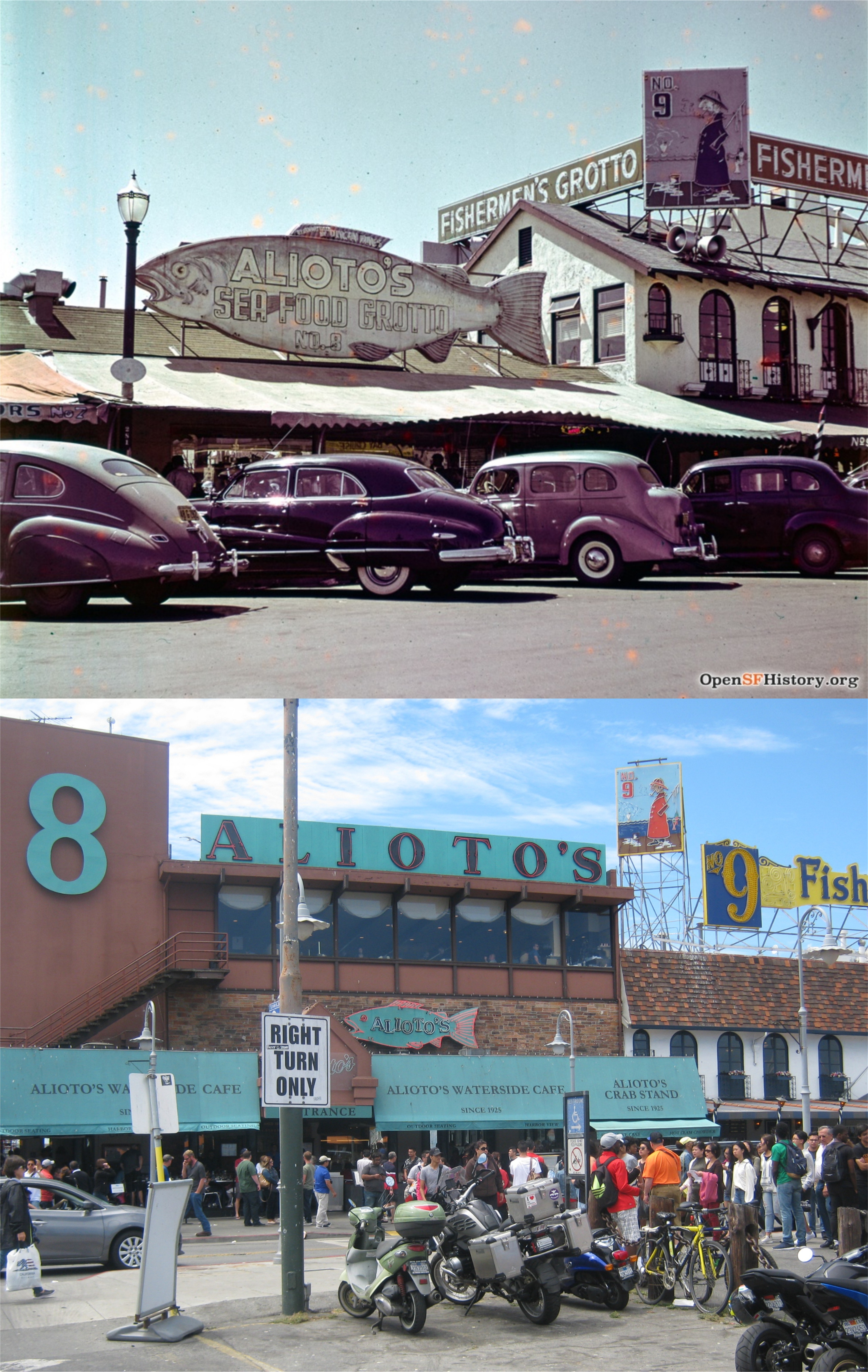 What a great Picture of Alioto’s Restaurant, circa 1949!
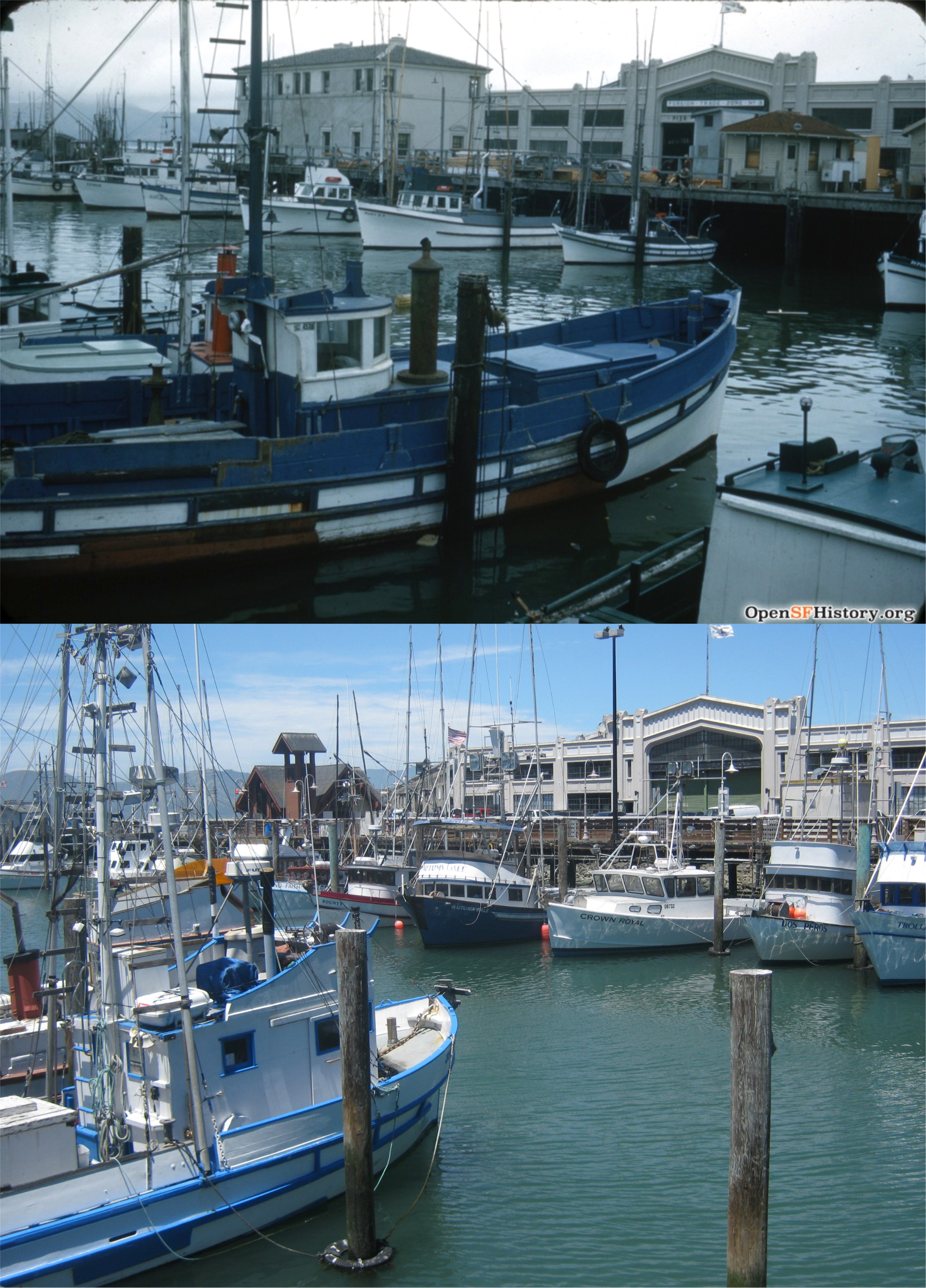 Looking toward Pier 45 where the SS Jeremiah O’Brien Liberty Ship and the USS Pampanito submarine, both World War Two survivors, are docked, circa 1950: A little fishermen’s chapel has replaced the older building in the center of the vintage picture.
 Looking toward Russian from the boat lagoon circa 1950: All of the buildings on Russian Hill in the vintage photo can be seen in the modern one:
 Looking across a parking lot toward Russian Hill in 1952: The Standard Station on the northeast corner of Jefferson and Taylor Street, designed like a ship, was there from the 1930’s to the 1970’s, although, by the 70’s it had been remodeled. Two buildings built since 1952 make an exact line up impossible now, but the gas station was just in front of where the ships wheel Fisherman’s Wharf sign is now. The Sabella/La Torre Restaurant is on the right in both photos.
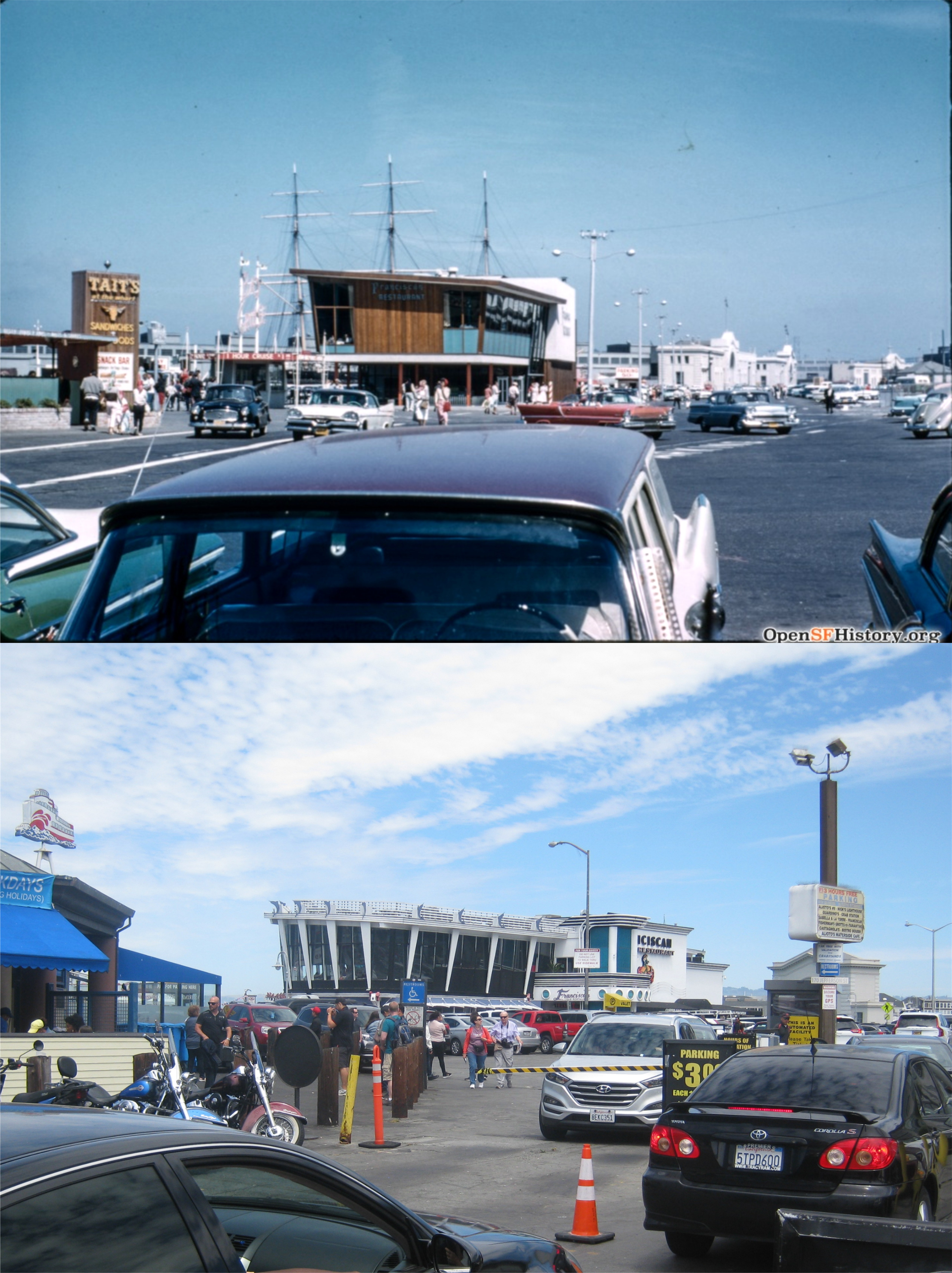 Looking northeast from Taylor Street in August of 1959 toward the Franciscan Restaurant: Those are the masts of the sailing ship Balclutha that was docked at Pier 43 back then.
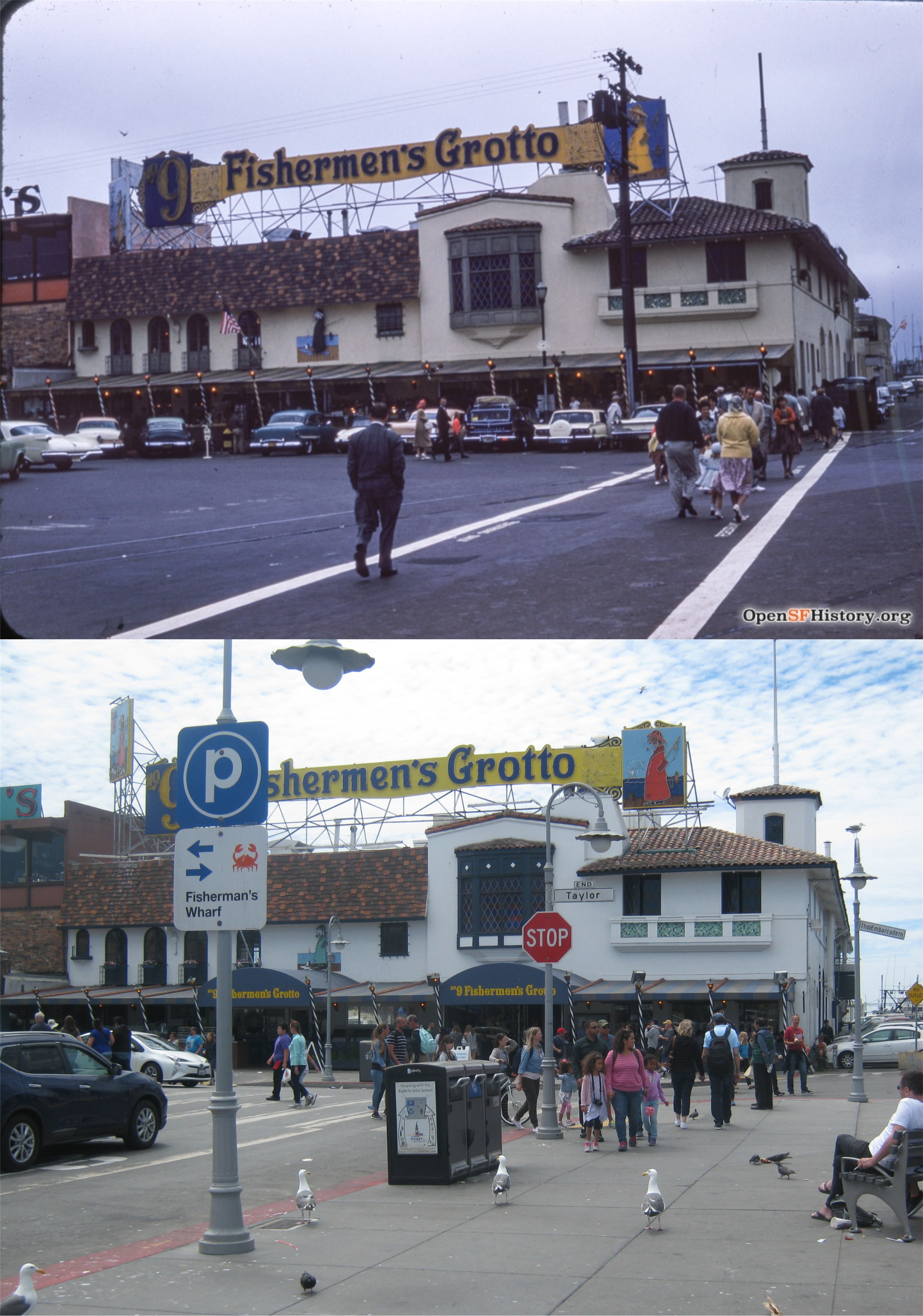 Another view of Fishermen’s Grotto Restaurant, (Yes, they spell if different from Fisherman’s Wharf) in July of 1960.
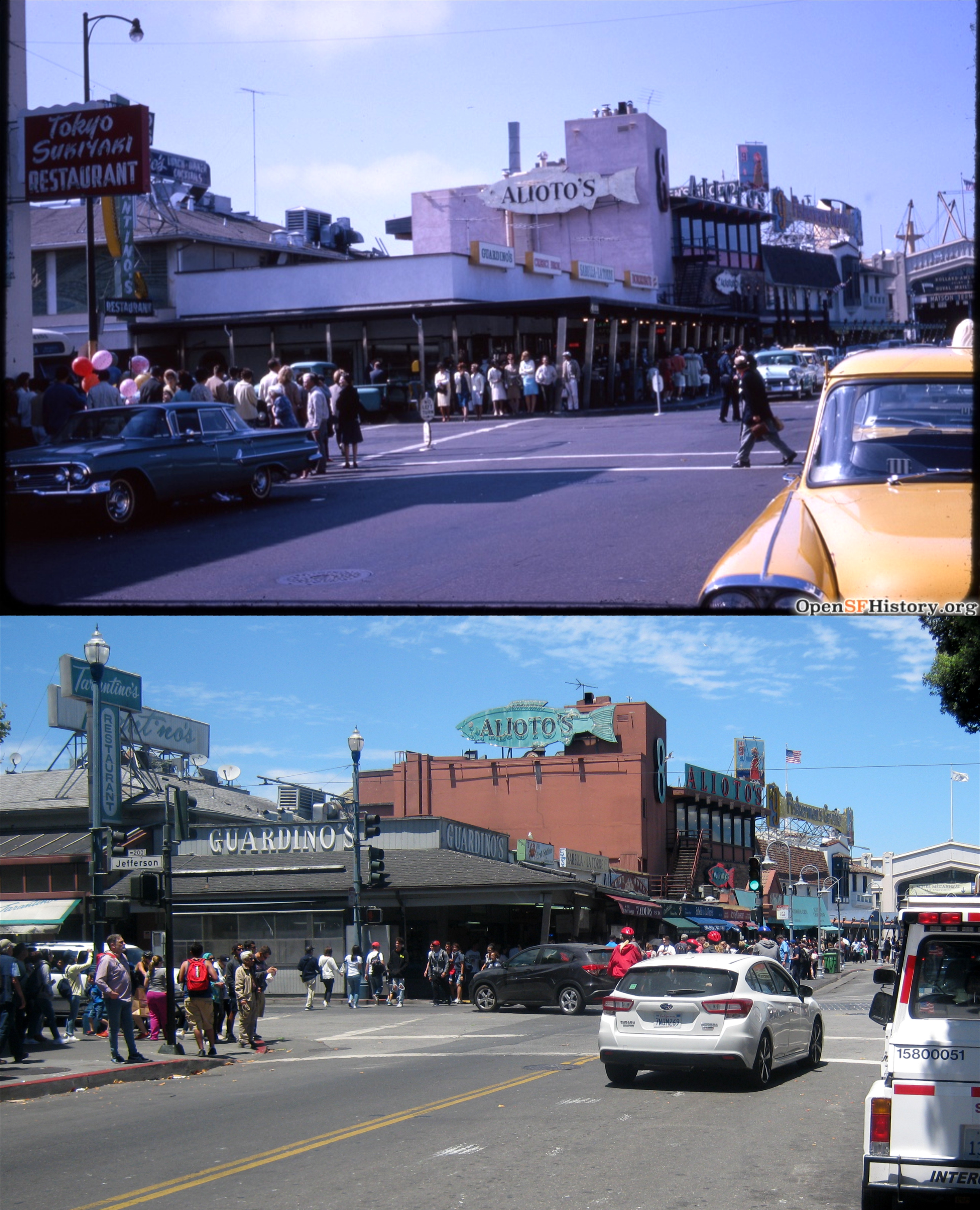 Taylor and Jefferson Streets looking north in August of 1964:
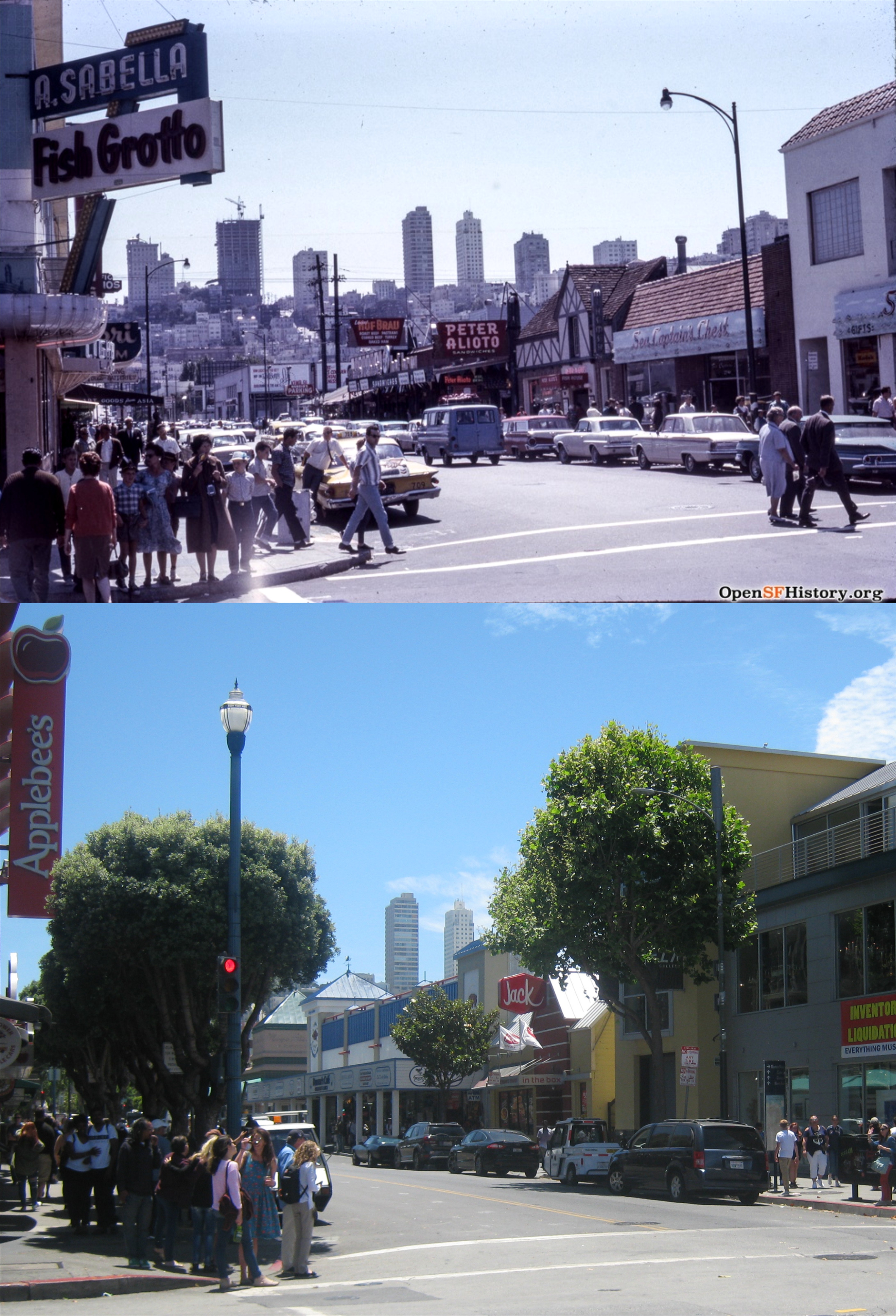 Looking toward Russian Hill on the opposite corner of Jefferson and Taylor in 1965: I was able to find a table for lunch at the Jack in the Box restaurant, about where the Alpine looking building was in the vintage shot. Sometimes a Breakfast Jack and a couple of tacos are all you need to get through the day.
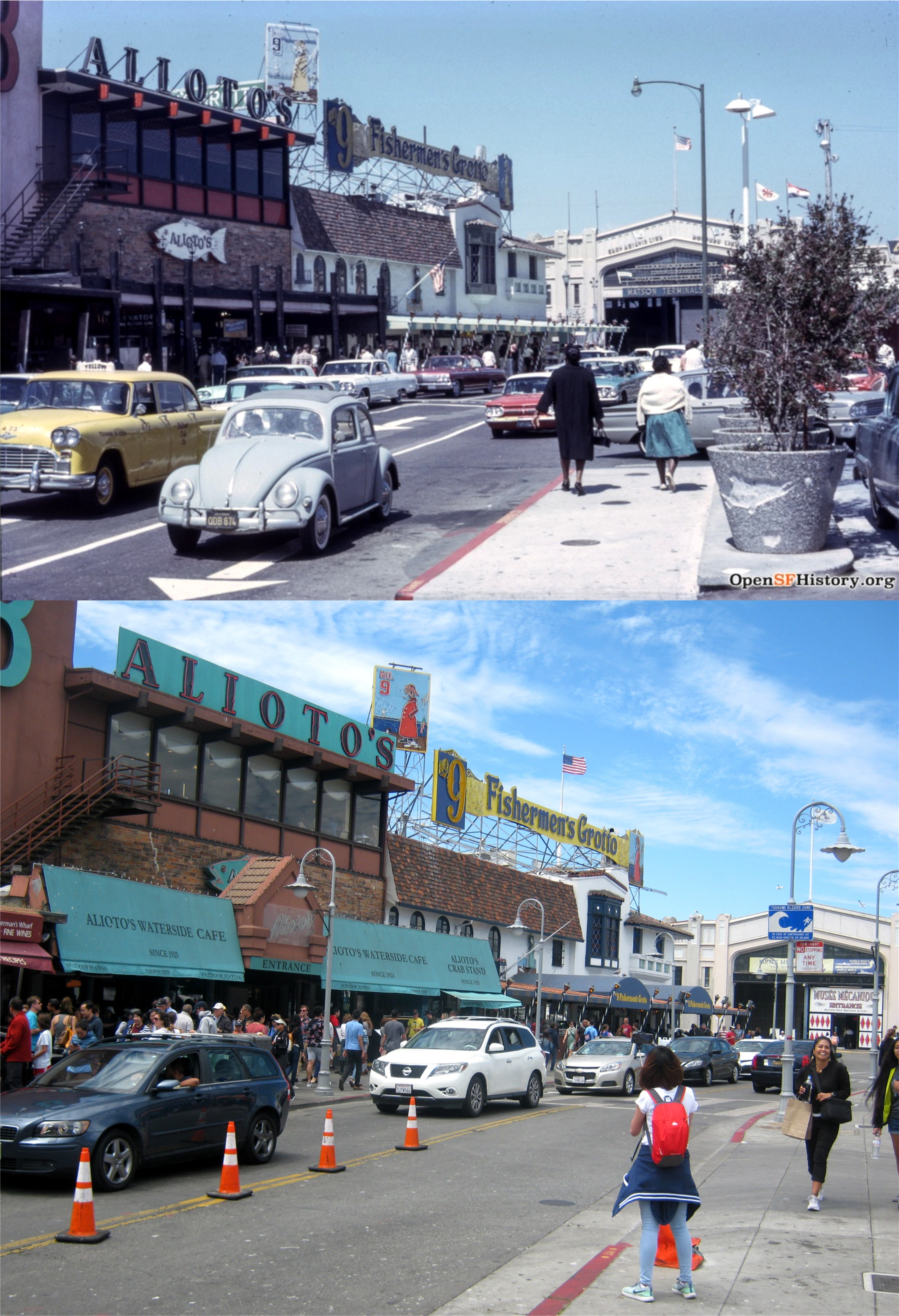 Looking back along Taylor Street toward the eastern wing of Pier 45, circa 1965:
 ‘Down Periscope’, starring Kelsey Grammer and Lauren Holly, was filmed in 1995 and released in 1996. It’s a silly thing about a World War Two era submarine involved in war games with the modern 1990’s United States Navy, but it’s fun to watch, and it was filmed in part at Fort Mason and on board the submarine the USS Pampanito, now at Fisherman’s Wharf.
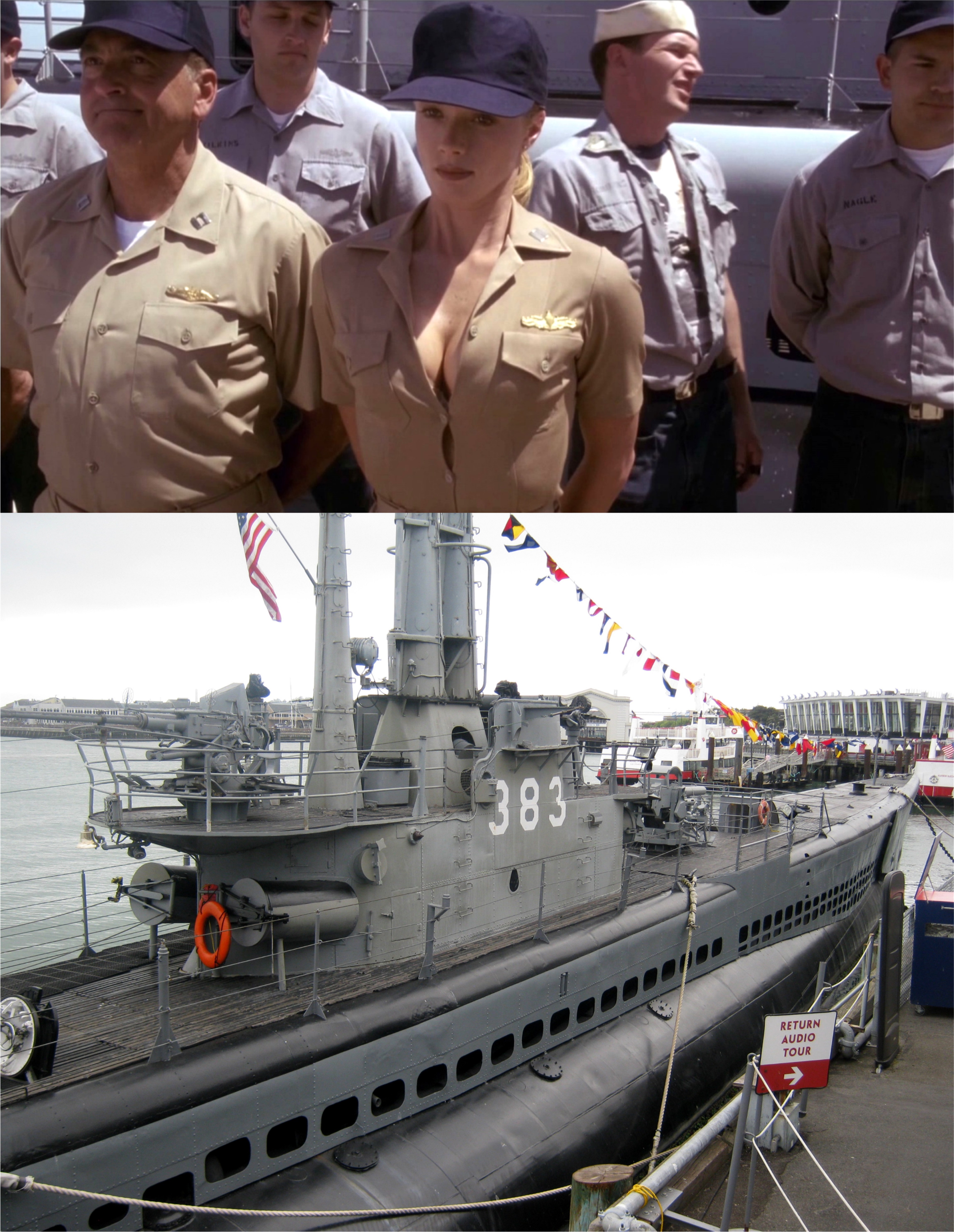 The crew, along with Lauren Holly, line up alongside the Pampanito for inspection:
 That’s the Pampanito’s aft deck gun behind her. (IMDb)
 “Fifteen Men and Lauren Holly’s chest; Yo-ho-ho, and a bottle of rum.”
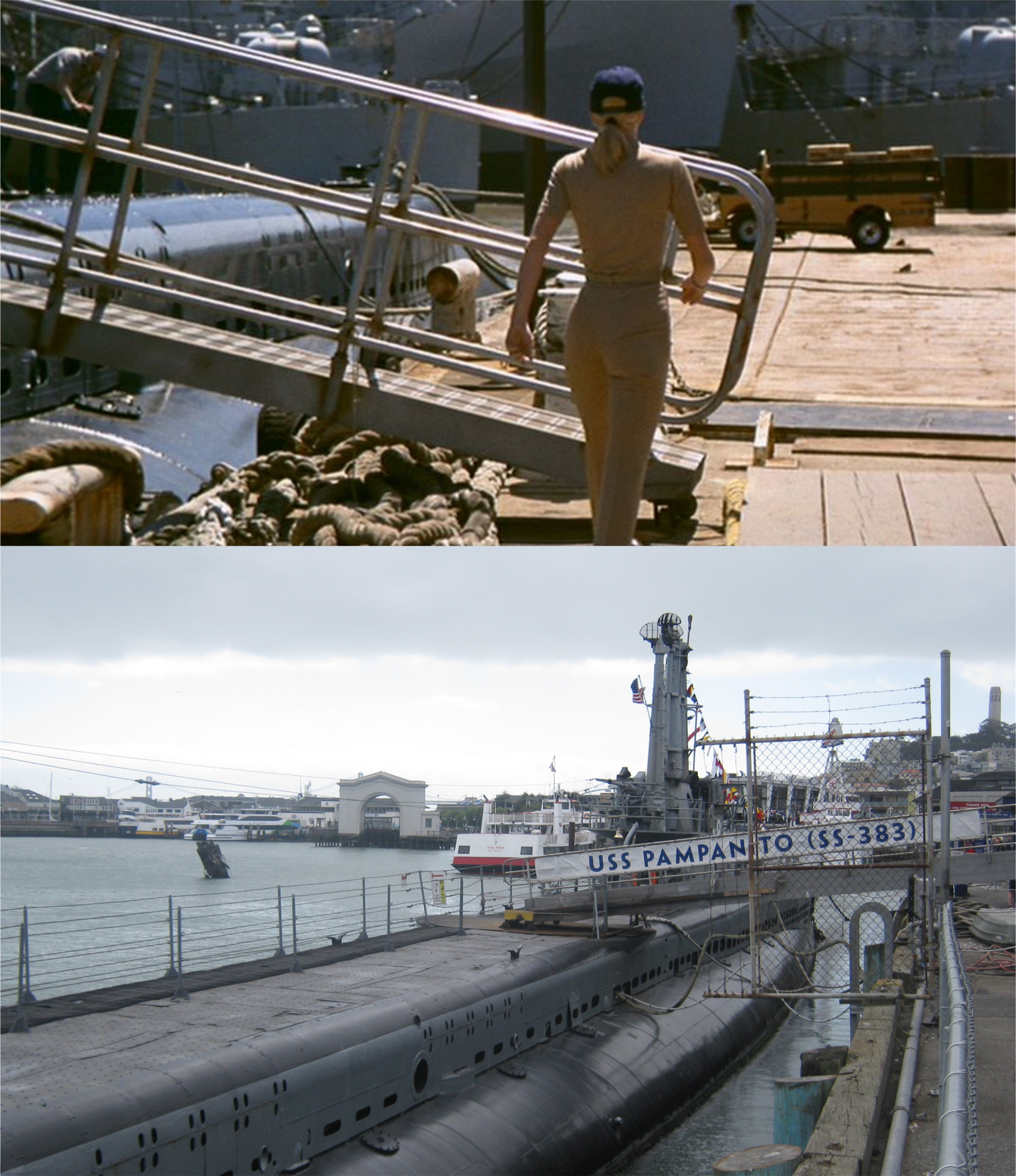 There she is; sleek and fast, built to kill, a real beauty forward and aft. Hey, I’m talking about the Pampanito! (musings.elisair.com)
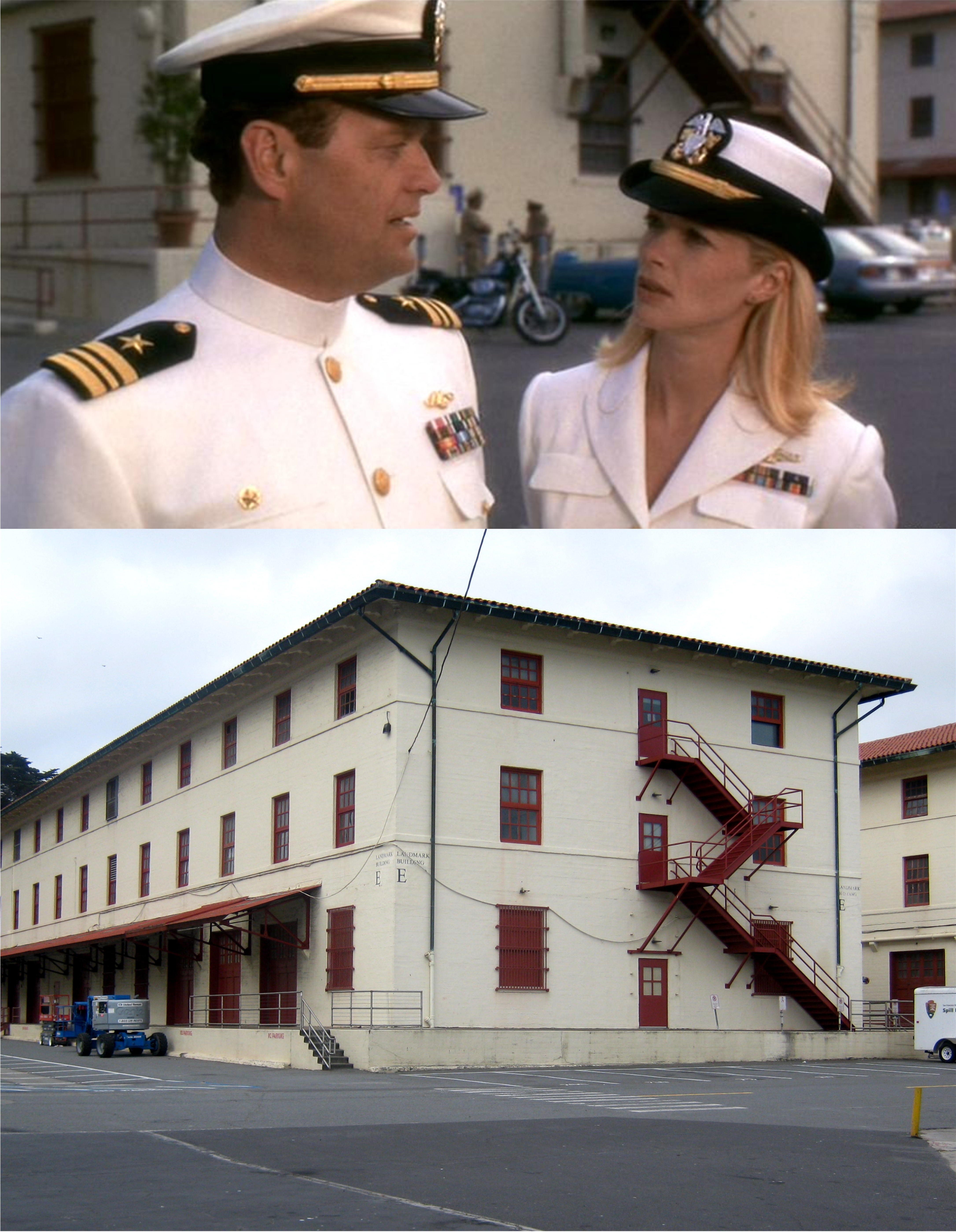 The submarine was towed over to Fort Mason for the closing scenes. (musings.elisair.com)
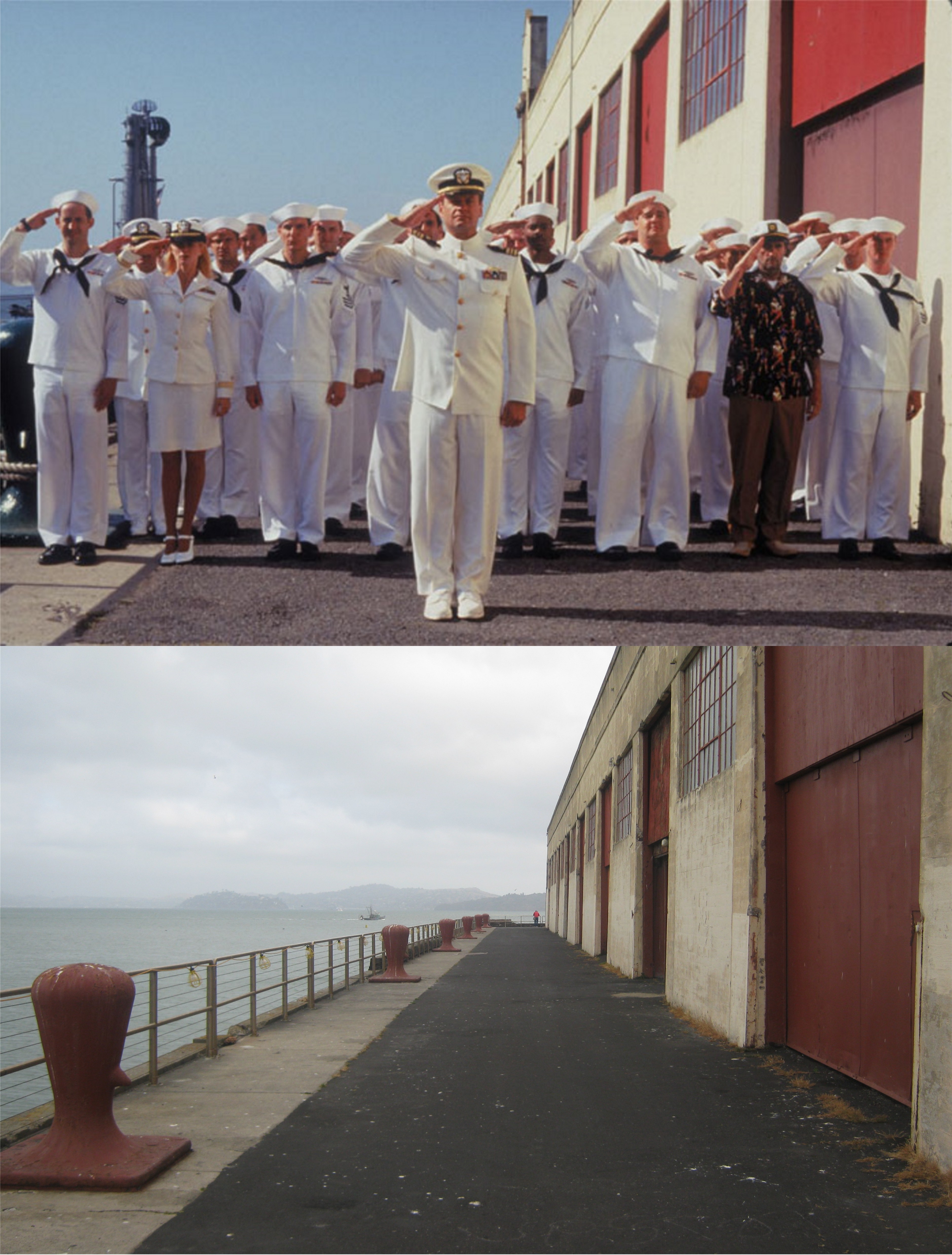 Regulation high heels and a salute: (musings.elisair.com)
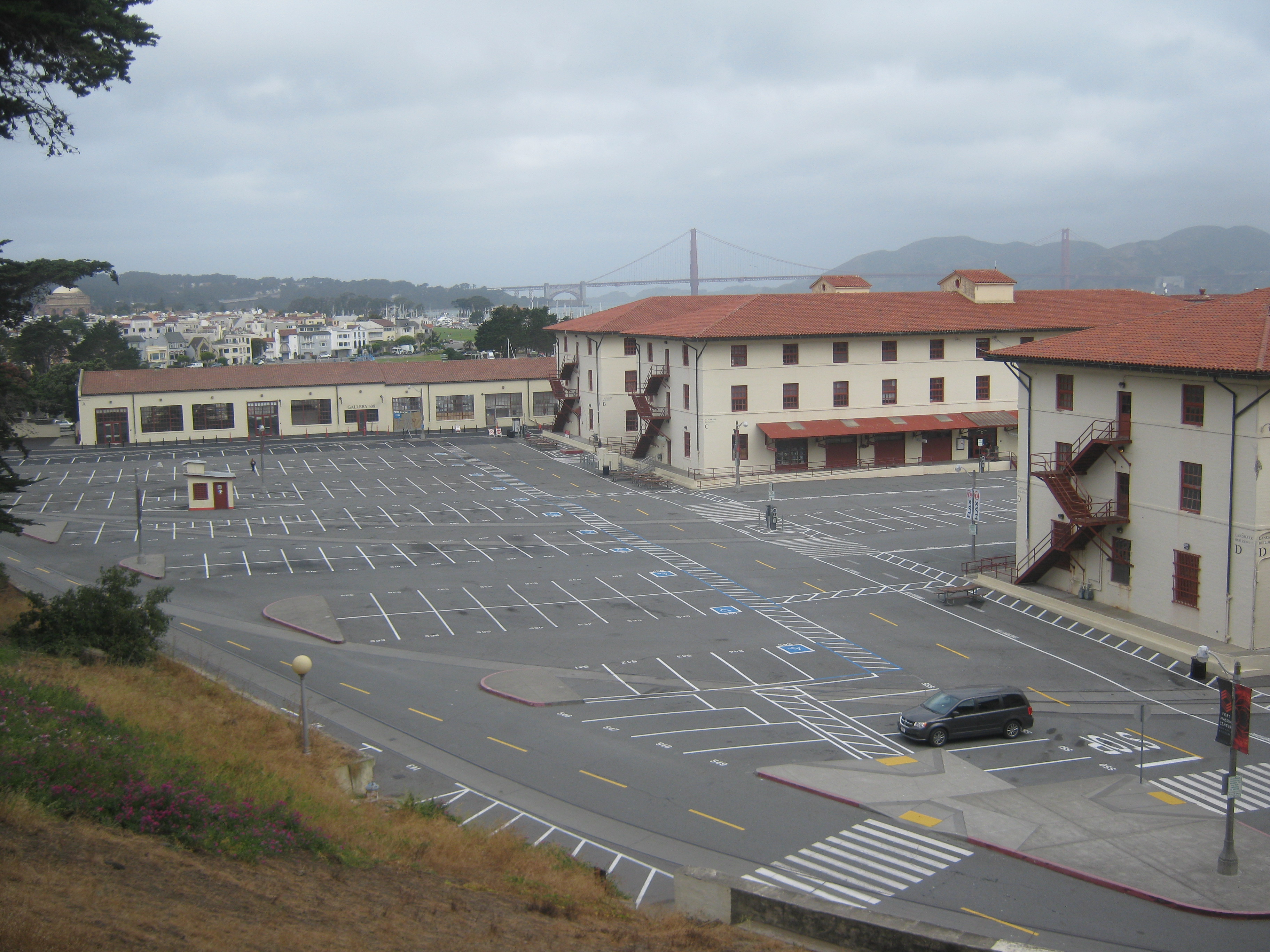 I walked around Fort Mason early in the morning on July 4th. It felt both spooky and sad. Being one of the largest embarkation centers for the Pacific Theater during World War Two, the amount of activity that took place here back then is hard to imagine, and many, many, people left from here and never returned. I was singing ‘I’ll Be Seeing You’ to myself as I thought about that generation.
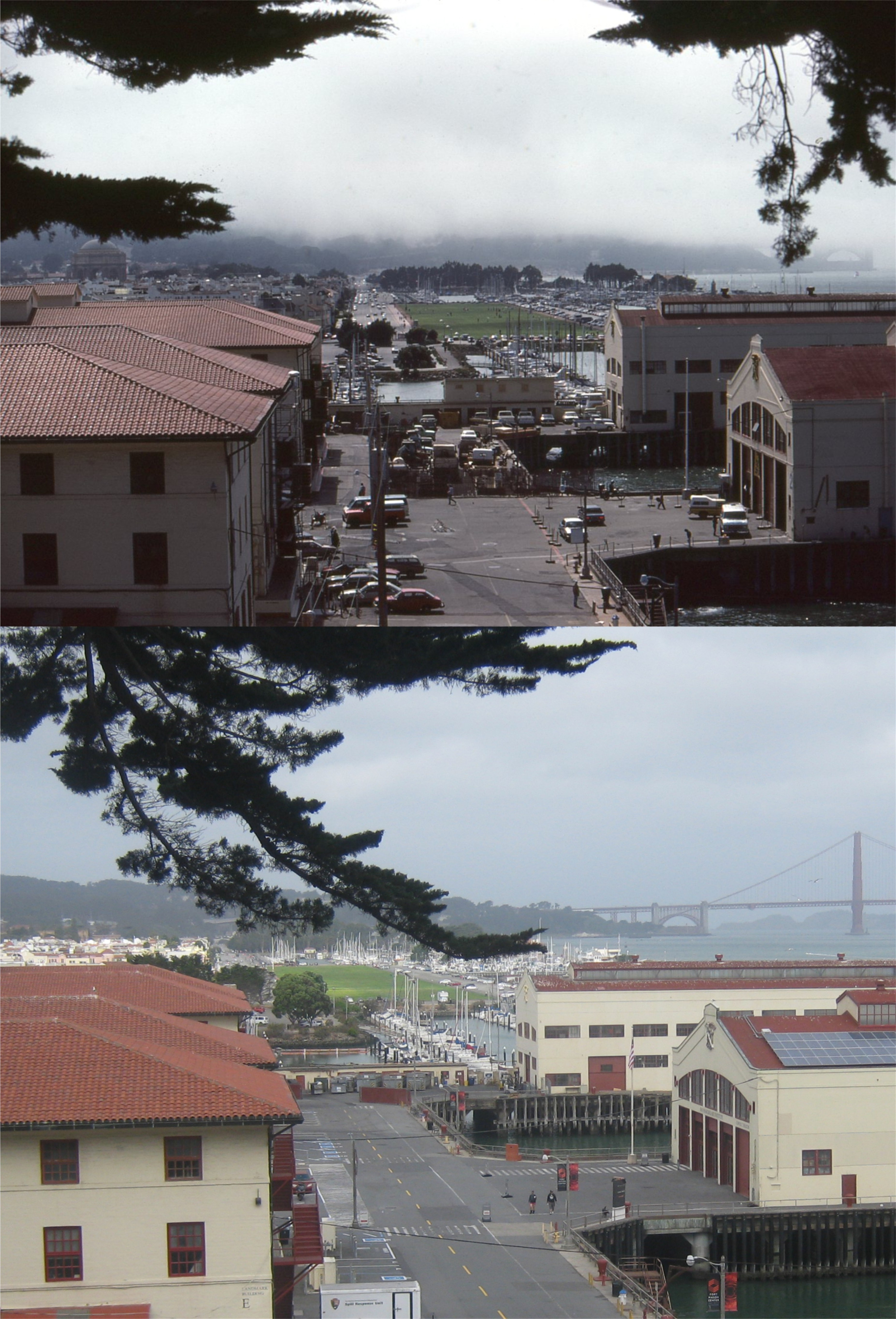 The top photo is a slide I took above Fort Mason around 1985. I remember that they had a World War Two exhibit in one of the pier buildings and it was filled with World War Two veterans talking about their experiences. Sadly, it’s not likely many of them are still around now.
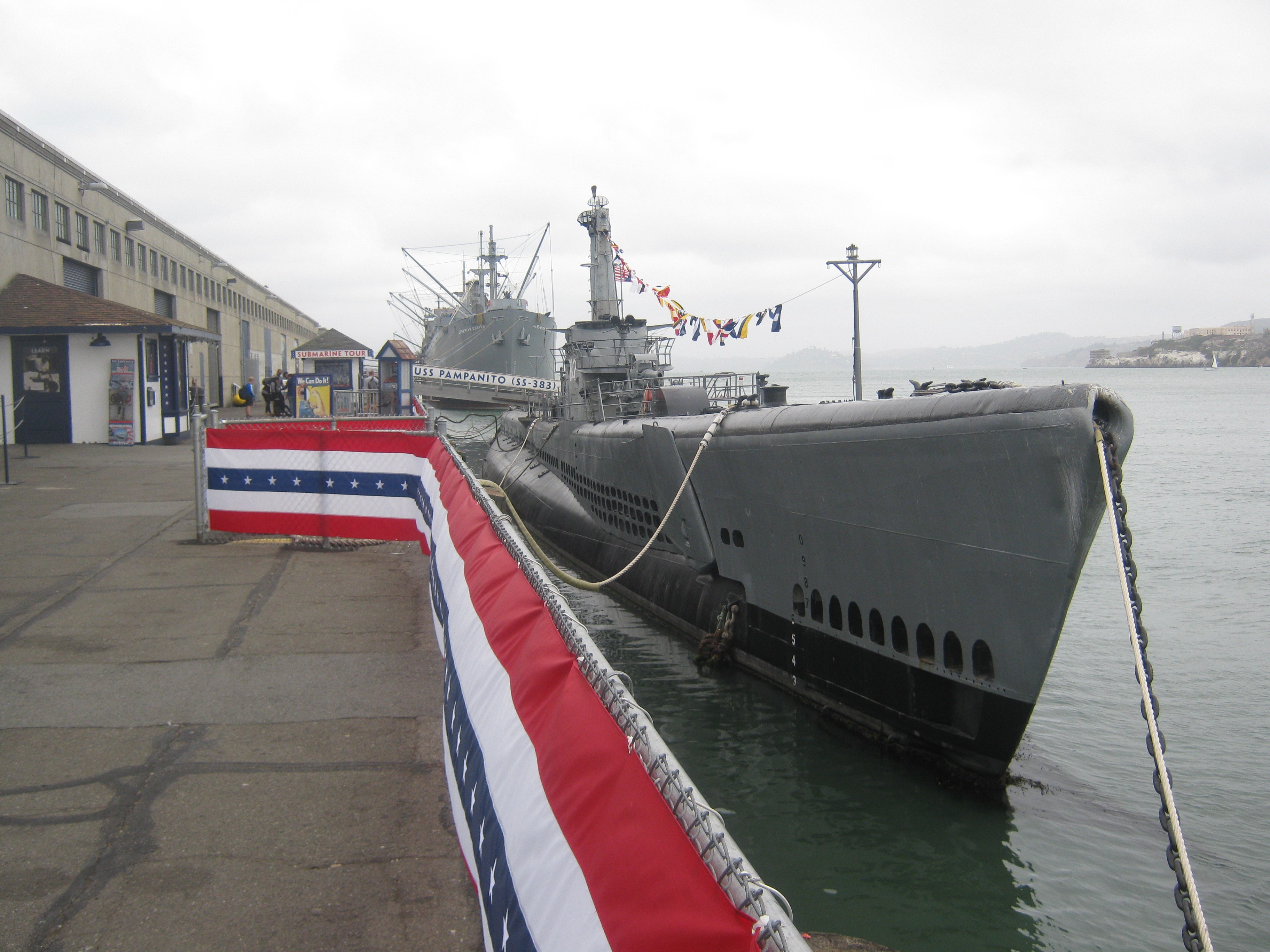 Here’s the USS Pampanito all decked out for the 4th of July. The film crew, in no way, showed any disrespect for the landmark, and took good care of her during filming. Pampanito took six war patrols during World War Two, sank at least as many ships, and was heavily damaged from depth charges on one of the patrols. Sadly, in one of the attacks Pampanito was involved in, the ship sunk was carrying Allied prisoners, unknown to the crew. Over 1100 POW’s died in the sinking. The torpedo was not fired from the Pampanito, however, but from a sister sub involved in the attack, the USS Sealion. Seventy three of the survivors were rescued from the sea by the Pampanito. Let’s take a tour, aft to forward, through the submarine.
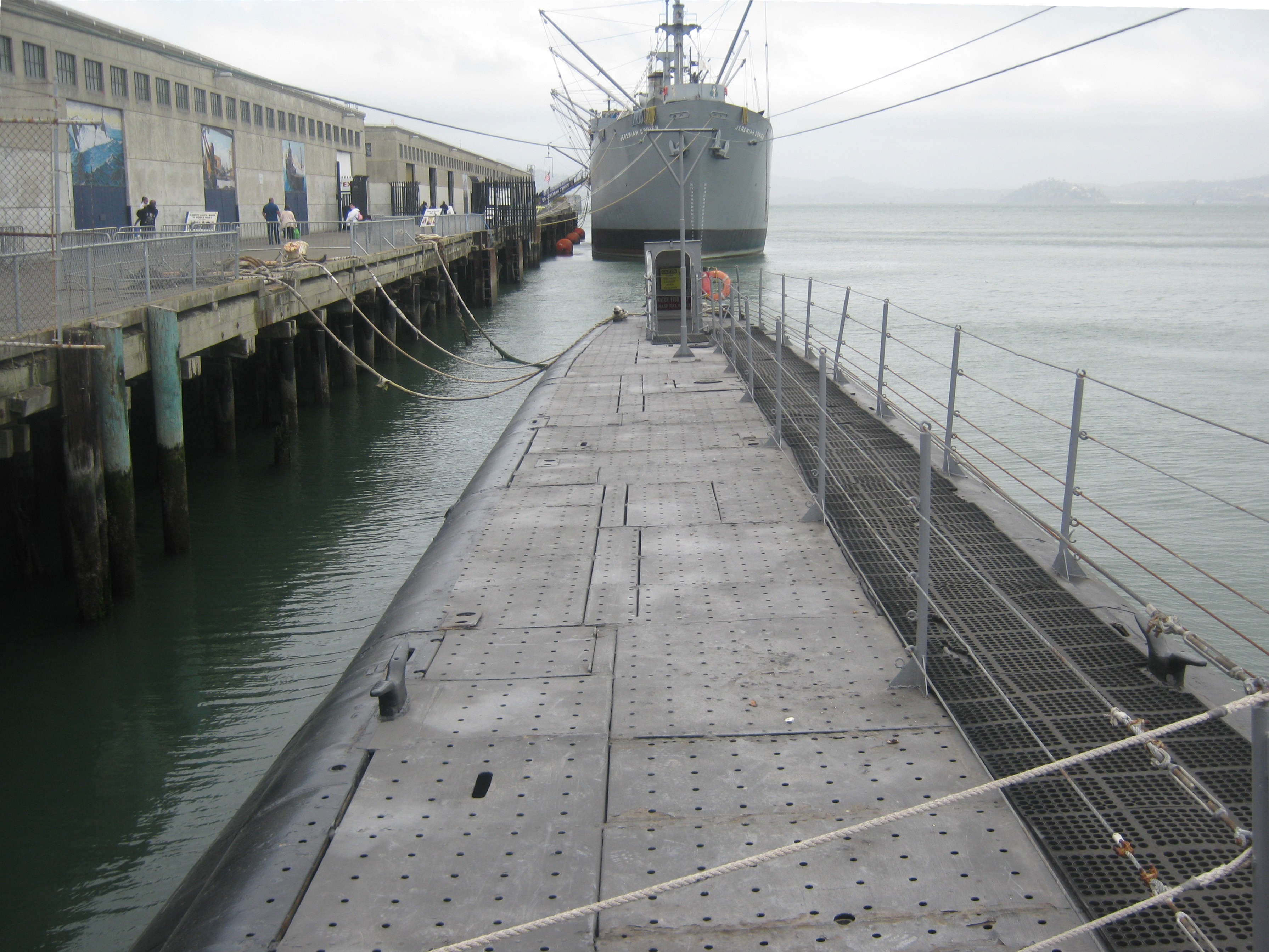 You cross this passage and enter the sub through this hatch on the aft side.That’s the Jeremiah O’Brien Liberty Ship behind her.
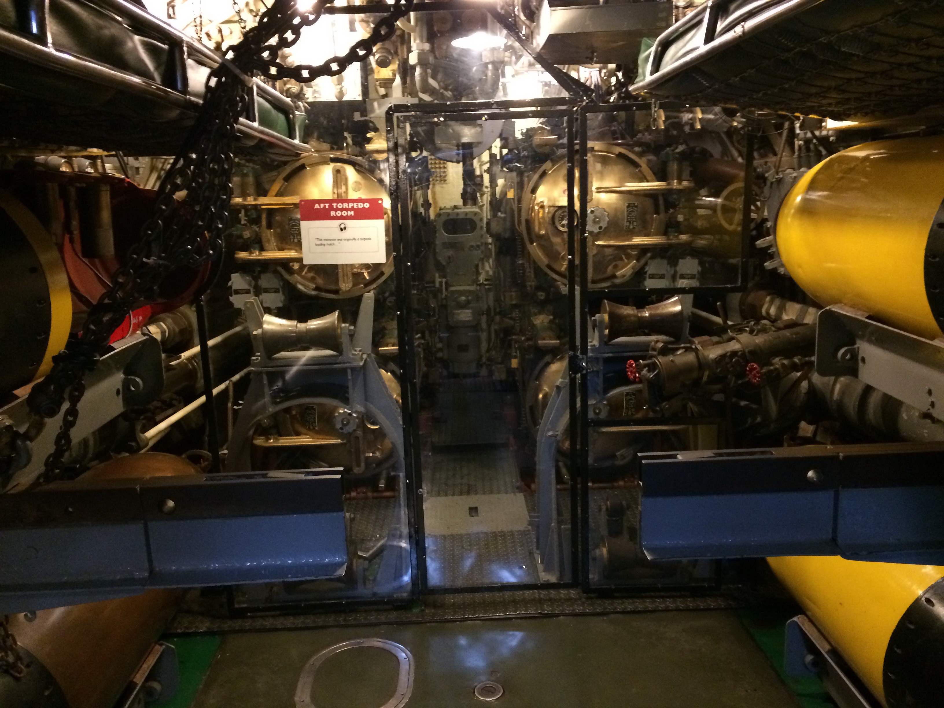 The aft torpedo room:
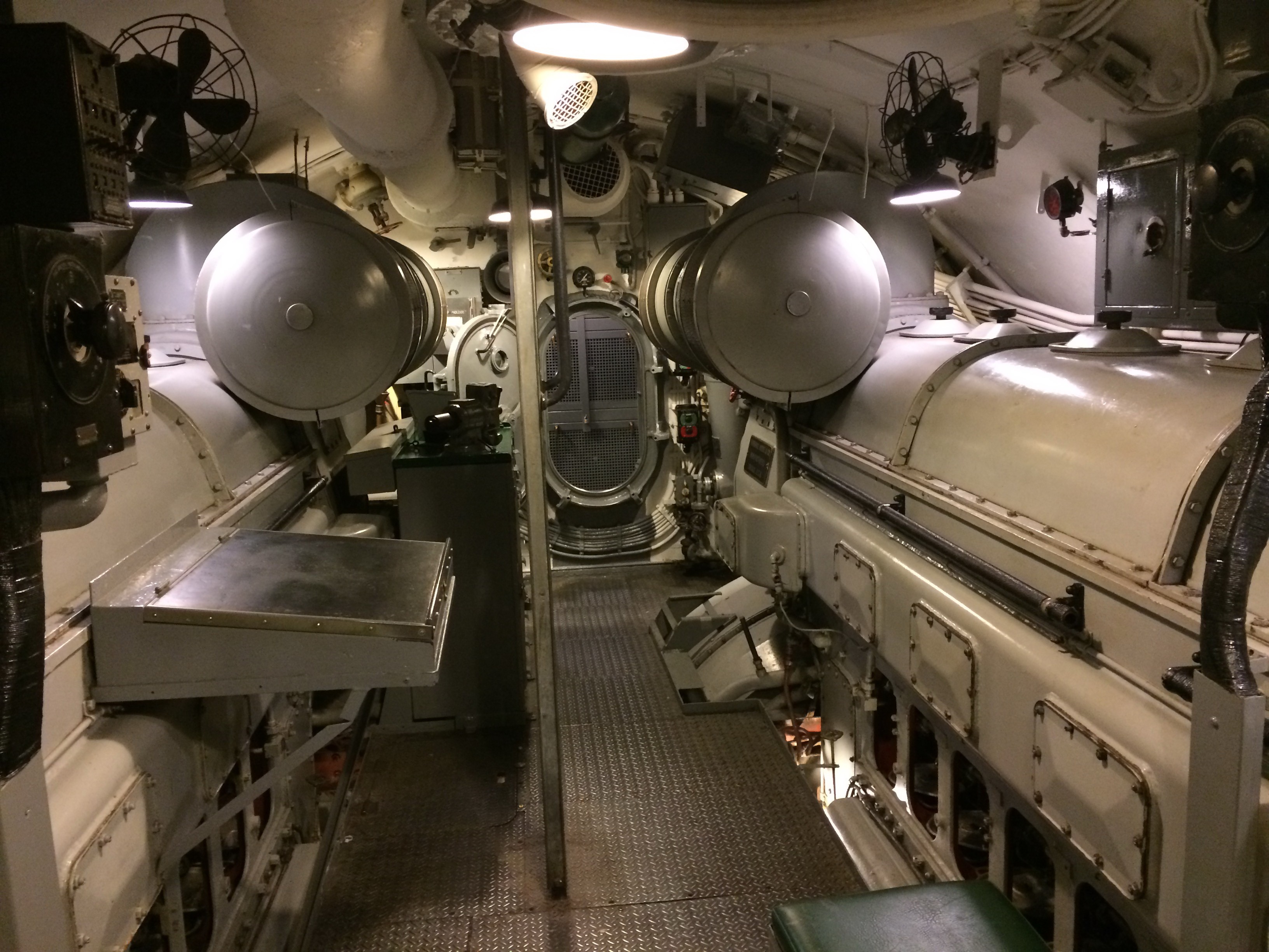 The aft engine room:
 The forward engine room:
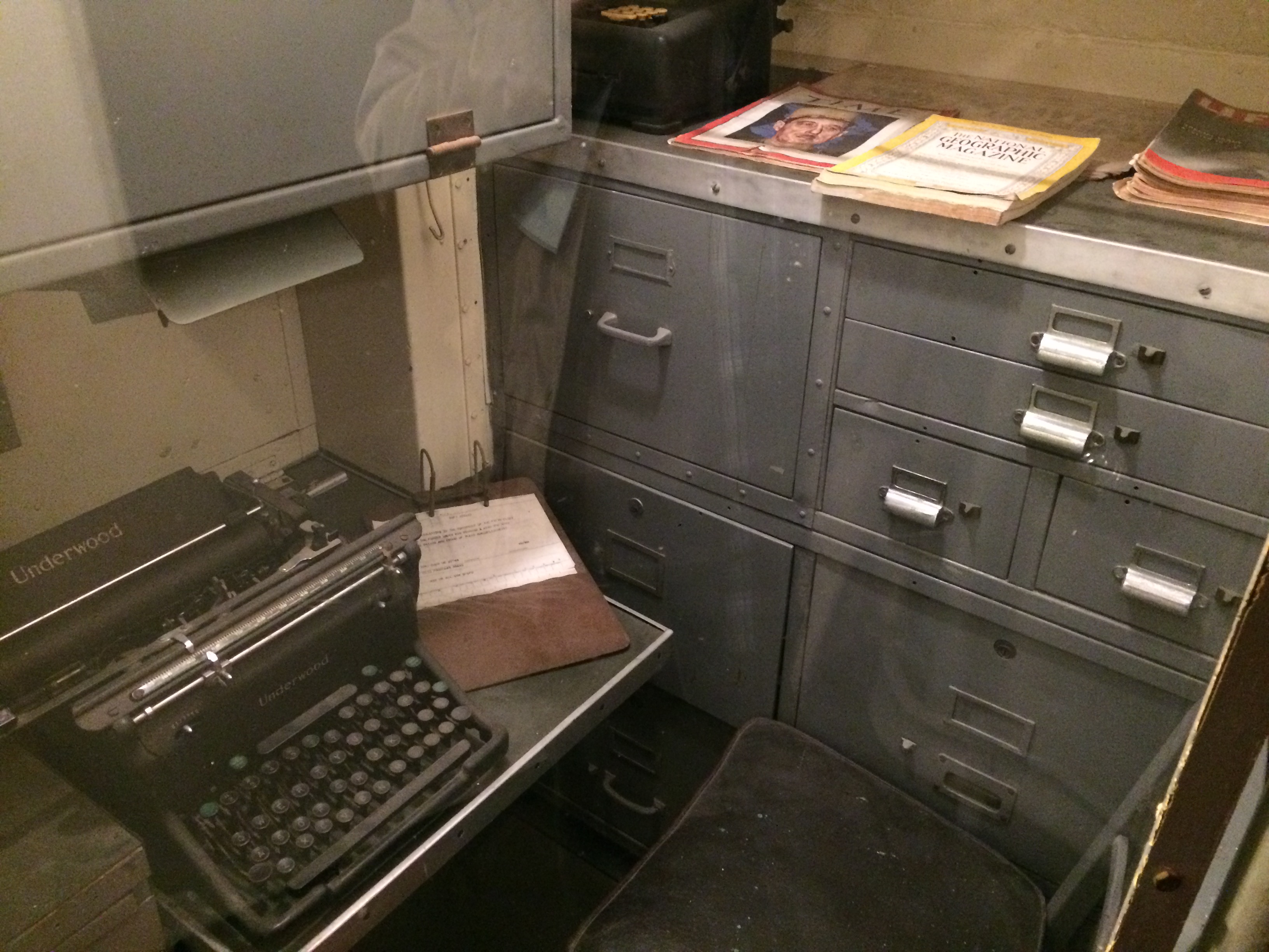 That looks like Charles de Gaulle on the cover of that Time Magazine.
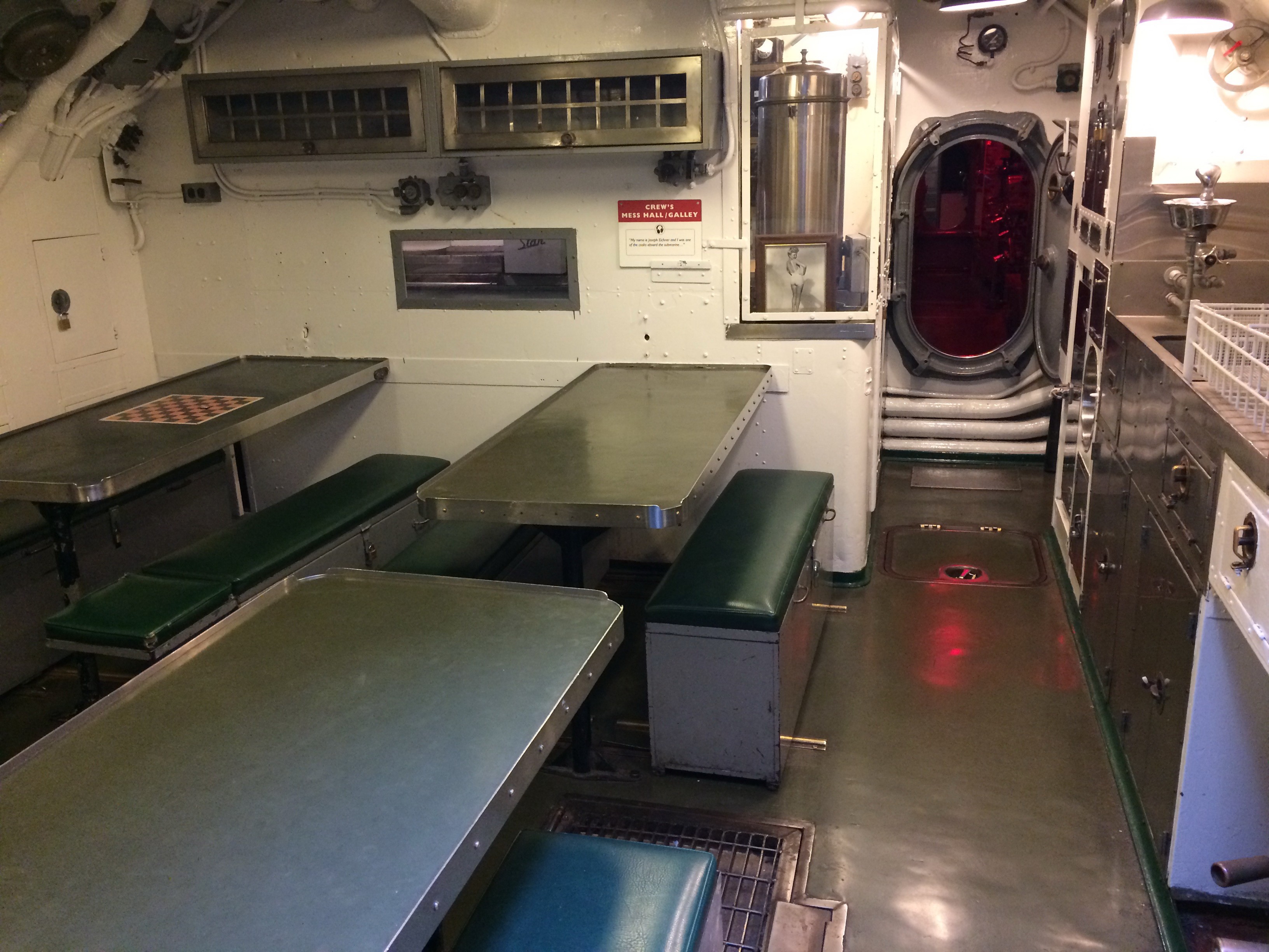 The Crew’s Mess:
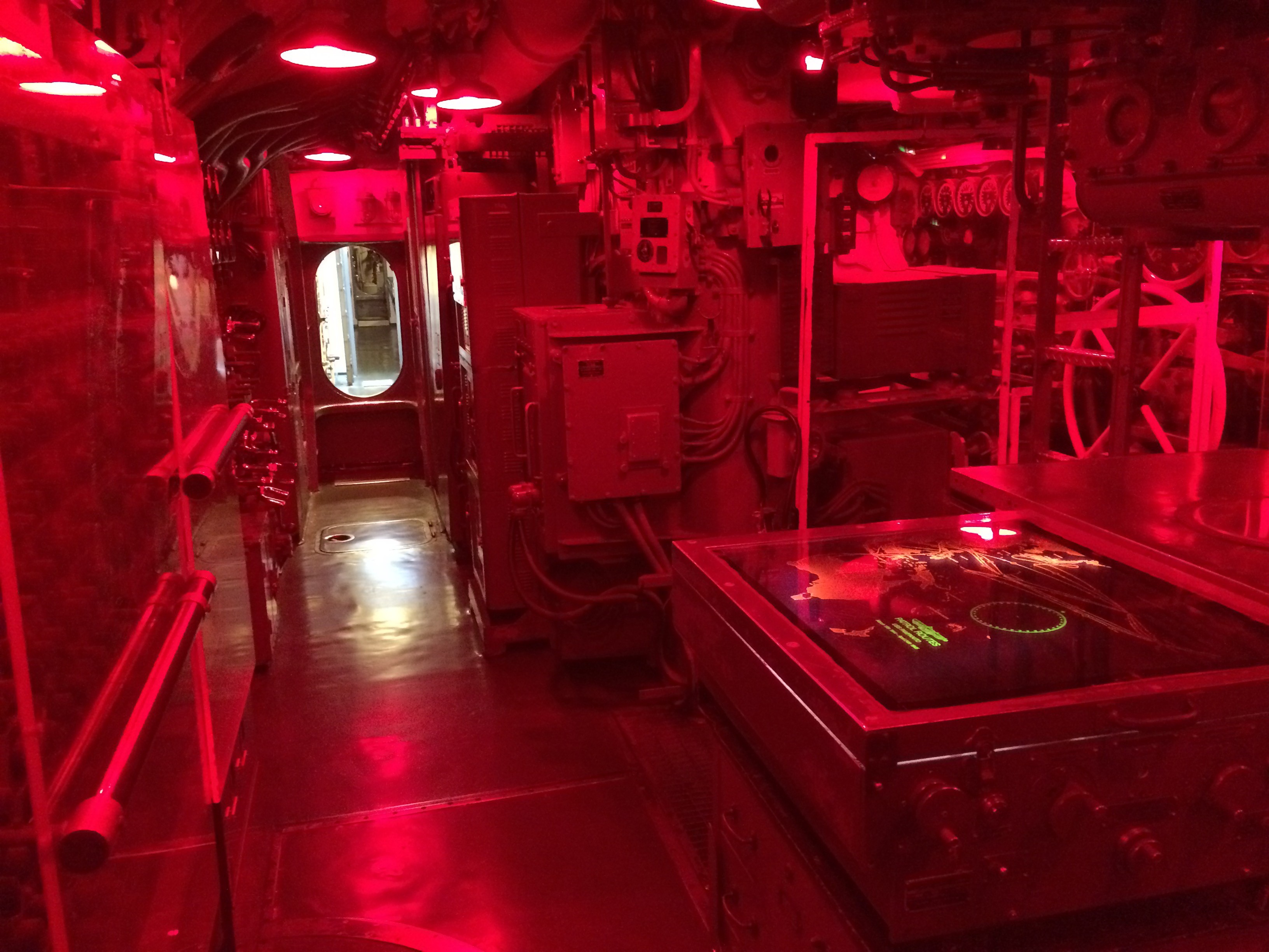 This room with the eerie red light is the control room where all attacks were planned.
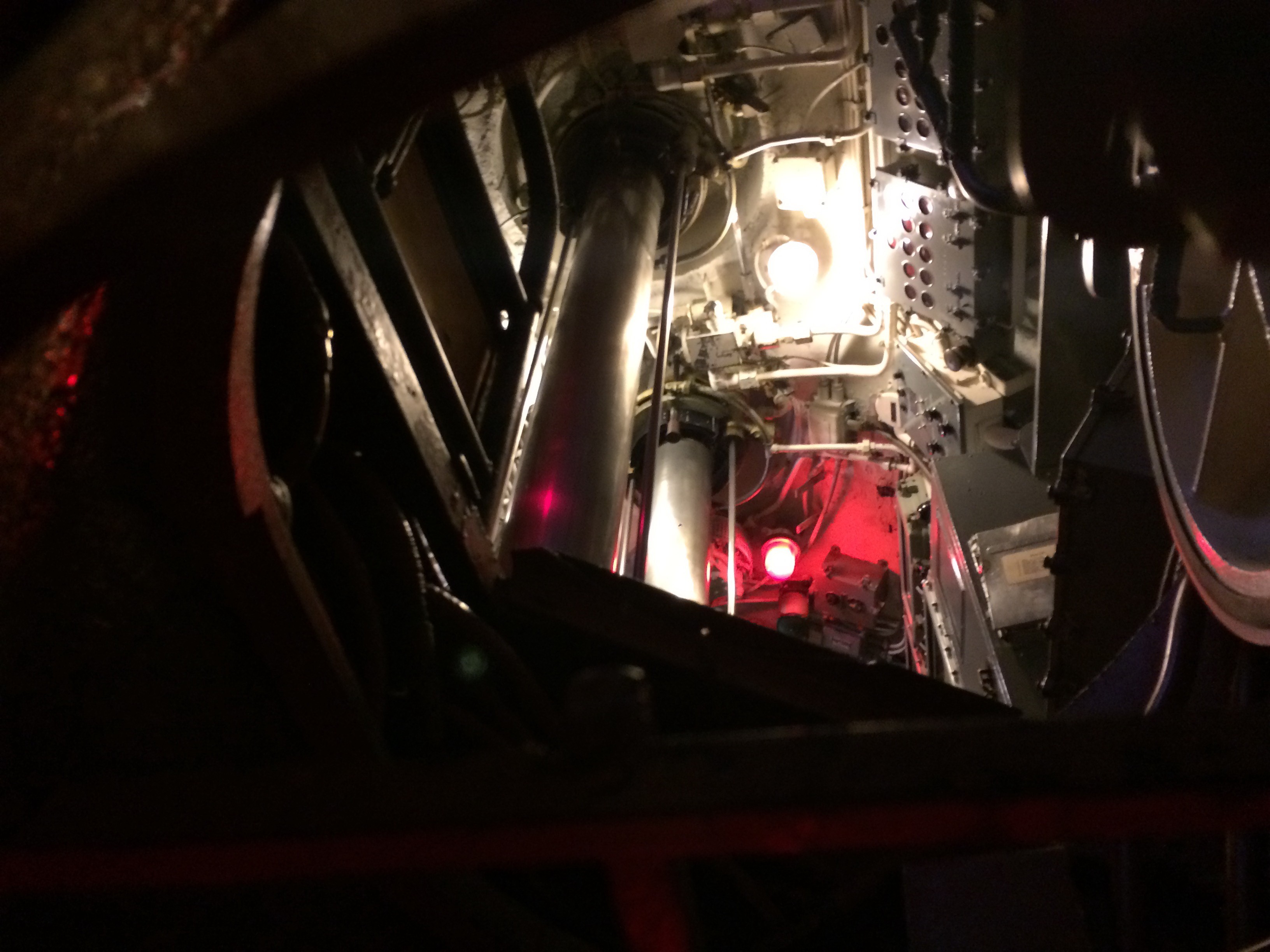 Looking up through the conning tower, that’s the periscope.
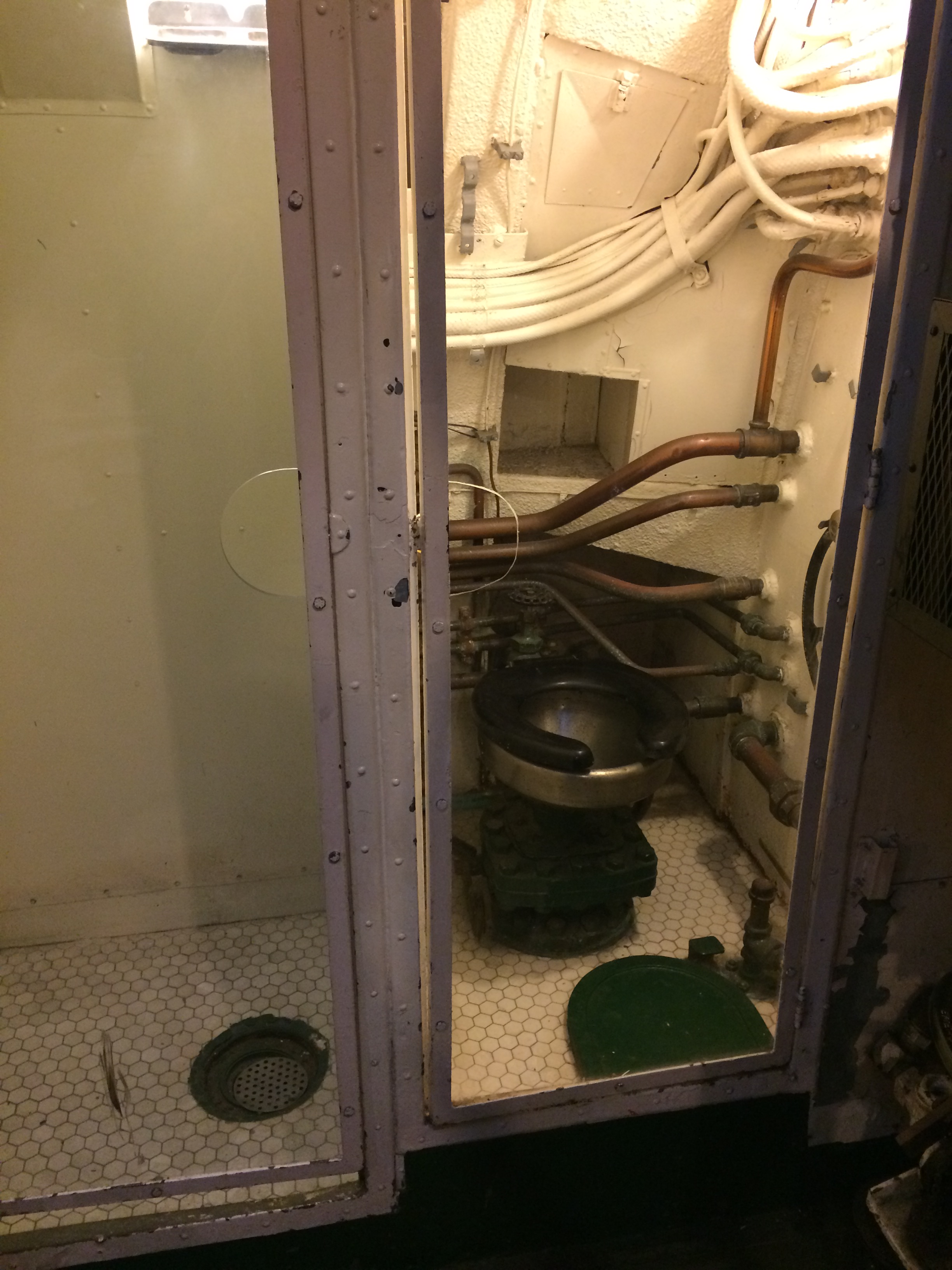 I would have been the first person heading here after a depth charge attack!
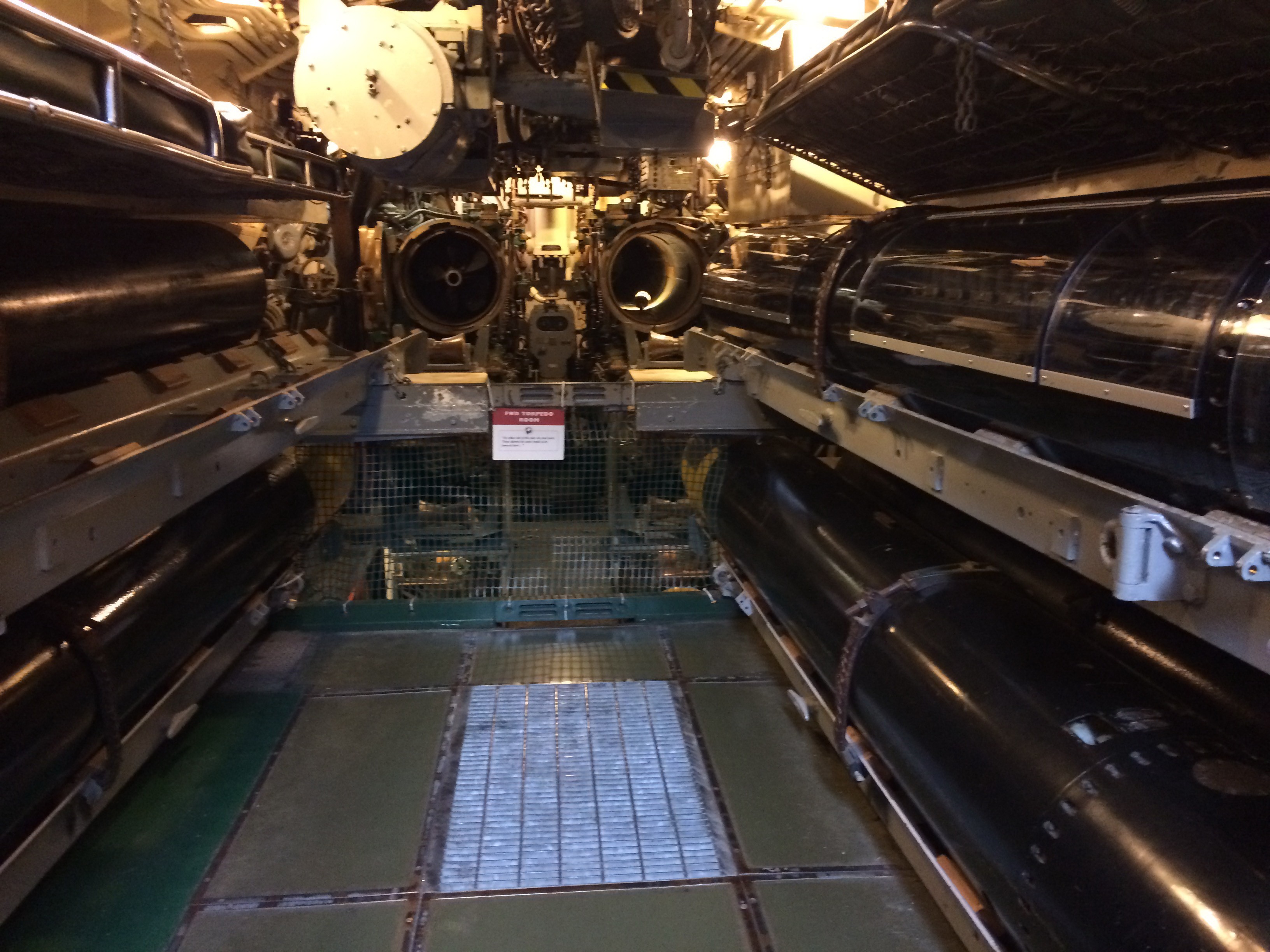 The forward torpedo room:
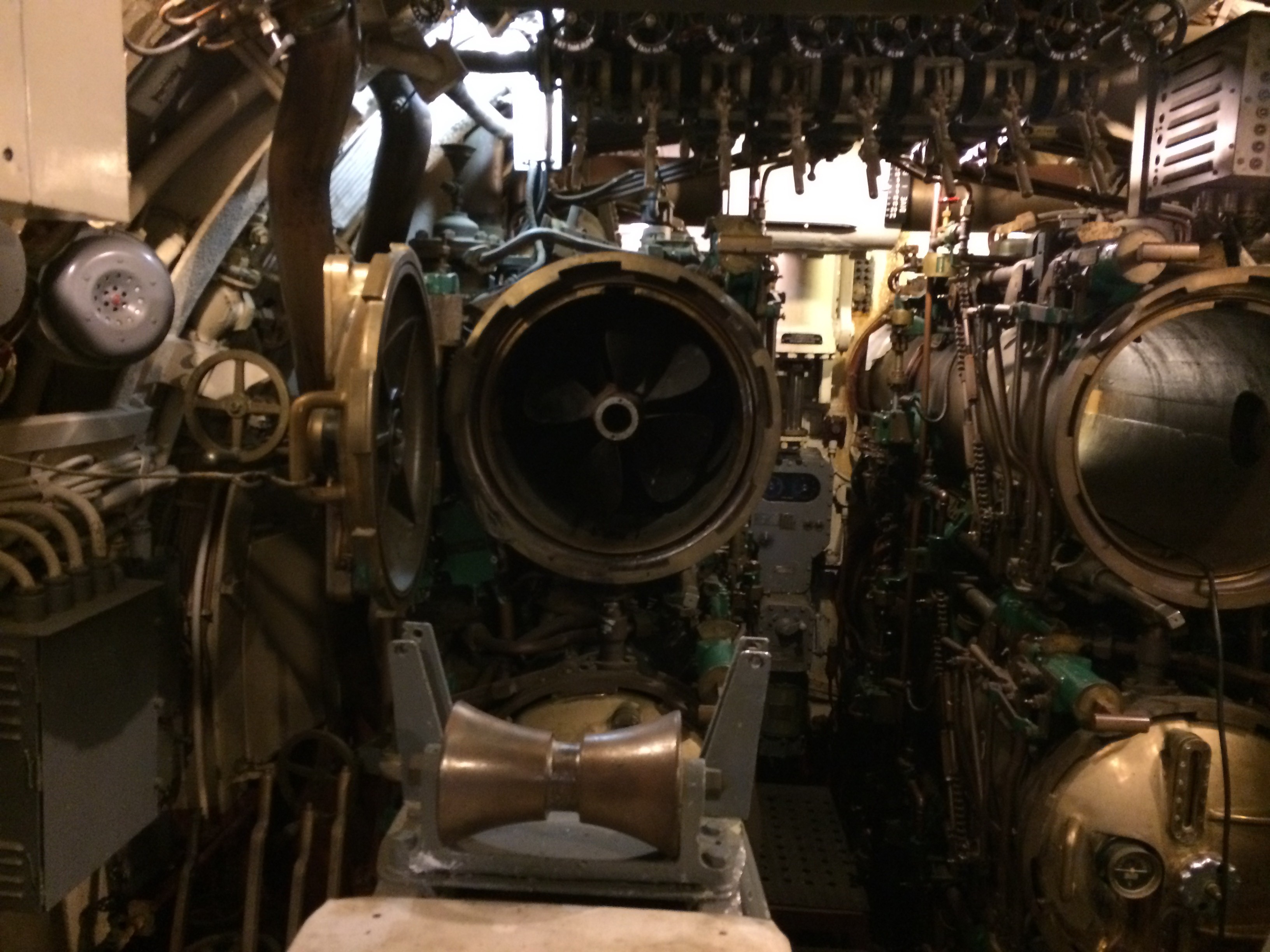 Those are the forward torpedo tubes. The left one has a torpedo in it.
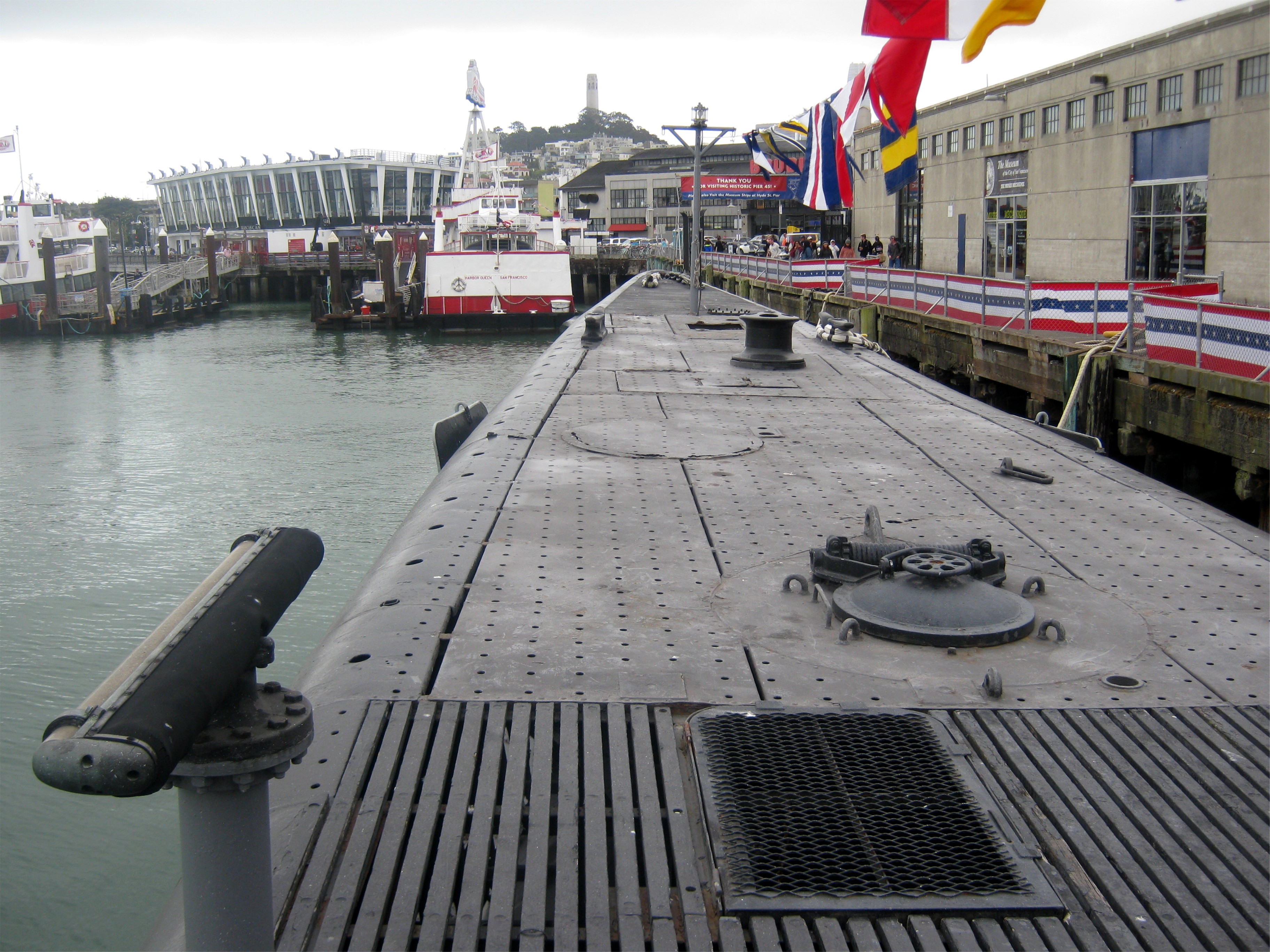 You break to the surface here in the fore of the ship, and you don’t have to worry about enemy destroyers or airplanes watching for you like the incredibly brave and heroic men of the “Silent Service” did.