The link to the film clip that I did these updates on is below my pictures. This one was posted on the Market Street Railway Facebook page by one of the group’s members. These colorized films, enhanced with sound effects and presented on You Tube by NASS, are sometimes maligned by some viewers, but I enjoy them. This one starts out in Chinatown, moves to Market Street, jumps to the Embarcadero north of the Ferry Building, goes back to Chinatown, and ends up back on the Embarcadero, south of the Ferry Building. (Thumbnail images)
The film clip opens up on Grant Avenue near California Street in Chinatown. The car the cameraperson is riding in is chasing a man south on Grant Avenue.
The running man and the auto chasing him turn west on California Street, and head up Nob Hill. I don’t know if that was a “rub out” or not; the car in the film does appear to run the guy over! Maybe somebody back then just had a sense of humor. (This one didn’t come through as a thumbnail image)
The film moves to Market Street, near 1st, and follows streetcars toward the Ferry Building.
The next scene is on the Embarcadero at Pier 3, north of the Ferry Building.
The camera moves north along the Embarcadero to Pier 7. Pier 7 is gone now, so Pier 5 was as close as I could get to a comparison image.
The next scene is back in Chinatown, moving south along Grant Avenue from Pacific Avenue past Washington Street. The film is a little choppier here and the images aren’t as clear.
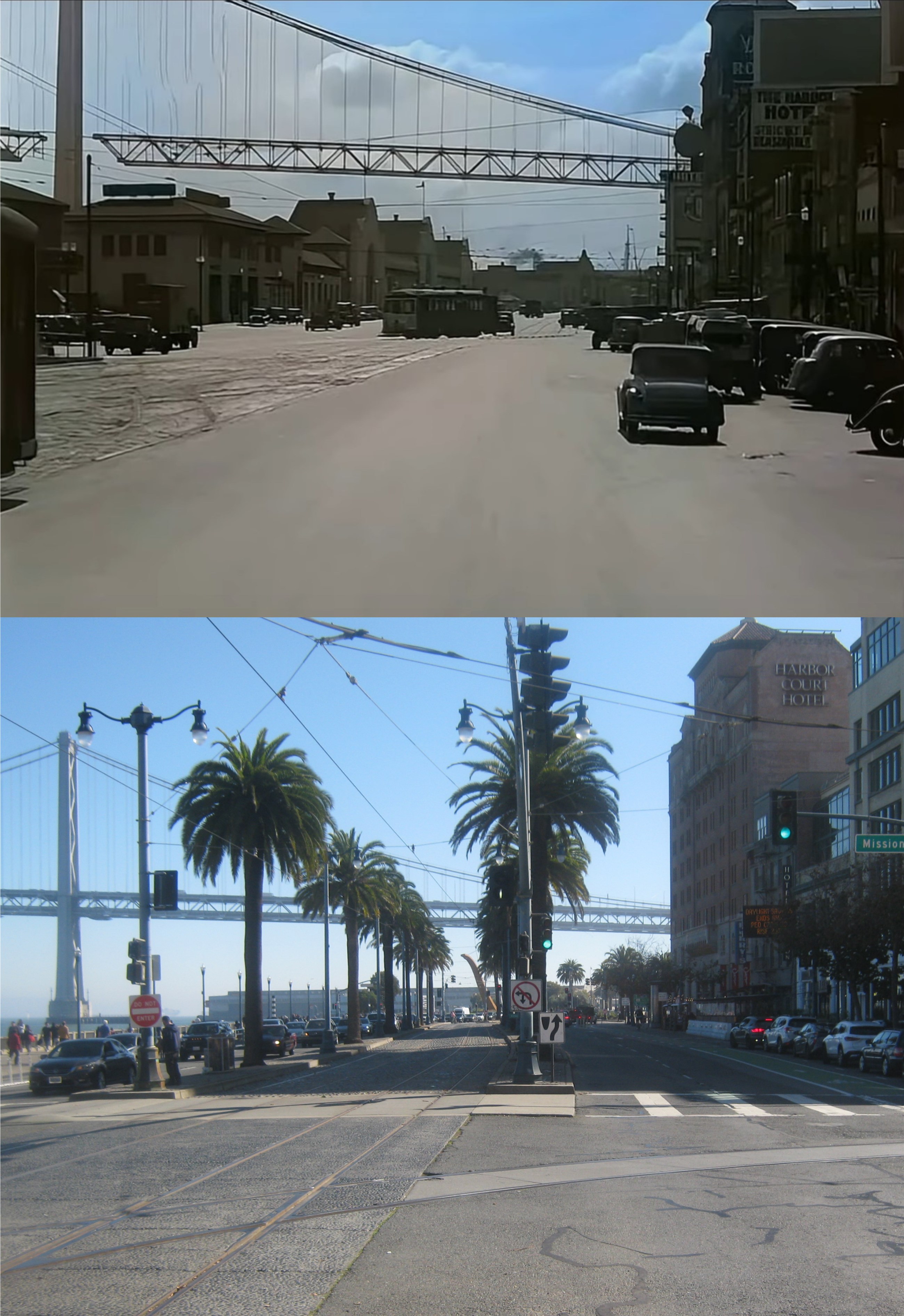
The film ends up back on the embarcadero between Mission and Howard Streets, south of the Ferry Building. The scene is looking south toward Howard Street past the old YMCA Building, which is still there. On the right background of the film image is a Sherwin-Williams advertising sign of a paint can covering the world on top of the building on the corner of Howard Street. Notice on the left that the Bay Bridge hadn’t been completed yet when the film was made. The Embarcadero was reconfigured in the 1990s, and curves at a different angle here than it did in the 1930s.
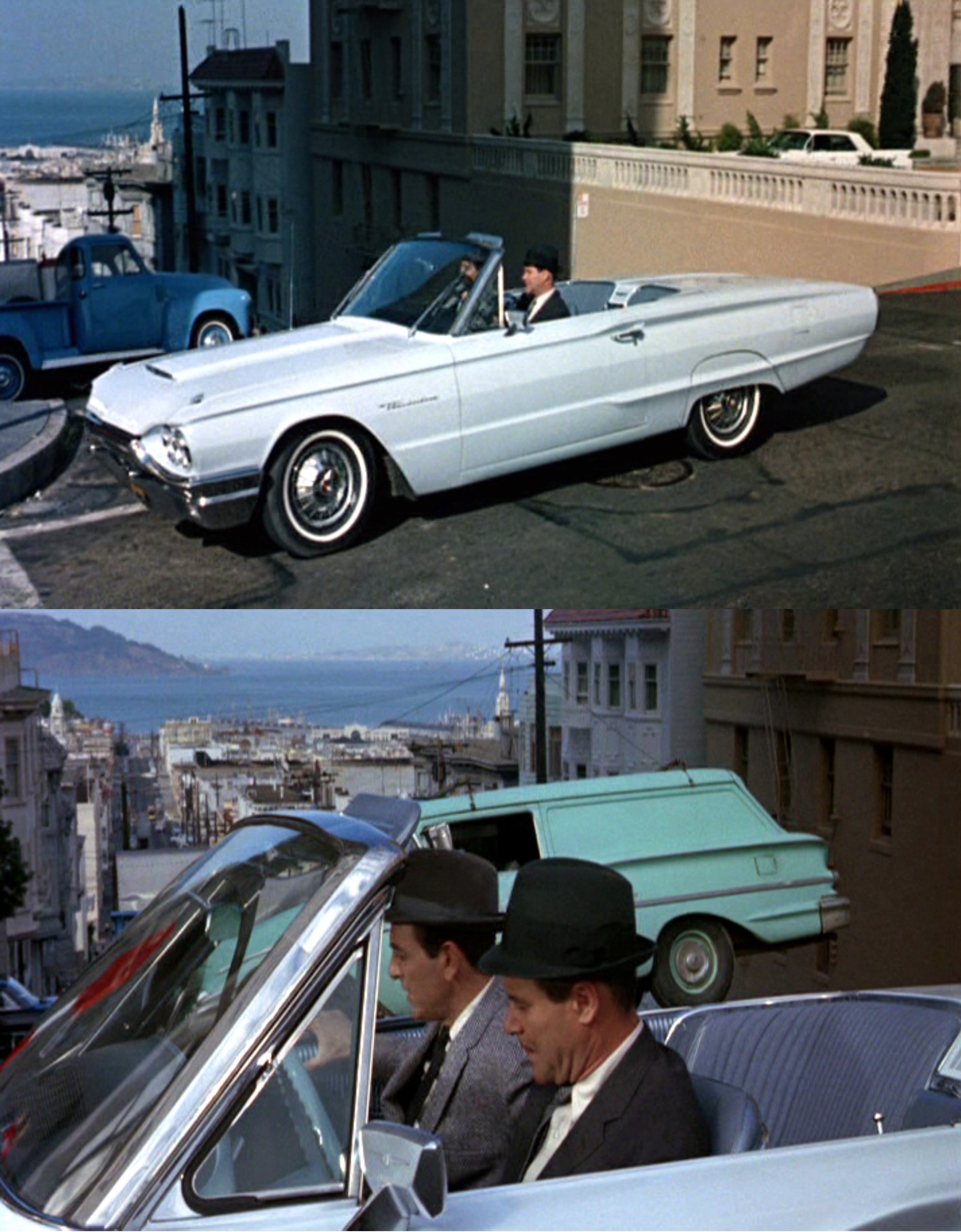
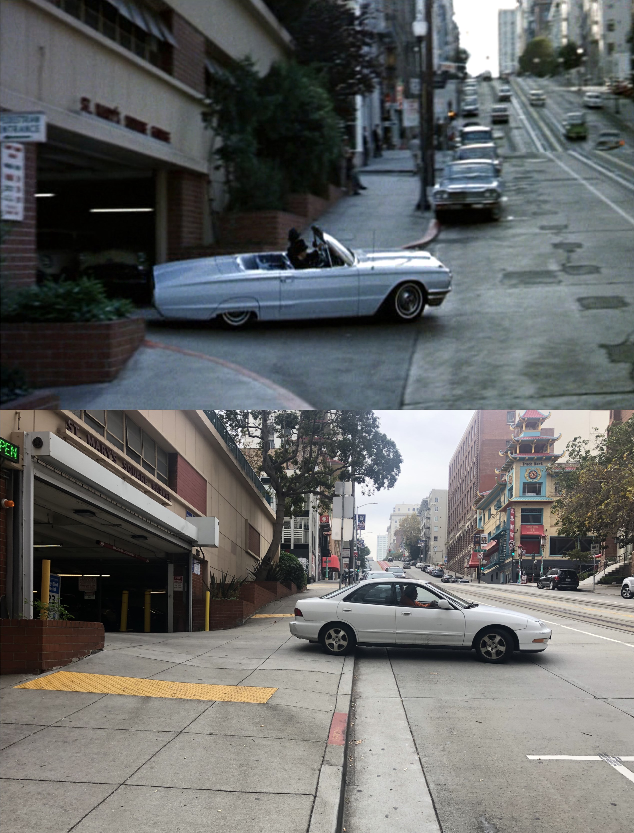
That probably wouldn’t have been a very good promo for a film, but it is an interesting and off beat location as part of a wild car ride scene, the highlight of the 1964 movie, ‘Good Neighbor Sam’. It’s only two and half stars on the must watch list, but the wild car ride in a Ford Thunderbird is as inconsistent and almost as fun to watch as the chase scene in ‘Bullitt’. Jack Lemmon takes a private eye who’s been spying on him for a crazy ride around San Francisco that takes in the cable car turnaround at Bay and Taylor Streets, the old Belt Line Railroad on the Embarcadero, the SOMA Area, Lombard Street and the Lansing Street, Guy Place curve on the western side of Rincon Hill, among other places. (Thumbnail images)
Sam and Minerva Bissell, played by Jack Lemmon and Dorothy Provine, get mixed up in shenanigans involving their next door neighbor, Janet Lagerlof, (Romy Schneider). It’s a little too complicated to explain, but Sam has to pretend that he’s Janet’s husband rather than Minerva’s so Janet can collect a fifteen million dollar inheritance from a deceased uncle. Things get even more complicated when Janet’s estranged husband, Howard Ebbets, played by Mike Connors, shows up. In the above pictures, Sam drops Howard off to work in Howards Thunderbird at Mason and Sacramento Streets.
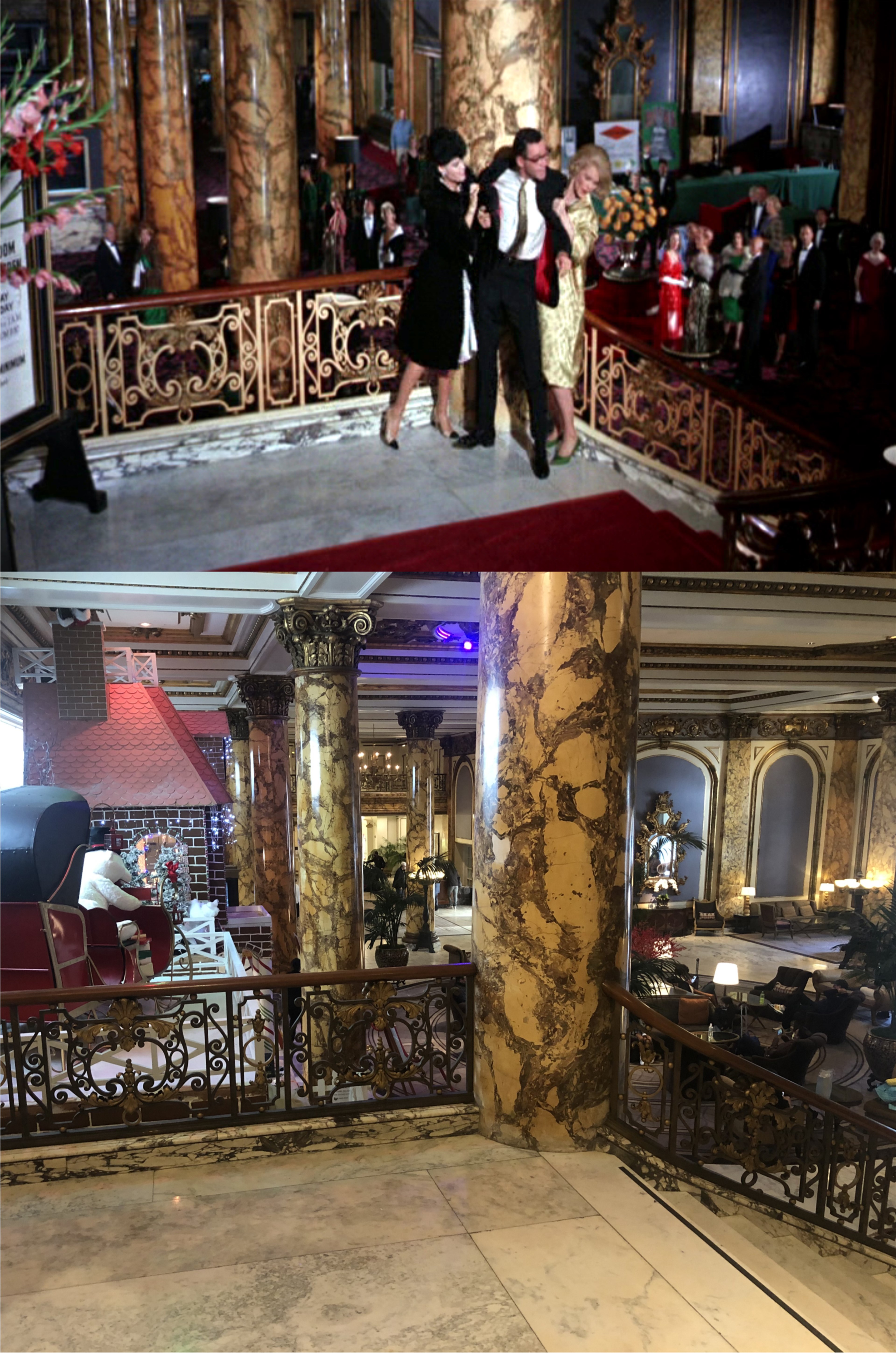
Earlier in the movie, Sam, Minerva, and Janet go out for a night on the town to celebrate Sam’s promotion at work due to an advertising tip he gives to a prospective client, Simon Nurdlinger, played by Edward G. Robinson. They end up in the Fairmont Hotel Lobby, with Sam completely hammered by this time.
Sam ends up rolling down the Fairmont’s marble stairway, knocking over several people. They don’t have the red carpet on the stairs anymore.
Now we come to the main reason to watch the movie. Sam is confronted by a private eye who mistakenly claims to have positive proof the Sam is, in fact, Janet’s husband, Howard Ebbets! This plays out perfectly for Sam because Janet has agreed to give Sam and Minerva one million dollars of her fifteen million dollar inheritance for helping her. Sam agrees to give the detective a ride home. However, the advertising company Sam works for has also mistaken Janet for Sam’s wife, and has placed billboards up all over town with pictures of Janet and Sam, identifying them as Mr. and Mrs. Sam Bissell. Don’t ask, it’s too complicated to explain. Here, Sam and the private investigator exit the St. Mary’s Parking Garage, across California Street from old St. Mary’s Church, and head up Nob Hill.
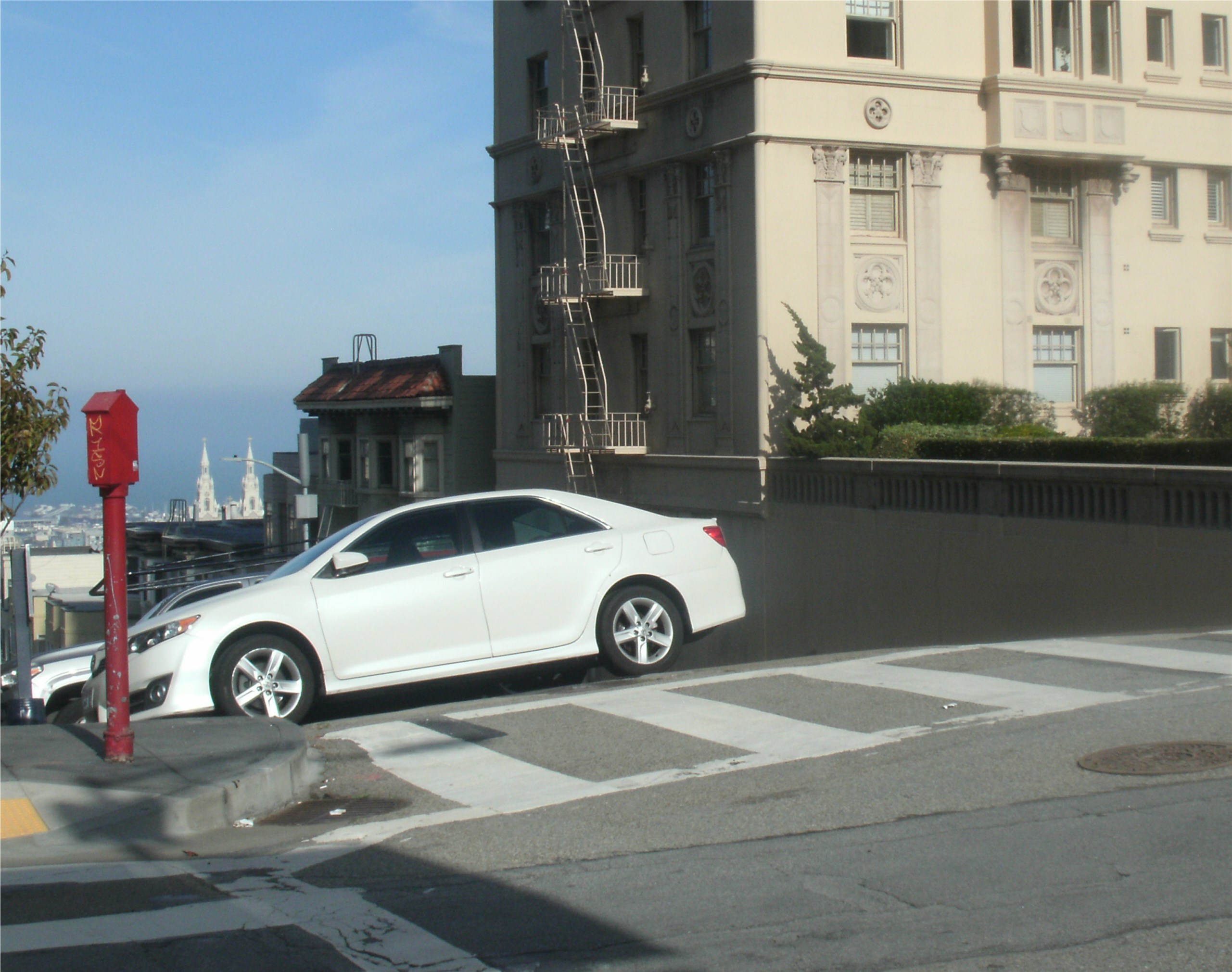
Sam spots one of the billboards on the corner of California and Powell Streets.
Sam takes a sharp left on Powell to prevent to investigator from seeing the billboard. Several years ago, I did a comparison of this scene when the old Crest Garage was still there. The garage was demolished in 2018; here’s the view today.
Sam heads down Powell Street. In the far back is the Sir Francis Drake Hotel, blocked from the view here today by the San Francisco Marriott Hotel. I think you can see some of the construction on the Marriott Hotel to the left of the Sir Francis Drake Hotel in the film shot. Also the flag on the Francis Drake Hotel is at half mast. The movie was released in July of 1964, but possibly the car ride scene was filmed when flags across the country were flying at half mast due to the November 22, 1963 assassination of President John F. Kennedy.
The billboards have been placed up all over San Francisco, and Sam constantly has to make fast turns and maneuvers to prevent the investigator from seeing one. Here, Sam guns the T-Bird past a cable car turning around at Bay and Taylor Streets. This spot has changed drastically since 1964, although the 76 Gas Station on the right is still there today. You can also see the Cost Plus World Market sign on the right in the movie scene. The Cost Plus here closed in 2020.
Lansing Street and Gulf Place curve around the western side cliff of Rincon Hill, cut off due to excavation of this part of the hill that would eventually be the Fremont Street freeway off ramp from the Bay Bridge. The Clock Tower Building at Bryant and 2nd Streets can be seen on the right in both images. I’m a little further up Gulf Place in my picture because I wanted to get some of the beige house on the left in the film shot and still on the curve, although partially blocked by a newer building today.
Sam races down Gulf Place toward 1st Street, causing another car coming up the hill to crash into a pile of boxes. You could still see the Bay Bridge from here in 1964.
I don’t usually sneak out of the office on a rainy day, but there’s something beautiful about San Francisco in the rain sometimes, especially if it’s a warm rain that’s not uncomfortable. (Thumbnail images)
Jefferson and Taylor Streets at Fisherman’s Wharf, seen in the 1960s in the vintage photo:
One of my favorite pictures of the Fisherman’s Wharf Boat Lagoon, taken by Charles Cushman in 1940: The lagoon was full of boats yesterday because the crab season has been delayed again.
I was coming back from the Wharf on a cable car, and when we got to Columbus Avenue near Lombard Street I remembered a picture by Peter Stratmoen from 1975 that I did a then and now on once. My picture is a little blurrier than I’d like it to be because I was leaning out as far as I could on the cable car trying to get a good shot, and I didn’t want to fall off. The spires of Saints Peter and Paul Church are on the left, and the vintage KFC has been replaced by an apartment building.
So, I got back down to Union Square at Powell and Geary Streets on the cable car when things started getting weird. Have you ever have had one of those days when all of a sudden you’re in a Film Noir movie sitting next to Humphrey Bogart on a cable car?
I took another ride on the cable car line they used to call the ‘Hyde Street Grip’ on Friday; it’s always one of the best attractions in town.
North Beach to Tenderloin, over Russian Hill,
the grades are something giddy, and the curves are fit to kill!
All the way to Market Street, climbing up the slope,
down upon the other side, hanging to the rope;
But the sight of San Francisco, as you take the lurching dip!
There is plenty of excitement, on the Hyde Street Grip!
I wanted to get a seat up front for picture taking so I jumped on the cable car before it stopped. “Nope! Nope! Nope!” the conductor said to me in a friendly manner. “No boarding the car while it’s moving.” My first impulse was to say to him, “Hey, I’ve been riding these contraptions since before you were born, buddy. Don’t tell me how to ride a cable car!” But times have changed and he was right. I just smiled and said “Sorry!” and we got along fine.
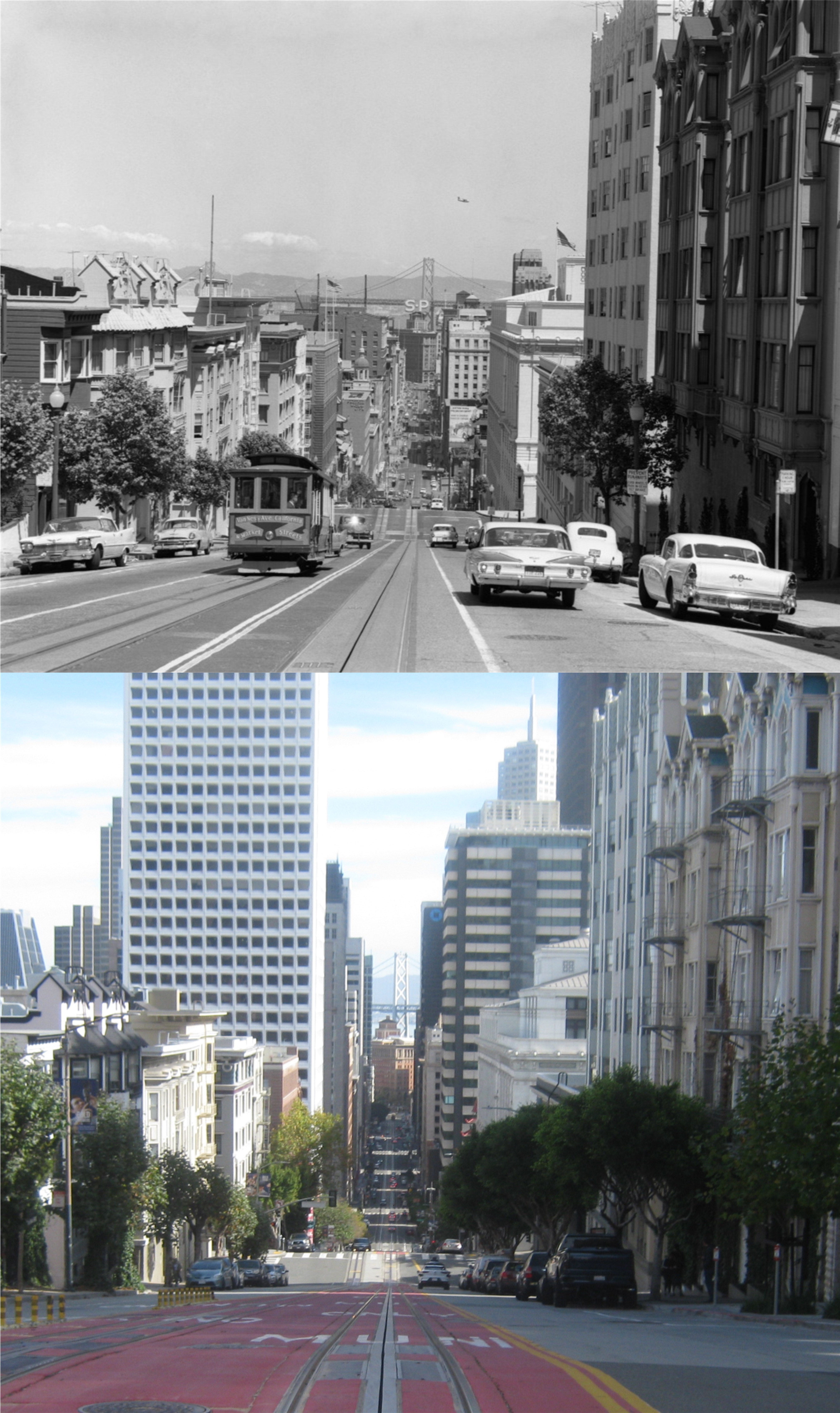
Heading up past Union Square: It’s hard to get a perfect line up updating vintage photos when you’re rocketing along at a lightening nine miles an hour, but they turned out okay. The vintage photo is from 1963. (opensfhistory.org)
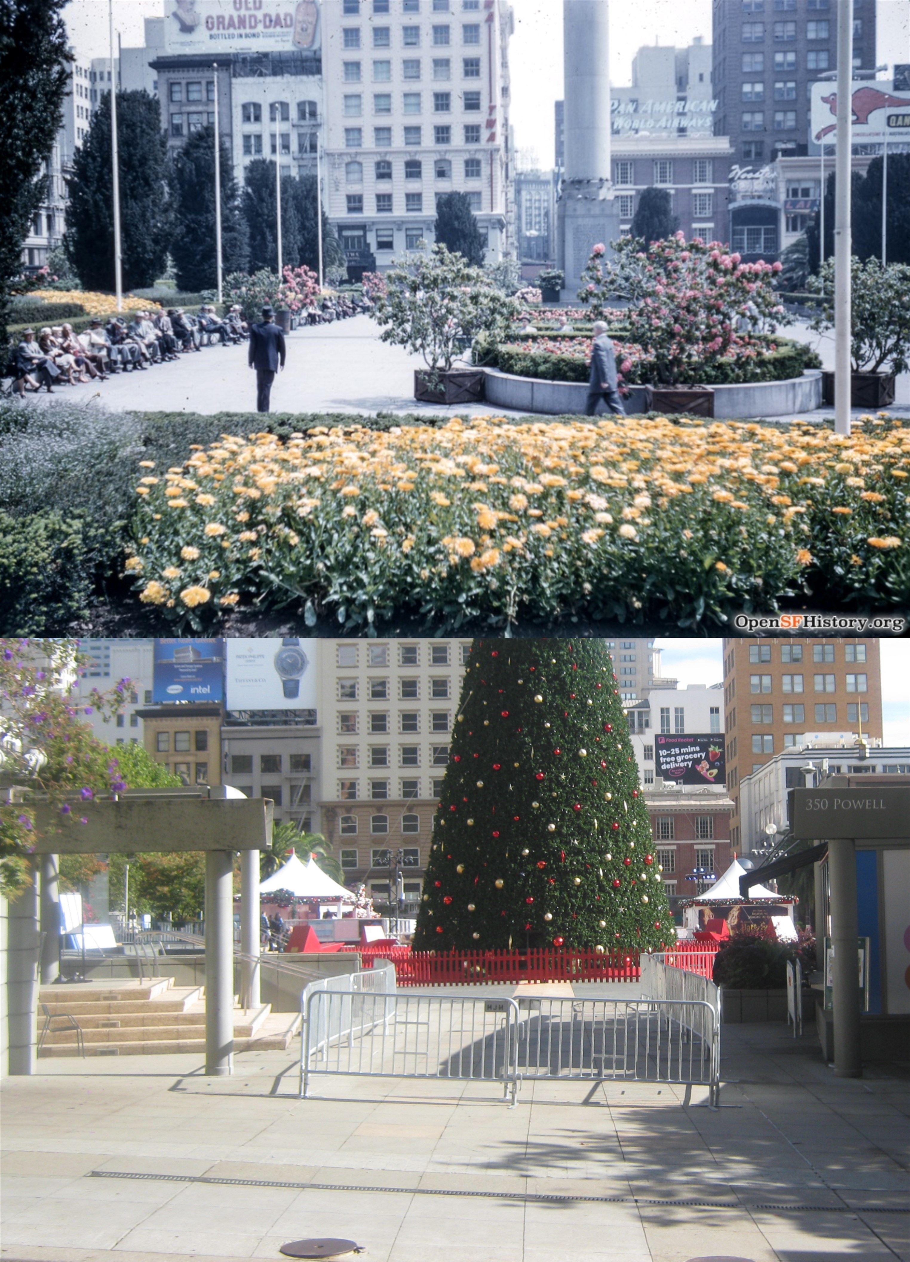
They’re all set up for the Holiday Season again in Union Square. The Dewey Monument, seen in 1957 in the vintage photo, is behind the Christmas tree in the current picture. (opensfhistory.org)
On top of Nob Hill we rolled past California Street, the only place where two separate cable car lines cross each other perpendicularly. (Walmartimages)
We leveled out for a bit at Powell and Clay Streets, and I was riding on the opposite side of a cable car like the one seen in the 1965 picture. (opensfhistory.org)
Rattling along past Lombard Street; the tourists are back here again in the hundreds at any given time. The vintage picture is from 1960. (opensfhistory.org)
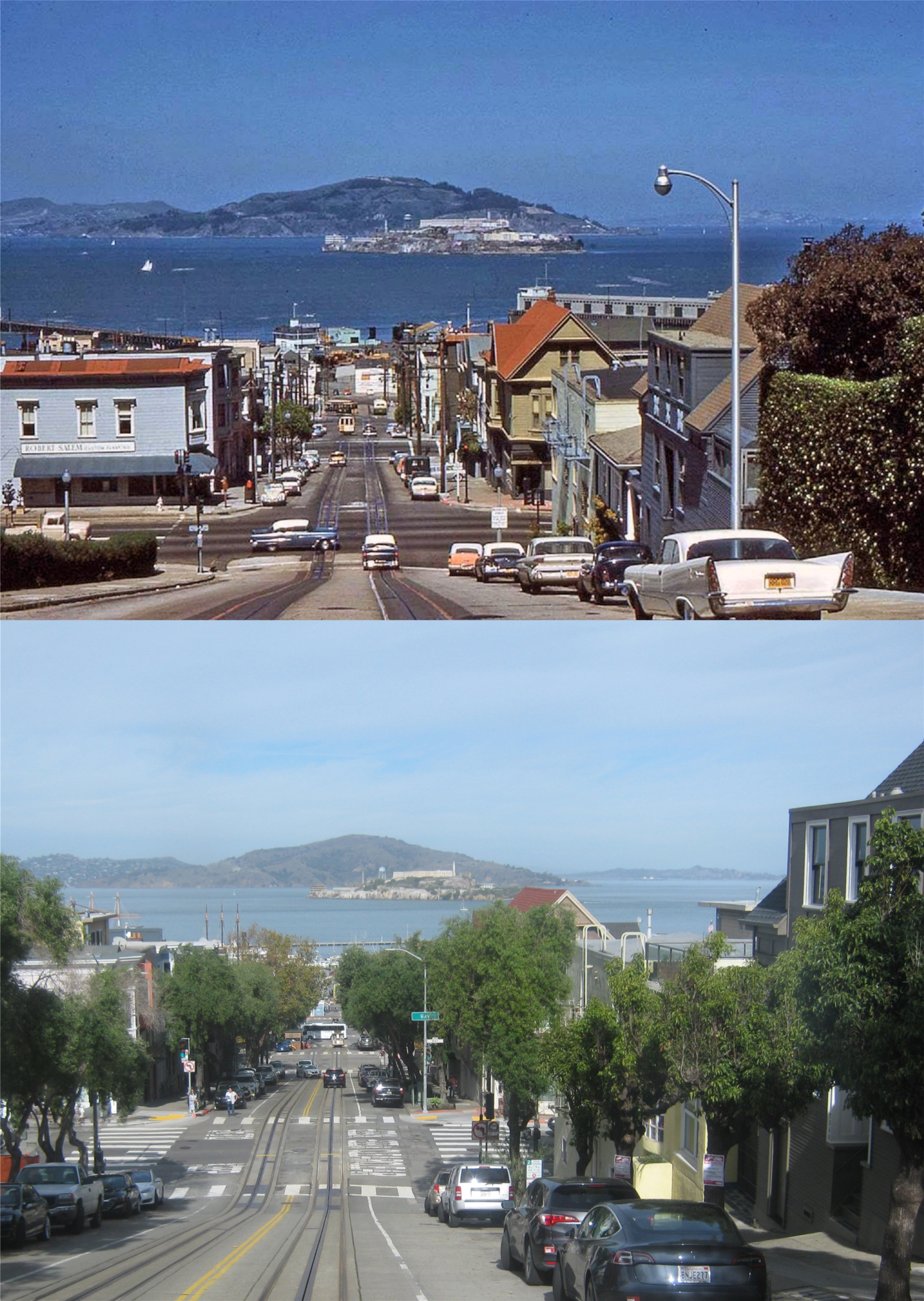
And you end up taking the “lurching dip” from Chestnut to Bay Streets with spectacular views of the Golden Gate, Alcatraz, Angel Island, and the Bay.
Addendum: Always point out when you’ve been corrected. I’ve referred to this cable car line in the past as the ‘Hyde Street Grip’, but the cable car line that Gelett Burgess wrote about in his poem, ‘The Ballad of the Hyde Street Grip’, was actually the now defunct O’Farrell and Jones Line. Check out the story below from the Market Street Railway.
Hah, I still have favorite clothes I wear that I bought in the 1990s! Usually, I don’t update posts about anything more contemporary than the 1980s, but to my alarming awareness, the 1990s may be vintage years now, as well. (Thumbnail images)
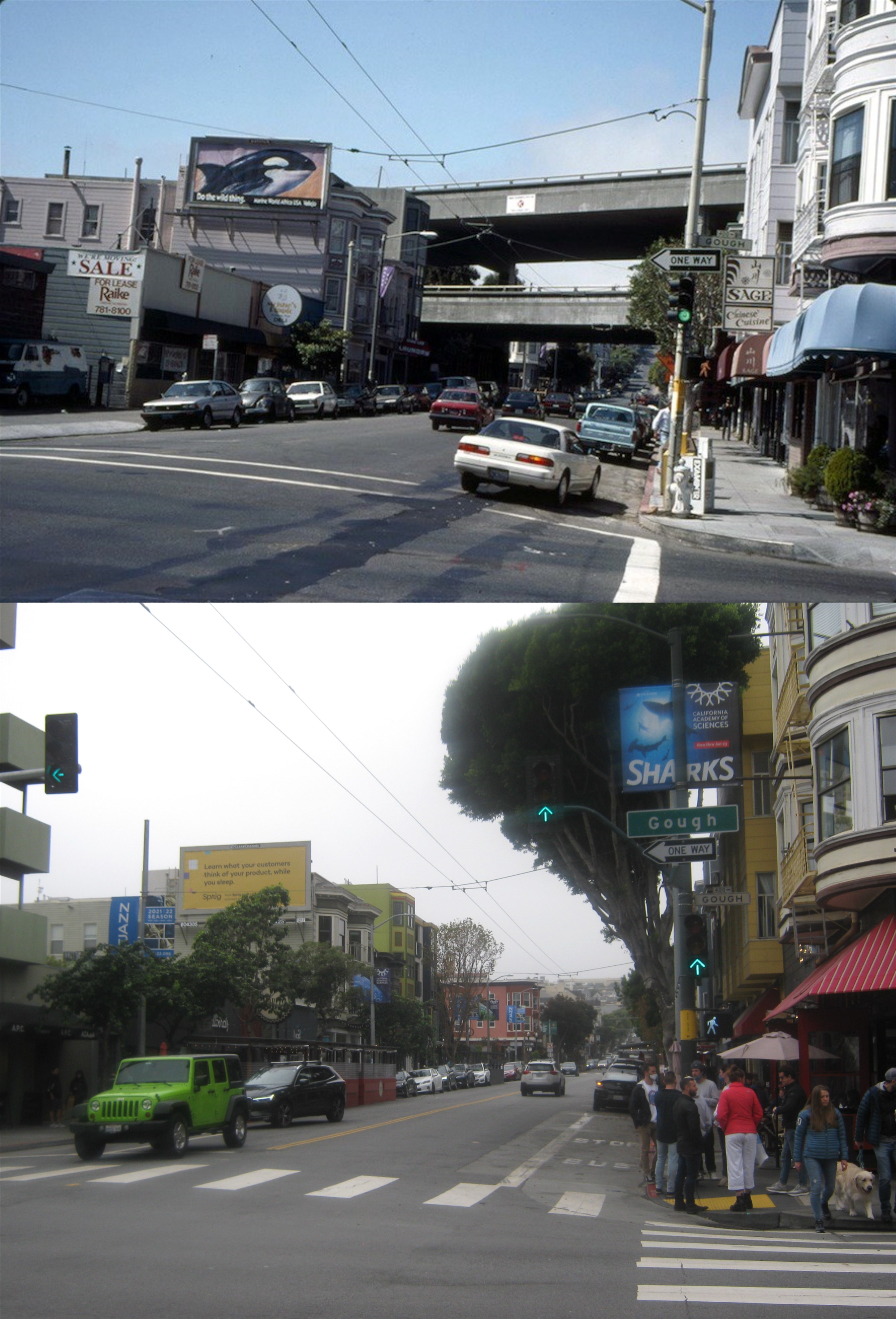
Taken from the northeast corner of Gough and Hayes Streets, looking west along Hayes, on a gloomy Halloween Eve: This portion of the Central Freeway in the background was closed by this time due to the Loma Prieta Earthquake of October of 1989. It was demolished in 1992. The long standing argument on how to pronounce Gough Street, like cough or though, even had Herb Caen write about it in one of his columns. (Bold Italic)
On the opposite southeast corner of Gough and Hayes, demolition had already begun on the Central Freeway when the top picture was taken. (Bold Italic)
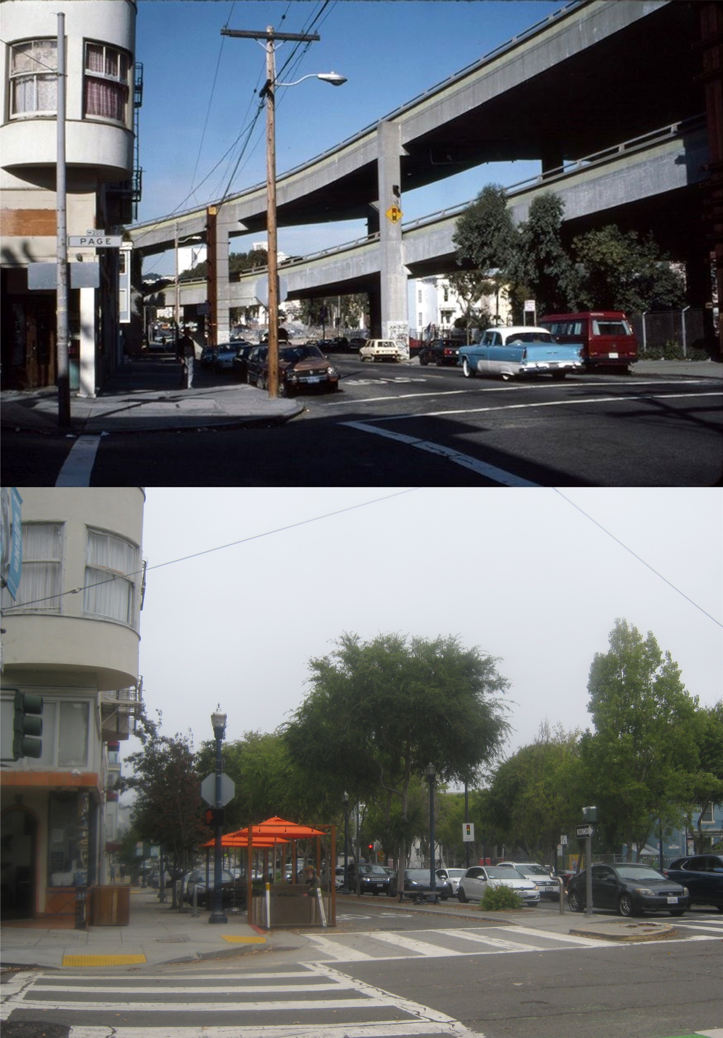
Page Street and Octavia Blvd., looking north toward the Central Freeway: In keeping with the spirit of a Halloween Eve, this portion of the old freeway here, although convenient, sure was a monstrosity. (Pinterest)
Market Street, looking east past Octavia: The demolition of the northern part of the Central Freeway caused a traffic mess on Market Street, but the Octavia Throughway that replaced it, (that’s through like boo, not cough) is a really pretty drive. (hoodline.com)
I took this slide picture, looking north from Mission Street, in September of 1991. The demolition of the Embarcadero Freeway, also closed due to the Loma Prieta Earthquake, had reached the Ferry Building by this time.
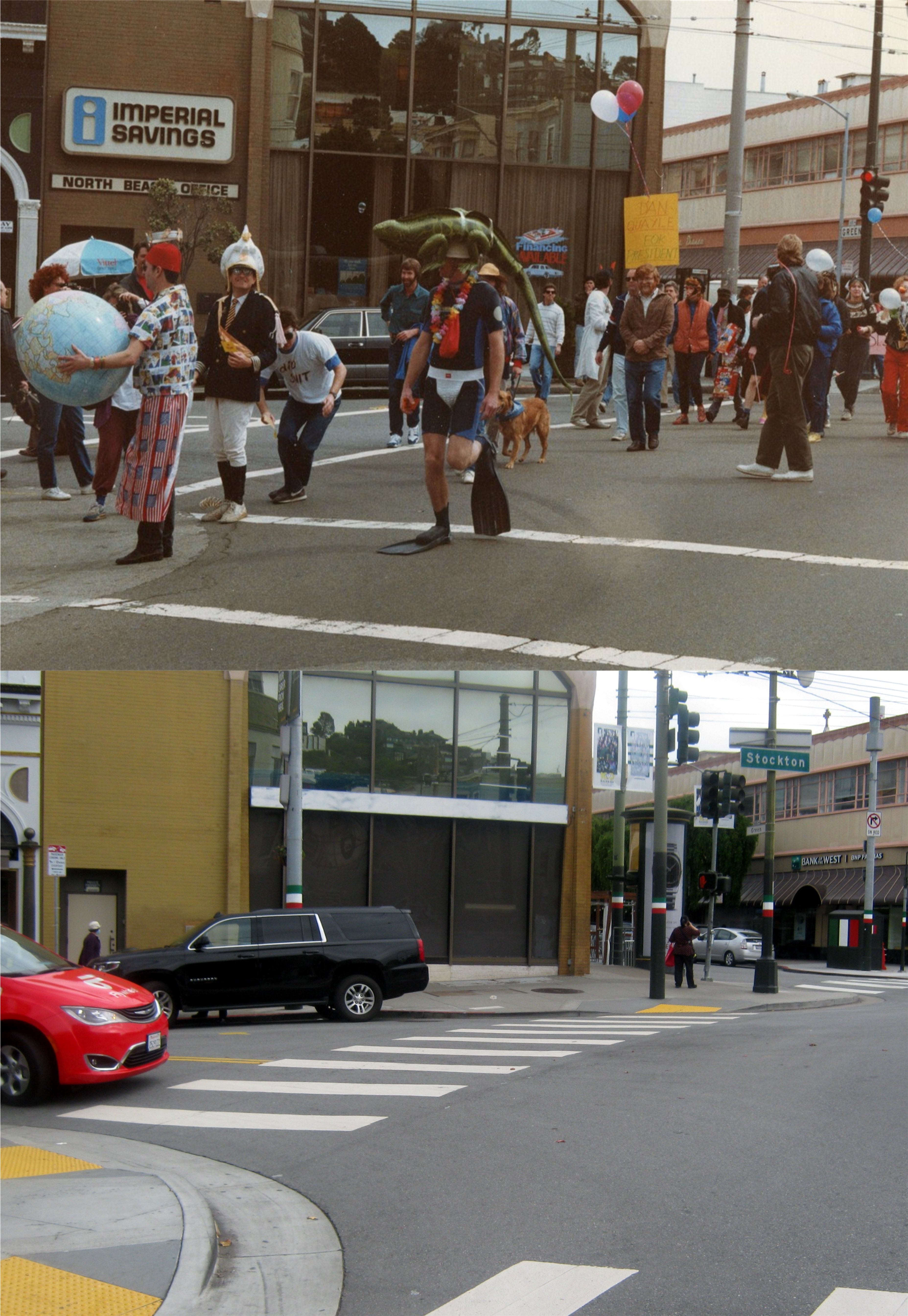
I’m not sure what was going on here at Columbus Ave. and Green Street in the late 1990s. Dan Quayle had indicated that he might run for president around this time, but I don’t know if that’s the main theme of the parade. (medium.com, Jay Hinman)
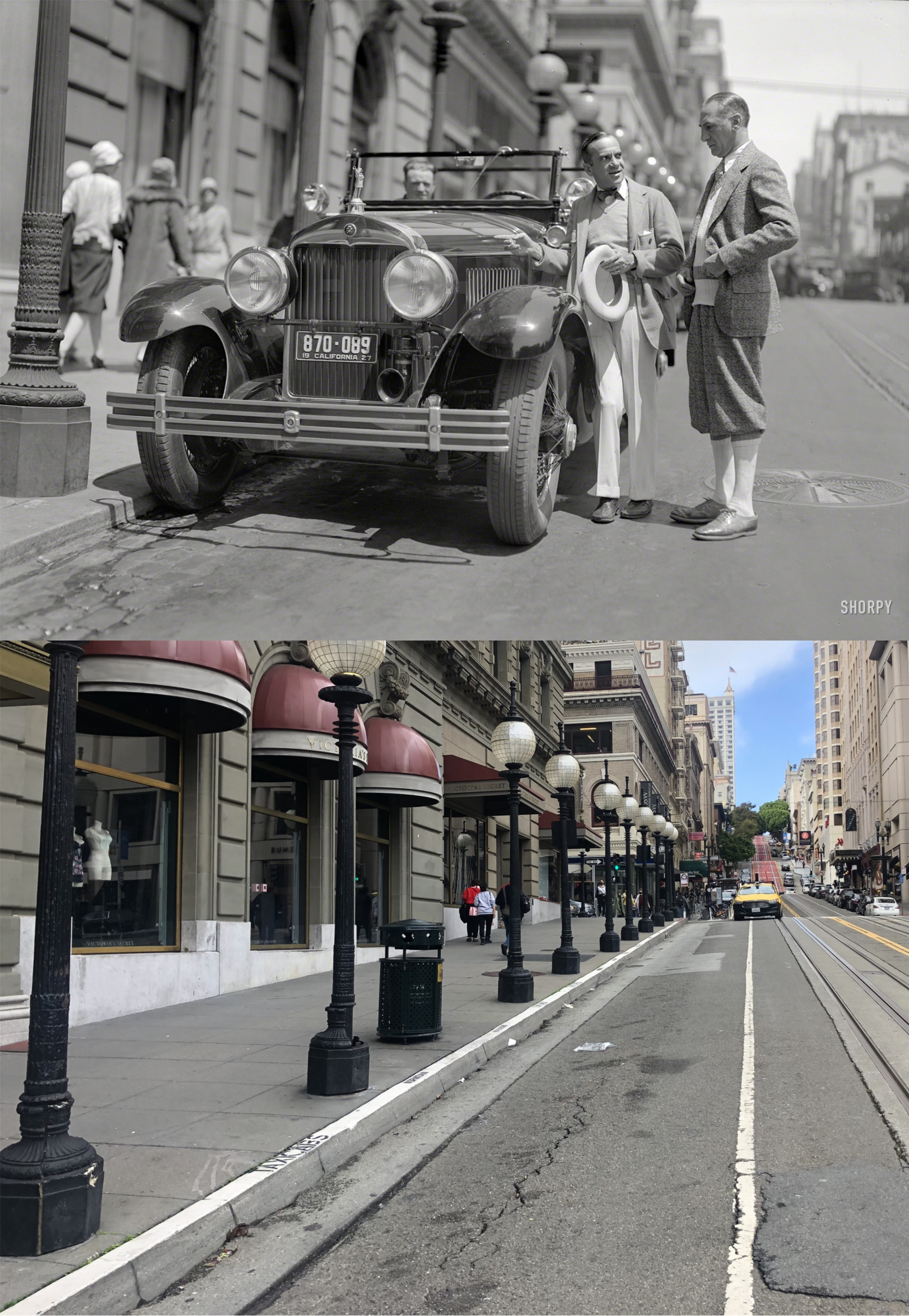
That’s what I needed to recover from the results of the first round of the 2021 baseball playoffs, pure escapism therapy. The Shorpy Photo Archive has a stunning collection of high density vintage pictures, many taken in San Francisco, that are a lot of fun to browse through, or if you’re like me, to visit the locations and update some of the photographs. (Thumbnail images)
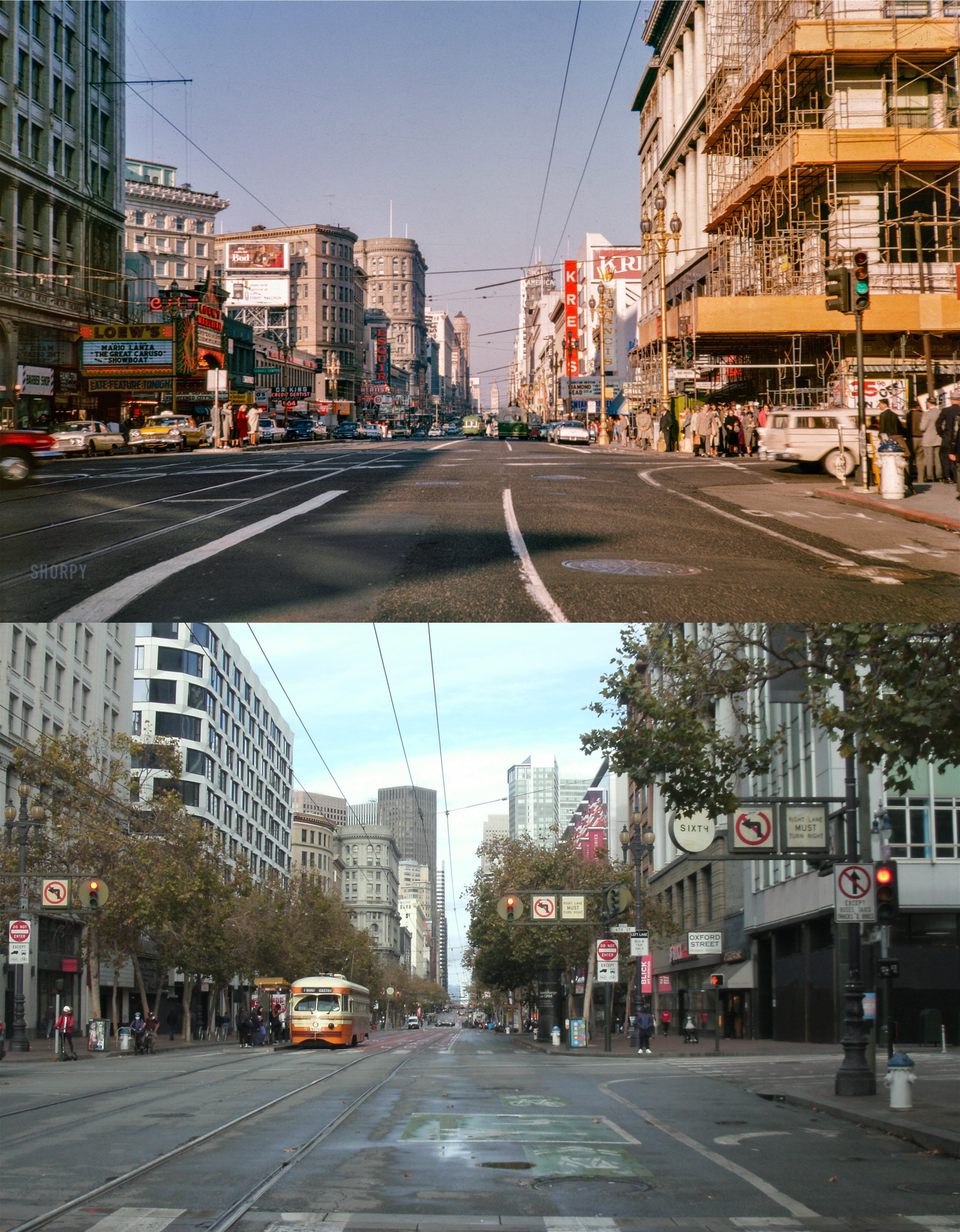
Market Street at Street ay 6th, looking east in 1963: Many of the buildings from the vintage picture can still be seen today. The building on the right being remodeled is the old David Hughes Building that housed the Western States Life Insurance Company for many years. The building, with a completely different look today, was built in 1908.
The California Street Stairs to Huntington Park on Nob Hill in 1923: The late October shadows were sort of haunting me in this one, but it’s a reasonable facsimile. The Pacific Union Club Building is on the right in both pictures.
“Wait a minute. Wait a minute. You ain’t heard nothing yet!” And so Al Jolson effectively made silent movies obsolete in the first talkie, ‘The Jazz Singer’ from 1927. Much maligned today for his many black face routines, Al Jolson was still an important part of film history. Jolson is the one with the hat next to the car in the 1927 picture on Powell Street in front of the St. Francis Hotel. Ironically, Jolson died of a heart attack at the St, Francis Hotel in 1950, twenty three years after this picture was taken.
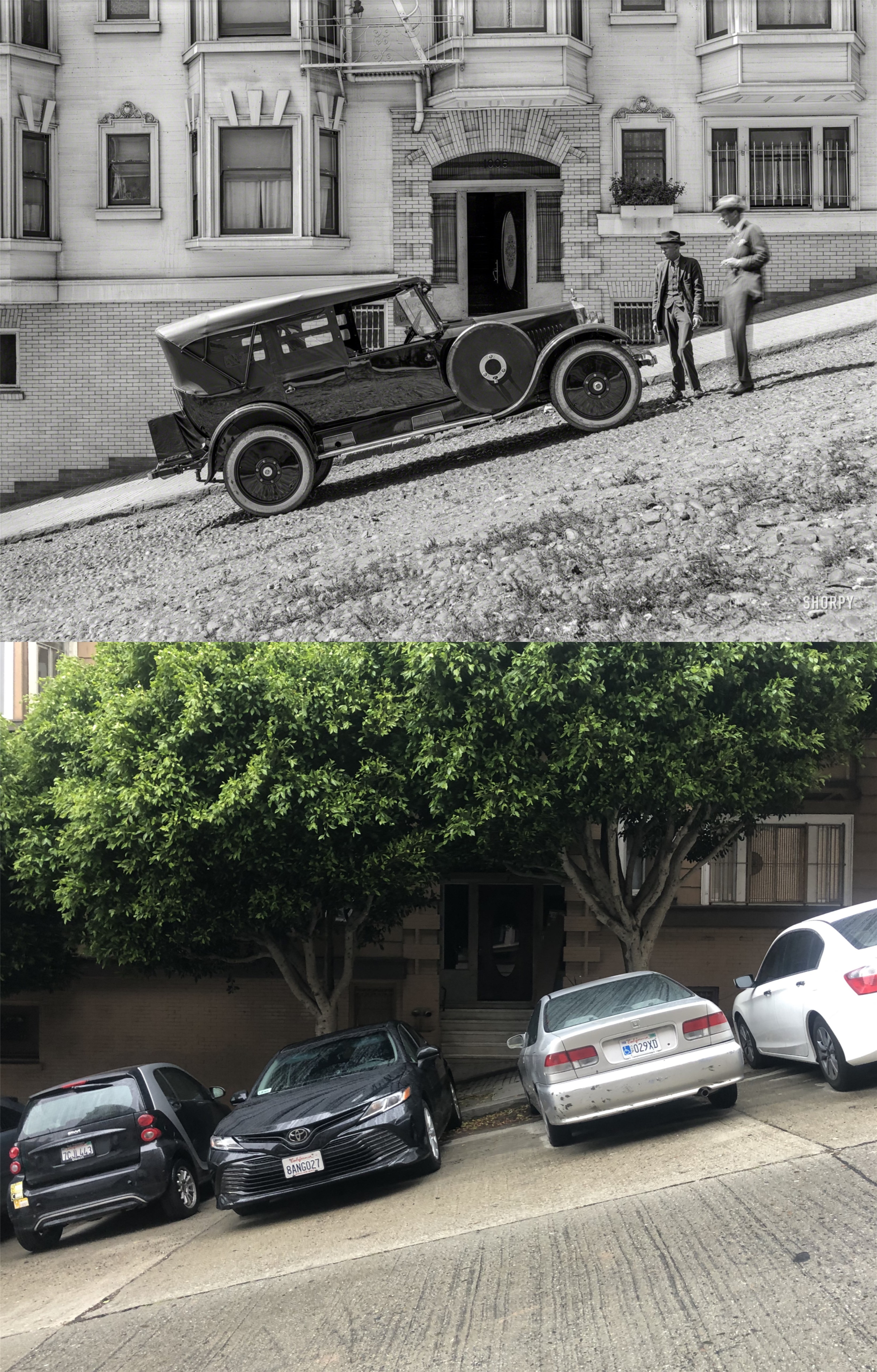
Jones Street, between California and Pine Streets in 1923: This is one of the steepest and scariest streets to drive down in San Francisco; for a brief moment as you head down from California Street, it looks like you’re going over a cliff! The apartment building in the vintage picture is still there behind the trees.
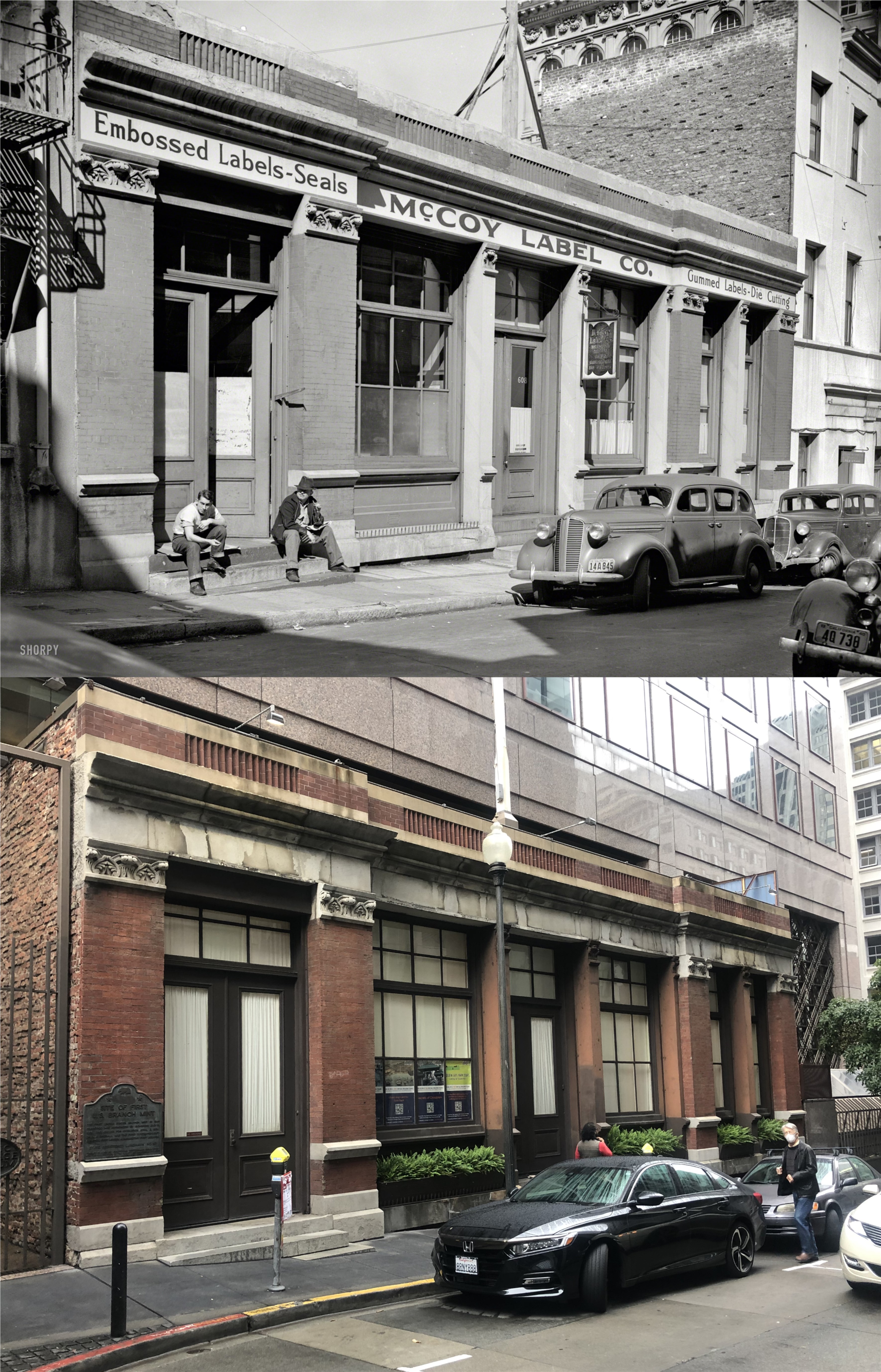
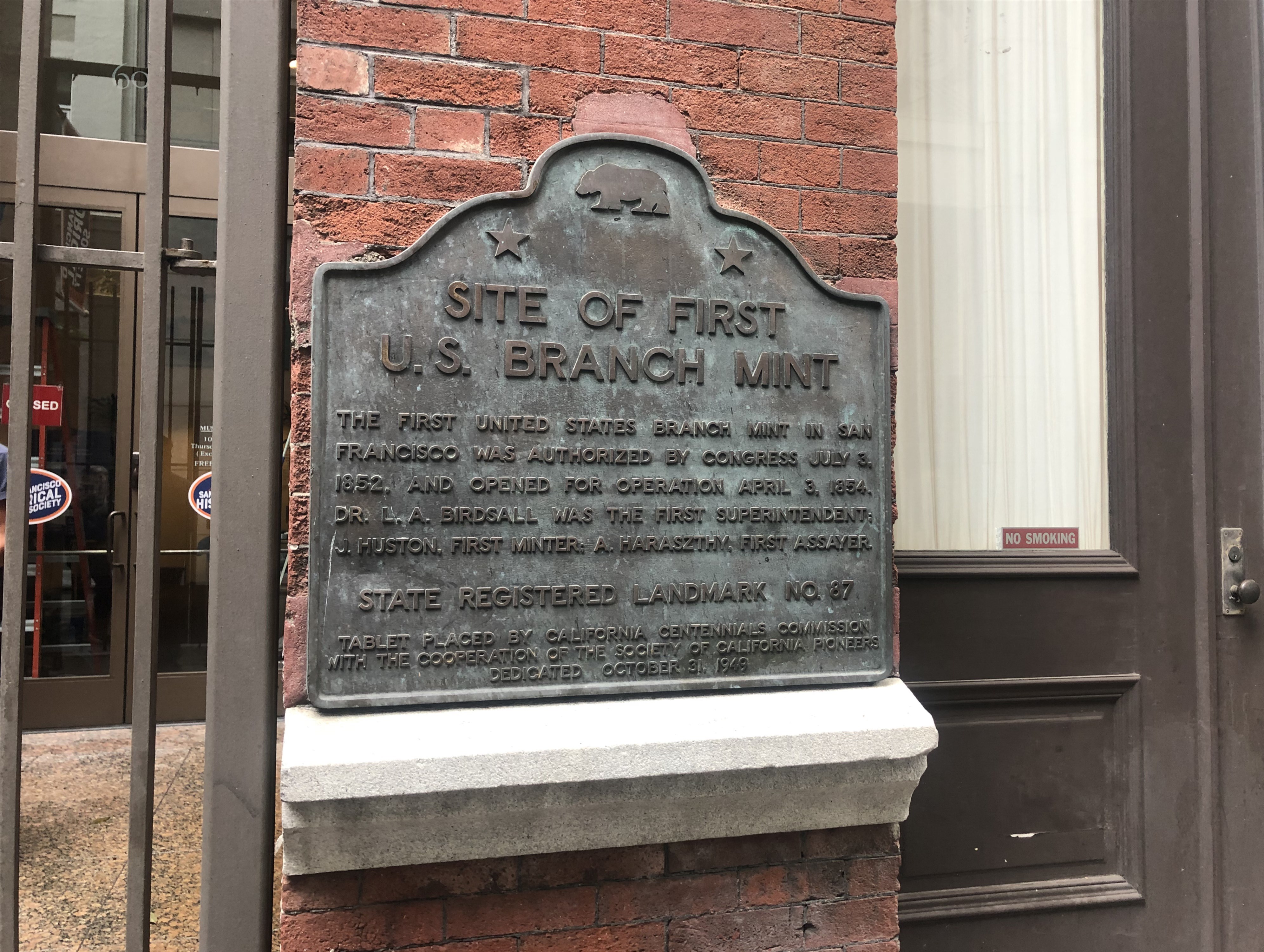
608 Commercial Street, site of the first U.S. Mint in San Francisco: When they decided to put up an office building here, in respect to the historic building they built the skyscraper on top of it. They vintage picture is from 1940.
There’s a large collection of 1906 Earthquake pictures in the Shorpy Archives, as well; this one on Market Street at Kearny looking toward the old Palace Hotel. The Palace Hotel was completely destroyed by the earthquake and fire, and was rebuilt in 1909. The old Chronicle Building survived the earthquake and is on the left in both pictures.
Market and 1st Street in 1947: I wonder how this old photo survived. True, it’s an interesting vintage location shot taken from inside an auto, and as such, it turned out well, but I don’t think it can be considered as a good picture. Now, my goal was to try to take a picture that was equally as bad as the 1947 picture, and I think I pulled it off. Note, FIRST ST. then and IST ST now.
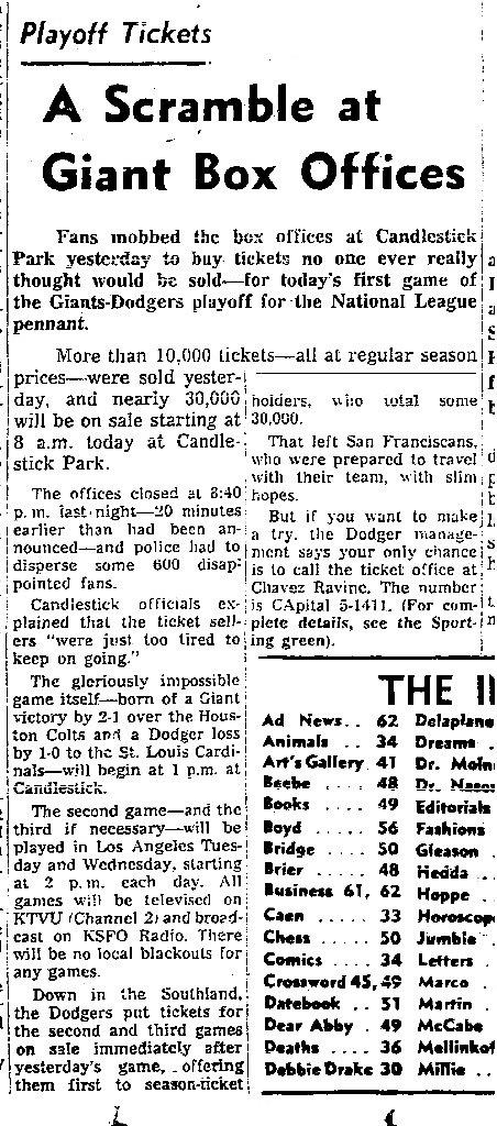
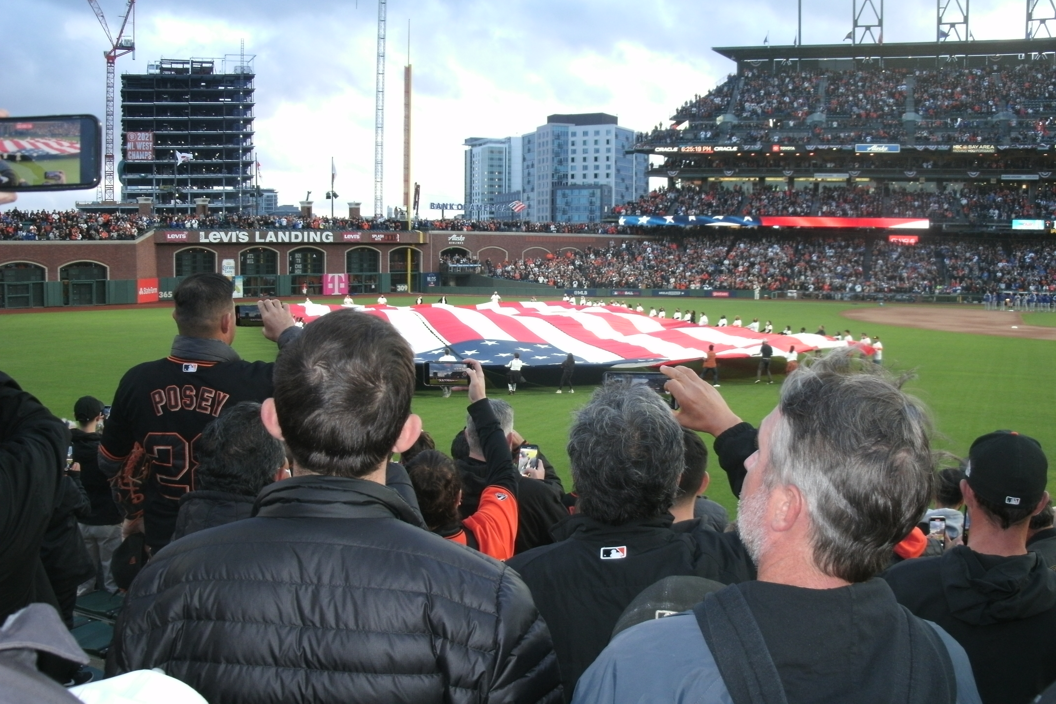
No, that’s not yesterday’s SF Chronicle’s sport page; it’s from October 1, 1962. At the end of the 1962 baseball season the San Francisco Giants and Los Angeles Dodgers ended up in a dead tie for first place; so, a three game series was held to determine which team would win the National League Pennant and advance to the World Series. The Giants beat the Dodgers three games to two, and went on to lose the World Series to the New York Yankees. The Giants and Dodgers met again last night in a best of five game championship playoff that everybody in the Bay Area, including the media, has been saying and reporting is the first time that the SF Giants and LA Dodgers have faced each other in post season history. I contend that the three games played after regular season in 1962 was the first time these two teams met in post season play, and I said so on social media. Most agreed with me, but some argued that this was not ‘Post Season’ play, but an extension of the regular season. I rebutted that the 1962 Playoffs could not be considered an extension of the regular season games because the season stats would not be fair if only two Major League teams had a 165 game season and all of the rest had 162 games. Also I contended that the only reason that the 1962 Playoffs are not considered as ‘Post Season’ is because that expression had not been invented yet back then. At any rate, the SF Giants and LA Dodgers met again last night at Oracle Park and I was out there. It was crowded and I was out in the bleachers, but it was wonderful fun, depending on who you were rooting for. Like the October 1, 1962 game, the Giants blanked the Dodgers, this time 4 to 0; they won the first game of 1962 out at Candlestick Park 8 to 0. Game two will be tonight at 6:07 PST. (SF Chronicle)
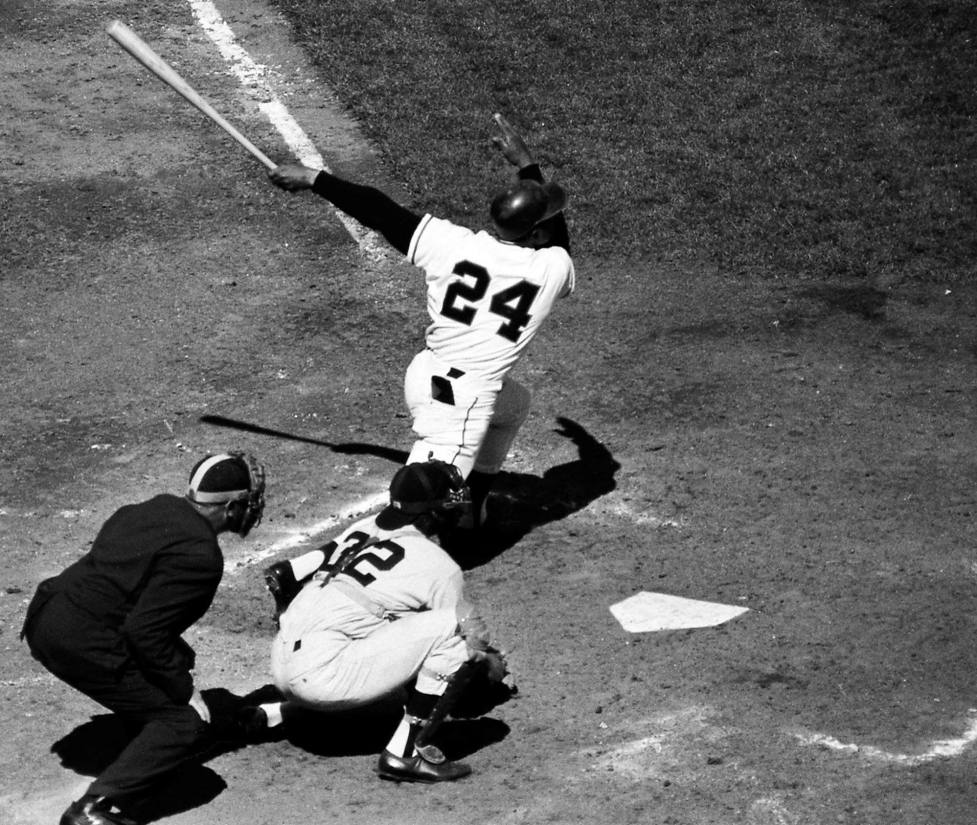
Willie Mays hits a home run off Sandy Koufax in the first inning. (SF Chronicle)
Last night’s game began with a huge flag unfurling during the National Anthem.
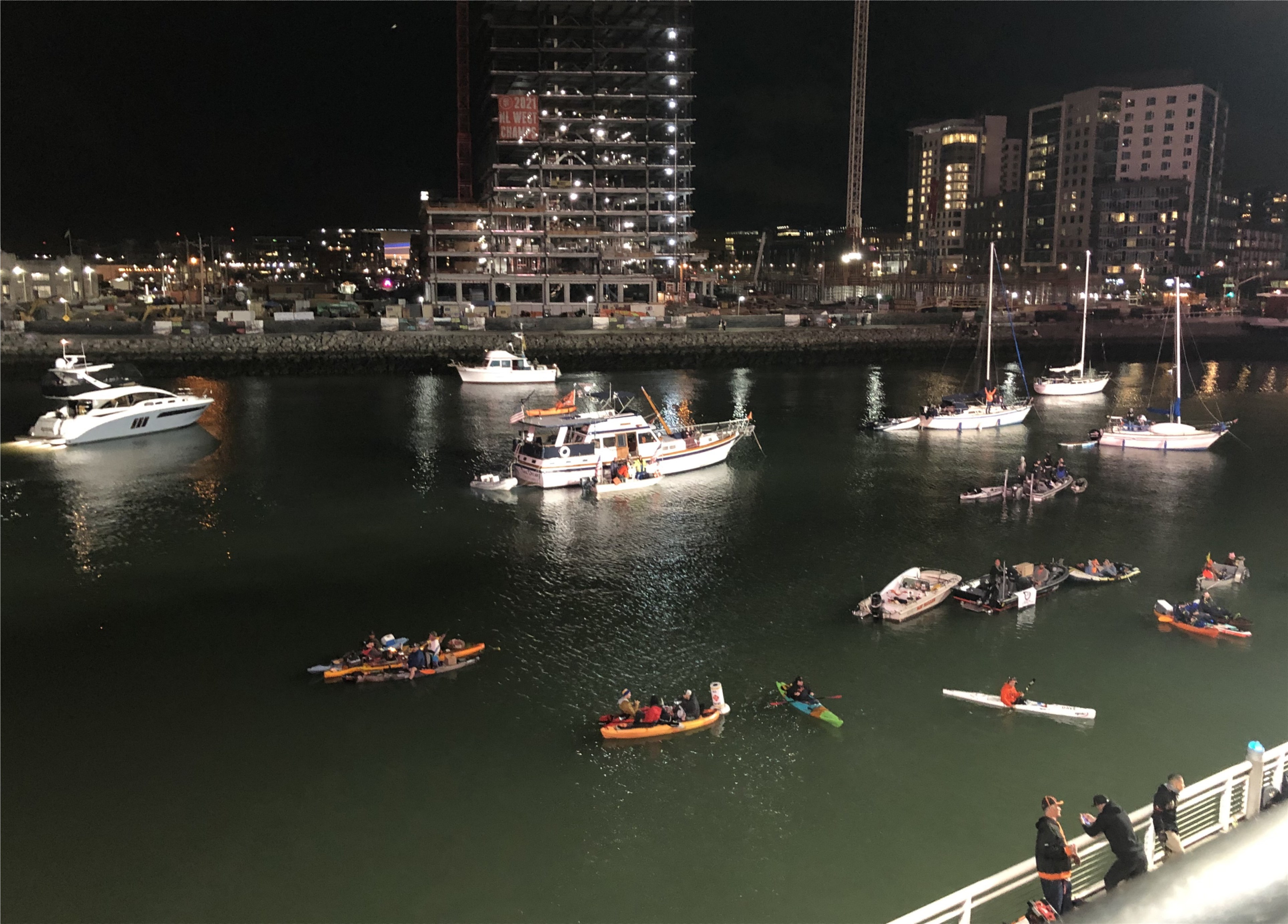
Always fun to see McCovey Cove crowded again.
1962 fans at Candlestick Park and 2021 fans at Oracle Park: I think the 1962 fans had a little more creativity. (SF Chronicle)
I’ve never used a hashtag for a title before; I kind of like it. These warm early fall nights we’ve been having this week make it especially pleasant to walk around San Francisco after dark. It still feels like summer, but there’s a little spookiness in the gentle wind and fog that reminds me that Halloween isn’t far away. (Thumbnail images)
I got to the Powell and Market Streets cable car turnaround at twlight, seen here in the 1960s, but it didn’t take long for the sun to disappear.
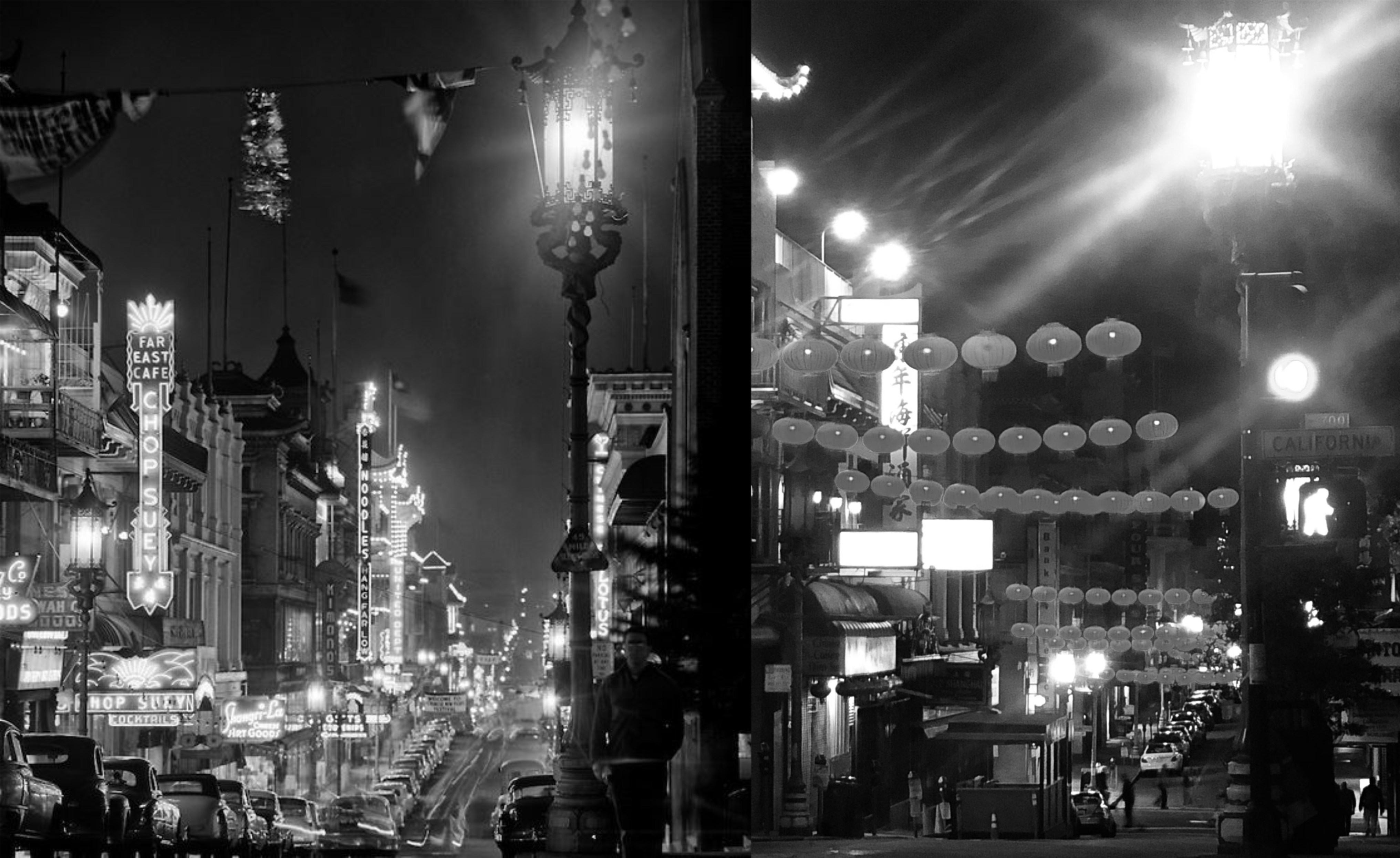
That’s a spooky looking vintage picture of Chinatown at the intersection of Grant Avenue and California Street in the 1950s. I believe the photographer was Fred Lyon. The view is next to old St. Mary’s Church looking down to Sacramento Street.
The intersection of Grant Avenue and California Street is also a good place to catch a cable car heading up Nob Hill, as seen in the vintage picture from the 1950s. (Phil Palmer)
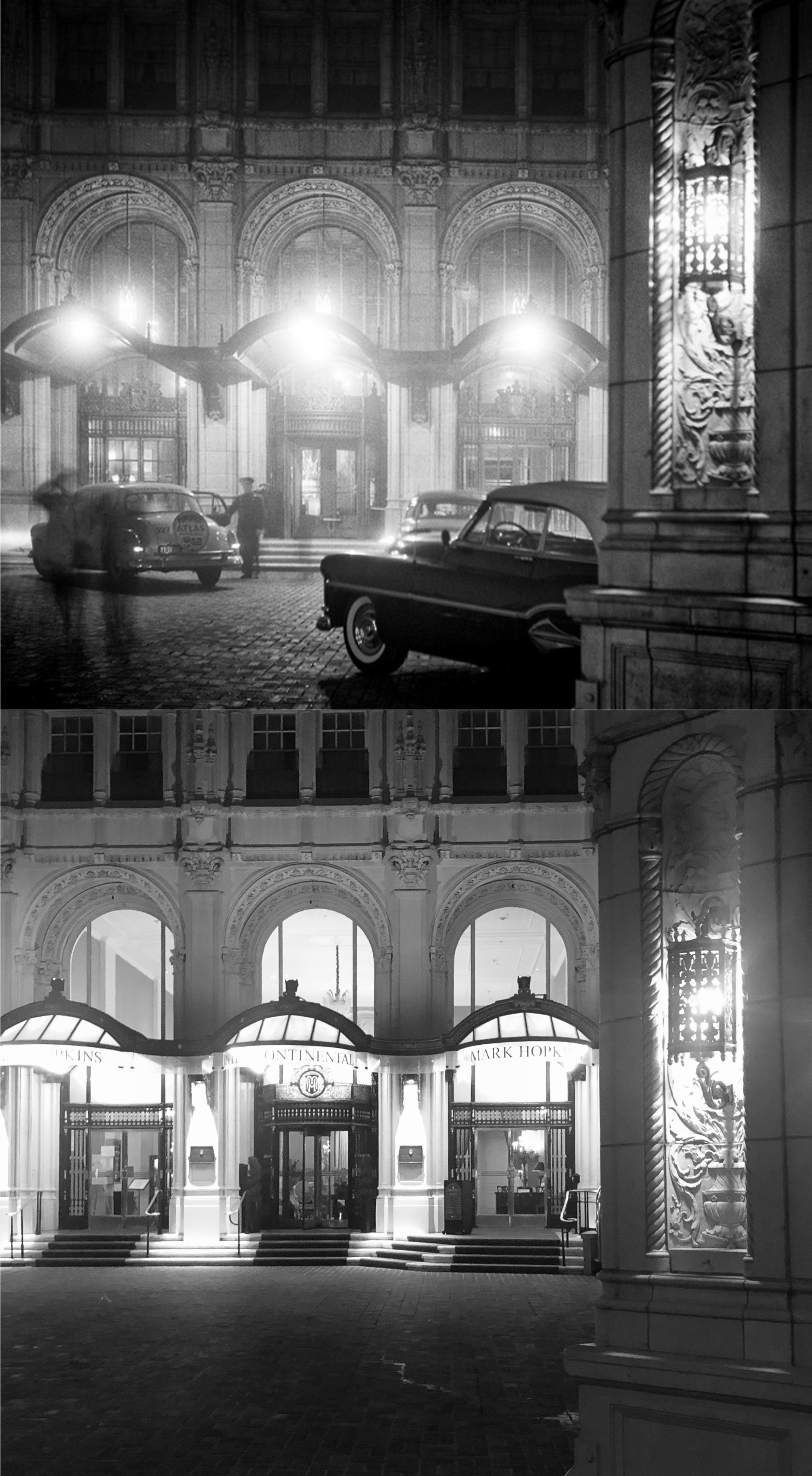
I got off the cable car at the Mark Hopkins Hotel to update another one of Fred Lyon’s wonderful black and white photos, this one from the 1950s.
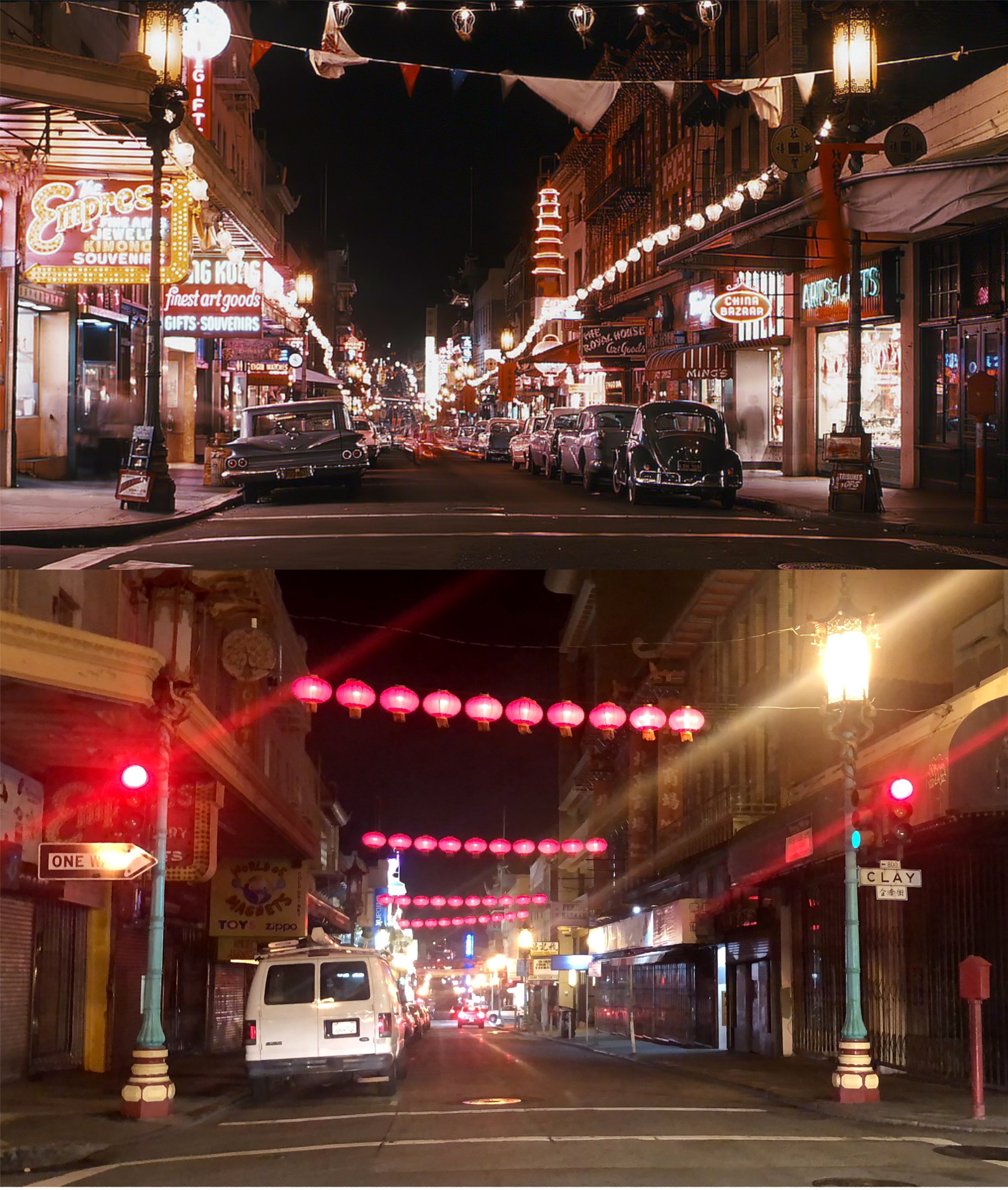
I doubled back down Nob Hill into Chinatown, seen here at Grant Avenue looking north from Clay Street. They don’t light Chinatown up as much at night as they did in the 1960s picture. (Vintage Everyday)
I ended up my nocturnal knock around back down on Market Street and Kearny, seen in the 1960s in the vintage picture. That’s the Palace Hotel on the right. (Vintage Everyday)
This weekend will be the final three games of the San Francisco Giants 2021 season, so I took a bag lunch out to Oracle Park yesterday to take a few pictures, and wish them luck. They’re already in the Playoffs for the first time since 2016, but this weekend, they’ve got a chance to end up with the best record in baseball for the 2021 season, and that doesn’t happen very often. (Thumbnail images)
A three mast ship in China Basin, now called McCovey Cove, in 1922: Behind the ship is now where Oracle Park is. (opensfhistory.org)
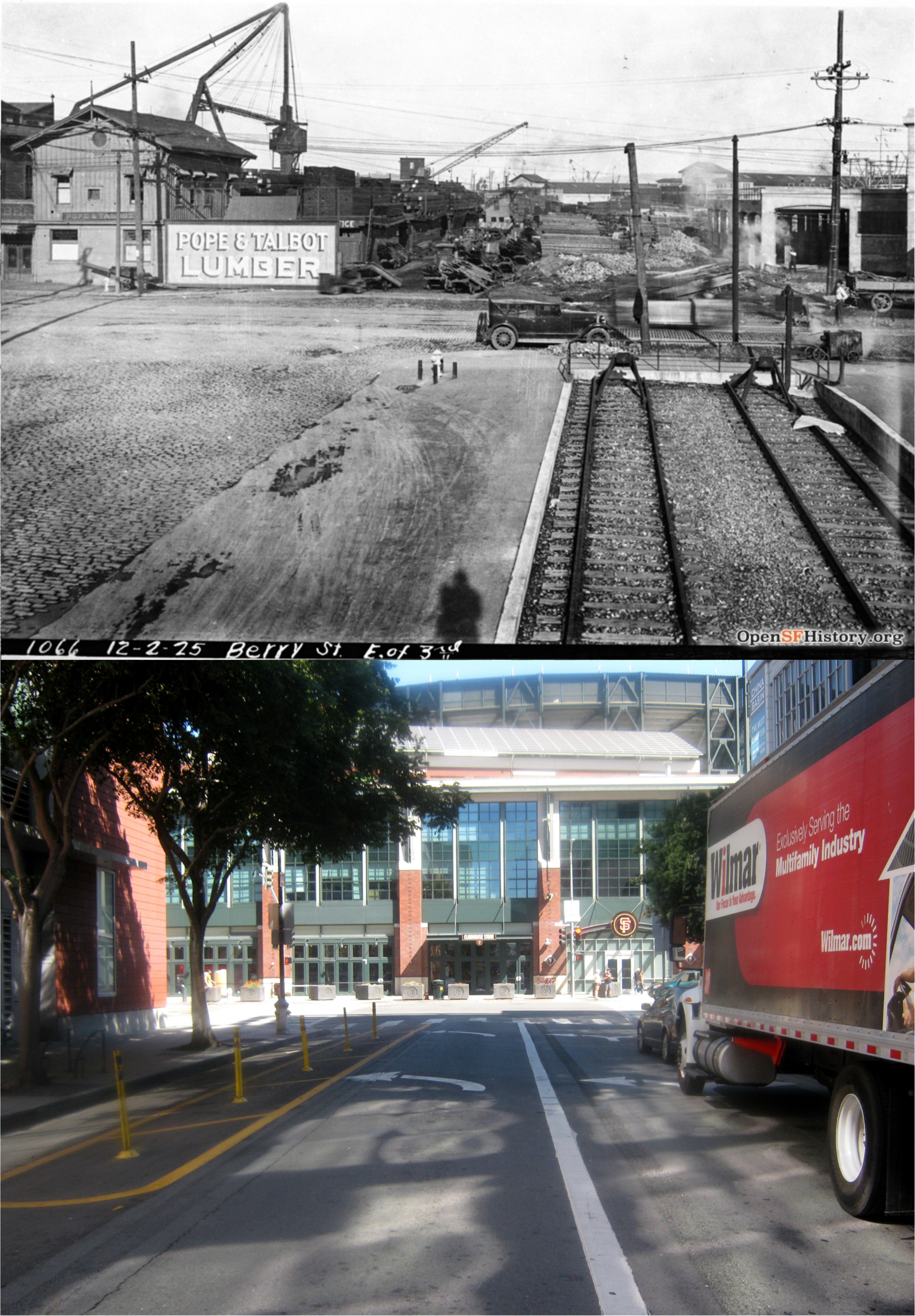
Looking east on Berry Street to 3rd Street in 1925: Pope &Talbot Lumber was where Giants Stadium is today. (opensfhistory.org)
Lefty O’Doul Bridge in 1933, then known as Butcher Town Bridge because of all the slaughter houses in the area back then: Those two little white buildings on each side of the bridge are still there. (opensfhistory.org)
McCovey Cove in September of 2012 and September of 2021: Eh, at least the ballpark is aging well. The following October after the 2012 picture was taken the Giants won their second World Series. So, maybe……
Before it was filled in to become the small strip of water originally called China Basin, the area was called Mission Rock Bay, seen here in an 1859 Coastal Survey Map. (Foundsf.org)
A Thomas Brothers map shows the filled-in area in 1937.
An aerial photo from David Rumsey’s Historical Map Collection shows a view looking directly down toward China Basin in 1938. Lefty O’Doul Bridge and the area where Oracle Park is today are in the upper center of the photograph. The now gone Piers 44 and 46 are in the upper right.
A 1987 map plan from founds.org shows how they envisioned the future for the China Basin Area then. Well, they did include a smaller ball park on the left back then.
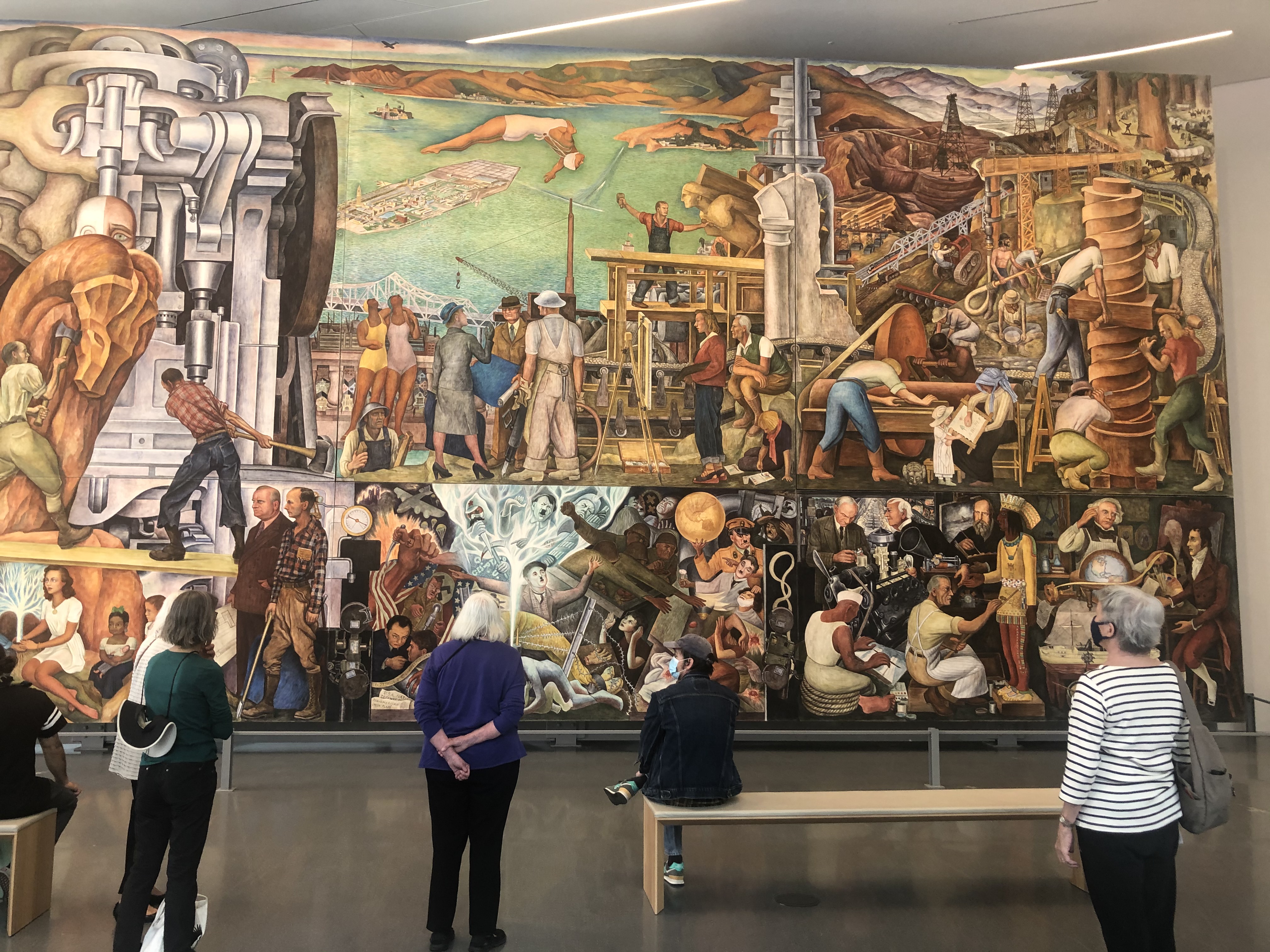
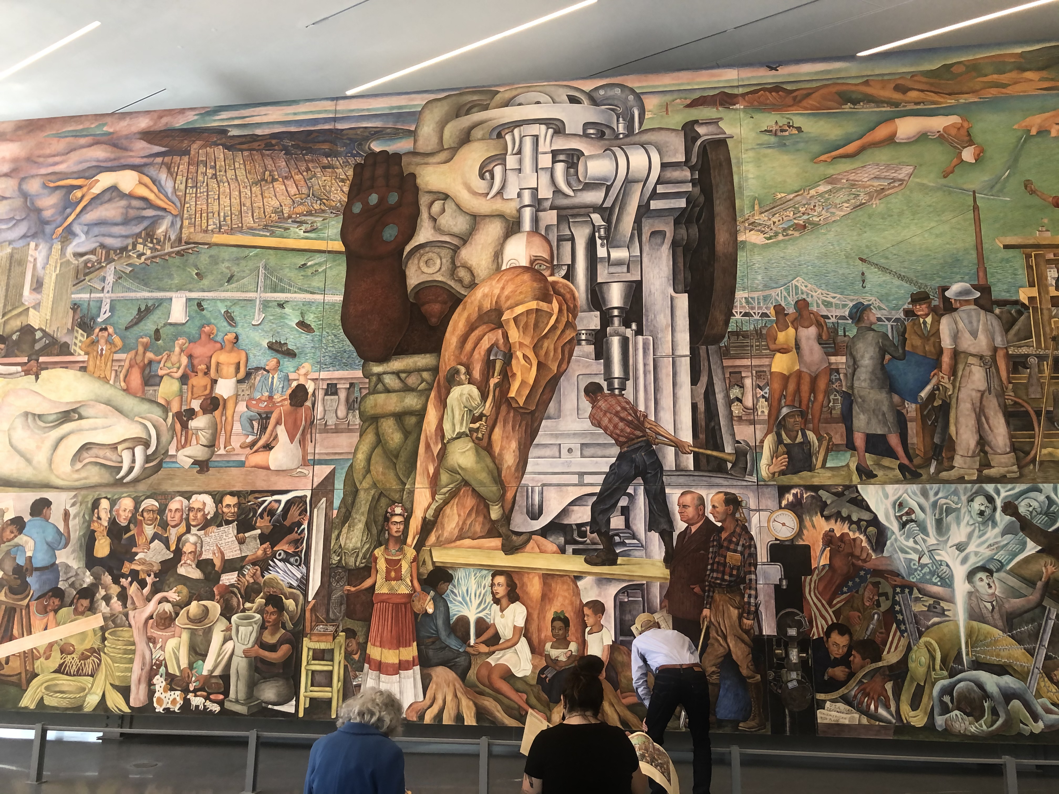
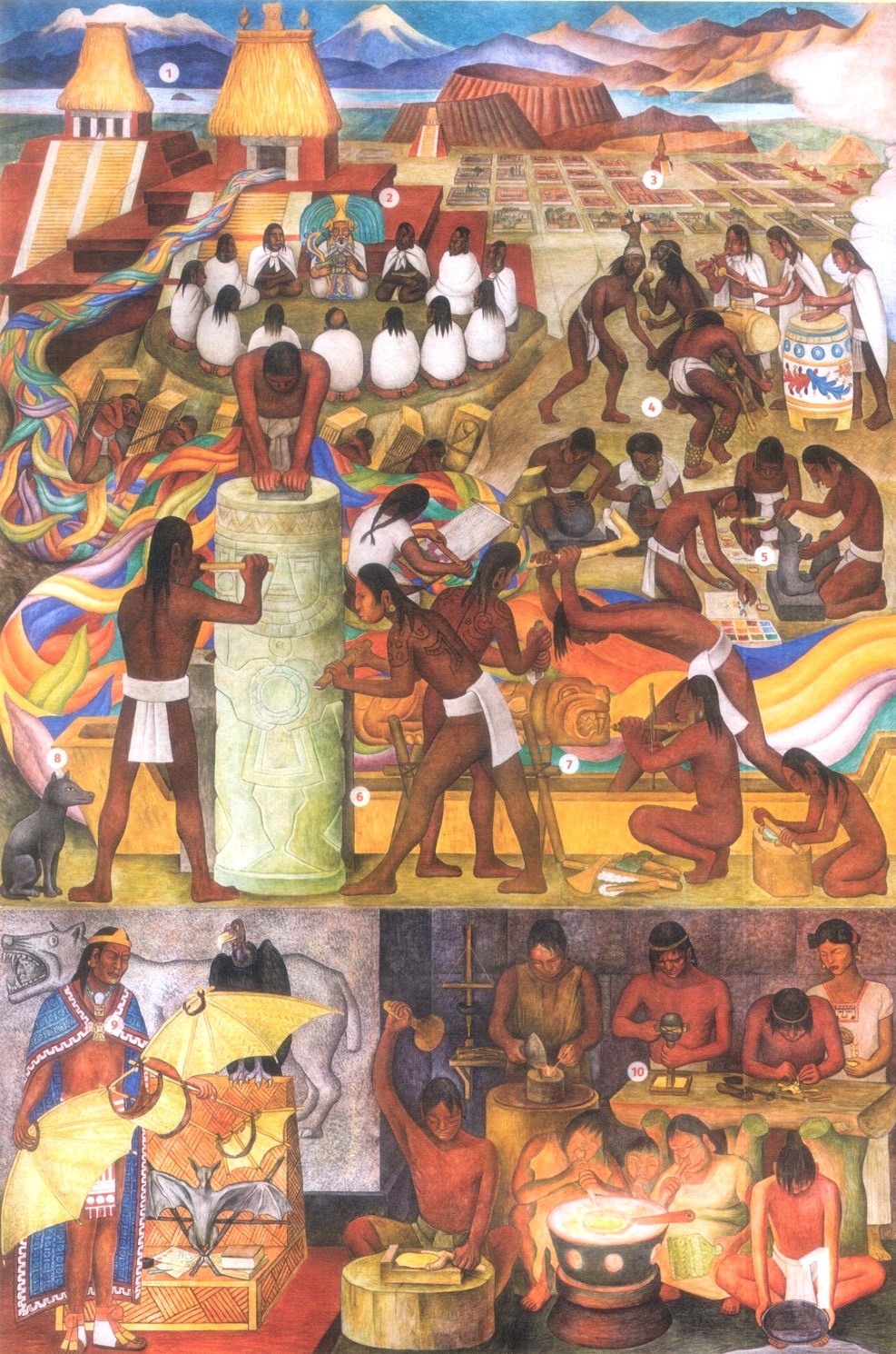
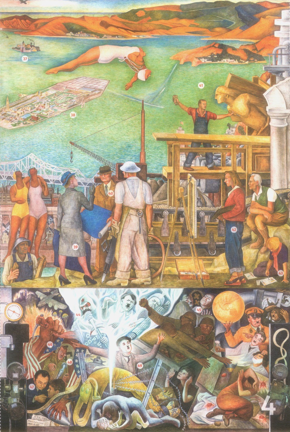
One of the most prominent Mexican painters of all time, Diego Rivera, was commissioned by San Francisco Architect, Timothy Pflueger, to paint a mural for the 1939 / 1040 Golden Gate International Exposition at Treasure Island for the 1940 season of the fair. Fair visitors were allowed to watch Rivera as he painted the mural. The painting is on display at the San Francisco Museum of Modern Art until the summer of 2023. Split up into five panels, I’ll highlight a few of the enormous amount of people and places Rivera included in the mural, identified in the free brochure of the exhibit provided by SFMOMA.
Panel number one depicts images of people and places of Rivera’s native Mexico, real and folklore, some of which I’m not familiar with. #1 are the volcanoes IxtaccihuatI and PopocatepetI to the east of Mexico City. #2 is the Aztec deity, Quetzalcoatl. #3 is the Temples of Tenochtitlan, the Aztec Capital which is now Mexico City.
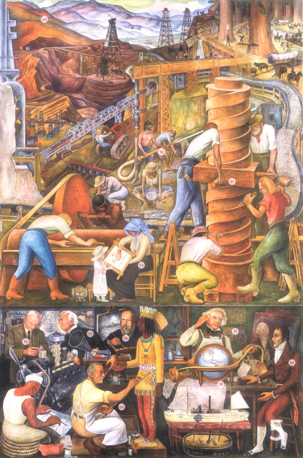
San Francisco starts to appear in panel number two. #12 is the 450 Sutter Building designed by Timothy Pflueger. #13 is the Bay Bridge. #15 is another Timothy Pflueger San Francisco building, the Pacific Telephone Building on New Montgomery Street. Among other notable historic figures in this panel are #23, George Washington, #24, Thomas Jefferson, and #25, Abraham Lincoln.
At the top right of panel number three is #28, the Golden Gate Bridge. #31 is Frida Kahlo, a beautiful Mexican artist who married Diego Rivera in 1929, was divorced from him in 1939, and remarried Diego in December of 1940, just after completion the mural. #33 is film actress Paulette Goddard helping Diego Rivera himself plant the tree shown in #2. I don’t know if Diego ever actually met Paulette Goddard. Timothy Pflueger gets an honorable appearance in #36.
Panel number four is the most interesting one to me, complete with film stars, villains and San Francisco. Up at the top you’ll see #37, Alcatraz Island, and #38, Treasure Island. In #44 are Joseph Stalin, Adolf Hitler and Benito Mussolini. Even though Rivera was a Communist, Stalin was an ally of Hitler when Diego did the painting. In #45 are Jack Oakie and Charlie Chaplin as they appeared in Chaplin’s satire about Hitler, ‘The Great Dictator’. Edward G. Robinson is seen in # 47. Robinson was starring in the 1940 movie ‘Confessions of a Nazi Spy’ at the time of the painting. The evil monster, Heinrich Himmler is in #48. Charlie Chaplin appears again in #49.
Diego Rivera leaves San Francisco in panel number five. Mounts Lassen and Shasta in Northern California are seen in #50. There’s an interesting collection of inventors and industrialists in the closing panel; Henry Ford in #54, Thomas Edison in #55, Samuel Morse in #57, and Robert Fulton in #58