These are some vintage Christmas pictures from the San Francisco Chronicle, and also one of my favorite Christmas scenes from an old Bob Hope movie.
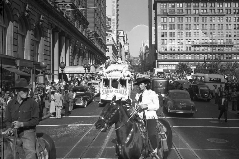
 Santa Claus and his pretty assistant, (Remember, Santa, “naughty or nice”) cross over Market Street from Powell toward the old Emporium Department Store in 1962: The building with DOBBS FOR MAYOR has been demolished and Hallidie Plaza at the BART Station is there now.
 Union Square is the center of Christmas activity, just as it was in 1949. Here, the “SANTA CLAUS EXPRESS” crosses Geary St., past the St. Francis Hotel and Union Square, heading down Powell toward Market Street.
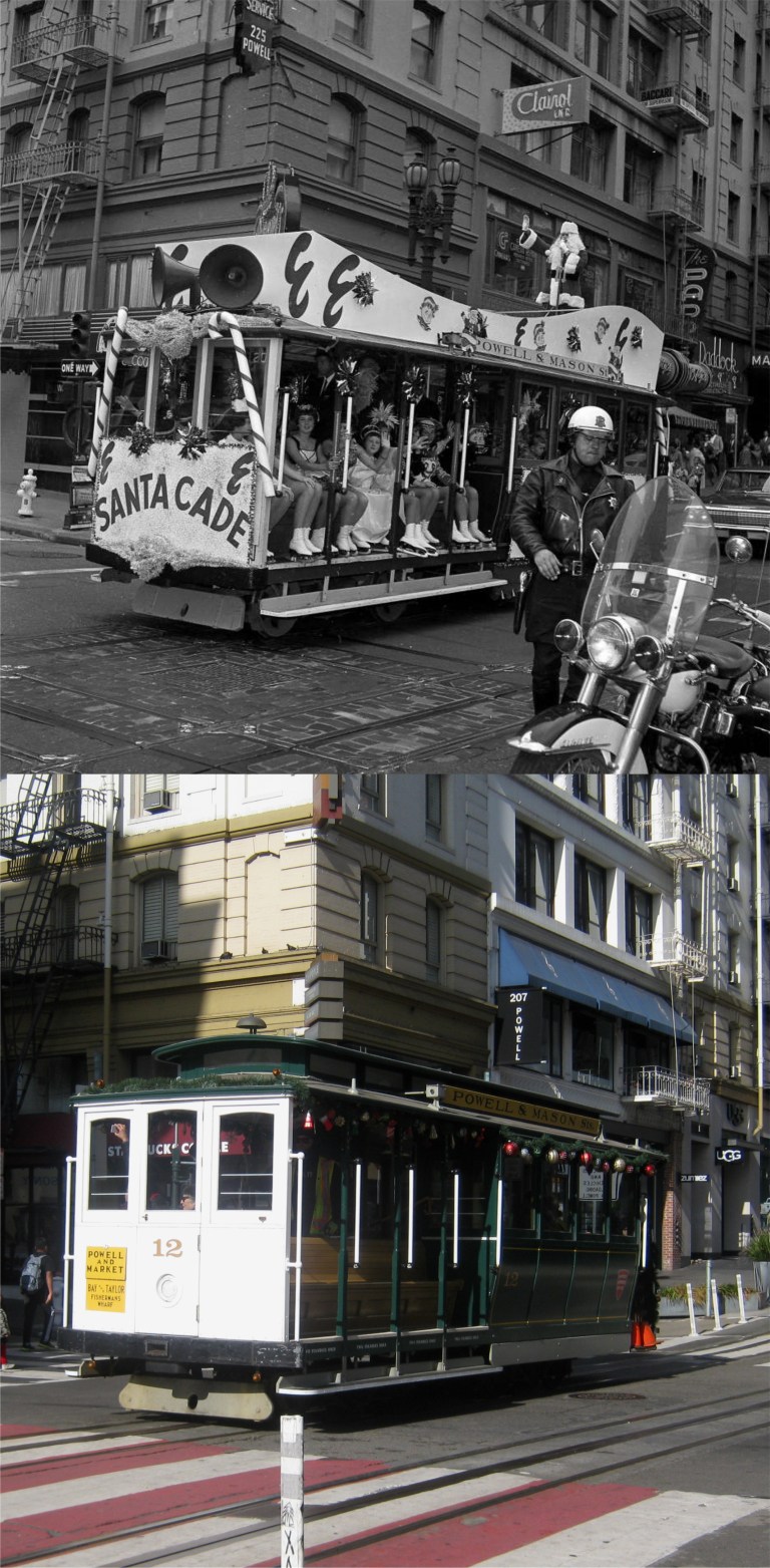 Another “SANTACADE” cable car, sponsored by the Emporium, crosses O’Farrell Street at Powell in 1962:
 A motorized Christmas cable car crosses over Market Street at Powell Street toward the old Emporium Store in 1962: The real cable car turnaround at this spot is on the far left in my picture.
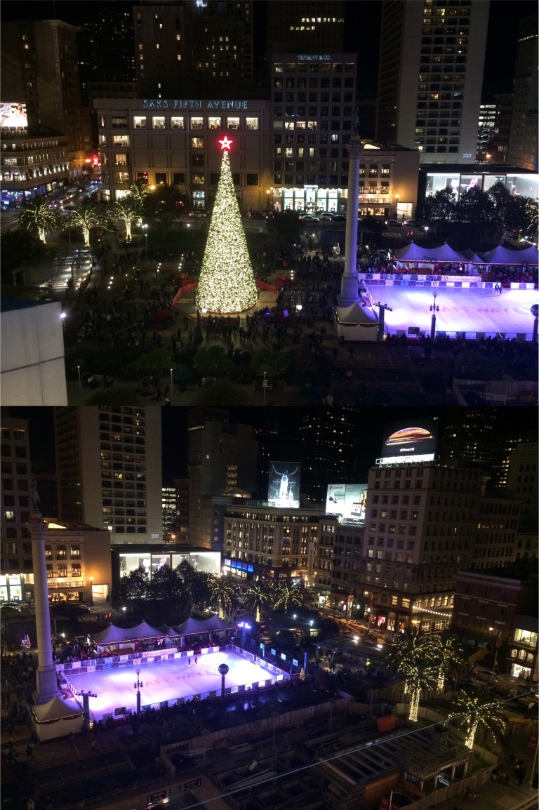
 Sugar Plum Fairies at the Christmas tree in Union Square in 1956: They have a bigger tree there nowadays. That’s the Sir Francis Drake Hotel behind the tree in both pictures.
 I know, it was made in Hollywood and set in New York City, but whenever I walk around Downtown San Francisco at night during Christmastime I’m reminded of the scene that introduced the song ‘Silver Bells’ in the 1951 movie ‘The Lemon Drop Kid’. Bob Hope and Marilyn Maxwell sing the song as they walk around New York on a snowy day near Christmas, and the atmosphere of the shopping district of San Francisco during the Holidays always comes close to capturing this movie moment, minus the snow. I don’t know what that headgear Bob Hope was wearing is, but only he would try to pass that off as Santa Claus equipment!
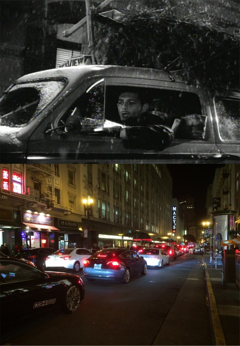
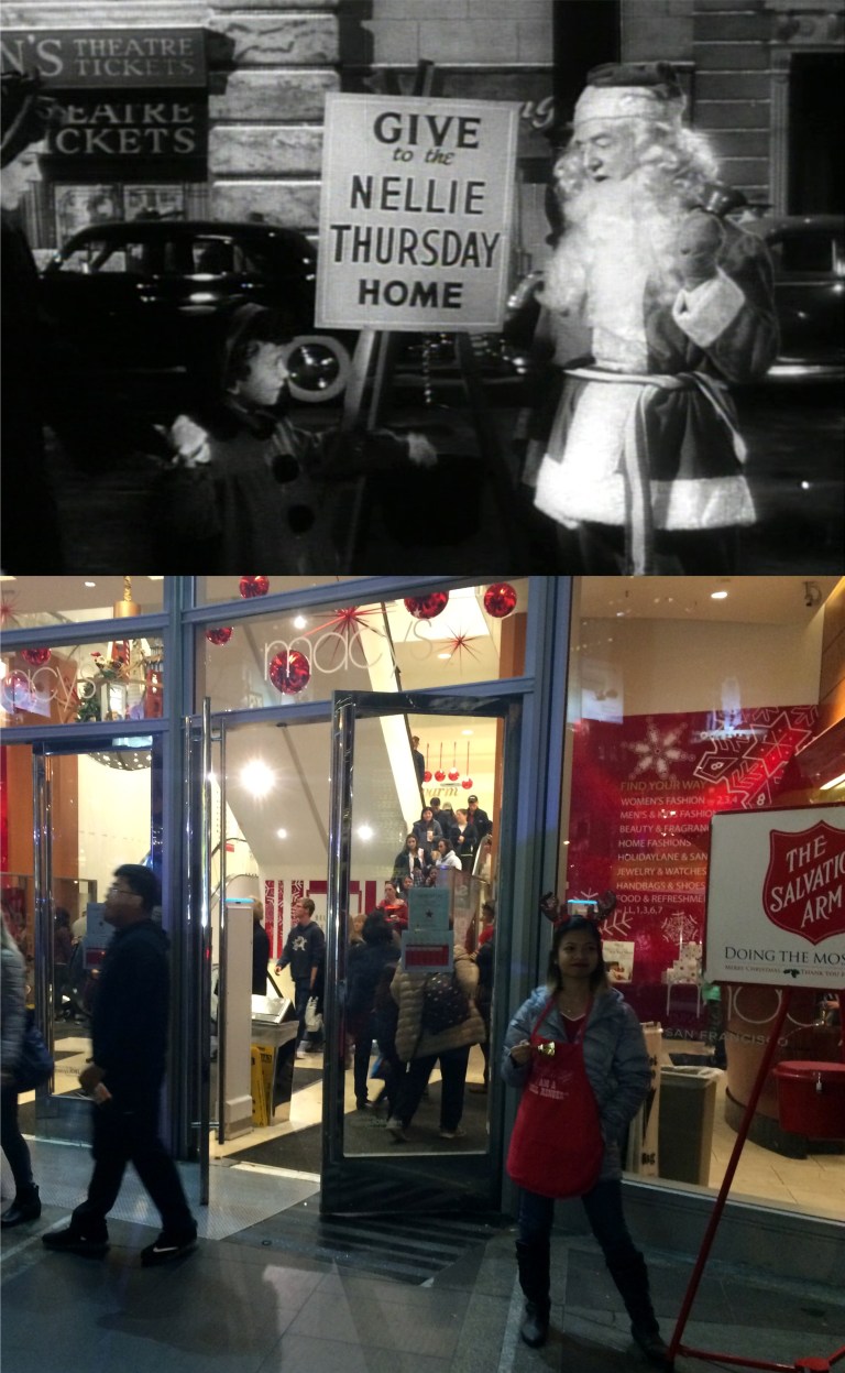 Bob Hope has thugs, like William Frawley here, collecting charity money around town, supposedly for a rest home for elderly ladies, but in reality Hope is collecting the money to keep him from being rubbed out by the mob. However, the young lady in my picture is on the legit, and fortunately doesn’t look like William Frawley!
 “City sidewalks, busy sidewalks, dressed in holiday style. In the air there’s a feeling of Christmas. Children laughing, people passing, meeting smile after smile”
 “Strings of streetlights, even stop lights, blink a bright red and green, as the shoppers rush home with their treasures.”
 They had traffic jams during the holidays back then too. “I wish this was a sleigh!’ a frustrated driver stuck in traffic sings.
 “And above all this bustle, you’ll hear, Silver bells. Silver bells”
You can hear the Salvation Army bells from this spot above the Union Square Garage just fine.
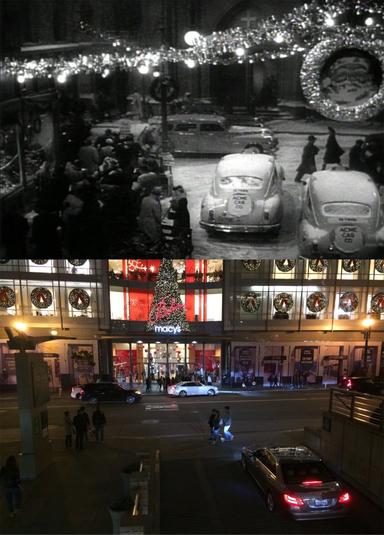
 I’ll close with a view of Union Square from atop Macy’s Department Store, and the You Tube link to the “Silver Bells” scene from ‘The Lemon Drop Kid’.
 Market Street in 1972, across from the old Emporium Department Store, looking east toward the Call and Humboldt Buildings: (amazingurban.com)
 Powell Street looking down Sacramento Street in 1952: (Skyscrapercity.com)
 Looking west along Geary St. from Kearny St. in the early 1950’s: (opensfhistory.org)
 O’Farrell Street looking east from Mason toward Macy’s and the Call Building in 1971: (amazingurban.com)
 Thomas Kinkade has sometimes been accused of being just a crowd pleasing painter with no artistic ingenuity. I don’t know about that, but I like his San Francisco paintings. He painted San Francisco in a way that the city would be nice if it looked like that, but doesn’t. Many of his San Francisco works are set in the rain. His painting looking down Nob Hill along Powell toward Market Street has almost everything wrong, but it’s still fun to look at. For instance, The Manx Hotel is on the wrong side of Powell Street and the Bay Bridge isn’t south of Market Street. He did get something right, though; the tall building on the left is the Sir Francis Drake Hotel, and would have looked like this from here once. It’s now blocked out forever by the Union Square Marriott Hotel there now.
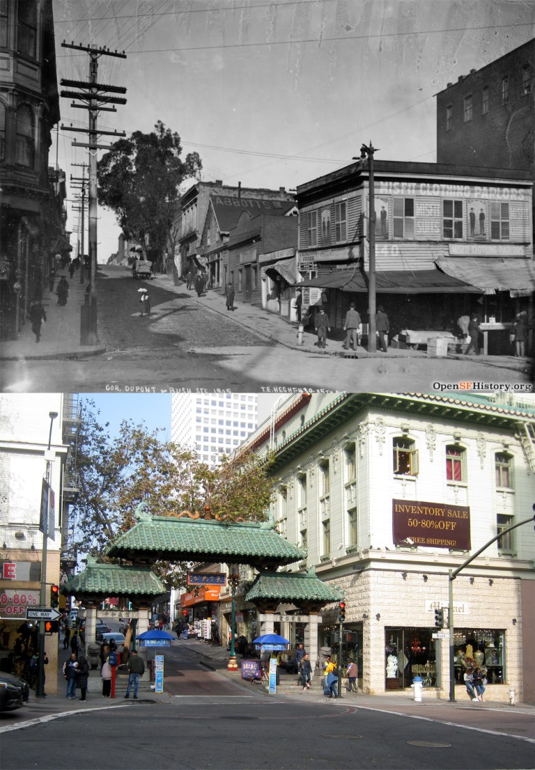 1905: From the southwest corner of Dupont Street (later renamed Grant Avenue) and Bush Street looking north. It looked almost like a little country town back then. We’ll come back to this spot in 1951.
 1910: Grant Avenue approaching Sacramento Street. I didn’t realize that the Canton Bazaar went that far back.
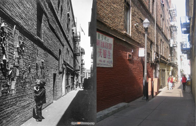 1910: Ross Alley, once one of the most notorious alleys in old Chinatown. The Golden Gate Fortune Cookie Factory is in this alley.
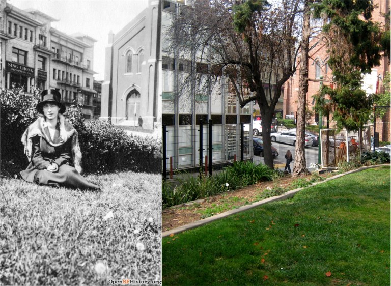 1915: St. Mary’s Square. She would have been sitting about here. Love the hat!
 1925: Bush Street at Grant Avenue: “Where Bush Street roofed Stockton before slipping downhill into Chinatown, Spade paid his fare and left the taxi.” That’s how Dashiell Hammett describes this spot in ‘The Maltese Falcon’.
 1927: Looking south down Grant Avenue from Pine Street. Look at the kid in the knickerbockers.
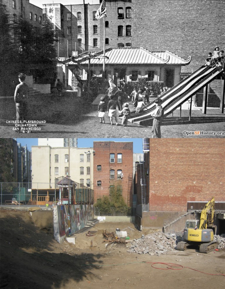 1930’s: The Willie “Woo Woo” Wong Playground on Sacramento Street. The playground is getting a 6 million dollar make over this year.
 1937: A cable car coming down Sacramento Street from Stockton Street. How cool it would be if that line still existed.
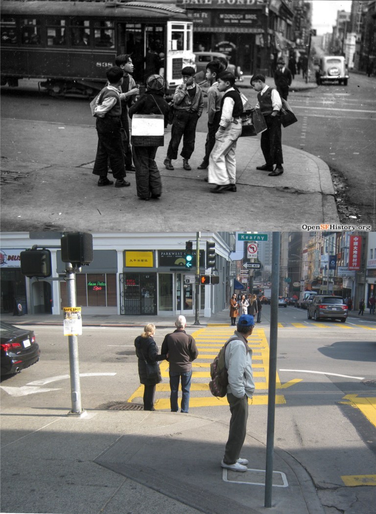 1938: Kids with shoeshine boxes on the northwest corner of Kearny and Clay Streets at Portsmouth Square.
 1941: Passengers getting off a California Street cable car coming down from Nob Hill at the intersection of Grant Avenue and California Street.
 1943: A Twentieth Century Madonna and child in St. Mary’s Square. The building to the right of St. Mary’s Church was demolished long ago.
 1951: Grant Avenue at Bush Street. This is about the same spot we started from in 1905. Lucky Lager; we used to drink that in high school, um, I mean, college, because they had those picture puzzles inside the caps.
 1952: California Street at Grant Avenue with Old St. Mary’s Church in the background. Only a rude cab driver would dare to cut off a cable car!
 1960: Washington Street at Grant Avenue. That pagoda building was the old Chinatown Telephone Exchange Building on Washington.
 1960: Waverly Place at Clay Street; probably the most famous side street in Chinatown. You can still see some of the old bricks on Clay Street.
 1960: The southeast corner of Clay and Kearny Streets looking toward Portsmouth Square. In the early settling days of San Francisco, Portsmouth Square was the heart of the city. It was here in 1848 that Sam Brannan shouted, “Gold! Gold on the America River!” which started the 1849 gold rush to California.
 1965: Salts and sweeties at the northwest corner of Grant Avenue and Washington Street.
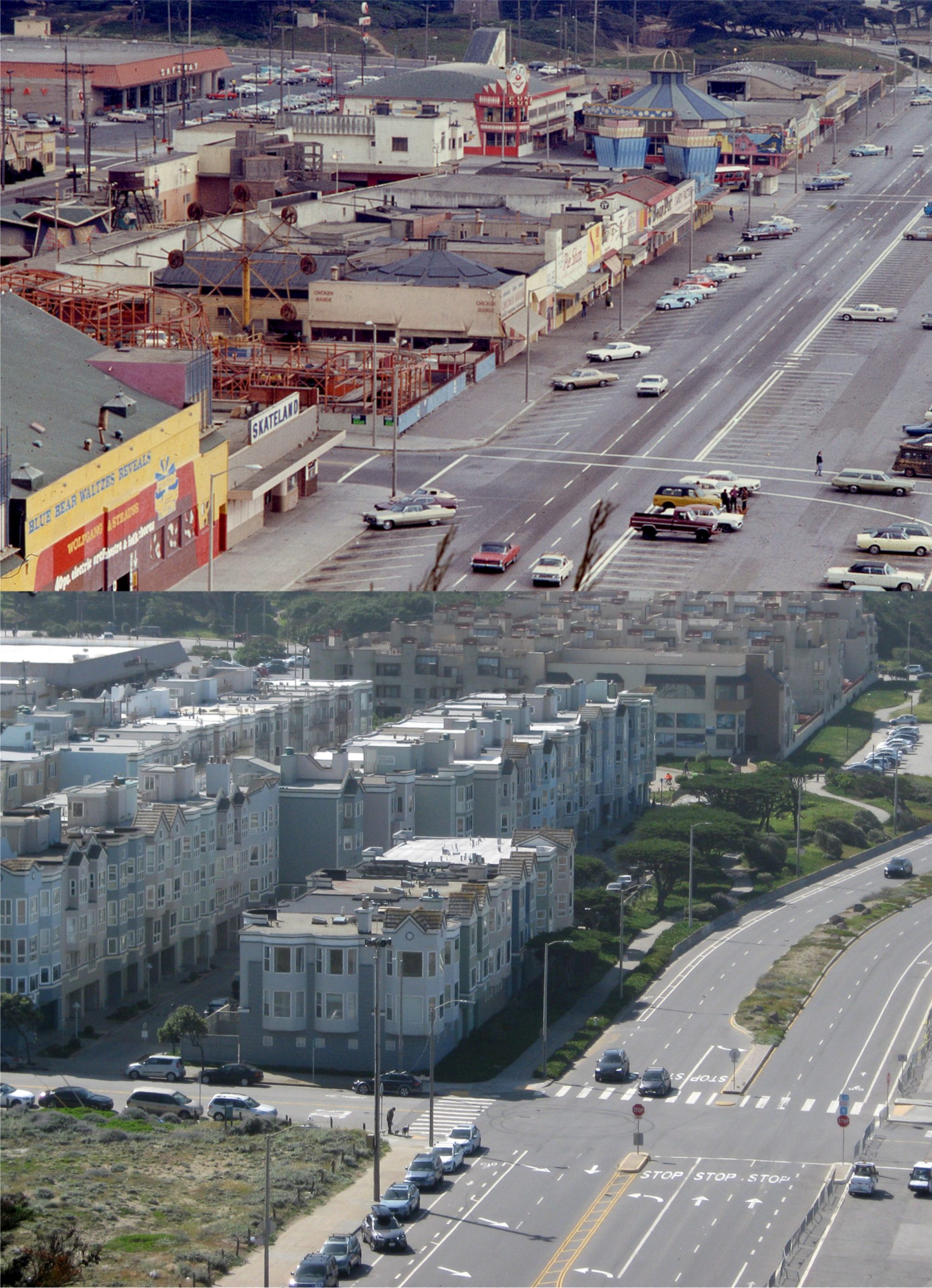
 We’ll start on Market Street near 6th in 1966. As I mentioned, that’s not the famous San Francisco fog blanketing Market Street.
 We’ve moved east along Market Street to Kearny St and the old San Francisco Chronicle Building. Originally built in 1889, the clock on top was made from wood and burned in 1905. The building was gutted in the 1906 Earthquake and Fire, but was rebuilt.
 Chinatown: We’re back again in 1957, tailgating like in Part two, only this time we’re crossing Sacramento Street along Grant Avenue.
 Washington Street between Jones and Taylor Streets in 1973, and another example of how bad the smoke is:
 Looking down California Street next to the Fairmont Hotel in 1961: That crane is working where the old Crest Garage that was demolished earlier this year was. I’m sure that they’re constructing still another building that will block out more of the view.
 Looking south down Powell Street to Bush Street in the 1950’s: The tall building on the left in the old photo is the Sir Francis Drake Hotel, blocked from the view here now by the newer building.
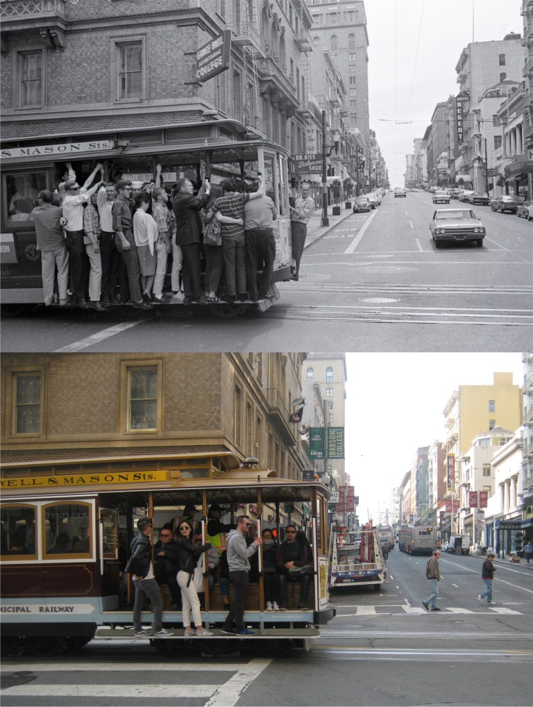 Looking west at Powell and Sutter Streets in the late 1960’s: That must be some kind of a conga line on the cable car in the older photo! They don’t allow overcrowding on the cars anymore.
 We’ll finish up at Hyde and Market Streets near the Civic Center in 1969. That’s construction work on the building of BART on Market Street in front of the Orpheum Theater. (Leroy W. Demery Jr.)
 The first drawings, such as the above one at the Powell Street cable car turnaround, are by Floyd Hildebrand. A client and friend of mine named Joanne Gonzales found a collection of his works sponsored by the California Savings and Loan Company of San Francisco at an estate sale, and she picked them up for me. The California Savings and Loan Association was originally founded in 1887. After several name changes during the 20th and 21st Centuries it ended up as the Pacific National Bank. The bank failed in October of 2009. Floyd Hildebrand died in 1984. These drawings of his are dated from 1961.
 California Street, looking down toward Chinatown:
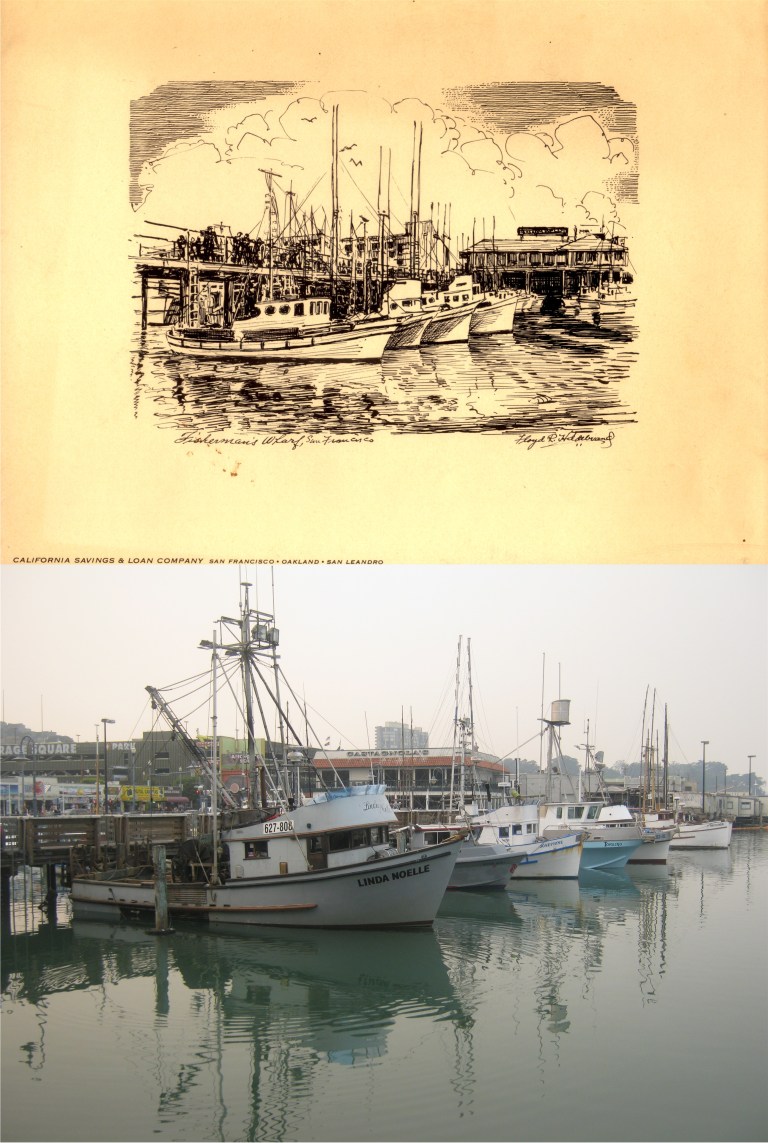 The Fisherman’s Wharf Boat Lagoon:
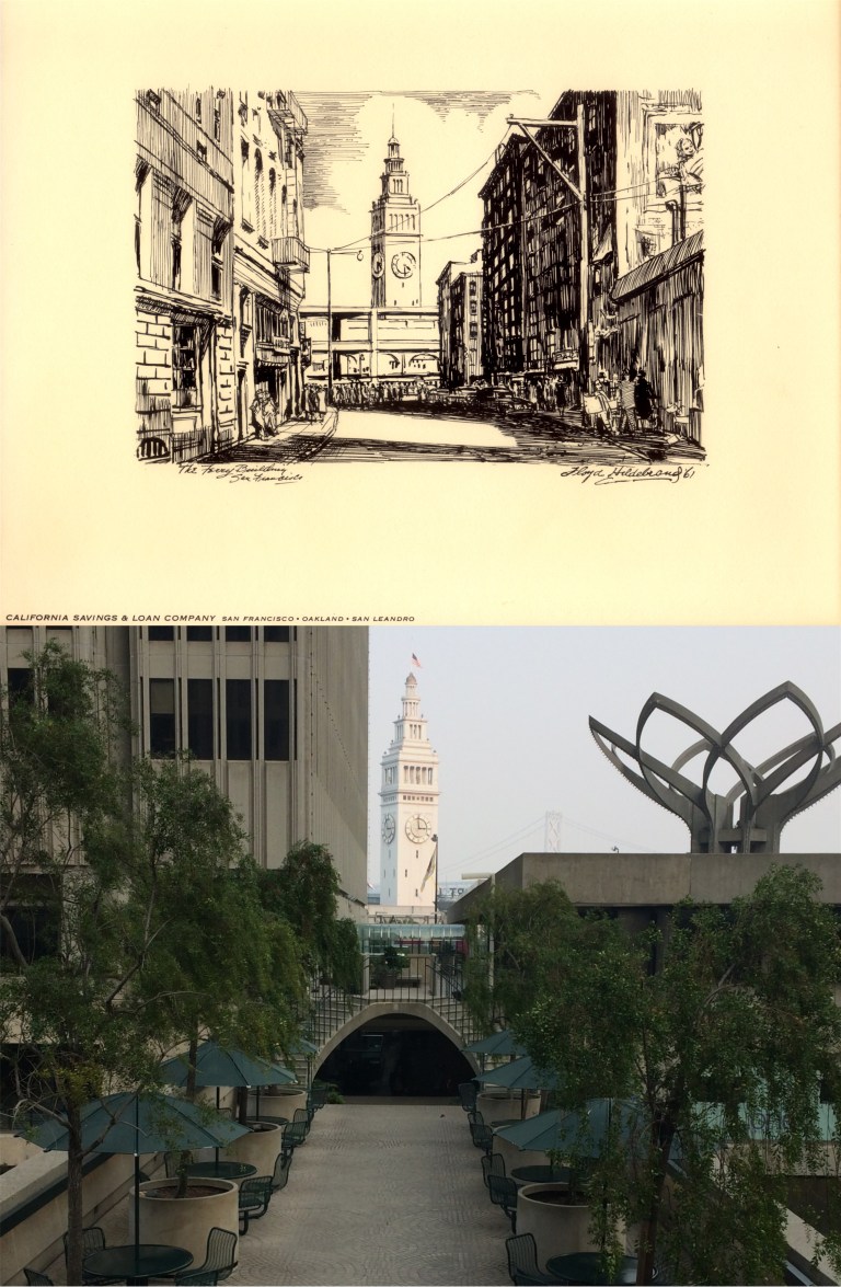 Commercial Street was one of two streets in San Francisco that ran straight to the Ferry Building, the other being Market Street. In 1971, the eastern portion of Commercial was closed off by construction of the Embarcadero Center, and this is as close to the spot in the drawing as you’ll get today. That’s the Embarcadero Freeway running past the Ferry Building in the sketch.
 The northwest corner of California and Montgomery Streets in 1887: Well, I’m sure glad that I got everything else in my picture in focus except the cable car! The gradient of the street on the left in the drawing suggests that it was probably the northeast corner of California and Montgomery Streets looking west and endorsed wrong, but I went with what the artist wrote.
 This spot has a special place in my heart. I’m usually alone nowadays when I visit Telegraph Hill, but once on a long ago October night, I sat at this same spot behind Coit Tower looking toward Russian Hill with “a girl with moonlight in her eyes” and we fell in love…… for awhile anyway. That girl died three years ago and there isn’t a time that I come up here that I don’t think about her. The telescope, concrete circle and stairs weren’t there when we sat here, and the telescope has to be a practical joke, you’re not going to see anything through those trees!
 The next group of pictures, including the above illustration of Lotta’s Fountain, were drawn by Edward H. Suydam during the 1930’s. He often picked less known areas in San Francisco that weren’t as popular for his work. Edward H. Suydam died in 1940.
 Looking west along McAllister Street where McAllister, Jones and Market Streets meet. The beautiful building with the columns is the Hibernia Bank building, closed for years.
 Sacramento Street, looking past the Pacific Union Club toward the Fairmont and Mark Hopkins Hotels:
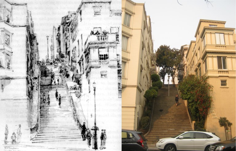 The Joice Steps off of Pine Street, on the south side of Nob Hill: One day I’ll have to climb those and see what’s up there.
 Tillman Place on Grant Avenue just south of Chinatown: This was a bustling little alley once, filled with little shops, but it seems quietly forgotten now.
 Chinatown, looking north from Sacramento Street: I saw a lot of people wearing safety masks in San Francisco yesterday.
 Looking east at the old Emporium Store getting ready for Christmas in 1971: Bloomingdale’s needs to fix some of the dead letters in their name above the old Emporium entrance. (Kid 101)
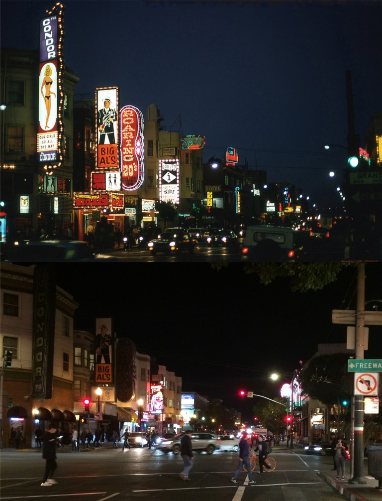 Broadway at Columbus Avenue in 1971: The ‘Condor Club’ and ‘Big Al’s’ aren’t lit up anymore, but the ‘Hungry I’ still is. (Skyscrapercity.com)
 The notorious International Settlement on Pacific Avenue during the 1940s from the photographer Fred Lyon. Spider Kelly’s and the Barbary Coast Club were in the building behind the car that’s leaving in my photo. A little trivia here that’s of interest to probably only me; “Baby Face” Nelson used to come out from Chicago and hang out at Spider Kelly’s when he wasn’t robbing banks with John Dillinger!
 Grant Avenue, between Sacramento and Clay Streets during the 1940s: If this was during World War Two, Chinatown isn’t observing blackout rules. It’s amazing that the Bakery neon sign is still there! (Skyscrapercity.com)
 Looking east along Broadway from Russian Hill in 1880: There’s still a church at the same location as the church in the old photo, but the one there today was built in 1912.
 Montgomery Street, where it meets Post and Market Streets in 1909: That’s the Palace Hotel on the right.
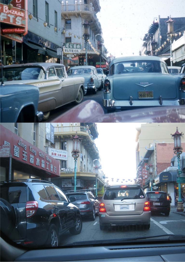 Grant Avenue at Clay Street in 1957 from somebody’s car: I never noticed until I did this update, but I can’t even see the hood of my car when I’m driving!
 Looking down Lombard Street in a less crowded 1963:
 Jefferson and Taylor Streets at Fisherman’s Wharf in 1967: I don’t know who that fellow was handing out propaganda in the vintage picture, but I don’t think it was Jerry Garcia.
 Chinatown, between Pine and California Streets in 1968:
 Market Street at 6th, looking east in the 1920’’s: The building with the crown in the center of both photos is the Golden Gate Theater.
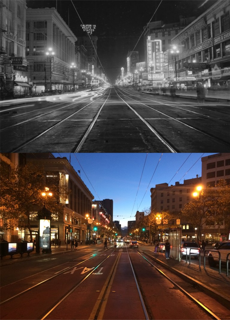 Market Street at 5th looking west in 1945: All those old movie palaces are gone!
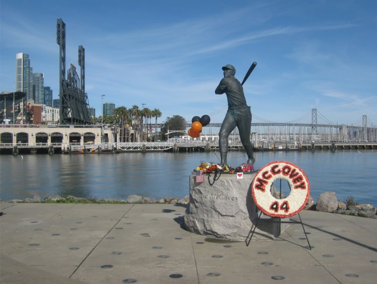

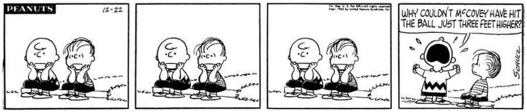 Went out to McCovey Cove today to pay my respects to “Stretch”. I love this ‘Peanuts’ cartoon from 1962 about McCovey’s line drive that ended the 1962 World Series in a loss for the Giants. Charlie Brown is obviously a Giants fan!
 Looking down California Street near Powell on Nob Hill in 1960: I only got one cable car in my picture, and that’s as far out as I’m going onto California Street with oncoming traffic behind me. Down the hill where the PARKING and 76 sign are in the vintage picture was where the old Crest Garage, demolished just this year, was.
 Grant Avenue and California Street in 1955:
 The Powell Street cable car turnaround in 1967:
 Waverly Place at Washington Street in the heart of Chinatown in 1946:
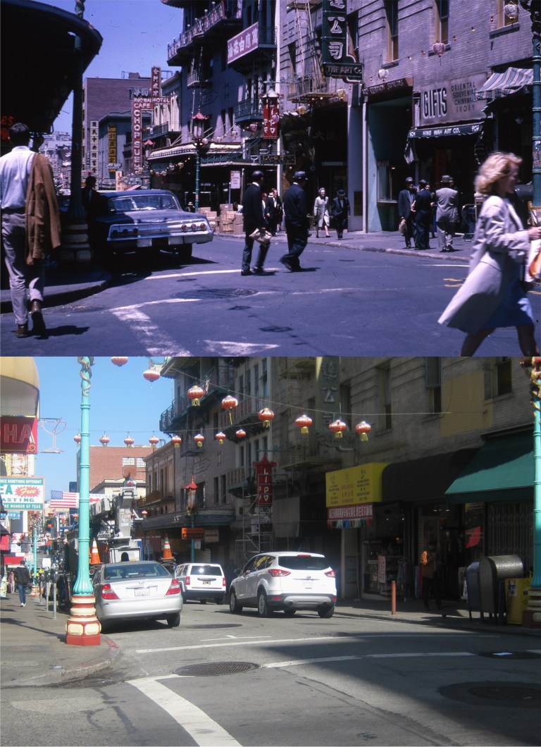 Grant Avenue at Washington Street in 1966:
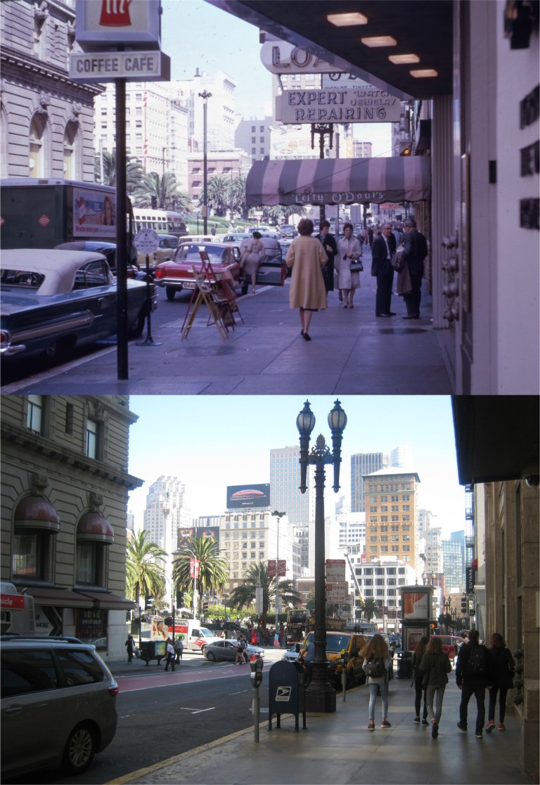 Geary Blvd. near Powell Street and Union Square in 1962: Lefty O’Doul’s closed in 2017.
 Grant Avenue at Jackson Street in the early 1960’s: Red’s Place is a great place to stop in for a pick-me-up (a drink not a date) after walking around the hills of Chinatown all day. Downstairs in the old building, you could look into rooms that were said to have once been opium cribs, but the area is closed off now.
 The San Francisco skyline near the Ferry Building from San Francisco Bay in 1960, before the skyscraper boom:
 With Halloween approaching, it seems appropriate to post a spooky mystery story. The fate of the World War Two blimp, L-8, is one of San Francisco’s greatest mysteries. I have read of the story before, but a recent article in the San Francisco Chronicle by Gary Kamiya raised my interest in the incident again. During World War Two blimps regularly patrolled the Pacific Ocean in search of Japanese submarines that may be lurking off the coast. (In fact, it was discovered after the war that a Japanese submarine did, indeed, fire a torpedo at the Golden Gate Bridge) On August 16th 1942, a navy blimp piloted by Lieutenant Ernest DeWitt Cody and Ensign Charles Adams left Treasure Island, flew over the Golden Gate Bridge, and headed toward the Farallon Islands. Shortly after that, a message, “Am investigating suspicious oil slick, stand by.” was sent to Treasure Island from the blimp. That was over 76 years ago, and that was the last thing ever heard from the two pilots! The blimp came down empty in Daly City, just south of the Crocker Amazon District, (not far from where Parry Hearst was captured) and to this day, no one knows what happened or what became of the two pilots on board. (Vintage photo from Welweb.org)
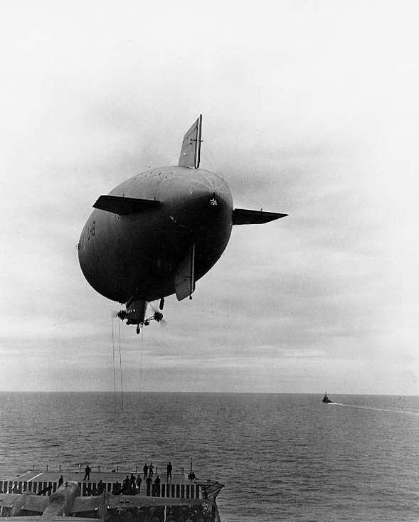 The L-8 blimp had a few previous moments in history. This photo from Wikipedia shows it delivering parts to the aircraft carrier USS Hornet just before she left for the famous “Doolittle Raid”.
 Around 11:15 AM, the blimp was photographed near the shoreline by Lake Merced deflating and descending. It struck a hill near the Lake Merced Golf Course which caused one of the depth charges on the ship to break off and roll down the hill. Fortunately, it didn’t explode. (Allthat’sinteresting.com)
 The blimp eventually crashed down on Bellevue Avenue in Daly City, seen here in this view looking southeast. (SF Chronicle)
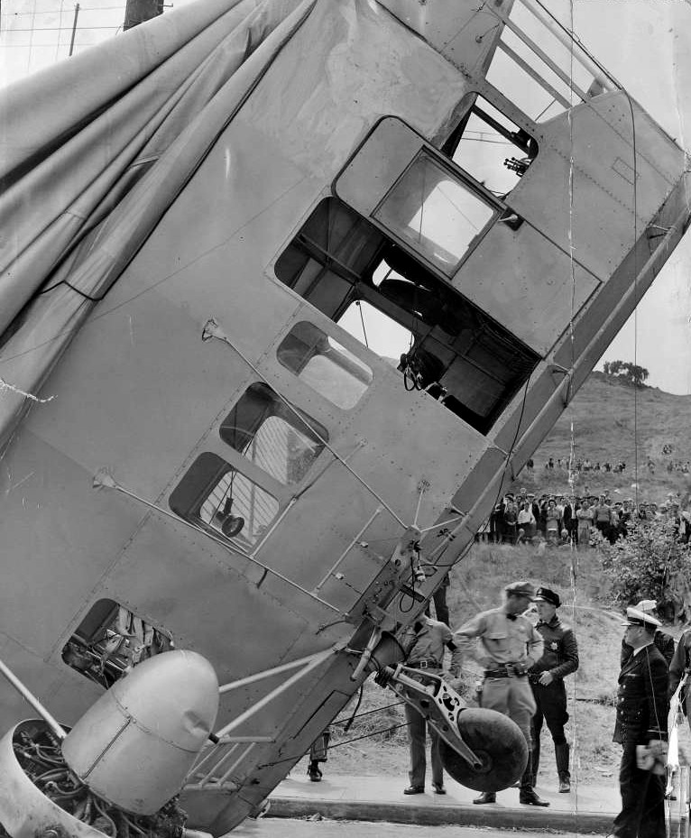 The blimp was intact, all the parachutes were still on board, but the door was latched open, which it should not have been. I think I may have solved a mystery within a mystery I was encountering from this San Francisco Chronicle photo of the gondola taken at the time. The L and 8 letter and number visible in the previous photo are missing in this picture. This may have been requested by the navy as not to identify which blimp it was.
 Two views of the downed airship from the San Francisco Chronicle, looking southwest:
 A view of the gondola looking northwest: That’s probably the same telephone pole.
 The San Francisco Examiner edition that covered the story: (Atlas Obscura)
 The two, lost forever, pilots, Ernest Cody and Charles Adams: It’s unlikely anyone will ever know what became of them.
 While I was researching the story, I met a nice lady from the area named Veronica who was interested in the incident, and the pictures. She helped me match up some of the angles. The top vintage photo was on the north side of Bellvue where the blimp came down. I was looking at the three houses in the center photo as the ones in the old photo; the stairs, doorways and small windows on the right side of the houses match up. Veronica thought it was where the houses in the bottom photo further to the east are, even though two of the houses didn’t match. There is a gap on the right that could be the same as the one in the vintage photo, so I took a picture of her guess, just in case.
 When I got back to the office I looked the area up again on Google Maps. Trust a woman’s intuition, Veronica was right!
 The L-8 gondola was eventually used for other Goodyear blimps after the war, and is now on display in the Naval Aviation Museum in Pensacola, Florida. (navalavationmuseum.org)