 {San Francisco
Monday, July 13th
Arrived in port: Stmr. Araby, Captain Jarvis; general cargo from New Orleans and Gulf ports.
Docked at Pier 43.
S. F. Shipping Guide}
{In silence, Greg turned. Yes, he understood only too well! He had heard enough tales about the San Francisco waterfront to know that there was truth in the man’s statement. He recalled stories of bodies found floating in the bay, with marks of violence upon them; stories of men picked up in dark nooks along the dockside, men barely breathing – all of them crimes rarely cleared up.}
Doesn’t paint a rosy picture of the Embarcadero in 1937 when Howard Pease wrote his mystery ‘Foghorns’, does it? And it wasn’t inaccurate at all! Violence, sabotage, labor unrest, and the always pending threat of a longshoremen strike made the San Francisco waterfront an uneasy and often dangerous area. At night when the fog came in sailors and longshoremen often had to be very cautious on a shore leave. Howard Pease’s book is filled with descriptions of the color, flavor, and mystery of what it must have been like along the Embarcadero back then, and there are also a number of references to historical incidents that had and were occurring around San Francisco at that time. So put on a pair of dungarees, throw a duffel bag over your shoulder, and listen to the foghorns as we explore the Port of San Francisco and other locations in the city described in passages from the book, (in brackets) and I’ll include vintage and updated pictures of the long-ago San Francisco the author writes about.
 The main character is Gregory Richards, eighteen years old and down-and-out, trying to get a job on one of the many ships docked along the Embarcadero in 1936. His two main troubles are a pending waterfront strike, and the fact that none of the ship crews are willing to hire someone who hasn’t shipped out and hasn’t had ship sailing experience. He meets a fellow named John Brant who is willing to sell him a phony discharge certificate proving he has had sea experience and tells him where a ship named the SS Araby, that will hire him if he’s willing to cross a picket line, is docked.
{“She’s tied up at Pier 43. Go straight along the Embarcadero to Fisherman’s Wharf.” Well, she sounded all right to him. He picked up the two bags, and stuck off through the fog toward Pier 43.}
The illustration of Greg applying for work on the Araby is from the 1948 reprint of ‘Foghorns’ that I bought.
 Before Richards runs into John Brant, he is warned of the dangers along the waterfront by a gentleman at a sailor’s hiring hall, particularly for strike breakers. When Richards inquires about police protection, the fellow tells him,
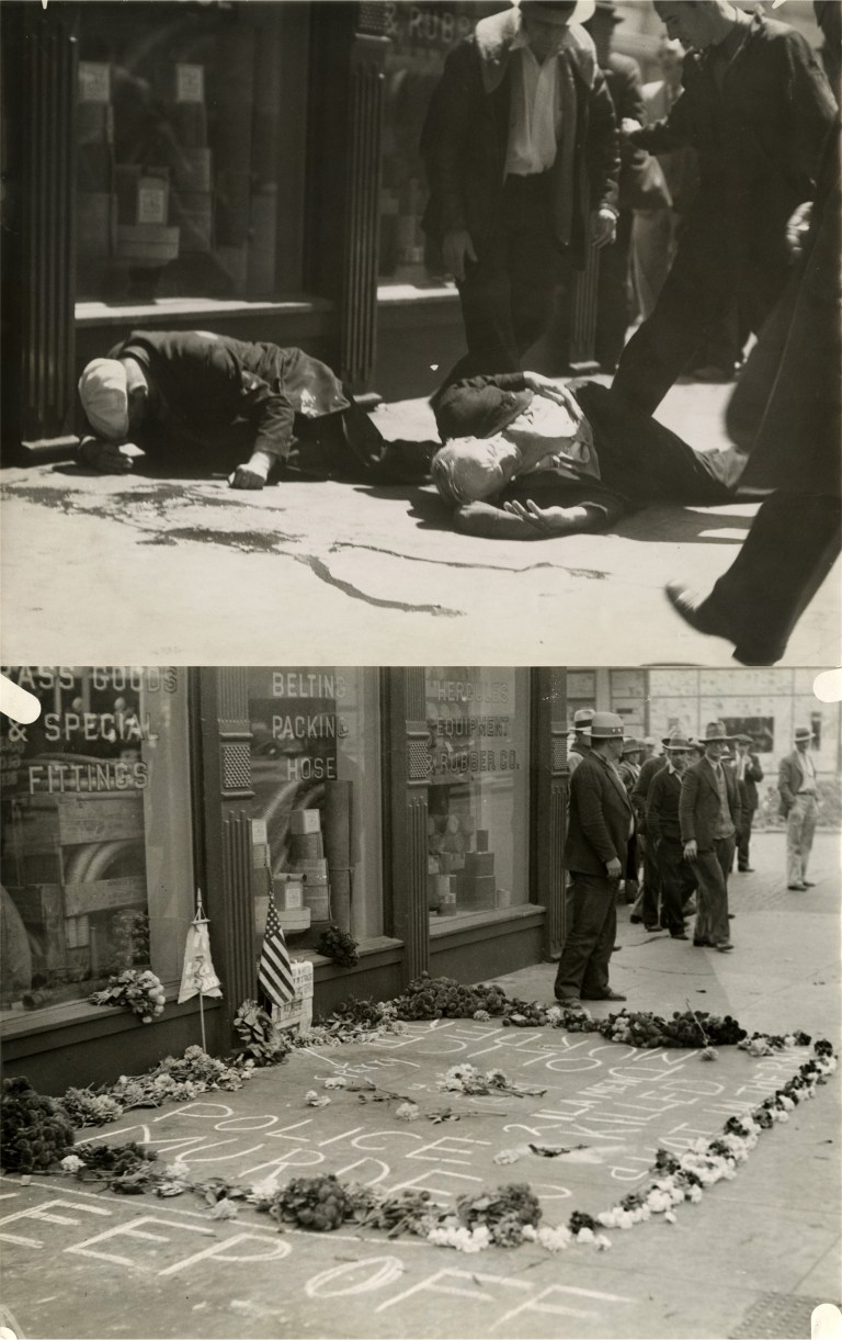
{“The police? Say, the cops is lucky not to get beat up too. Why? Because the police shot down two unarmed seamen out on strike. Shot ‘em down right here on the sidewalk. Left ‘em lying with their blood dripping into the gutter.” The man looked down as if he could see two outstretched bodies at his feet.}
This man is referring to the famous July 5th 1934 “Bloody Thursday” incident where police fired into a crowd of striking longshoremen at the intersection of Steuart and Mission Street, hitting three men, two of whom died. A shrine was established in the following days at the southeast corner of Steuart and Mission where two of the victims crawled to, seen in the top pictures.
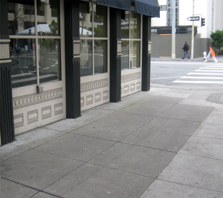 The spot where the previous two pictures were taken today:
 There is a marker describing the incident on a building at Steuart and Mission Streets today.
 The “Bloody Thursday” incident is still commemorated today on the sidewalk in front of the Longshoremen’s Hall on North Point Street.

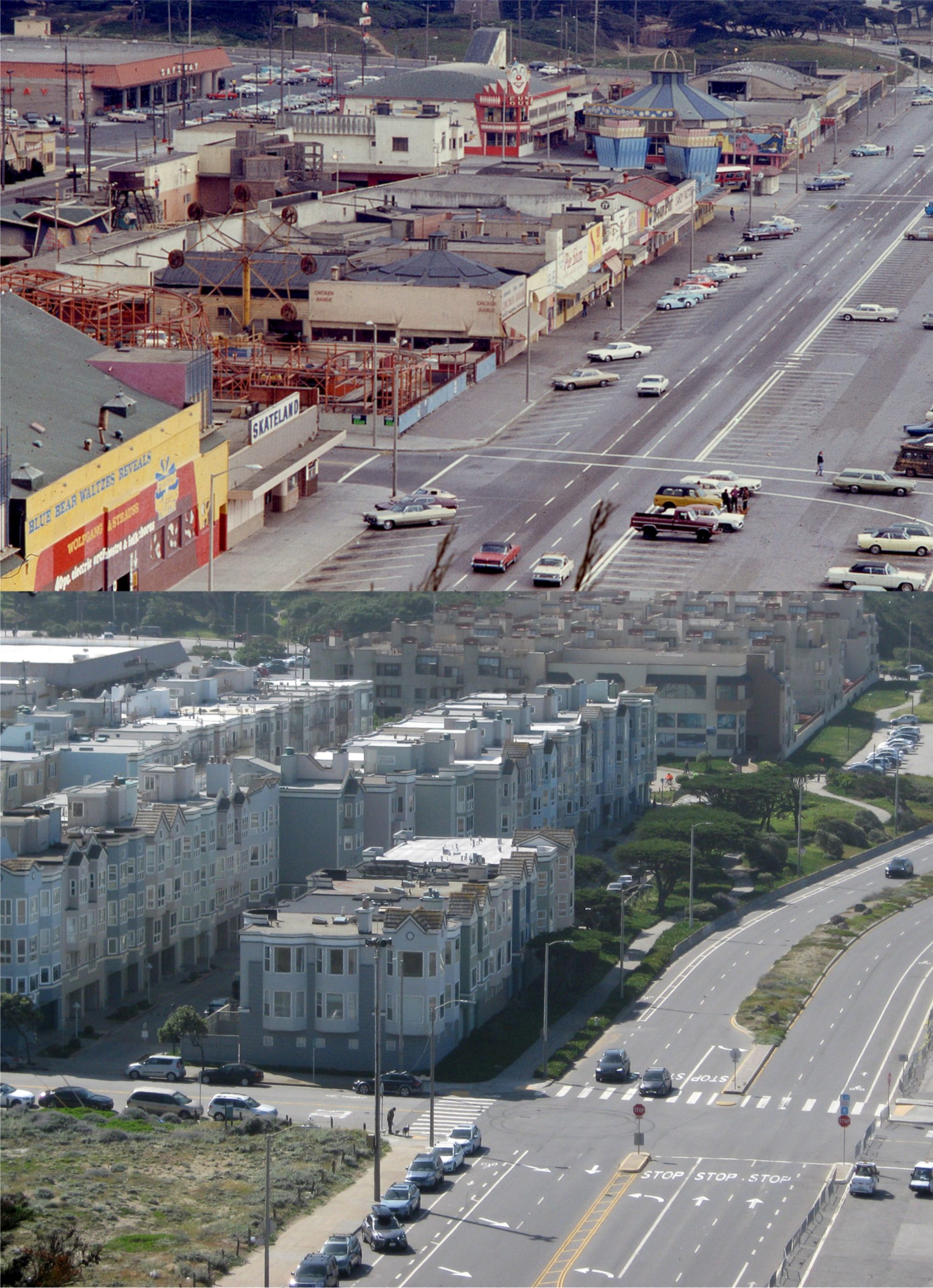
 Greg counts the piers as he walks from Mission Street to Pier 43.
{On his right hand rose a line of great covered piers, silent and dark, their immense doors closed for the night. He counted them as he went along. Pier 29 – the Luckenbach Steamship Company. Pier 31 – the Oriental Line. Pier 33 – the American-Hawaiian SS Company. Even their names spelled romance.}
The above top photo is a close-up portion of these same piers from David Rumsey’s incredible aerial collage of San Francisco taken in 1938, one year after ‘Foghorns’ was written. The bottom picture is at this stretch of Embarcadero piers from ground level nowadays.
 Having been discouraged by the picketers in front of Pier 43, Greg requests assistance from a police officer watching from across the street to cross through the picket line and board the Araby.
{“Just a seaman going on board the Araby, boys. No trouble, now.”
“Okay.” one of the men nodded, grinning.}
Pier 43 is the pier on the left in Davis Rumsey’s aerial photo from 1938. The round buildings at the bottom of the photo were the large gas tanks that were there from the 1930s until the 1960’s.

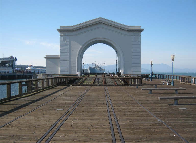 The top vintage picture above from opensfhistory.org is Pier 43 with a ship docked there in 1939. The picture below it I took looking through Pier 43 toward the Liberty Ship Jeremiah O’Brien:
 Greg is hired on to the crew of the Araby, but shortly after, an arsonist fire is started in the cargo hold. A series of clues leads Richards to believe that John Brant, who gave him his phony discharge certificate, is involved. He confesses to Captain Jarvis, master of the freighter, and Third Mate, Tod Moran in order to warn them of his suspicions. Partly because of his honesty, and partly because he can identify John Brant, they keep him on the crew. They leave the ship to search the waterfront for John Brant.
{Seated ten minutes later beside Third Mate Moran, Greg looked out the window at the dark Embarcadero speeding past. Telegraph Hill came into view, its top obscured by a bank of fog. They over took a freight train of the Belt Line rumbling toward the Ferry Building, then it fell away in their wake and only the low throb of their motor was audible.}
Above is a Belt Line Engine on the Embarcadero at Lombard Street in the early 1950s. (blogspot.com)
 The Ferry Building is mentioned often in ‘Foghorns’.
{Almost before he knew it their cab had speed through the underpass at Market Street and was drawing up at a corner beyond. Tod Moran looked up through the rear window at the clock on the tower of the Ferry Building. “Five after eleven. I’m afraid we’ll never find him.”}
The underpass along the Embarcadero allowed traffic to duck under the streetcar turnaround in front of the Ferry Building. In the vintage photo above you can see traffic emerging from the underpass past the Ferry Building near Mission Street.
 Richards, Moran, and Captain Jarvis go back to the waterfront hotel where Brant sold Richards his phony discharge certificate on the corner of Mission Street at the Embarcadero and called the Bay View Hotel, and break into a room Brant was occupying when they made the sale looking for clues. They find a message that leads them to believe Brant will be meeting a confederate at the Canton Low Restaurant in Chinatown.
{“That’s it.” Tod Moran was jubilant. “The Canton Low is a famous restaurant in Chinatown where everybody goes. Brant made his appointment with his accomplice. It’s where they’ll meet tomorrow night.”}
They would have been referring to the old Shanghai Low Restaurant on Grant Avenue between California and Pine Streets. When they go to the meeting spot the following evening, Greg gets his first look at Chinatown.
{“Why, this must be just like China.” Greg’s voice was filled with enthusiasm as he rejoined the two men. “Look at that balcony up there.” His gaze was fixed with rapt attention upon a tall building across the street, its pagoda tower rising into the fog above. Even the street lamps, he noticed, were of oriental design; they were patterns of intricate beauty.}
 But John Brant, sensing a trap bolts out the back door of the restaurant, as Greg takes after him. He follows Brant out to St. Mary’s Square at Quincy Street.
{When he reached the end of the buildings he stopped. Facing him was a small park, lighted by a single lamp in its center. It was surrounded on three sides by the dark rear walls of buildings. All at once he came to a halt. Far down the alley someone was running from a lighted doorway.}
Above is an old postcard of St. Mary’s Square and old St. Mary’s Church. Behind the statue of Sun Yat-sen is Quincy Street.
 Throughout the book is mentioned a foreboding possibility of another waterfront strike like the one in 1934 that shut down the entire San Francisco waterfront. In 1937, Longshoremen led by Harry Bridges were establishing a union along the San Francisco waterfront that was opposed by many ship company owners. In August of 1937 they founded the International Longshore and Warehouse Union. This 1937 picture from opensfhistory.org shows longshoremen gathering in front of Pier 15.
{The hotel clerk slowly shook his head. He was a young fellow with blue eyes, a freckled face, and pale-red hair. His tone was sympathetic. “All this talk about a strike, you know. It’s brought men here from the back country looking for jobs.”
“Strike breakers, eh?”
“Well, you know how it is.” The clerk glanced uneasily down the corridor.}
Greg Richards was one of those “strike breakers”, but during the course of the book, he eventually becomes sympathetic to the longshoremen.
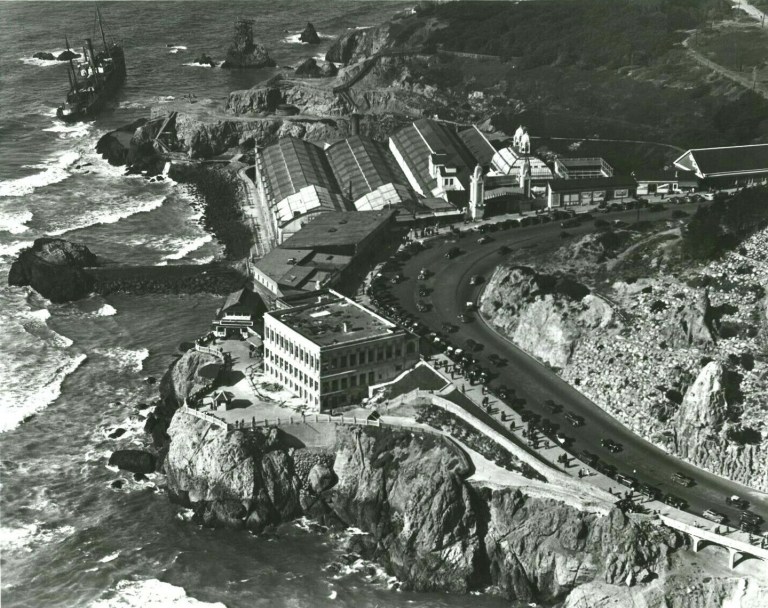 I’ll close with another reference in the book to an historical San Francisco Incident taking place when the book was written. In October of 1936, the cargo ship the SS Ohioan ran aground on the rocks near the Sutro Bathhouse and the Cliff House. The crew, much of the cargo, and parts of the ship were salvaged, but in March of 1937 the ship caught fire and was eventually smashed to pieces by the surf. The photo above is an aerial view of the Cliff House and Sutro’s Bathhouse showing the stranded SS Ohioan at the upper left. (ebay)
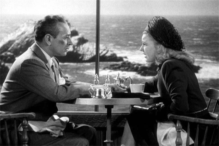
{“I know.” Greg sighed. “I went out to the Cliff House the other day to see the big freighter that’s piled up there on the rocks. In a way, I feel as if I were headed for the rocks, too.”}
 A closer look at the stranded Ohioan and the area behind Sutro’s where she ran aground: (Vintage photo from worthpoint.com)

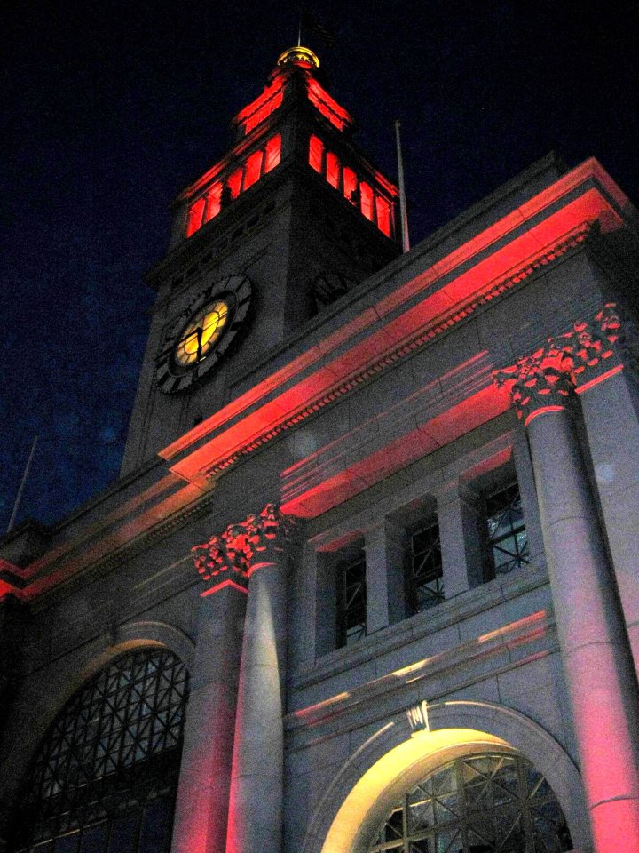
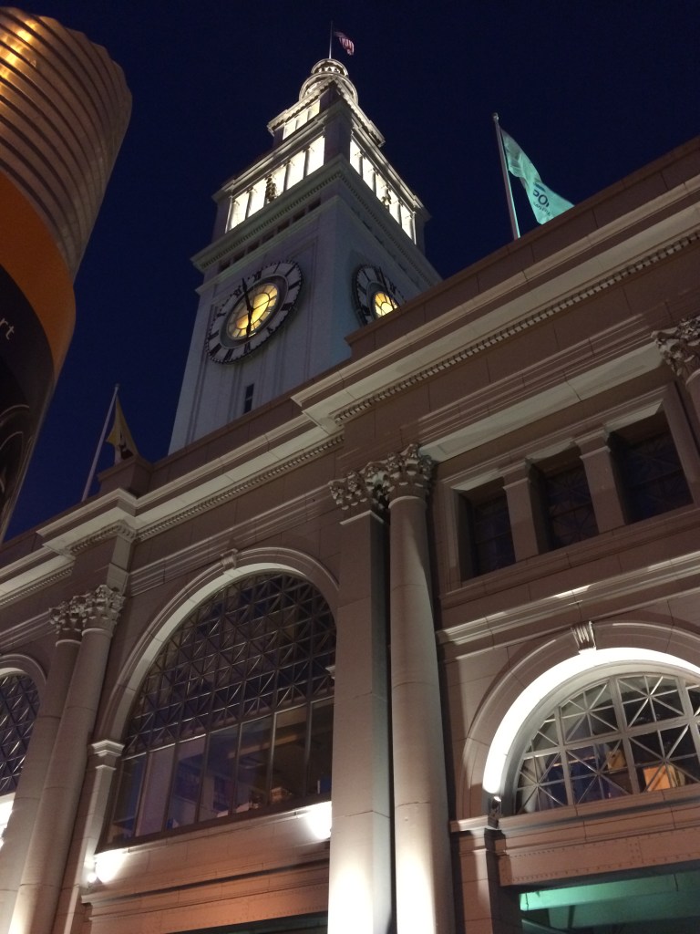 The old Southern Pacific Building on Market Street is getting into the fun, but the Ferry Building, all aglow in red in 2013, didn’t change its color this time.
 The sidewalk lights on the Embarcadero, (Herb Caen Way) were changed to red back in 2013 and you could stand in the glow. No red sidewalk lights at Pier 1 this time. “I wore a younger man’s clothes” back then. Oh, wait; those are the same clothes I was wearing last Sunday!
 The Billy Graham Civic Auditorium is in gold and red this year.
 I got a fuzzy picture of City Hall on that January Saturday night in 2013 and another last night. It’s not that I’m a better photographer since seven years ago; I just have a better camera now.
 A MUNI bus coming along Post Street in January, 2013: We won’t see that this year.
 In 2011, the University of California Press reprinted a 1940 guide to San Francisco written by the Federal Writers Project (WPA) of the Works Project Administration (WPA). The Works Progress Administration was the result of Executive Order 7034, Signed by Franklin D. Roosevelt in 1935 to create jobs for unemployed workers, artists, musicians, etc. during the Great Depression of the 1930s. A lot of the San Francisco we appreciate today, such as the murals inside Coit Tower and the Beach Chalet, and the exhibits at the San Francisco Zoo came about because of WPA. The ‘San Francisco in the 1930s’ WPA Guide has numerical descriptions that correspond with maps in the book. The points of interest listed take in just about all of San Francisco with occasional outdated descriptions that were new in 1940. These are a collection of some of the descriptions of places from the book, (in brackets) with vintage pictures I updated of each location taken close to the period when the book was written.
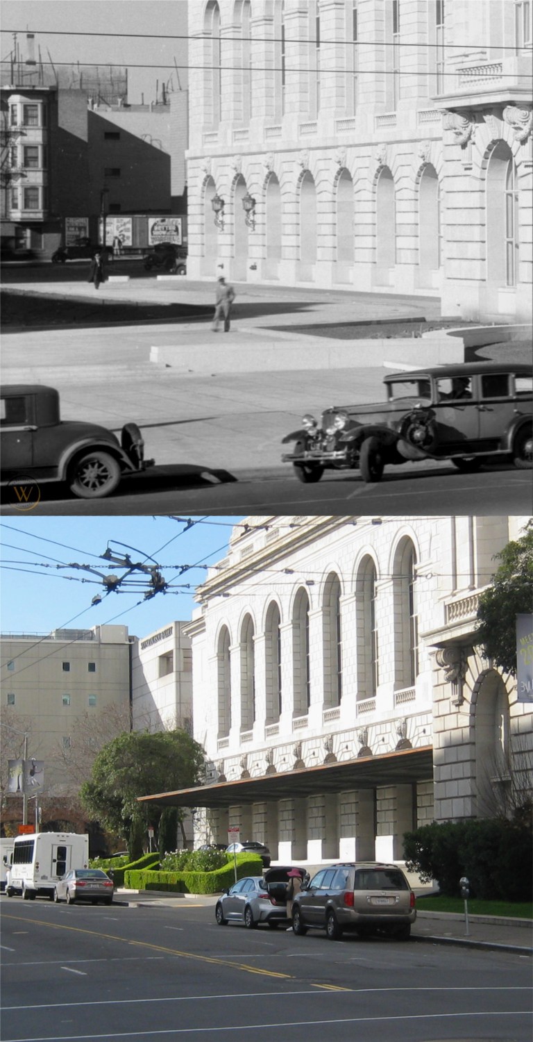 The south side of the Opera House on Van Ness with long gone buildings on Franklin Street in the background: (Vintage picture from worthpoint.com)
 The cable car turnaround at Powell and Market Streets:
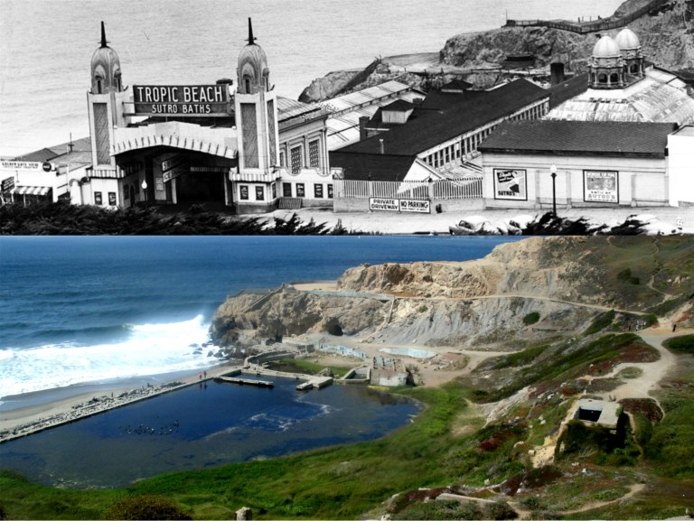 The old Sutro Bathhouse:
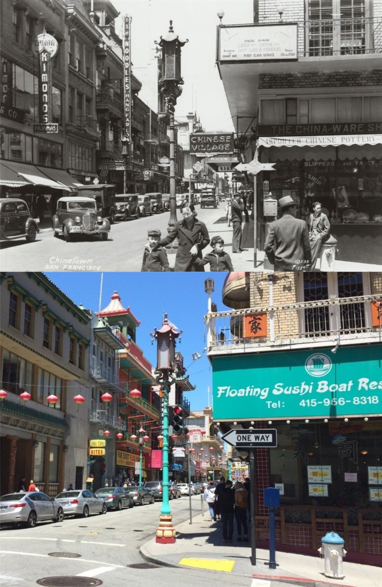 Grant Avenue looking north from Commercial Street:
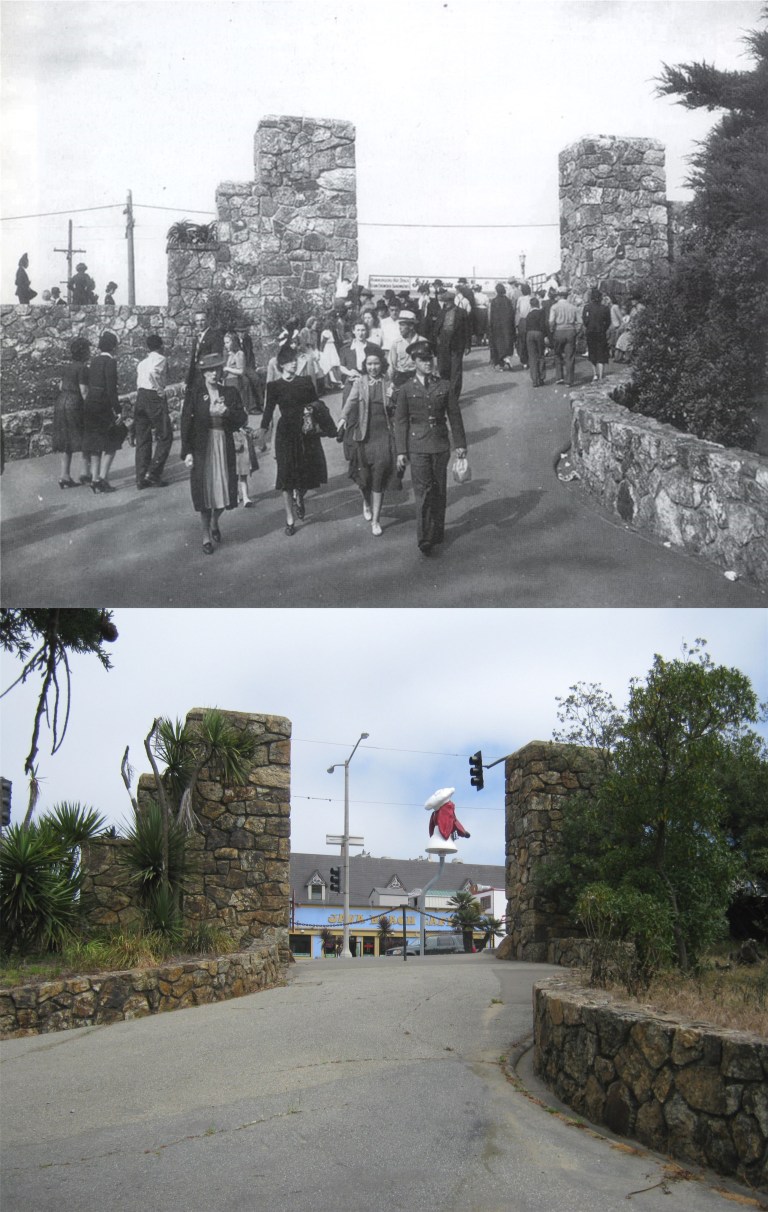 The old WPA built entrance to Fleishhacker Zoo on Sloat Ave.
 One of the pictures I was able to get at the old stone entrance to the zoo on Sloat Blvd before they closed it off was the spot where my 17 year old mother on the left with her cousin Frances sat during a visit to San Francisco from North Dakota in 1939.
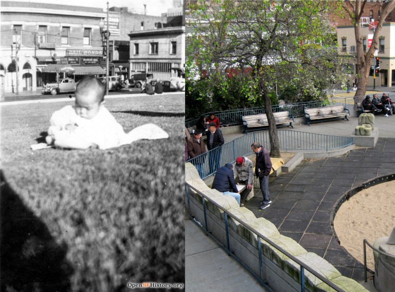 The southeast corner of Portsmouth Square:
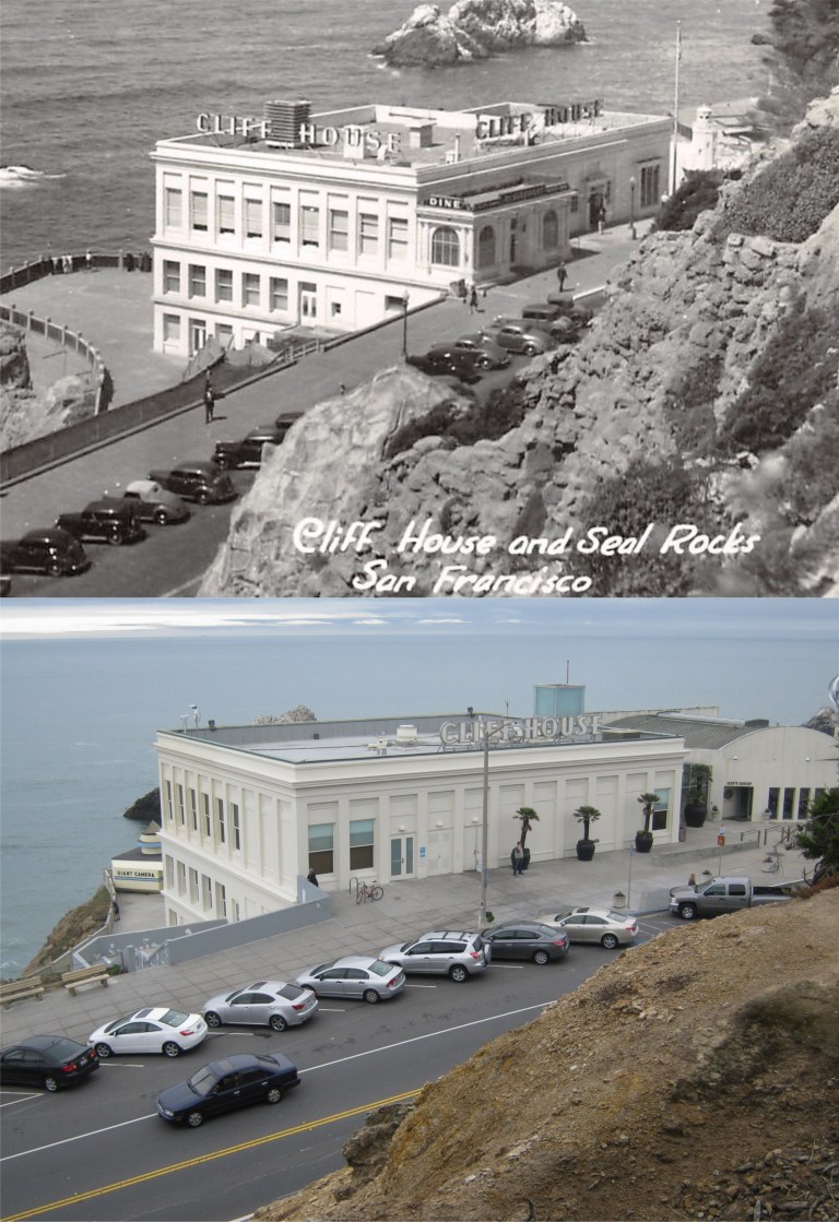 {The CLIFF HOUSE. Point Lobos Ave. at Great Highway, a white stuccoed building terraced along the edge of the cliff south of Sutro Baths, is a modern restaurant, bar, and gift shop. Both the barroom and the Sequoia Room – a cocktail lounge – are finished in redwood, from the smooth walls to rustic beamed ceilings, and both house huge fireplaces in which open fires glow on chilled days. From the lounge and the blue and white dining room in the rear of the building guests seated at the great plate glass windows on clear days look beyond Seal Rocks for miles across the Pacific.}
 The De Young Museum and the Pool of Enchantment:
 The Fisherman’s Wharf Lagoon:
 The Embarcadero near Green Street, looking south:
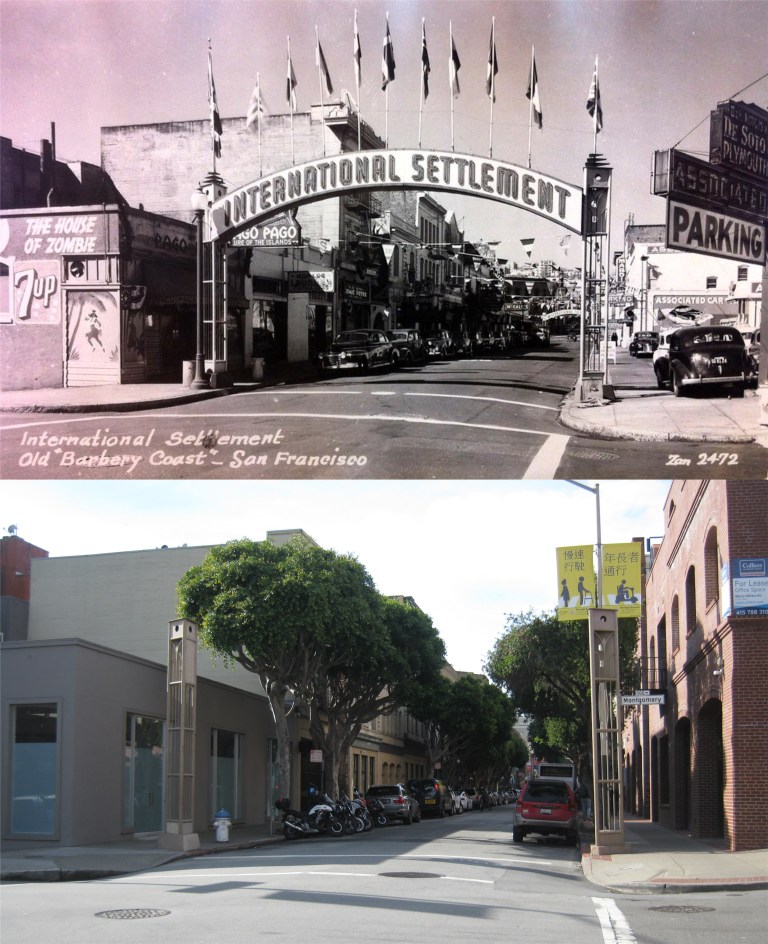 Pacific Avenue and Montgomery Street looking west and the old signposts of the eastern side of the International Settlement:
 Mason and Sacramento Streets looking west in 1956: I think I’m far enough out in Sacramento Street with my picture; the traffic lanes were just different back in 1956. (San Francisco Pictures)
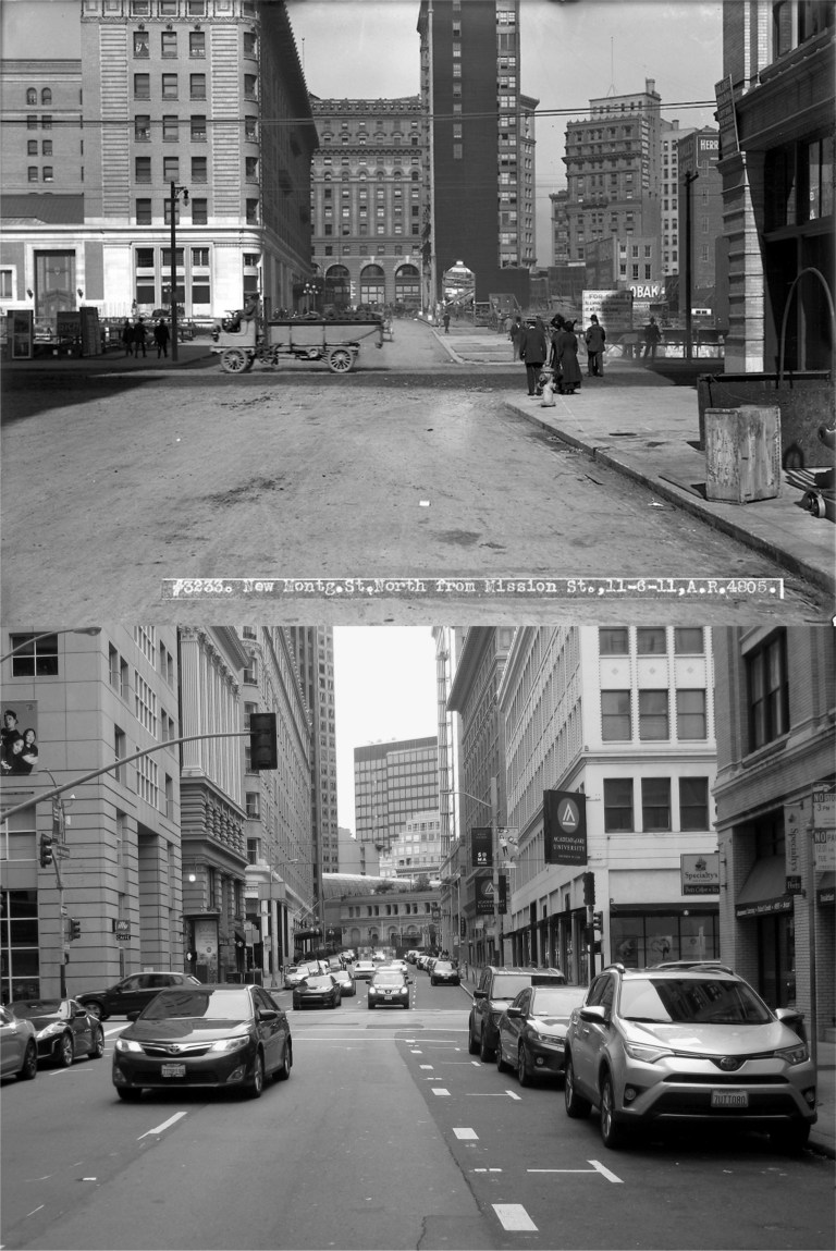 New Montgomery Street, looking north toward Mission Street in 1911: The Palace Hotel, which is the prominent building on the left in the vintage photo, can just barely be seen from here today. The Number One Montgomery Building, built in 1908 and seen in the far background in my picture, had its top portion removed in the 1970s. It angles differently and appears farther away than the old building on the corner of Market and Montgomery Streets in the vintage picture because they’re not on the same block. The old Crocker Building in the background of the old photo was demolished and Number One Montgomery is actually on the corner of Post and Montgomery Streets, which cuts in a different direction. (San Francisco Pictures / SFMTA Photo Archives)
 Grant Avenue at Washington Street: The blog lists the vintage picture as from 1920. I’m sure I’m standing in the same spot, but the old and same buildings on the west side of Grant Avenue on the left don’t line up. I’ll put it down to an optical illusion. (San Francisco Pictures)
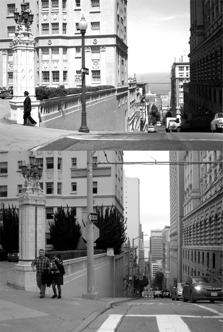 Mason and Sacramento Streets looking east in 1956: Sometimes I’ll do an update photo and think I got the picture at just the right spot, and then when I put it together with the vintage picture I’ll say to myself, “Darn, I should have been more to the left!” or “Darn, I should have been more to the right!” or “Darn, I should have been closer!” or “Darn, I should have been farther back!”. I don’t always say “darn” either. I missed this one, alright. I should have been farther out in the intersection, but it’s a busy crossing and I never get a good line up when I’m looking back over my shoulder while I take the picture. (San Francisco Pictures)
 Washington Street at Hyde looking east in 1957: I got a pretty good line up on this one, but that’s not the interesting thing about the picture. The Washington Street cable car line used to run west past Hyde Street all the way to Steiner Street. The line had been discontinued by 1957 but you can still see the cable car tracks at the bottom of the vintage picture. (San Francisco Pictures / SFMTA Photo Archives)
 Looking north along Hyde Street in 1957 from the same intersection at Washington Street as the previous picture: Trees block most of the view along Hyde Street today. The vintage picture was probably taken from the back of a cable car, and the tracks curve a little differently today due to the O’Farrell Line that used to continue south along Hyde as far as Pine Street once, and the cable car overhaul of 1982 and 1983. (San Francisco Pictures / SFMTA Photo Archives)
 A cable car plunging down Washington Street from Jones in 1947: I gave it a try; “Close but no cigar”, or cigarette, or even a vape! (San Francisco Pictures / SFMTA Photo Archives)
 Jones Street looking south toward Post Street in 1913: This one was a pleasant surprise; usually I’m not far enough out into traffic when I take my picture, on this one I was too far out in the street. The construction work on Post Street was probably for the laying of streetcar tracks that by then began to replace cable car lines. However, you can still see the Jones Street cable car lines heading up Nob Hill. Good 1913 advertising; I suddenly have a craving for a stick of Wrigley’s Spearmint Gum! (San Francisco Pictures / SFMTA Photo Archives)
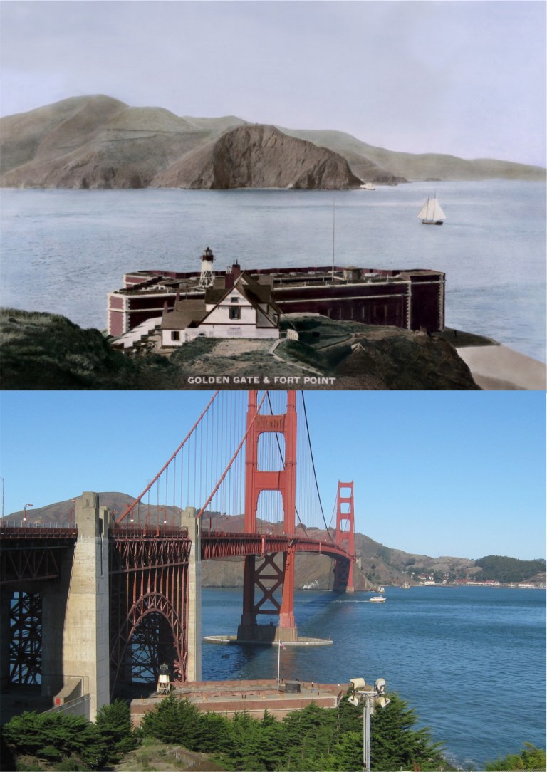 The Golden Gate and Fort Point in the 1880s:
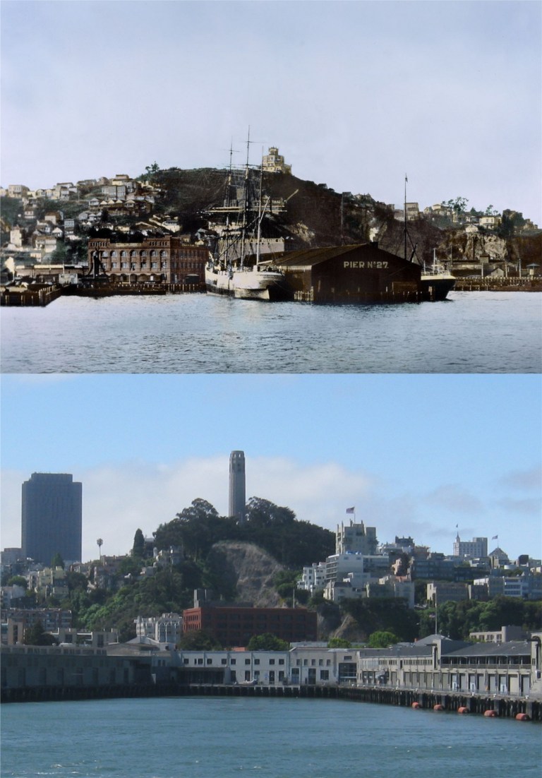 The San Francisco waterfront beneath Telegraph Hill in 1885 before the Embarcadero Piers were built: Dynamite blasting of Telegraph Hill in the late Nineteenth Century, particularly by the brothers George and Harry Gray for their stone quarry, removed the natural slope of the eastern side of the hill before it was stopped early in the Twentieth Century. You can see the damage the Gray Brothers caused in my picture.
 The area that used to be called Meiggs Wharf but is today’s northern waterfront and Fisherman’s Wharf in the 1870s: Alcatraz Island, the Tiburon Peninsula, Angel Island and Sausalito can be seen in both pictures.
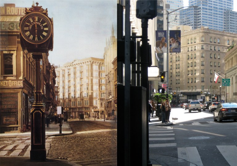 Montgomery Street at Sutter looking south toward the old Palace Hotel in the late 1870s:
 The waterfront looking down from Telegraph Hill in 1865:
 The Vallejo Street Wharf looking toward Telegraph Hill in 1866: Much of this area has been filled in now.
 Looking down from Telegraph Hill toward Vallejo Street and Broadway, where most of the ships docked back in 1865:
 The wharf near Broadway, the opposite view of the previous photos, looking back toward Telegraph Hill: The picture is dated 1850, which would make it one of the oldest pictures or daguerreotypes of San Francisco known.
 In ‘Many a Monster’ written in 1948 by Robert Finnegan, Dan Banion is a newspaper reporter trying to prove the innocence of a fugitive from the police, hiding in San Francisco and wanted for the gruesome serial killings of four women.
 Read Banion’s dreary description of 3rd Street as he turns onto it from Market Street looking for clues.
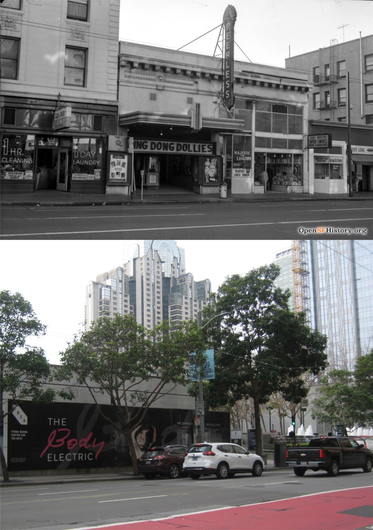 {Farther up the street, Dan could see the neon sign of the Regent Theater projecting over the sidewalk.}
 In ‘My Dead Wife’ (Is that a grabber title or what?) written in 1948 by William Worley, Frank Terrance who lives on the Telegraph Hill part of Kearny Street, (Curiously, the author spells it Kearney Street) is a depressed and lonely man in love with his unfaithful wife who has left him. His wife, Jessie, shows up at his apartment in the first chapter broke and obviously in some type of trouble. Torn between his feeling for her and aware that she doesn’t love him, he begins drawing back to her in spite of himself. Hey, we’ve all been there. The reunion doesn’t last long because while he’s in the kitchen mixing Jessie a drink she’s shot to death while sitting in his arm chair. Well, at least Frank had the sense enough to slam down the drink he made for Jessie when he saw her bleeding in the chair. After kneeling on the floor by her to make sure she’s dead, Frank panics fearing he may be blamed and quickly leaves his apartment.
 {I walked down to Columbus and turned into Grant Avenue. I walked at a steady, easy pace through Chinatown towards Market Street. I went past the wailing and whining of the Chinese theater, past the night clubs and their displays of Chinese fan dancers, past the bars and chop suey parlors, the joss houses, the entrances where tourists never go, past the glittering Chinese art stores and the stench of poultry and fish markets.}
 Terrance stops at his walk along Grant Avenue here at Grant and Geary Blvd. and goes into a cocktail lounge and begins to drink heavily until he notices the other customers staring at him with curious looks. He discovers that he has blood on his face and clothes from his murdered wife. The vintage picture is from 1957.
 ‘Murder Up My Sleeve’ was written in 1937 by Erle Stanley Gardner, the creator of Perry Mason, although Perry Mason isn’t in this book. I liked this one the best; however, some readers might find it lacking in action. Much of the dialogue between the characters is surprisingly contemporary, and I developed a crush on Cynthia Renton right from the first page she appears in. Our hero is Terry Clane who is often referred in the book as an “adventurer”. Clane is summoned to the District Attorney’s office in the opening of the book because a blackmailer named Jacob Mandra has been murdered with a “sleeve gun”. A sleeve gun is a weapon that can be hidden in the sleeve and fires a deadly dart that can be launched by pressing your arm against a solid object, such as a desk. Terry Clane owns such a weapon.
 The District Attorney tries to intimidate Clane by reading to him from a dossier his office has collected on our “adventurer”, including this information.
 Clane travels through the Stockton Tunnel to Chinatown to visit Chu Kee who lives on Stockton Street. Chu Kee’s daughter, Sou Ha, knew Jacob Mandra and was one of the last people to see him alive. Clanes’s encounter with Chu Kee and Sou Ha has an atmosphere of danger that reminded me of when Bette Davis goes to meet mysterious Gale Sondergaard to purchase a letter that will incriminate her in the murder of her lover in the 1940 film ‘The Letter’. Clane describes coming out of the north end of the Stockton Tunnel and entering Chinatown.
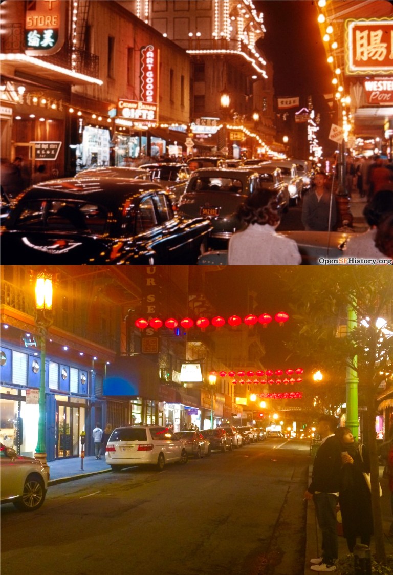 Later on Clane drives along Grant Avenue in Chinatown at night with Sou Ha.
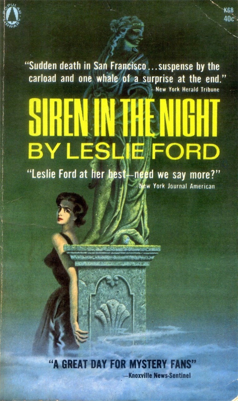 ‘Siren in the Night’ written in 1942 by Leslie Ford received the best reviews of the books I read, but I found it really slow in parts. It concerns a murder committed during a blackout and siren warning alerting San Franciscans of a possible air raid that was common in the city in 1942. In one chapter the heroine, lady detective Grace Latham, walks down Nob Hill with a Colonel John Primrose from the Mark Hopkins Hotel to Jack’s Restaurant on Sacramento near Montgomery Streets. Written in first person, Detective Latham describes the San Francisco sites as they walk along.
 {We walked down California Street. The cable cars clanging up the hill were jammed with people sticking on like caviar on a forty –five degree oblong of toast.}
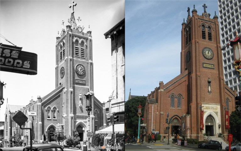 {The clock on the square dark tower of St. Mary’s was striking seven. The gold inscription above it – “Son Behold the Time and Fly From Evil” – was glistening in the low shafts of sunlight through the Square across the street.}
 {The sun shone too on the stainless steel robe of Sun Yat-sen , his rose marble face , benign and placid, gazing out over the green Square.}
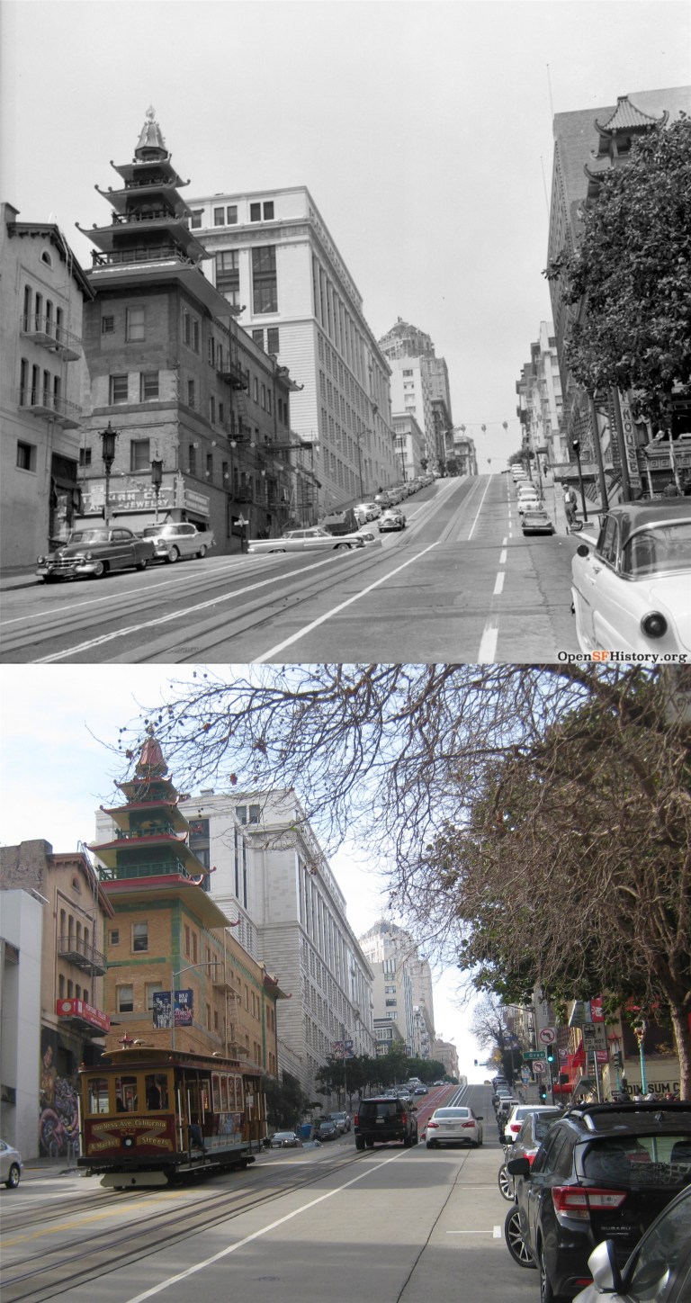 {We turned the corner where the five-tiered pagoda towers stand, green and yellow faded to chartreuse.}
 {We turned down Sacramento Street through the crowded section where Chinatown streams across it into the deserted stretch toward Montgomery Street. There was a parking lot on either side of the restaurant we were going to.}
 ‘Murder Loves Company’ is a long out of print book written in 1940 by John Mersereau. It takes place during the second year of the Golden Gate International Fair on Treasure Island. Although, corny at times, it’s page-packed with descriptions of many of the fair’s attractions and the best first-hand account of the world’s fair you’ll get in a book of fiction.
 The book opens up with a deadly accident just east of the Yerba Buena Tunnel that nearly involves Professor Biddle and a lady reporter named Kay Ritchie as they exit the tunnel while driving across the Bay Bridge to Berkeley.
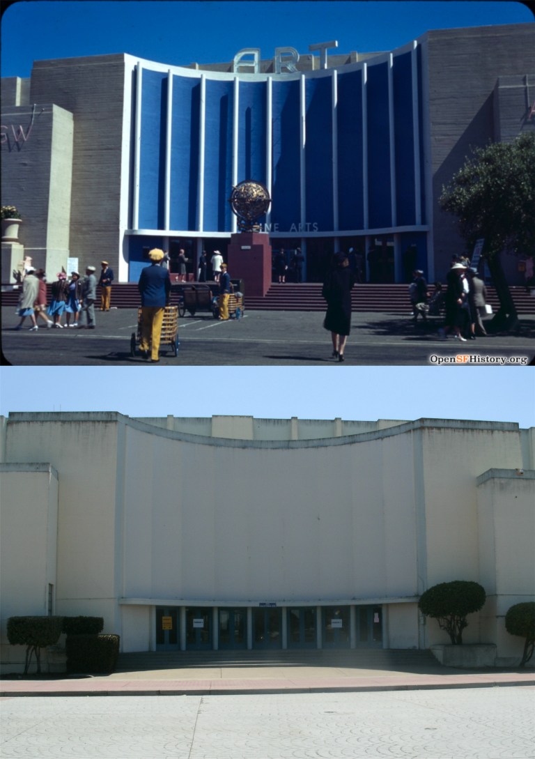 Later on in a visit to the fair, the book describes the Treasure Island attraction this way as Professor Biddle takes a ferryboat to the fair
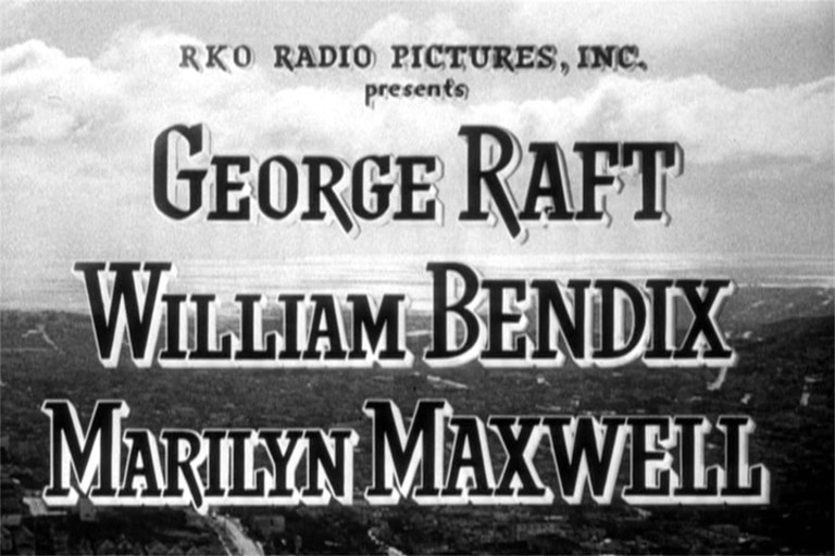
 The film stars George Raft. Raft originally made it on the map with his coin flipping gangster scenes in the 1932 movie ‘Scarface’ with Paul Muni. Check out Bugs Bunny’s George Raft impersonation on the link below.
 Raft’s girlfriend is Marilyn Maxwell, who helped introduce the song ‘Silver Bells’ with Bob Hope in ‘The Lemon Drop Kid’ from 1951.
 The film also co-stars Harry Morgan, probably most famous as Colonel Potter in the television show ‘M*A*S*H’.
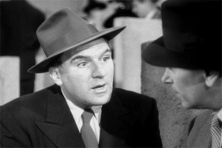 But to me the star of the movie is the character actor William Bendix. I like him in everything he was in. His best role was probably Gus in Alfred Hitchcock’s 1944 film ‘Lifeboat’. “Give us a kiss, toots.” Gus says to Tallulah Bankhead as she’s about to assist in amputating his leg. (She does) Bendix plays a nice guy cop trying to keep Raft out of trouble.
 The movie shows a panoramic sweep of San Francisco from Twin Peaks behind the opening credits.
 The view from Twin Peaks now:
 The movie opens up with a 1948 view from the Top of the Mark.
 The story starts out showing a number of San Francisco locations. This is the cable car turnaround at Powell and Market Streets looking toward Eddy Street. The building with the Gray’s Suits advertisement was demolished and Eddy no longer cuts through to Market Street. This is where Hallidie Plaza is now. You can see the old JC Penny’s Store building on the corner of 5th and Market Streets in both pictures.
 This is Montgomery Street at Market Street looking north.
 The action starts with a customer going into the clothes store front for Raft’s bookie business on Post Street across from Union Square. The building the clothes store was in may have been the fashionable men’s store, Bullock & Jones, which is now Williams-Sonora. The building is still there.
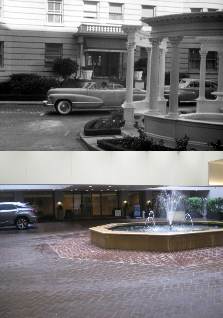
 Raft’s squeeze, Marilyn Maxwell, lives in the Stanford Court Building on Nob Hill on California Street. Here, they’re leaving the courtyard, still there but not as fancy.
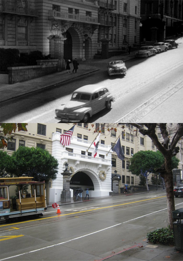 They merge onto California Street across from the Fairmont Hotel.
 They cross Powell Street at California Street, the only place where the three remaining cable car lines cross each other.
 The two head down California Street past the old Crest Garage, demolished in 2018.
 The view down California Street from here now:
 Raft lives on Nob Hill as well at an apartment building on the southwest corner of Jones and California Streets. The tall building in the far background is the old Empire Hotel Building in the Civic Center area. You can just barely see it through the rainy mist in my picture.
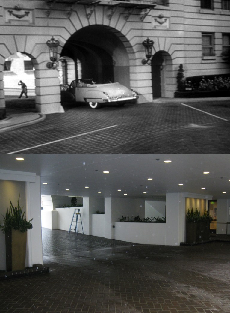
 He drives down the west side of Nob Hill and turns into his parking garage.
 I’ll have to ask my arborist friend, Tony, if that could possibly be the same hedge that was growing there in 1948. He’ll probably think that’s a ridiculous question, but I have vines growing in the back yard of my house that go back to the 1960s.
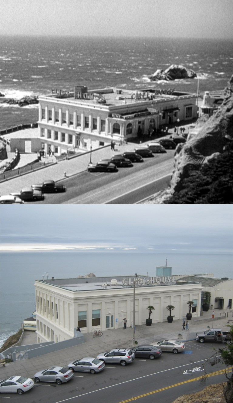
 The movie even takes a trip out to the Cliff House where Raft has lunch with his sister who is worried about his prospects for bucking the mob. Seal Rocks are in the background of the lunch scene.
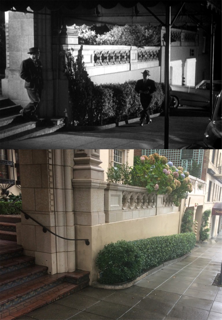
 I’ll close with a few of the scenes filmed at night. Refusing to be intimidated by the mob, Raft is intercepted by one of “the boys” going into his apartment. I’ll bet he has a gun in his pocket! I’m bright about things like that.
 Raft gets taken for the proverbial “ride”. It’s never a good sign when one of the hoods gets in the back seat with you and not in the empty front seat.
 Mr. Big, played by Frank Faylen, tells Raft he had better get in line. This would certainly persuade me! Raft plays along with him to bide time, although they rough him up pretty good.
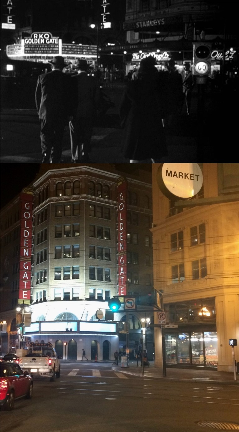 In one scene, Bendix tries to talk Raft out of taking the mob on without involving the police as they cross Market Street from 6th Street toward the Golden Gate Theater, at that time owned by Howard Hughes’ RKO Movie Studio.
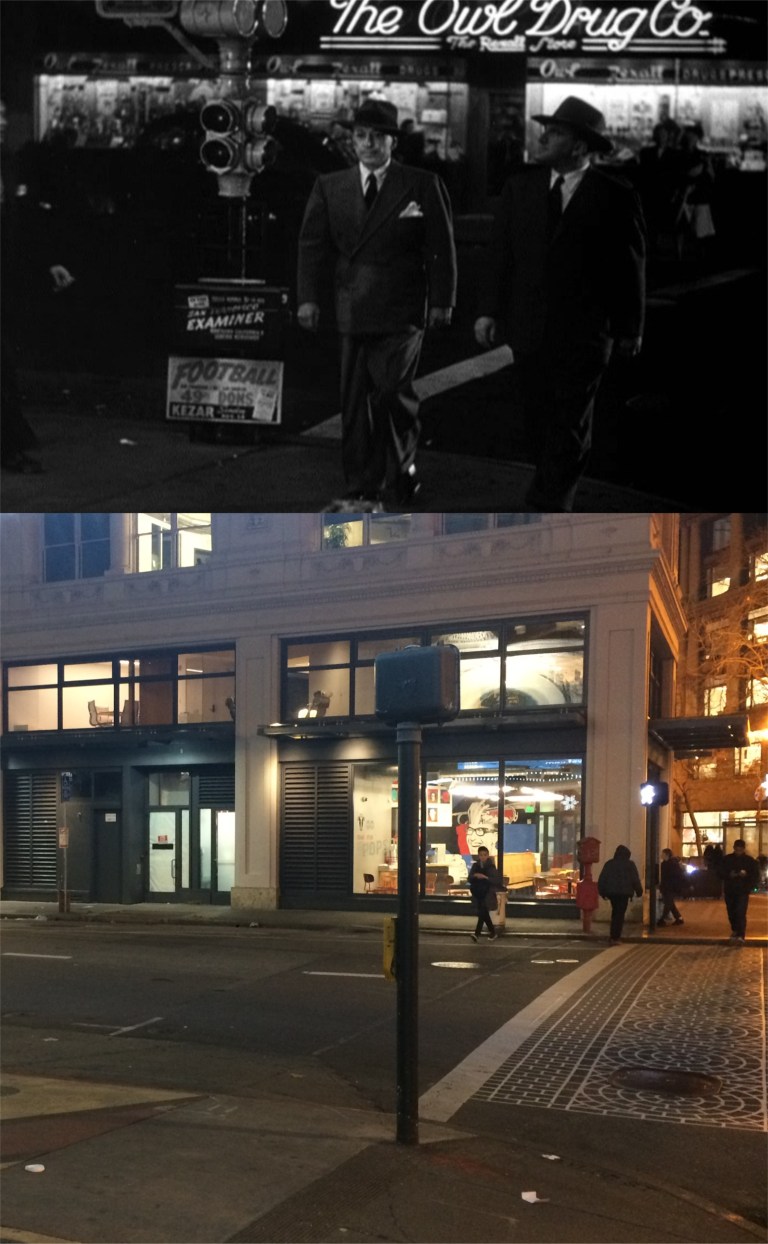
 The movie ends back where it began at the Top of the Mark for a nighttime view of the City, and closes out overlooking the Embarcadero and the Bay Bridge. The closing music even plays a little of ‘San Francisco’ from the 1936 movie.
 Nick and Nora Charles getting pulled over on the Bay Bridge while they were heading east to the Golden Gate Fields in Albany in the 1941 film ‘The Shadow of the Thin Man’. A lot of new buildings have sprung up in SOMA since I took this picture about 7 years ago.
 I should redo this one I did in 2013 in honor of the closing at the end of this year after running for over 45 years of the San Francisco musical ‘Beach Blanket Babylon’.
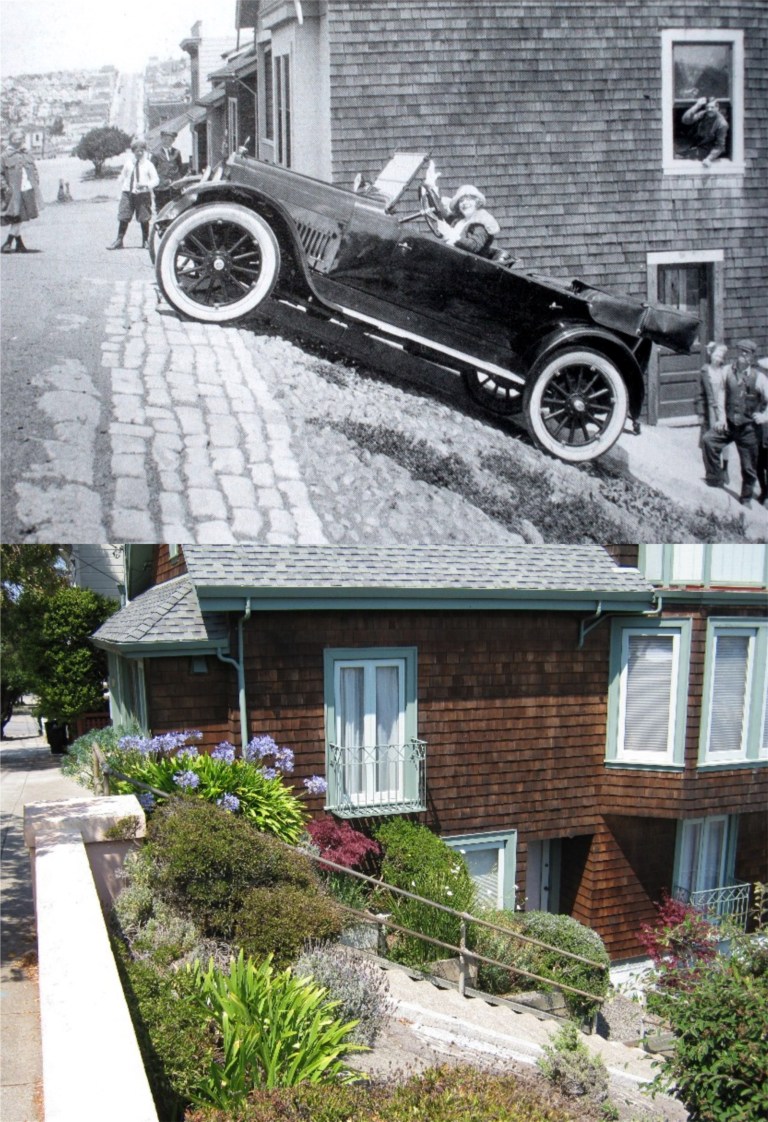 I’d like to redo this 1920’s photo from the Image of America Series taken at the top of Duncan Street in Noe Valley just to go there again.
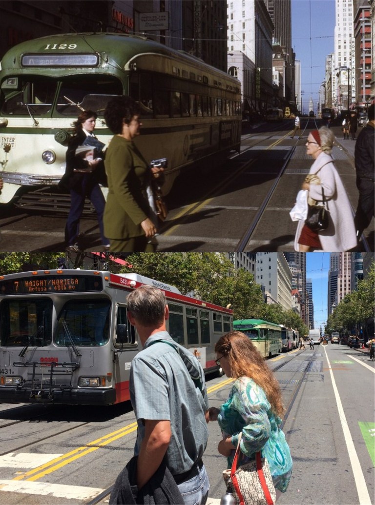 Market Street at Powell Street in the 70s: Ah, if only the vintage F Line streetcar behind the number 7 Muni bus would have been the one in the lead!
 I was leaving Treasure Island with friends in October of 2014 when this view of the eastern span of the Bay Bridge being dismantled reminded me of a fuzzy picture had in my computer of the bridge being built from this angle. I snapped a quick picture as we passed. I’d like to redo it, but never will.
 Looking south toward the old Southern Pacific Train Depot and the Lefty O’Doul Bridge from Brannan Street in the 1940’s: I’ll have to borrow someone’s crane if I’m going to get this one accurate in a redo.
 The opening of the Bay Bridge in November of 1936: As I mentioned in the opening picture to this post, a lot of new buildings have sprung up in the background since I took this picture in January of 2015.
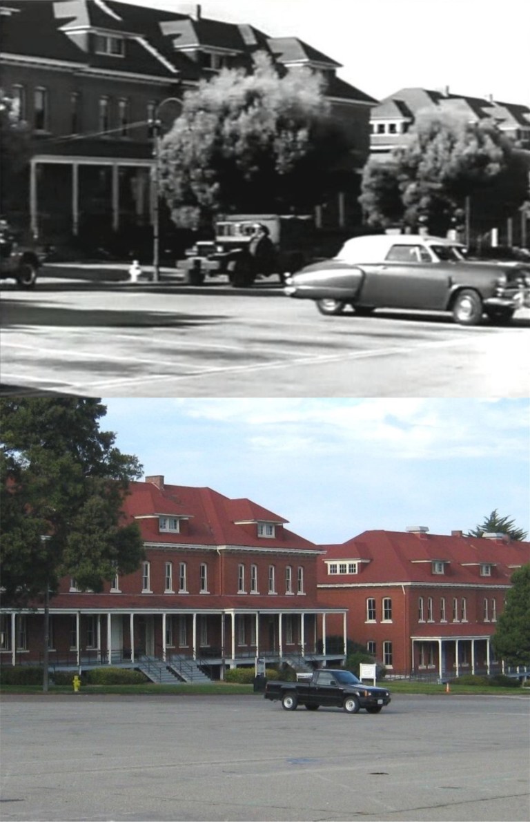 The old Montgomery Barracks in a scene from an odd 1950 film called ‘Experiment Alcatraz: Here, prisoners from Alcatraz Prison are being transported by the army to a location in the Presidio to participate in a medical experiment that may earn them their freedom. To me, the star of these pictures is my old truck that still runs. This area is all grass now, and more visitor friendly than when I took the original picture.
 I should probably redo this one on a regular basis to see if this building on the corner of Hayes and Laguna Street continues to survive. This was where the dental office of John McTeague was located in the 1924 film ‘Greed’, a movie that is considered one of the greatest films of all time.
 Almost a perfect matchup, except that I’m 210 feet higher than from where the vintage postcard was taken: I’ll redo it from the Coit Tower parking lot instead of at the top of the tower after they cut back all of those trees blocking most of the view from the parking lot nowadays.
 Buffalo Bill at the Cliff House: I’d give anything to redo this one if my best friend could be in it again.
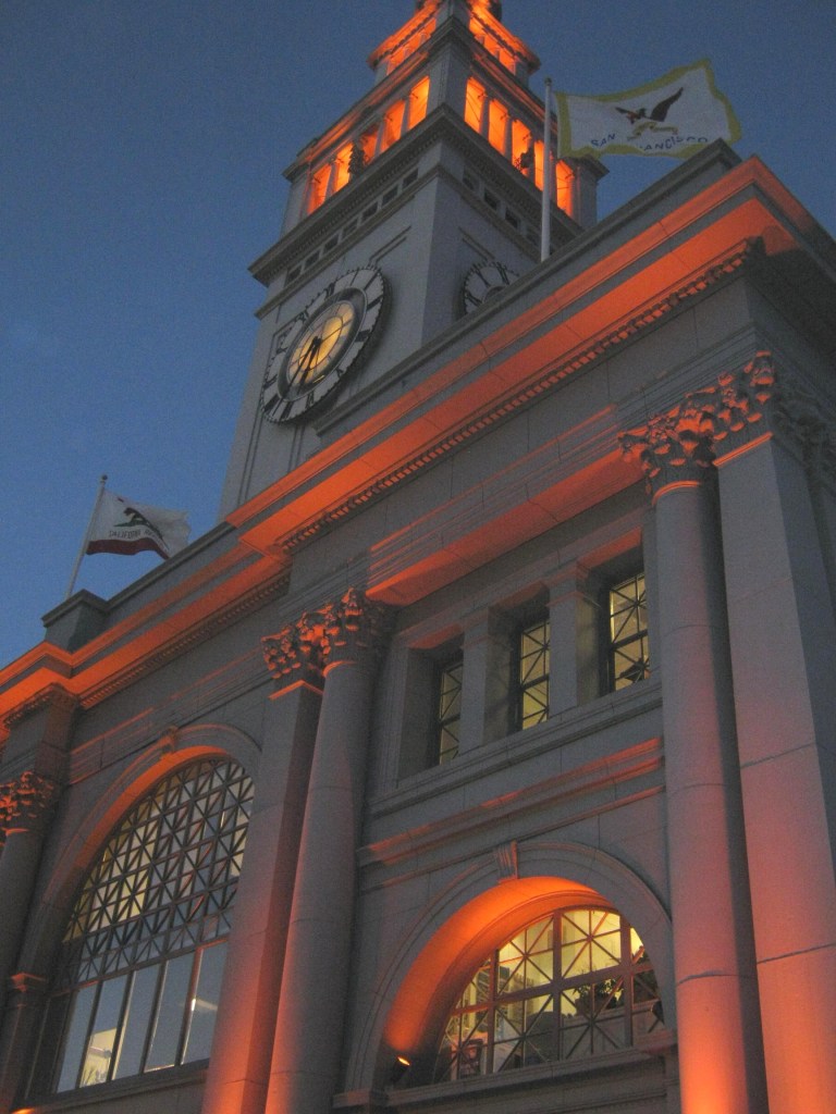 The Ferry Building on Halloween, 2010: No, that orange wasn’t for Halloween, the Giants were just about to win their first World Series in San Francisco. I’ll redo it again the next time they win the World Series.
 Last February I mentioned that someday I’d like to redo the top then and now picture I posted of the east entrance to the Union Square Garage taken during the 1940s. The source of the vintage picture was the Facebook page San Francisco Remembered. The Stockton Street construction on the Muni Metro extension to Chinatown made for a poor comparison picture back then. They’ve finished this portion of the new rail line and I was able to get a better then and now picture in between rain showers today. Back in the 40s Union Square had four entrances and exits; north, south, east and west. Today, there’s only the north and south drive-through on Post Street and Geary Street.
 With lower Stockton Street open again after so many years they’re not about to close it again, so they moved the street mall to Grant Avenue between Geary Blvd. and Post Street, and Maiden Lane. The vintage picture here on Grant Avenue is from 1960. (Source, opensfhistory.org)
 The pedestrian mall used to run along Stockton Street from Market Street to Geary Blvd for years. This picture of mine was taken in 2016 between O’Farrell Street and Geary looking toward the old Macy’s clock. The vintage picture is from the 1940’s.
 There were a lot of Maidens in Maiden Lane in this picture from 1949. (opensfhistory.org)
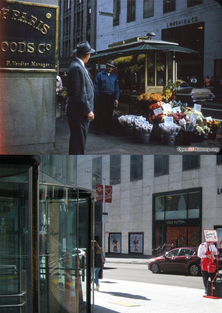 The southeast corner of Stockton Street and Geary St. in 1958, looking toward the old I Magnin Department Store: The vintage picture was taken near the entrance of the much loved City of Paris Department Store. (opensfhistory.org)
 The City of Paris seen from Union Square in the 1940s: Forsaking a rally to save the old landmark building, it was demolished in 1979. The Neiman Marcus Department Store is there today. (SF Chronicle)
 Neiman Marcus had the class to save the painted glass ceiling from the rotunda of the City of Paris, and you can step back in time for a minute when you go up to look at it. (SF Chronicle)
 The northwest corner of Geary St. and Stockton Street looking toward Union Square during the 1950s: (San Francisco Pictures Blog)
 I’ve been waiting for awhile for them to clear the construction off Stockton Street from the MUNI expansion to Chinatown so I could get a comparison picture of this Charles Cushman Collection, looking past Maiden Lane toward Post Street in the 1950s.
 The north entrance to the Union Square Parking Garage on Post Street in 1967: The vintage picture is a nice time capsule. (San Francisco Pictures Blog)
 A gloomy 1987 picture along Post Street from Powell Street in 1987: San Francisco has had days like the older picture a lot recently, but yesterday was a little nicer. (San Francisco Pictures Blog, Rob Weststrate)
 The Ferry Building and the Ferry Building: The bottom picture is a gingerbread Ferry Building on display this season in the lobby of the Ferry Building
 Jefferson and Taylor Streets looking north, probably the most recognizable view of Fisherman’s Wharf and one of the most photographed intersections in the city: The vintage picture is from 1953. (San Francisco Pictures blog)
 One block south of the previous picture on Taylor Street in 1956: Somebody didn’t take very good care of this old picture.
 Looking southwest along Taylor Street from Jefferson in 1963: The Z backwards K Gallery is where the old Sea Captain’s Gift Shop used to be. Personally, I think Fisherman’s Wharf lost a little of its atmosphere when that gift shop went out of business. (San Francisco Pictures blog)
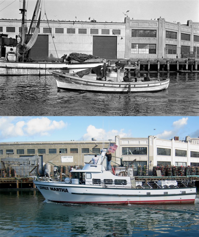 Pier 45, Shed B at Fisherman’s Wharf in 1932: Those baskets on the pier in my picture are crab nets being stored on Pier 45 until crab season opens.
 The Fisherman’s Wharf Boat Lagoon in 1955: Now, you see, here’s the way my mind works; the vintage picture doesn’t say anything about who the three gentlemen on the left were, but I see three plain clothes cops investigating a crime scene. It could have been. Somewhere underneath all those crab nets in my picture are a fleet of fishing boats. (Opensfhistory.org)
 The end of Taylor Street north of Jefferson in the 1930s: I had a better line up with the old picture here on Taylor Street, but then a line of vintage cars past by and I took this picture. I like the two sea gulls on either side of the procession watching the vintage autos pass; a couple of car buffs. (Opensfhistory.org)
 The best views from land in San Francisco of Alcatraz Island are from Fisherman’s Wharf, seen in both these pictures from the very end of Pier 45. The vintage picture was taken in 1935. Al Capone and “Machine Gun” Kelly were on the island when the old picture was taken. The ferryboat was leaving from the Hyde Street Pier for Berkeley. . (Opensfhistory.org)
 Three blocks south of Fisherman’s Wharf is the cable car turnaround at Bay and Taylor Streets, seen in 1964. It used to take only one person to push the car off the turntable back then. (San Francisco Pictures blog)
 Although there’s no geographical boundary I know of, the general rule is that the western side of Fisherman’s Wharf ends at the Hyde Street Pier. I wasn’t really going any further in this direction anyway. Still, I figured that I’d just shoot through the fence and tell people who worry about me that I ignored the sign.