
It’s the 4th of July weekend, and a perfect day to head to the Beach!
“Hey, this ain’t a beach, Tim!
“You misunderstood me, I’m referring to Beach Street.”
No, there isn’t anymore beach along Beach Street, although Louis Loewenstein, in his book about the origins of San Francisco street names, writes that the beach actually did come up to Beach Street before landfill put the street a block away in the Fisherman’s Wharf area, and two blocks away in the Marina. Traveling east to west, Beach Street starts at the Embarcadero, disappears completely at Fort Mason, then reappears in the Marina District, running all the way to the Palace of Fine Arts. My walk was west to east from Fort Mason to the Embarcadero. (Thumbnail images)
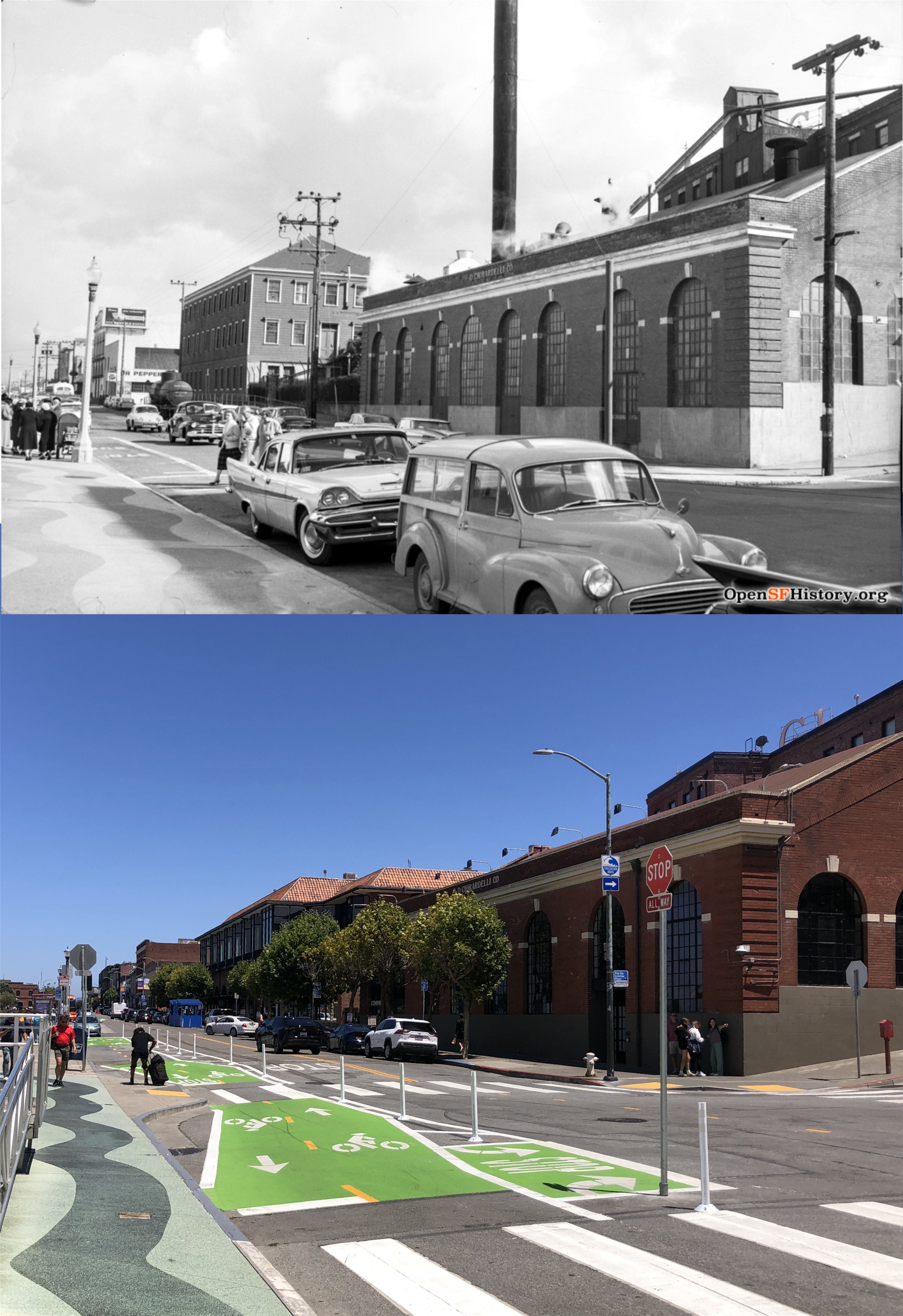
We’ll start at the Polk and Beach Street, looking toward Ghirardelli Square from the Maritime Museum in a vintage 1962 picture from opensfhistory.org. The sidewalk in front of the museum still has the same waves on it.
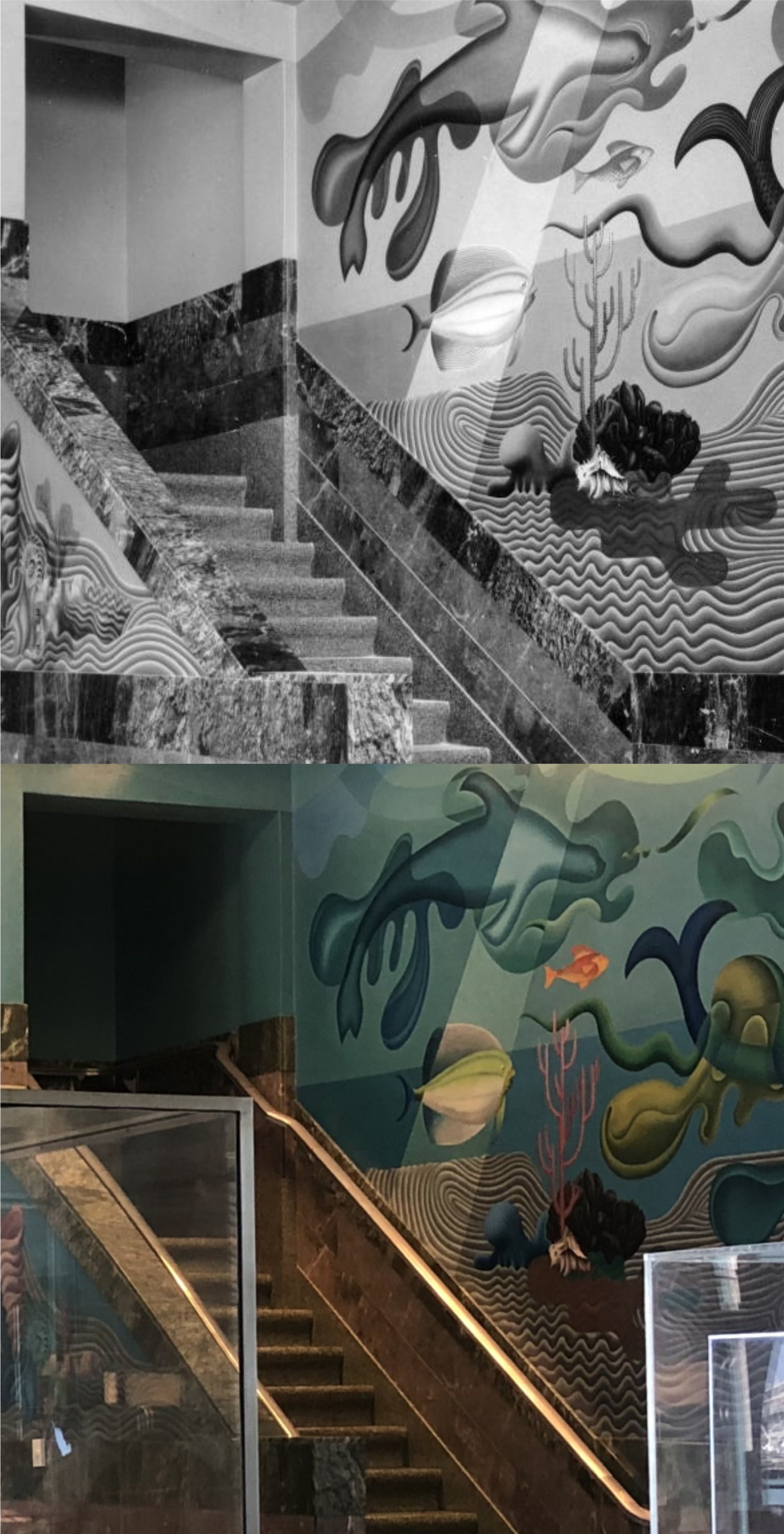
Let’s step inside the museum to look at some of the artwork on the walls, beautifully unchanged since the building opened up as a bathhouse and casino in 1939. (San Francisco Library Digital Archives)
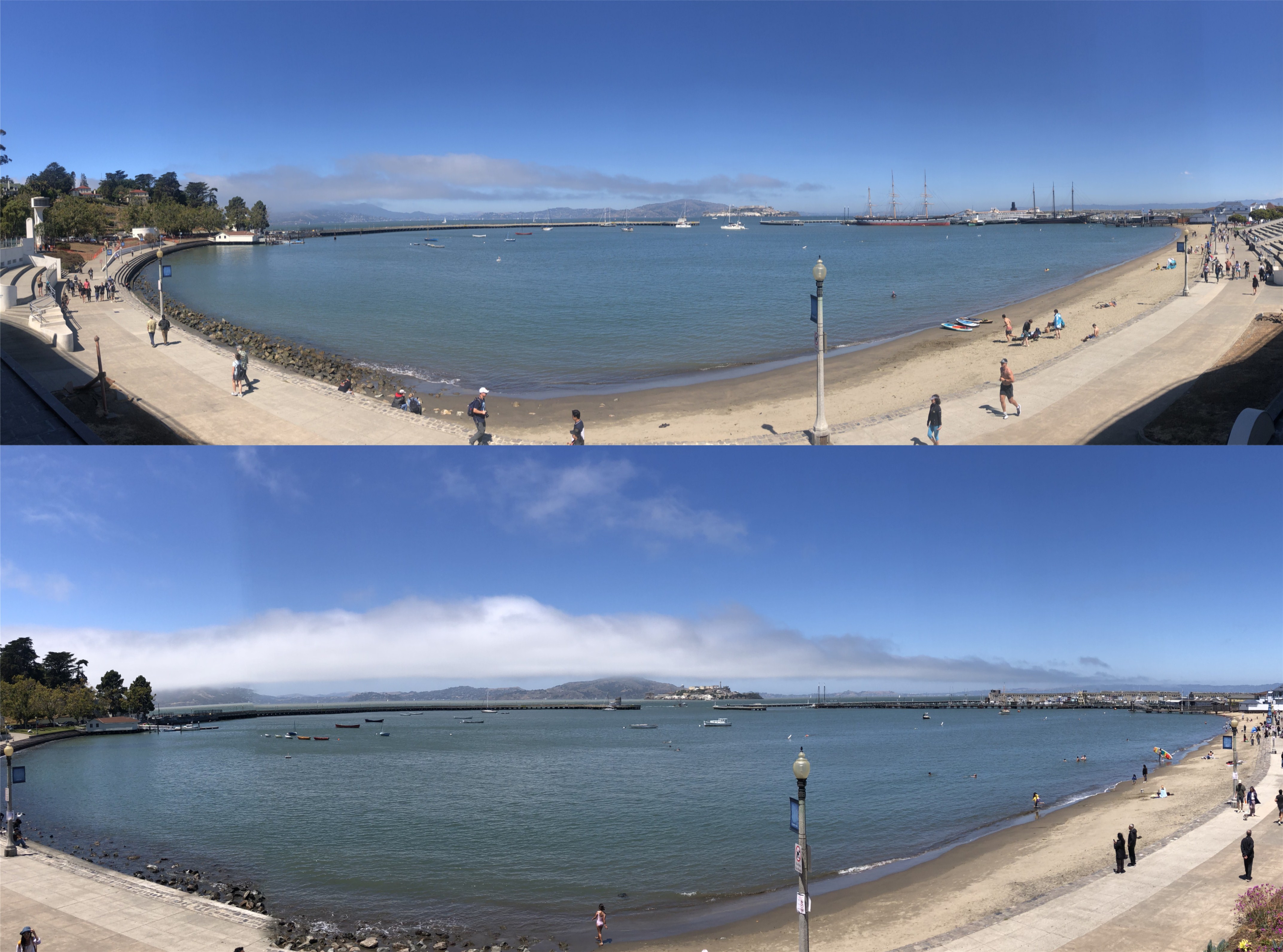
The closest you’ll get to the beach on Beach Street is from behind the Maritime Museum. The last time I visited the museum in 2023 and took the top wide angle picture, all of the historic ships at the Hyde Street Pier on the right were still there. They’ve all been moved out of San Francisco now while the pier is being restored.
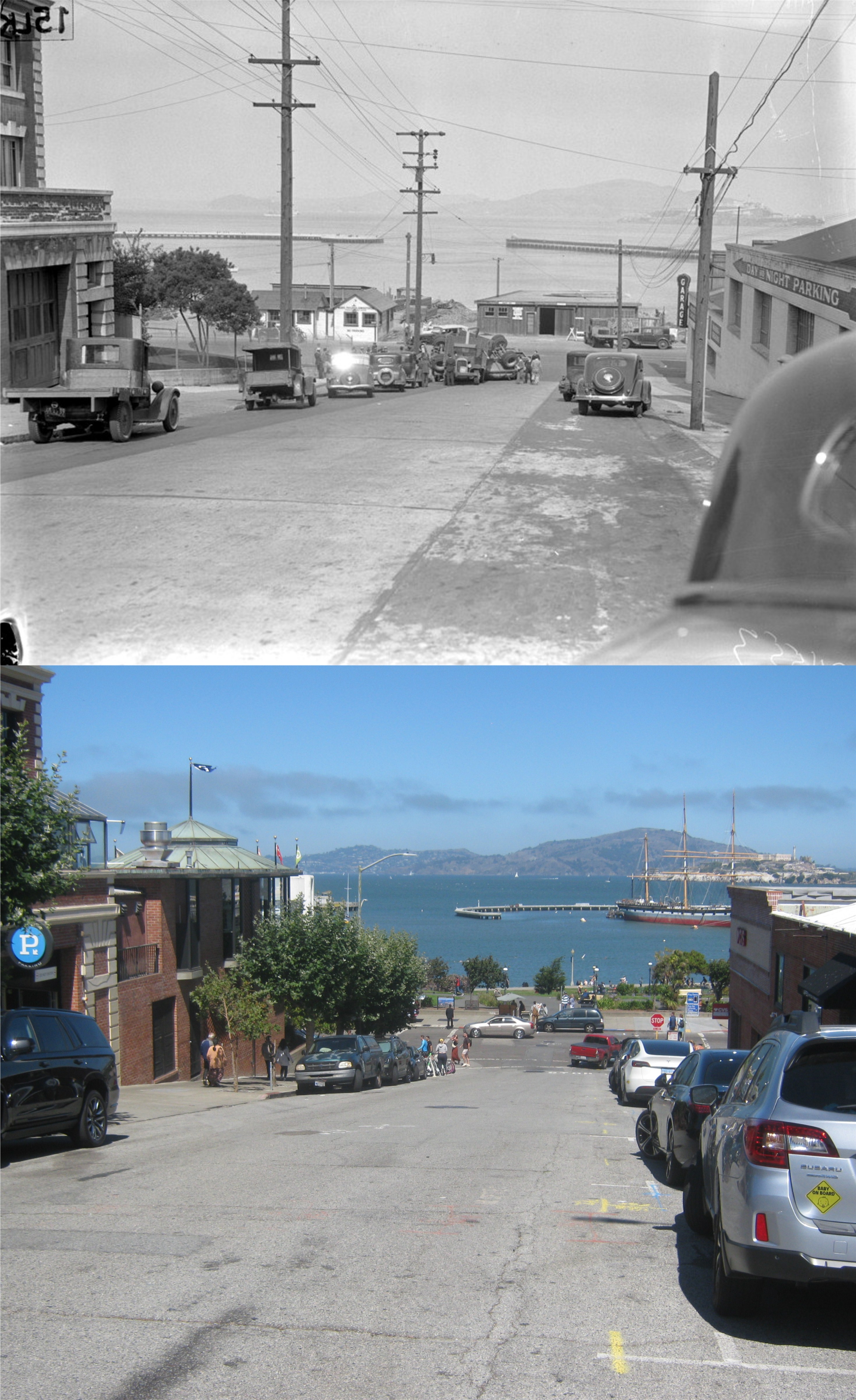
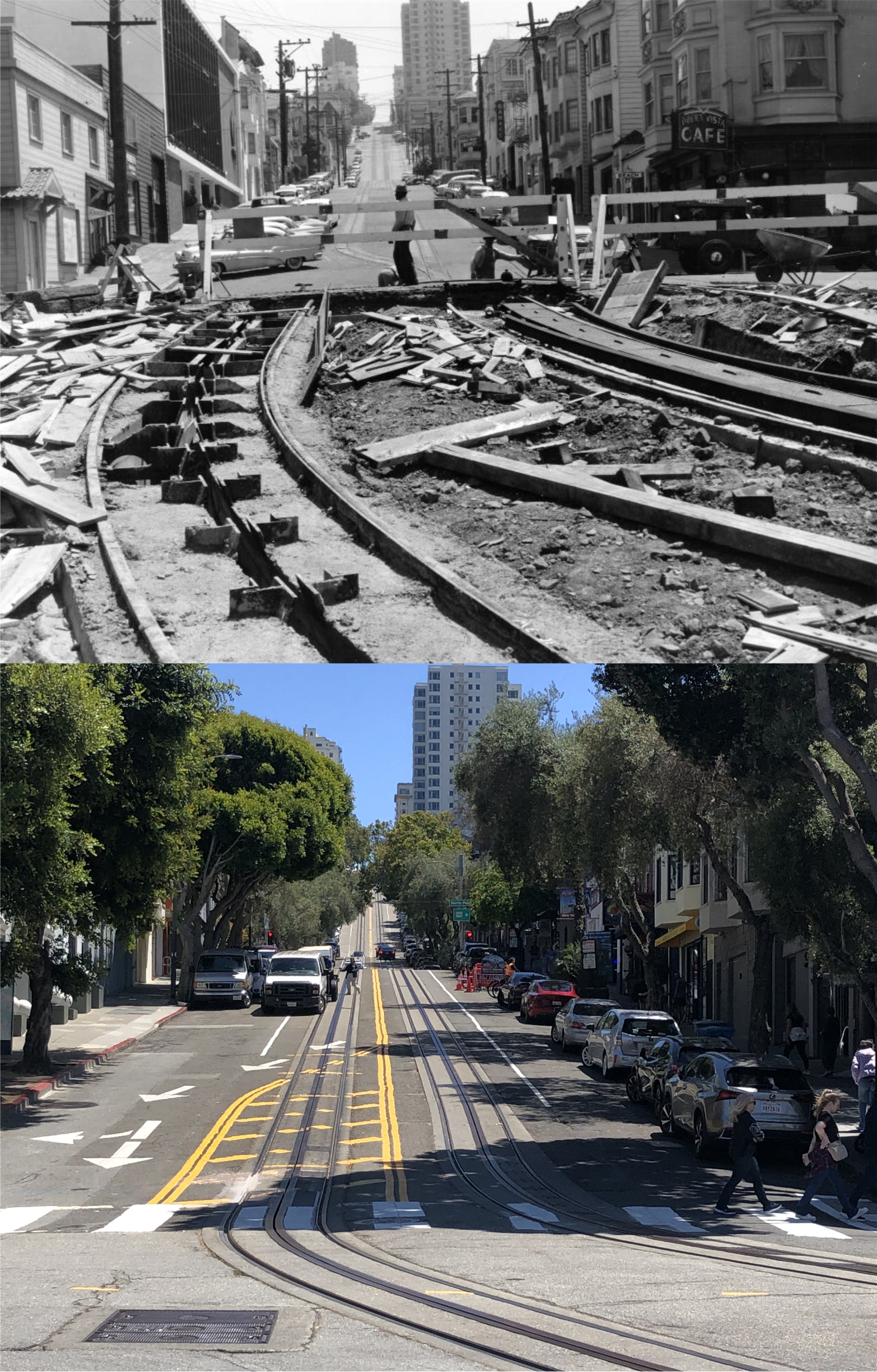
Looking down Larkin Street toward Beach at an overturned truck in a 1937 photo from the UC Berkeley Library Archives. You can see a portion of the Ghirardelli Tower Building on the left in both pictures.

The old Rolphe’s Restaurant in a 1964 photo in June of 1964 from Alan Canterbury: Canterbury took a lot of pictures around San Francisco in 1964 that are available to view on the San Francisco Library Digital Archives. The building now houses several hobby businesses.
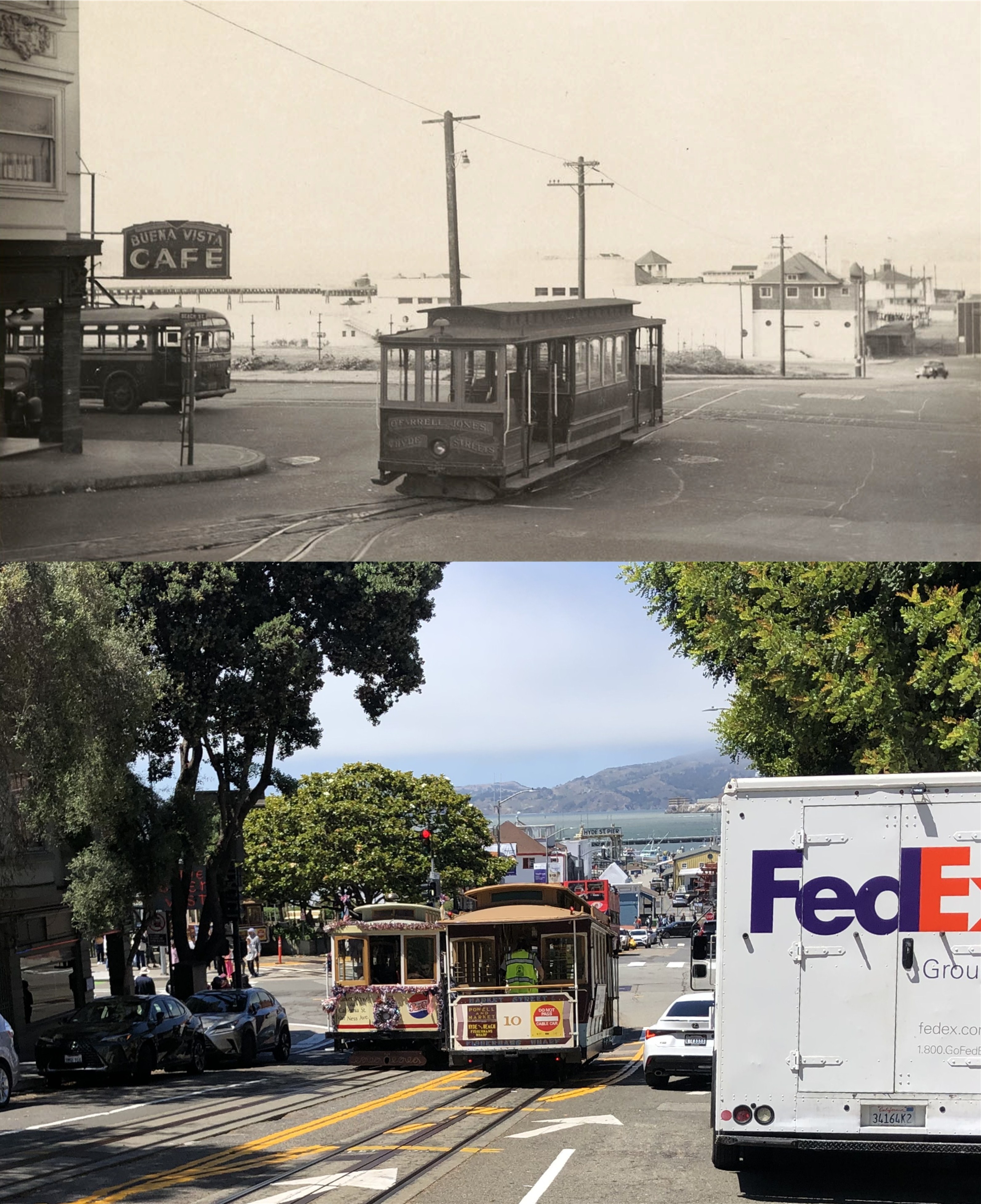
Probably the most popular portion of Beach Street is where it intersects with Hyde Street. Cable cars turn around in Victorian Square, and the Buena Vista Cafe serves Irish Coffees. The Buena Vista sign is barely visible through the tree on the left. The vintage picture from the UC Berkeley Library Archives is from 1950.
In May of 1956, they ran the Hyde Street cable car line into the Victorian Square portion of Aquatic Park. In 1983 the turn in the tracks to the turntable were moved closer to the intersection of Beach and Hyde Streets. (San Francisco Library Digital Archives)
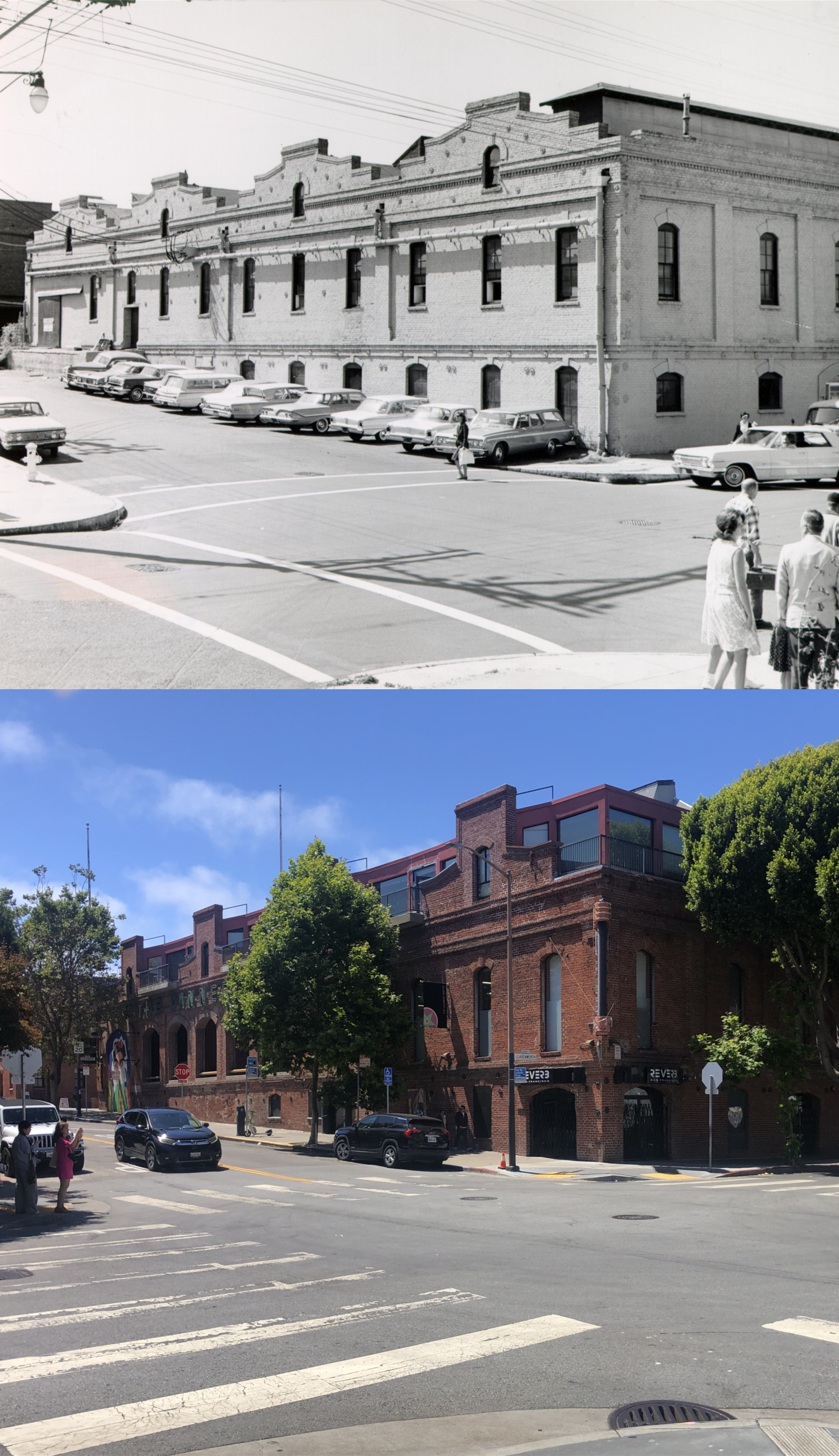
The Beach Street at Leavenworth side of the old Del Monte Cannery, in another Alan Canterbury picture from 1964: The Cannery opened in 1907, and is said to have been built on bricks from buildings destroyed in the 1906 Earthquake and Fire. (San Francisco Library Digital Archives)
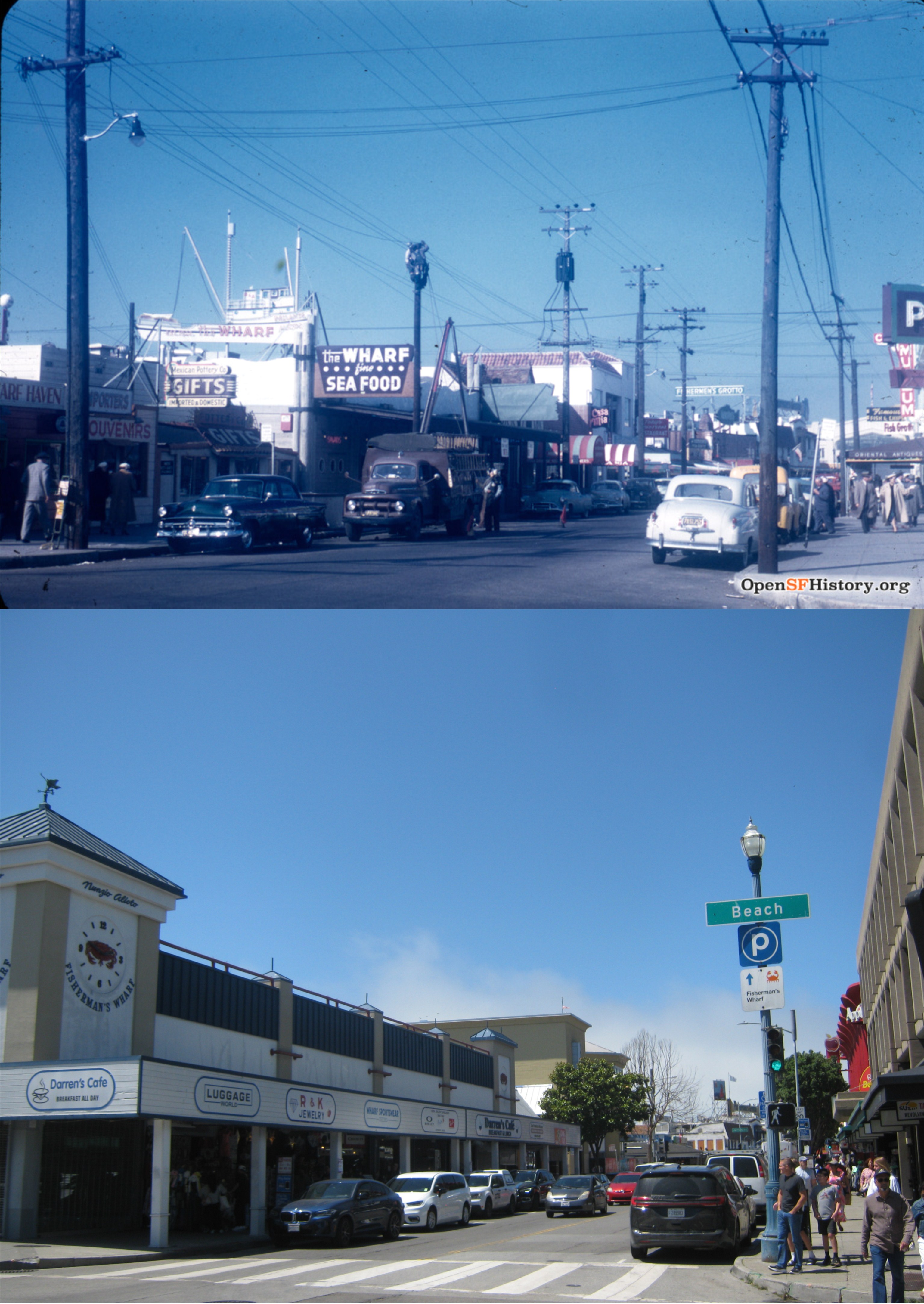
Beach Street at Taylor, looking northwest toward Fisherman’s Wharf in 1953, the way it used to look. Now it looks more like a gigantic model. You can see Fishermen’s #9 Grotto in the right background. (opensfhistory.org)
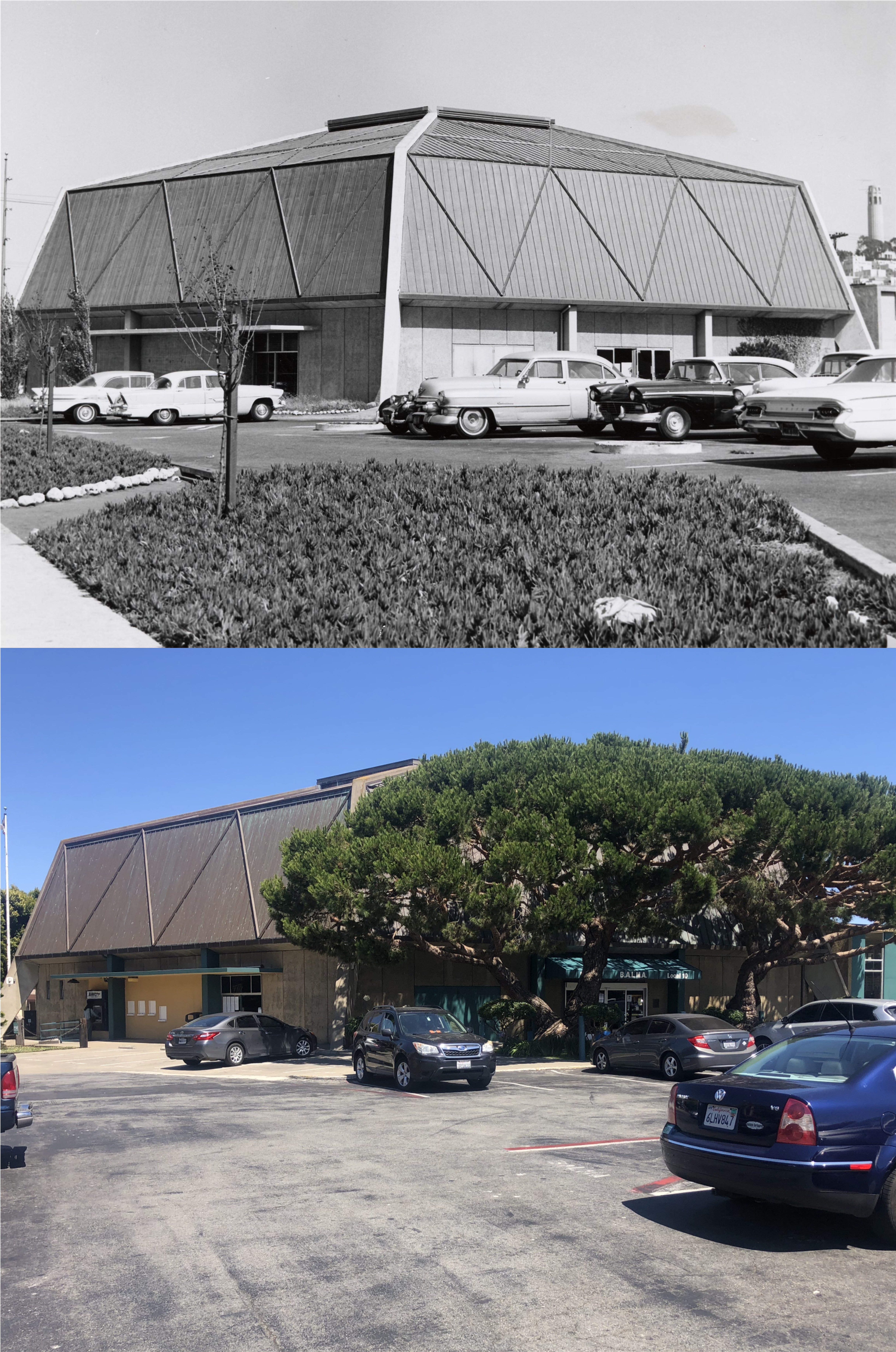
The Longshoreman’s Hall in a 1964 picture from…. you guessed it, Alan Canterbury. I discovered his pictures last fall, and have enjoyed updating many of his photos since then. You can’t see Coit Tower from here through the trees now. (San Francisco Library Digital Archives)
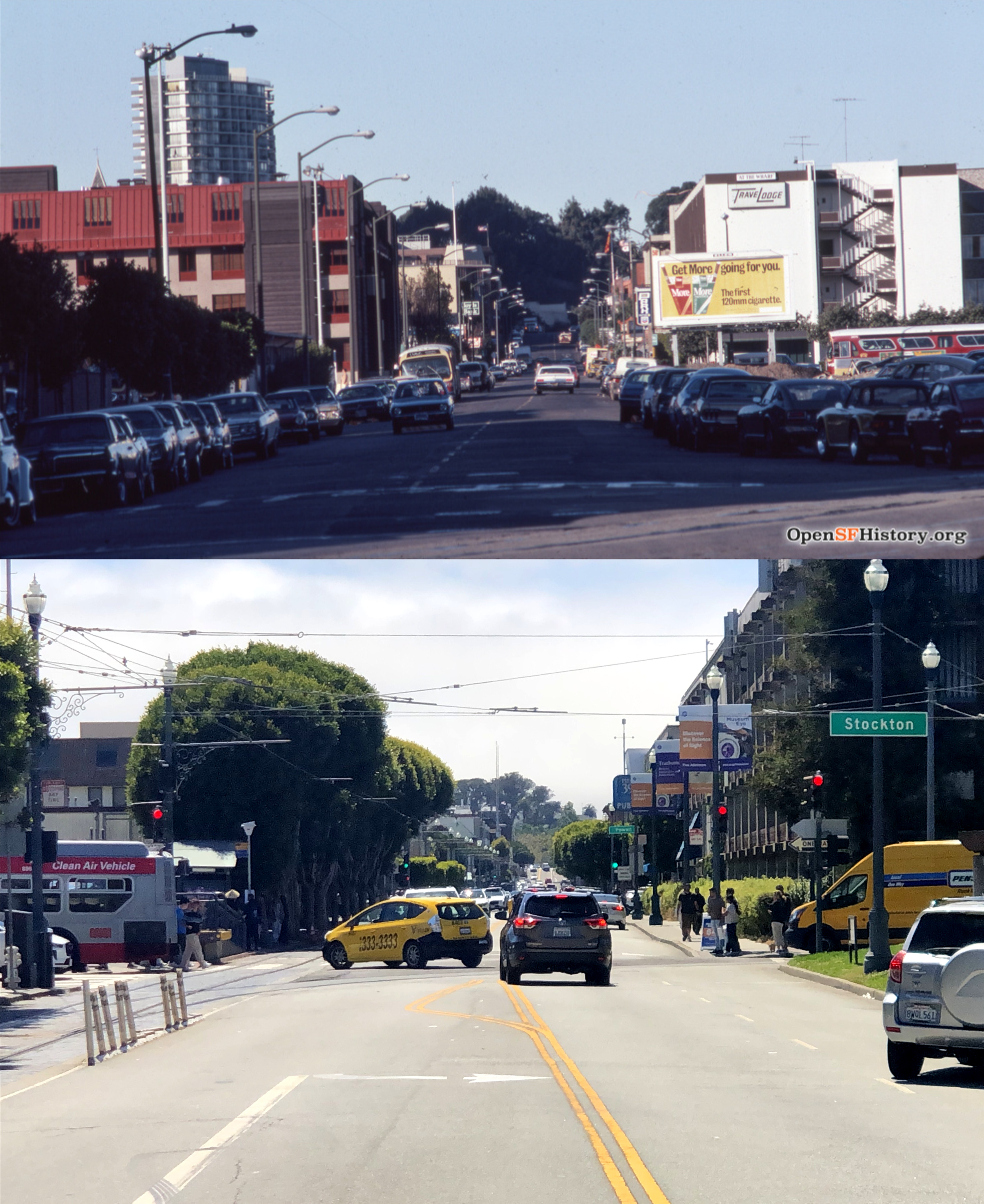
Looking west along Beach Street from Stockton Street in 1975: About the only thing noticeable still in my picture is the remodeled Riu Hotel building on the left. (opensfhistory.org)

You visited the Maritime Museum in 1923? The mural is very impressive because it is in such good condition after so many years. Even though it did not get painted over, a bit of age should be showing by now.
Oops! Gotta fix that typo!