Postcards from the past (Thumbnail images)

“Long past?”

“No, your past.”

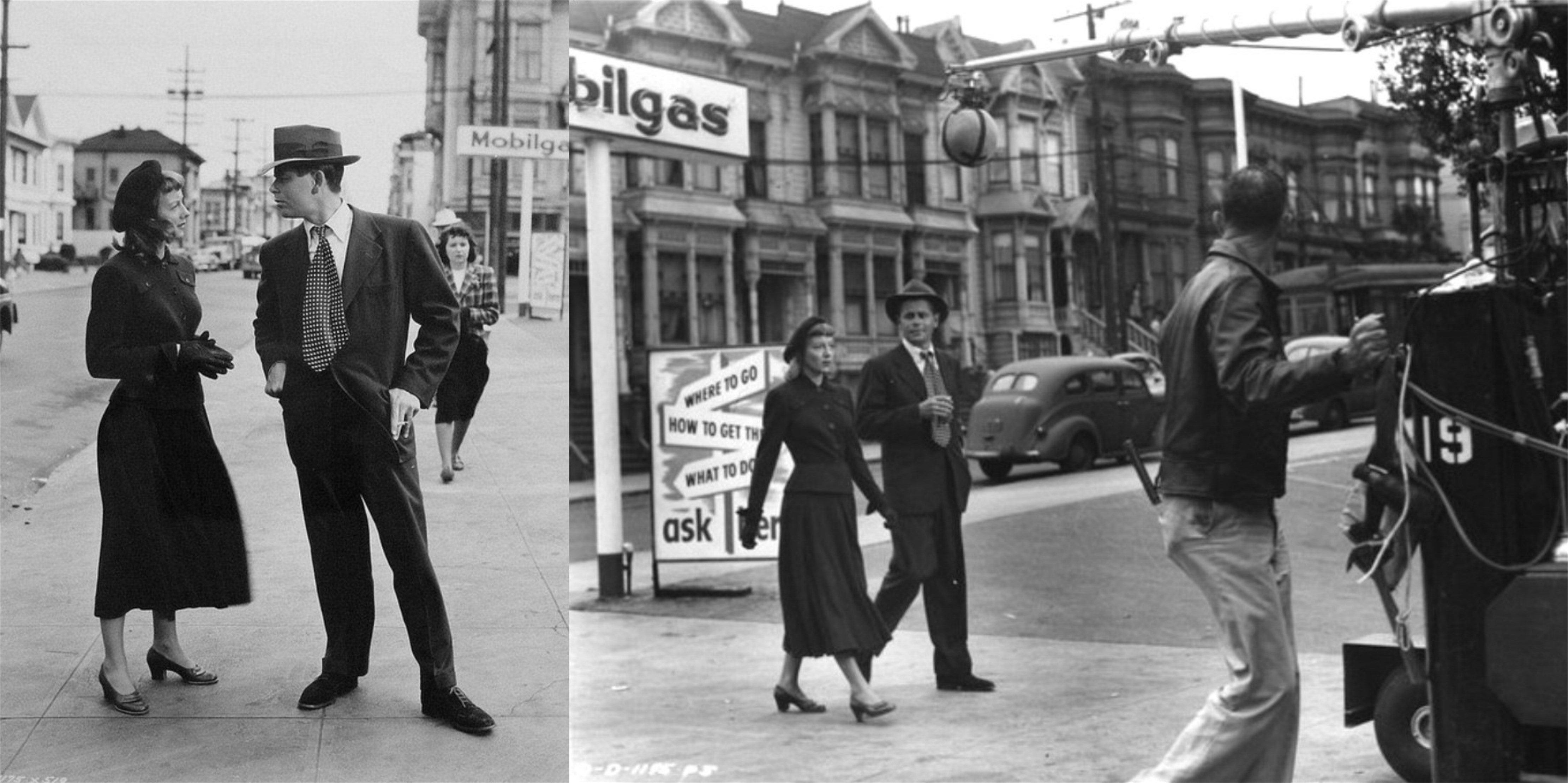
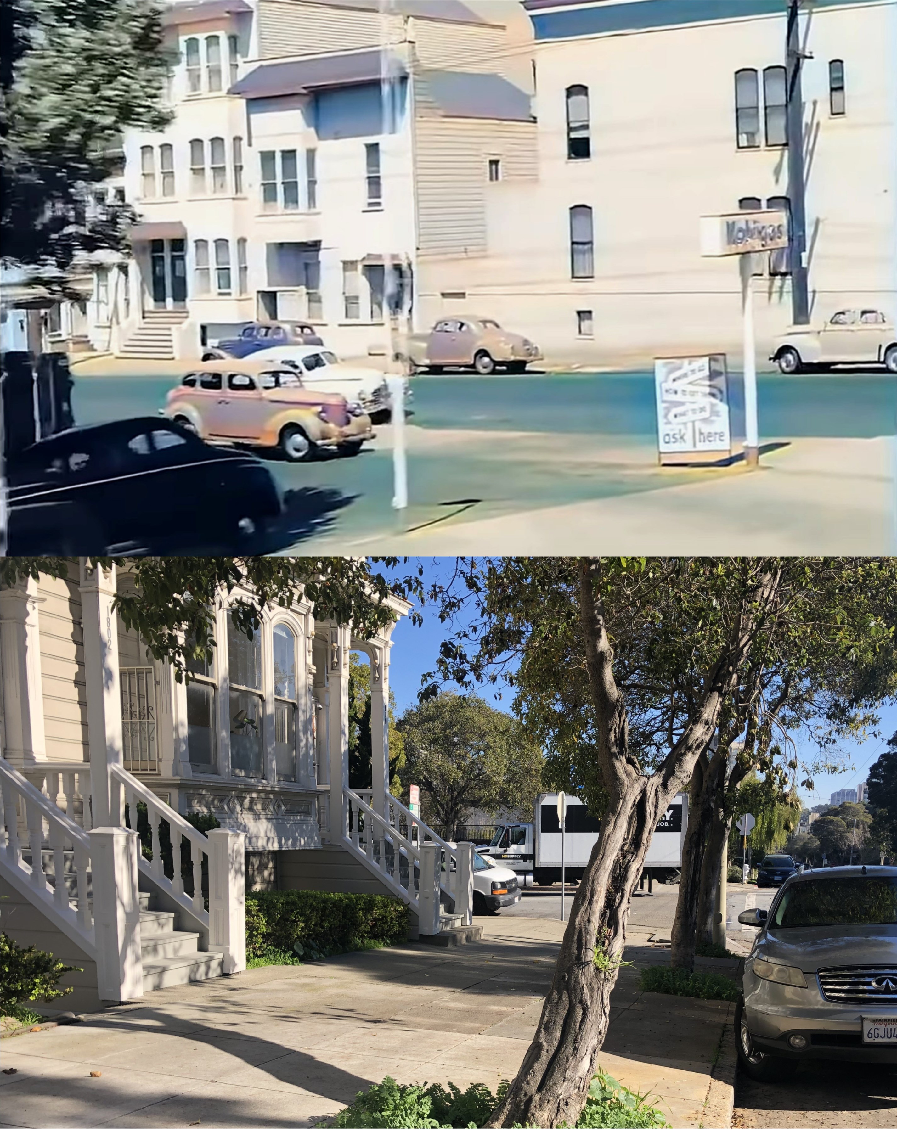
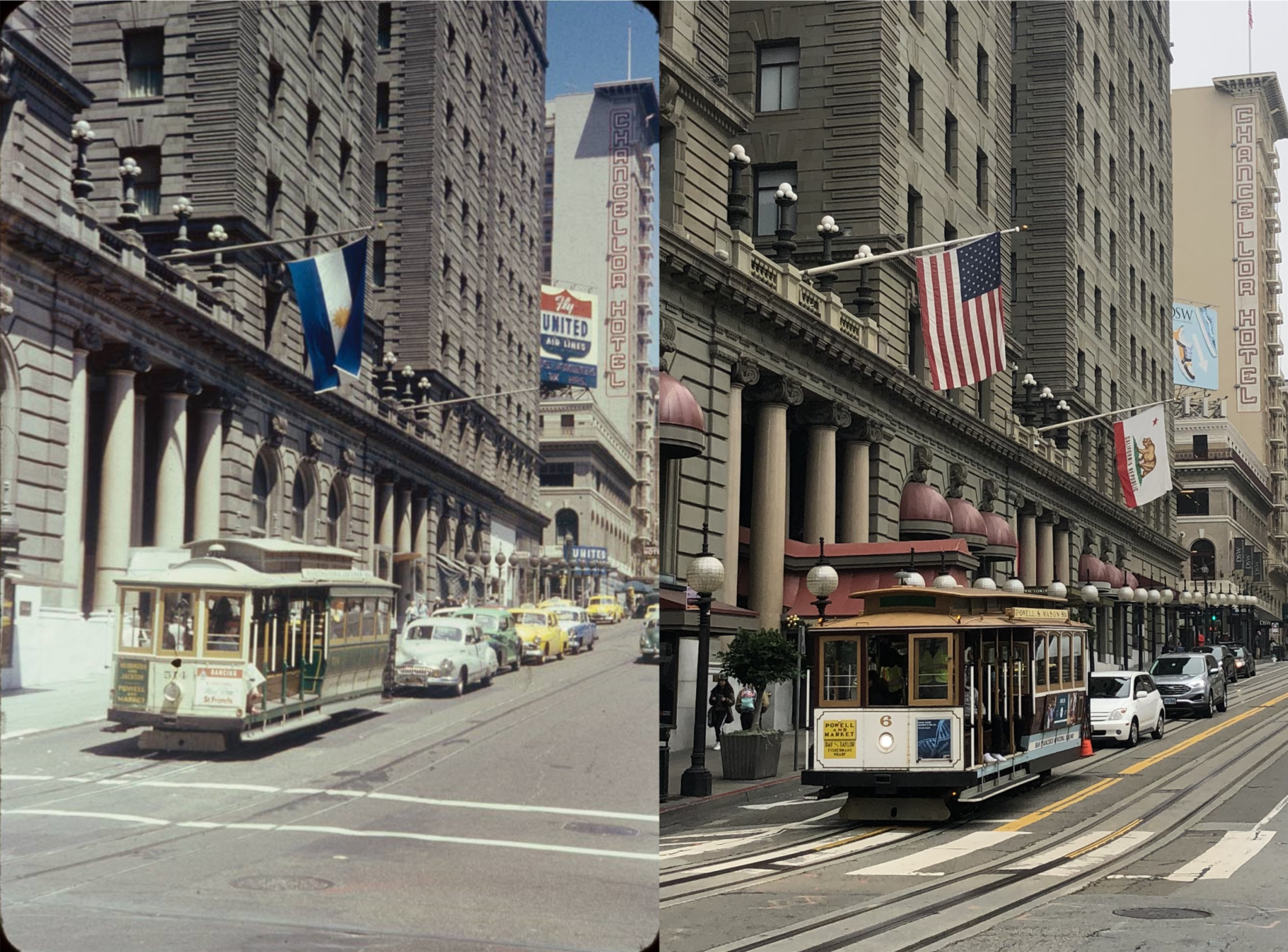
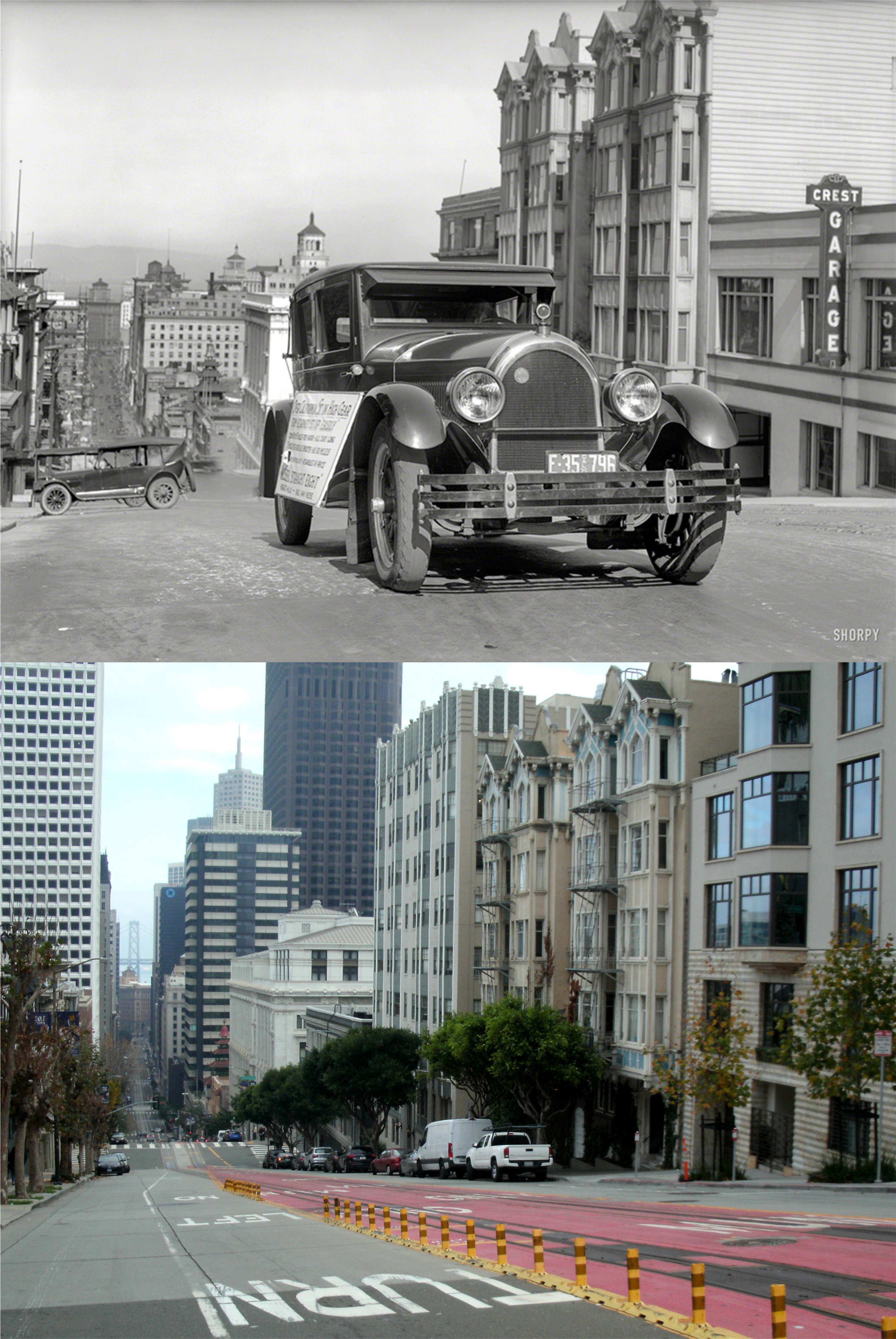
These are postcards of San Francisco that I bought when I was in high school. If I remember correctly, many of them I bought for a dime at the old Transbay Terminal Building when heading home from a day in SF. Progress has taken its toll on the beauty of the views in many of these postcards. I opened up with a line from Dickens ‘Christmas Carol’, so I’ll sum up the San Francisco you’ll see in a lot of these old postcards by quoting the last thing Jacob Marley’s ghost said to Ebenezer Scrooge;

“Look for me no more.”

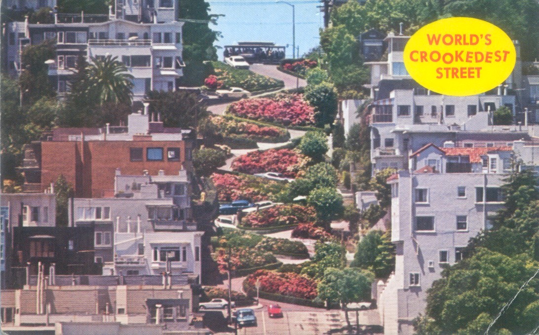
Lombard Street, “The World’s Crookedest Street”, to which Herb Caen added, “after Wall Street.”.

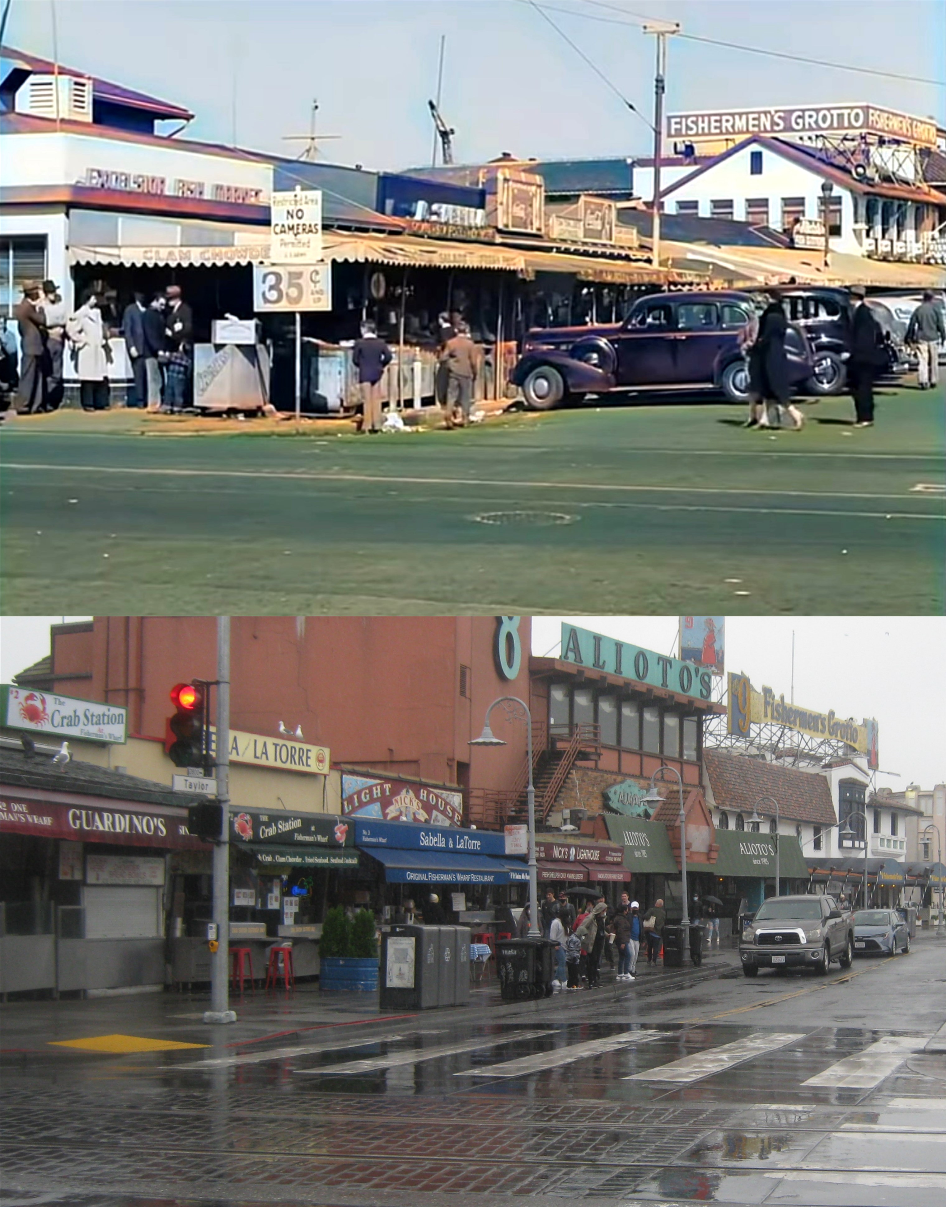
Looking toward Alioto’s, Fishermen’s Grotto, and Pier 45:

SOMA from Twin Peaks, with the Pacific Telephone Building the only skyscraper:


The Cliff House and Sutro Baths at Lands End: Sutro’s was gone and his postcard was already outdated when I bought it.

Civic Center, with the water pools still in front of City Hall:

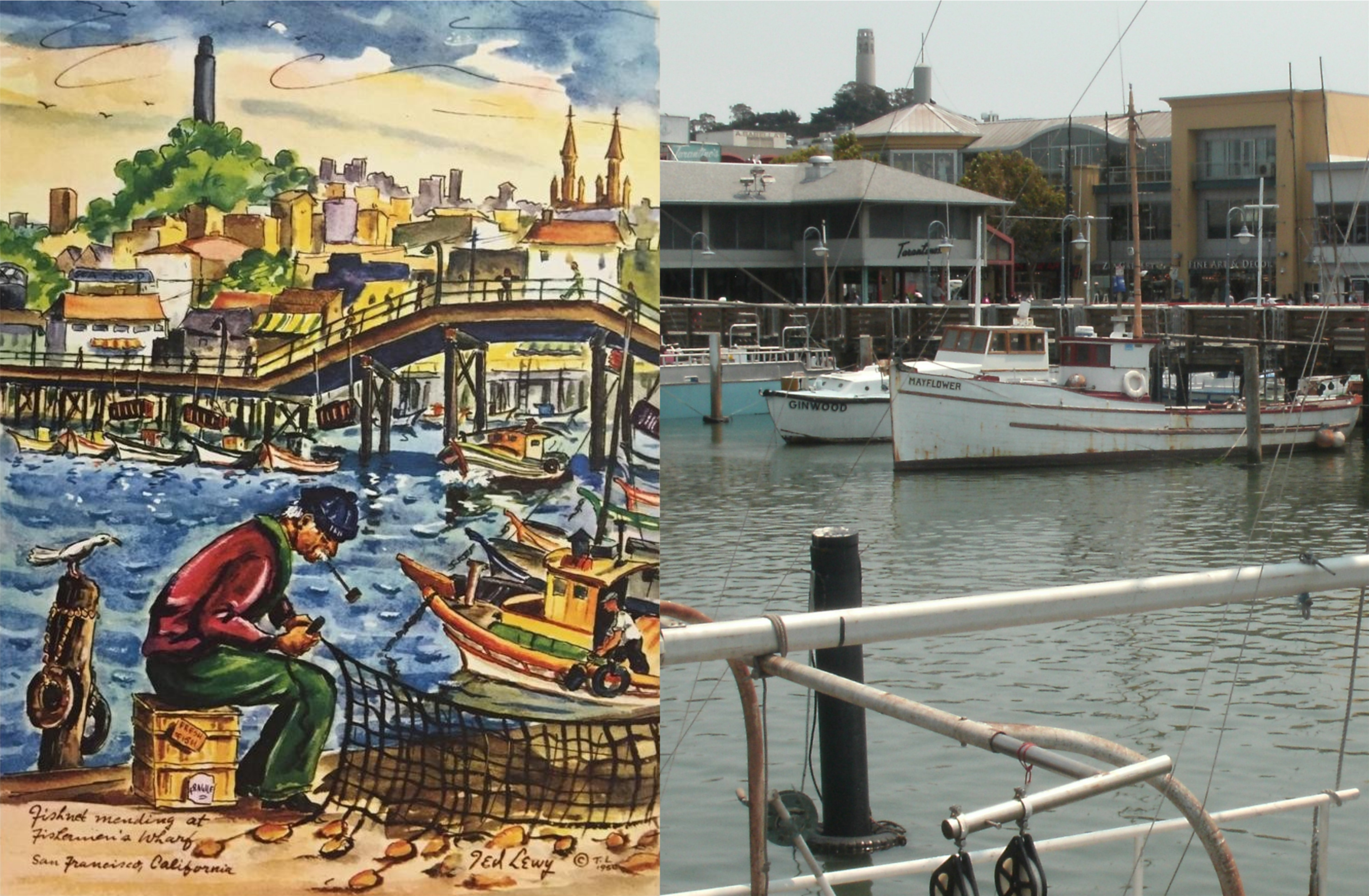
Above the Fisherman’s Wharf Lagoon and Pier 45: The little chapel is now where the white building at the bottom center was.

The view from the Coit Tower parking lot, looking toward Piers 39 and 41, both demolished now:

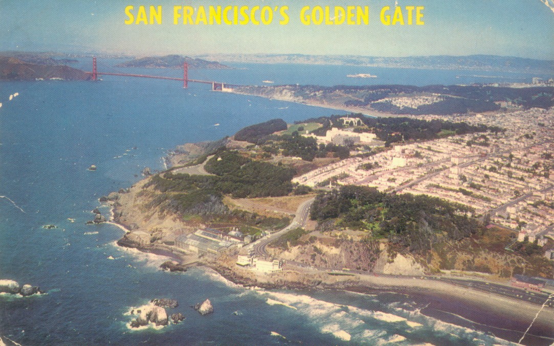
An aerial view of northeastern San Francisco before the skyscraper boom of the late 1960s changed the view radically:


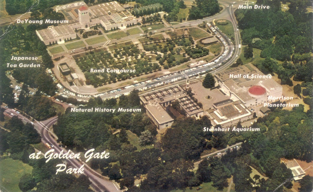
Above the portion of Golden Gate Park where the Midwinter International Exposition of 1894 was held: All of the structures except the Band Concourse have been demolished and rebuilt. I liked it so much better before.

The Cliff House that I loved the best:

Looking along Market Street past the Ferry Building; this is my favorite one.

Ghirardelli Square and the Maritime Museum:

Telegraph Hill and Coit Tower:

And remember, “Don’t call it Frisco”.

The Sir Francis Drake Hotel

When we were young, we were told that Francis Drake was a brave explorer who circumnavigated the globe, helped defeat the Spanish Armada, and discovered San Francisco Bay. Well, two out of three ain’t bad; the famous Drake Plate found in Marin County in 1936, which led to the belief that Drake discovered the Bay, was declared a fake in the 1970s, I believe. Drake actually landed further up the California Coast. However, there’s also evidence that Drake was a slave trader, took part in the massacre of women and children on Rathlin Island, off Ireland, and beheaded his co-commander on one of his voyages for witchcraft. (Source, Wikipedia) Because of these revelations, the Sir Francis Drake Hotel, on the corner of Powell and Sutter Streets and opened in 1928, will be changing its name to the Beacon Grand when it reopens this spring. I did a look back on my blog recently to some of the pictures featuring the famous hotel that I’ve posted. (Thumbnail images)

Looking down Powell Street to the Sir Francis Drake Hotel in the 1950s: The northern view from the Starlight Room on the top of the hotel, which Herb Caen preferred to the Top of the Mark, was completely blocked by the Marriott Hotel.


A cable car climbs Powell Street on Nob Hill in the 1940s:

The view along Powell Street from the south in the 1960s: (Vintage Everyday)

The hotel lobby in 1928, the year the hotel opened: I got my update in February of 2020, just before the Covid 19 Pandemic closed the Sir Francis Drake, which is its current status. (North Point Press)

A lonely looking serviceman walks past the garage entrance to the Sir Francis Drake Hotel during World War Two.

Thomas Kinkade’s glamorous, although inaccurate, painting featuring the Sir Francis Drake Hotel:

Jack Lemmon races his Thunderbird down Powell Street from California Street in the 1963 film ‘Good Neighbor Sam’.


A streetcar rattles east along Sutter Street past the Drake Hotel on the corner in the 1950s; (opensfhistory.org)

The Sir Francis Drake was a guidepost for finding the location of these photos of a newspaper stand on the day after the Pearl Harbor attack, when I first saw them in 2016. They were identified incorrectly as being taken at Market and Montgomery Streets. The key to finding this spot was in the tall building in the distance at the center of the first comparison picture. That looked to me like the old Sir Francis Drake Hotel. If it was, then I had to find out what angle the pictures were taken from. You can’t see the Sir Francis Drake from here anymore, but these pictures were shot on the northeast corner of Sutter and Kearny looking west. (Shorpy Archives)

4th, 5th, and 6th Streets

Last November, I posted a collection of vintage pictures from 1st, 2nd, and 3rd Streets. On last Sunday, I took BART over to San Francisco to do some updates of vintage pictures from 4th, 5th, and 6th Streets; not necessarily an upgrade. This was actually a historic day for BART because this was the first day since the transit system opened in 1972 that all five of the BART lines were running on a Sunday. (Thumbnail pictures)

Looking across Market Street from 4th Street to Stockton and Ellis Streets in 1942: The old Flood Building at Powell and Market Streets is on the left in both pictures. (San Francisco Picture Blog)

Looking the exact opposite from the previous picture is Market Street and Stockton, looking toward 4th Street in 1979. (San Francisco Picture Blog)


4th Street at Natoma, looking toward Market Street in 1941: Natoma, on the right, doesn’t cut through to 4th Street anymore. Minna Street, where the car is turning into on the left in the vintage picture, still does. The old Roos Brothers building at Stockton and Market Streets, built in 1907, is in the far background of both pictures. (SFMTA Archives)

A streetcar turns south on to 5th Street from Market Street in 1941: The view is looking north across Market Street to where the Hallidie Plaza BART Station is today. (opensfhistory.org)

The crown jewel of 5th Street is the old U.S. Mint Building on 5th and Mission Streets, built in 1874. To the left of this view, and out of the picture, is the San Francisco Chronicle Building. Herb Caen wrote so many passages in his columns and books about activities he witnessed at this intersection. (San Francisco Picture Blog)

Looking west on Market Street toward Twin Peaks from 6th Street in 1945, with the old Paramount Theater on the right.  (San Francisco Picture Blog)


6th Street at Natoma in 1985: This is not a pleasant walk from Market Street to here nowadays; enough said. The old Golden Gate Theater, on Golden Gate Avenue and Taylor Streets, is in the far background of both pictures. (San Francisco Picture Blog)

Backyard history

Not far from where I work, Heritage Park, bounded by C Street, D Street, Mission Blvd. and Watkins Street in Hayward, opened up last summer. The block was originally a park before the 1950 Hayward Library was built in the middle of it. The library was demolished several years ago, and the block is now a park again. Recently, commemorative markers were placed on the Watkins Street side of the park in remembrance of Executive Order 9066, signed by Franklin Roosevelt February 19th 1942; eighty years ago this Saturday. Japanese families were rounded up and sent to internment camps after Pearl Harbor. More than 600 members of these families were shipped off by bus here on Watkins Street. (Thumbnail images)

This is the spot on Watkins Street where the families, with the belongings they gathered, were taken away by bus.

“Life imitates art” (Sorry, Oscar, I just don’t buy it)

“Life imitates art far more than art imitates life.” That’s probably Oscar Wilde’s most famous expression, but I don’t agree with it. For example, how many girls want to look like Pablo Picasso’s ‘Girl before a Mirror’? No, to me it always seems the other way around. Anyway, these are a collection of paintings and drawings where the artists are clearly imitating life or landscape, and sometimes taking artistic licenses with their work. (Thumbnail images)

This one is a 1950 program guide of a pending San Francisco 49ers playing the Los Angeles Rams football game at Kezar Stadium, posted last Sunday on the San Francisco Remembered Facebook page. I wonder how that game turned out! This picture, painted at Market and Montgomery Streets, is a lot more accurate than it looks; including the Pig ‘n Whistle and Hoffman Grill.

Looking east down California Street from Stockton Street in a 1940s TWA Advertisement. This poster was spot-on accurate. (Amazon.com)

On the opposite side of California Street from the previous update is a United Airlines poster showing a disproportionate view down California Street.

I’m not sure where the artist was going with this travel poster. Based on the cable car line, the grade of the hill, and what looks like the Hyde Street Pier near the end of the line, it appears to be looking down Hyde Street from Russian Hill. It is curious that the painter put the Bay Bridge in the background, which doesn’t come anywhere near the northern view from Russian Hill, but left out Alcatraz. (Pinterest)

The view east on Market Street from Stockton Street on a rainy pre 1906 Earthquake setting by Thomas Kinkaid, and the same view on a rainy nowadays: The crowned Call Building on the right, and the Gothic looking Mutual Savings Bank Building on the left are still around

.

The Palace of Fine Arts; just as beautiful to visit as it looks in the 1960s painting by Tom Hone:

A lonely fisherman fixing his nets at the Fisherman’s Wharf Boat lagoon, with Telegraph Hill in the background: You can’t see the spires of Saints Peter and Paul Church from here today, but the walkway in the background actually did have an uphill loop for boats to pass under during the 1930s. (Ted Lewy)

This one of the cable car turnaround at Powell and Markets Streets in an old postcard from the 1950s is about the most accurate drawing of this set. That’s the old Bank of America, Number One Powell Street Building behind the turnaround. (ebay.com)

E. H. Suydam was an artist whose drawings appeared in two 1930s San Francisco history and guide books; ‘San Francisco, a Pageant’, and ‘San Francisco’s Chinatown’. This sketch is at Grant Avenue and Washington Street in Chinatown, looking north.

Another E. H.Suydam drawing looking south along Spofford Alley in Chinatown: The stairs being used by people on the right in the sketch are gone now.

Outclassed again (For Judy)

My brother sent me a link to another one of those old San Francisco film clips, posted occasionally on YouTube by NASS Video Restoration. The film features fine, although sometimes protracted, vintage San Francisco locations during the 1940s, and for me, a surprise I didn’t see coming. The clip features scenes in Chinatown, North Beach, Civic Center, and Sutro Heights among some of the locations. (Thumbnail images)

The opening scene is at Grant Avenue at Washington Street: This is one of the protracted scenes with people coming and going; some of them kind of sinister looking.

Jefferson and Taylor Streets, Fisherman’s Wharf:


Looking down California Street from Stockton Street toward Chinatown:

I was able to get a shot of a cable car going down California Street from here, as well.

The view of Playland-at-the-Beach, Golden Gate Park and the Great Highway from Sutro Heights: The statues, urns and cannon of Adolph Sutro are gone now, and so is a lot of the view because, like Coit Tower, they simply will not trim the trees here.


Now to the reason for the title to this post: These are movie stills from the 1949 film ‘Mr. Soft Touch’, starring Glenn Ford and Evelyn Keyes. The movie has many San Francisco locations, such as North Beach, the Lefty O’Doul Bridge, and a service station at this unidentified corner. I’ve been curious for some time as to where this corner was at, but hadn’t been able to locate the spot. My guess was that it was in the Western Addition somewhere, and all of the old houses in the background of the second picture have been demolished. (Not a bad guess)


So when I came to this scene in the NASS clip, I was fascinated, to say the least! It was the same corner, the same Mobile Station, and the same advertisement sign as the corner in ‘Mr. Soft Touch’ I rewound the film clip several times looking for a street sign or a building I could recognize, but I didn’t have any luck. I consider myself pretty good at finding San Francisco locations, but I also know my betters. I went to the experts; I posted it on the San Francisco Remembered Facebook page asking for assistance, and by nice detective work, a group member named Judy H. located the corner. After several blind alleys, such as old telephone book listings of gas stations in San Francisco from that period, by studying the film, and using street view maps and old city directories, Judy correctly identified the corner as the northwest corner of Eddy and Scott Streets.

The location of the 1949 film stills today: Well done, Judy! The gas station is gone now, and an old Victorian house may have been relocated to the corner in the 1970s, or Scott Street has been widened since then.

Many of the houses in the NASS clip, like these two, are still around.

The columned building, seen just before the clip moves to Fisherman’s Wharf, is now the Macang Monastery on Eddy Street.

Here’s the YouTube link to the NASS clip.

Some redos, brand news, and a “just for you” (For Megan)

These are a few updates of pictures I’ve done in the past, and a few new ones that I worked on in December, 2021. (Thumbnail images)


Where California Street comes into Market Street in 1941, and a rainy December, 2021: The Hyatt Regency blocks the view of the Ferry Building from here today.

The pedestrian island on Market Street in front of the old Emporium Store during the 1970s: “Don’t crowd! There’s another one right behind me, and another one right behind that one, and another one……”


A rainy day on the Embarcadero at Pier 7 in the 1950s and a rainy December day in 2021: Pier 7 was demolished and was to the left of the foremost Pier 5 seen in my picture. (Phil Palmer)

Another cable car heading up California Street from Market Street in 1961 and December of 2021: The old Southern Pacific Building is in the background of both pictures. (San Francisco Pictures Blog)


In Front of the St. Francis Hotel in 1954: The more things change…….. You know the rest of it. They’ve replaced, what looks to me like the flag of Argentina, with the flag of the United States. The vintage photo is by Charles Cushman.


California Street approaching Powell Street during the 1920s: The old Crest Garage, demolished in 2018, is on the right in the vintage picture. (Shorpy Archives)

Union Square, Christmas Eve, 2021

Union Square, Christmas Eve, 2021: Perfect weather and a perfect place to develop a touch of Christmas spirit instead of Omicron. (Thumbnail images)


The southeast corner of Geary  and Stockton Streets in the 1950s: The Salvation Army playing Christmas songs was just the right touch. (San Francisco Pictures Blog)


The opposite corner of the previous picture, looking toward the City of Paris Department Store in another 1950s picture: That angry looking girl in the dark hoodie doesn’t look like she likes having her picture taken! Or maybe she’s mad at the guy she’s with. “But, honey, we can’t afford it!” (opensfhistory.org)


A crowd in the 1940s on the west side of Union Square and the same spot yesterday: The camera in the old photo is looking toward the old Macy’s Store. (SF Chronicle)


The northwest corner of Union Square, looking toward the old City of Paris Department Store in the 1930s, and on Christmas Eve, 2021: (opensfhistory.org)

Nash Bridges visits Pier 45, Fisherman’s Wharf

In May of 2021 they filmed scenes for the USA Network revival film of Nash Bridges, starring Don Johnson and Cheech Marin, which premiered on November 21, 2021. If you’re a fan of the show, you probably enjoyed it. Major scenes were filmed on Pier 45 and the World War Two Liberty Ship, the Jeremiah O’Brien. (Thumbnail images)


In the first image, Nash Bridges and Joe Dominguez are searching for a suspect onboard a Ukrainian cargo ship; standing in for the foreign vessel is the Jeremiah O’Brien. I have no idea how to pronounce what they changed the name of the ship to.

As they approach the ship, you get a good look at the portion of Pier 45 destroyed in the devastating fire in May of 2020.

Nash and Joe, and a rookie cop played by Joe Dinicol stop at the ship. My brother, Kevin, was working on the ship while they were filming and sent me this picture he took from aboard the ship. You don’t see all the technicians involved when you watch the movie.


Guns drawn, they charge up the gangplank.


Nash storms into the Captain’s Mess, (“Well, if it’s the captains mess, let him clean it up.”) encountering two innocent ship mates.


Nash and Don finally take down the suspect aboard the ship.


Earlier in the film, there’s an extensive scene filmed in the Muse Mechanique Arcade. Here, a sleek and mysterious lady exits a limo and enters the arcade.


She confronts a fellow playing a pinball machine in the empty arcade. The Muse Mechanique had not reopened yet.

When she takes her coat off, I was thinking that they were about to have more fun than I ever had in the Muse Mechanique, but it turns out they’re going to have a duel to the death with exotic weapons. The fight is being filmed by a camera for off-location spectators betting on who will die. That scene alone is worth watching the movie. You can see Laffin’ Sal in the background.


‘Black Friday’, 2021

Last Friday was a far cry from last year’s ‘Bleak Friday’, due to the COVID-19 Pandemic of 2020. If shoppers were discouraged on this traditional first shopping day of the Christmas Season by the recent smash-and-grab robbery pandemic, they didn’t show it. They showed up packing loaded wallets, daring any trouble. Coupled with the unseasonably warm November weather in San Francisco lately, once again there was a touch of magic around Union Square for the beginning of the Holiday Season. (Thumbnail images)

Geary St. and Stockton Street looking toward the old City of Paris Department Store in 1974: Neiman Marcus occupies the corner now. (viewoftheblue.com)

The northeast corner of Union Square in 1974: Due to the remodeling of Union Square in 2002, a perfect line up with the old photo isn’t possible anymore. (viewoftheblue.com)

Shoppers looking into the Macy’s store window in 1979 and 2021: (SF Chronicle, SF Gate)


The cable cars are back running again, but Santa ain’t riding them anymore. (SF Chronicle, SF Gate)


Something was going on at the Stockton Street side of the City of Paris Department Store at Christmastime, 1974. The Macy’s Store is on the right. (viewoftheblue.com)

Whatever was happening in the previous vintage picture from 1974 extended all the way to O’Farrell Street. The view is looking along O’Farrell toward Market Street. (viewoftheblue.com)


Looking along Geary St. toward Stockton Street from Union Square in 1947: The building under construction is the I Magnin Store, now a part of the Macy’s Store. (opensfhistory.org)

The Fairmont Hotel Lobby in a scene from the 1964 film ‘Good Neighbor Sam’ and decorated for the 2021 Christmas Season:

The Union Square Christmas tree in 1929 and 2021: The building on the left in the old photo is still there, the building on the right was remodeled in 1947 for the I Magnin Store.  The Dewey Monument is behind the tree in the old photo. Notice how the Christmas tree in the vintage picture is warped, like a Christmas tree should be, rather than the perfect but still beautiful cone shape of the current tree. (emporernortontrust.org)


Well, after a long day of watching people buy gifts that weren’t for me, (“Doesn’t this guy have anything better to do?”) I headed for the Hallidie Plaza and a BART Train home. The older picture is from 1974. (viewoftheblue.com)