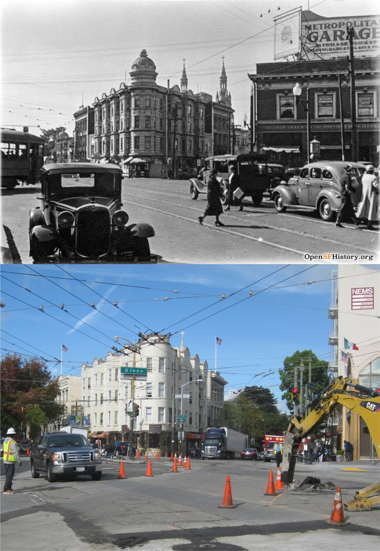
The Barbary Coast Trail walking tour, established in May of 1998, was created by the San Francisco Historical Society and historian Daniel Bacon, a member of the society. It follows north to south, from Aquatic Park to the old U.S. Mint Building on 5th Street, or south to north from the Mint to Aquatic Park, whichever is preferred. It trails through much of old San Francisco, and at times travels along the original shoreline. The entire trail can be followed on the old McQuillan map from 1878 below. Our tour will follow the south to north route. Some references suggest that you can take this tour all in one day. I broke it up over three days and I still felt old and tired when I finished, although, I enjoyed every step of the way! So put on some comfortable shoes and kick back, you’re in for a long armchair walk!

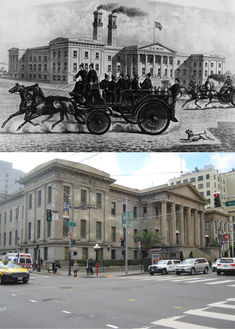 Beginning at the old Mint Building on 5th and Mission Street the trail moves north along 5th to Market Street. (SFGate)
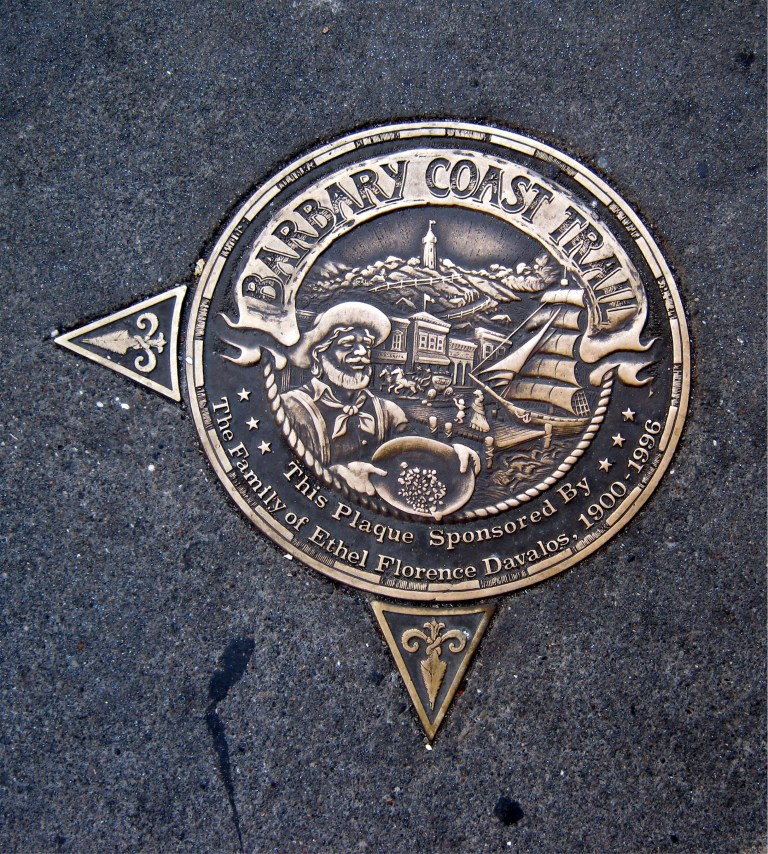
 Along the way, you’ll spot gold medallions placed in sidewalks along the trail like this one at the Mint Building. The medallions have an arrow pointing toward the direction of the Barbary Coast Trail. I’ll have more on these later in the post.
 The trail crosses Market Street and heads up Powell Street to Union Square. The cable cars at the Powell Street turntable were temporarily shut down when the vintage picture was taken. The photo looks like the 1970’s so I don’t think that this was during the big shut down from 1982 to 1984.
 We’re now at Union Square across from the St. Francis Hotel.
http://opensfhistory.org/
 The tour crosses Union Square, seen here just after the 1906 Earthquake and Fire, and enters Maiden Lane.
 Moving through Maiden Lane we turn left onto Grant Avenue. Maiden Lane, once called Morton Street, was an alley filled with brothels before the 1906 Earthquake.
 Along Grant Avenue we’ll cross Sutter Street where the old Whitehouse Department Store was located. Our view is from Sutter Street looking east toward Grant.
 At the next block we arrive at the official entrance to Chinatown at Bush Street. In 1983 I took the top picture looking back down Grant Ave. toward Sutter Street. The Whitehouse Store had not yet become the Banana Republic.
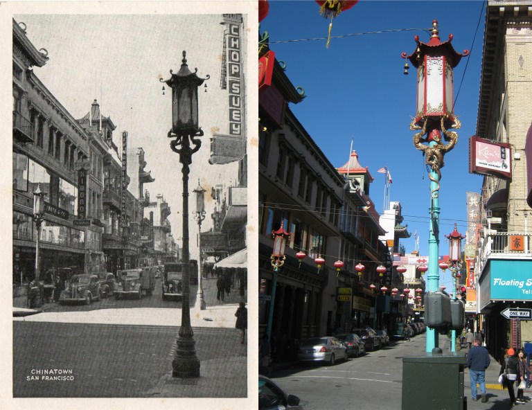 We’ve entered Chinatown and we’ll head north past where the old postcard was taken.
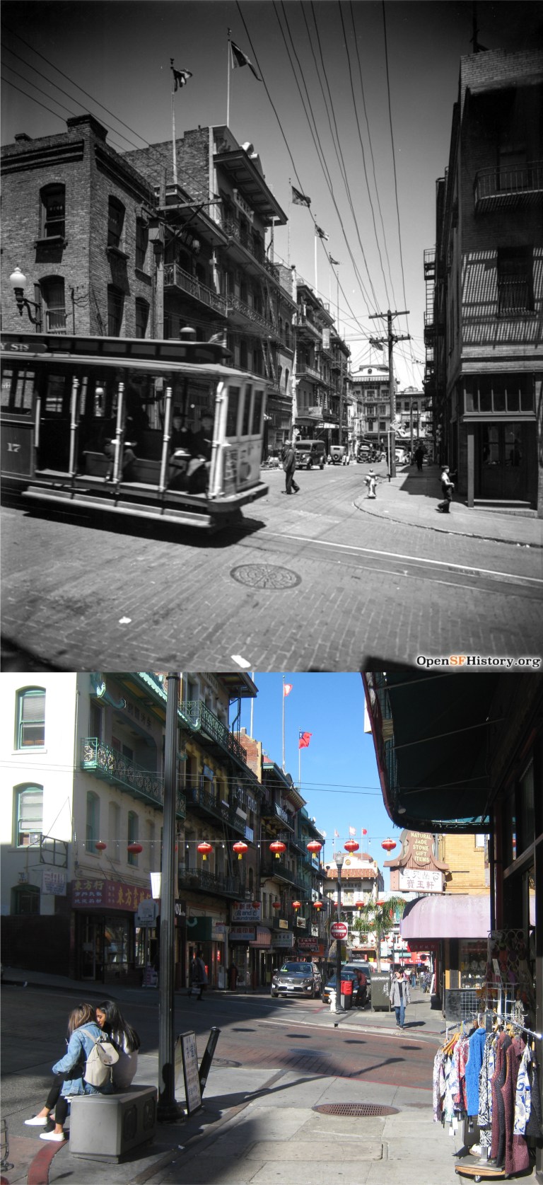 The trail moves into Waverly Place, seen here from Clay Street in 1938 when a cable car line ran along Clay.
http://opensfhistory.org/
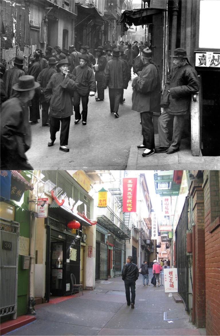 From Waverly place we’ll head into once notorious Ross Alley, long ago famous for Shanghaiing, Tong Wars, and prostitution cribs. Seen here in Arnold Genthe’s vintage photo from before the 1906 Earthquake and Fire, the alley is quaint and peaceful today. The building the gentleman is looking into in my picture is the Golden Gate Fortune Cookie Factory where you can have your own fortune baked into a cookie.
 From Ross Alley we’ll double back to Washington Street and Grant Avenue. The medallion on the northwest corner of this intersection has two arrows. These are the medallions placed between the two origination points of the Barbary Coast Trail directing visitors traveling either north along the trail or south.
 The trail passes through the old Portsmouth Square. We are now in some of the oldest settled areas of San Francisco and near the original city shoreline. The vintage photo is another Arnold Genthe picture taken at Portsmouth Square.
 Let’s head down to Montgomery and Clay Streets, where the old Montgomery Block, a hangout for writers and poets, was torn down at the end of the 1950’s. The Transamerica Pyramid building, seen from Montgomery and Clay Streets under construction, occupies the location of the old “Monkey Block” today.
 Now we’re on Pacific Avenue, the street that epitomizes the “Barbary Coast” more than any other street in San Francisco. “Blackie” Norton’s Paradise Saloon from the 1936 film ‘San Francisco’ was on Pacific Ave. Nick’s Saloon, from William Saroyan’s play ‘The Time of Your Life’ was on Pacific. Just about every old movie about San Francisco before the 1906 Earthquake is centered around or mentions Pacific Avenue. In the 1940’s and 1950’s it became the ‘International Settlement’ the center of San Francisco’s wickedest nightlife. The two posts that held up the International Settlement sign on Pacific Avenue at Montgomery Street are still there today.
http://opensfhistory.org/
 We’re going to turn north onto Columbus Avenue from Pacific and head north, or more accurately, northwest. Look back at the old Sentinel Building, also known as Columbus Tower, completed in 1907. The vintage picture is from the Charles W. Cushman Collection.
 We’re going to travel along Columbus Avenue, seen here at Columbus and Stockton Street, and head toward Washington Square. I couldn’t get the most accurate lineup with the OpenSFHistory picture because of the construction, but you can still see the steeples of Saints Peter and Paul Church in the background of my picture.
 Washington Square at Saints Peter and Paul Church: The famous San Francisco Chronicle columnist Herb Caen once quoted something to the effect, “Washington Square, which is not a square, has a statue of Benjamin Franklin not George Washington, and is located in North Beach where there is no beach!” From Washington Square we’ll head up to the top of Telegraph Hill.
 A 1926 picture from the Shorpy Historic Photo Archive shows the old urn balustrade that circled the parking lot where Coit Tower is today. The balustrade was considered unattractive and removed by the end of the 1930’s.

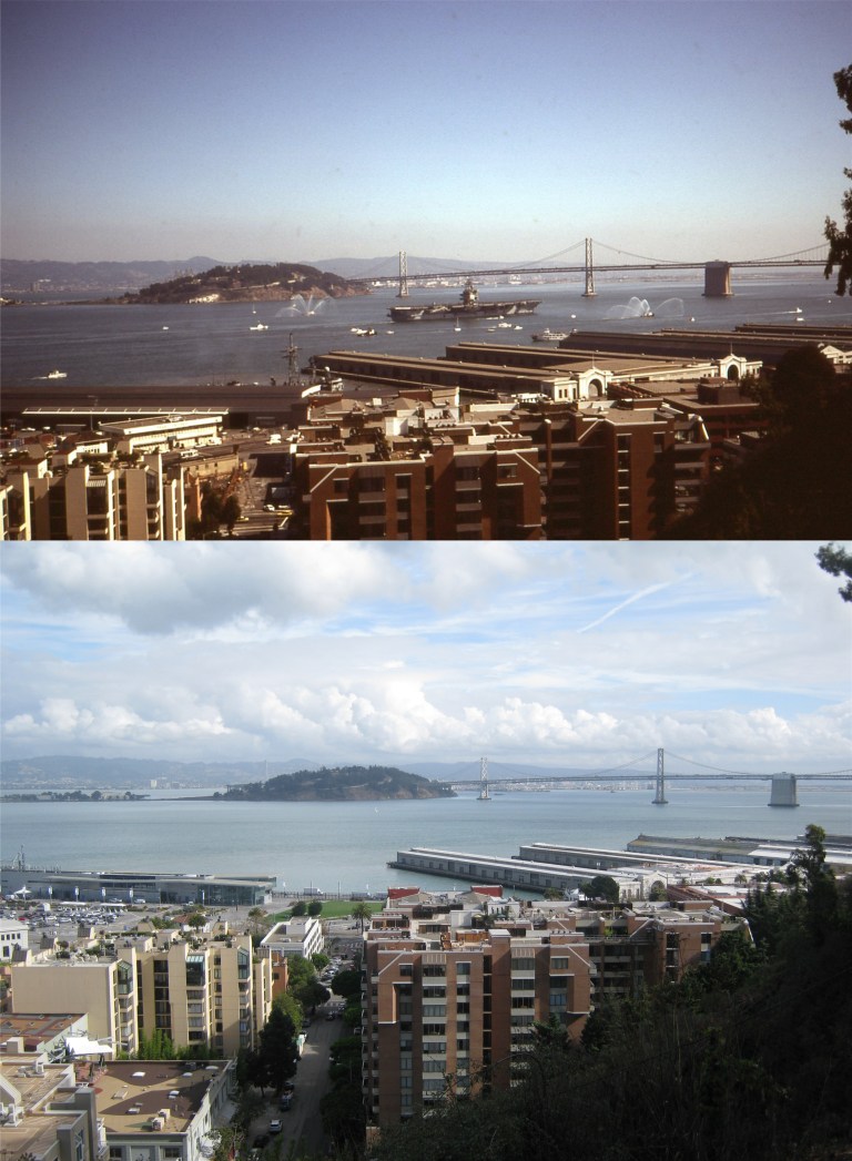 We’ll head back down Lombard Street from the top of Telegraph Hill. In October of 1983 I took the above two pictures of the Parade of Ships for Fleet Week from here on Lombard Street when there was a greater navy presence for the occasion. These are two perfect photos for today’s November 11th posting.
 From Telegraph Hill the Barbary Coast Trail takes you down to the Embarcadero, probably my favorite street in San Francisco. There’s just something magical to me about the shipping history, the fog, and the film noir like setting of this street. The foggy vintage picture is from the great photographer Fred Lyon.
 After leaving the Embarcadero the Barbary Coast Trail travels along Jefferson Street past Fisherman’s Wharf and where the old Joe DiMaggio Restaurant was located. (Gordon Clark)
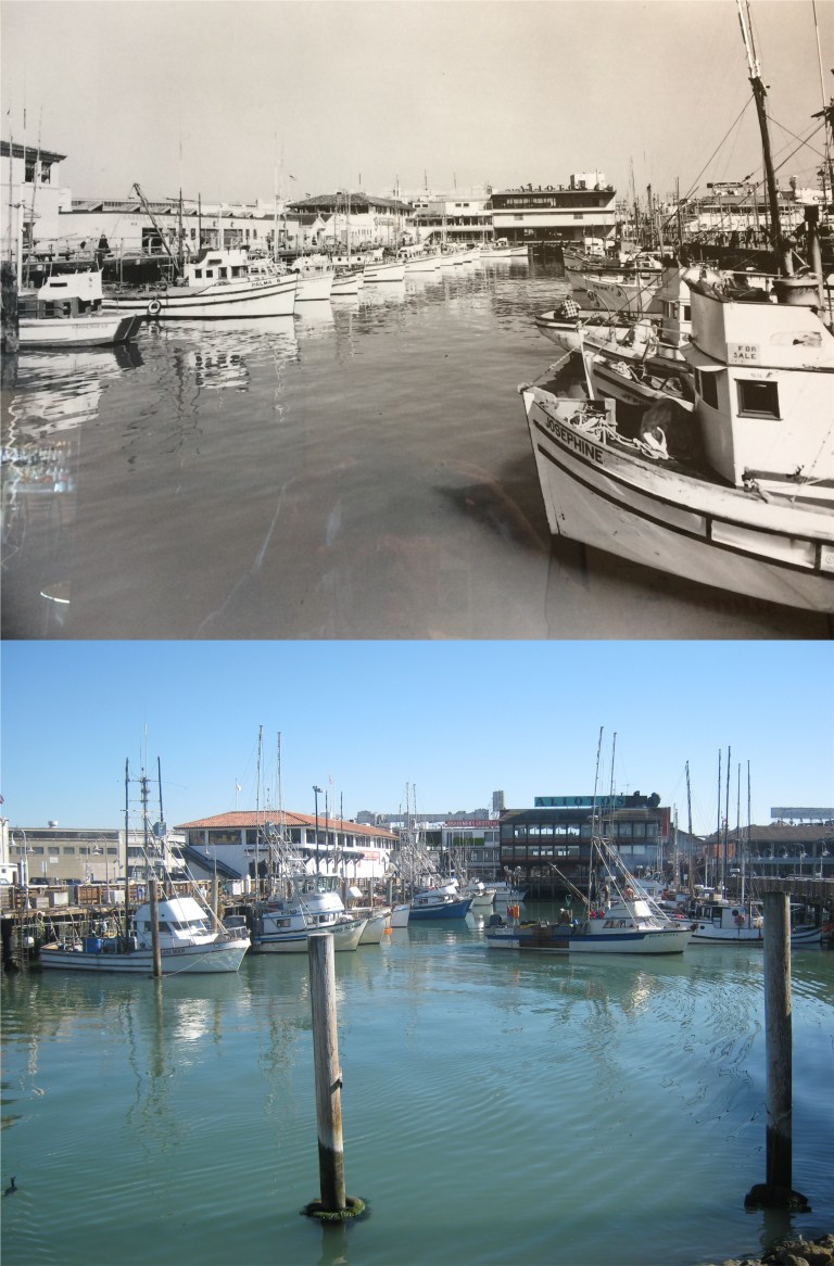 We can’t pass by here without stopping at the Fisherman’s Wharf Boat Lagoon. The vintage picture is on the wall of Alioto’s Restaurant, seen in both photos.
 We’re nearing the end of our journey. These two photos were taken at the Hyde Street Pier from the ferryboat Eureka looking over to Aquatic Park across the 1895 schooner C.A. Thayer. The top picture is from a slide I took in 1985 from the third deck of the Eureka. Yesterday’s photo was from the second deck, the third deck being closed off now.
 The trail ends (and begins) at Aquatic Park. We’re looking at the Hyde Street Pier from behind the Maritime Museum. My 1985 slide looks very similar to the picture that I took yesterday. The 1886 square-rigger Balclutha has been relocated to the Hyde Street Pier since my 1985 picture but is temporarily away from the pier in dry dock for repairs at the current time.
 We’ll end on the steps behind the Maritime Museum. I don’t remember what was going on in 1985 when I took the top slide picture, and I don’t know who the girl dancing was, but it must have been a fun day!

 The “Hyde Street Grip” at Chestnut Street on Russian Hill, looks like in the 1960’s: I snapped my picture a split second too soon for a perfect comparison, but the cable cars were running slow and it was too cold up there today to wait for another one heading downhill. (Vintage Everyday)
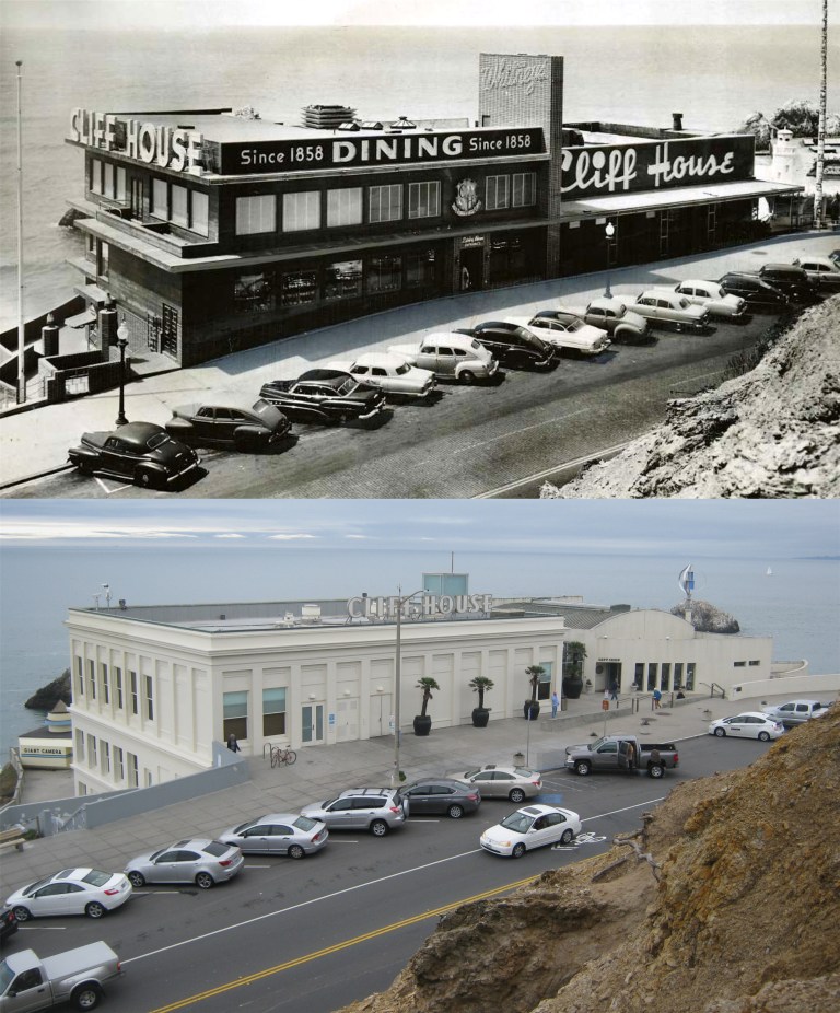 The Cliff House in the 1950’s: I haven’t been able to get a full frontal of the restaurant from Sutro Heights since I’ve been taking pictures because of the trees that block the view today. However, in November I found a walking trail that winds along the Sutro Heights mountainside that allows hikers to get a clear view if the Cliff House like long ago.
 The Powell and Market Street cable car turnaround in the late 1960’s: December’s cold weather in San Francisco made the cable car passenger line even lighter this week than in the 1960’s. (Vintage Everyday)
 The San Francisco Skyline from the Bay in the mid 1970’s and during Fleet Week, 2017:
 San Francisco Bay looking east from Telegraph Hill in 1880: No Treasure Island, no piers, and no Bay Bridge.
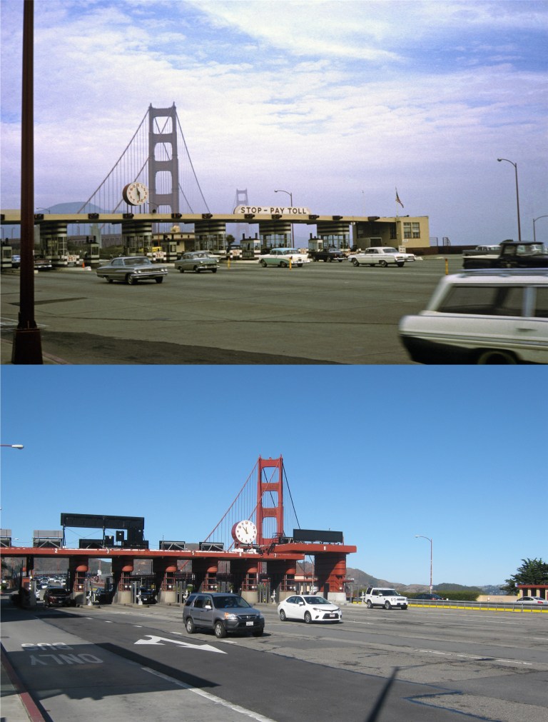 The art deco Golden Gate Bridge Toll Booths in the 1950’s: Although they’re obsolete now, I hope they keep them; they’re as much a part of the bridge as the famous span is. (Vintage Everyday)
 A suitor on a scooter! This is near the approximate spot he was chugging up in the Life Magazine picture, Lombard Street, just down from “The Crookedest Street in the World”, but a little further down the street in order to get the view today. The building behind his left shoulder is the building the couple are walking past in my photo. In the background is Telegraph Hill with Coit Tower and the two spires of Saints Peter and Paul Church in North Beach.
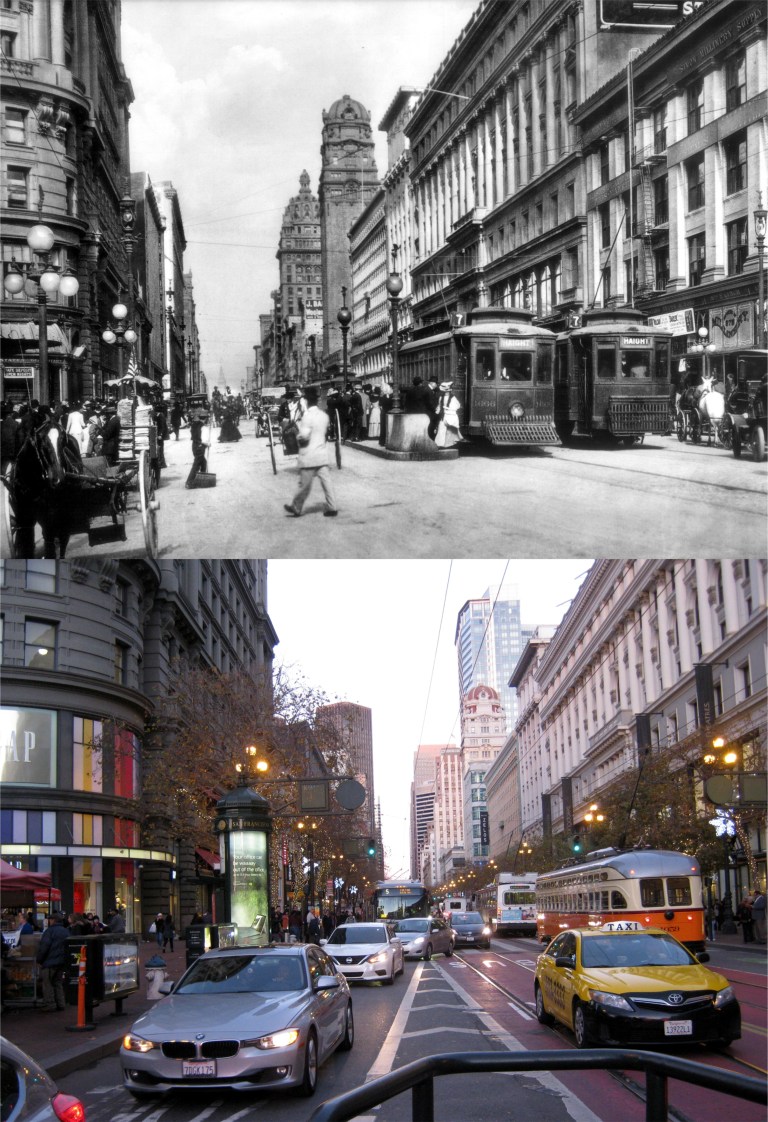 Market Street at Powell circa 1908: On the left is the Flood Building, across Market Street in the center are the towers of the Call and Humboldt Buildings, and on the right is the Emporium Building. (Charles C. Pierce)
 Powell and Ellis Streets at twilight in the 1950’s: (Vintage Everyday)


 Mason and Market Streets looking north toward Nob Hill: (Vintage picture from Monovisions.com)
 Looking east along O’Farrell Street: The domed Call Building in the center was the tallest building west of the Mississippi River at the time. You can see the remodeled Call Building, now called Central Tower, in the center of my photo. (OpenSFHistory.org)
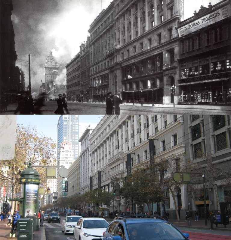 San Franciscans crossing Market Street toward the Emporium Department Building as the fires head up Market Street.: The Call Building is already on fire in the background. (Moulin Studios)
 3rd Street at Mission Street looking north: You can see the Call Building (Central Tower) peeking out on the left in my picture. The old gothic Mutual Savings Bank Building, another survivor, is in the center of both pictures.
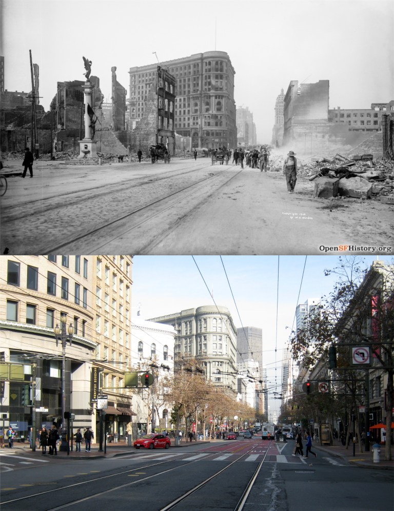 Mason, Turk, and Market Streets looking east: The Admission Day Monument on the left in the vintage picture is now on the corner of Montgomery and Market Streets. (OpenSFHistory.org)
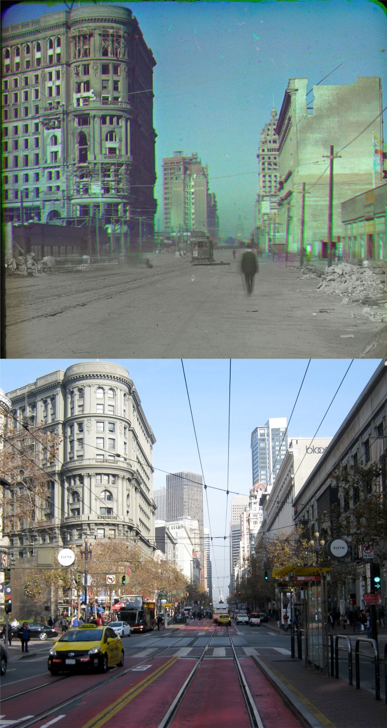 This is a rare early color photo of the San Francisco ruins by Frederick Eugene. On the left is the Flood Building, center is the Mutual Savings Bank, and on the right is the Call Building. (The Smithsonian Museum of American History)
 The Orpheum Theater at Hyde and Market Streets was completely destroyed and has been rebuilt. (Monovisions.com)
 The west side of San Francisco didn’t get off easy, either. The Sharon Building at the Children’s Playground in Golden Gate Park was heavily damaged. The domed Carousel Building is on the left. (SFMTA Photography)
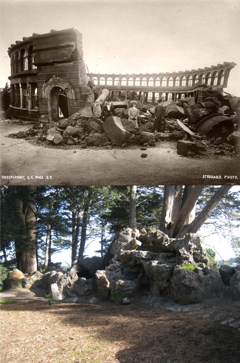 Some things were never rebuilt. At the top of Strawberry Hill in the middle of Stow Lake in Golden Gate Park was where the Sweeney Observatory once stood. It collapsed during the earthquake and is seen here in a picture taken shortly after the disaster. The ruins of the observatory are still up there and can be seen in my picture. It’s always a pleasure to meet people and talk with them when I’m working on these pictures. I met a really nice Park Ranger on top of Strawberry Hill named Ed, and I enjoyed talking about San Francisco history with him for a little while. (Monovisions.com)
 I seem to be going down to Disneyland a lot lately; I think it’s known as “escaping from reality”. I haven’t been down there at Christmas time though since the top photo was taken in 1986.
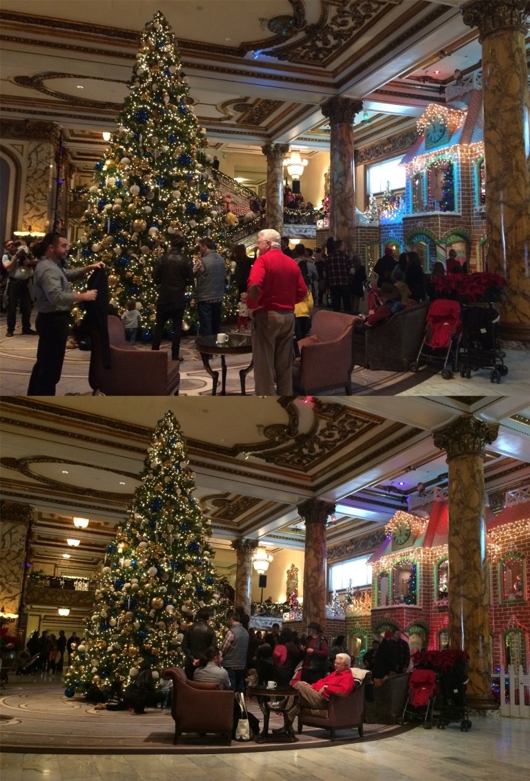
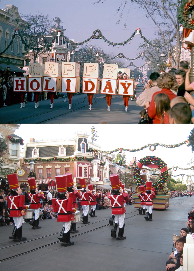 A Christmas Parade in 1961 and a Christmas Parade in 2017: (Vintage picture from Gorillas don’t Blog)
 No Christmas Star on top of the Matterhorn today, like in 1968: You can still see the old People Mover tracks today. (Pinterest)
 The entrance to Frontierland from a slide picture I took in 1983: They’re letting the place get overgrown!
 Another 1983 slide showing Tom Sawyer Island and the Mark Twain Steamboat: They finally reopened Tom Sawyer Island, (now called the Pirate’s Lair) and the Mark Twain is sailing around the island again too.
 The Mark Twain from the Tom Sawyer Island – Pirate’s Lair in 1983 and 2017: I haven’t been out to that island in I don’t know how many years!
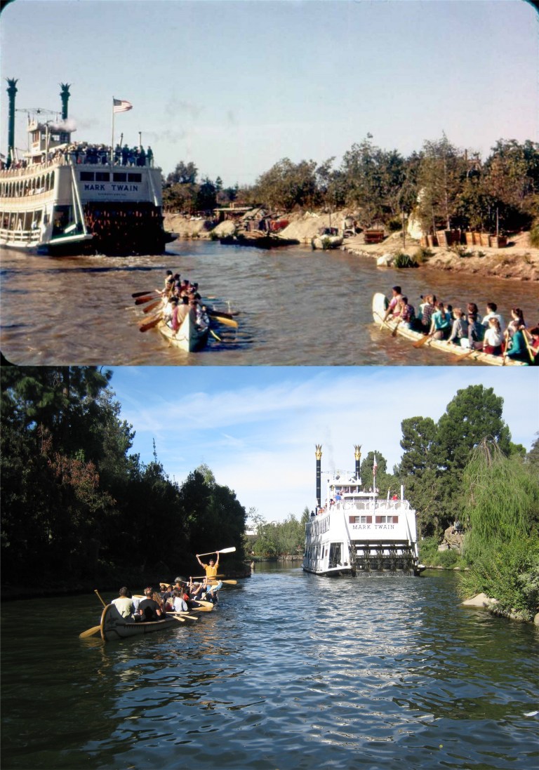 The Indian Canoe Ride following the Mark Twain in the 1950’s: This looks like a photo from the Charles Cushman Collection.
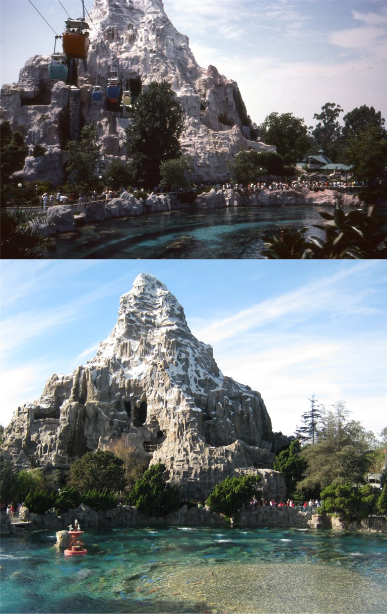 The Matterhorn Skyway in another 1983 slide: I miss the Skyway ride.
 Where the ‘America the Beautiful in Circle Vision’ movie was: I remember seeing that for the first time when I was 16 and thinking that was the coolest thing I’d ever seen! (Duchess of Disneyland)
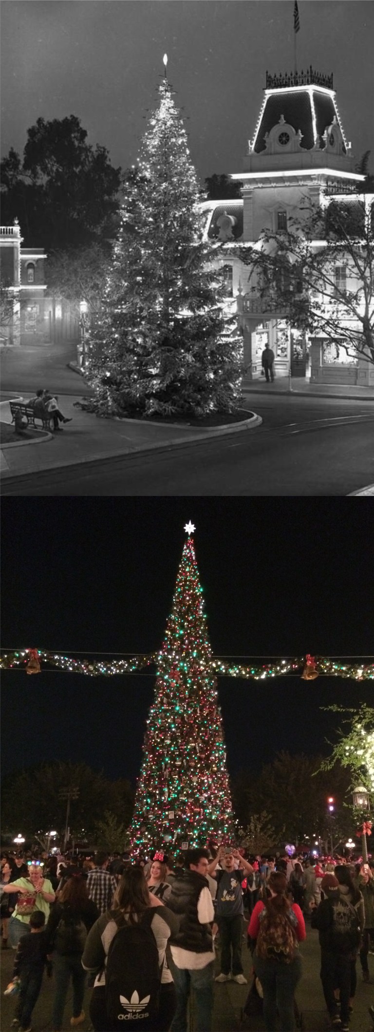 The Christmas Tree on Main Street in 1955, when Disneyland opened, and in 2017:
 Of course, I couldn’t get down there for a visit if it wasn’t for the brave firefighters battling all the L A Fires, and they’re not like the Three Stooges! My brother Kevin and I stopped in Hollywood on the way back to track down a few Three Stooges filming locations that I read about in Jim Pauley’s book about filming locations used by the Stooges. In ‘False Alarms’ from 1936, the Stooges are firemen. Curly gets the bright idea of rolling out the fire hoses across North Larchmont Street at Melrose where they cut by a passing streetcar. Moe’s not going to like this. This is the spot today. (Columbia Pictures)
 Yeah, Moe didn’t like it! (Columbia Pictures)
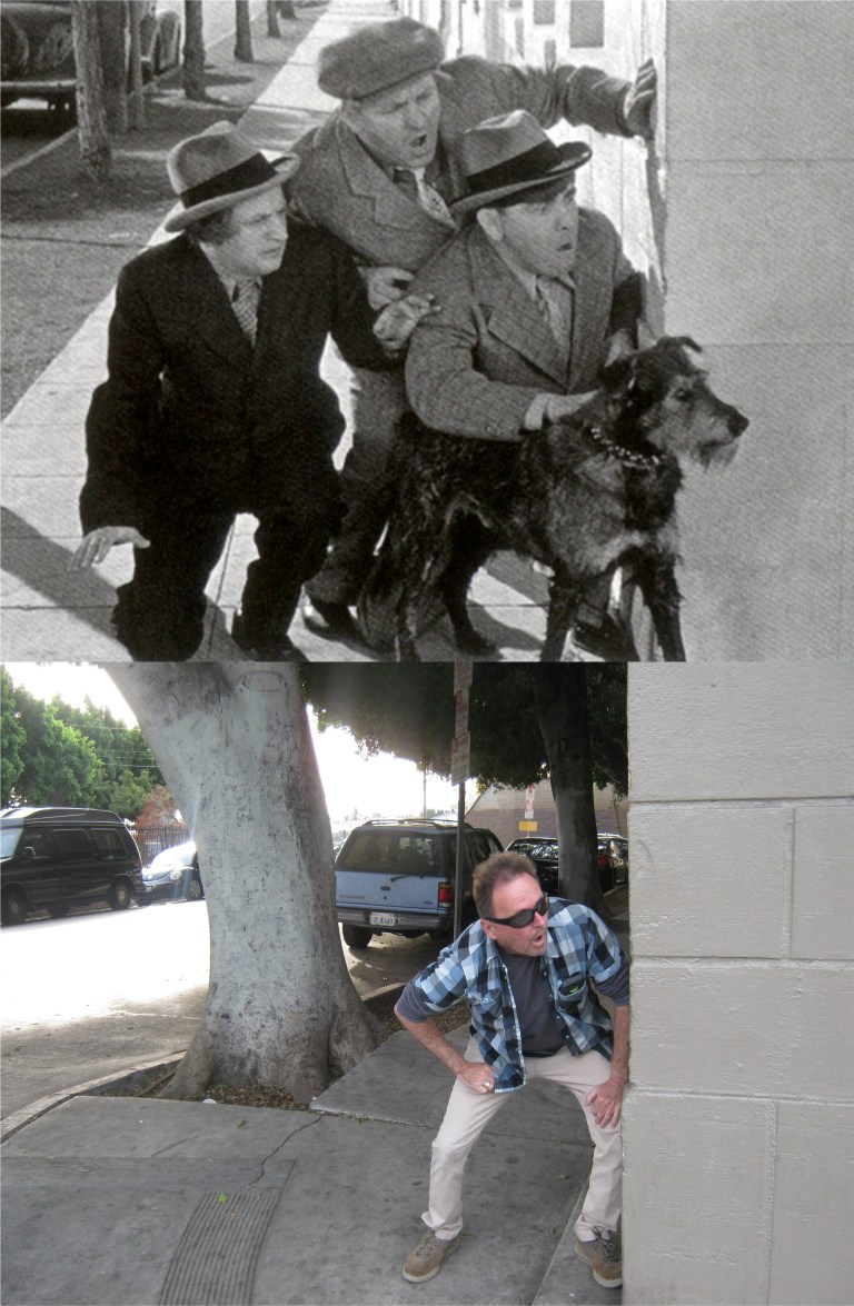 In ‘Calling all Curs’ from 1939, the Three Stooges are peeking around the corner of Fernwood Street and North St. Andrew’s Place trying to find a lost dog named “Garcon” they were in charge of that was dognapped. Those trees sure have grown since the Stooges were there! We met a very friendly security guard at this location named Crisco, and he enjoyed learning that the Three Stooges filmed a scene at his location. (Columbia Pictures)
 Long-ago people from the 1920’s at the Father Junipero Serra statue in Golden Gate Park: (OpenSFHistory.org)
 “Do I have to stop this car?”
 A vintage picture from the Shorpy Collection at Stow Lake with the old Rustic Bridge to Strawberry Hill in the background:
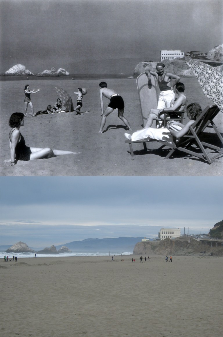 A long-ago family enjoying Ocean Beach in 1939: (Moulin Studio)
 Pedestrians on the Golden Gate Bridge on opening day in May of 1937: Obviously, you can’t walk on the road anymore, (although, I did once in May of 1987 for the 50th anniversary of the bridge) so this is as close of a comparison as I could get. (Moulin Studio)
 Long-ago cars with long-ago people in them: This is on 5th Street between Market and Mission Streets near the old Mint Building. The Pickwick Hotel was where Sam Spade hid the Maltese Falcon before turning it over to the “Fat Man”. The Chronicle Building is in the background on the right. (SF Chronicle, SF Gate)
 Montgomery Street at Sutter looking toward Market Street in the early 1950’s: I tried to compare the people in the old picture from today’s crowd, but the group in the vintage picture all look like people from a film noir movie, and the people in the current picture all look like something from ‘Invasion of the Body Snatchers’ to me. (SF Chronicle, SF Gate)
 Maiden Lane in the early 1960’s and long-ago people who may still be with us, except for the old man on the right: They reopened the old Xanadu Building in September of 2017, the only building in San Francisco designed by Frank Lloyd Wright, after being closed many years. It’s now an Isaia Clothing Store. That’s an interesting suit that fellow on the motor scooter was wearing; it’s like you are looking at it through 3D glasses. (John Whinham Doss)
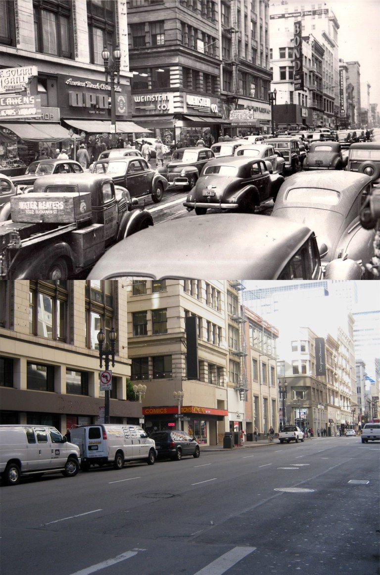 Maiden Lane where it ends at Kearny in the 1940s: “BOND TWO TROUSER SUITS”. You know, it’s probably just me, but I hate the word “trousers”, it sounds so old fashioned to me. I bought my very first suit at age twenty two at a Bond Clothing Store shortly before the company folded, but not the one on Kearny. Street. I bought mine at the one on Broadway in Oakland, and I didn’t get two pairs of “trousers”.
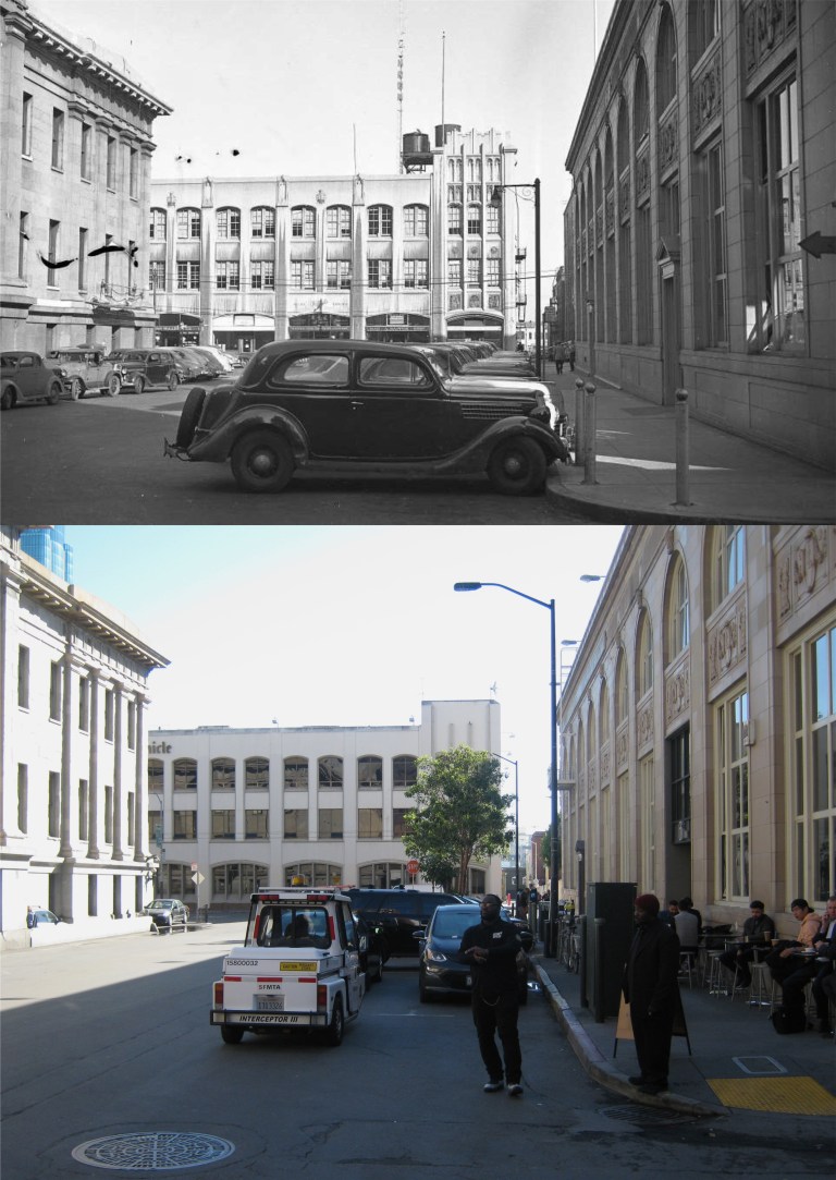 Mint Street behind the old San Francisco Mint Building at 5th and Mission Street: Across the street is the San Francisco Chronicle Building, built in 1924. I subscribed to the Chronicle for many years and had a number of letters printed on their editorial page from the 1980s to the New Millennium. Then the internet came along and you didn’t have to write letters to the newspapers anymore, you could just voice your opinion on Facebook. But to me the San Francisco Chronicle Building means “Mr. San Francisco” Herb Caen who spent most of his career here. I was proud to have met him once. His love of San Francisco will never be matched by anyone, and his sense of humor had a lot to do with shaping mine, only his jokes were funny. This is also ‘Maltese Falcon’ territory. That building in the shadow on the right is where the old Remedial Loan Company was, and still is. In the novel, Sam Spade makes Brigid O’Shaughnessy hock her jewelry here to come up with money for his retainer. “You’ll have to hock them.” Spade says to her. “The Remedial’s the best – Fifth and Mission.” Also, across 5th from the Mint Building is the old Pickwick Hotel where Sam Spade stashes the Maltese Falcon after it comes into his possession. (San Francisco Chronicle, SFGate)
 Montgomery Street near Sutter Street around 1915: Three of the Buildings in the old photo are still around. In the center is the Palace Hotel, built in 1909. President Warren G. Harding died in office at this hotel in 1923. Just to the left of the Palace is the old Metropolis Savings and Trust Building, built in 1907. For many years a Bank of America has been located here. The building just to the right of the Palace has been demolished, but the one next to that is the old Crocker Bank Building, built in 1908. It’s now a Wells Fargo Bank and the top floors were removed at the end of the 1970s.
 Now, do you see what I mean about the November shadows? This might have been a good picture otherwise! Well, you still have Chinatown, Old St. Mary’s, and the Transamerica Pyramid Building. You also have the Cathay House on the corner of Grant Avenue and California Street. That restaurant goes back a long way! In fact, it can be seen in the 1947 Bob Hope movie ‘My Favorite Brunette’. (Vintage Everyday)
 An old postcard of St. Mary’s Square in the heart of Chinatown, and a perfect place to relax and enjoy a little “sweater weather” at the end of November: The statue on the left is of Sun Yat-sen, sculpted by Beniamino Bufano and erected in 1938.
 The old Turk Street Follies in the Tenderloin:
 This is Market Street looking east from Stockton Street circa 1900. Three buildings can still be seen today. First and foremost, the crowned Call Building on the right, remodeled in the late 1930’s. On the left is the Gothic looking Mutual Savings Bank Building with its green and red roof. Just behind that is the brownish-red Chronicle Building. The clock at the top of the building was destroyed in 1905, the year before the 1906 Earthquake and Fire.
 Stockton Street at O’Farrell looking north in 1951: Neiman Marcus and Macy’s Men’s Store are now where the City of Paris Department Store was. This area of Stockton Street from Market Street to Geary Blvd., under construction because of the MUNI Metro extension to Chinatown, is closed off and carpeted for shoppers during the Holiday Season. (San Francisco Chronicle, SFGate)
 The southwest corner of Union Square in 1974: (Vintage photo from Viewoftheblue.com)
 The east side of Union Square looking toward Maiden Lane in 1974: The Suntory Whisky billboard has been replaced by Sennheiser and Sonos billboards. Viewoftheblue.com)
 Elegant Maiden Lane at Christmastime in 1949: You don’t see a lot of crowds in this famous alley anymore. That was an interesting lady having a quiet smoke in front of me. I was worried that she might be a little “out there” (she was probably worrying the same thing about me), but when I said hello to her, she was quite elegant herself, a hang on from the old days. (Moulin Studio)
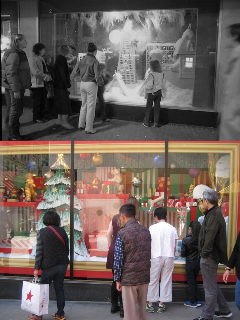 A Macy’s Department Store display window for Christmas in 1979 and 2017:
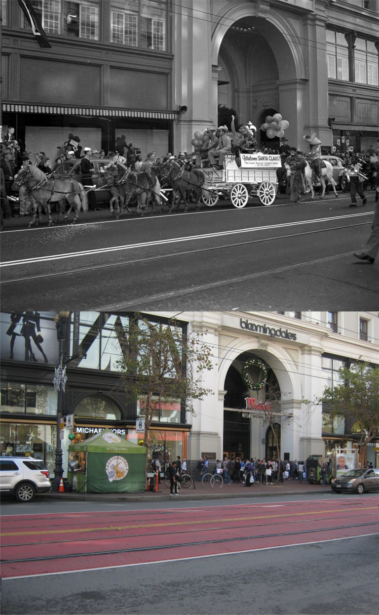 Santa Claus arrives at the Emporium Store on Market Street by wagon in 1949: Boy, that ain’t the way I heard that he gets around! (San Francisco Chronicle, SFGate)
 The dome inside the Emporium Department Store in 1898, and the dome in Emporium, now Bloomingdale’s on Black Friday, 2017:
 The cable car turntable at Powell and Market Streets, no Santa and no pretty girl dressed like an elf anymore:
 In 1953 on the northwest corner of O’Farrell and Stockton Streets they staged a demonstration to point out the dangers of jaywalking. Our Junior G-man at the same corner was going to make sure that didn’t happen on Black Friday, 2017. (San Francisco Chronicle, SFGate)
 The Mechanics Monument at Battery and Market Streets circa 1910: (Vintage photo from Moulin Studios)
 Fisherman’s Wharf, 1938: That tank on the left was full of gas. What a terrorist alert that would create today! It would have blown Fisherman’s Wharf all the way over to Chinatown! (Moulin Studios)
 Approaching the Bay Bridge from Oakland in the 1940’s: (SF Chronicle)
 Telegraph Hill from the Bay, back when the Embarcadero was still a bustling port: (Vintage Everyday)
 Ocean Beach and the Great Highway, circa 1915: (Moulin Studios)
 The old Gingerbread Cliff House that burned down in 1907 from a rare angle: I’ve been trying to get a good photo of the Cliff House from Sutro Heights for a long time now. Trees block most of the view of the restaurant from the top of the park today. However, earlier this week I found a trail that winds part of the way around the side of the cliff. It can be dangerous if you’re not careful and there’s evidence that homeless people have been sleeping there, but it offers a view of the Cliff House that not many people can see anymore.
 Another terrific picture from the Shorpy Collection of the Fairmont and Mark Hopkins Hotels on top of Nob Hill:
 I started out at the Powell and Market Streets cable car turntable at twilight in the rain. Trees block the view past the St. Francis Hotel and up Nob Hill today. The old Powell Theater that went back to the 1920’s is where the Burger King is today. (Vintage picture from Vintage Everyday)
 Before catching a cable car up Nob Hill, I headed one block east to 4th and Market Streets across from Stockton Street to get a comparison of this twilight picture from 1954. (SFGate, San Francisco Chronicle)
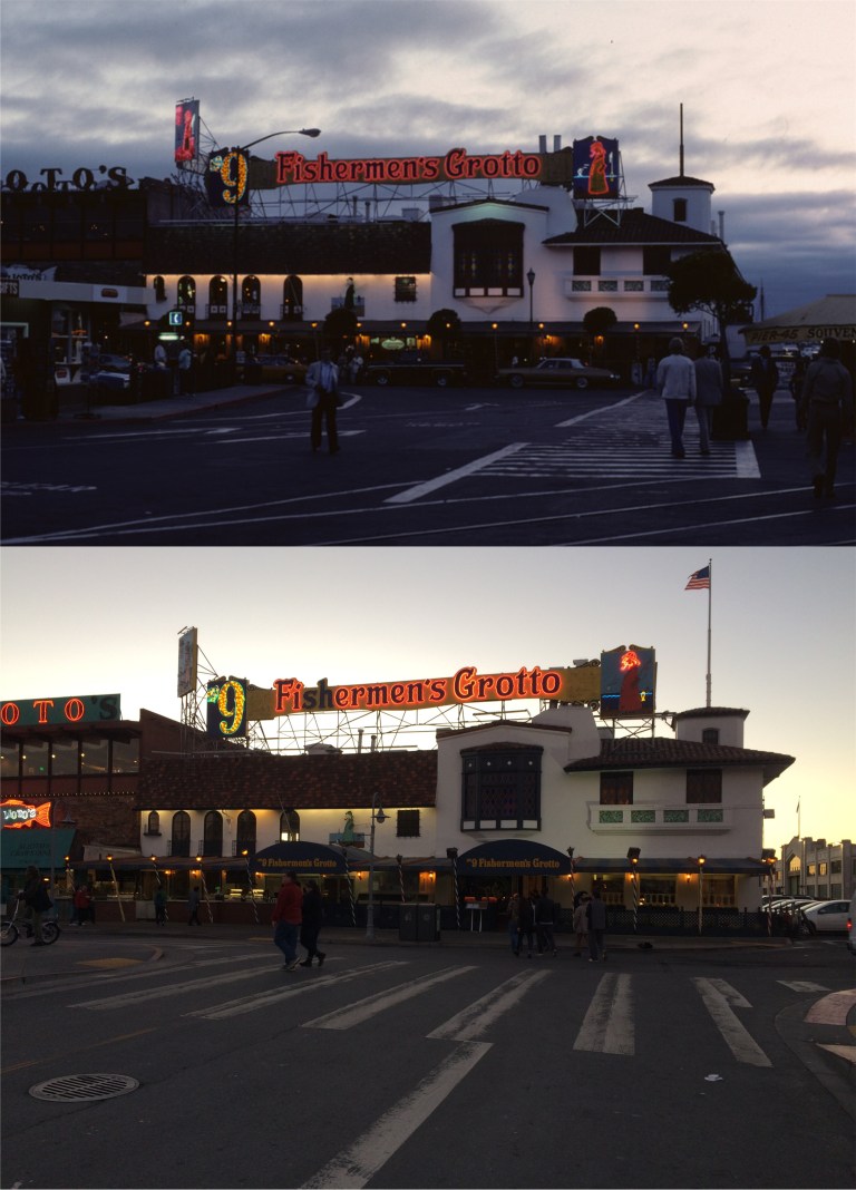 Fisherman’s Wharf at dusk:
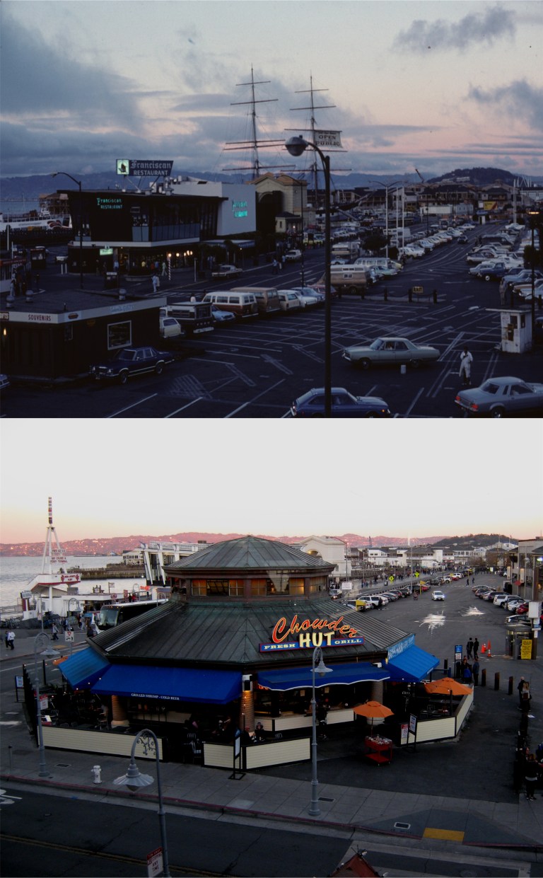 Looking east of Fisherman’s Wharf at dusk from Alioto’s Restaurant: Funny how the rain stopped so suddenly, huh? Actually, I took in two evenings for my nocturnal knock around, the 16th and the 17th. That mast ship in the background of the vintage picture is the square rigged ‘Balclutha’, built in 1886. In 1988 she was moved from this location to the Hyde Street Pier. (Peter Stratmoen)
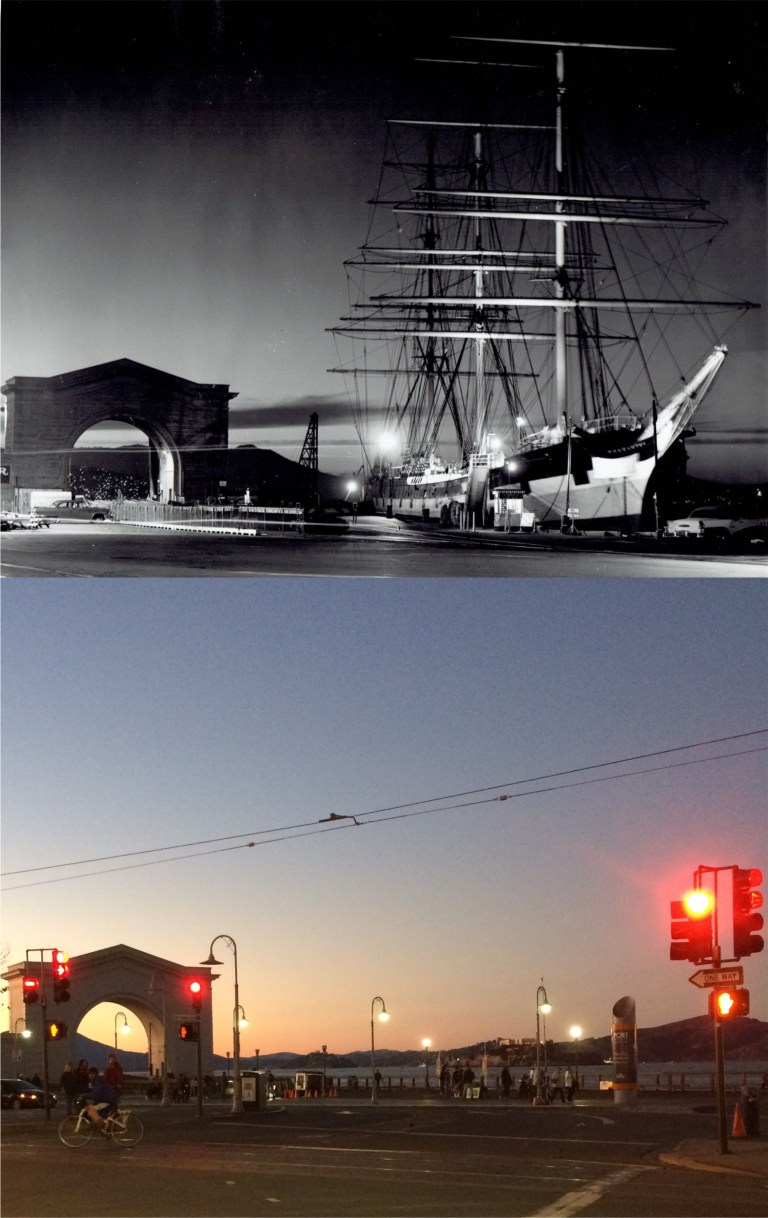 Speaking of the Balclutha, here she is docked at Pier 43. Also, here’s something I didn’t know until I researched the Wikipedia entry on her, the Balclutha was filmed in a scene in the 1935 movie ‘Mutiny on the Bounty’ with Clark Gable and Charles Laughton!
 The Fairmont Hotel on Nob Hill, where Tony Bennett introduced the world to ‘I Left My Heart in San Francisco’, probably, around the time that the vintage picture was taken: (Vintage Everyday)
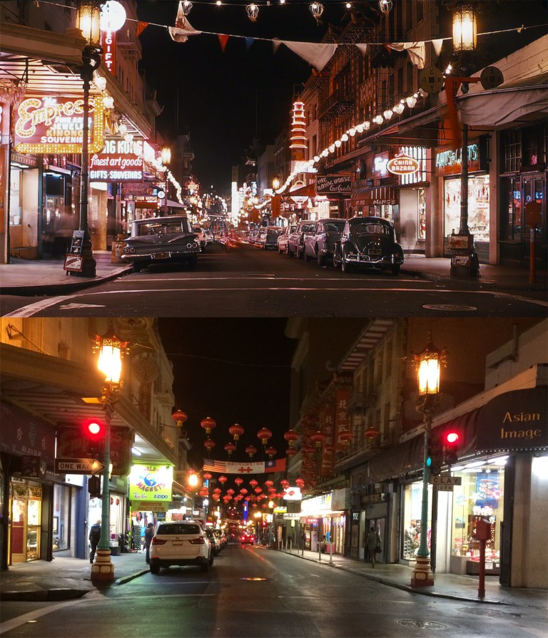 Grant Avenue at Clay Street, and the never-changing Chinatown with its multicolored manhole covers: (Vintage Everyday)
 With the accuracy in continuity of the ‘Bullitt’ car chase scene, we’re back where I ended the night before. This is at Market and Powell Streets at 5:15 PM on December 14th 1945, and Market and Powell Streets at 6:15 PM on November 16th 2017. I took my picture an hour later because it isn’t as dark at 5:15 PM in November as it is in December. The Market Street crosswalk has been relocated since December of 1945 so my picture is a little farther back. The old Emporium Store, now Bloomingdale’s is in the background of both photos. (SFGate, San Francisco Chronicle)