 In 2011, the University of California Press reprinted a 1940 guide to San Francisco written by the Federal Writers Project (WPA) of the Works Project Administration (WPA). The Works Progress Administration was the result of Executive Order 7034, Signed by Franklin D. Roosevelt in 1935 to create jobs for unemployed workers, artists, musicians, etc. during the Great Depression of the 1930s. A lot of the San Francisco we appreciate today, such as the murals inside Coit Tower and the Beach Chalet, and the exhibits at the San Francisco Zoo came about because of WPA. The ‘San Francisco in the 1930s’ WPA Guide has numerical descriptions that correspond with maps in the book. The points of interest listed take in just about all of San Francisco with occasional outdated descriptions that were new in 1940. These are a collection of some of the descriptions of places from the book, (in brackets) with vintage pictures I updated of each location taken close to the period when the book was written.
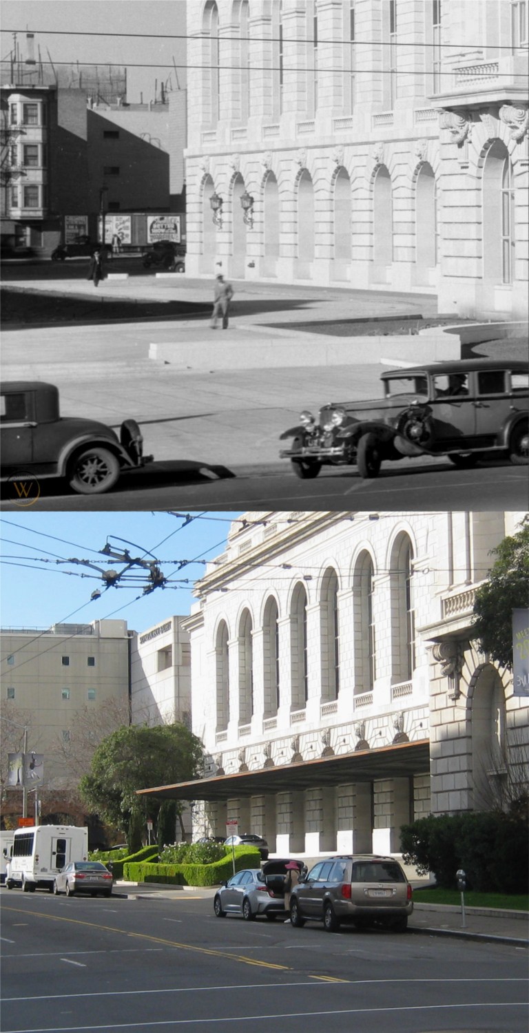 The south side of the Opera House on Van Ness with long gone buildings on Franklin Street in the background: (Vintage picture from worthpoint.com)
{The OPERA HOUSE (open weekdays 10 -4) NW corner Van Ness Ave. and Grove St., and the Veterans Building form the War Memorial of San Francisco, erected in 1932 as a tribute to the city’s war dead.}
{This, the Nations only municipally-owned opera house, represented the achievement of years of struggle by San Francisco music lovers for an opera house of their own. It was opened October 15, 1932 with Lily Pons singing Tosca. The auditorium, seating 3,285 persons, is richly decorated. The floor of the orchestra pit can be raised and lowered. The stage is 131 feet wide, 83 feet deep, and 120 feet from floor to roof.}
The dimensions of the stage area may have changed since 1940.
 The cable car turnaround at Powell and Market Streets:
{Traffic waits good naturedly at the CABLE CAR TURN-TABLE, Market, Powell, and Eddy Sts., where a careening southbound car comes to a halt every few minutes, while conductor and grip man dismount and push the car around until it faces north.}
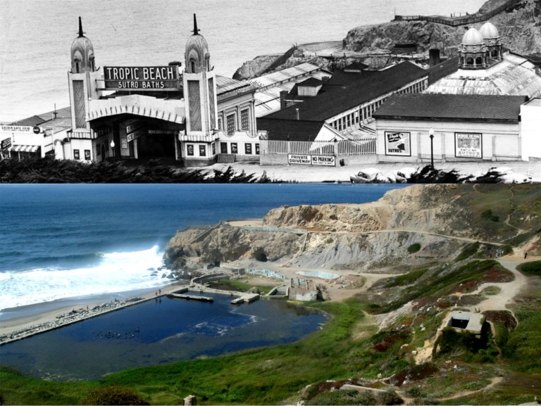 The old Sutro Bathhouse:
{The sprawling building of the SUTRO BATHS AND ICE RINK (open Mon.-Fri. 10 a.m. – 11 p.m.; Sat. , Sun., holidays 9 a. m. – 11 p. m.; skating 35 cents Sun. afternoon and every evening, 25 cents other times; skate rental 15 cents, swimming 50 cents) . Point Lobos Ave. near Great Highway, covering three acres of sloping beach in the lee of Point Lobos, were built in 1896 by Adolph Sutro. Long advertised as the world’s largest are the six indoor pools; of both fresh and salt water, these vary in size depth, and temperature. Also here, are a floodlighted ice rink and an indoor sand plot for sunbathing. It is said that 25,000 persons have visited “Sutro’s” in one day.}
Sutro Bathhouse burned down in 1966.
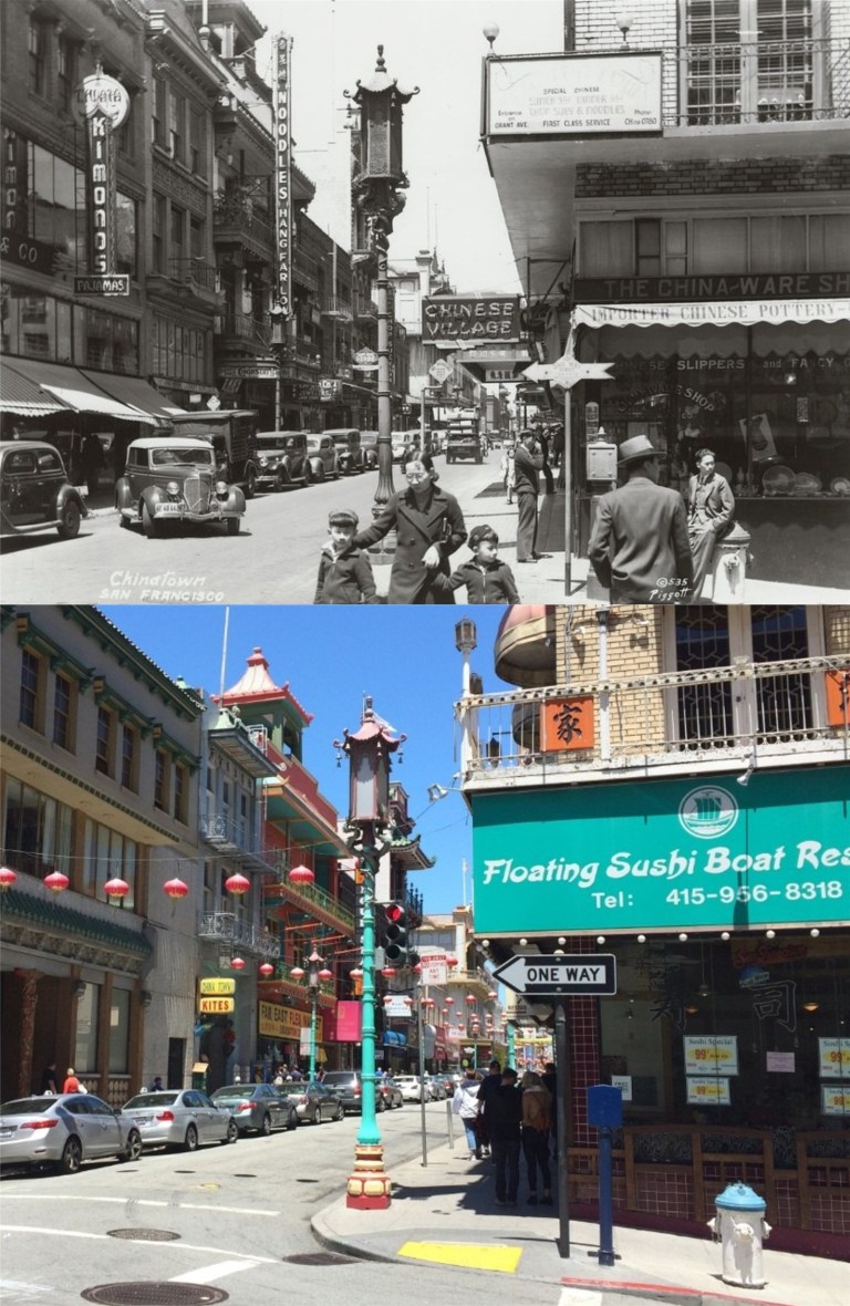 Grant Avenue looking north from Commercial Street:
{A quarter of old Canton, transplanted and transformed, neither quite oriental or wholly occidental, San Francisco’s Chinatown yields to the ways of the West while continuing to venerate a native civilization as ancient the Pyramids. Grant Avenue, its main thoroughfare, leads northward from Bush Street through a veritable city-within-a-city – alien in appearance to all the rest of San Francisco – hemmed within boundaries kept by tacit agreement with municipal authorities for almost a century.}
 The old WPA built entrance to Fleishhacker Zoo on Sloat Ave.
{FLEISHHACKER PLAYFIELD AND ZOOLOGICAL GARDENS, foot of Great Highway at Sloat and Skyline Blvds. This recreation center dates from 1922, when the city acquired from the Spring Valley Water Company 60 acres on which to construct a playground and pool. Only 37 acres at first were developed; opened in 1924, the park was named for Herbert Fleishhacker , then president of the Park Commission, who donated the pool and the Mothers’ House. Adjoining the playground is the Zoo (open 10 – 4:30; free). Begun in 1929 with a few lion cubs and monkeys, gradually more animals were acquired (by purchase and donation) until the animal, bird and reptile population reached 1,000. Noted is the fine collection of “cats” which includes lions, tigers, leopards, lynxes, and panthers. In 1935 sixty-eight acres adjoining the zoo were purchased and here WPA labor constructed the fine ZOOLOGICAL GARDENS, modeled after Germany’s famous Hagenbeck Zoo. Here, among man-made streams, waterfalls, islands, cliffs and caves, are simulated natural habitats of many animals – separated (where practical) from spectators only by moats and designed to give the animals the illusion of freedom}
The vintage picture is the opening day of the WPA built entrance to the zoo in 1937. I was able to get some pictures there before they boarded it up. (Vintage picture from Images of America)
 One of the pictures I was able to get at the old stone entrance to the zoo on Sloat Blvd before they closed it off was the spot where my 17 year old mother on the left with her cousin Frances sat during a visit to San Francisco from North Dakota in 1939.
 The southeast corner of Portsmouth Square:
{Upon the green, sloping lawns of PORTSMOUTH PLAZA, Kearny, Clay and Washington Streets, Candelario Miramontes, who resided at the Presidio, raised potatoes in the early 1830’s. When the plot became a plaza is not known.}
{Most of the stirring events from the 1840’s to the 1860’s took place here – processions, flag raisings, lynchings, May Day fetes.}
{Here terrified Chinese ran about beating gongs to scare of the fire demons during the earthquake and conflagration of 1906; here came exhausted firefighter to rest among milling refugees; here shallow graves held the dead; and thousands camped during reconstruction. The Board of Supervisors, in December of 1927, restored the square’s Spanish designation of “plaza”.}
Well, maybe so, but I read real San Franciscans prefer Portsmouth Square to Portsmouth Plaza, so that’s what I refer to it as. The buildings behind the vintage picture of the square taken in 1937 are still there today. (opensfhistory.org)
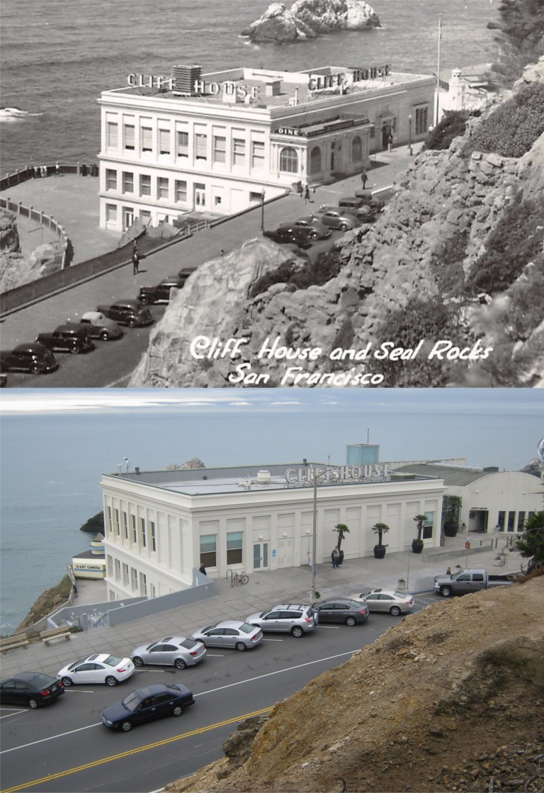 {The CLIFF HOUSE. Point Lobos Ave. at Great Highway, a white stuccoed building terraced along the edge of the cliff south of Sutro Baths, is a modern restaurant, bar, and gift shop. Both the barroom and the Sequoia Room – a cocktail lounge – are finished in redwood, from the smooth walls to rustic beamed ceilings, and both house huge fireplaces in which open fires glow on chilled days. From the lounge and the blue and white dining room in the rear of the building guests seated at the great plate glass windows on clear days look beyond Seal Rocks for miles across the Pacific.}
It’s a crowd pleaser still and you can’t stop progress, but I remember the Sequoia Room with its fireplace well, and I miss the Cliff House the way it was before the New Millennium restoration. (Vintage picture, hippostcard.com)
 The De Young Museum and the Pool of Enchantment:
{On the NW. side of the Music Concourse, flanked by trim lawns and stately Irish yews, is the M. H. DE YOUNG MEMORIAL MUSEUM (open daily 10 – 5). Of Sixteenth- Century Spanish Renaissance design, the buildings pale salmon-colored facades are burdened with rococo ornamentation. Its two wings extend from either side of the 134 foot tower facing a landscaped court. In the court, before the main entrance, lies the POOL OF ENCHANTMENT, in which a sculptured Indian boy pipes to two listening mountain lions on a rocky island.}
Before the De Young Museum was demolished and rebuilt in the New Millennium, I had a chance to take a comparison picture at the spot in front of the museum next to the Pool of Enchantment where my mother, on the right with her cousin Frances posed during her 1939 trip to San Francisco by train while she was in high school. The Pool of Enchantment is now on the eastern side of the De Young Museum.
 The Fisherman’s Wharf Lagoon:
{Twentieth-Century commercialism and Old World tradition go hand in hand at FISHERMAN’S WHARF, foot of Taylor St., where are moored in serried ranks the tiny, bright-painted gasoline boats of the crab fishermen and the tall-masted 70 foot Diesel-engined trawlers of the sardine fleet.}
{The boats of the crab fishing fleet, like their larger sisters of the sardine fleet, are brightly painted, with blue and white predominating hues. During the fishing season (November through August) the crab fleet usually leaves the wharf with the tide – between two or three o’clock in the morning – bound for fishing grounds between three and six miles outside the gate, where each boat anchors within hailing distance of its neighbor. In mid-afternoon they return laden from one to four dozen crabs apiece, accompanied by screaming hordes of gulls.}
Most of the boats in the lagoon in the 1940 picture from the Charles Cushman Collection do appear to be blue and white, and even a number of them today.
 The Embarcadero near Green Street, looking south:
{Even before the eight o’clock wail of the Ferry Building siren, the Embarcadero comes violently to life. From side streets great trucks roll through the yawning doors of the piers. The longshoremen, clustered in groups before the pier gates, swarm up ladders and across gangplanks.}
{Careening taxis, rumbling under slung vans and drays, and scurrying pedestrians suddenly transform the waterfront into a traffic thronged artery.}
{Stored in the Embarcadero’s huge warehouses are sacks of green coffee from Brazil; ripening bananas from Central America; copra and spices from the South Seas; tea, sugar, and chocolate; cotton and kapok; paint and oil; and all the thousand varieties of products offered by a world market.}
Maybe a long time ago, but not anymore. You can’t see the Ferry Building from this spot anymore through the palm trees either, but you can still see the pointed YMCA Building in the far background.
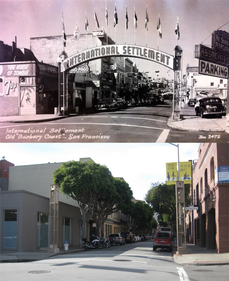 Pacific Avenue and Montgomery Street looking west and the old signposts of the eastern side of the International Settlement:
{The “Terrific Street” of the 1890’s – that block of Pacific Street, SITE OF THE BARBARY COAST, running east from the once-famous “Seven Points” where Pacific, Columbus Avenue, and Kearny Street intersect – is set off now at each end by concrete arches labeled “INTERNATIONAL SETTLEMENT”.}
{Where gambling halls, saloons, beer dens, dance halls, and brothels once crowded side by side, a Chinese restaurant, a night club and cocktail bar, a Latin American café, and an antique shop now appear,}
World War Two would change all that after this passage was written when soldiers and sailors on leave brought back the “gambling halls, saloons, beer dens, dance halls, and brothels”. It’s interesting how they referred to it as Pacific Street in the book rather than Pacific Avenue. The House of Zombie and Pago, Pago Buildings on the left are still there. (Vintage picture, Flickr)

 I observe very little “social distancing” at Ocean Beach in 1948. (opensfhistory.org)
 The Cliff House closed up tight and there’s still little parking in front. That’s because the Ocean Beach Parking Lot has been closed off and people are still going to the beach.
 The Beach Chalet on the western edge of Golden Gate Park in 1963; now closed and quiet. (San Francisco Chronicle)
 Alamo looking northeast toward the “Painted Ladies” after the 1906 Earthquake: (Vintage photo from the California Academy of Sciences)
 The famous Lombard Street, between Hyde and Leavenworth Streets, is still open to traffic, but there are few cars or people visiting the tourist site. (opensfhistory.org)
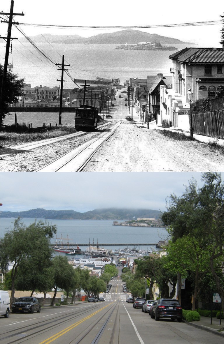 The Hyde Street Gripless! The best portion of the entire cable car system looks even quieter than the old 1920s photo.
 A closed and empty Golden Gate Bridge Promenade last Friday and in June of 1987 with me and some of my family: This area has changed a lot since then.
 Looking down Geary Blvd past Lotta’s Fountain during the 1930s: Lotta’s Fountain was not only taller then, but it was in a slightly different spot at the intersections of Geary Blvd, Kearny and Market Streets. The fountain was moved back to its original location in 1999.
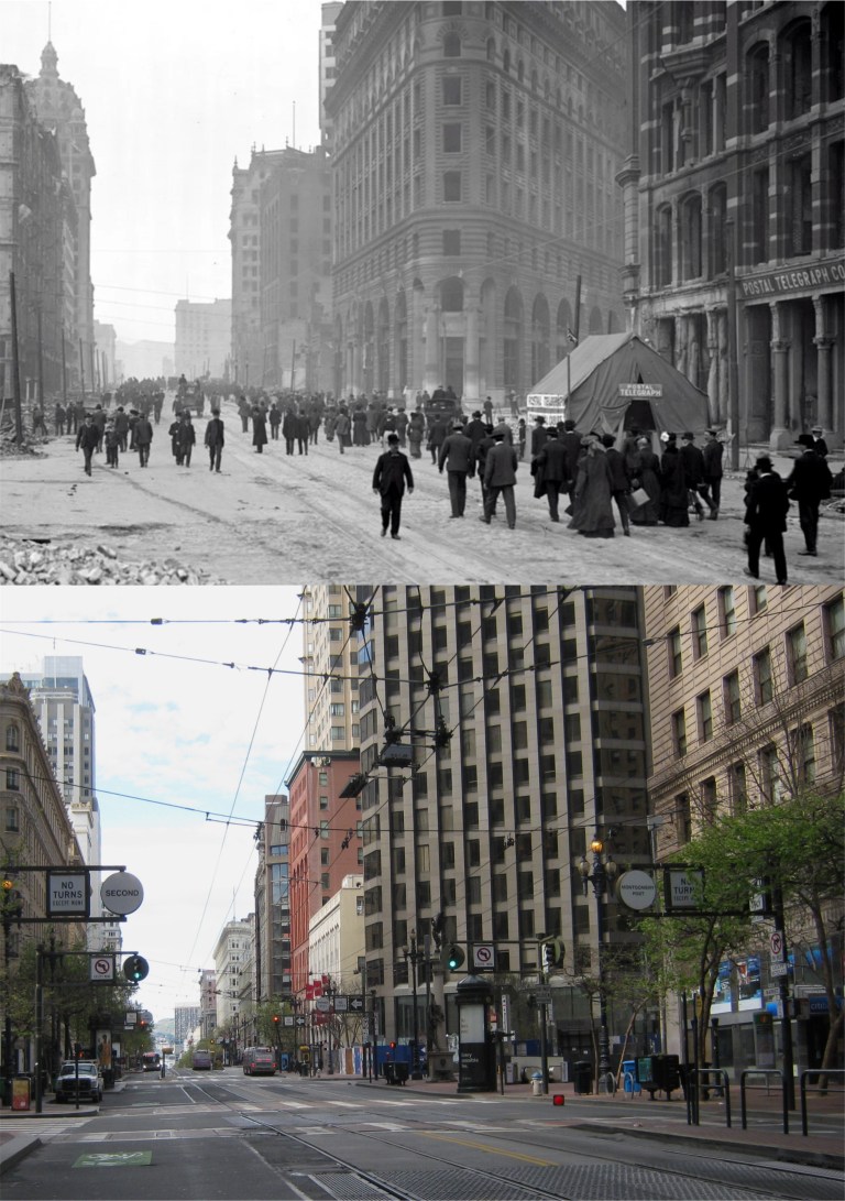 Looking west on Market Street at Montgomery Street after the San Francisco Earthquake of 1906: You can see the old and new Palace Hotels and the Call Building on the left in both pictures. (San Francisco History Center)
 A parade on Market Street at 4th St in the 1920s: The crowned Call Building, today’s Central Tower, is in the background of both pictures. The thin Humboldt Building is on the right in both pictures.
 Market Street at Grant Avenue in the 1940s: An American Werewolf in San Francisco!
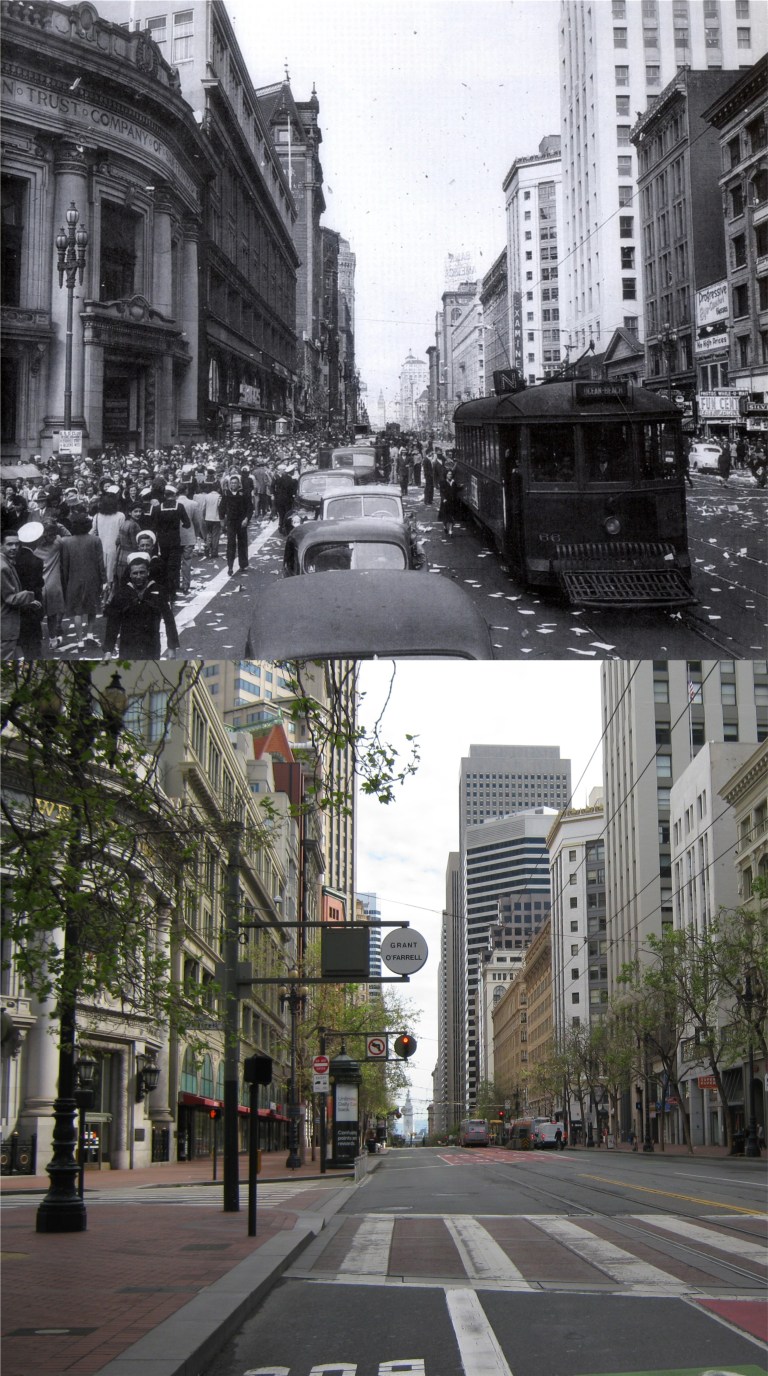 VJ Day, celebrating the end of World War Two, at Grant Avenue and Market Street in August of 1945: (Vintage picture from the San Francisco History Center)
 Market Street, across from the old Emporium Department store, during the 1930s: I saw several incidents of police having to deal with the street people during yesterday’s walk.
 Powell Street Looking across Market Street toward the Emporium in 1971: The Flood Building is on the left in both pictures.
 The cable car turnaround looking north on Powell Street in the 1950s: (Vintage Everyday)
 A protest March on Market Street at 5th looking toward the old Flood Building in 1966: (The Shorpy Archive)
 Broadway at Columbus Avenue:
 Grant Avenue, North Beach: Even the Live Worms Shop was closed! (Whatever that is)
 The silence even reaches up to the top of Telegraph Hill.
 No trouble finding parking at a closed and quiet Coit Tower.
 Looking down Montgomery Street from Telegraph Hill:
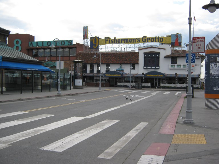 Fisherman’s Wharf, as dead as Elvis is:
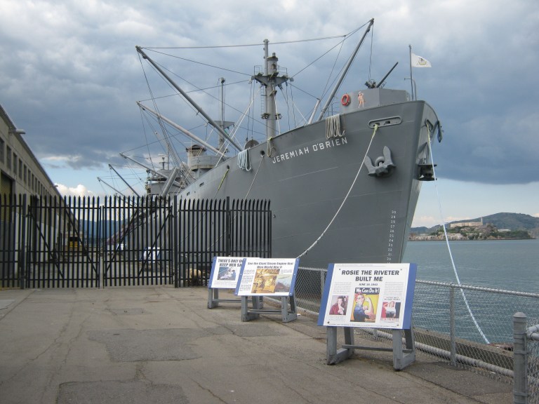 The Liberty Ship Jeremiah O’Brien tucked in for the duration: If she could talk she’d probably say, “I braved Nazi submarines in the Atlantic Ocean, I’m not afraid of a little bug!”
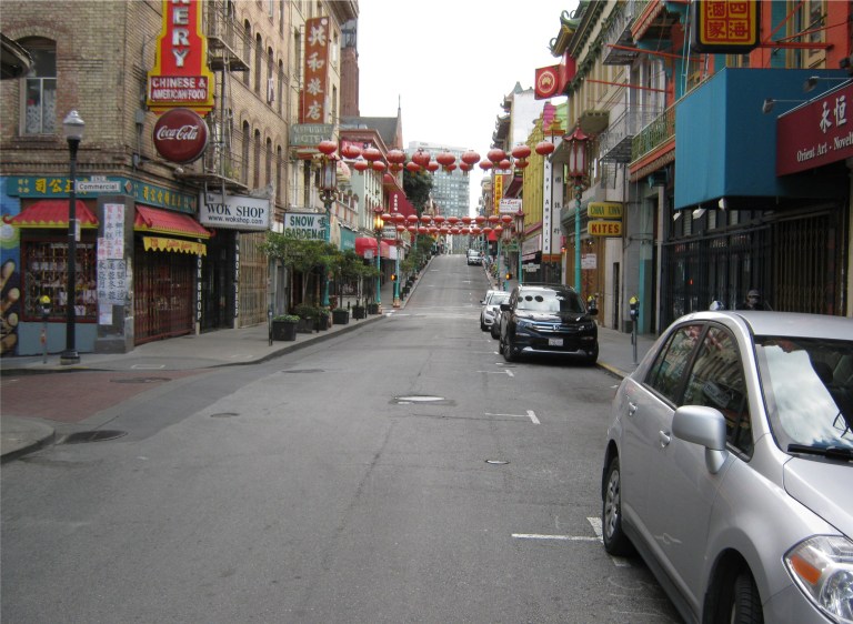 A spooky and empty Chinatown: The crowds have all gone home.
 A cable car heading up Powell Street in the 1950’s: (The Charles Cushman Collection)
 As I mentioned there was a noisy and fun-to-watch festival happening on Grant Avenue at Jackson Street when I got there.
 Grant Avenue and Jackson Street in the early 1960s: It was in an old hotel at this intersection that the first victim of the 1900 plague died. (The San Francisco Pictures Blog)
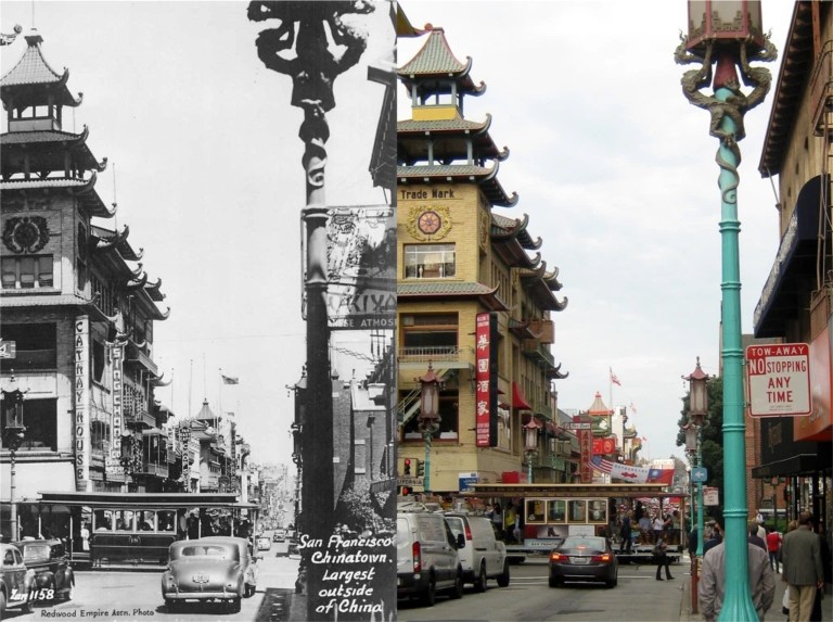 Grant Avenue and California Street looking north in the 1940s:
 Looking southeast on Grant Avenue and California Street at passengers boarding a cable car in the 1950s: (The San Francisco Pictures Blog)
 The old Shanghai Low Restaurant on Grant Ave between California and Pine Streets in the 1960s: (The San Francisco Pictures Blog)
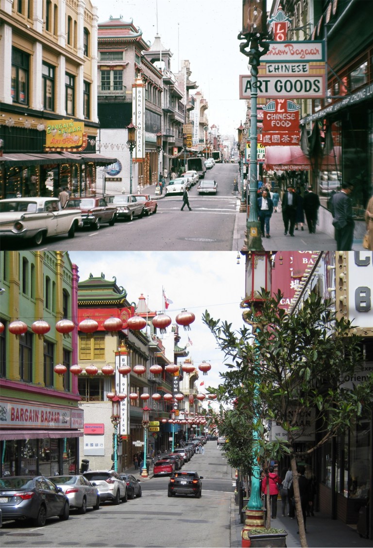 Grant Avenue looking north as it approaches Sacramento Street in the 1960s: (The San Francisco Pictures Blog)
 The Chinese New Year Parade on Grant Avenue at Sacramento Street in the 1940s and the last time I attended the parade in 2017. It was reported that the crowd of parade watchers was considerably lower in February of 2020. I didn’t go this year, either; not because of the coronavirus, but because I’ve “been there, done that” too.
 The northwest corner at the Top of the Mark, “Weeper’s Corner”, looks like the 1940’s or early 1950’s: “Weeper’s Corner” got its nickname during World War Two when mothers, wives and sweethearts sat in this corner watching their loved ones sail off to the Pacific Theater of the war. The Top of the Mark is still a special place to take a break; visitors are no longer required to dress up to come up here, and as far as I know, weeping in this corner is still allowed.
 The old Redwood Room at the Clift Hotel, seen here in the 1950s, is another historic place to relax with a cold one and try to forget about all of the money you’re spending on your visit to San Francisco. (hippostcard.com)
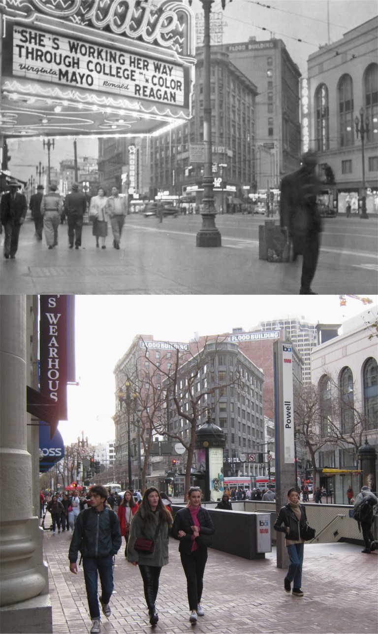 Checking out a flick on Market Street to get away from it all, like here at the State Theater at 4th and Market Streets in 1952, isn’t going to work anymore; all of the theaters in this area have been demolished. (tumblr.com)
 Now, if you really want to make it a special afternoon, lunch in the Garden Court of the Palace Hotel is one of the best ideas for a breather; although, sometimes it’s prettier and cheaper just to sneak upstairs and take a picture of the hotel court. (ebay)
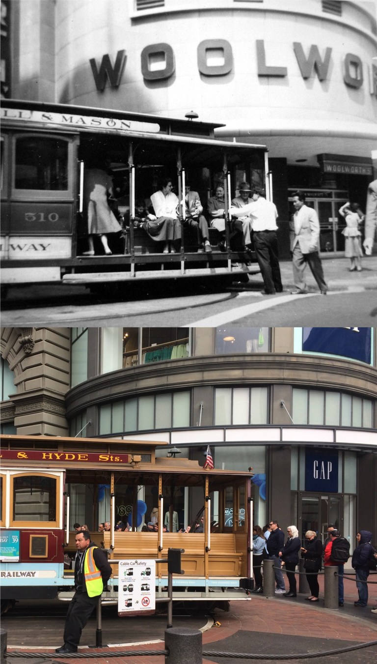 A relaxing cable car ride at Powell and Market Streets might bring the energy back to your feet, but the problem is that the wait standing in the long line to catch a car can sometimes be longer than the walk you took around San Francisco.
 Hotels like the Fairmont, St. Francis, and here at the Sir Francis Drake lobby, seen here in 1928 in the vintage picture, usually don’t mind visitors sitting awhile to relax in their lobbies. Sometimes, they even encourage people to stop and browse on occasions like holidays. (North Point Press)
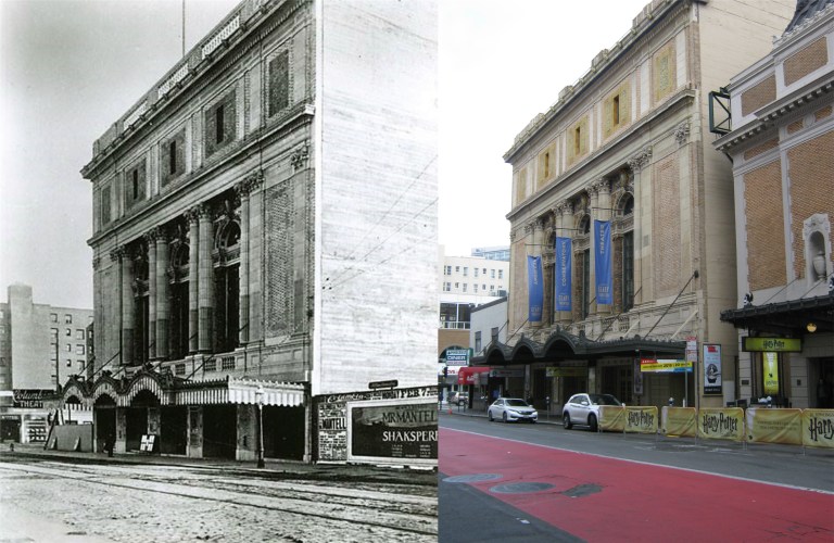 And if you need a long rest, you can catch a play at the Geary Theater on Geary St.. near Mason Street, seen here in 1910, the year the theater opened. The Curran Theater, west of the Geary Theater, had not been built yet in the vintage picture. (San Francisco Theaters / blogspot.com)
 The Geary and Curran Theaters looking west in 1958: Notice what was playing at the Curran Theater. (blogspot.com)
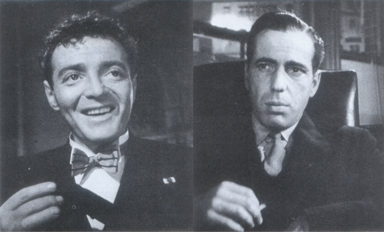
 I’ll pause for five seconds while movie buffs spot what’s going on here….. Joel Cairo (Peter Lorre) in attempting to search the office of Sam Spade (Humphrey Bogart) in the 1941 film ‘The Maltese Falcon’ is knocked out by Spade. In searching through the pockets of the unconscious Cairo, Spade finds, among other things, that Joel will be attending a play that evening at the Geary Theater. This was where Cairo was planning on being that night in the novel by Dashiell Hammett, as well. (Flare Books / Richard Anobile)
 Executive Order Number 9066, signed by Franklin D. Roosevelt on February 19th, 1942, forced Japanese citizens on the West Coast to leave their homes and businesses for internment after Pearl Harbor in fear that some may create acts of sabotage in support of Japan’s military machine. The Japanese owners of this business on Grant Avenue south of Pine Street in Chinatown, (there were several Japanese owned businesses on Grant Avenue between California and Bush Streets in 1942) are selling off as much of their inventory as possible before being relocated. Ironically, their shop was the one with the green BLOWOUT SALE sign in the window behind the California flag in my update.
 South of the Ferry Building, around 1984: I was standing in the shadow of the Embarcadero Freeway. Looks like I got here close to the same time as I did thirty six years ago. They’re doing some work on the south wing of the Ferry Building lately, but I haven’t had a chance to find out what that’s all about yet.
 The Embarcadero just south of Levi Plaza around 1985: Although the old Belt Line Trains were long gone by then, the tracks still ran down the Embarcadero all the way to China Basin. The Embarcadero Freeway, where it stopped at Broadway, is in the center. One of the buildings the Exploratorium is housed in now is on the far left.
 Pier 33, on the left, on a rainy day: I’m not sure when I took this picture; some of those cars look newer than the 1980’s. Might have been in the 1990’s; neither one of those decades seems that long ago to me! I remember the Peer Inn Restaurant, though; it was where the restaurant with the pink awning is now.
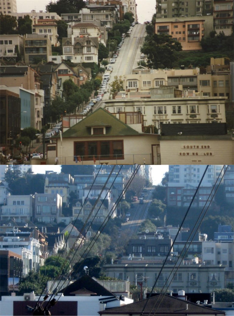 I had to do a little detective work to locate where I took these two photos. They were taken around 1985. I wasn’t even sure if I took them on the same day, but Hyde Street coming down Russian Hill in the second picture was my guideline. They were both taken from the second deck of the old ferryboat the Eureka at the Historical Hyde Street Pier. I was able to find the same spot I took my old pictures from on a visit to the Eureka last Saturday; maybe the first time I’ve been on board that old ferryboat since then. The top one, of course, is looking toward Telegraph Hill, the bottom one is Russian Hill, with a close up of Hyde Street where the cable cars plunge down from the top of the hill.
 I took the top picture in 1985; some vistas don’t change much with the passing of time.
 {San Francisco
 The main character is Gregory Richards, eighteen years old and down-and-out, trying to get a job on one of the many ships docked along the Embarcadero in 1936. His two main troubles are a pending waterfront strike, and the fact that none of the ship crews are willing to hire someone who hasn’t shipped out and hasn’t had ship sailing experience. He meets a fellow named John Brant who is willing to sell him a phony discharge certificate proving he has had sea experience and tells him where a ship named the SS Araby, that will hire him if he’s willing to cross a picket line, is docked.
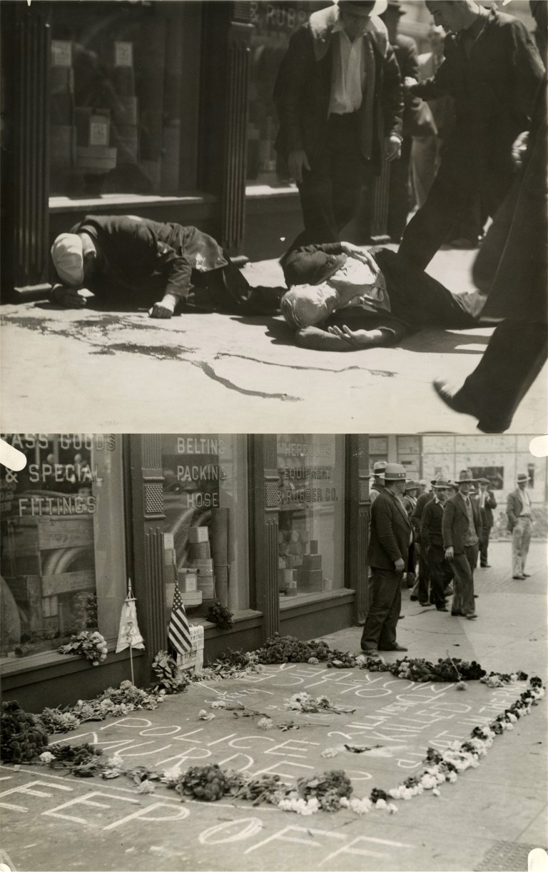 Before Richards runs into John Brant, he is warned of the dangers along the waterfront by a gentleman at a sailor’s hiring hall, particularly for strike breakers. When Richards inquires about police protection, the fellow tells him,
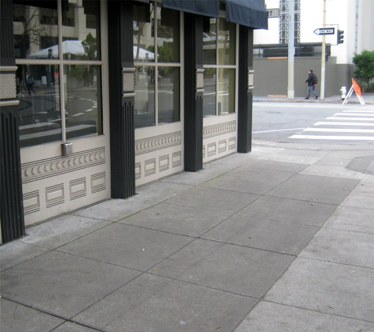 The spot where the previous two pictures were taken today:
 There is a marker describing the incident on a building at Steuart and Mission Streets today.
 The “Bloody Thursday” incident is still commemorated today on the sidewalk in front of the Longshoremen’s Hall on North Point Street.
 Greg counts the piers as he walks from Mission Street to Pier 43.
 Having been discouraged by the picketers in front of Pier 43, Greg requests assistance from a police officer watching from across the street to cross through the picket line and board the Araby.
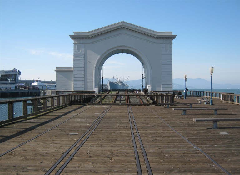 The top vintage picture above from opensfhistory.org is Pier 43 with a ship docked there in 1939. The picture below it I took looking through Pier 43 toward the Liberty Ship Jeremiah O’Brien:
 Greg is hired on to the crew of the Araby, but shortly after, an arsonist fire is started in the cargo hold. A series of clues leads Richards to believe that John Brant, who gave him his phony discharge certificate, is involved. He confesses to Captain Jarvis, master of the freighter, and Third Mate, Tod Moran in order to warn them of his suspicions. Partly because of his honesty, and partly because he can identify John Brant, they keep him on the crew. They leave the ship to search the waterfront for John Brant.
 The Ferry Building is mentioned often in ‘Foghorns’.
 Richards, Moran, and Captain Jarvis go back to the waterfront hotel where Brant sold Richards his phony discharge certificate on the corner of Mission Street at the Embarcadero and called the Bay View Hotel, and break into a room Brant was occupying when they made the sale looking for clues. They find a message that leads them to believe Brant will be meeting a confederate at the Canton Low Restaurant in Chinatown.
 But John Brant, sensing a trap bolts out the back door of the restaurant, as Greg takes after him. He follows Brant out to St. Mary’s Square at Quincy Street.
 Throughout the book is mentioned a foreboding possibility of another waterfront strike like the one in 1934 that shut down the entire San Francisco waterfront. In 1937, Longshoremen led by Harry Bridges were establishing a union along the San Francisco waterfront that was opposed by many ship company owners. In August of 1937 they founded the International Longshore and Warehouse Union. This 1937 picture from opensfhistory.org shows longshoremen gathering in front of Pier 15.
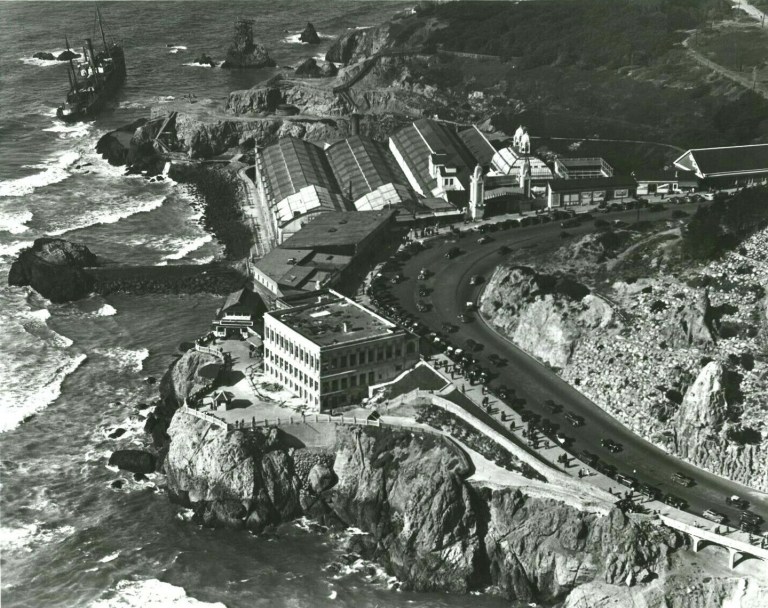 I’ll close with another reference in the book to an historical San Francisco Incident taking place when the book was written. In October of 1936, the cargo ship the SS Ohioan ran aground on the rocks near the Sutro Bathhouse and the Cliff House. The crew, much of the cargo, and parts of the ship were salvaged, but in March of 1937 the ship caught fire and was eventually smashed to pieces by the surf. The photo above is an aerial view of the Cliff House and Sutro’s Bathhouse showing the stranded SS Ohioan at the upper left. (ebay)
 A closer look at the stranded Ohioan and the area behind Sutro’s where she ran aground: (Vintage photo from worthpoint.com)
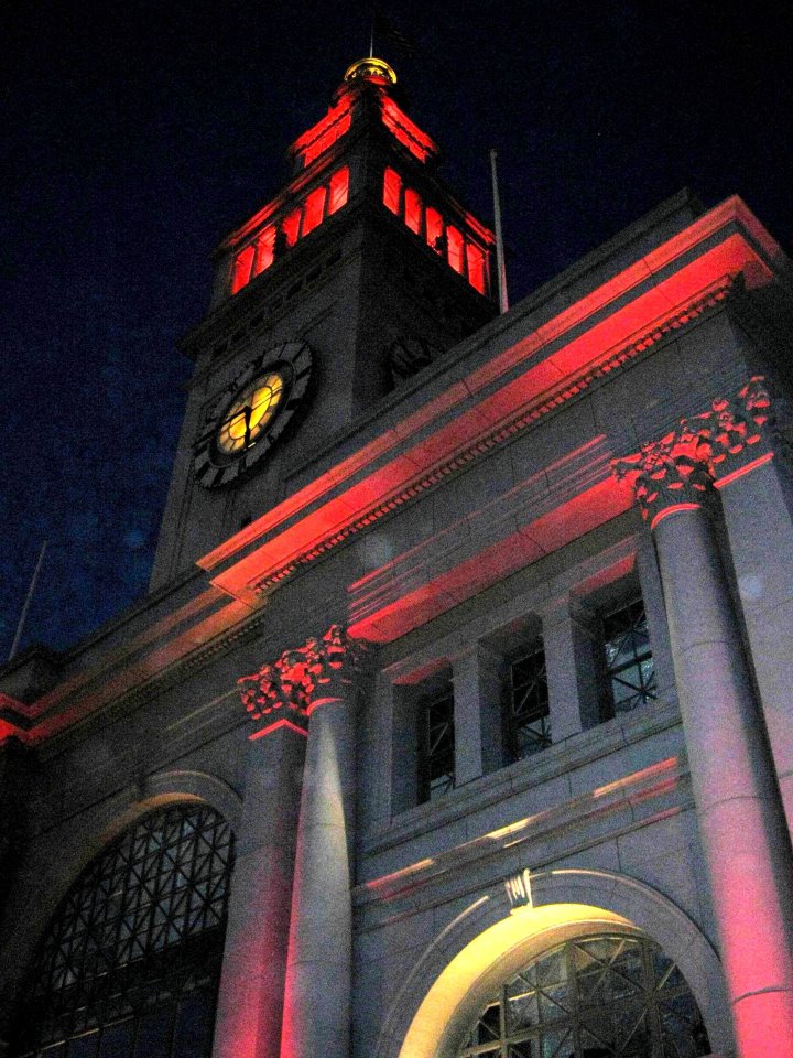
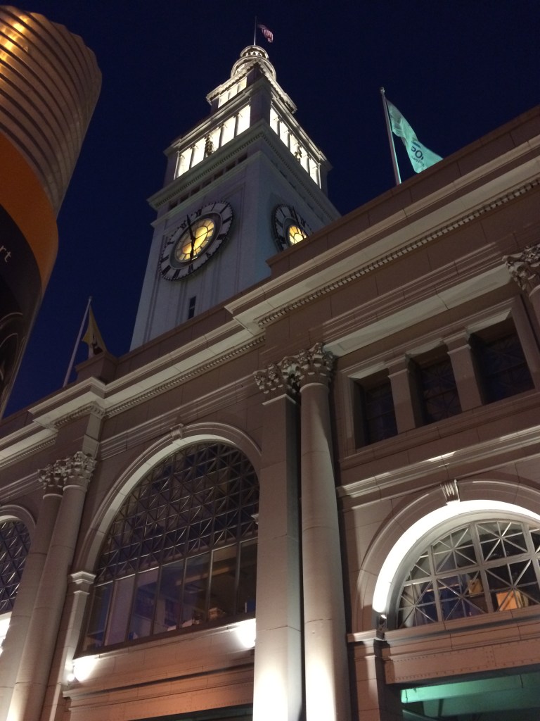 The old Southern Pacific Building on Market Street is getting into the fun, but the Ferry Building, all aglow in red in 2013, didn’t change its color this time.
 The sidewalk lights on the Embarcadero, (Herb Caen Way) were changed to red back in 2013 and you could stand in the glow. No red sidewalk lights at Pier 1 this time. “I wore a younger man’s clothes” back then. Oh, wait; those are the same clothes I was wearing last Sunday!
 The Billy Graham Civic Auditorium is in gold and red this year.
 I got a fuzzy picture of City Hall on that January Saturday night in 2013 and another last night. It’s not that I’m a better photographer since seven years ago; I just have a better camera now.
 A MUNI bus coming along Post Street in January, 2013: We won’t see that this year.