Another armchair tour of San Francisco, courtesy of the WPA

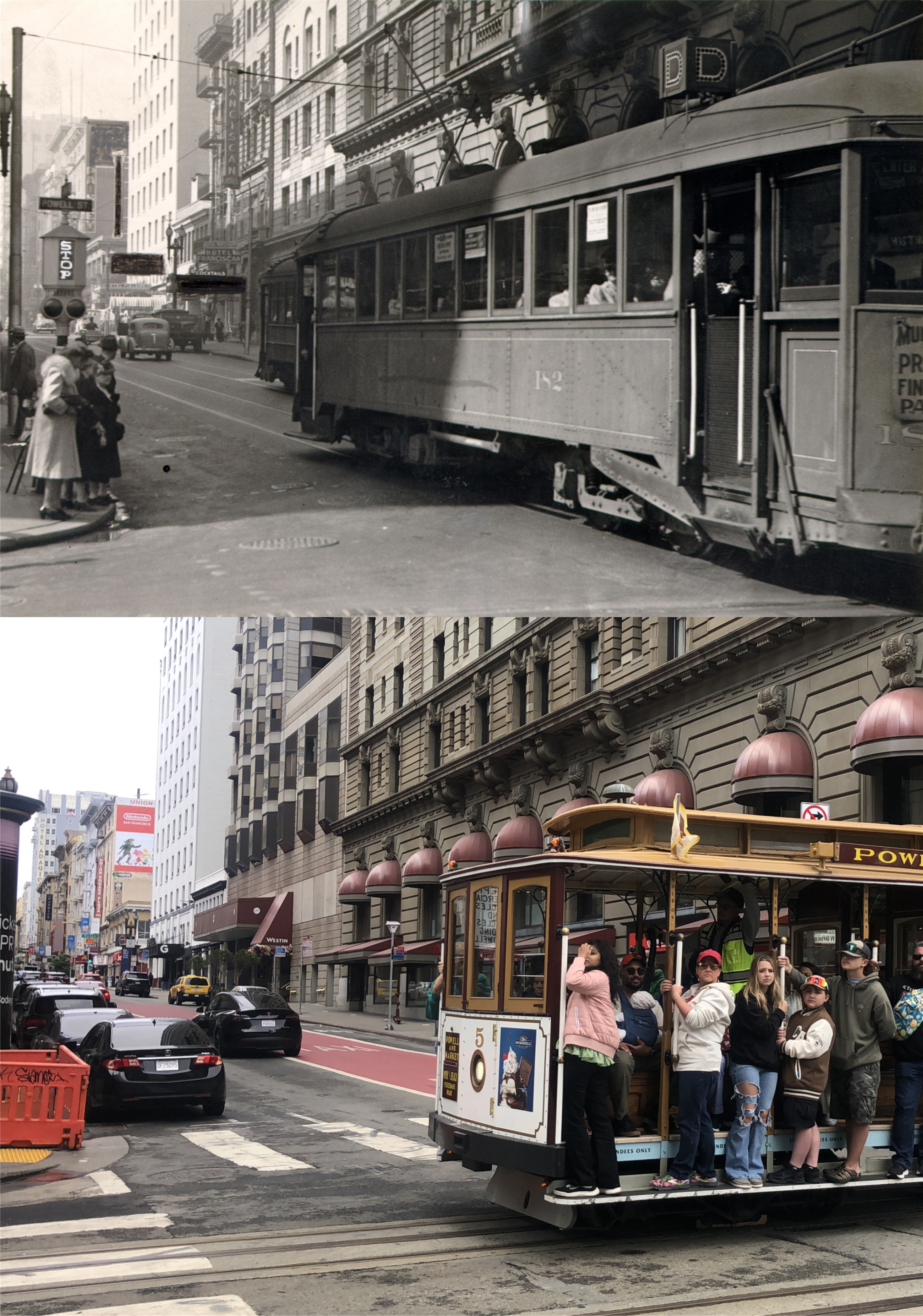
As I mentioned several posts ago, I have two copies of the 1940 WPA guide to San Francisco, the original 1940 hardback copy from Armchair Guide Series, and the 2011 paperback issue reprinted by the University of California Press. These are a few more ‘POINTS OF INTEREST’ from the book of locations not usually on visitors itinerary when they tour San Francisco. As before, I’ll post the descriptions from the book, many of them enjoyably outdated but some of them still accurate, along with then and now photos from my archives of the sites.(Thumbnail images)


{17. Founded a decade after ‘49 by John Sullivan, the HIBERNIA SAVINGS AND LOAN SOCIETY (open 10-3), NW. corner McAllister and Jones Sts., has survived eight decades of prosperity and panic to become one of San Francisco’s oldest banks. Its classic one-story building (Albert Pissis, architect) – whose granite facades were gleaming white when finished in 1892 but have weathered to a dull gray – survived even the fire of 1906.}

My update was of an Edward H. Suydam drawing from the 1930s. The building has been empty for years and years.


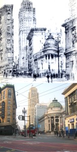
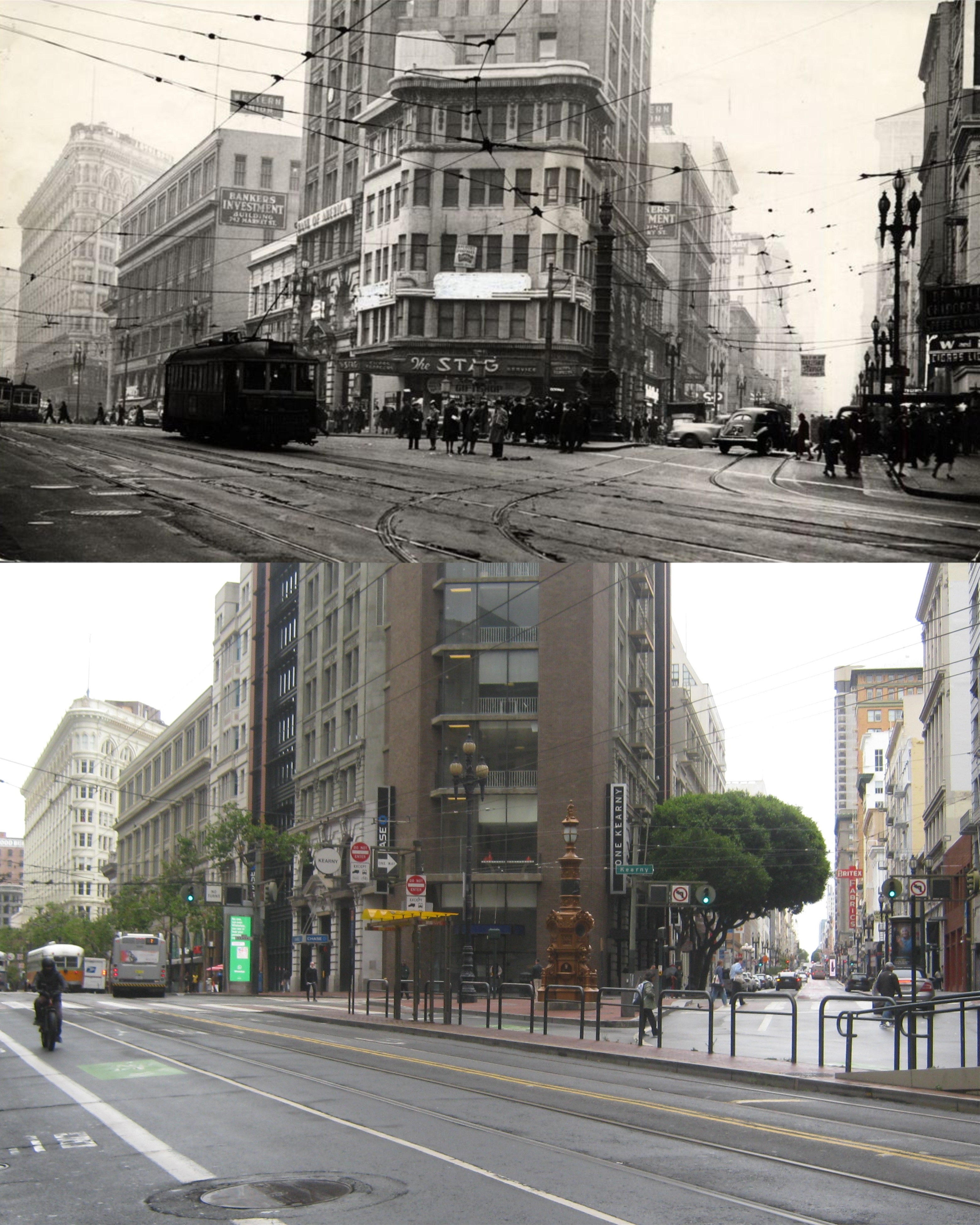
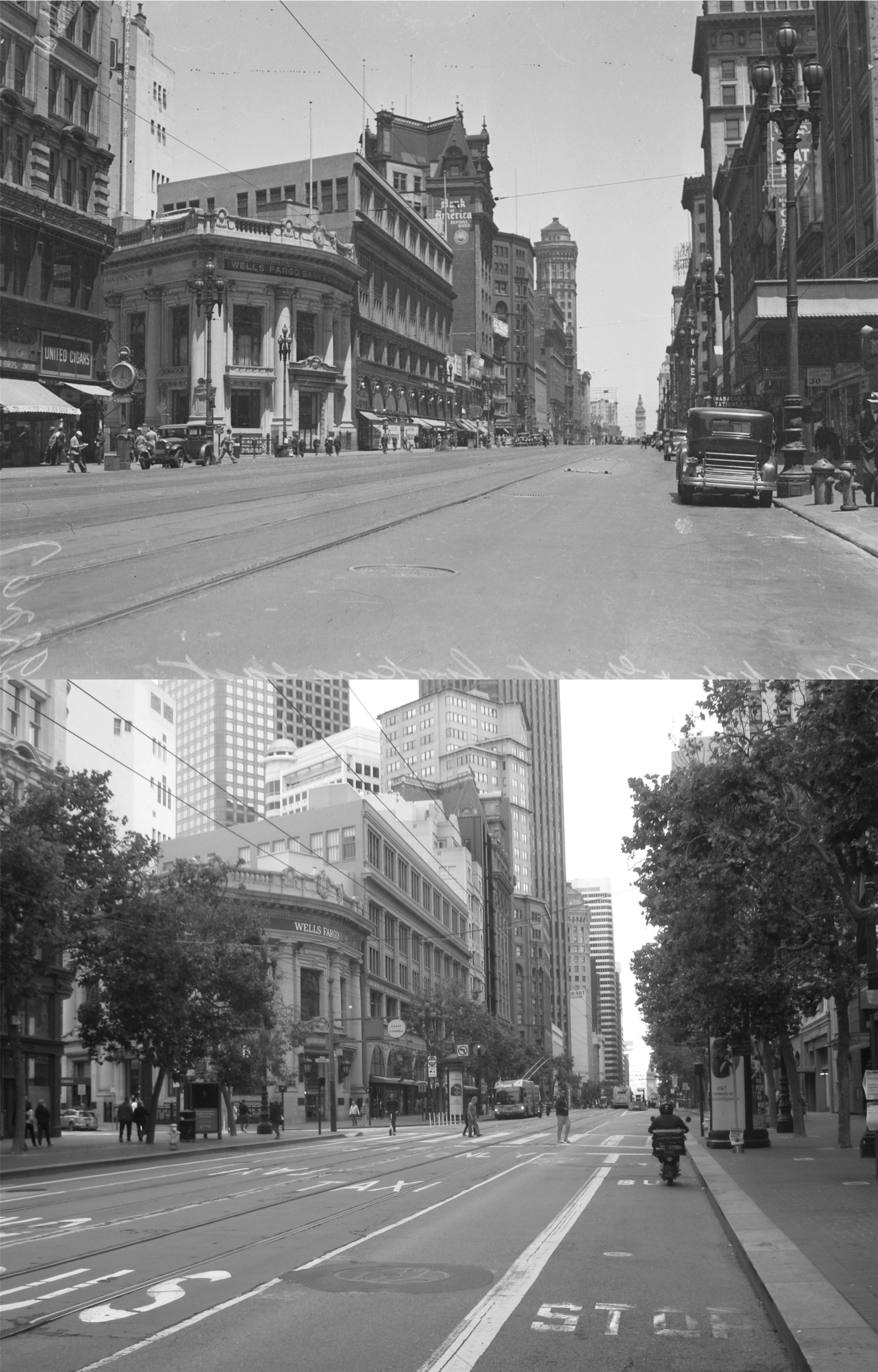
{55. The 12-story HEARST BUILDING (visitors conducted on two-hour 7-9 p.m.), SE. corner Market and Third Sts., of white terra cotta with polychrome ornamentation, houses the San Francisco Examiner, first paper in the Hearst chain. The first of its five regular daily editions appears on the streets about seven o’clock in the evening.}

My update is of the original Hearst Building on the left, destroyed and rebuilt by Hearst after the 1906 Earthquake and Fire.


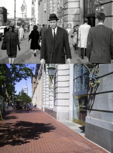
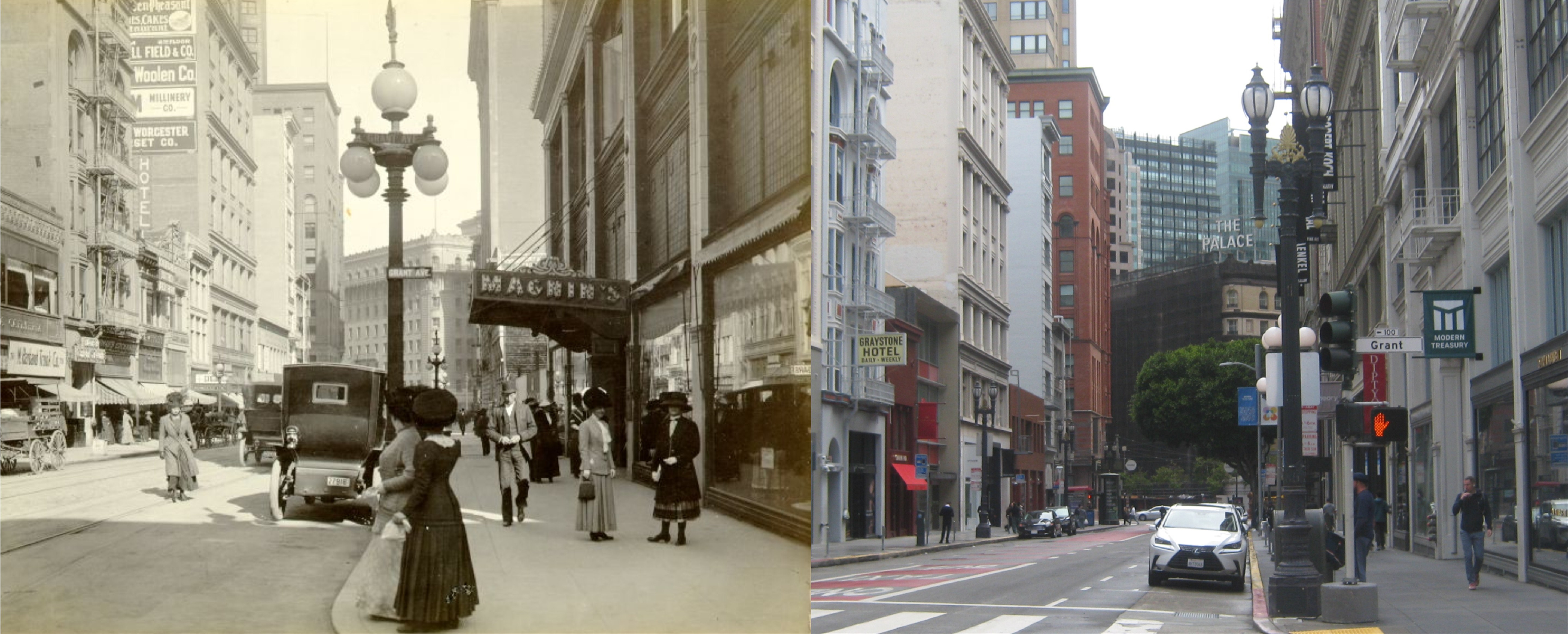
{65. The neo-Gothic, gable-roofed ONE ELEVEN SUTTER BUILDING, SW corner Montgomery and Sutter Sts., since 1927 has reared its buff-colored terra cotta facades 22 stories above a site that was worth $300 when James Lick bought it and 175,000 when he died.}

The authors didn’t mention that it is also considered to be the building where Sam spade’s office was in the novel ‘The Maltese Falcon’ by fiction historians. 111 Sutter, on the right in the photo from the 1984 edition of the novel from North point Press, can just be seen between taller building in my picture taken from the St. Francis Tower.

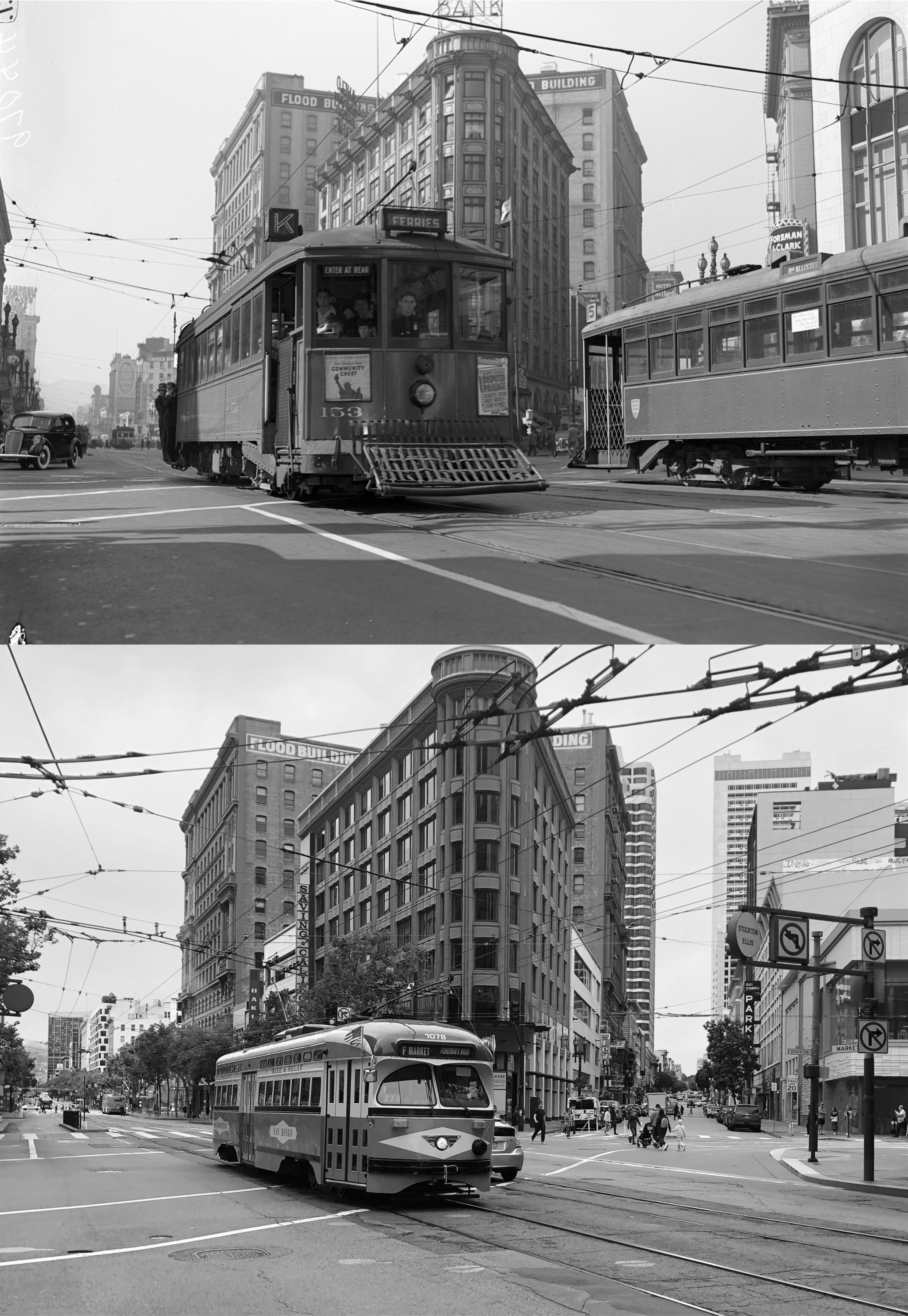
{75. By day, bathed in sunlight, the 30-story SHELL BUILDING, NW. corner Battery and Bush St., San Francisco headquarters of the Shell Oil Company empire, is a buff, tapering shaft; by night, floodlight-swept, a tower looming in amber radiance.}


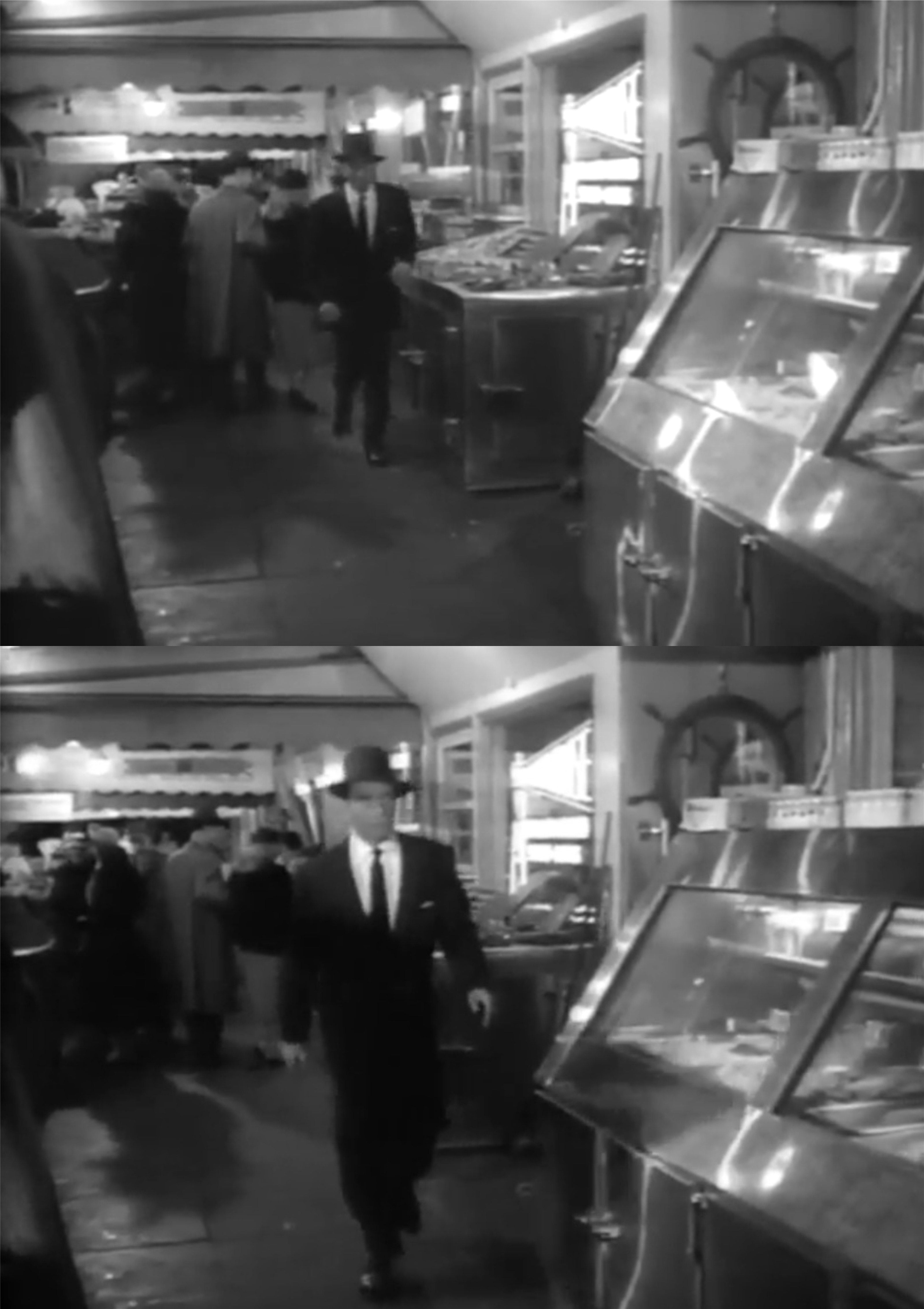
{81. On wooden piles driven into the mud of what was Yerba Buena Cove rest the 17 steel-and-concrete stories of the PACIFIC GAS AND ELECTRIC BUILDING, 245 Market St., headquarters of the nation’s third largest utilities system, which originated with Peter Donahue’s gas company (1852) and the California Electric Light Company (1879), both Pacific Coast pioneers.}

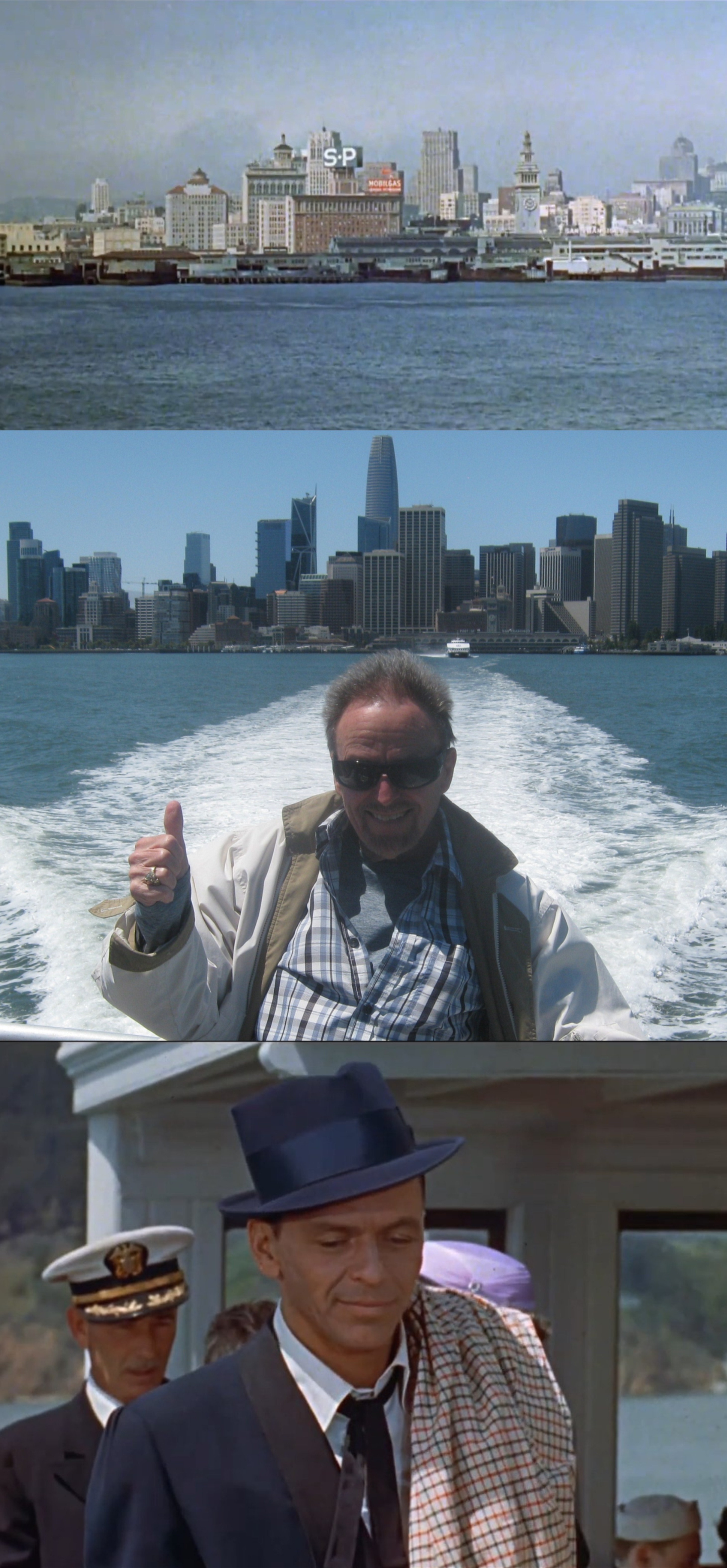
That’s Lee Remick running after Jack Lemmon out of the PG&E Building in the 1962 film ‘Days of Wine and Roses’. You can see the Embarcadero Freeway in front of the Ferry Building in the film image.


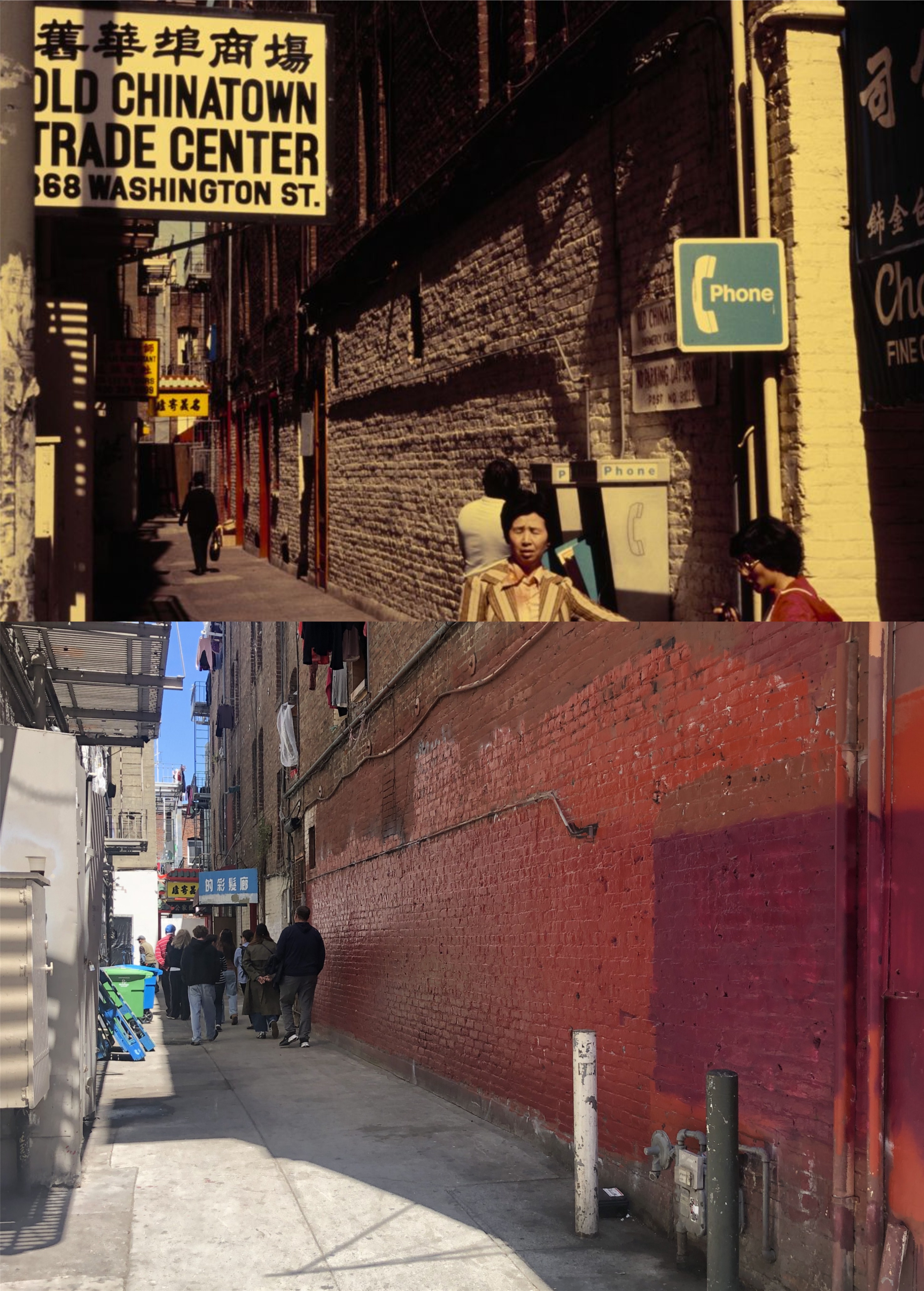
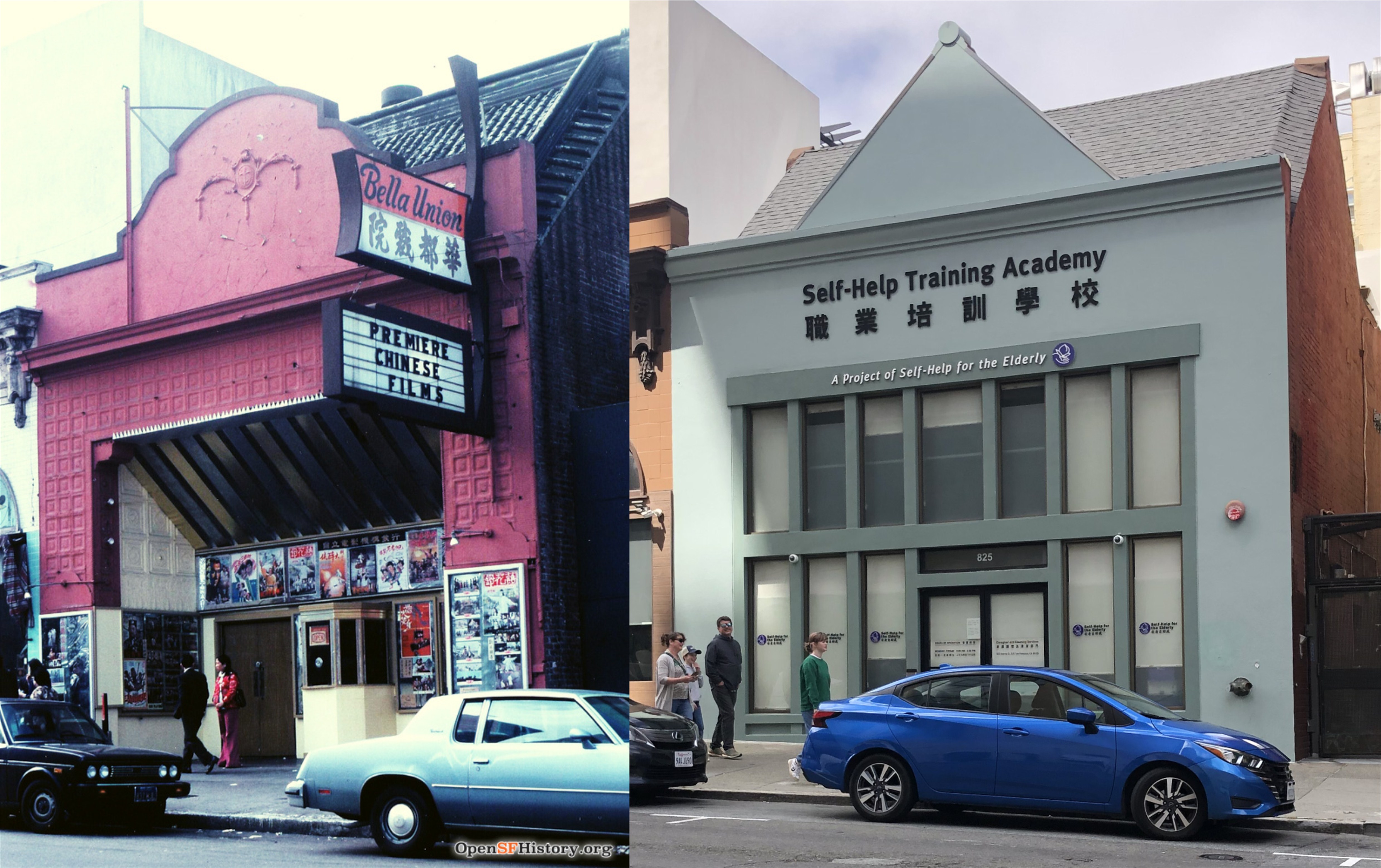
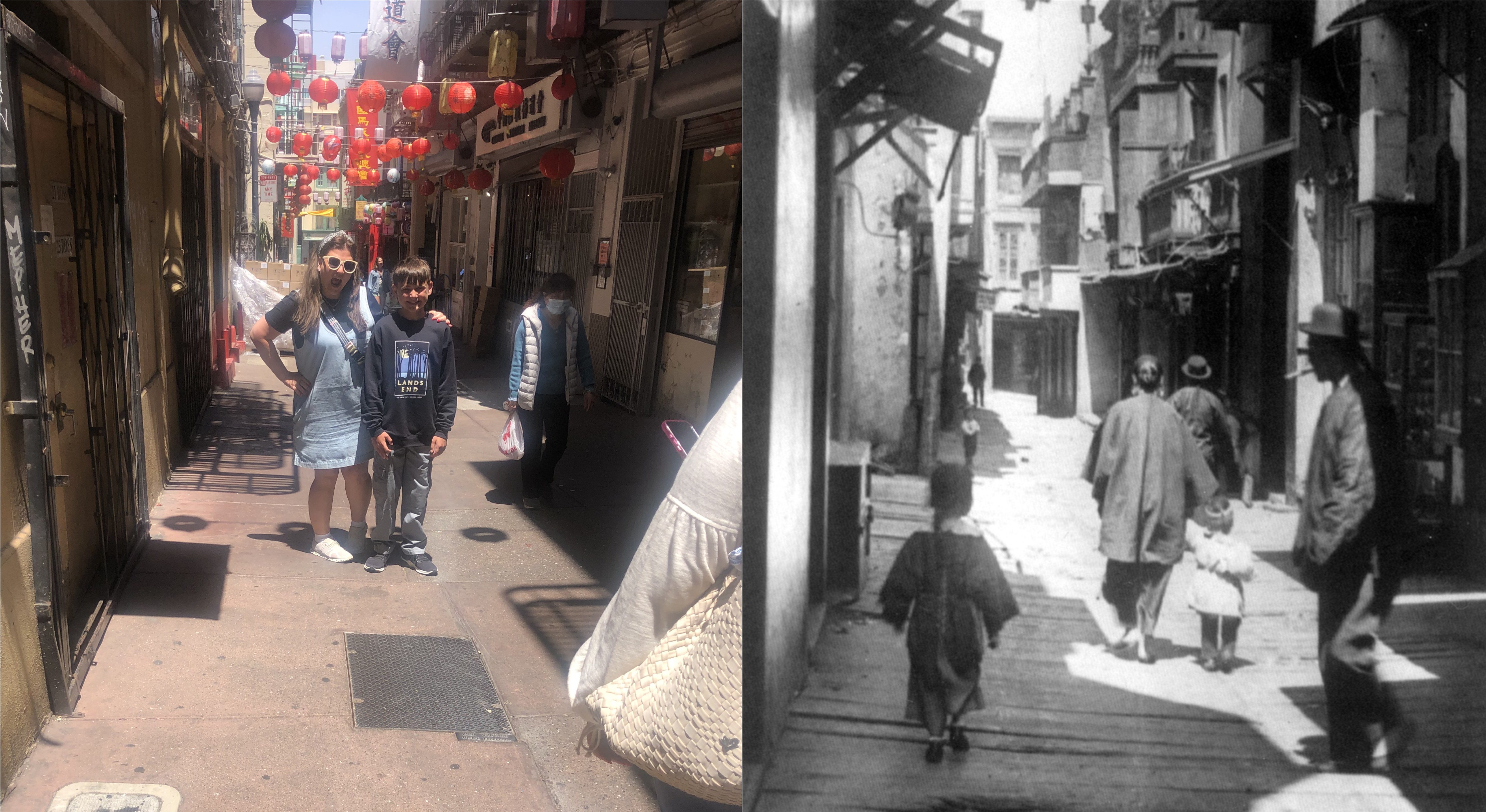
{119. Everyone is a first-nighter at the MANDARIN THEATER (open 7:30 p.m. – 12:30 a.m.; adm. 25 cents-50 cents), for the play changes each evening. With few props and little scenery, the native dramas seem to flow on endlessly, while the orchestra (seated onstage out of range of the play and the audience consume melon seeds, ice cream and “pop.”

The 1930s picture, looking toward the Mandarin, is from photographer, Ken Cathcart.


{122. First Roman Catholic parish church in San Francisco. ST. FRANCIS CHURCH, 620 Vallejo St., owes its origin to the religious zeal of a group of the Gold Rush town’s French Residents, who persuaded a young officer of the United Stated Army to give the use of a small room for services.}

In the 1962 film ‘Experiment in Terror’ FBI agent John Ripley (Glenn Ford) goes into the St. Francis Church to question a priest in the hopes of finding an extortionist and murderer.


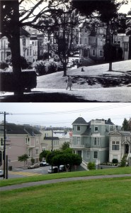
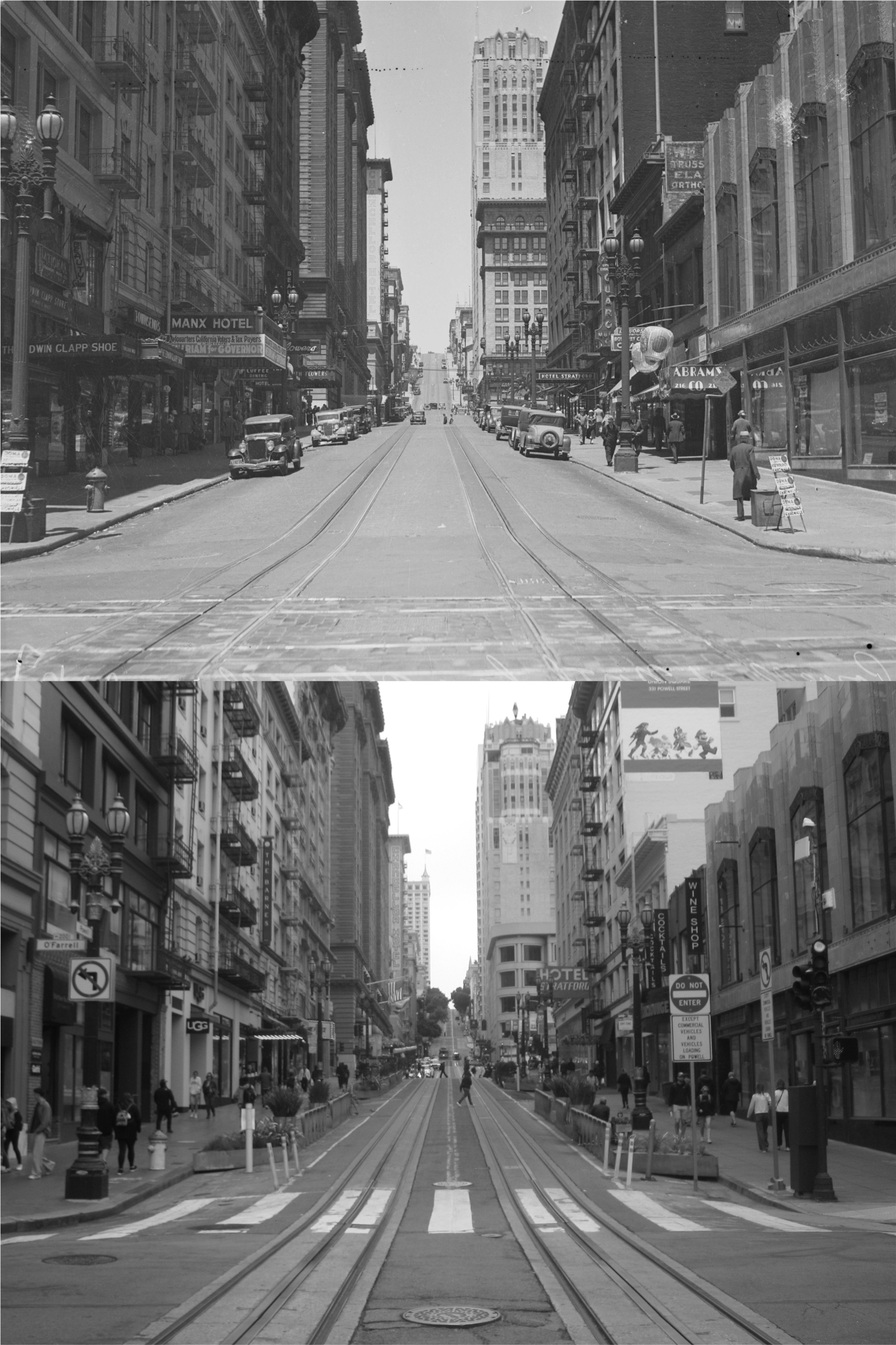
{130. Where nursemaids trundle streamlined prams along the shrubbery-bordered paths of HUNTINGTON PARK, California, Taylor, and Sacramento Streets., Colis P. Huntington used to stride up to his front door from the cable car stop on California Street.}

{131. Like those Gothic churches of the Middle Ages under construction for generations, GRACE CATHEDRAL, California, Taylor, Sacramento and Jones Sts., is not finished, although its cornerstone was laid by Bishop William Ford Nichols 30 years ago.}

This is the view of Huntington Park and Grace Cathedral from the Top of the Mark. Grace Cathedral, unfinished in the vintage picture, was not completed until 1964.


{179. ALTA PLAZA, Steiner, Scott, Clay, and Jackson Sts., was reclaimed by John McLaren when he filled a deserted rock quarry with rubbish, topped it with soil, planted lawns, and laid out walks and tennis courts. The stairway on the south side’s steep terraced slope is a reproduction of the grand stairway in front of the gaming casino at Monte Carlo.]

The vintage photo at the southwest corner of Alta Plaza is by Phil Palmer. John McLaren was also responsible for Golden Gate Park.


{184. Site of the first observatory in California, LAFAYETTE SQUARE, Washington, Gough, Sacramento and Laguna Sts., is a sloping green hill crisscrossed with hedges and graveled walks, topped with tennis courts and a small playground.}

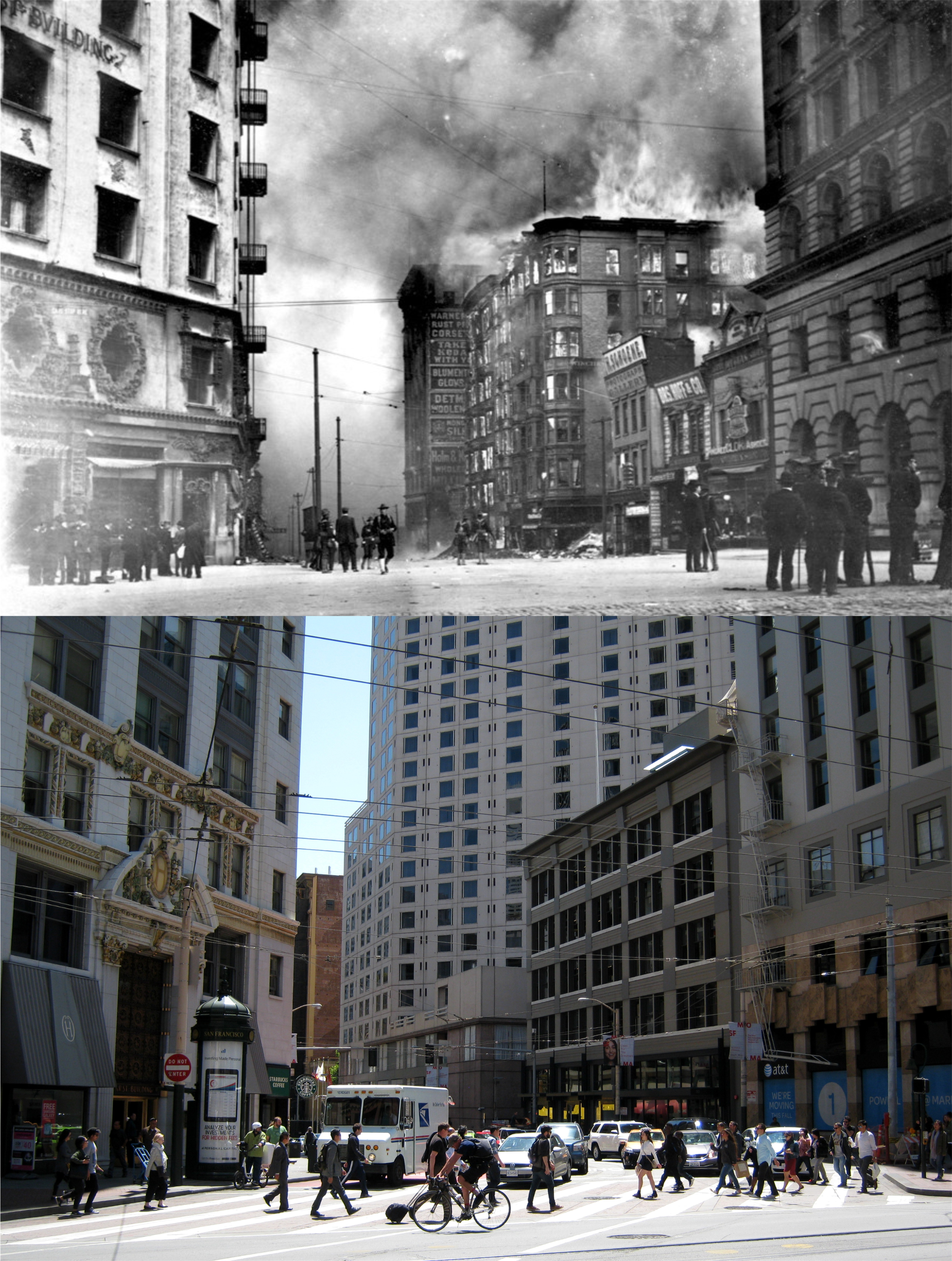
San Franciscans watch San Francisco burn after the 1906 Earthquake from the southeast side of Lafayette Square in a photo that may have been taken by Arnold Genthe.


{195. Popular with fishermen of all ages and Sunday promenaders is the 1,850-foot long white concrete MUNICIPAL PIER, foot of Van Ness Ave. The semicircular sea wall, constructed in 1929-34, swings northeastward to protect Aquatic Park’s little harbor.}

Tyne Daly and Clint Eastwood stroll along the pier in the 1976 film ‘The Enforcer’. The pier is closed off to the public now.


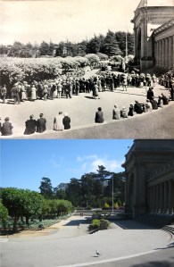
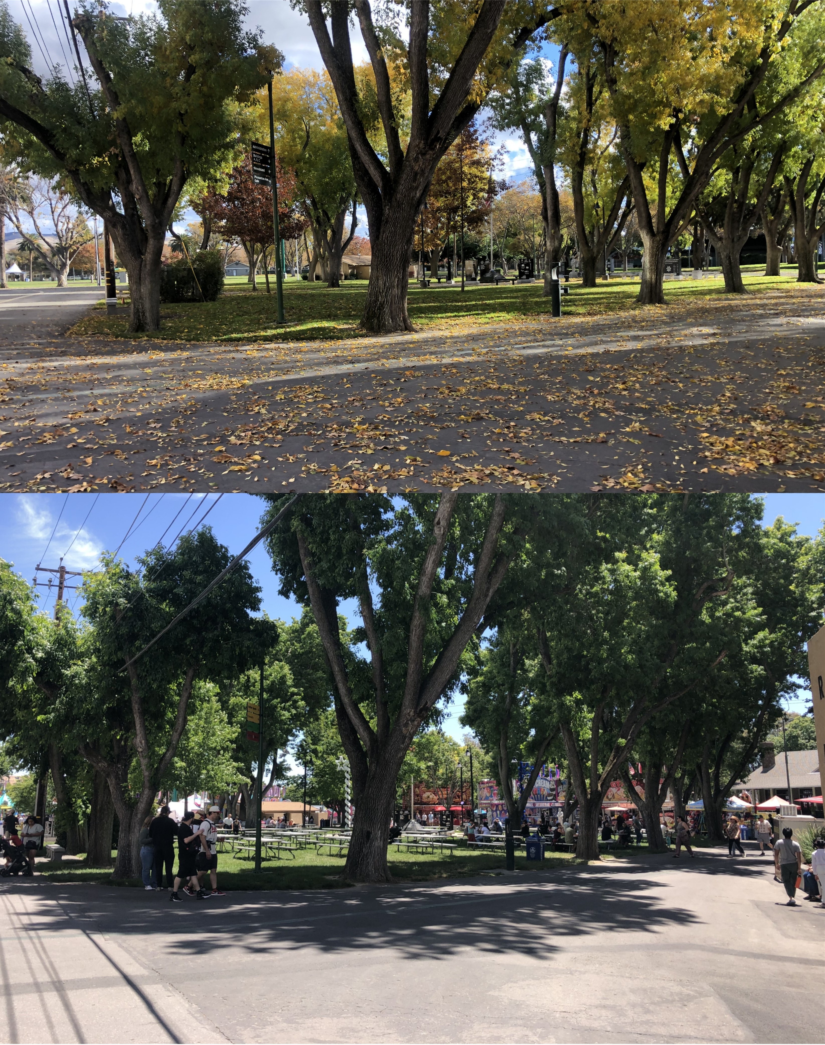
{254. The MUSIC CONCOURSE (band concerts Sun. and holidays 2-4:30), S. of Main Dr. near Eighth Ave. park entrance, a sunken outdoor auditorium seating 20,000, is 12 feet below the service of the surrounding roadway.}

Main Drive is now called John F. Kennedy Drive.


{274. The sandstone PRAYER BOOK CROSS, N. of Main Dr., modeled after an ancient Celtic Cross on the Scottish island of Iona, towers 57 feet above the edge of the bluff.}

{275 On Sundays and holidays, tiny RAINBOW FALLS, N of Main Dr., rush over a cliff at the base of Prayer Book Cross into a fern-bordered pool. Artificially fed from a reservoir atop Strawberry Hill, they were named when colored electric lights were strung along the cliff to make rainbows appear in the spray.}

The electric lights are long gone, and Rainbow Falls has stopped flowing since I did my then and now, but the cross is still on top of the hill.

{281. Homing ground for migratory game and domestic water fowl, SPRECKELS LAKE, N. of Main Dr., supplies much of the water for the park irrigation system. Each Sunday from March to late September the miniature sail and speed boats of the San Francisco Model Yacht Club trim their way across its rippling waters, some attaining a speed of 40 miles an hour.}

Spreckels Lake is one of my favorite spots too, although it doesn’t have the rough shoreline anymore that gave the lake more of a natural look, but I suppose that had to go too.

It’s a photog. blog

Now, you’re asking, “What does that mean?” Well, every now and then I post something that isn’t San Francisco, and isn’t vintage. The pictures in this post aren’t San Francisco vintage, but they are then and now photography, and that’s, in part, what this blog is about. Also, a blogger friend of mine named Tony may be interested in the fall and summer horticulture in this set, to which he’ll be familiar with, whereas I’m not. Late November last fall, I was watching the rare autumn horse racing in Pleasanton, CA. It always seems kind of lonely walking around the empty fairgrounds when the fair isn’t going on; no crowds, no corn dogs, no ice cream, no turkey legs, no oysters-on-a-stick, (I can do without those anyway) no deep fried Oreos, just horse racing. I enjoy taking pictures around the empty fairgrounds and matching them up when the Alameda County Fair is open. The fair opened this weekend, and everything is back, except the horse races. The County Fair is always a major part of the summer for me, but without the horse racing it’s kind of like going to Disneyland with Tomorrowland closed. (Thumbnail images)


The Green Entrance, where most visitors enter the fair: I’m a little farther back than my November photo, but I wanted to get the overhead sign in.


Looking toward where, last November, the Midway of the fair would be this June:


The Sky Tram between Buildings B and C:


The area between Building C and Q: I’m not sure what they call this area, but it’s pretty fall or summer.


I had a hard time finding this spot again; I had to go by the tree on the left. It’s between Buildings C and F.


Heritage Park: This used to be about the only place for shade and relaxation in the fair long ago.


“Lazy day, Sunday afternoon.”

Those are the opening lyrics to an old Moody Blues song. The singer likes to put his feet up and watch television, which is fine, but I’d probably fall asleep. Last Sunday, a definitive lazy Sunday in my book, I grabbed my camera, and took a walk around the Market and Powell Streets area of San Francisco to update some interesting vintage photographs from the UC Berkeley Library Archives. On some lazy Sundays, Downtown San Francisco is as quiet, uncrowded, and peaceful as some of the vintage pictures here. (Thumbnail images)


Market Street on July 15, 1934 during the Longshoremen’s Strike that shut down the Port of San Francisco: The view is looking toward Grant Avenue. The streets were relatively quiet and empty. The Wells Fargo, the Bankers Investment Building, the Gothic Bank of America, the Chronicle, and the Hobart Buildings on the north side of Market Street can still be seen.


A streetcar crew fixes a broken power line in front of the Emporium Department Store in May of 1938: The Humboldt and Call Buildings are in the background.


The intersections of Market, Ellis, and Stockton Streets in November of 1939:


A solitary figure on the North side of Maiden Lane on July 15, 1934 during the Longshoremen’s Strike, and a solitary figure in the south side of Maiden Lane Sunday: I have no idea what that thing covering up the Dewey Monument in Union Square in the vintage picture was all about; I’ll have to do some research. You can just barely see the monument through the trees in my photo.


Powell Street at O’Farrell on July 15, 1934, during the strike: The old Omar Khayyam Restaurant Building is in the right foreground, the Sir Francis Drake Hotel, now called the Grand Beacon, is in the far right background, the St. Francis Hotel is on the left.


I don’t know what was going on on January 17, 1939 in San Francisco, when this picture was taken, but the streets were packed! I looked the date up on the internet; that was a Tuesday! That reminds me, the Moody Blues had a song about ‘Tuesday Afternoon’, as well. The view is looking east from Market and 5th Streets.

The Works Progress Administration Guide to San Francisco (Part two)


Back in 2019, I picked up a paperback copy of a reprint of the 1940 book ‘San Francisco, The Bay and its Cities’. The updated book was titled ‘San Francisco in the 1930s, The WPA Guide to the City by the Bay’. Last weekend I found an original 1940 copy of the Works Progress Administration Guide in the bookstore at the San Francisco Main Library. If you’re interested in vintage San Francisco and San Francisco history it’s, like Bogie said in the Maltese Falcon, “The stuff that dreams are made of.” Well, that may be going a little too far, but it’s a very interesting outdated guide, although much of the book’s descriptions are still contemporary, and I wanted to do another post on it. I’ll show in the brackets some of the hundreds of points of interest listed throughout the book using the numbers they were listed, and duplicate the descriptions the original authors used. I’ll also post updated pictures I’ve taken in the past of the locations mentioned. (Thumbnail images)


{1. Dominating the Civic Center, the CITY HALL , Van Ness Ave., Po;k, McAllister, and Grove Sts., lifts its gold-embellished dome 308 feet above ground level – 16 feet 2 and 5/8 inches higher than the National Capitol in Washington D. C., as Mayor James Rolph used to boast.}

{2. The CIVIC CENTER PLAZA, Grove Polk, McAllister, and Larkin Sts., with its broad red bricks walks, its fountains playing in circular pools, its great flock of pigeons, its flower beds and box hedges, is surrounded by a row of acacia trees and lined, along Larkin Street, by flagstaffs.}


{16. Looming over the Civic Center and uptown San Francisco, the soaring shaft of the 28 story HOTEL EMPIRE, NW. corner Leavenworth an McAllister Sts., embodies the spirit of a new era rising from the old, like the Phoenix of the municipal seal.}


{18. The bronze angel atop the NATIVE SONS MONUMENT, Market, Turk, and Mason Sts., holds aloft a book inscribed with the date of California’s admission to the Union: September 9, 1850. Beside the granite shaft a youthful miner shouldering a pick, armed with the holstered six-shooter of his day, waves an American flag. Gift of James D. Phelan, the monument (Douglas Tilden, sculptor) was unveiled on Admission Day, 1897.}

Today the Native Sons Monument is on Market Street and Montgomery.


{23. Traces of discoloration in the sandstone near the entrances of the FLOOD BUILDING, NE. corner Market and Powell Sts., recall the earthquake and fire of 1906, which broke windows and blackened the walls of the structure a year after its completion.}

The damaged Flood Building is on the left behind the cable car.


{21. On the highest assessed piece of land in the city is San Francisco’s largest department store, THE EMPORIUM (open 9:45-5:25), 835 Market Street. The massive, gray sandstone facade, its three arched entrances opening onto a quarter block-long arcade, is ornamented with columns in half-relief rising from the fourth-story level to the balustrade at the roof edge. Inside, an immense glass-domed rotunda, 110 feet in diameter and 110 feet high, ringed by the pillared gallery, rises through four stories to the roof garden.}


{36. December, 1914 saw completion of the $656,000 STOCKTON STREET TUNNEL (Michael Shaughnessy, engineer), boring 911 feet through Nob Hill from Bush almost to Sacramento Street to connect downtown San Francisco with Chinatown and North Beach. The tunnel is 36 feet wide and 19 feet high; sodium vapor lights were installed in 1939.}


{41. One of the Nation’s oldest jewelry establishments, SHREVE AND COMPANY (open 9-5), NW. corner Grant Ave. and Post St., has been dealing in precious stones and rare objects of gold and silver since 1852. It is the only large downtown store still operating whose advertisement appeared in the San Francisco City Directory of 1856 – when its address was No. 139 Montgomery St.}


{79. Of the thousands of commuters who once poured daily through the Ferry Building, for six decades San Francisco’s chief gateway from the east, most now enter the city through the BRIDGE TERMINAL BUILDING, Mission, First, and Fremont Sts. The low-spreading three-story steel-and-concrete structure, completed in 1939 at the cost of $2,300,000, is the terminal for electric interurban trains carrying passengers oveer the San Francisco-Oakland Bridge to the East Bay. Through the terminal pass an estimated number of 60,000 persons daily, 21,000,000 annually.}

The Bridge Terminal Building was where the Salesforce Tower is today.


{85. On historic ground stands the HALL OF JUSTICE, SE. corner of Kearny and Washington Sts., facing Portsmouth Plaza. Here stood the famous Eldorado gambling house, and here too, was Dennison’s Exchange Saloon, where the first official Democratic Party meeting was held October 25, 1849, and where the first of the city’s fires broke out two month later.}


{104. Where the soft crunch of gravel or the snores of a drowsing panhandler disturbs the quiet of green-terraced ST. MARY’S SQUARE, Pine, Anne, and California Sts., the raucous solicitations of the inmates of brothels once mingled with the bark of rifles in shooting galleries below, and American and British sailors met periodically for bouts and brawls.}

The top painting of Anne Street between the back of the buildings on Grant Avenue and St. Mary’s Square is by Jade Fon. Anne Street is now renamed Quincy Street.


{114. What is now OLD CHINATOWN LANE, extending a half-block northward from its entrance near 868 Washington Street – a narrow paved thoroughfare of bazaars and shops characteristic of old Chinatown – was once the “Street of the Gamblers,” a crowded little lane notorious for its gaming rooms and brothels.}

The chase scene in Old Chinatown Lane is from the 1949 film ‘Impact’.


{121. Only church in San Francisco whose services are conducted in the Spanish Language is NUESTRA SENORA DE GUADALUPE, 908 Broadway, which derives its name from the shrine erected near Guadalupe, Mexico, in commemoration of the appearance before the peon, Jean Diego, of the Virgin Mary.}


{125. Crowning the brow of Telegraph Hill is PIONEER Park, whose paved esplanade and parkway command a stirring panorama of the vast Bay and its shores and the city crowding to the edge of the Peninsula.}

Pioneer Park is directly behind Coit Tower.


{126. Twentieth-century commercialism and Old-World tradition go hand in hand at FISHERMAN’S WHARF, foot of Taylor St., where are moored in serried ranks the tiny, bright-painted gasoline boats of the crab fishermen and the tall-masted 70 foot Diesel-engined trawlers of the sardine fleet. The high-sterned junks with the square sails of the Chinese shrimp fishermen who supplied the forty-niners with seafood have long since disappeared.}


{143. More universally accepted as a symbol of San Francisco than any other single landmark, the FERRY BUILDING, Embarcadero and Market Street., has served to identify the city in the minds of countless travelers throughout the world. Before the completion of the two bridges across the Bay, this was the gateway to San Francisco, its high clock tower the most conspicuous feature of the skyline to passengers on the lumbering ferries which churned the waters for nearly nine decades.}


{150. Venerable MISSION DOLORES (adm. 25 cents including cemetery; open daily May to Sept, 9-5, Oct. to April 9:30-4:30), Dolores, between sixteenth and Seventeenth Sts., its heterogeneous architecture well preserved after more than 150 years, was founded by Padre Francisco Palou. Father Palou has told how the pioneer chapel, dedicated on June 29, 1776 to “our seraphic Father San Francisco” was founded just five days before the signing of the Declaration of Independence.}

The top Mission Dolores picture is from the 1958 film ‘Vertigo’.

{229. The OCEAN BEACH, between the Cliff House and Sloat Blvd., is thronged on pleasant days with picnickers, surf and sun bathers, equestrians, and sightseers. The pedestrian esplanade bordering the seawall affords a broad view of the Pacific. A vicious undertow is created by the sudden drop beyond the edge of the surf and annually takes its toll of the unwary.}


{277. The PORTALS OF THE PAST, six white marble Ionic Pillars reflected in the tranquil surface of Lloyd Lake, are all that remain of A. N. Towne’s Nob Hill residence burned in the 1906 fire.}


{290. The two-story BEACH CHALET (open daily except Mon. 10-6), E. of Great Highway, has a large glassed-in dining room over looking the ocean and the Great Highway. The foyer is ornamented with murals and mosaics by WPA artists.}


{291. THE MURPHY WINDMILL (not open to public), N. of South Dr. near SW. corner of park, the second of the park’s two Dutch mills is one of the largest sail-type structures in the world, having a wing spread of 114 feet.}


In a non number portion of the book near the end titled Part IV Around the Bay, is part of this description: {Resembling a huge battleship lying just within the Golden Gate, grim Alcatraz Island is known as “The Rock” to the Nation’s underworld, whose desperate criminals are confined within its practically inescapable walls. With a capacity of 800, normally two-thirds filled, this prison for incorrigibles has had such notorious inmates as Al Capone, “Machine Gun” Kelly, and mail robbers Albert Bates, Gene Colson, and Charles “Limpy” Cleaver.}

“Pick an intersection, any intersection.” “Okay, Taylor and Jefferson Streets.”

I haven’t visited Fisherman’s Wharf for awhile, so I stopped by over the Memorial Day Weekend. It’s definitely not what it was before 2020, but it’s still a tourist trap, still fun to visit, and Jefferson at Taylor is still the heart of the Wharf. (Thumbnail images)


Taylor and Jefferson in 1954: “It’s all about the cars”. (opensfhistory.org)


Looking east during the 1950s: I remember the Sea Captain’s Chest as a kid, but it didn’t survive the 70s. That’s the SkyStar Wheel in the background of the modern photo. (fishermanswharf.org)


Looking north during the 1950s, when they still had the gas station there that was designed to look like a ship. That’s a mean looking lady in the crosswalk of the old picture! (Vintage Roadside)


Looking south toward Russian Hill: I got a reasonable line up on this one, but picked the wrong time of day. (opensfhistory.org)


The southwest corner of Taylor and Jefferson Streets: I always thought that the Tokyo Sukiyaki Restaurant must have felt out of place near Alioto’s, Tarantino’s, Castagnola’s, and Sabella & LaTorre’s, but they probably served good food, if that was your taste. (San Francisco Main Library Archives)


Looking toward the northwest corner of Taylor and Jefferson in 1937: You can see Pier 45, where the Musee Mecanique is today, on the right of both pictures. (opensfhistory.org)

Simon Templar comes to San Francisco

I was watching an episode of the television show ‘The Saint’ starring Roger Moore that aired in March of 1964, and was set in San Francisco. Although the captures are grainy they’re discernible, and you can see some interesting vintage San Francisco in the images. (Thumbnail images)


You don’t actually see Roger Moore on location in any of the outdoor shots, so his scenes were probably filmed in a studio, but he came back twenty one years later as James Bond in ‘A View to a Kill’. The San Francisco location pictures may also have been stock footage taken in San Francisco from around that time.


Post Street, looking past Union Square to the City of Paris Store: You can’t see the Dewey Monument through the trees from here now.


The obligatory cable car at Powell and California Streets: What’s interesting in this scene is the KSFO Radio Station sign at the Fairmont Hotel, and in the far background, Grace Cathedral before the south spire was built.


Looking down California Street from Powell as the cable car in the previous film picture passes: Visitors got in my way when number 50 passed me heading down California, so I had to wait for the next one, which was number 49.


The southeast corner of Stockton and Post Streets: You see a lot of interesting 50s and 60s cars in these vintage street images.


A scene looking down Geary Street from the northwest corner of Geary and Stockton Streets. Hey, is that lady in the vintage photo talking on a cell phone?

Charlie Chaplin Festival, 2025, in Niles, CA

This event gets better and better every year. (Thumbnail images)


Mini Chaplins and pretty Chaplins out at the 2025 Charlie Chaplin Days:


From a picture in the Niles Museum: Charlie’s leading lady in the five films he made in Niles, Edna Purviance, is on the left. Chaplin is next to her. The house that Edna stayed in while in Niles is behind them, and, yes, Charlie and Edna had sleepovers.


They’re still taking good care of Edna’s house.


The festival goes from Friday evening until Sunday evening. This is the schedule of the events they held.

‘It was the Rialto of the desperate, Street of the Adventurers.’

That’s how the San Francisco Sun newspaper described Kearny Street three days after the 1906 Earthquake in an article called ‘The City That Was’. {Kearney Street, a wilder and stranger Bowery} or {In a half an hour of Kearney Street I could raise a a dozen men for any wild adventure, from pulling down a statue to searching for the Cocos Island Treasure} are some of the passages from the article describing Kearny Street; interestingly spelled Kearney by the long ago author. It’s not as colorful as it used to be, but you can find as many vintage pictures of Kearny Street as you can of Market Street, California Street, or the Embarcadero. I took a picture taking walk along some of Kearny Street over the Mother’s Day weekend. (Thumbnail images)


Kearny  Street at Broadway: The caption says 1905. (UC Berkeley Library Archives)


Kearny at Columbus during the 1930s: The building on the left in the vintage picture where the Pyramid Building is now was the beloved Montgomery Block Building, the hangout of writers and artists. The Sentinel Building is in the center of both pictures. (San Francisco Main Library Archives)


The next two sets are related. These first two are a then and now I did some years back of a picture I found in a 1949 magazine showing three children on the northwest corner of Kearny at Broadway.


This photo I found in the San Francisco Main Library Archives last week while researching for vintage Kearny Street pictures. I looked at it closer and wondered if they were the same kids as in the previous magazine picture. Yup, they sure are! The picture was taken at the same spot from the opposite direction.

An off-Broadway nightclub at Kearny Street and Nottingham during the 1960s: Kearny and Market Streets from 3rd Street in 1938: (San Francisco Main Library Archives)


The Hastings Department Store on the northwest corner of Kearny and Post Streets in 1938: (UC Berkeley Library Archives)


Looking back past Hastings toward Post Street in 1938: You can see the Call Building, now called Central Tower, at the far left of both photos. (UC Berkeley Library Archives)


The old and new Palace Hotel, looking past Lotta’s Fountain at Kearny and Market Streets: (UC Berkeley Library Archives)


Market Street at 3rd looking towards Kearny in 1938 and a quiet Mother’s Day, 2025: You can see the then extended and in a different spot, Lotta’s Fountain, behind the old streetcar.

“Now, I’m standing on the corner of Third and Market. I’m looking around. I’m figuring it out. There it is, right in front of me. The whole city. The whole world. People going by. They’re going somewhere. I don’t know where, but they’re going. I ain’t going anywhere.” – From ‘The Time of Your Life’ by William Saroyan. (San Francisco Main Library Archives)

A whirlwind tour of San Francisco, all in 42 pages

I finished reading a book titled ‘My San Francisco An Appreciation’, written in 1953 by Joseph Henry Jackson. At 42 pages, you can finish it in less than an hour. It’s a great travelogue and time capsule describing the San Francisco of 72 years ago. I’ll post some of the author’s passages, and add some update pictures I’ve done on a few of the locations Mr Jackson writes about. (Thumbnail images)


{Over on Kearny Street, the Hall of Justice process offenders day after day, facing Portsmouth Square where the Spanish customs-house used to stand.} The old Hall of Justice was torn down in 1967, and a Hilton Hotel is there now. (opensfhistory.org)

About Portsmouth Square, Jackson writes, {Across the way from the parked police cars a little galleon atop a granite shaft spreads its bronze sails over the chiseled lettering: “To be honest, to be kind, to earn a little, to spend a little less”} He’s referring to the Robert Louis Stevenson Monument in the Square.


{It was in the Presidential Suite at the new Palace Hotel, that President Harding died, seven stories above the Palm Court where General Grant had been received with wild enthusiasm half a century earlier.}


The above mentioned Palm Court is still there.


In reference to the Russ Building on Montgomery Street, Jackson writes, {On the Bush Street side, just where the tenants garage-entrance dives underground, there once stood the little tobacco shop of Mr. Thomas Ware.} The garage-entrance on Bush still dives underground. Jackson goes on to write that it’s only a short walk from here down to Montgomery Street where the stagecoach robber, Black Bart, was captured. (opensfhistory.org)


{Even The brassy International Settlement – milder successor to the city’s wild Barbary Coast, and, you would say, made to order for the tourist trap, is a haunt of San Franciscans.} Last time I was there, the posts that held the International Settlement sign up over Pacific Ave and Montgomery Street were sill there.


{On an evening when the winds are tempered and the air is clear, you may take a newcomer to the flattened top of Telegraph Hill where the broad parking space lies at the base of Coit Tower; he can see the sweeping curve of the Embarcadero with its jutting piers at this point better than from anywhere else} In a scene from the film ‘Woman on the Run’ with Ann Sheridan and made three years before Joseph Jackson’s book was published, that description of the Coit tower parking lot was accurate; the view through those telescopes have to be somebody’s joke now.


{Who are the people you find on a sunny Sunday if you make a run out to the Cliff House where the peninsula has rounded its turn into the Pacific?} Well, actually, nobody today, Mr. Jackson.

“Pick a street, any street. Okay, Battery Street.”

“I’d rather be a busted lamp post on Battery Street, San Francisco, than the Waldorf-Astoria.”

That remark is attributed to a prominent long ago man-about-town named Willie Britt right after the 1906 Earthquake and Fire. However, the statement is also quoted as coming from a prize fighter named Jimmy Britt, who was also in San Francisco during the earthquake. I don’t know if it’s that wonderful of a street, but I took a walk along Battery Street last Sunday, a street that runs from Market Street to the Embarcadero, looking for interesting buildings that have survived the sands of time. They were easier to locate than finding out information about who actually made the “busted lamp post” comment in 1906. (Thumbnail images)


The UC Berkeley Library Archives caption refers to this old photo of the building on the northwest corner of Broadway and Battery Street as an “unidentified building”. It’s not unidentified today if you watch Channel 5.

A 1950s picture of 901 Battery Street on the northwest corner of Battery and Vallejo Streets: (San Francisco Main Library Archives)


The old RCA Communications Building on the southeast corner of Battery and Sacramento Streets: (San Francisco Main Library Archives)


An interesting building on the southeast corner of Battery and Vallejo Streets: The old telephone pole survived too. (San Francisco Main Library Archives)


The Reed Feather Company Building at 950 Battery Street is now the Feather Factory Hotel. (San Francisco Main Library Archives)


Street work on Battery Street near Pine, looking toward Market Street in 1916: Both of the buildings on the southeast and southwest corners of Battery and Pine have survived. (opensfhistory.org)


Probably the most well known man made object on Battery Street is the Mechanics Monument on the corner of Battery and Market Streets. Dedicated in 1901 as the Donahue Fountain, it was a survivor of the 1906 Earthquake and Fire, as seen in the vintage photo. In May of 1903, President Theodore Roosevelt spoke to a large crowd using the monument as a backdrop. (Source, Wikipedia). The 1906 picture is from the San Francisco Main Library Archives.