The City at twilight (For Teddi)

I feel sorry for people who avoid going to San Francisco because of the ‘Chicken Little’ talk about San Francisco being unfriendly, unsightly and dangerous. At twilight, it’s still one of the most beautiful cities in the world. (Thumbnail images)


Fisherman’s Wharf at twilight during the 1950s: That top photo just might be my favorite San Francisco picture.


#9 Fishermen’s Grotto at dusk: I used to think the Fisherman’s Wharf and the top of Telegraph Hill were the two most romantic spots in San Francisco to be at during sunset. Unfortunately, Fisherman’s Wharf has lost a lot of its charm now, and I worry it will never again be like it was.


Pier 43: The old Sailing ship, the Balclutha, is now over at the Hyde Street Pier.


Looking toward Pier 43 from upstairs Alioto’s Restaurant during the 1970s:


Looking up Powell Street from Market Street; looks like the early 1960s:


One block up from the previous picture at Powell and Ellis Streets:


Geary Street, west of Mason in the 1950’s: Carol Channing was appearing at the Curran Theater. I learn something new about San Francisco all the time; when I was researching this location I found out that the old Paisley Hotel, now the Union Square Plaza, is where a woman named Florence Cushing jumped to her death in 1911. It’s rumored to be haunted.


An Old San Francisco travel poster of the Golden Gate Bridge at sunset: Well, if they can make a fake sunset, I can too.


Ghirardelli Square from the old, and now closed, Van Ness Pier:


The top photo is a slide picture I took from Telegraph Hill during Fleet Week 1985. The bottom picture is a redo I did in 2020.


Kim Novak and Frank Sinatra wander off into the sunset behind the St Francis Club building at the end of the 1957 film ‘Pal Joey’. This time the sunset in my picture wasn’t fake.

“Pick a MUNI Route, any MUNI Route.” “Okay, #12, Folsom/Pacific.” (For Francis)

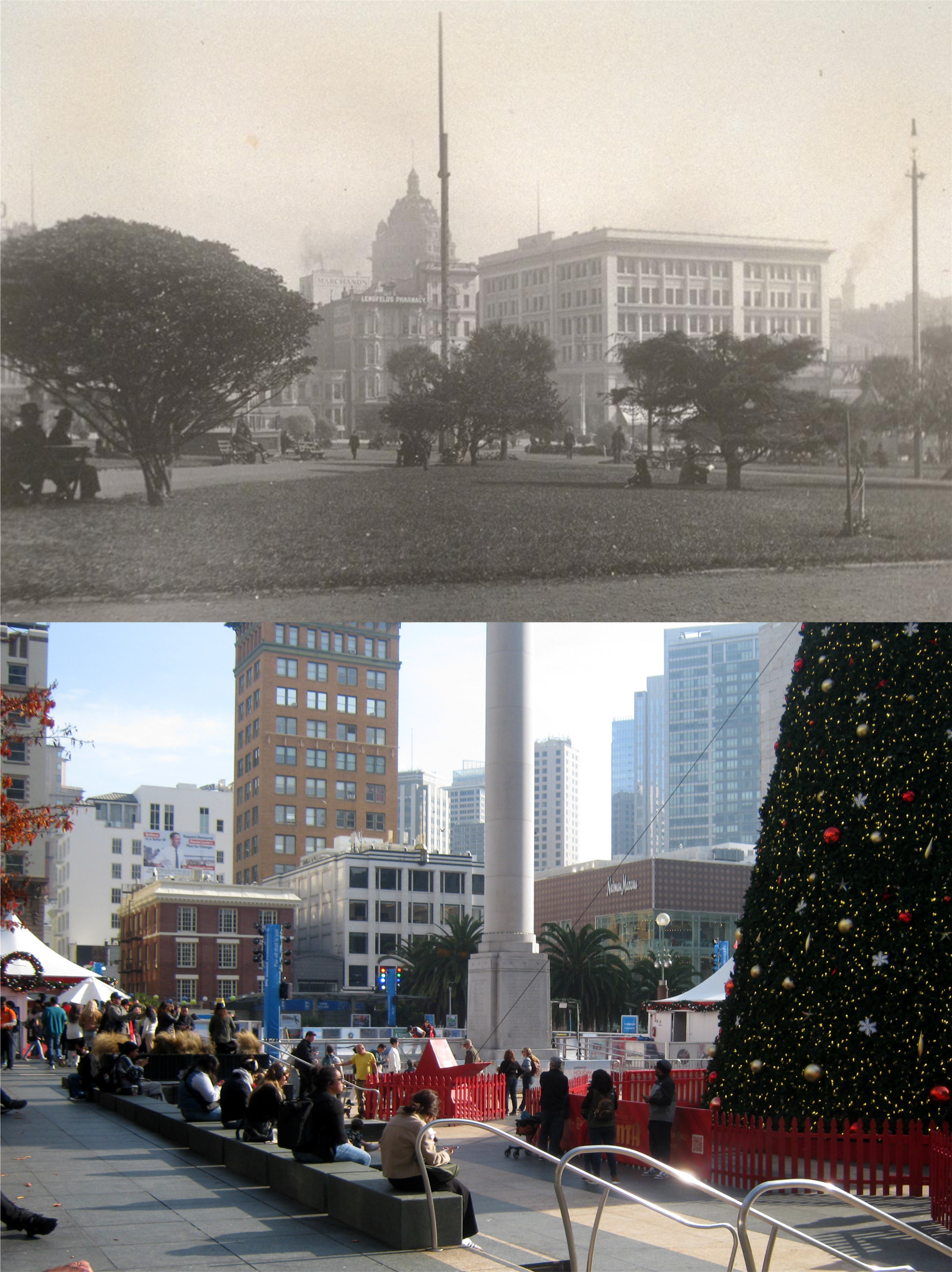
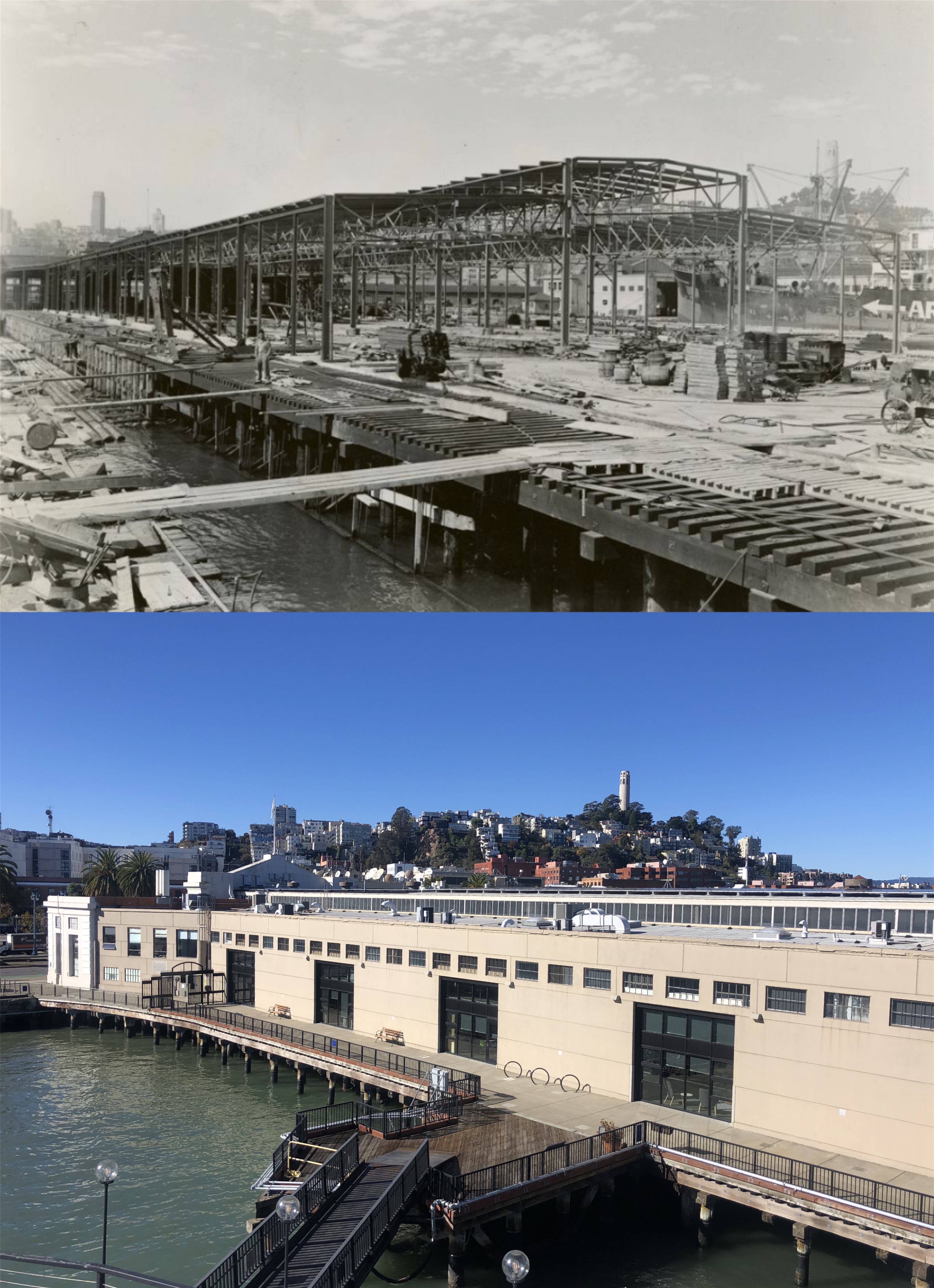
#12, Folsom/Pacific MUNI Route, approaching from the south, starts deep in the Mission District near Cesar Chavez Street and from south to north travels north, northeast, northwest, north, west, north again, and then west again to Van Ness, and travels back along a similar route in the opposite direction with a few variants. Along the way, it travels through the Mission District, SOMA, Downtown San Francisco, North Beach, and Chinatown, and is one of the most relaxing and peaceful MUNI rides you can take. I only covered a small portion of it, from Drumm Street to Powell Street, and back to Drumm. (Thumbnail images)


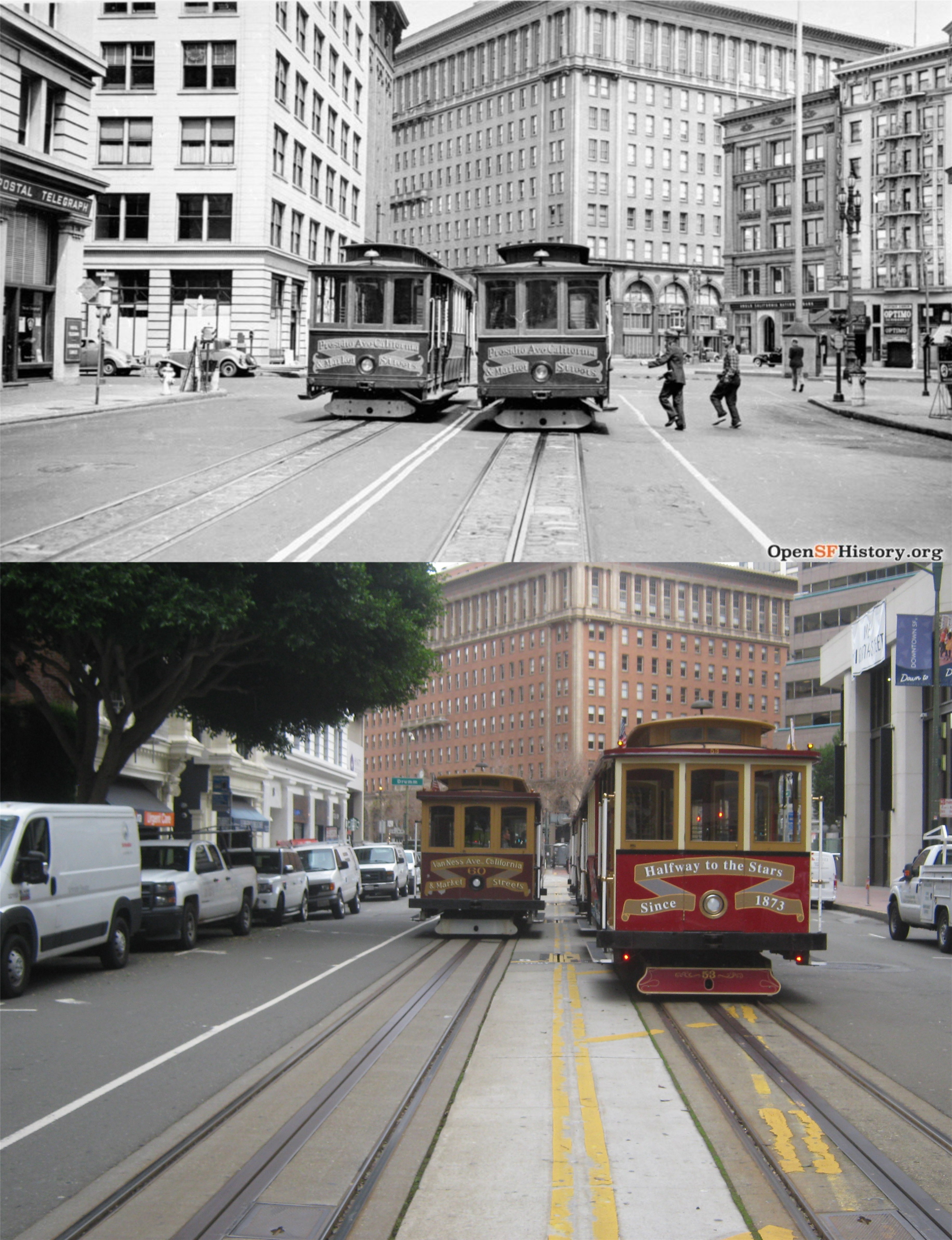
I usually catch #12 at Drumm and California Streets heading north, about left center in the vintage picture. My match-up is further west on California Street because California Street cable cars are backed up almost the whole block here. As often in the past, I found vintage photos along the portion I traveled from the terrific opensfhistory.org web site.


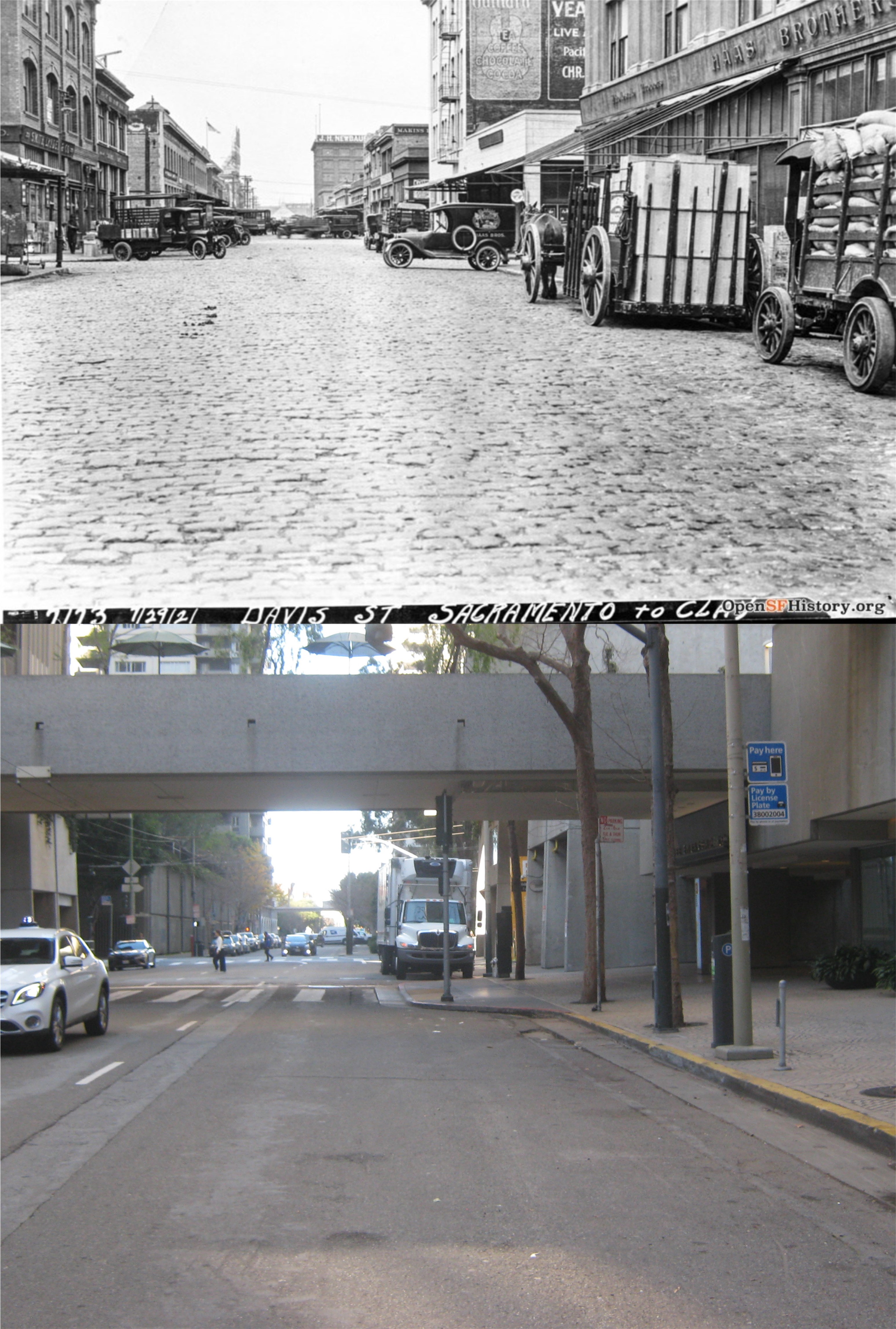
From Drumm Street, #12 travels west along Sacramento Street, looking north along Davis Street from Sacramento in 1921.


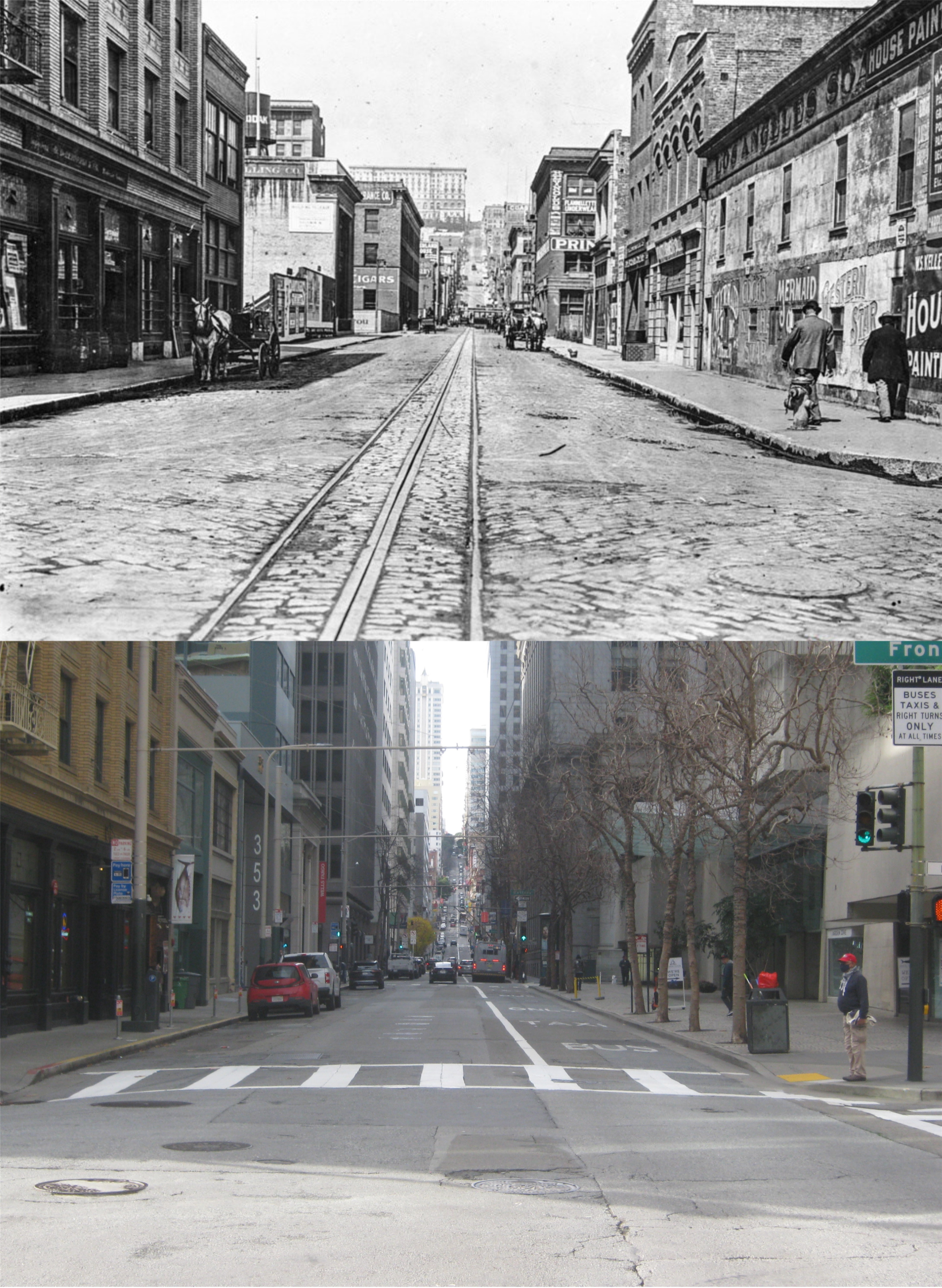
Sacramento at Front Street, looking west toward Nob Hill in 1914: You can see the Fairmont Hotel at the top of Nob Hill in the vintage picture, and the Fairmont Hotel Tower in my photo.


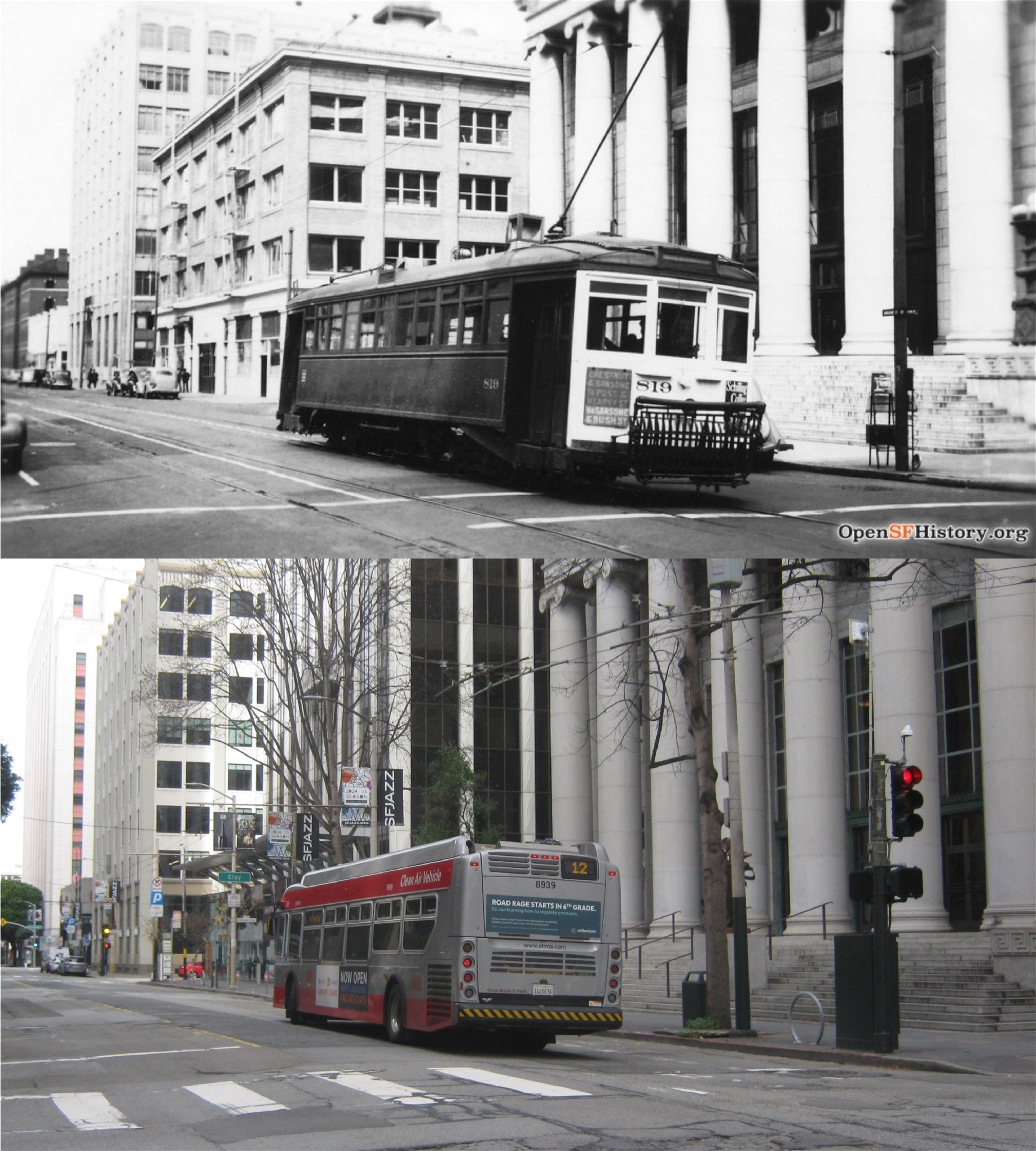
#12 turns north onto Sansome, seen here in 1938. #12 runs every ten minutes on weekdays, so I got off the bus for pictures I was taking in different areas before re-boarding another #12 that came along. The old Federal Reserve Bank Building is on the right in both photos.


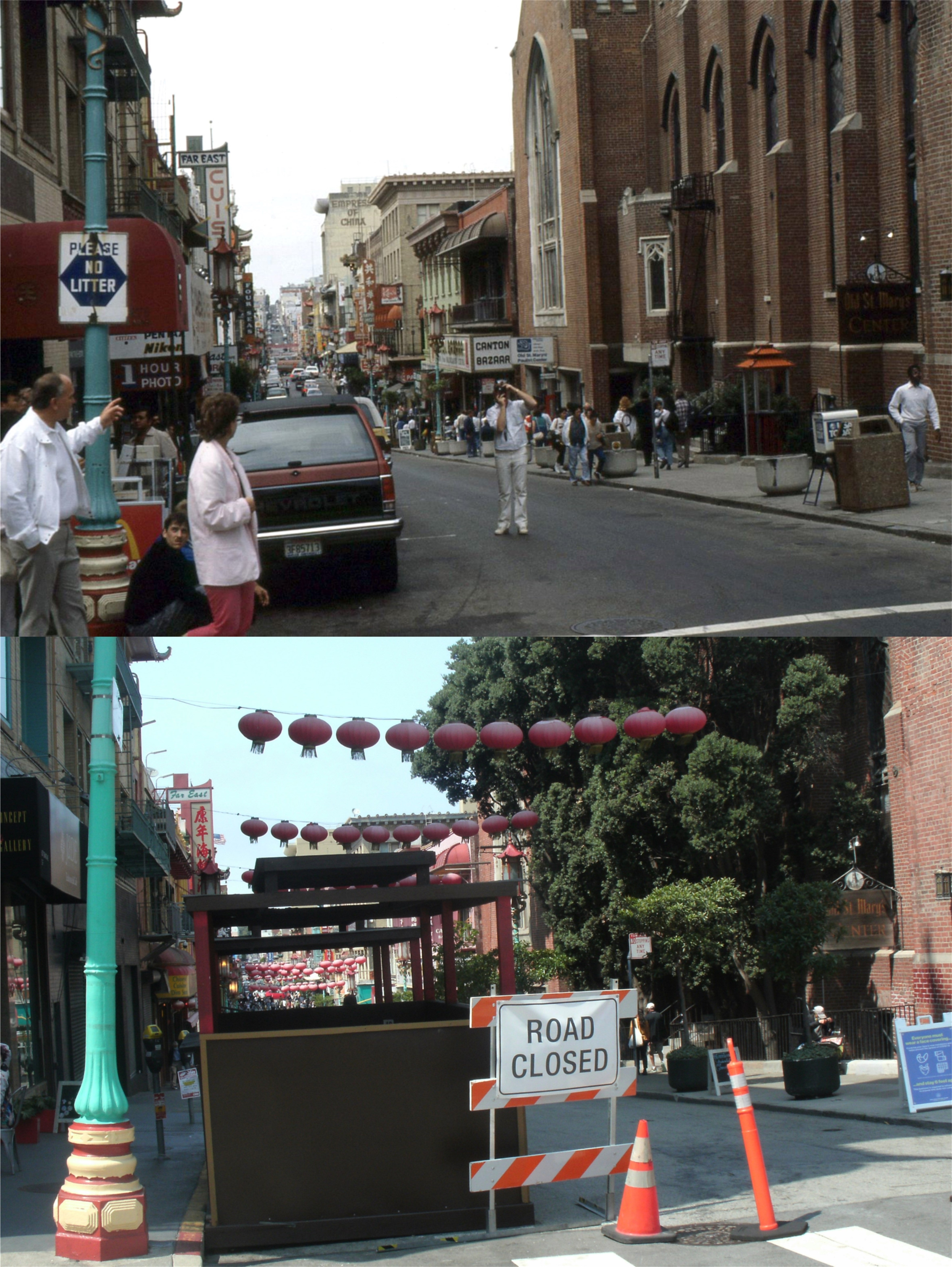
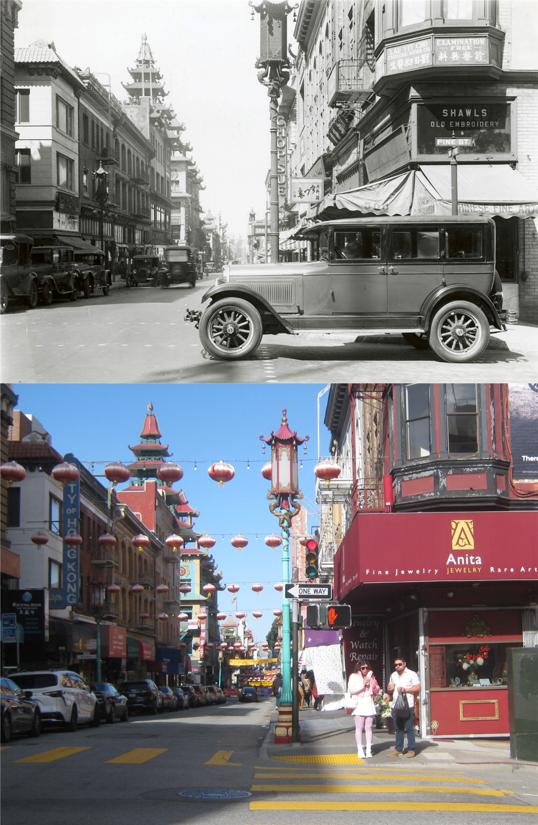
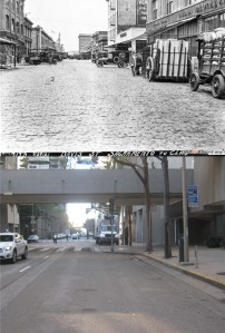
The north bound bus turns west on Pacific Avenue, and we traveled through lower North Beach into Chinatown. The 1949 photo is looking south along Grant Avenue from Pacific.


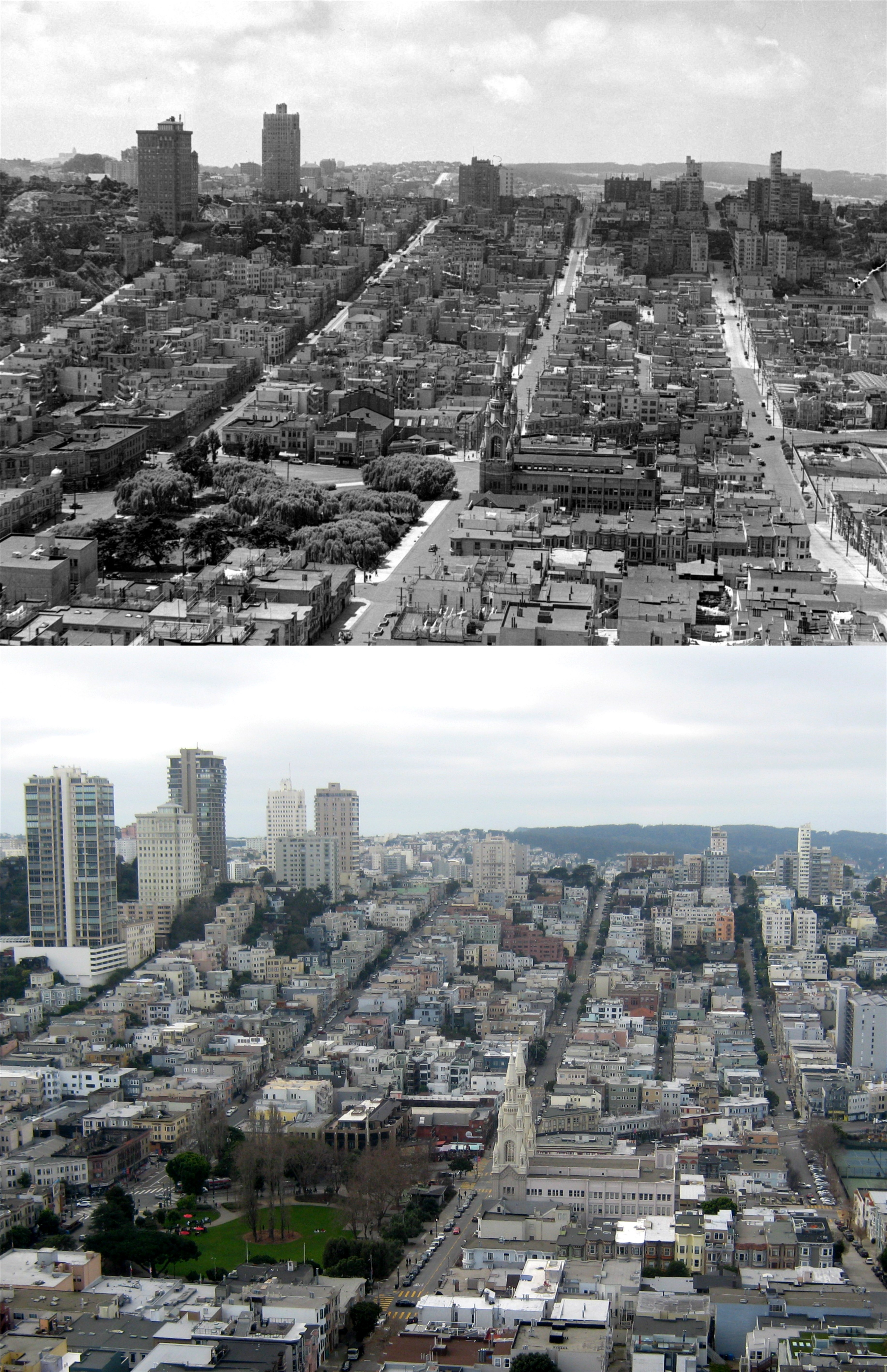
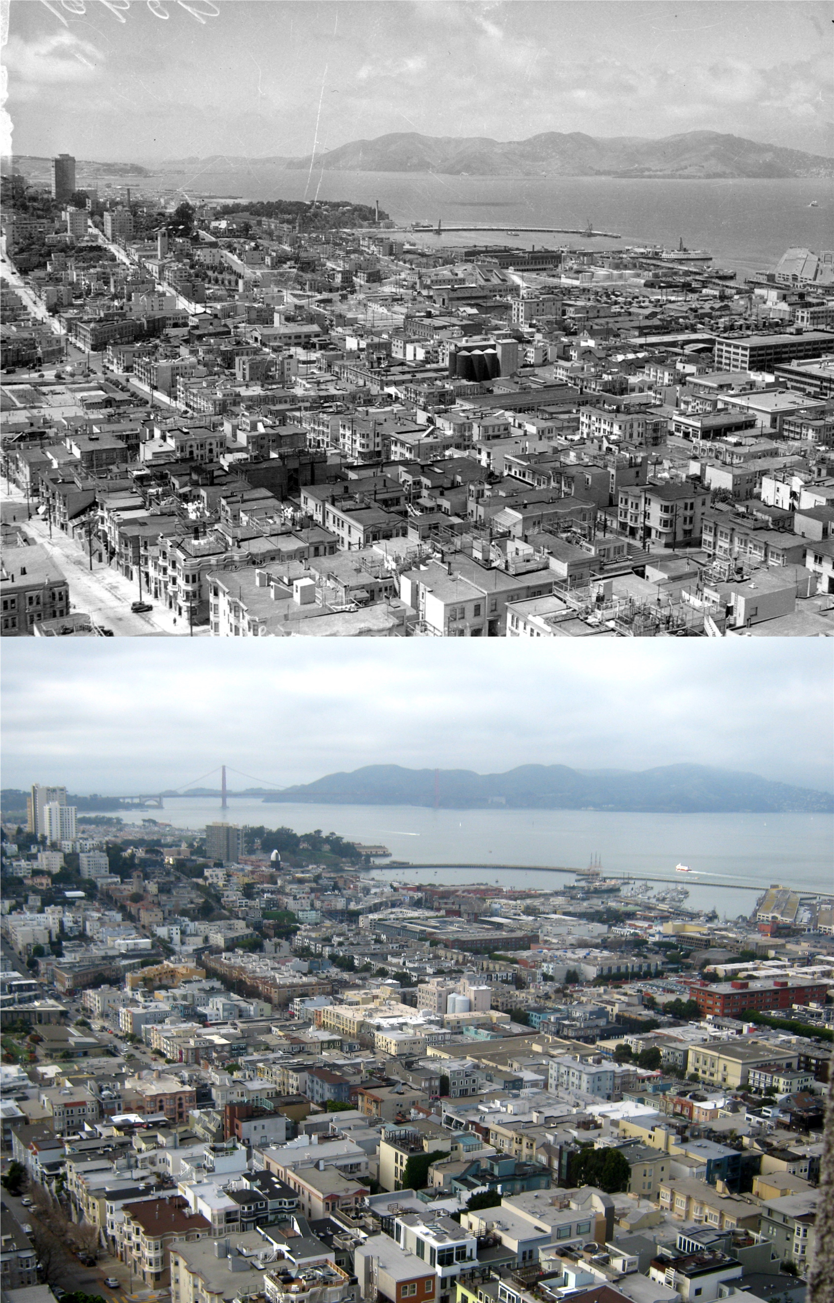
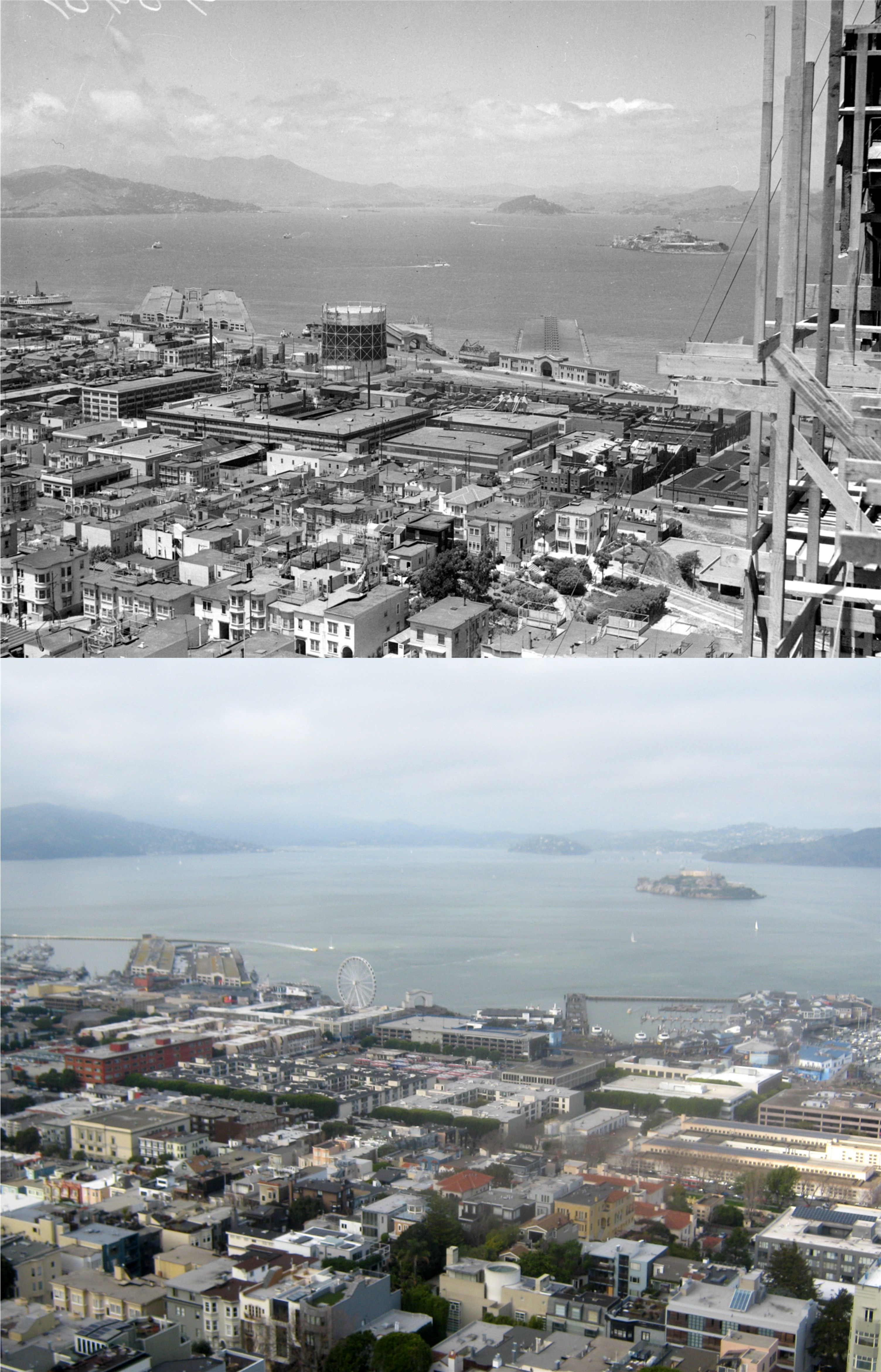
The route continues west along Pacific before looping around at Polk Street to Jackson Street to Van Ness, back to Pacific Avenue, and heads back to Powell Street, where it turns north to Broadway. Along Broadway it heads east back to Sansome Street. The vintage picture is looking north from the intersection of Broadway and Stockton Street during the 1940s.


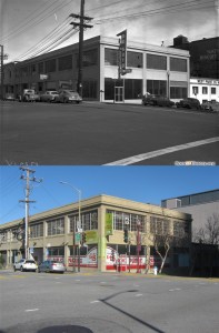
At Sansome Street, #12 turns south. The De Soto and West Paint  buildings on the northeast corner of Broadway and Sansome Street, and the National Biscuit building (Nabisco), now the KPIX building,  are still around. That’s always a comforting sight for me.


From Sansome Street, #12 turns east on Clay Street and heads back to Drumm Street. The view east along Clay from Drumm Street is not as quaint as the 1915 picture, but it still has the cobblestone and the north wing of the Ferry Building.

A visit to the Cliff House

There was a report early in 2024 of a possible reopening of the Cliff House by December of 2024. Obviously that didn’t happen. I went out there last Saturday to walk around the empty and lonely Cliff House wondering when, if ever, the famous restaurant will reopen. Also, if the new owners think that people will refer to it by any other name other than the ‘Cliff House’ well….. (Thumbnail images)


No trouble finding a parking spot Saturday.


My niece, Beverly, my sister, Julie, my niece, Christie, my brother, Pat and my niece, Stacy, walking into the Cliff House in 1989.


A scene from the best Film Noir movie set in San Francisco, the 1958 movie ‘The Lineup’.


This photo from the San Francisco Library Archives only notes that this was the “Site where a woman leaped off from the rocks.” I couldn’t find out much info on the story, but I did find out that it happened on October 3, 1941, and the unfortunate woman never did it again. This was as close of an angle to where she jumped as I could get.


A photo from probably the 60s of the Cliff House I liked the best. (ebay.com)


Looking down toward Playland-at-the-Beach in the late 1960s: (San Francisco Public Library Archives)


The pathway that leads to behind the Cliff House in 1909: This is basically the same structure that’s there today. (UC Berkeley Library Archives)


Visitors looking at Seal Rocks from behind the Cliff House in the 1950s: Nobody behind the Cliff House Saturday. (San Francisco Chronicle)


Now for something entirely different; sort of. (For Nora)

On Christmas day I took a walk through Union Square, past Maiden Lane to Chinatown. From Chinatown, I rode a cable car up to the Fairmont hotel to check out their lobby. A friend of mine named Nora wanted to go along but couldn’t make it, so I took some videos for her, and text them to her as I went along. In keeping with the vintage vibes, I thought it would be fun to try to find some old pictures afterward that were taken close to where my videos were shot. Some of them line up pretty good to my mini movies. The vintage pictures are thumbnail images.


I started out here in Union Square; I didn’t take a video for Nora while I was here, but I got a nice wide angle shot of the Square. Leaving Union Square, I crossed through Maiden Lane to Grant Avenue, and headed up to Chinatown. From there, I took a cable car up Nob Hill to the Fairmont Hotel to check out their festive lobby. I jumped back on a cable car at California Street and Mason and headed back down to Market; all in all, a Christmas Day well spent.


Walking up Grant Street from Maiden Lane, I passed by the old White House Department Store. The store is gone now, but the parking garage is still there. The garage was playing Bing Crosby and company singing ‘White Christmas’ from the old movie ‘Holiday Inn’. Class is where you find it. The vintage picture is a slide photo I took in the early 1980s. You can see the Parking Garage sign in the lower center of my picture.

Reaching Commercial Street and Grant Avenue, a group of musicians were entertaining passing visitors (me included) with a version of Jingle Bells. They were performing about where the lady is stepping on to the sidewalk in the 1960 photo from opensfhistory.org.


I headed back to California Street and jumped on the outside of a cable car heading up Nob Hill, the same stretch as the two cable cars in the vintage 1950 pictures. (opensfhistory.org)


I couldn’t get a date on the picture of the Fairmont Hotel Lobby from the San Francisco Public Library Archives, but it was taken at almost the same spot as my video. The Christmas tree is blocking out the view of the Grand Staircase in my movie.

I got a spot up front on a cable car taking the plunge back down California Street from Mason, seen in the 1950 photo.

Passengers exchanging cheers from the passing cable cars as we crossed Kearny Street heading toward Market Street and the Southern Pacific Building: The older photo is from 1973. (opensfhistory.org) People who knock San Francisco should go there on Christmas Day; it’s just as wonderful as any place in the country to spend the holiday, or anyplace in the world, for that matter.

‘Winter Walk’, 2024

It dried up Saturday afternoon, and was perfect Christmas weather to check out the Stockton Street closure from O’Farrell to Post Streets. I was able to get some r.f.m.u. shots (reasonable facsimile match ups) of vintage photos of the two block stretch from UC Berkley and San Francisco Main Libraries Archives. (Thumbnail images)


Looking north from Geary to Post Streets: This was as close of a lineup I could from the Neiman Marcus Restaurant. All of the buildings along Post Street at the top have been demolished, except for the Bullock and Jones Building with the arched windows in the top row that may have been featured in the 1948 film noir, ‘Race Street’. (See December 13, 2019)

The walk stretches from here at O’Farrell and Stockton Streets…..


…..to here at Post and Stockton. “Don’t worry, fellow, it’s only a camera.” Of course, he did have to insult my photographic capabilities by saying, “Well, just as long as there isn’t any film in it.”


Can’t leave out the beloved City of Paris Department Store, in a photo taken probably shortly before it was demolished in 1979:


Airline strikers at Maiden Lane:


Looking north toward the old Sutter Medical Building and the Hotel Plaza where the Apple Building is now:


The intersection of Geary and Stockton in 1909:


Streetcars rumbling through Geary and Stockton Streets:

Union Square getting ready for Christmas, 2024

Union Square is all dialed in for Christmas again, and Friday will start another Winter Walk, where parts of Stockton Street and Maiden Lane are closed off and carpeted for foot traffic only. I went over there last Saturday to do some updates around the Square of some old pictures I found on the San Francisco and UC Berkeley Library Archives. (Thumbnail images)


The northwest corner of the Square: Looks like an art display going on. The kid probably didn’t enjoy it much; kids have more fun in Union Square nowadays.


The northeast corner: Yeah, he’s digging the art displays. The Apple Building is now where the Plaza Hotel was. Lots of police presence, which doesn’t bother me at all.


Looking west toward the St. Francis Hotel; looks the 1950s: The United Crusade, are they still around?


Looking down Geary toward Powell: I remember BLUMS.


Looking toward the southwest corner of the Square from the corner of Powell and Geary during the 1940s:

Same corner as the previous picture during the 60s: I can recognize a Valiant on the far left, and a ford Fairlane, I think.


A rare picture of Union Square looking toward the southeast corner of the Square in 1898, before the Dewey Monument was installed in 1903: The domed building in the center is the Call Building. You can just barely make it out in the haze without its dome to the left of the Dewey Monument. The City of Paris Department Store is the large building on the right in the vintage picture, and is where Neiman Marcus is today.


This old photo looking southeast down Geary from the UC Berkley Library Archives lines up pretty good with a picture I took from the Westin St Francis Tower a few years ago before they closed the tower elevators to the public.. It shows the rebuilding of Downtown San Francisco after the 1906 Earthquake and Fire, so it was probably taken in 1907. Some of the surviving buildings from the earthquake can be seen in my picture. The steel frame of the Whittell Building, I think it’s now called the Grace Building, is on the left. The Gothic roof of the old Mutual Savings Bank Building at Market and Kearny Streets, to the right of the Whittle Building, is in the center of the modern picture. The Call Building on the right was modernized and had its dome removed in 1939. It’s the brown and white building directly below it in my photo, and is now the Central Tower. The City of Paris Department Store, lower right center, survived, but was demolished in 1979. It’s where the Neiman Marcus Department Store is now.

Pier 9 and the old Klamath Ferryboat

Another SF Secret: There was an article in a recent San Francisco Chronicle by Peter Hartlaub about the old ferryboat, the Klamath, retired from service in 1956. She’s now tied up at Pier 9 on the Embarcadero, open to the public and free. It’s a great spot to have your lunch, like I did last week. (Thumbnail images)


The Klamath is second from the bottom in the 1957 picture from the Chronicle.


An F Line Streetcar drops you off right by Pier 9. 


The Klamath is docked on the south side of Pier 9 where the SS Momacdawn was docked in the opensfhistory.org picture from 1949.


The south side of Pier 9 in 1966: (opensfhistory.org)


Another view of Pier 9 from the north side in the 1960s: (San Francisco Library Archives)


Pier 9 used to be Pier 11, built at the end of the Nineteenth Century. It was demolished in 1935 and rebuilt as Pier 9. The old photo is Pier 11 in 1907. (Vintage picture from Port City by Michael R. Corbett)


Let’s go aboard the Klamath.

The second deck is open for people to sit and relax as long as they want. There weren’t many people on the boat last Wednesday; I don’t think a lot of people are aware that the Klamath is open to the public.


There are some interesting pictures and stories on the walls of the boat, like this newspaper story of when the Klamath collided with a submarine in the Bay in 1944.


The views from the third deck are the best part of the visit.


The Ferry Building, Salesforce Tower, and the Embarcadero Center, among others, seen from the Third deck:


And a great view of the Bay Bridge.


Pier 9 under construction, looking toward Telegraph Hill in 1935: (San Francisco Library Archives)


I’ll close with a television drama scene near Pier 9 in a 1957 episode of in a little known series that ran from 1957 to 1958, ‘Harbor Command’. Although the show only ran for one season, it has some great San Francisco locations from the 1950s. Here, in an episode entitled ‘Gold Smugglers’ two dental assistants have been forging the dentist’s name to order gold that they’ve been stockpiling. They murder the doctor when he finds out what they’ve been doing, and they attempt to smuggle the gold out of San Francisco. Here, they’re trying to make their escape in a taxi on the Embarcadero; Pier 9 is in the background. Of course, they didn’t get away. You can see construction work on the soon to be finished Embarcadero Freeway in the right background of the show scenes.


Some re-dids

Just for no reason, I felt like redoing some of the older photos I posted on my website. As to the results of the updated updates, some were an improvement, some might have been better left alone, but all of them were fun to revisit. Most of the vintage pictures I originally posted back when I was careless in not naming the source of many of the old pictures; my apologies for not being able to list many of them. (Thumbnail images)


Where the California Street Cable Car Line comes into Market Street in the 1940s and now: This was as close to a line up as I could get. The Southern Pacific Building is on the right in both pictures. Back in August of 2015, when I did my first update of the old photo, the numbers 15 were on the Ferry Building  commemorating the one hundred year anniversary of the 1915 Panama Pacific Exposition.


Union Square after the 1906 Earthquake: I got a better line up with the Dewey Monument than when I originally did an update of the vintage photo in January of 2016, although I had to cut out half of the Union Square 2024 Christmas tree, which is a shame because it’s such a nice tree.


I think it’s cool that this location at 17 Street and South Van Ness hasn’t changed much at all since the 1940s; except for the gas prices.

A rainy day on the Embarcadero during the 1950s: Pier 7 is gone now, and was where the portable bathroom is now. You can see a part of the northern most portion of the Embarcadero Freeway on the right of the vintage picture.


A Life Magazine picture at Civic Center during World War Two: They were walking about where the San Francisco Library Building is now; I’m standing at the entrance to the library. The Empire Hotel Building is in the right background of both pictures. I first did an update of this Life photo on Halloween of 2014, as San Francisco was getting ready for a parade to celebrate the San Francisco Giants third World Series Championship.


Traffic crossing Market Street from 4th Street to Stockton in the 1950s: Traffic runs only north to south from Stockton to 4th Street now.


A movie scene on California Street up from Grant Ave in the 1947 film ‘My Favorite Brunette’: That’s Bob Hope, hot on a detective case, driving away from his office in the Trafalgar Building. The Trafalgar Building is gone now and was where the parking garage for the Ritz-Carton Hotel is now. Back in January of 2015 and also January of 2017, when I did an updates of this spot, the 717 entrance to the Sig Fat Building still had the white frame around the door entrance.


The entrance to the Palace Hotel on a rainy 1950s day: The clock is still there, but the Pig ‘n Whistle is gone. A blurry update on my part, but the vintage picture is too good to leave out.


Back in 2016 I did an update comparing the Neiman Marcus Christmas tree to the one the used to be in this rotunda when the City of Paris Department store stood here. Now I’m doing an update on the 2016 Neiman Marcus Christmas tree to the 2024 Neiman Marcus Christmas tree.


A Ferryboat with Frank Sinatra aboard arrives behind the Ferry Building in the open scenes of the 1957 film ‘Pal Joey’. You can still see the old Southern Building, lost in the modern crowd of today’s skyline. This was a redo of the first then and now I posted on this blog in June of 2013.

“Pick a spot, any spot.” “Okay, South Park.”

In his unflattering description from his 1933 book ‘San Francisco, a Pageant’, Charles Caldwell Dobie doesn’t write highly of South Park. He writes, {Once upon a time, South of Market  boasted two fashionable districts that more or less merged one with the other: South Park, a frigid respectable square, lined with elm trees, and Rincon Hill…. South Park and Rincon Hill still persist as geographical units, but nothing of their former grandeur survives.}  Dobie goes on to write of South Park, {The oval circle, once planted to fresh green grass that gained the name of Park for this exclusive  inclosure, is now a thing of unpainted benches and seared  turf, shadowed by wind-bitten elms and maples. One wonders if the ghosts of old South Park ever come back to shudder of the change in its fortunes–} Probably not, and his description gets even uglier. Dobie does write that South Park is {an exact copy of Berkeley Square in London} and I didn’t know that.  Gary Kamiya writes about South Park in his two fine books ‘Portals of the Past’ and ‘Spirits of San Francisco’, but a little more flattering because the area is not at all as bad as it was in 1933.  South Park was also the scene of the capture of one of San Francisco’s most repulsive criminals. (Thumbnail images)


We’ll head into South Park from 3rd Street, seen in the 1950s photo from the San Francisco Public Library Archives. Notice the round cornered building on the right in the vintage picture; we’ll get back to that later.


Burning leaves in South Park during the 1950s: The curved roof-top building in the center of the old photo is the aqua green color building seen through the trees in my picture. (San Francisco Public Library Archives)


Looking east from the north side of South Park during the 1950s: (San Francisco Public Library Archives)


102 South Park on the north side at Jack London Alley during the 50s: Jack London Alley extends to Bryant Street on the north side of South Park, and to Brannan Street on the south side. (San Francisco Public Library Archives)


South Park, looking west from 2nd Street in 1856: (San Francisco Public Library Archives)


Now we’re on the east side of South Park looking north along 2nd Street. I had to take my picture a little further out from the Park than the 1963 photo to avoid having the tree block out the Clock tower Building at 449 2nd Street at Stillman. (opensfhistory.org)


De Boom Street, or what Herb Caen called Lower De Boom, (Oh, Herb, where are you now when we need your humor?) near the east side entrance to South Park. The vintage picture, erroneously labeled De Bloom, is from 1915. (opensfhistory.org)


Now we come to the main attraction. The round cornered building that I referred you to in the first picture of this set is where police captured one of the biggest creeps in San Francisco history. In October of 1926, Clarence Kelly Jr. and two accomplices committed robberies throughout San Francisco. During the spree, Kelly personally murdered four innocent people. (calisphere.org)


Before their capture, newspapers were referring to them as the “Terror Bandits”.


When one of the punks was apprehended by the police, he squealed on Kelly, leading police to the apartment at 47 South Park, on the corner of what is now the south side of Jack London Alley, where Kelley lived with his family. As police raided the building from the front, Kelly tried to escape down the back stairs where he was shot twice by police on the stairs, according to the San Francisco Examiner. Those stairs are on the far right in my picture. Kelly was hanged at San Quentin in 1928, and he was pronounced dead by San Quentin physician, Dr. Leo Stanley, who claimed part of Kelly’s body for a quack experiment he was practicing. I’ll just leave it at, you’ve heard the expression “You can’t take it with you.” well, for Dr. Stanley, it was more “You can’t take ‘em with you.” You’ll have to read into the story of Clarence Kelly Jr. and the “eminent” Dr. Leo Stanley yourself for more on the subject.

“They’re off!”

Horse Racing is back at the Alameda County Fairgrounds every Friday, Saturday, and Sunday through mid December. I went out to the Pleasanton Fairgrounds, last weekend, for the second day of the Fall Schedule Horse Racing. I know that for some people, horse racing, like boxing, is an outdated sport, and I don’t know how bad it is on the horses. However, it’s fun to watch, especially if you win, which, more often than not, I don’t. There’s always something depressing to me walking around the empty fairgrounds when there’s no fair going on. It’s like one of those spooky Twilight Zone shows where everybody in a whole town mysteriously disappears. Plus, there’s nothing like an empty fairground to give you an overpowering craving for a corn dog. I walked around the fairground in between races to match up some of the pictures I took last summer during the 2024 Alameda County Fair. (Thumbnail images)


Passing the empty Livestock Pavilion on the way in:


Looking toward Heritage Park from the entrance to the Racing Grandstand:


Looking in the opposite direction of the previous picture toward what used to be the main area of the Fair. The smell of chicken tacos on a flour tortilla, or roasted turkey legs was alarmingly absent.


Ah, the Midway; “Vomit Valley”. I even miss that, and I hardly spend any time there.


Looking past the kid’s area toward the Racing Grandstand:  After the horse racing area, this has to be where they take in the most money during the run of the Fair.


No 4-H Club in the Livestock Pavilion:


Those two things in the background are rides I never plan to go on when the Fair’s back, but they’re fun to watch.