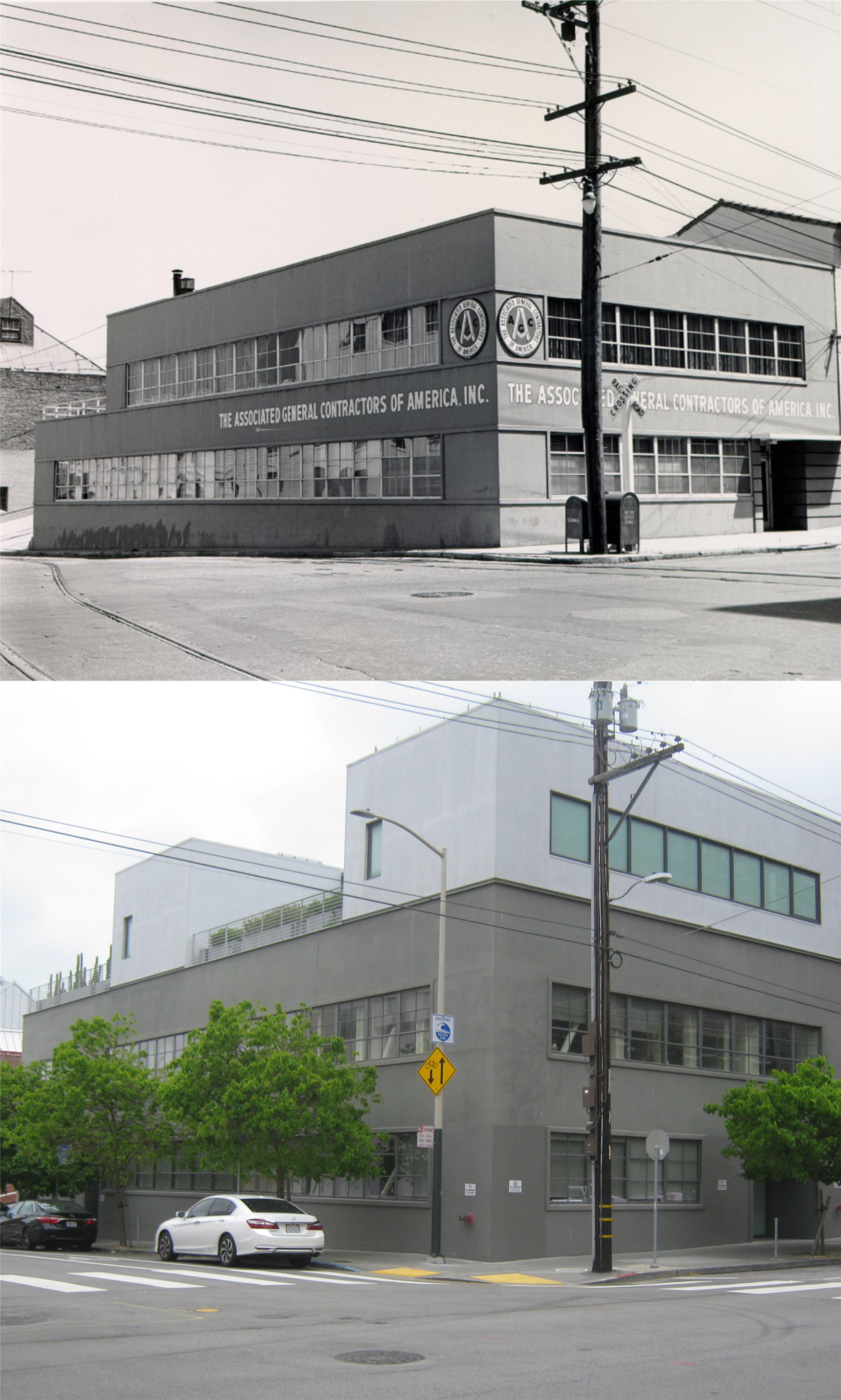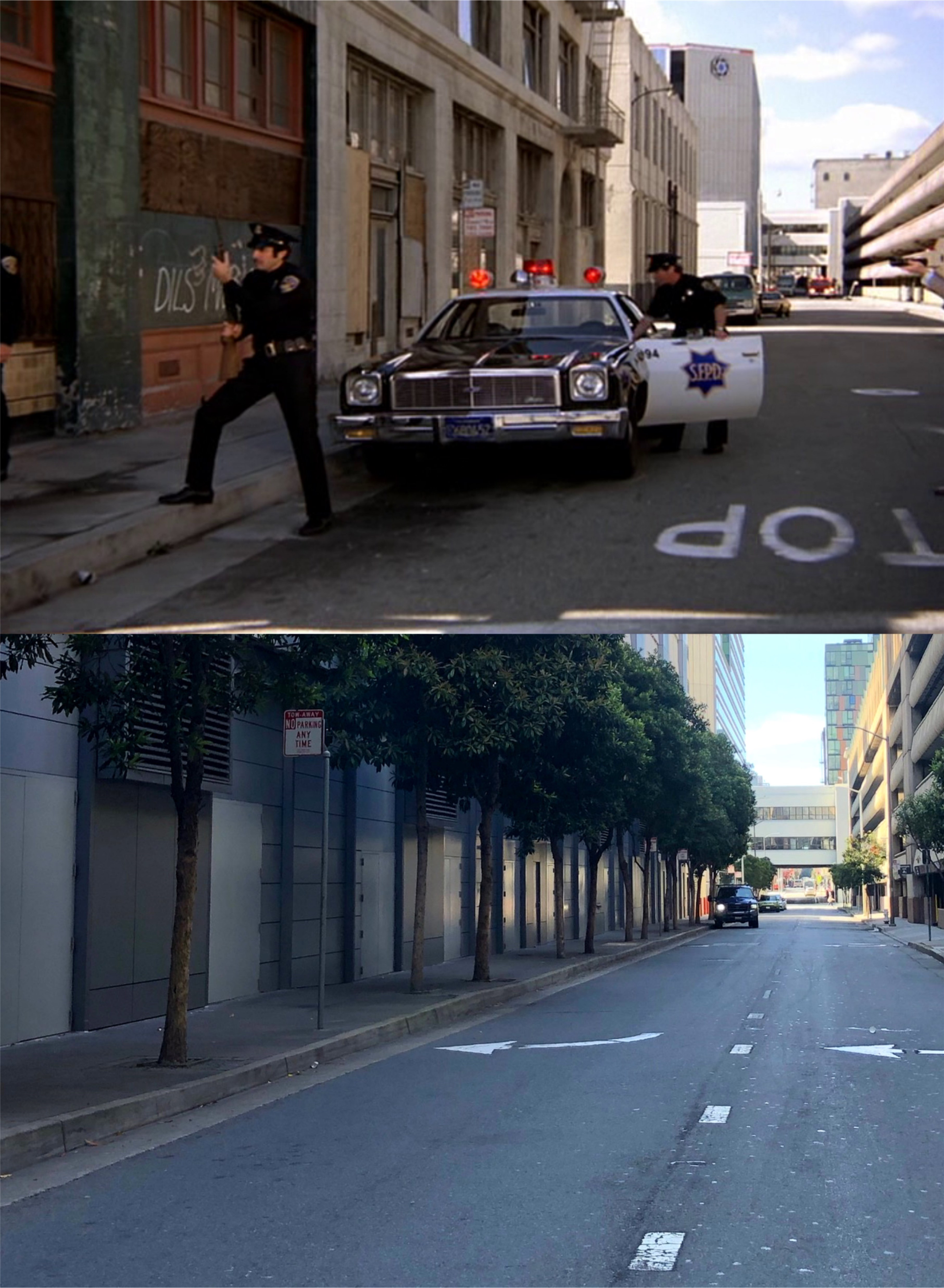
Back in 2019, I picked up a paperback copy of a reprint of the 1940 book ‘San Francisco, The Bay and its Cities’. The updated book was titled ‘San Francisco in the 1930s, The WPA Guide to the City by the Bay’. Last weekend I found an original 1940 copy of the Works Progress Administration Guide in the bookstore at the San Francisco Main Library. If you’re interested in vintage San Francisco and San Francisco history it’s, like Bogie said in the Maltese Falcon, “The stuff that dreams are made of.” Well, that may be going a little too far, but it’s a very interesting outdated guide, although much of the book’s descriptions are still contemporary, and I wanted to do another post on it. I’ll show in the brackets some of the hundreds of points of interest listed throughout the book using the numbers they were listed, and duplicate the descriptions the original authors used. I’ll also post updated pictures I’ve taken in the past of the locations mentioned. (Thumbnail images)

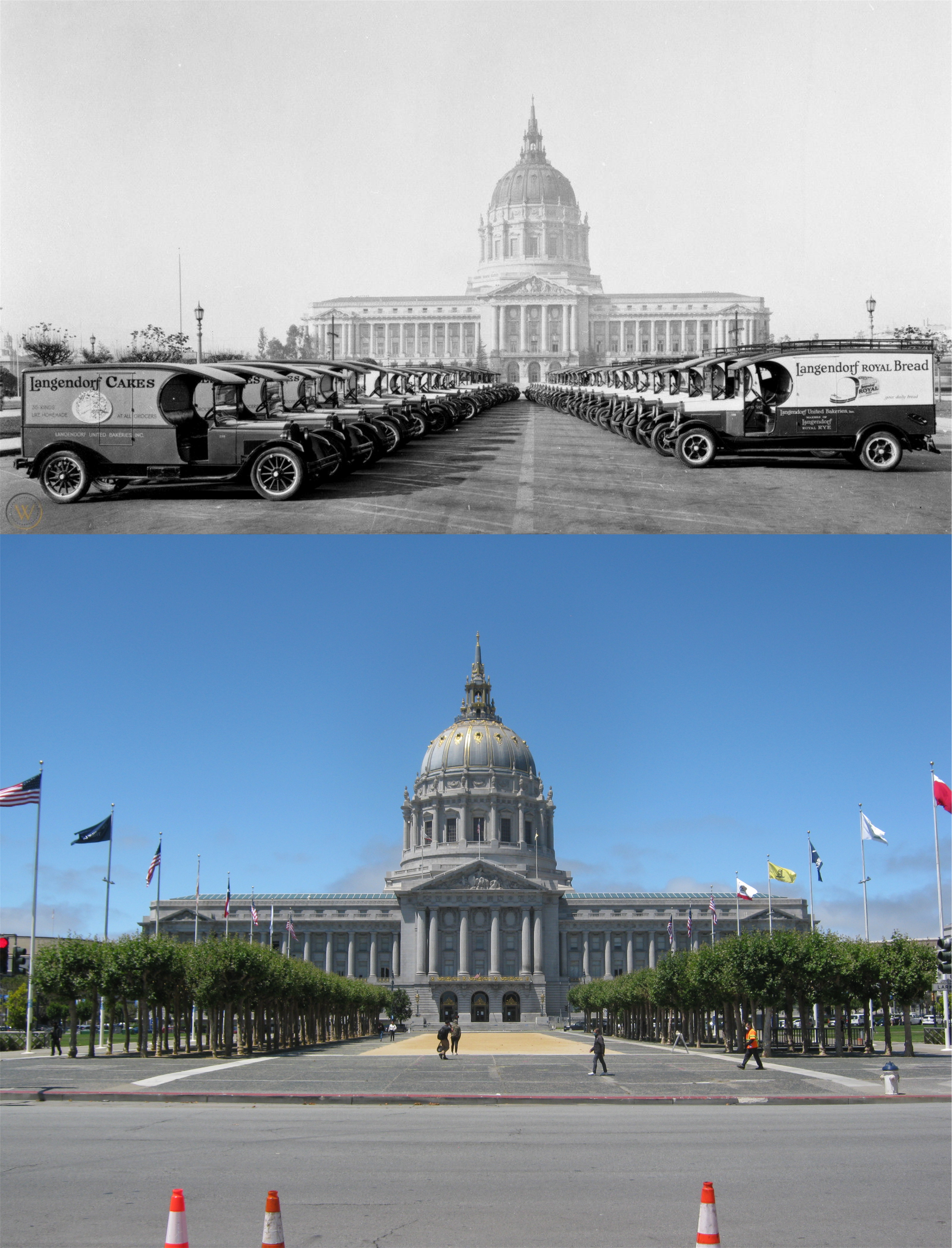
{1. Dominating the Civic Center, the CITY HALL , Van Ness Ave., Po;k, McAllister, and Grove Sts., lifts its gold-embellished dome 308 feet above ground level – 16 feet 2 and 5/8 inches higher than the National Capitol in Washington D. C., as Mayor James Rolph used to boast.}
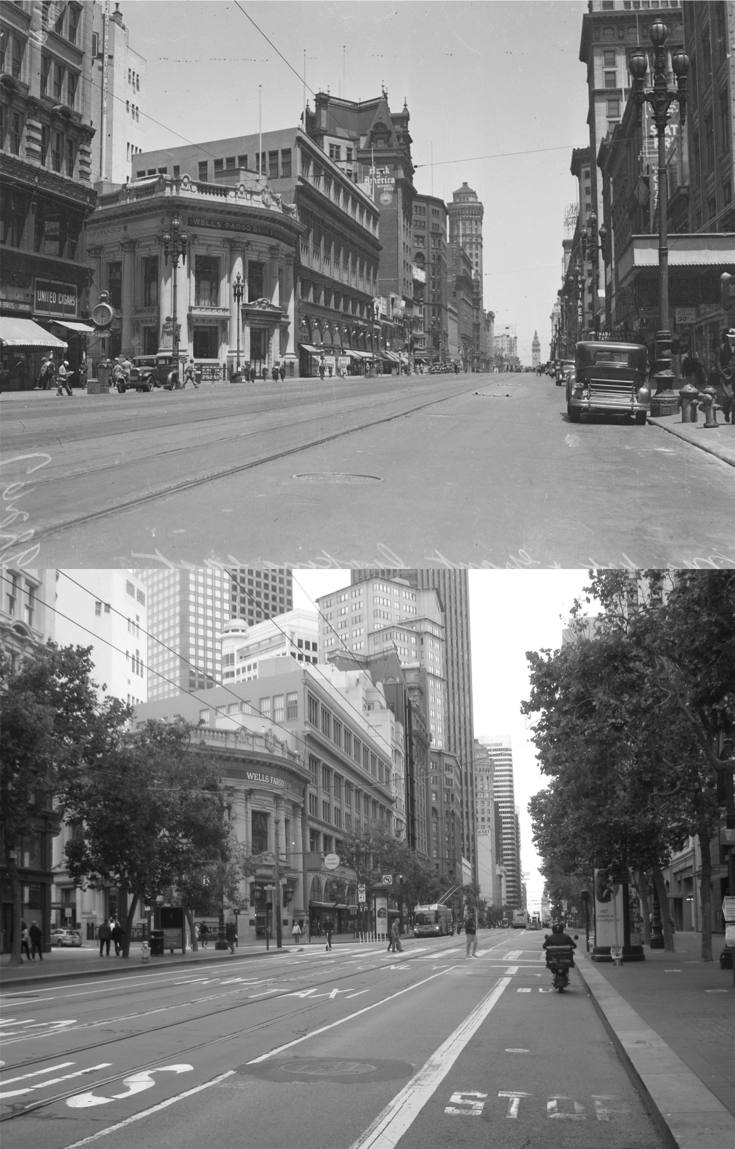
{2. The CIVIC CENTER PLAZA, Grove Polk, McAllister, and Larkin Sts., with its broad red bricks walks, its fountains playing in circular pools, its great flock of pigeons, its flower beds and box hedges, is surrounded by a row of acacia trees and lined, along Larkin Street, by flagstaffs.}
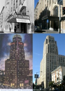
{16. Looming over the Civic Center and uptown San Francisco, the soaring shaft of the 28 story HOTEL EMPIRE, NW. corner Leavenworth an McAllister Sts., embodies the spirit of a new era rising from the old, like the Phoenix of the municipal seal.}

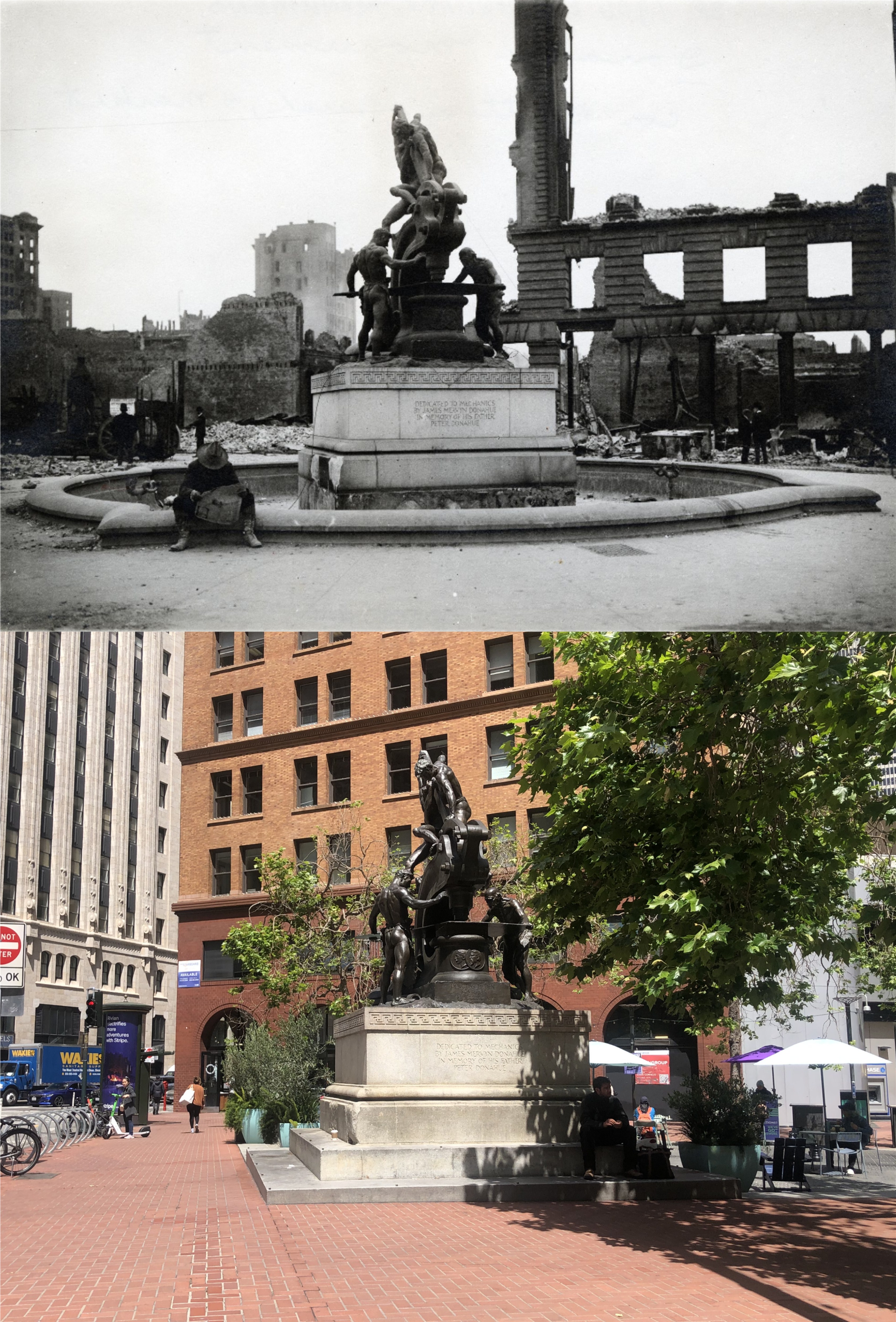
{18. The bronze angel atop the NATIVE SONS MONUMENT, Market, Turk, and Mason Sts., holds aloft a book inscribed with the date of California’s admission to the Union: September 9, 1850. Beside the granite shaft a youthful miner shouldering a pick, armed with the holstered six-shooter of his day, waves an American flag. Gift of James D. Phelan, the monument (Douglas Tilden, sculptor) was unveiled on Admission Day, 1897.}
Today the Native Sons Monument is on Market Street and Montgomery.

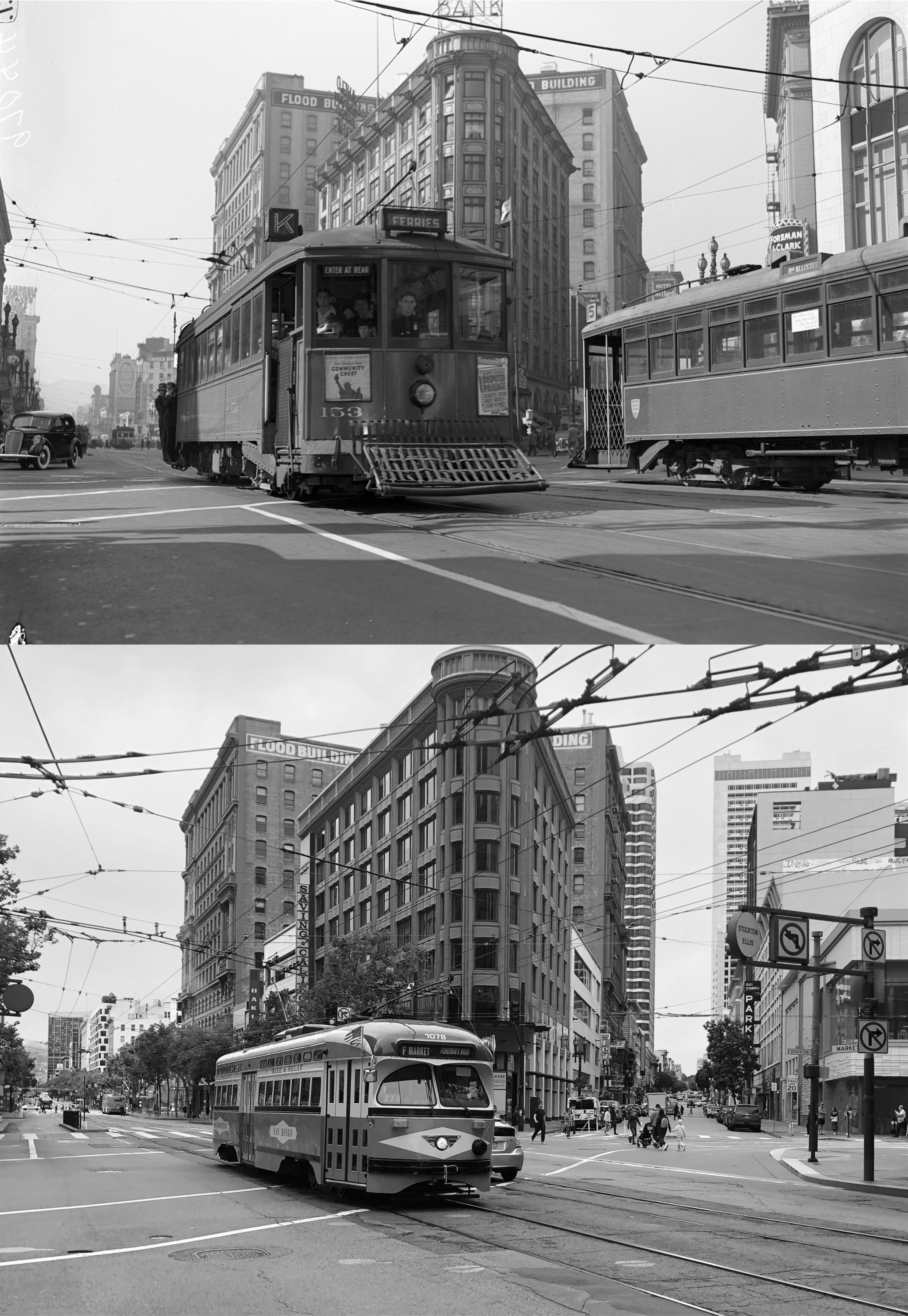
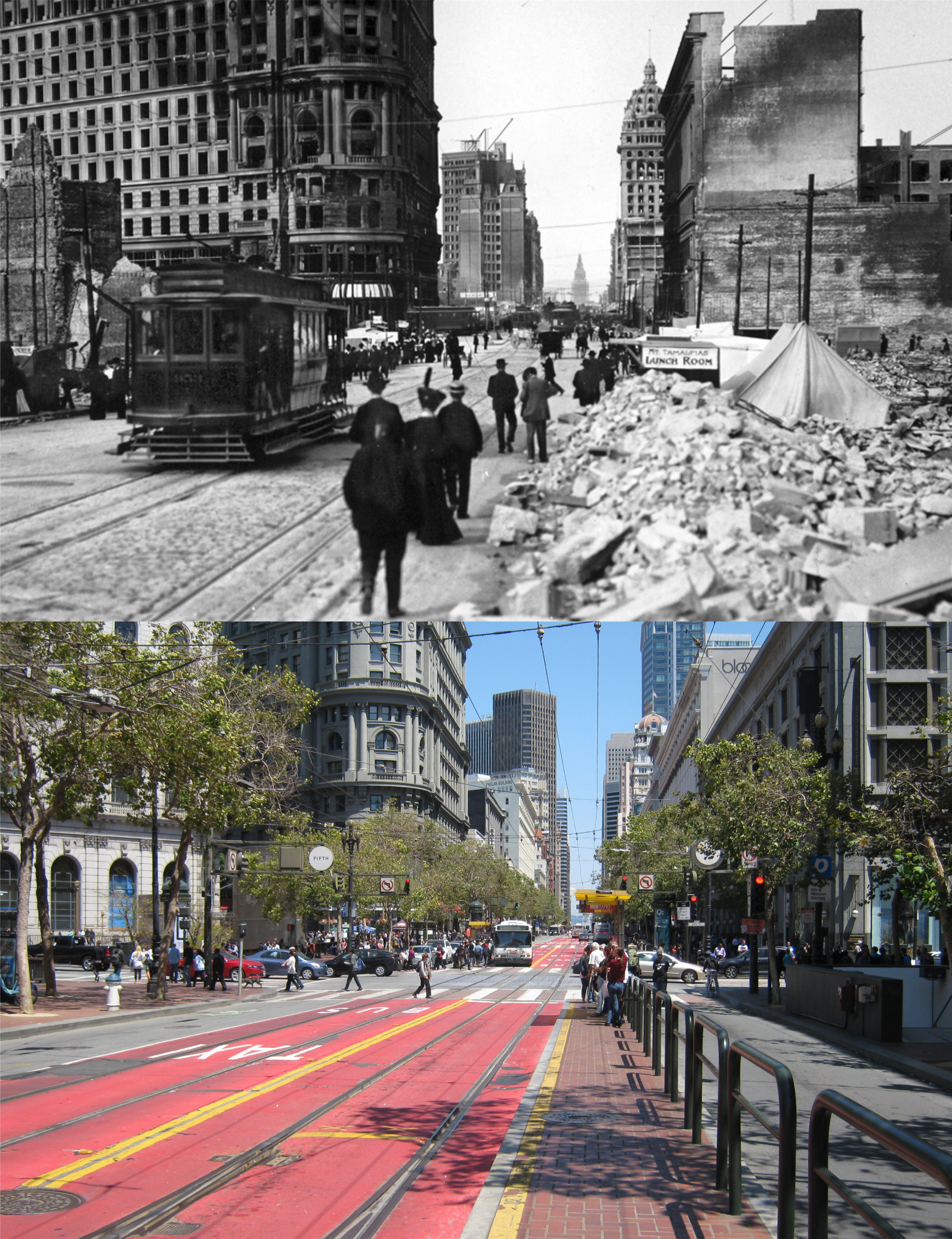
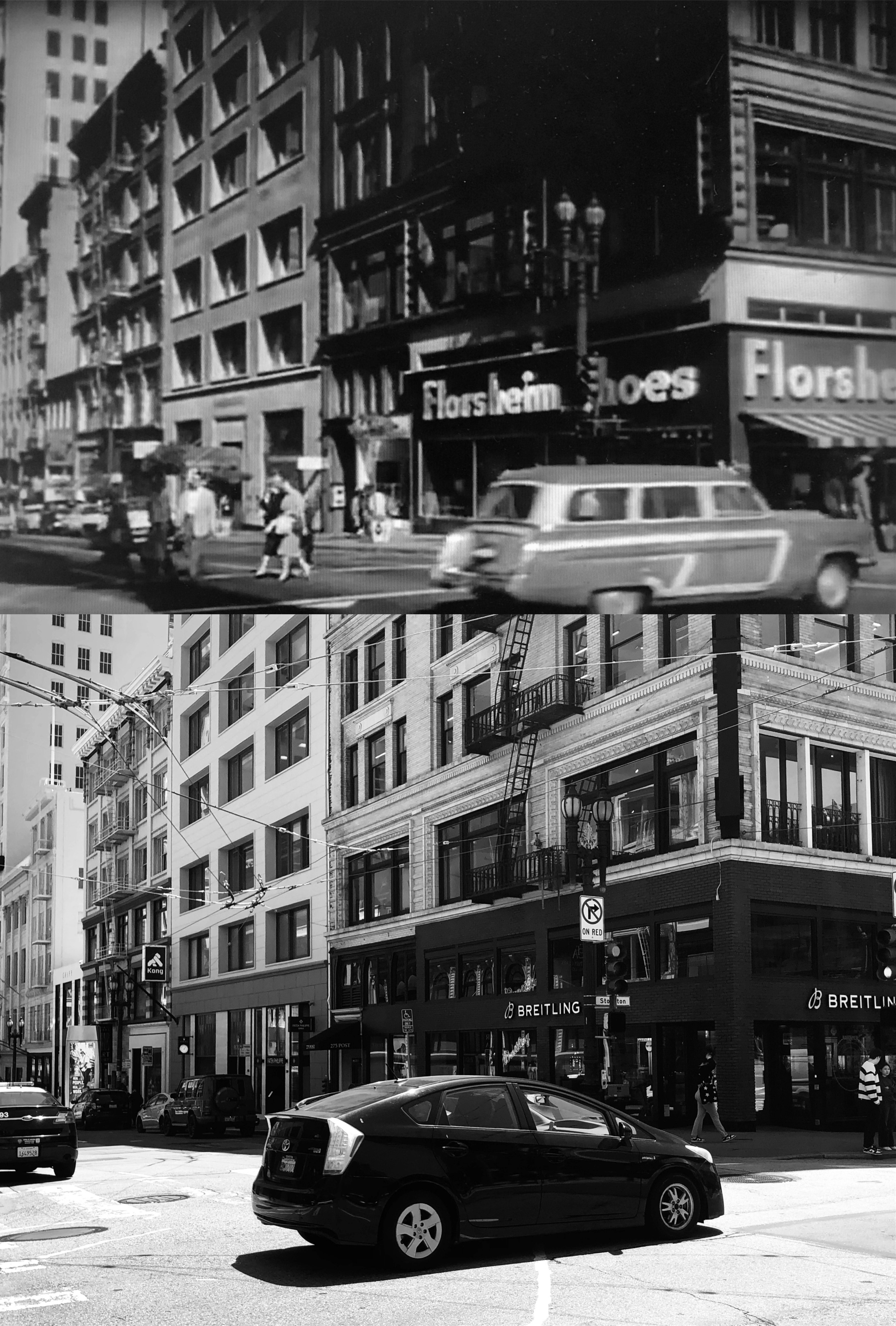
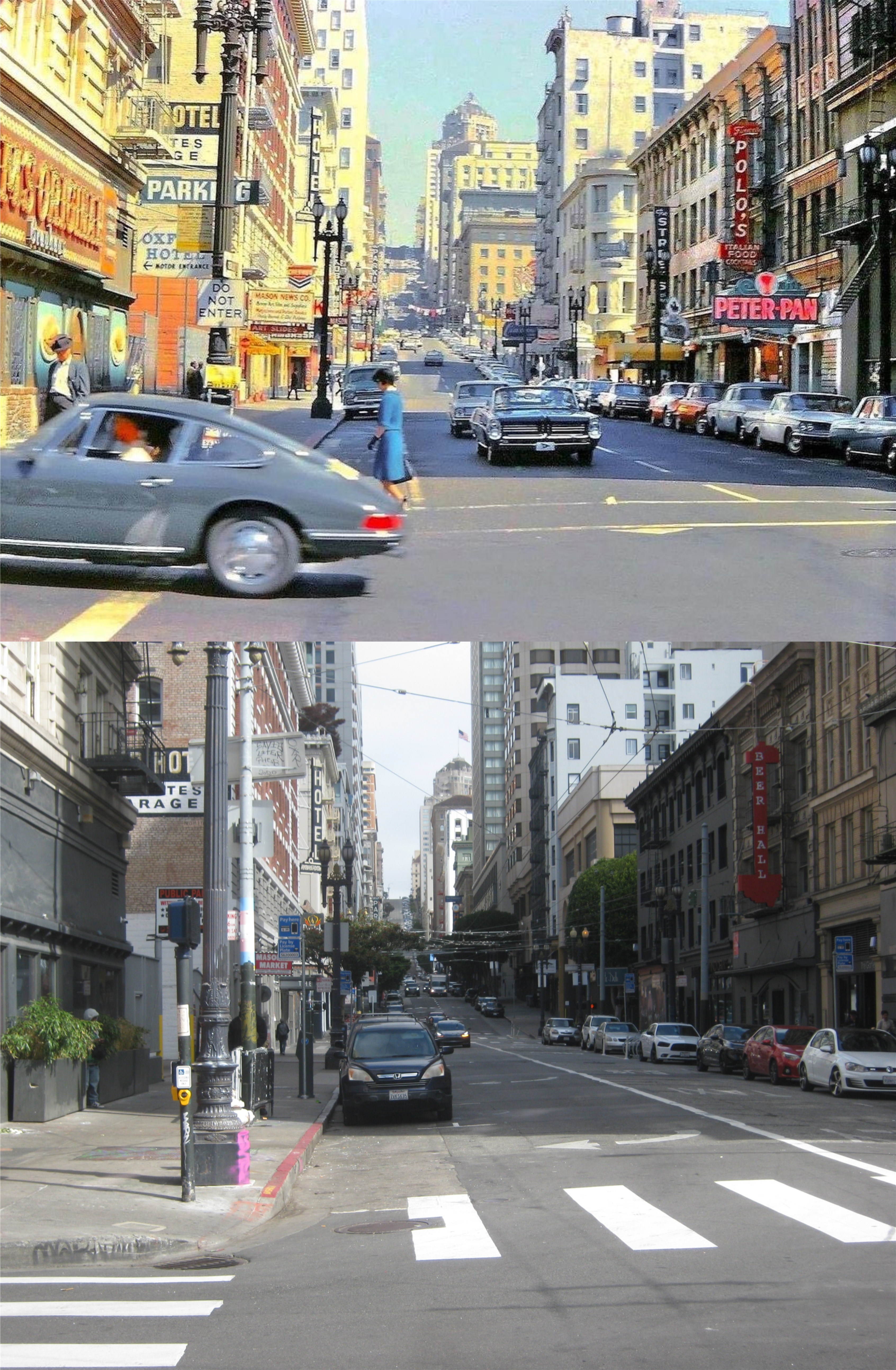
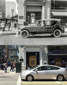
{23. Traces of discoloration in the sandstone near the entrances of the FLOOD BUILDING, NE. corner Market and Powell Sts., recall the earthquake and fire of 1906, which broke windows and blackened the walls of the structure a year after its completion.}
The damaged Flood Building is on the left behind the cable car.
. 
{21. On the highest assessed piece of land in the city is San Francisco’s largest department store, THE EMPORIUM (open 9:45-5:25), 835 Market Street. The massive, gray sandstone facade, its three arched entrances opening onto a quarter block-long arcade, is ornamented with columns in half-relief rising from the fourth-story level to the balustrade at the roof edge. Inside, an immense glass-domed rotunda, 110 feet in diameter and 110 feet high, ringed by the pillared gallery, rises through four stories to the roof garden.}

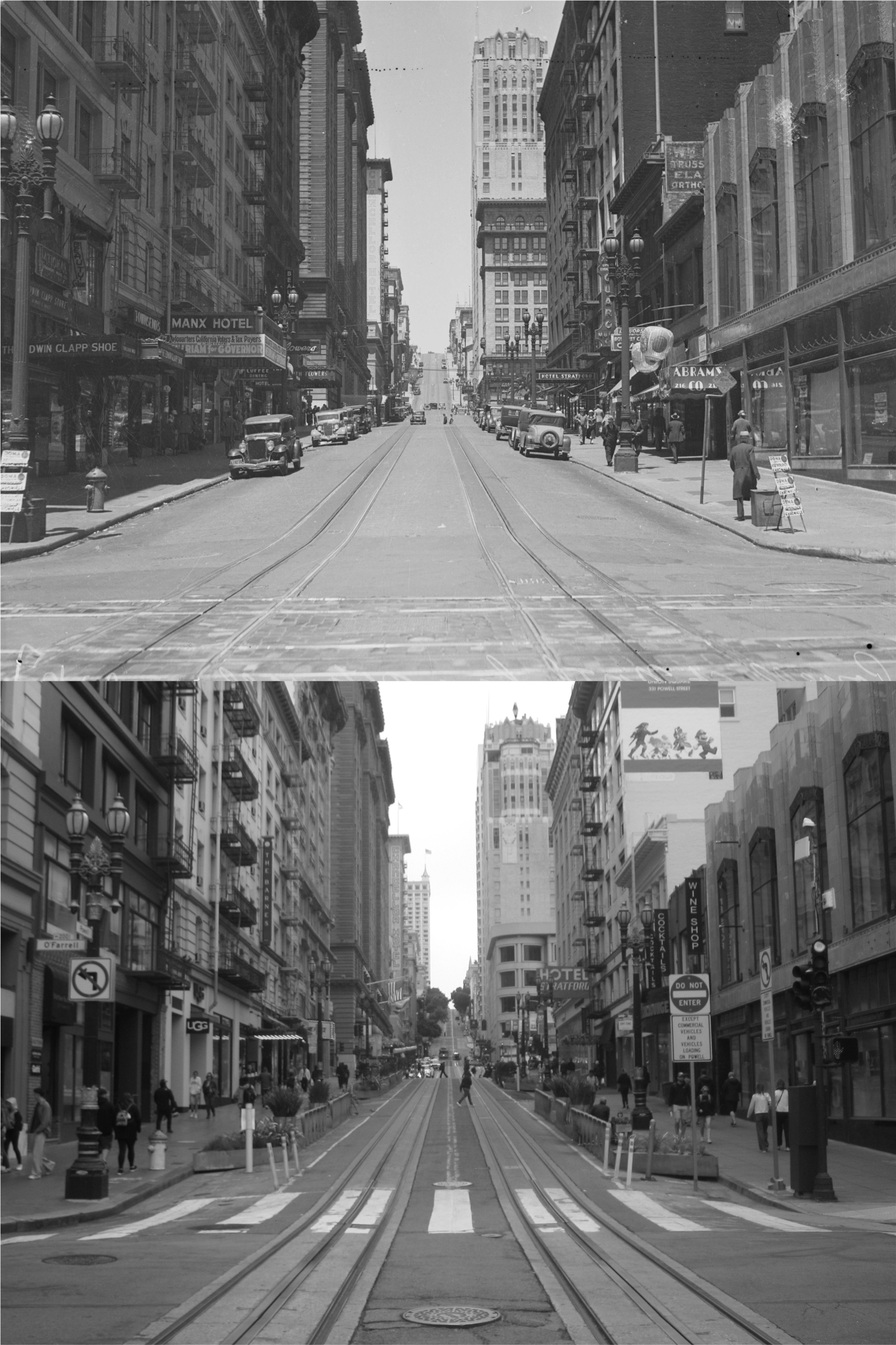
{36. December, 1914 saw completion of the $656,000 STOCKTON STREET TUNNEL (Michael Shaughnessy, engineer), boring 911 feet through Nob Hill from Bush almost to Sacramento Street to connect downtown San Francisco with Chinatown and North Beach. The tunnel is 36 feet wide and 19 feet high; sodium vapor lights were installed in 1939.}
{41. One of the Nation’s oldest jewelry establishments, SHREVE AND COMPANY (open 9-5), NW. corner Grant Ave. and Post St., has been dealing in precious stones and rare objects of gold and silver since 1852. It is the only large downtown store still operating whose advertisement appeared in the San Francisco City Directory of 1856 – when its address was No. 139 Montgomery St.}

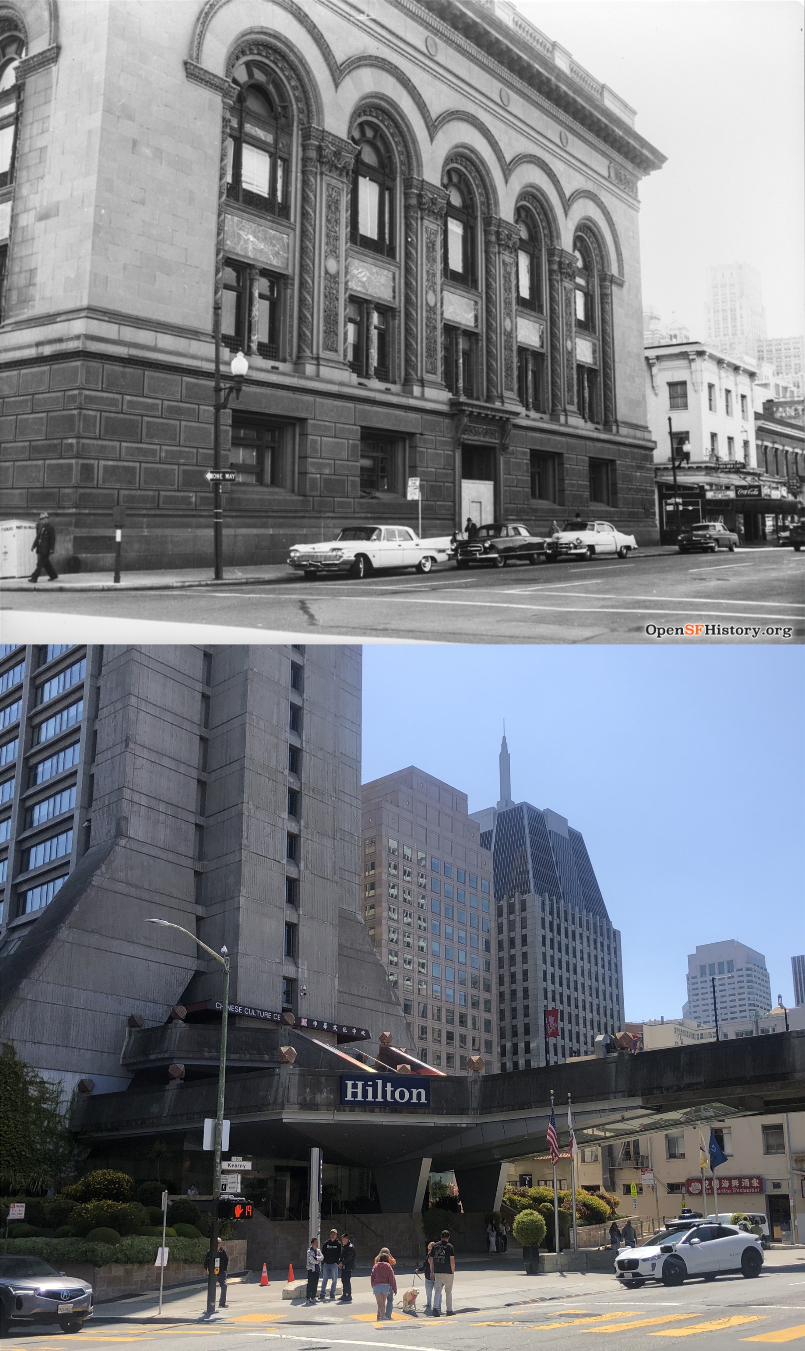
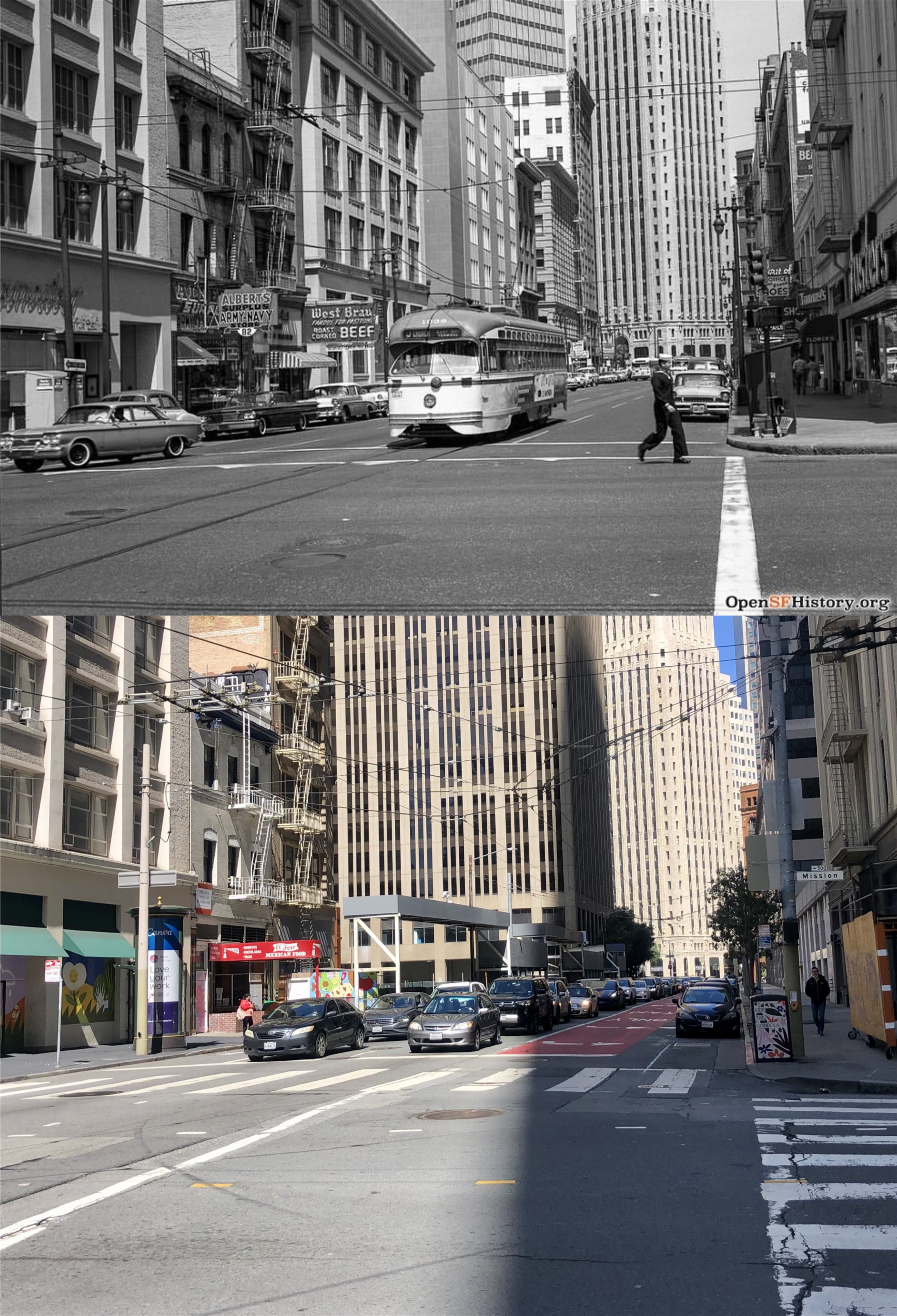
{79. Of the thousands of commuters who once poured daily through the Ferry Building, for six decades San Francisco’s chief gateway from the east, most now enter the city through the BRIDGE TERMINAL BUILDING, Mission, First, and Fremont Sts. The low-spreading three-story steel-and-concrete structure, completed in 1939 at the cost of $2,300,000, is the terminal for electric interurban trains carrying passengers oveer the San Francisco-Oakland Bridge to the East Bay. Through the terminal pass an estimated number of 60,000 persons daily, 21,000,000 annually.}
The Bridge Terminal Building was where the Salesforce Tower is today.

{85. On historic ground stands the HALL OF JUSTICE, SE. corner of Kearny and Washington Sts., facing Portsmouth Plaza. Here stood the famous Eldorado gambling house, and here too, was Dennison’s Exchange Saloon, where the first official Democratic Party meeting was held October 25, 1849, and where the first of the city’s fires broke out two month later.}

{104. Where the soft crunch of gravel or the snores of a drowsing panhandler disturbs the quiet of green-terraced ST. MARY’S SQUARE, Pine, Anne, and California Sts., the raucous solicitations of the inmates of brothels once mingled with the bark of rifles in shooting galleries below, and American and British sailors met periodically for bouts and brawls.}
The top painting of Anne Street between the back of the buildings on Grant Avenue and St. Mary’s Square is by Jade Fon. Anne Street is now renamed Quincy Street.
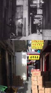
{114. What is now OLD CHINATOWN LANE, extending a half-block northward from its entrance near 868 Washington Street – a narrow paved thoroughfare of bazaars and shops characteristic of old Chinatown – was once the “Street of the Gamblers,” a crowded little lane notorious for its gaming rooms and brothels.}
The chase scene in Old Chinatown Lane is from the 1949 film ‘Impact’.
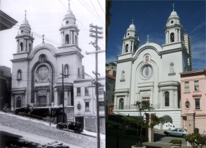
{121. Only church in San Francisco whose services are conducted in the Spanish Language is NUESTRA SENORA DE GUADALUPE, 908 Broadway, which derives its name from the shrine erected near Guadalupe, Mexico, in commemoration of the appearance before the peon, Jean Diego, of the Virgin Mary.}

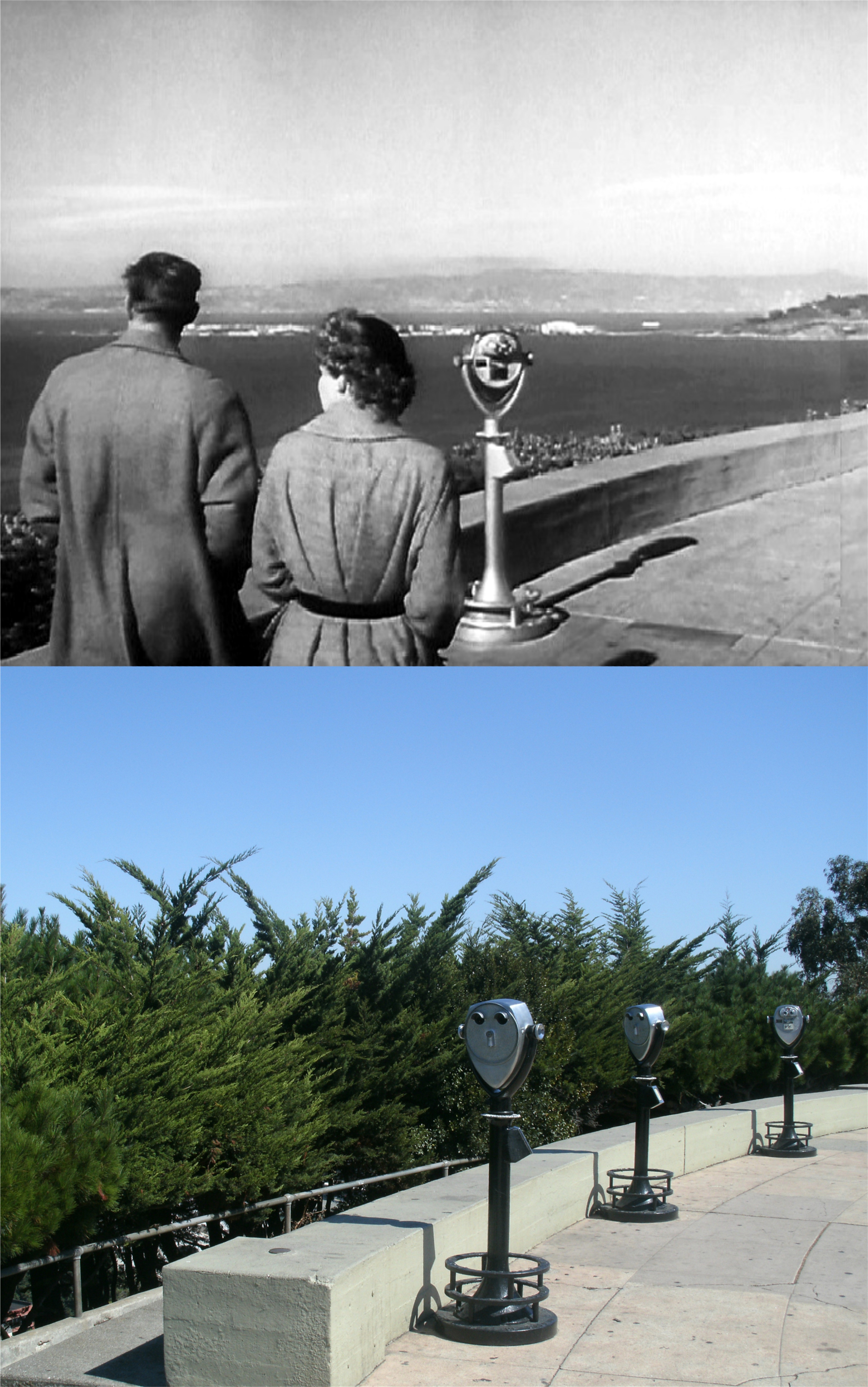
{125. Crowning the brow of Telegraph Hill is PIONEER Park, whose paved esplanade and parkway command a stirring panorama of the vast Bay and its shores and the city crowding to the edge of the Peninsula.}
Pioneer Park is directly behind Coit Tower.

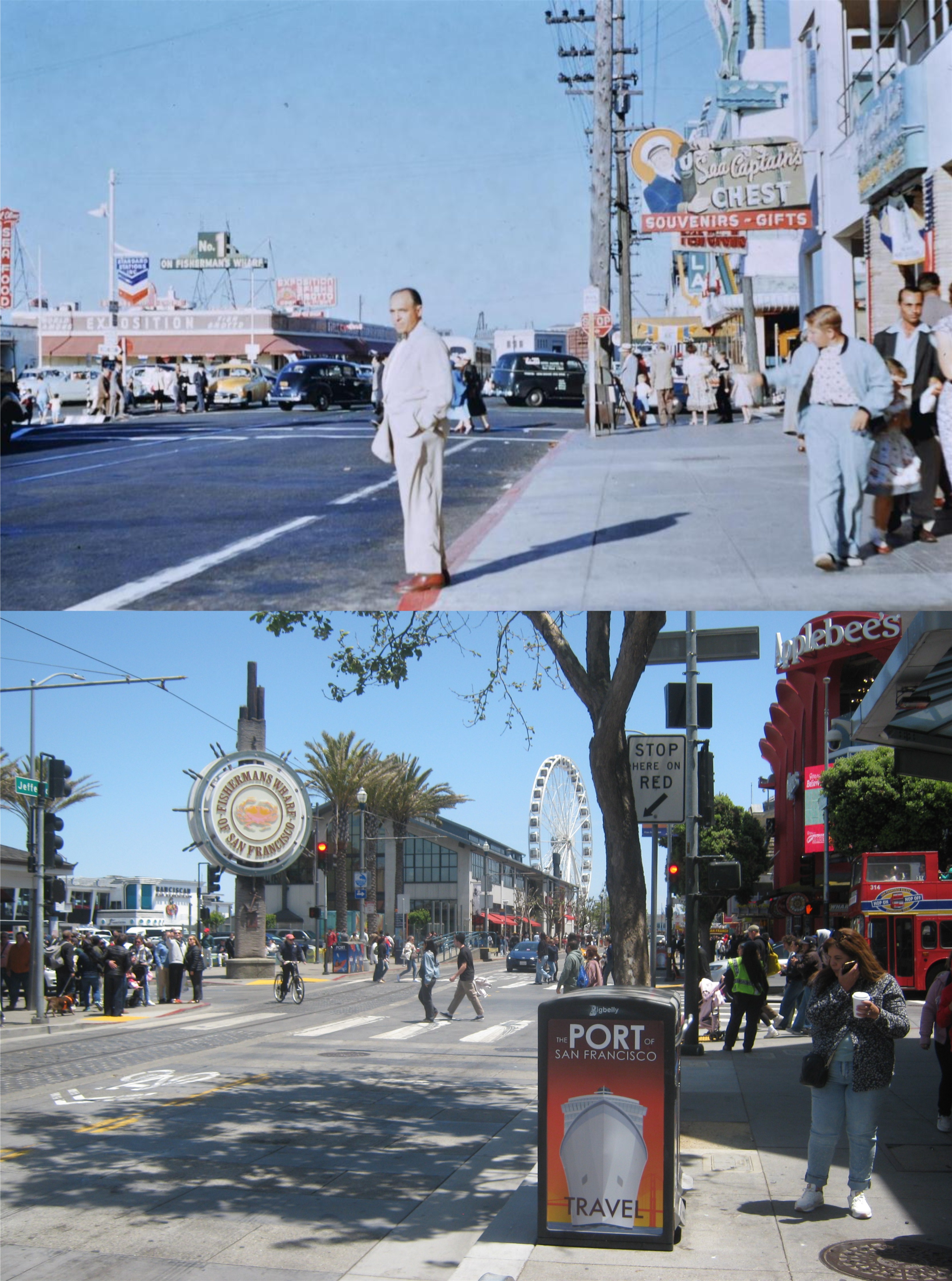
{126. Twentieth-century commercialism and Old-World tradition go hand in hand at FISHERMAN’S WHARF, foot of Taylor St., where are moored in serried ranks the tiny, bright-painted gasoline boats of the crab fishermen and the tall-masted 70 foot Diesel-engined trawlers of the sardine fleet. The high-sterned junks with the square sails of the Chinese shrimp fishermen who supplied the forty-niners with seafood have long since disappeared.}
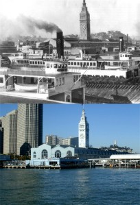
{143. More universally accepted as a symbol of San Francisco than any other single landmark, the FERRY BUILDING, Embarcadero and Market Street., has served to identify the city in the minds of countless travelers throughout the world. Before the completion of the two bridges across the Bay, this was the gateway to San Francisco, its high clock tower the most conspicuous feature of the skyline to passengers on the lumbering ferries which churned the waters for nearly nine decades.}
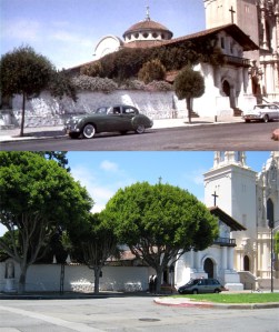
{150. Venerable MISSION DOLORES (adm. 25 cents including cemetery; open daily May to Sept, 9-5, Oct. to April 9:30-4:30), Dolores, between sixteenth and Seventeenth Sts., its heterogeneous architecture well preserved after more than 150 years, was founded by Padre Francisco Palou. Father Palou has told how the pioneer chapel, dedicated on June 29, 1776 to “our seraphic Father San Francisco” was founded just five days before the signing of the Declaration of Independence.}
The top Mission Dolores picture is from the 1958 film ‘Vertigo’.
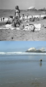
{229. The OCEAN BEACH, between the Cliff House and Sloat Blvd., is thronged on pleasant days with picnickers, surf and sun bathers, equestrians, and sightseers. The pedestrian esplanade bordering the seawall affords a broad view of the Pacific. A vicious undertow is created by the sudden drop beyond the edge of the surf and annually takes its toll of the unwary.}

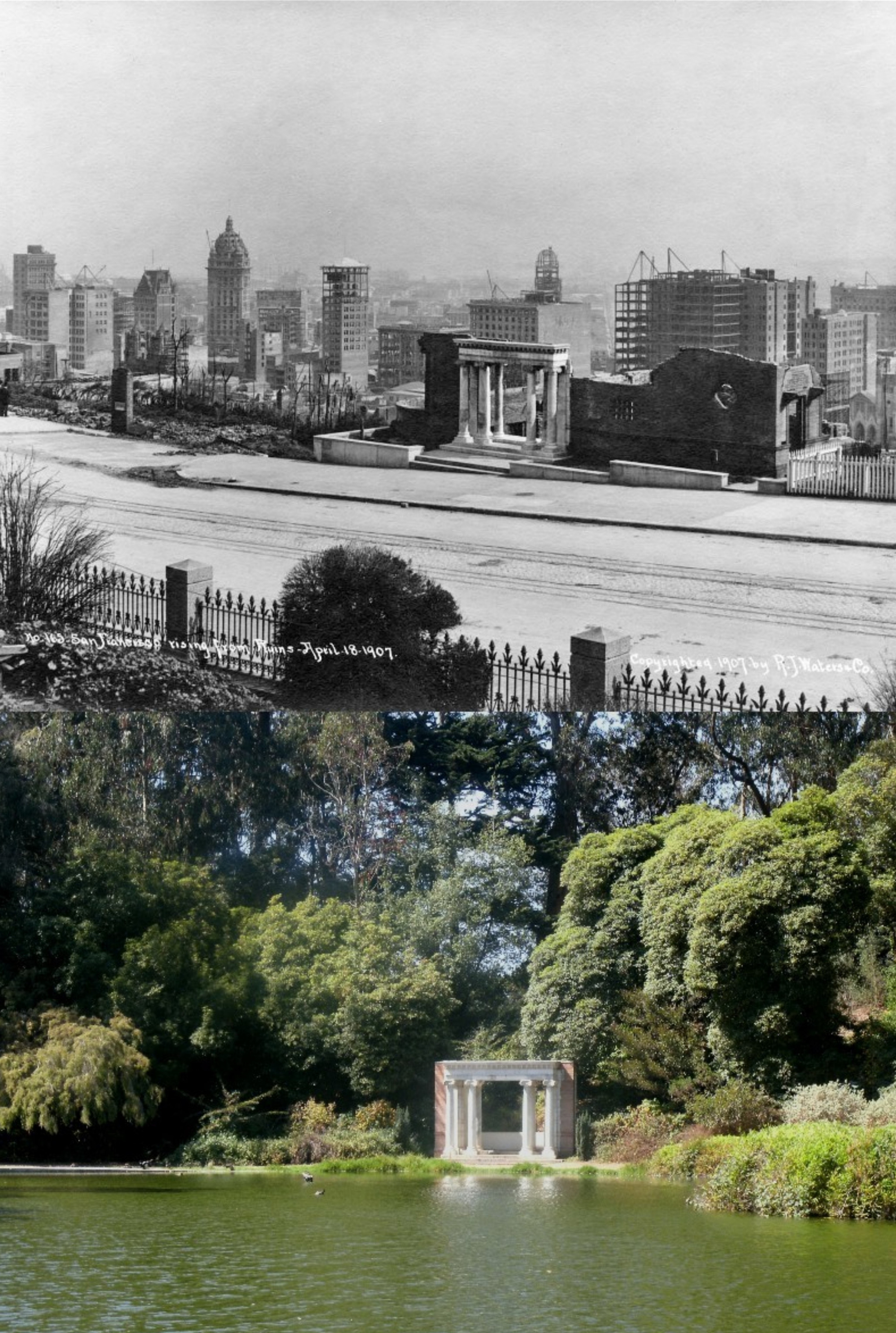
{277. The PORTALS OF THE PAST, six white marble Ionic Pillars reflected in the tranquil surface of Lloyd Lake, are all that remain of A. N. Towne’s Nob Hill residence burned in the 1906 fire.}

{290. The two-story BEACH CHALET (open daily except Mon. 10-6), E. of Great Highway, has a large glassed-in dining room over looking the ocean and the Great Highway. The foyer is ornamented with murals and mosaics by WPA artists.}

{291. THE MURPHY WINDMILL (not open to public), N. of South Dr. near SW. corner of park, the second of the park’s two Dutch mills is one of the largest sail-type structures in the world, having a wing spread of 114 feet.}

In a non number portion of the book near the end titled Part IV Around the Bay, is part of this description: {Resembling a huge battleship lying just within the Golden Gate, grim Alcatraz Island is known as “The Rock” to the Nation’s underworld, whose desperate criminals are confined within its practically inescapable walls. With a capacity of 800, normally two-thirds filled, this prison for incorrigibles has had such notorious inmates as Al Capone, “Machine Gun” Kelly, and mail robbers Albert Bates, Gene Colson, and Charles “Limpy” Cleaver.}