A Profile with Pictures’

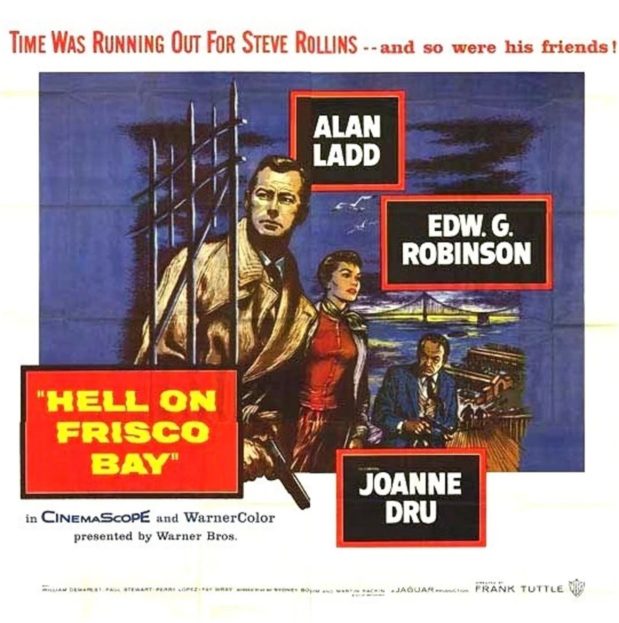
Around the time I fell in love with San Francisco during high school, I found a book in the school library called ‘San Francisco: A Profile with Pictures’ by Barnaby Conrad. Published in 1959, the book had already seemed outdated to me at the time, (although, that wasn’t that much earlier than my high school years) but I loved the photographs in the book. Conrad name-drops many famous people he was acquainted with throughout the book, from Herb Caen to John Steinbeck, although most of them I wasn’t familiar with at the time. Around seven years ago, I found a copy of the book at the used book store at the San Francisco Main Library. I’ve updated a number of the pictures from the book in the past, and I read it again, cover to cover, last week. (You can finish it in one day) Sadly, almost everyone he writes about is gone now, including the author, and it’s really a time capsule of a San Francisco that doesn’t exist anymore. Here are some of the pictures I’ve posted from the book in the past, and some of the comments I made about the photos. I’ll also list the photographers, which I may not have done in the past. I’ve included the almost archaic now guide map at the end of the book. (Thumbnail images)

That elegant lady in front of Fishermen’s Grotto #9 at Fisherman’s Wharf in the 1950’s had better get the service that she wants! The old Standard Station designed like a ship across the street remained in Fisherman’s Wharf from the 1930’s to the 1970’s, although, by the 70’s it had been remodeled to a more standard looking Standard Station. Sadly now, #9Fishermen’s Grotto is gone forever now, as well. (Jerome Zerbe)

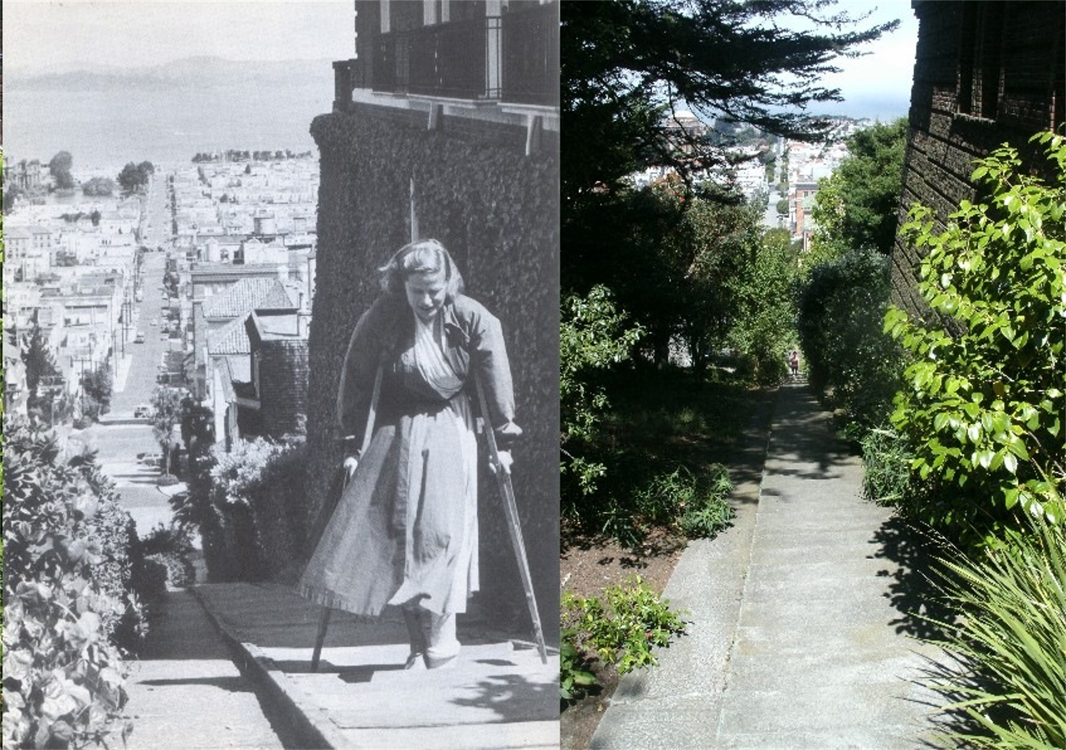
The Baker Street steps at Broadway in the 1950’s, and a really stoic way to treat a broken leg: (Miriam Young)

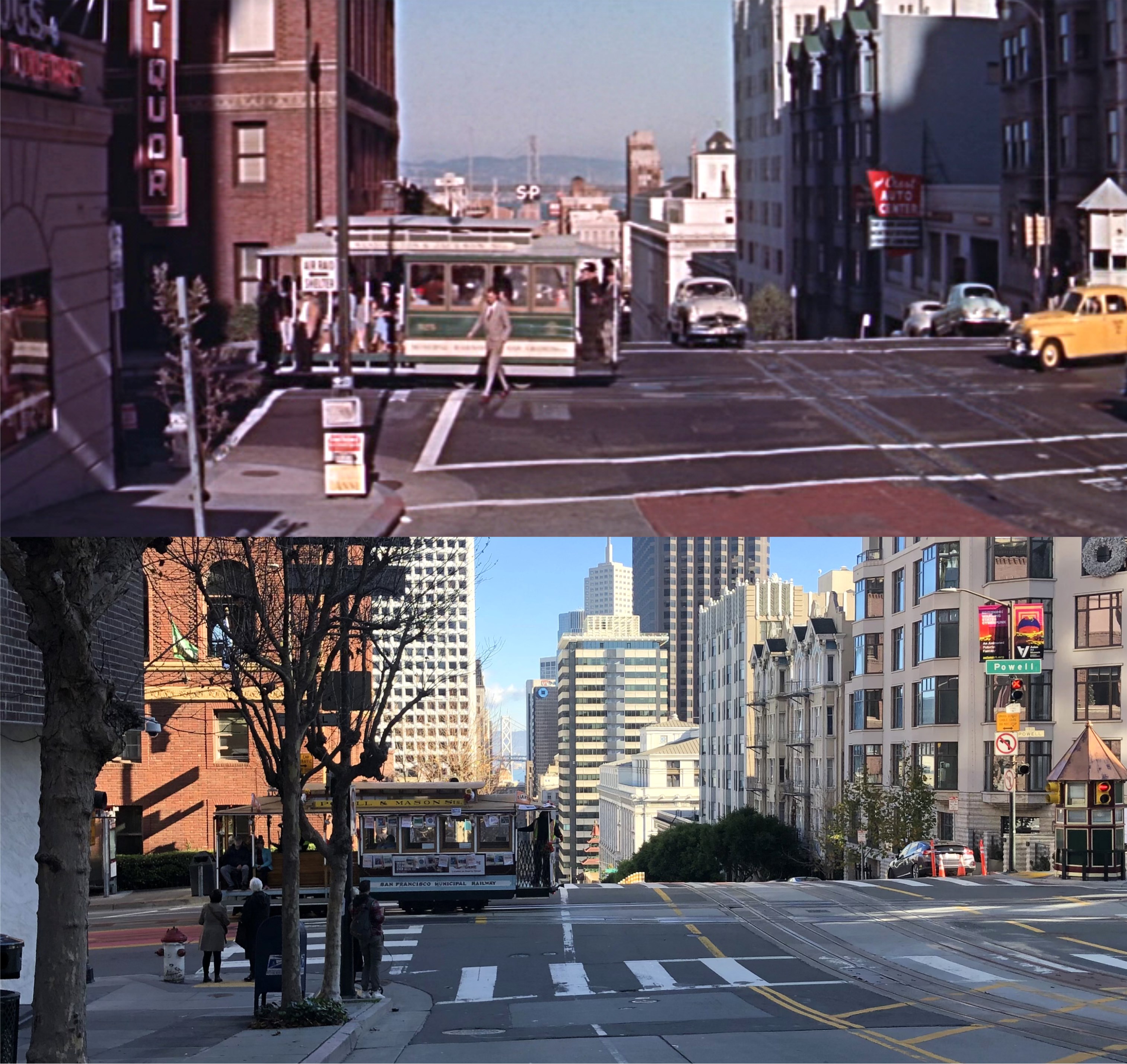
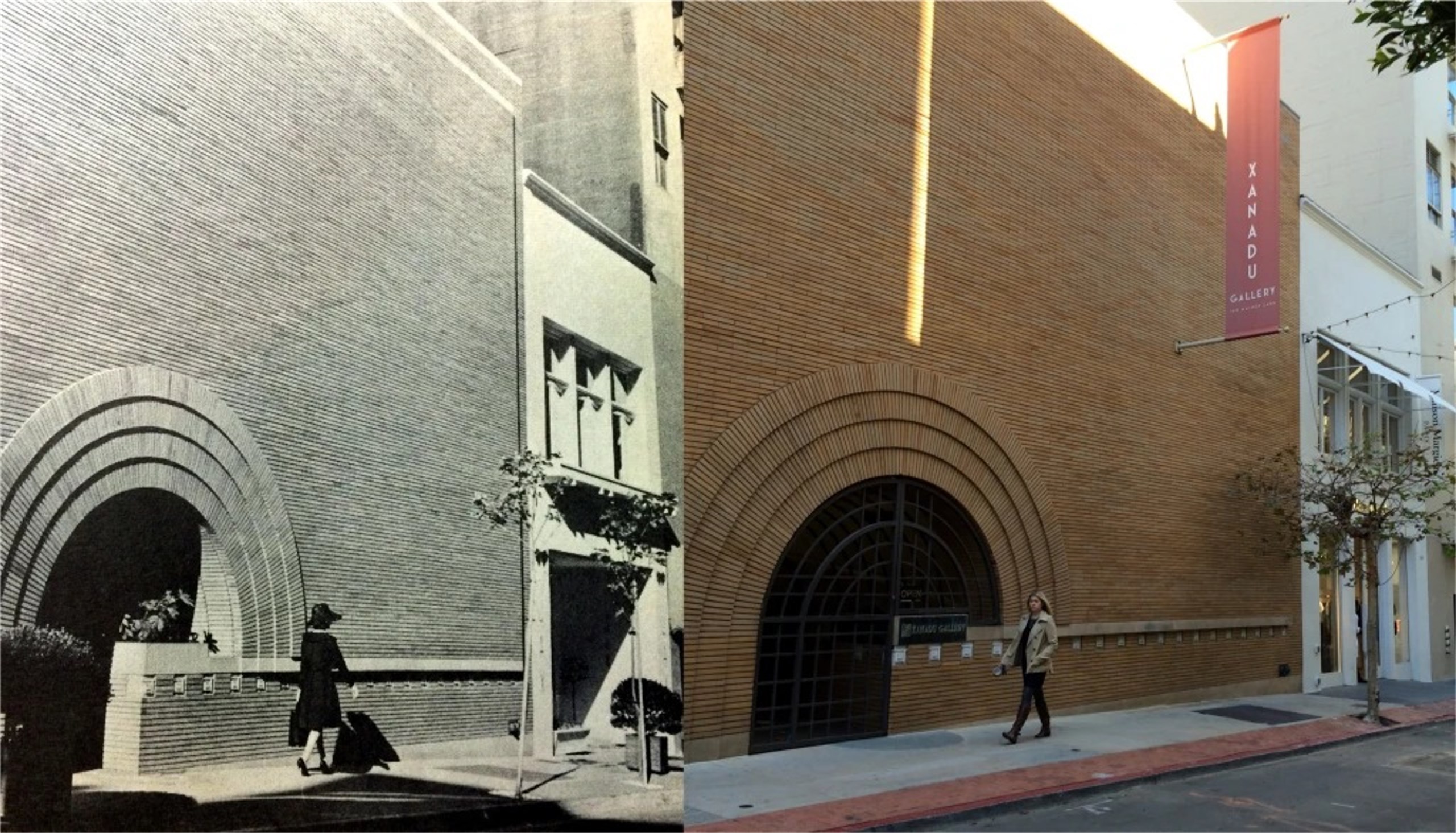
Maiden Lane in the 1950’s: She knows she’s hot! That building on the right with the round entrance, is the only building designed by Frank Lloyd Wright in San Francisco. (Tom King)

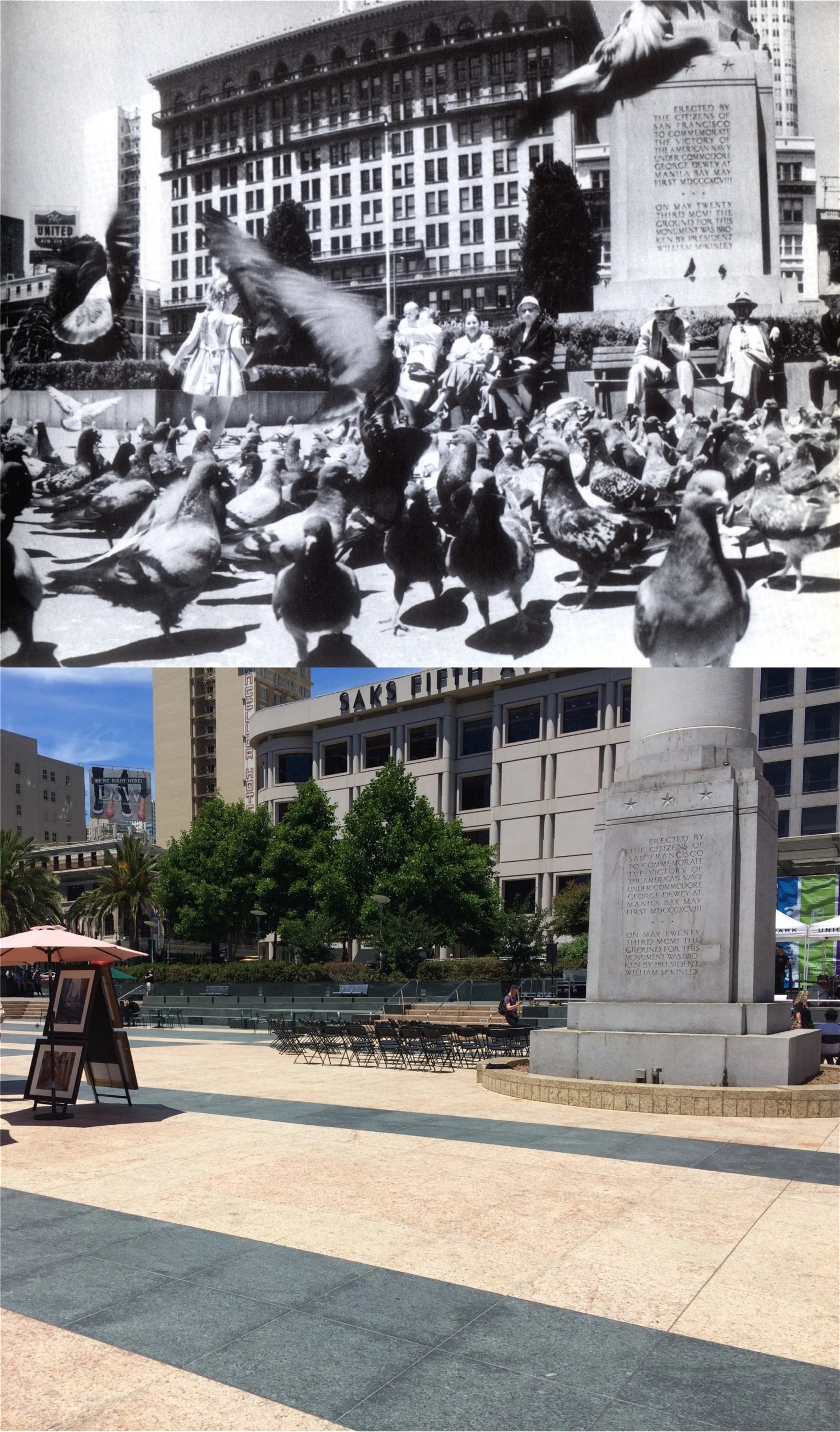
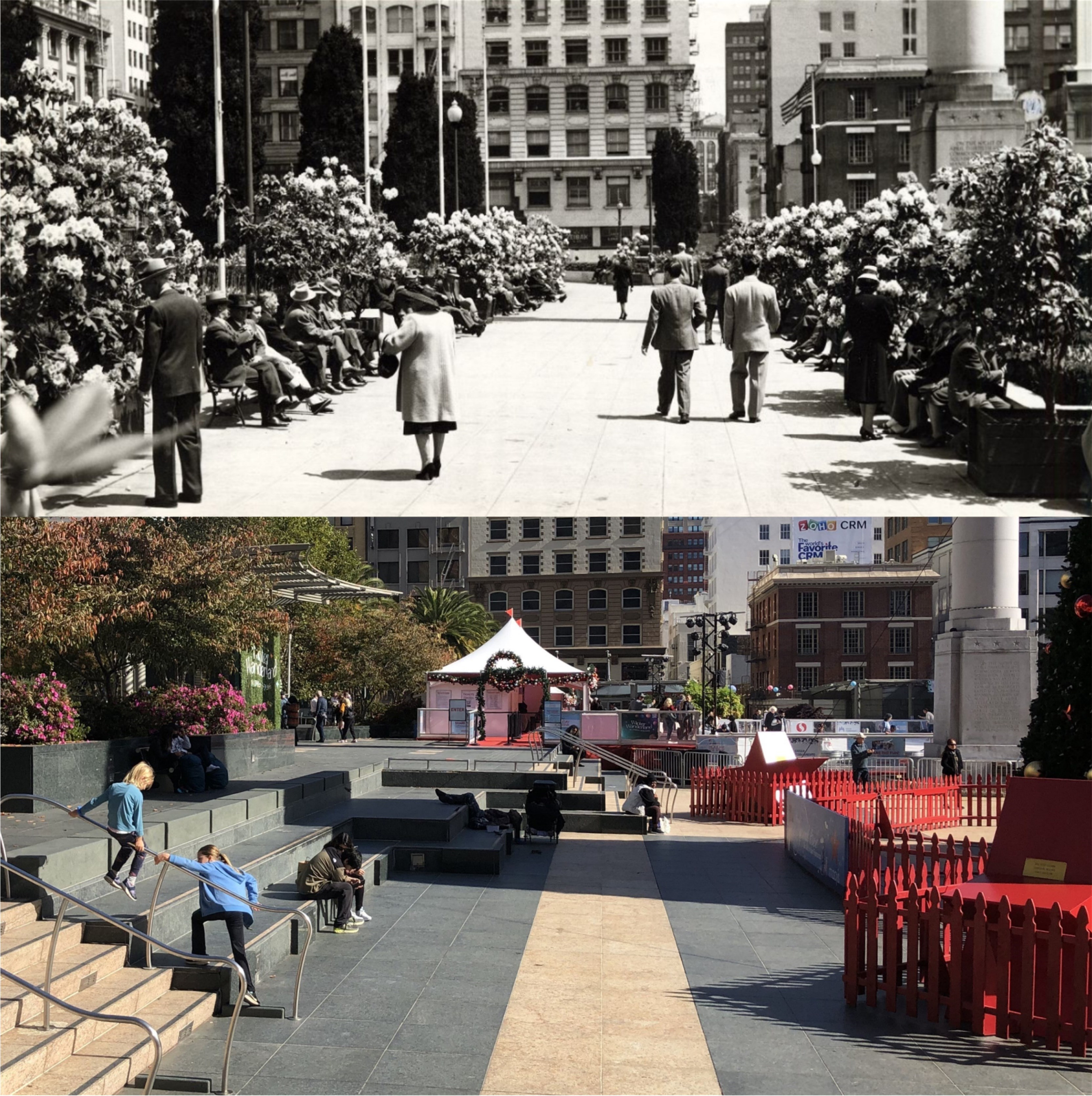
I’ve seen this Alfred Hitchcock movie, it’s scary! Actually, the little girl in the thick of it at Union Square in the 1950’s was a safe as the pigeons were! (Gene Wright)


Apartment hunting on Russian Hill in the 1950’s:
“Is this place for rent?”
“It is, fifty dollars a month.”
“Why, that’s ridiculous!”
“Take it or leave it.”
(Jacqueline Paul)

A student water-coloring at the Fisherman’s Wharf Boat Lagoon, under the supervision of Dong Kingman:

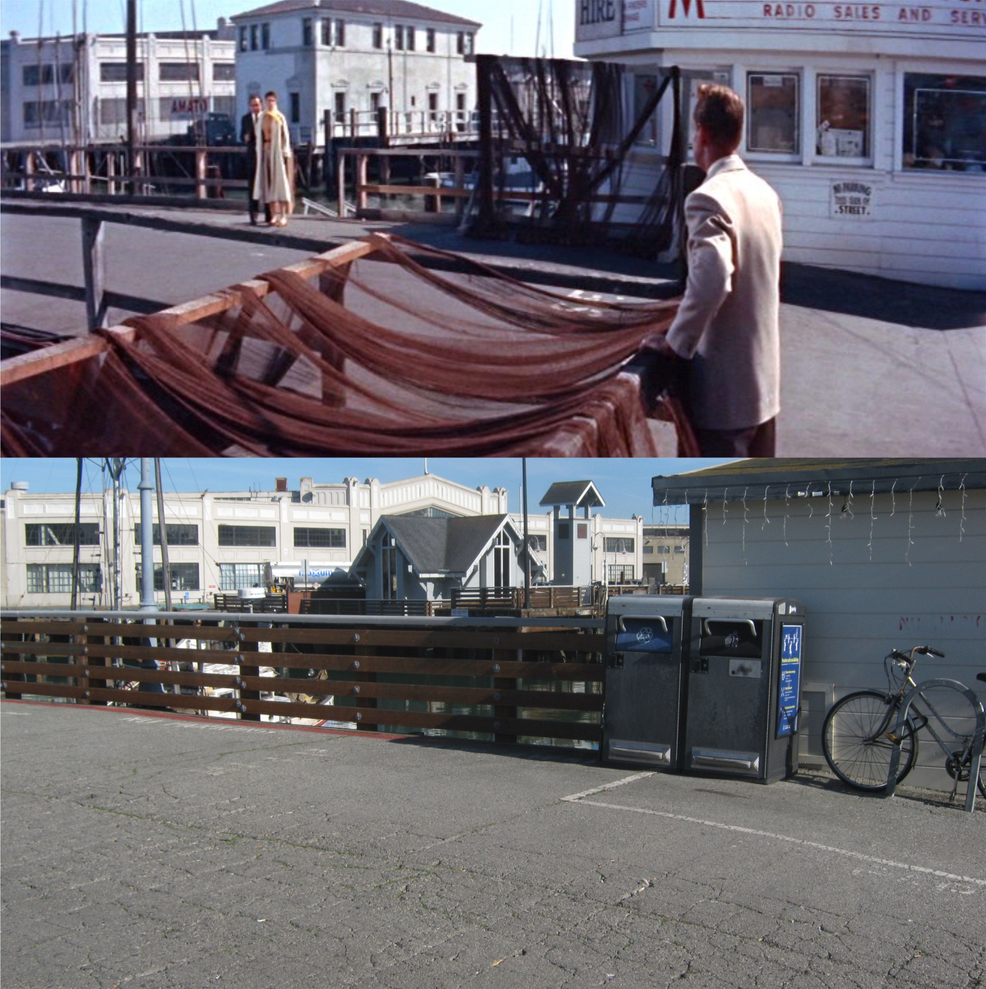
Fishing with a best friend behind the St. Francis Yacht Harbor: (Barnaby Conrad)


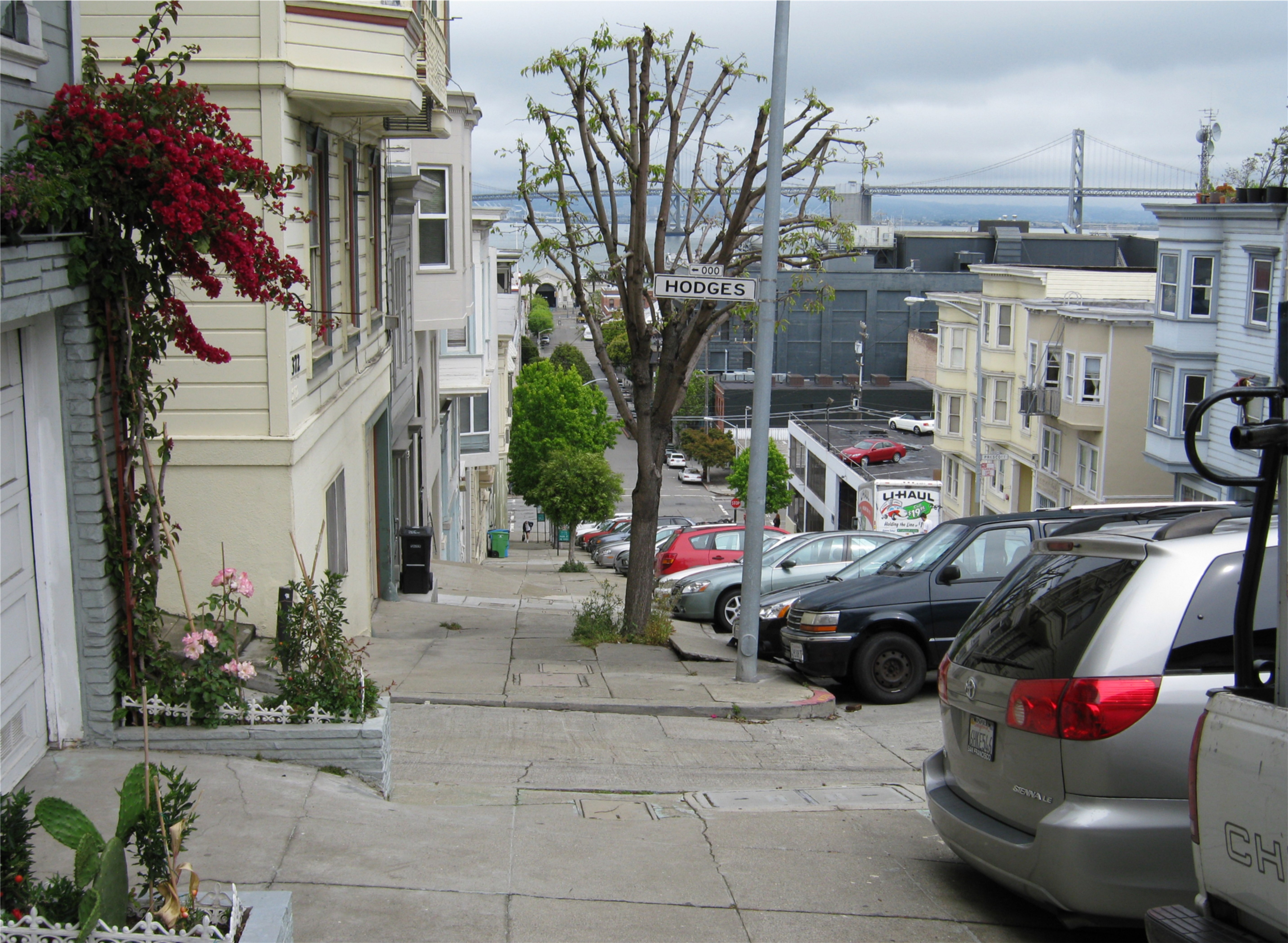
The double page guide map at the end of the book; let’s see what’s gone now. From west to east; Fleishhacker Pool, Kezar Stadium. Playland-at-the-Beach, the Cliff House, (closed) Mile Rock Lighthouse, the Produce District, SP Depot, and the Embarcadero Freeway hadn’t been built yet.

‘Hell on Frisco Bay’

I can forgive the “Frisco” in the title of the 1956 crime drama ‘Hell on Frisco Bay’ because it makes the film sound more dramatic. It’s only two and a half stars on the must-see list, but the movie is still fun to watch, and has interesting San Francisco locations. Alan Ladd looks old and tired, Joanne Dru is as pretty as she was in Red River’ and Eddy G. is….. Eddy G. Although, this has to be one of the most despicable characters Robinson has ever played.


Ladd plays a police officer released from prison after serving five years on a manslaughter charge he was framed for. Off the force now, he’s on a hunt to find the real killer. Like, we don’t know who it will turn out to be? Here, he follows a floozy, on the east side of Telegraph Hill at Vallejo St. at Hodges Alley, to a suspect played by a relatively unknown at the time, Rod Taylor.

There’s an interesting shot of a cable car at California and Powell Streets on Nob Hill. On the right is the old Crest Garage, demolished in 2018, and on the left is a liquor store where the Fairmont Hotel parking garage is now.

In the film’s denouement the real killer turns out to be Edward G. Robinson. Surprise!!! He takes Ladd’s wife, Joanne Dru, hostage, and tries to escape by boat on Al Scoma Way at the Fisherman’s Wharf Boat Lagoon. Behind Robinson and Dru you can see Pier 45, and the little chapel is where the gray building used to be.

As Ladd approaches, Dru breaks free and Eddy G. Jumps into a speed boat, followed by Ladd. The film crew placed the name AMATO on the building in the background. This was Robinson’s name in the film, and the building was his warehouse.

As Dru watches the police approach the alley from Jefferson Street, she tells them what’s happening. If you look close at the AMATO building, you can still see the checkerboard window on the warehouse behind the white truck.


In a fist fight as the boat races out of control around San Francisco Bay, they’re almost bisected by a tugboat, tanker, and naval vessel before Ladd knocks Robinson from the boat. Realizing he’s headed toward the second tower on the San Francisco side of the Bay Bridge, he jumps free.


The boat crashes into the Bay Bridge tower, and Alan and Joanne reunite. In a similar view near the crash area today, you can still see the Hills Brothers Building, but no longer the Pacific Telephone Building, once the largest building south of Market Street.


Back to Square one, Part two

As I mentioned in January of 2021, there are plenty of historic and relaxing public squares in San Francisco to visit, but Union Square is still THE Square I go to most to get a break during a busy San Francisco day. Don’t let the doomsayers frighten you; it’s festive, as always, in Union Square this Christmas Season. The Union Square Instagram page posted a map of historic places around the Union Square area to see, and it’s a nice little tour guide. They’ve included ten historic spots to visit on the map, although, I would have made it eleven historic things and included the Beacon Grand Hotel, or twelve historic things and included the Clift Hotel, or…… Anyway, I searched my site to find pictures I posted in the past at the historic points listed on the map, and added a few new updates. (Thumbnail images)

.

I’ll start at the northwest corner of Geary and Stockton Streets looking toward Union Square during the 1950s: (San Francisco Pictures Blog)

The northwest corner of Union Square in the 1960’s and a couple enjoying their Second Amendment Right to bare arms: (William Gedney)

Maiden Lane on St. Patrick’s Day 1948, and all dressed up at Christmastime, 2019: Maiden Lane doesn’t have the glamour any more that it once had when it was a crowded two block alley with expensive shops.

The only building in San Francisco designed by Frank Lloyd Wright is at 140 Maiden Lane. Built in 1949, a number of galleries and businesses have been housed there.


Hey, it’s Holly Golightly on the left!

The map includes the Dragon Gate at Bush Street and Grant Avenue. To me, this has always been in the geographic Chinatown area, but I’m not going to quibble.

Ruth Asawa’s Fountain on Stockton Street between Post and Sutter: I’ve never done an update on this fountain before, so I scrolled through the San Francisco Public Library Archives to find a vintage picture. The iPhone Building blocks the view of Maiden Lane from here today. I don’t know why I never covered it before; Asawa’s Fountain, with its San Francisco imprints, is a nice piece of art.

Union Square, with the Dewey Monument on the left, during the 1906 Earthquake and Fire and in an update I  did recently in November of 2022:

Looking over Union Square toward the St. Francis Hotel in a slide picture I took in 1983, and an update I did of my picture in 2016:

Lane Turner, going into the old I Magnin store with the St. Francis Hotel in the background in the 1960 murder thriller ‘Portrait in Black’ and in 2015:

The Geary and Curran Theaters looking west in 1958: (blogspot.com)

Carol Channing, appearing at the Curran Theater in the late 1950s:

We’ll end up at the cable car turnaround at Market and Powell Streets: The vintage picture is from the 1940s; my update was taken in 2016. The Flood Building is in the background of both pictures.

They still decorate some of the public transportation over the Holidays, like the cable car waiting to approach the turnaround in an update I did yesterday, only they don’t get as carried away as they used to.

The Flood Building in 1908: Somebody is writing to “Mamma” saying that he or she missed seeing this building during their San Francisco trip. It’s too bad because it’s one of San Francisco’s most historic buildings.


“Where angels fear to tread” (Or, at least, they should)

Don’t get me wrong, I love San Francisco; I think it’s the most beautiful city in the world. That being said, I’m also aware of its problem areas. I took a walk Thanksgiving Day along Market Street from Powell Street to Van Ness to get some vintage then and nows. Although this stretch of Market has always bordered the Tenderloin, this used to be the place to visit on Saturdays and Sundays with lots of movie theaters and elegant stores to shop in. Not anymore. On holidays, with most of the businesses closed and few shopping visitors, the vagrants come over to Market Street like something out of the ‘Night of the Living Dead’. These are not all unfortunate victims of the pandemic or hard times; many of them are creepy people, and all of the well-wishing for them isn’t going to make them any less creepy. Whether or not you liked Herb Caen or Mayor Alioto, they wouldn’t have tolerated this; Herb Caen would have blasted the administration with his columns, and Alioto would have certainly used more aggressive tactics to get these people off the streets. Oh well, like my niece Carry Ann’s scientific theory of futility, “I squared w i squared” = It is what it is. I finished my updates, watching where I stepped, and left. (Thumbnail images)

Market Street at Larkin, looking west in 1956: The old Fox Movie Theater is in the background. The fellow in the vintage picture looks like John Travolta. (opensfhistory.org)

Looking east at Market Street and Larkin toward a parade in 1946: Yeah, like they’re going to have a parade here nowadays! “Hey, kids, would you like to sit on the sidewalk?” Not recommended. (opensfhistory.org)

Market Street and Hyde in 1962: From ‘How the West Was Won’ to ‘Frozen’ at the old Orpheum Theater. (opensfhistory.org)

The old Whitcomb Hotel in 1950: How did that survive? (opensfhistory.org)

The Weinstein Department Store was very popular in its day for both elegant and well-to-do shoppers. (San Francisco Public Archives)

Market Street at Gough in 1937: The Hotel Transient Permanent; never was there a more prophetic name for a hotel. (San Francisco Public Archives)

Also, taking the long way to the top of Coit Tower

The title is in reference to my November 13th 2022 post, although this diversion wasn’t planned. Last Thursday, I thought I’d take another trip to Coit Tower. It was a clear day, and I decided to take pictures around the observation deck of the tower. To my disappointment, the elevator to the top of the tower was out of order, but one of the assistants said that if I bought a ticket, I could take the stairs to the top. I’ve been to Coit Tower many, many times, but I have never taken the often heard of closed off stairway to the top, so, I thought I’d give it a try. The stairway circles continuously around the inside of Coit Tower until it reaches the top. When I reached Level 4, I wasn’t sure that this was such a good idea, but I wasn’t going to back out in front of the tower employees. Besides, several much younger people than I am had gone on ahead, and I wasn’t going to let them show me up. When I reached Level 10, I felt like I was pretty much done for the day, and when I stumbled out at the top, I felt like I was about a hundred years old! After I took my pictures, I realized that descending down the steep stairway is almost as tiring! When I got back down, one of the ladies working there remarked, “Well, I’ll bet that’s something you haven’t done before.” and she was right; that’s something I hadn’t done before, or won’t ever do again! I stopped by Calhoun Terrace to take some pictures, and headed down the Filbert Steps, which didn’t seem like much of a bother now, to the bottom of Telegraph Hill. When I got to my office, I tried to match up my pictures with some slides from the top of Coit Tower that I took in 1983. (Thumbnail images)

In April of 1983, I snapped a picture of a tanker heading past the Embarcadero, and heading toward the Bay Bridge. When I saw a ship approaching the Bay Bridge, remembered my 1983 slide because it’s one of my favorites, and took pictures of the ship passing by Telegraph. On the third one, I got a near perfect lineup with my old slide.

I took the rest of my pictures through the windows of the tower, like this one showing the old Embarcadero Freeway. They don’t match up perfectly with my old slides, but they still make interesting comparisons.

Looking toward Downtown San Francisco: Except for the Pyramid Building, this one doesn’t match up at all. The Salesforce Tower, looming in the background through the haze, is actually much taller than the Transamerica Pyramid.

Now you’re looking across Chinatown, with Nob Hill on the right and the Bank of America Building on the left.

Looking toward Fisherman’s Wharf and Pier 45, with the Van Ness Pier on the left. The ship docked at Pier 45 in the 1983 pictures isn’t the Liberty Ship, the Jeremiah O’Brien, docked there today. On the right, you can see the arch of Pier 43 in both pictures. The sailing ship, the Balclutha, was still docked at Pier 43 in 1983.

After I left Coit Tower, I walked down the Filbert Steps to Calhoun Terrace, and another one of my all time favorite San Francisco views. You’re looking down toward Pier 17 on the Embarcadero. The Exploratorium is now housed in Pier 17. Back in 1983, somebody had the silly idea to paint the Embarcadero Piers mellow yellow and baby blue. Thankfully, they’ve been repainted since them. Yerba Buena and Treasure Islands, and the tower of the Bay Bridge eastern span are in the background.

The view further south of the previous pictures shows the Pier 7 walking pier at the foot of Broadway. The Pier 7 Building had been removed by 1983.

Last, is another view of the gone but not forgiven Embarcadero Freeway. I have to admit that I used that freeway often, and I was one of the last people on it before it closed forever, trying to get out of San Francisco during the hours after the October 17th 1989 Loma Prieta Earthquake, but I don’t miss it.


My last day at the terminal, Terminal

I not only wanted to be there, I had to be there in August of 2010 on the last day of service at the Transbay Terminal on Mission Street. Built in 1939, this transportation hub was my introduction to San Francisco at age 15 when my buddies and I learned how to take a bus from Castro Valley into the City. It was always a long trip there and back, involving a transfer of buses, but the magic feeling at the sight of the inside of the Transbay Terminal was as exciting as the view of the Disneyland Matterhorn was as a kid after a long drive with my family from Northern California. From the Terminal, my friends and I discovered Golden Gate Park, Playland-at-the-Beach, the Cliff House, Chinatown, Fisherman’s Wharf, the Embarcadero, Telegraph Hill and Coit Tower, cable cars…… oh, don’t get me started. Too late! The building was already old when I discovered it, and it’s amazing that it still lasted for decades after that. These are then and thens of pictures I recently found from the San Francisco Public Library archives in comparison to some of the pictures I took the day before the Transbay Terminal closed forever. (Thumbnail images)

The view of the Transbay Terminal during the 1950s from the northeast corner of Mission and Fremont Streets:

The third level of the terminal where the trains and buses loaded and unloaded passengers, showing the tracks of the Key System Train Service:

Passengers boarding one of the Key System trains that traveled to and from the East Bay Area by way of the lower deck of the Bay Bridge:

One of the ramps leading up to the third level of the Transbay Terminal: There must have been something pretty exciting going on in the East Bay when the vintage picture was taken.

Long ago ladies going down the stairs to the first level of the terminal, and my picture I took of one of the stairs leading down to the mezzanine: I’m assuming that they got off the train; when you’re dressed like that you don’t have to take a bus.

People packing into one of the buses on the third level, looks like the 1960s or early 1970s, and one lonely looking passenger boarding a bus on the last day of service in August of 2010:


Some of the people who’ll miss the Transbay Terminal posted comments on the Market Street Railway internet page, like this person.

Taking the long way to Tad’s (For Tad’s Steak House)

Yesterday, I headed over to San Francisco on BART for a breakfast at Tad’s Steak House on Ellis Street. If I get off at the Powell Street BART Station, I’m only about two minutes on foot to Tad’s. Knowing that I was planning on tackling a high cholesterol and unhealthy breakfast, I decided to take a roundabout way to Tad’s to get a little exercise first, and take a few pictures I’ve wanted get along the way. I got off BART two stops early at the Embarcadero Station, walked along Drumm to Sacramento Street, and caught the Muni #1 bus up the hill to Grant Avenue, Chinatown, and started heading back to Tad’s. (Thumbnail images)

At California Street I was able to update a 1950s picture of the St. Mary’s Square Garage. Some of the buildings you can see behind the garage in the vintage picture from left to right are the tall Russ Building, the Hobart Building, and the Hunter-Dulin Building with its Gothic looking roof. All of these are blocked now by buildings I couldn’t name if I had to. (San Francisco Public Library Archives)

I doubled back to Grant Avenue through St. Mary’s Square, the most peaceful spot in Chinatown. I love that little park, and I’ve never seen it as crowded as in this photo that looks like it’s from the 1940s. During World War Two, Madame Chiang Kai-shek, easily the most famous Asian woman in the world at that time, paid a visit to St. Mary’s Square. . (San Francisco Public Library Archives)

Leaving Chinatown, I moved down Grant Avenue to Maiden Lane, cut through to Stockton Street, and double back to Post Street to get this update of a 1940s picture taken at the northeast corner of Union Square. . (San Francisco Public Library Archives)

I crossed through Union Square to Powell Street, and walked down the west side of Powell to update this late 1950s picture from the San Francisco Remembered Facebook page of two ladies passing by Tad’s Steak House at 120 Powell Street, where the restaurant originally opened in 1955. In 2019, Tad’s closed on Powell Street, and moved around the corner to Ellis Street. Tad’s was right behind where the couple with the child in my picture were.

Ah, I’m getting closer and hungrier. I’m happy to say that the neon Tad’s Steaks sign made the move to Ellis, as well.

When I finished my breakfast and left Tad’s, I crossed over to Ellis Street at Powell, doubled back along Ellis to Market Street, and walked back along Market to the Powell Street BART Station. On the way, I did an update of the old clock across Market Street from the Emporium Building where the Bloomfield Shopping Center is now. The clock is not accurate nowadays, it was not 8:40. Before I left, I looked at the walking tracker app on my iPhone and found that I covered 2.6 miles on my journey. That ought to be enough exercise to offset eggs over easy, link sausages, hash browns, and toast.

‘Tis the season

Union Square is getting all decked out for the Holiday Season again. Once again, this little park will become probably the busiest shopping area in Northern California. Police presence will increase to deter smash-and-grabbers, and even those who avoid San Francisco because they fear the city is full of Commies and heathens, will come to Union Square to revive that Christmas feeling. After Fifth Avenue in New York City, Union Square may be the best urban area in the country to capture that ‘Miracle on 34th Street’ atmosphere.The vintage pictures are from the San Francisco Public Library Archives (Thumbnail images)

Dazed people gathering in Union Square just after the 1906 Earthquake: The Dewey Monument is on the left. The steel framed building under construction in the center of the old photo was completed after the disaster and is still there. The crown of the Call Building can be seen peeking out over the top of the original City of Paris Building, and is now the remodeled Central Tower behind Neiman Marcus.

The southeast corner of Union Square at Geary and Stockton Streets during World War Two: Hmmm, would I have bought War Bonds or Old Sunny Brook Whiskey?

The north side of Union Square, looking toward Maiden Lane during the 1940s:

Looking toward the St. Francis Hotel and some temporary Alpine Village on display during the 1970s:

Looking over the eastern side of Union Square toward Stockton Street and Maiden Lane during the 1950s: The November shadows kind of screwed my picture up a little, but it was the closest I could get to where the vintage photo was taken from. The ice skating rink on the left in my photo is getting ready to open for the 2022 Season.

Segue to November, 2022

All of these updates, except the black and white California and Sansome one, I did during the last week of October. The weather was perfect; “Second Summer” weather, in what used to be called an “Indian Summer”, made for a pleasant wrap up of my October, 2022 posts. The last update I did on November 1st, was when the weather turned suddenly cold and ugly. I took that to be nature’s way of warning us that winter is coming, but we still have nearly two more months of autumn, so I’m not going to take yesterday too seriously. The vintage pictures are from the San Francisco Public Library Archives. (Thumbnail Images)

The old Steinhart Aquarium and the Academy of Sciences in Golden Gate Park, demolished in 2005. I don’t know when the vintage picture was taken, but it was before the Sutro was built in 1973. I first visited Steinhart Aquarium on a field trip in the 6th grade. I bought a baby octopus preserved in a jar of formaldehyde and water. While the rest of the kids bragged about their new bike or skateboard, I had an octopus! The kids on the block “got nothin’ on this baby.”

The Number One Powell Street Building, originally the Bank of Italy Building, completed in 1920: The cable car turntable here is not in the same location today as it was when the vintage picture was taken, so I had to use a wider picture to get a cable car in.

Bush Street, between Sansome and Battery Streets, in the 1920s: I’ve always been intrigued by that thin little building with the advertising at 130 Bush Street, but I don’t know much about it, except that it was probably build in 1910, and the rumor isn’t true that only skinny people can work there. You can just see it today, squeezed in even more by the Shell Building that was constructed in 1930.

The old Audiffred Building on the corner of Mission and Steuart Streets, originally constructed in 1889: On “Bloody Thursday” during the 1934 water front strike, two strikers were shot to death on the Mission Street side of the building, which is around the corner on the right side of the pictures.

I got a pretty good line up on this one at Geary Blvd. and Powell Street, next to the St Francis Hotel looking toward Union Square. I’m not sure what those marks on the old photo were all about.

California Street at Sansome in the 1940s: Black and white’s better when wet; rain doesn’t color well. Fortunately there was a regular break in traffic on California Street due to street lights, so I was able to get a shot between the cable car tracks. Although not a ghost town, the Financial District still hasn’t come back all of the way from Covid 19.

The Mysterious City

Just a few night photos I’ve posted, courtesy of Fred Lyon, to get in the mood for Halloween: (Thumbnail images)

The Fairmont Hotel during the 1950s, with the Mark Hopkins Hotel barely visible in the background: I need a fog machine.

Looking past the Fairmont Hotel toward Sacramento Street during the 1950s:

Mason Street at Turk Street during the 1950s:

A mysterious figure coming up Mason Street out of the fog next to the Mark Hopkins Hotel, it looks like the 1940s:

Two mysterious figures at Woodside Avenue and Portola Drive in the 1940s, and a mysterious figure wannabe: