
That’s a pretty banal title for a post, but it’s accurate. Also, some of the photos are actually of cliffs on designated hills or heights. Herb Caen wrote something about when travelers get tired of walking around San Francisco, they can lean against it. That’s not inaccurate either. These are vintage photos of San Francisco that I took from two books I have, the 1939 WPA guide, ‘San Francisco in the 1930s’, and ‘The Far West’ by the editors of Look Magazine, published in 1948. They’re pictures of exciting views that are still around, although some of them have been drastically altered. (Thumbnail images)

A two page view of the Cliff House from Sutro Heights during the 1940s: I, and some buddies of mine, used to climb up this cliff from Point Lobos Avenue when we were teenagers, and I’m not making that up. (Look Magazine)
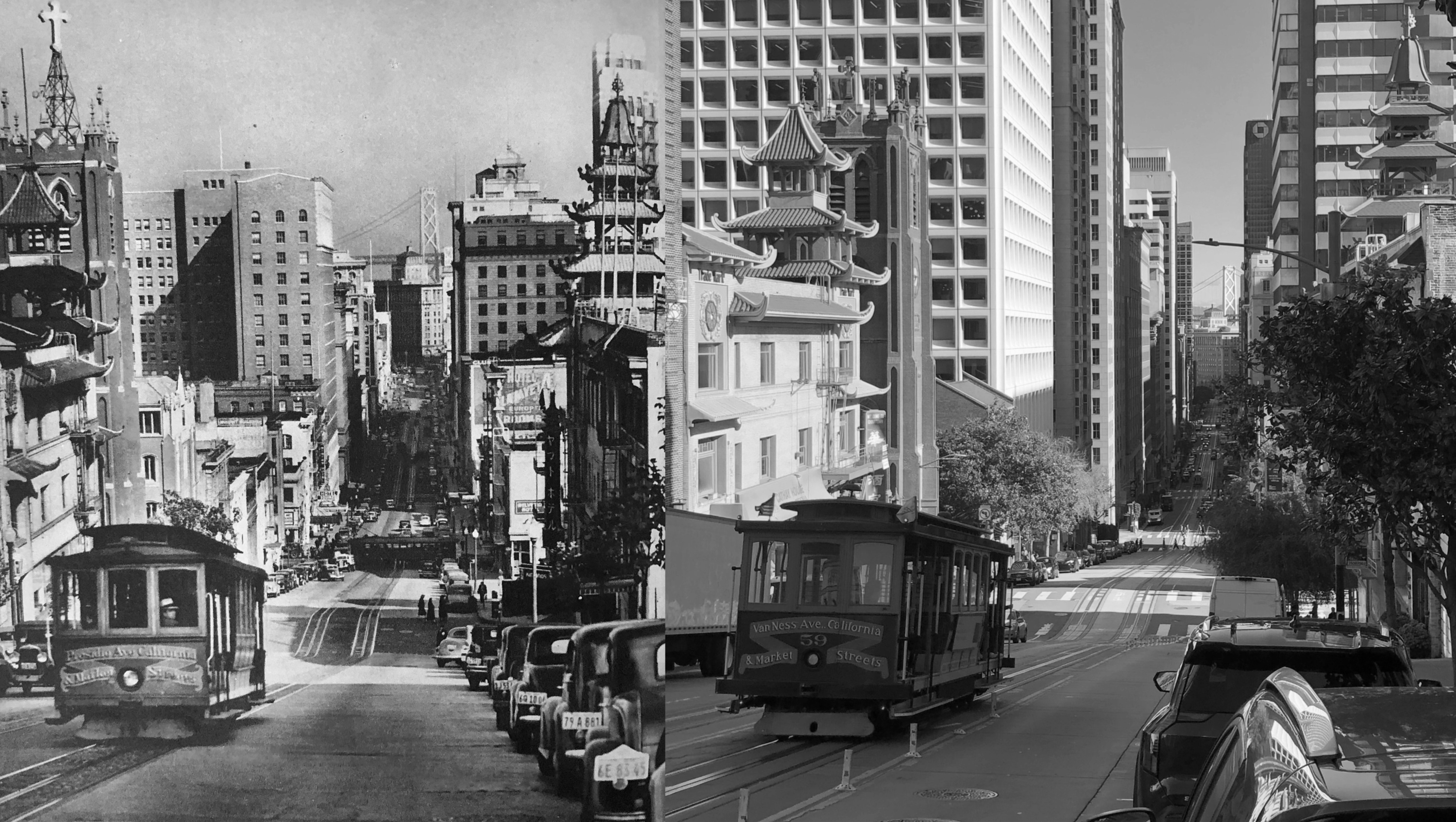
The view down Montgomery Street from Telegraph Hill: The picture is labeled “A FIVE MINUTE WALK FROM THE BUSINESS DISTRICT”. It’s an easy five minutes from one direction, and a tiring five minutes from another. The buildings that I can identify in the far background of the vintage picture are, from left to right, the Shell Building, the Standard Oil Building, the Hobart Building, the Russ Building, the Chronicle Building, and the Call Building, all still around. Only the Russ Building can be spotted in my photo. The tree on the left in my photo blocks an exact match up today (San Francisco in the 1930s)
Another two page view, looking east from the Top of the Mark: Once again, about the only discernible building in the modern picture is the Russ Building. Actually, this one at the top of the Mark Hopkins Hotel is 306 feet above Nob Hill, but I guess that still counts as a hill picture. (Look Magazine)
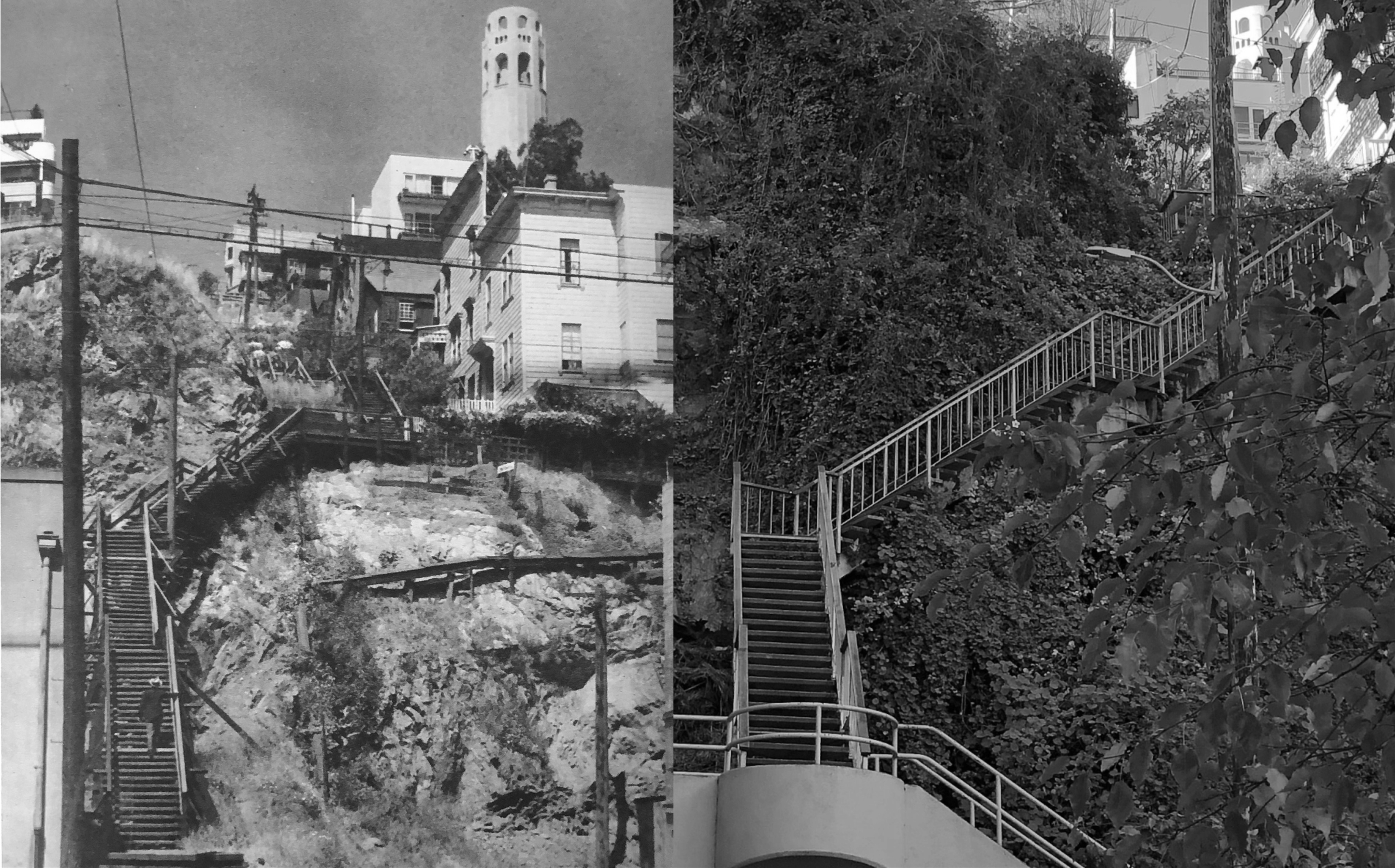
Looking up at the Filbert Steps from the bottom of Telegraph Hill in the 1930s: This one is labeled “TELEGRAPH HILL FROM THE PRECIPITOUS SIDE”. It’s even more precipitous when you’re walking up the steps, rather than down. You can just see Coit Tower in the upper right of my picture today. (San Francisco in the 1930s)
Another dramatic view down Nob Hill past Chinatown in the 1940: Cars shoot down from Stockton Street to where I’m at pretty quick, so it was too dangerous get a perfect lineup farther out into California Street with traffic at my back. I know, “And this is the guy who used to climb up Sutro Heights!” Well, at least back then you knew what was behind you. Old St. Mary’s and the Dim Sum Building on the left, and the Sing Fat Building on the right frame the view; the Southern Pacific Building and the Bay Bridge are at the far end of California Street.
