“Pick a street, any street. Okay, Geary Street, not Geary Boulevard.” (For Florence)


I’m amazed looking over past posts I have done at how many times I have referred to the portion of Geary that runs from Market Street to Van Ness Avenue as Geary Blvd. when it’s actually Geary Street. Also, I wasn’t clear on which came first, Geary Blvd. or Geary St. However, this old 1932 map of San Francisco from wikimedia.org shows that it was originally called Geary Street all the way from Market Street to Sutro Heights. I’ve included the link. I’ll have to do some research to find out when the western portion of the street/boulevard was changed to Geary Boulevard….. Just did, AI says it was in the 1970s; I thought it was earlier. I took a walk along part of Geary Street yesterday to update some vintage pictures from the internet. (Thumbnail images)

https://upload.wikimedia.org/wikipedia/commons/9/99/1932_Candrain_Map_of_San_Francisco%2C_California_-_Geographicus_-_SanFrancisco-candrian-1932.jpg


Geary Street at Market in 1945: Lotta’s Fountain was in a different spot then; it’s, reportedly, in it’s original spot now. By the way, Lotta’s Fountain’s 150th birthday is being celebrated this year. An addition to the Gothic Mutual Savings Bank Building is where the ‘The Stag’, whatever that was, used to be.


Looking down Geary toward the Palace Hotel from Grant Avenue; I think the vintage photo is from 1910: The building on the right is still named the Magnin Building.


People in the crosswalk at Geary and Stockton Streets in 1957. Ticket that grid-locker! I wasn’t sure which Stockton, Geary crosswalk this was in the vintage picture from the San Francisco Library Archives, at first. It couldn’t have been looking toward Union Square, I Magnin, or the City of Paris Department Store, but the Savings building in the background looked out of place at this intersection. (See next photoset)


So, I looked around for any vintage picture that would verify if the vintage picture in the previous set was labeled correctly. My “go to group” from opensfhistory.org came through with this picture from 1965; the crosswalk in the previous photoset was definitely the one that ran from the City of Paris to the Guaranty Savings Building.


What a great vintage picture this is of a streetcar passing Powell Street from Geary, heading east, in 1942! The St. Francis Hotel is in the background. I couldn’t get a photo with a streetcar entering the intersection, but I’ll settle for a cable car. (San Francisco Library Archives)


Now, we come to my dedication. Dedicating a post to a ghost might seem macabre, but I always felt sorry for Florence Cushing, the young girl who jumped to her death from the top floor of the Union Square Plaza Hotel in 1911, then called the Paisley Hotel, and reportedly still haunts the building. “(She) can check out any time (she likes), but (she) can never leave.” Here’s one of the links with a part of her story. Also in the 1971 picture from the San Francisco Library Archives is the unfinished Westin Tower of the St. Francis Hotel.

https://thehauntghosttours.com/blog/union-square-hotel-haunted-sf/


Mason Street was as far as I got yesterday; I wanted to explore Geary Street all the way to Van Ness Avenue where the twain of east Geary Street meets west Geary Boulevard, but “alas, alack, and Alaska” I’ve had an arthritis flare-up in my toe all month that’s been cutting into my “pounding the pavement” time. This vintage picture is looking east along Geary Street in 1913. The peak of the tall Whittell/Grace Building in the left background is painted white now, so sometimes it appears invisible in some of my pictures. The Hotel Stewart on the right is now the Handlery Hotel. (UC Berkeley Library Archives)

“If they asked me, I could write a book.”

“About the way you walk and whisper and look.”

In 1957, Hollywood took over Telegraph Hill for awhile to film scenes for the movie ‘Pal Joey’, starring Frank Sinatra, Rita Hayworth and Kim Novak. Herb Caen devoted one of his columns to the filming that was reprinted in his 1960 book ‘Only in San Francisco’. Here are some of his comments in brackets from that column, titled ‘Stars on Telegraph Hill’ (great title for a chapter) plus some then and nows I’ve enjoyed doing on ‘Pal Joey’.  (Thumbnail images)

{I scaled Telegraph Hill Thursday afternoon to see how they make movies, and I must say it was all pretty impressive. Frank Sinatra showed up a little late, the wind blew Rita Hayworth’s hair every which way, and they had to put up a rope to hold back the gawkers, but even so, a few seconds of an epic called Pal Joey was shot and the movie makers considered it a day well spent. Along with about $15,000.}

{Around the circle in front of Coit Tower, all was magnificent confusion. When Hollywood takes over, man how it takes over. There were wardrobe trucks. And sound trucks. And light trucks, and heavy trucks. And a long dressing-room trailer, from which Miss Hayworth presently emerged, wearing a cashmere sweater, camel’s-hair skirt, beige leather shoes and a piece of gauze around her wavy titian tresses. Her face was heavily made up and she looked younger than springtime.}

{Even Coit Tower was made up for the occasion. For one thing, a new entrance had to be built. On the lawn behind the tower, a vast terrace had been built, of wood painted gray to simulate stone. “This is Rita’s mansion on Telegraph Hill, see?” said Galanter.” (Ted Galanter, a press agent) She’s a very rich woman who’s in love with Sinatra, but it isn’t mutual.}

{At 5:15 PM. Sinatra strolled gracefully onto the set, wearing make-up and a gray suit and sipping a coke out of a paper cup. “Good morning!” he greeted. “I think I’m gonna make it.” He walked out onto the terrace, shook his fist at the skyline, and intoned with laughs, “San Francisco, I’ll lick you yet!”}

{The bells of SS. Peter and Paul, in the valley below, began ringing. “Stop that infernal clanging,” roared Sinatra. “Bells and sirens – that’s all you hear in this town. Sounds like one big jail break!” “Hey,” he called to director Sidney, “what are we waiting for – more wind?”}

{“All right, let’s do it,” suggested Sidney. “And don’t worry if the wind blows you away,” he said to Sinatra. “We’ve got an anti-aircraft crew alerted to shoot you down over the Golden Gate Bridge.” Everybody yelled, “Quiet!” and the cameras rolled.}

{And that’s how movies are made. Somehow.}


Here’s a picture of a scene from the make believe terrace behind Coit Tower that I think was left out of the film, and the spot where Rita’s back yard was today. You can vaguely see a Bay Bridge tower and the Ferry Building in the film print, just above Sinatra.


Sinatra arrives in San Francisco by a ferryboat from Oakland during the opening credits. You can just see a part of the Southern Pacific Building today, minus its enormous SP sign.


Sinatra and the classic Sinatra look, as he leaves through the south wing of the Ferry Building.


The first place Joey heads for on arriving in San Francisco is the International Settlement on Pacific Avenue between Columbus Avenue and Montgomery Street. This was the nightclub and bawdy entertainment capital of San Francisco back then, and probably the best look you’ll ever see of it on film in this movie.


Back up on Telegraph Hill where a lovesick Kim Novak leaves what is supposed to be Rita Haworth’s mansion, but is actually the entrance to Coit Tower.


But Kim Novak wins out at the film’s end, as she and Sinatra wander off behind the St. Francis Yacht Club Building into a Hollywood sunset.

Another shot from the opening credits scene of Joey coming in by ferryboat, and a great look at the 1957 skyline of San Francisco: What the heck, I don’t get to pose with a star often. “Never mind the dames, Frank, just enjoy the view.”


‘The Raging Tide’, the novel and the film

I first heard about the 1951 film ‘The Raging Tide’ from the book ‘San Francisco Noir’ by Nathaniel Rich. The movie is based on the the 1950 novel ‘Fiddler’s Green’ by Earnest K. Gann, and reprinted under the name ‘The Raging Tide’ to coincide with the opening of the 1951 movie version of the story. ‘Fiddler’s Green’ refers to a mythical afterlife associated with sailors, but the title ‘Raging Tide’ makes the film more intriguing. I ordered a paperback copy of the book, but unfortunately the only DVD copy of the film I could find isn’t of the best quality, but I’ll use some of the images from the movie when referring to it. Both the film and the book are excellent examples of a mystery story set in San Francisco. I’ll use excerpts from the novel in brackets describing some of the interesting San Francisco locations, including some then and now pictures of the areas described, and compare the handling of parts of the story in both the film and book. (Thumbnail images)

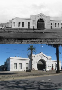
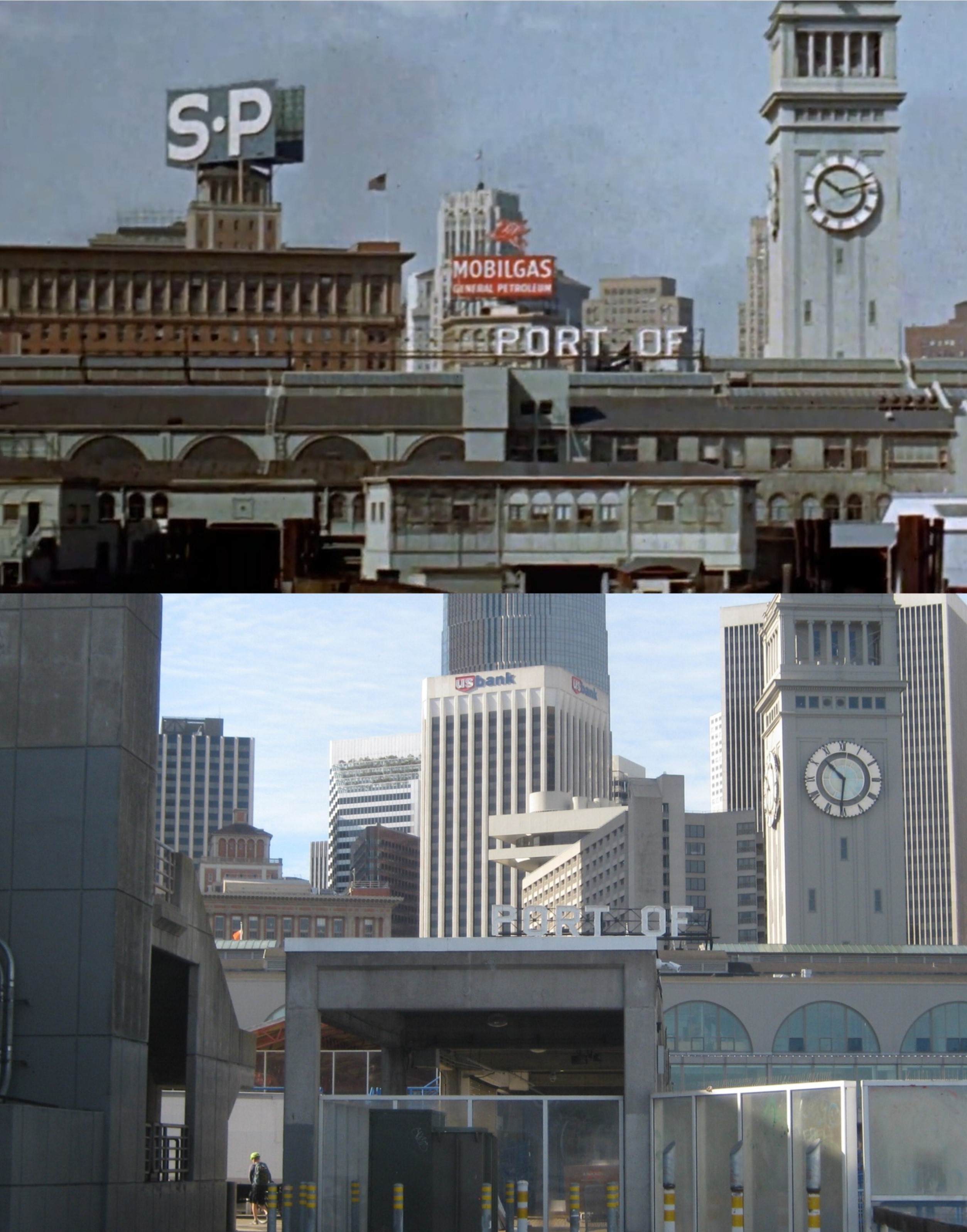
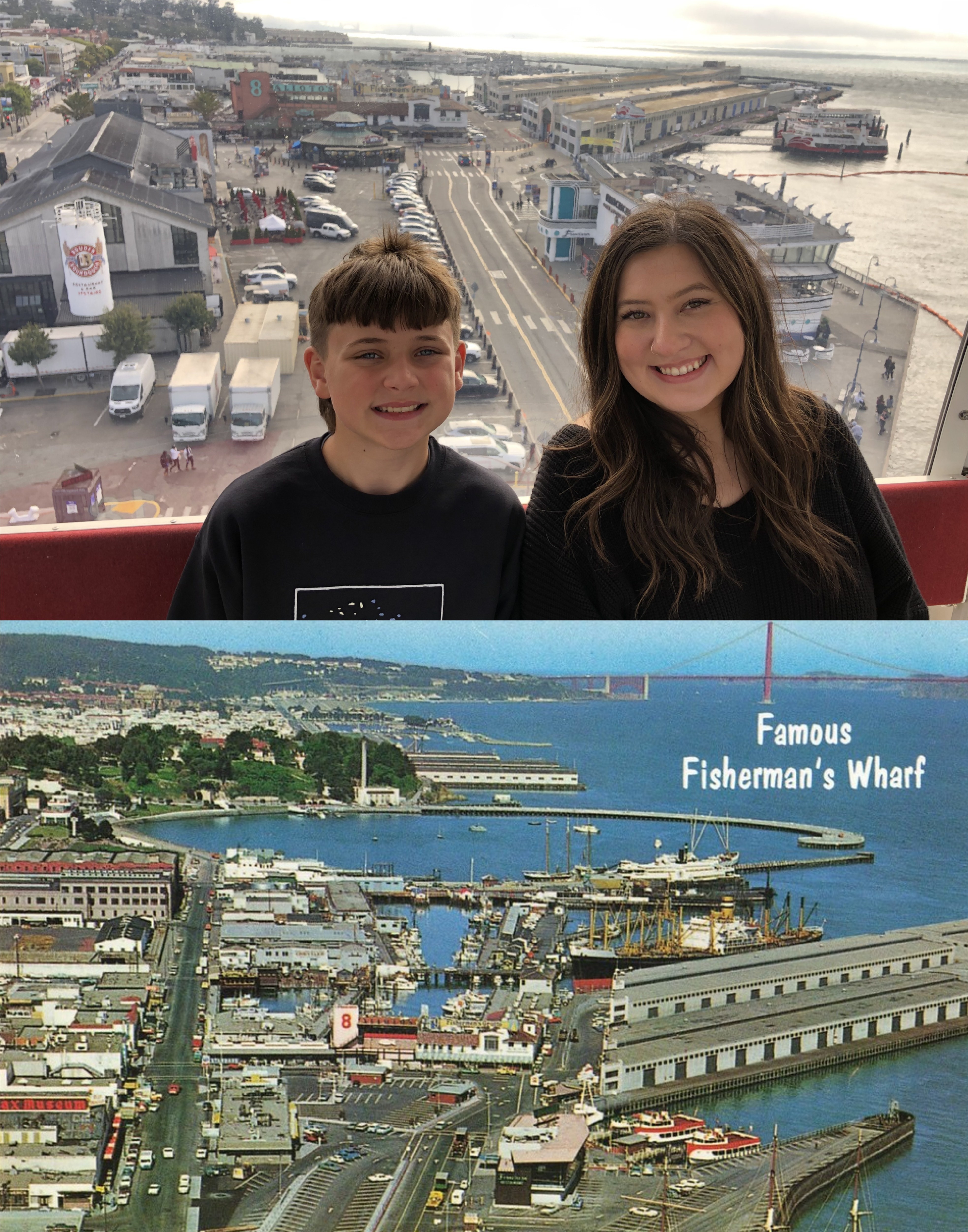
The movie opens up with a panoramic view of the San Francisco waterfront from the Coit Tower parking lot that is largely block by trees nowadays.


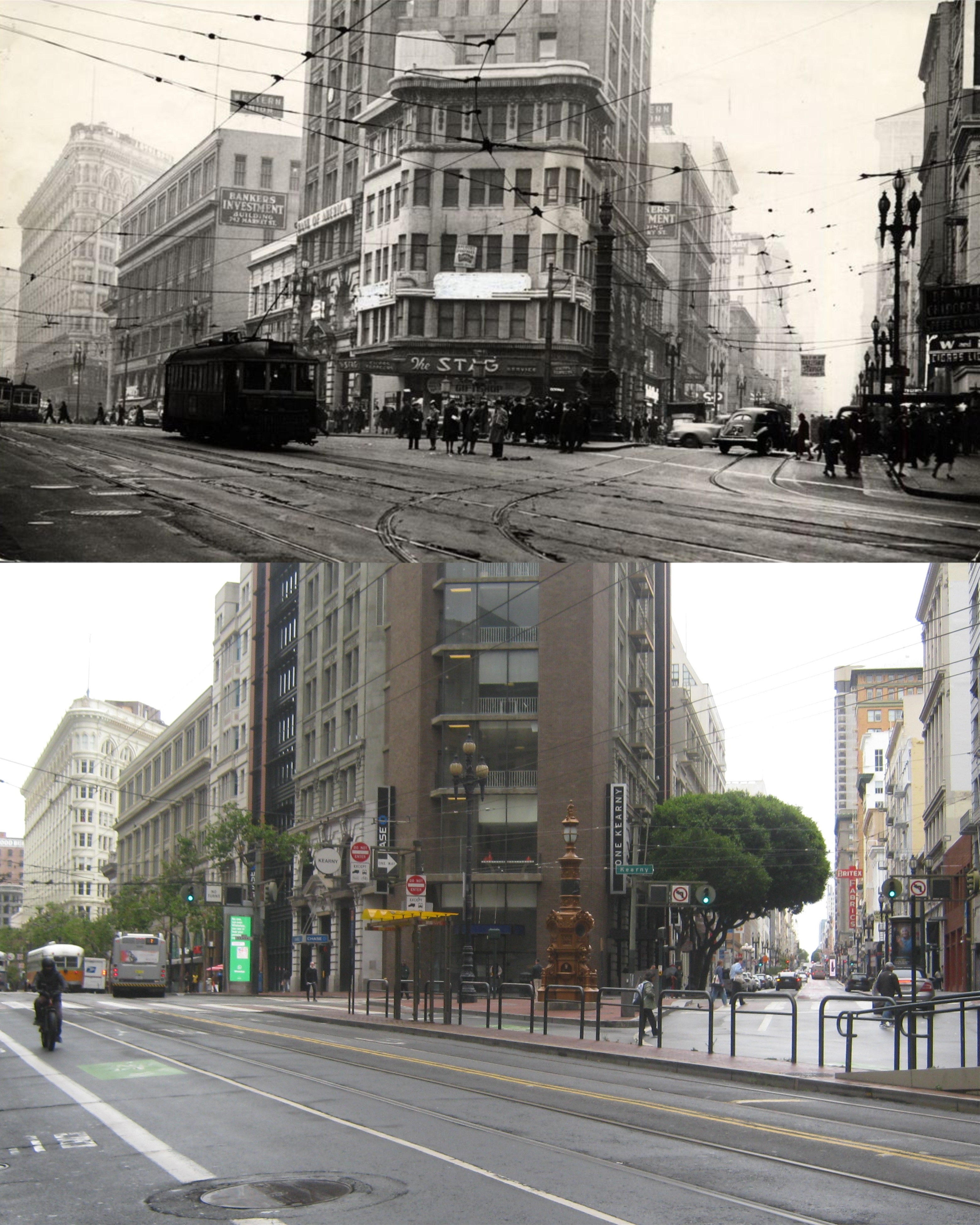
The novel opens up with three-time loser, Bruno Felkin, running north along the Embarcadero after shooting to death racketeer Sam Addleheim somewhere near the Ferry Building. Unlike the book the film opens with the actual shooting. We’re allowed to follow Bruno’s thoughts both in the book and the film as he runs away. Bruno is trying to get to his girlfriend Connie Thatcher’s apartment on Telegraph Hill to establish an alibi. {You cheap little tin horn. Let Sam kid around a little and you get excited. You wave a gun like a big grownup boy, and the damn thing goes off. The fact Sam grabbed you by the neck, the self-defense angle, wasn’t enough – and wouldn’t be. Not for a guy who was already a three time-loser. You lost your concrete head, so now you pound the concrete for all you’re worth.}


Bruno narrates a pretty good map we can follow as he tries to get to Connie’s Apartment. {Past Pier 5, Pier 7 behind and the cafeteria behind the Bar Pilots’ office. The cafeteria was closed. Past Pier 9 and now was the time to quite smoking. Right now. Instantly—when your realize what cigarettes can do to your wind.} The movie shows only night time scenes of part of the Embarcadero, the Filbert Steps, and some of Fisherman’s Wharf during Brono’s run. The photos are Pier 5 in a 1960s picture from opensfhistory.org, Pier 7, demolished now and a walking pier, taken in the 1950s during the building of the Embarcadero Freeway, and Pier 9 in the 1960s; the latter two pictures from the San Francisco Library Archives.


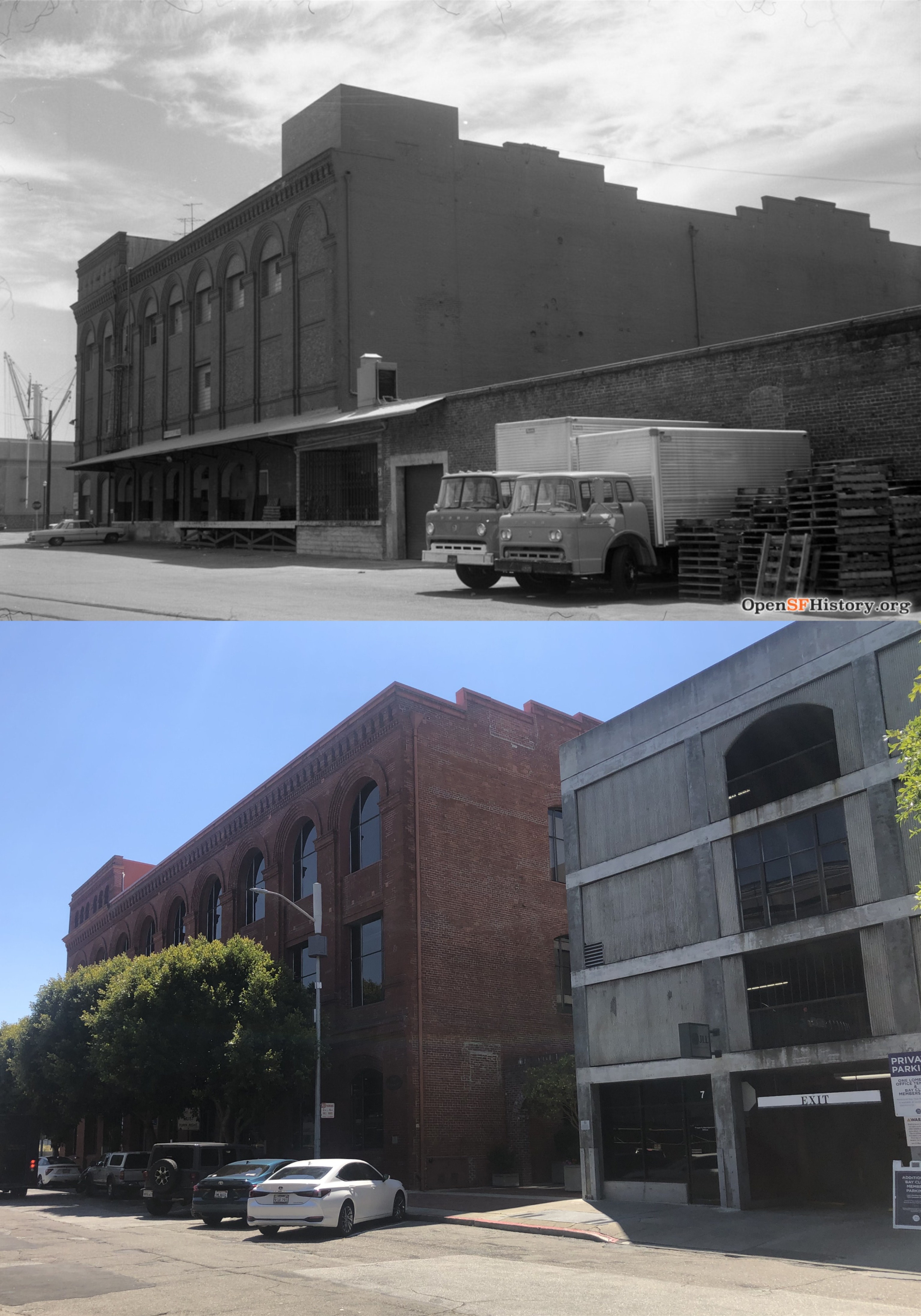
{Swing left now. Past the Merchants Ice and Cold Storage Company. Pier 27 . . . up Lombard Street. Get to hell away from the Embarcadero.} The Merchants Ice and Cold Storage Building is still around, seen here in a picture from the 1970s. (opensfhistory.org)


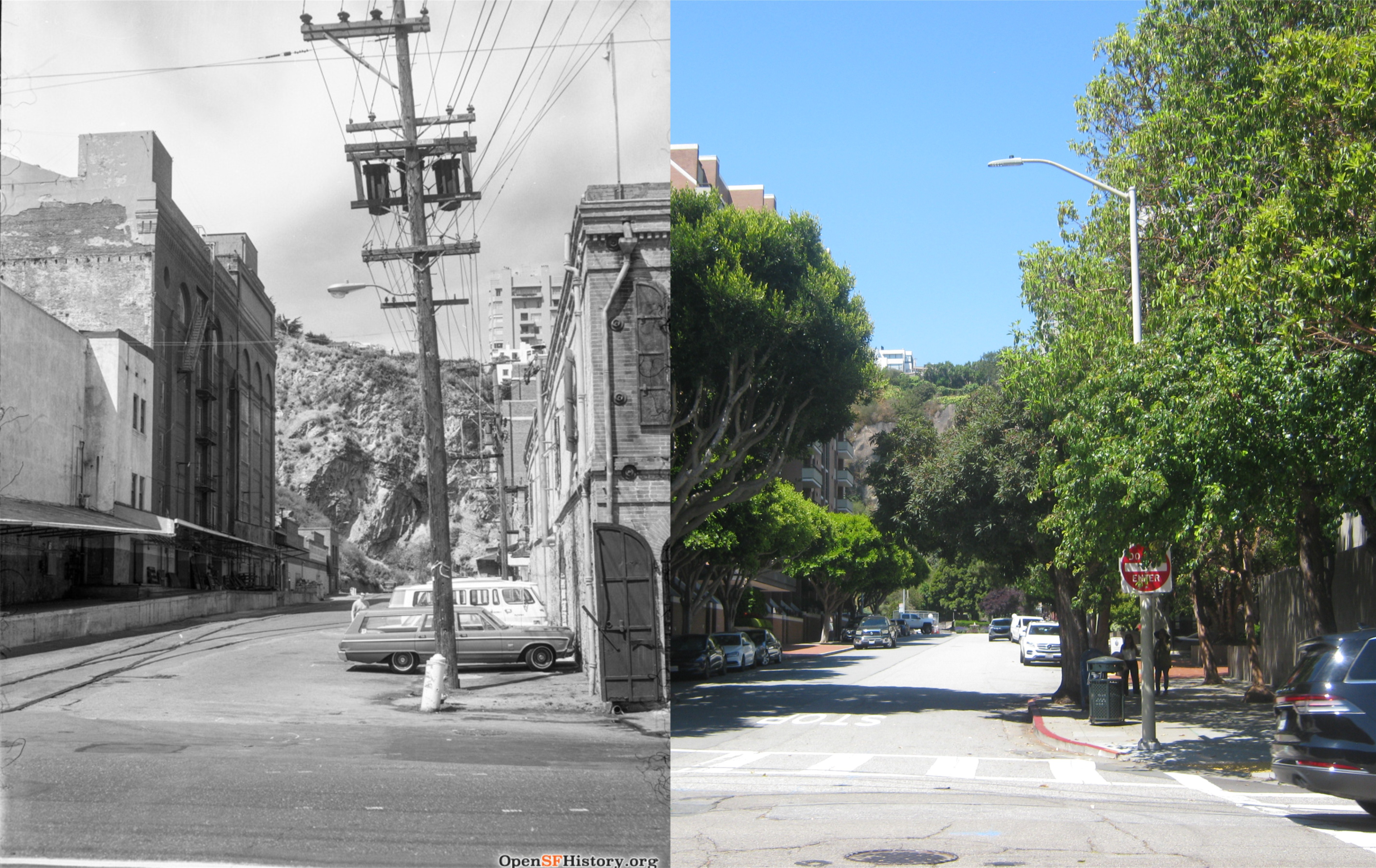
{Bruno ran west on Lombard, then turned to the right on Sansome Street.} Looking west on Lombard Street toward Telegraph Hill and Sansome Street which Bruno turns right on to in a vintage photo from the 1970s.(opensfhistory.org)


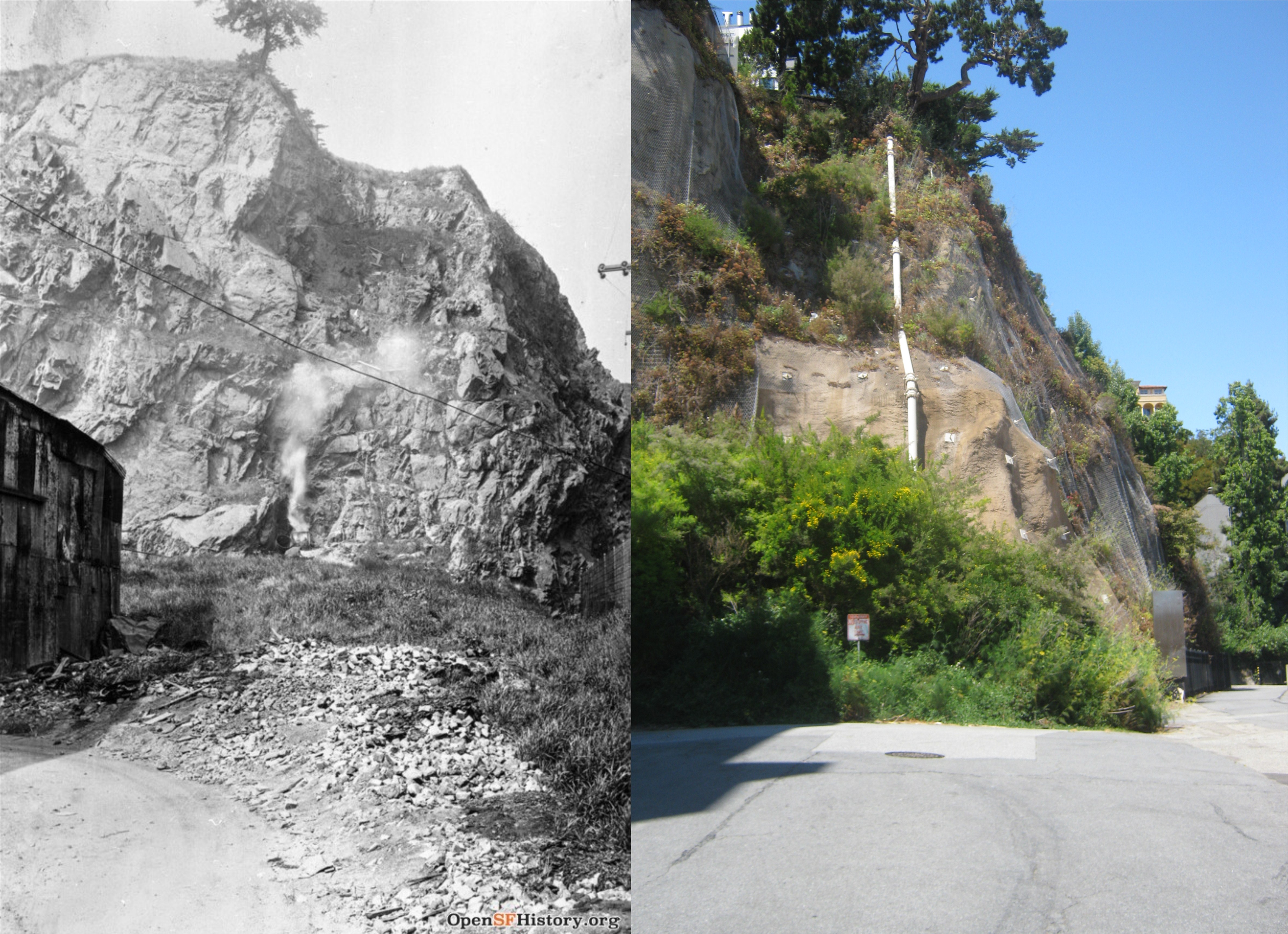
{He passed Vince’s hamburger stand at Chestnut, turned, ran west again. Damn! Chestnut was a dead end here. It banged strait into a cliff.} Chestnut Street still ends in a cliff here, as it did in the vintage picture from 1919, but you can get through on the right now if you’re on foot. (opensfhistory.org)

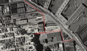
{He wheeled, ran around the Globe Flour Mills, crossed the railroad tracks on Francisco, and started up North Point Street. At Grant, the fog seemed suddenly heavier. To the left on Stockton and beat it between the two factories with the overhead bridge connecting them. The bridge looks like a crazy fake hanging up there in the fog–as if it couldn’t hold anybody.} These two close ups of David Rumsey’s 1938 aerial composite of San Francisco show the path Bruno is taking to try to reach Connie’s apartment. Bruno leaves the Embarcadero at Lombard, turns right on Sansome, and left on Chestnut, where he runs into the Telegraph Hill cliff. He doubles back to Montgomery Street, crosses Francisco to the Embarcadero, and heads north west to North Point. Bruno runs west on North Point, turning south at Stockton in the second Rumsey photographic map. The long gone overheard bridge on Stockton Street that Bruno passes under can be seen in the 1938 image. Bruno continues south on Stockton Street.


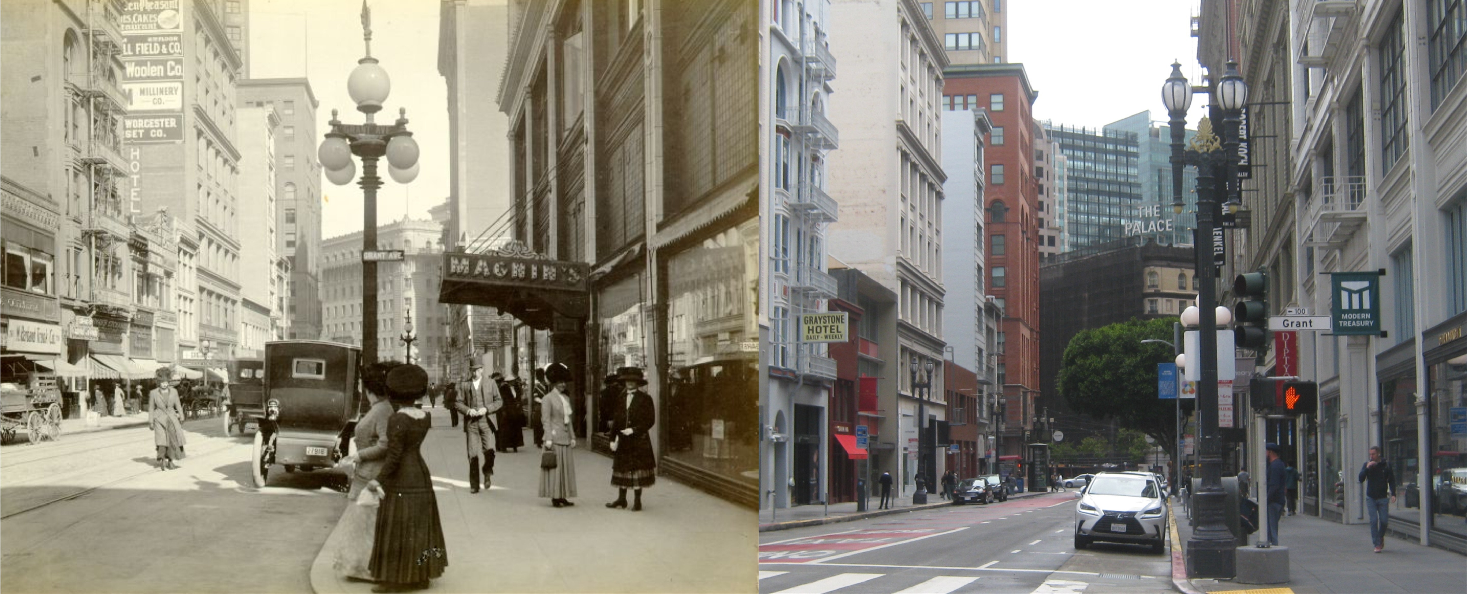
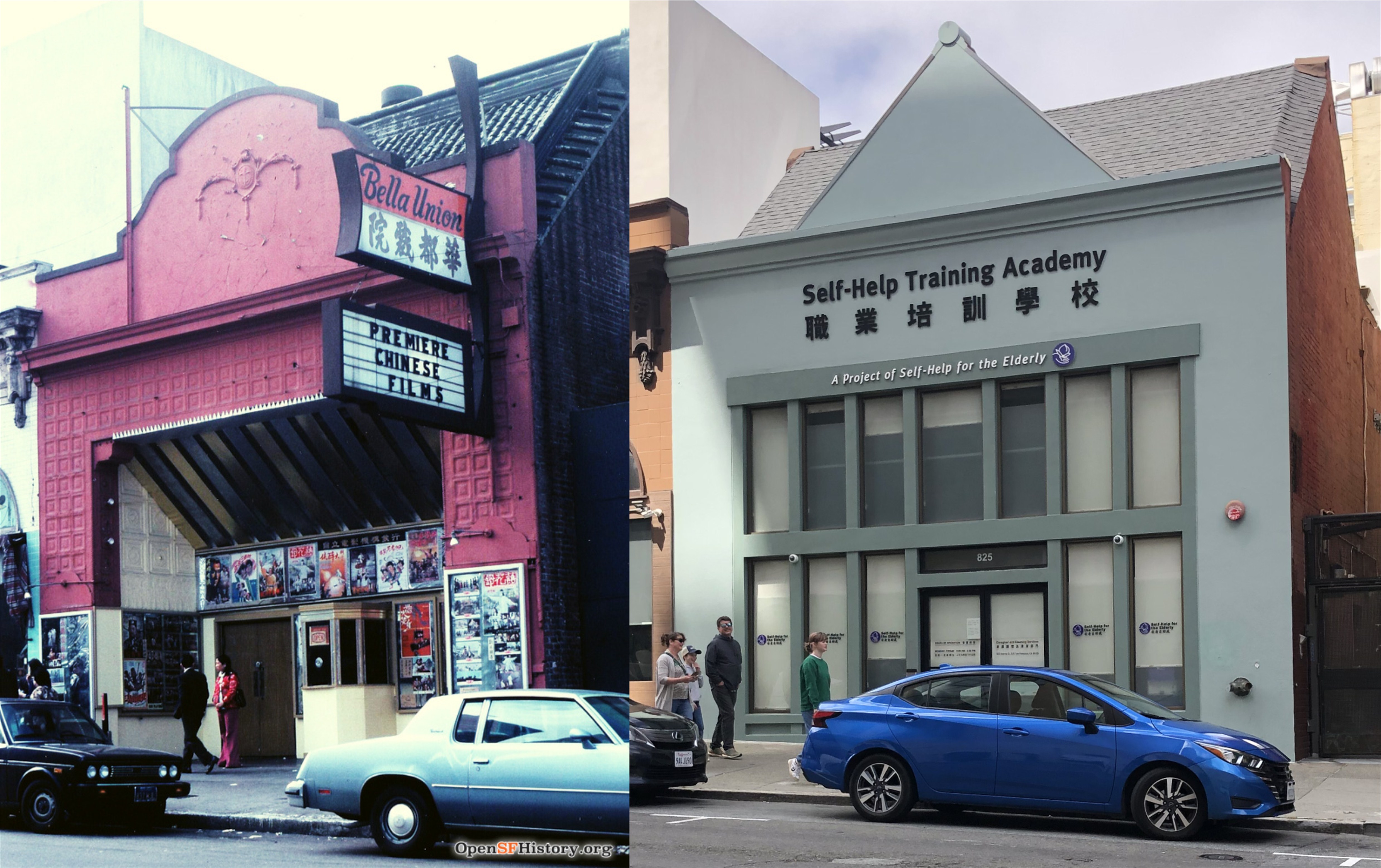
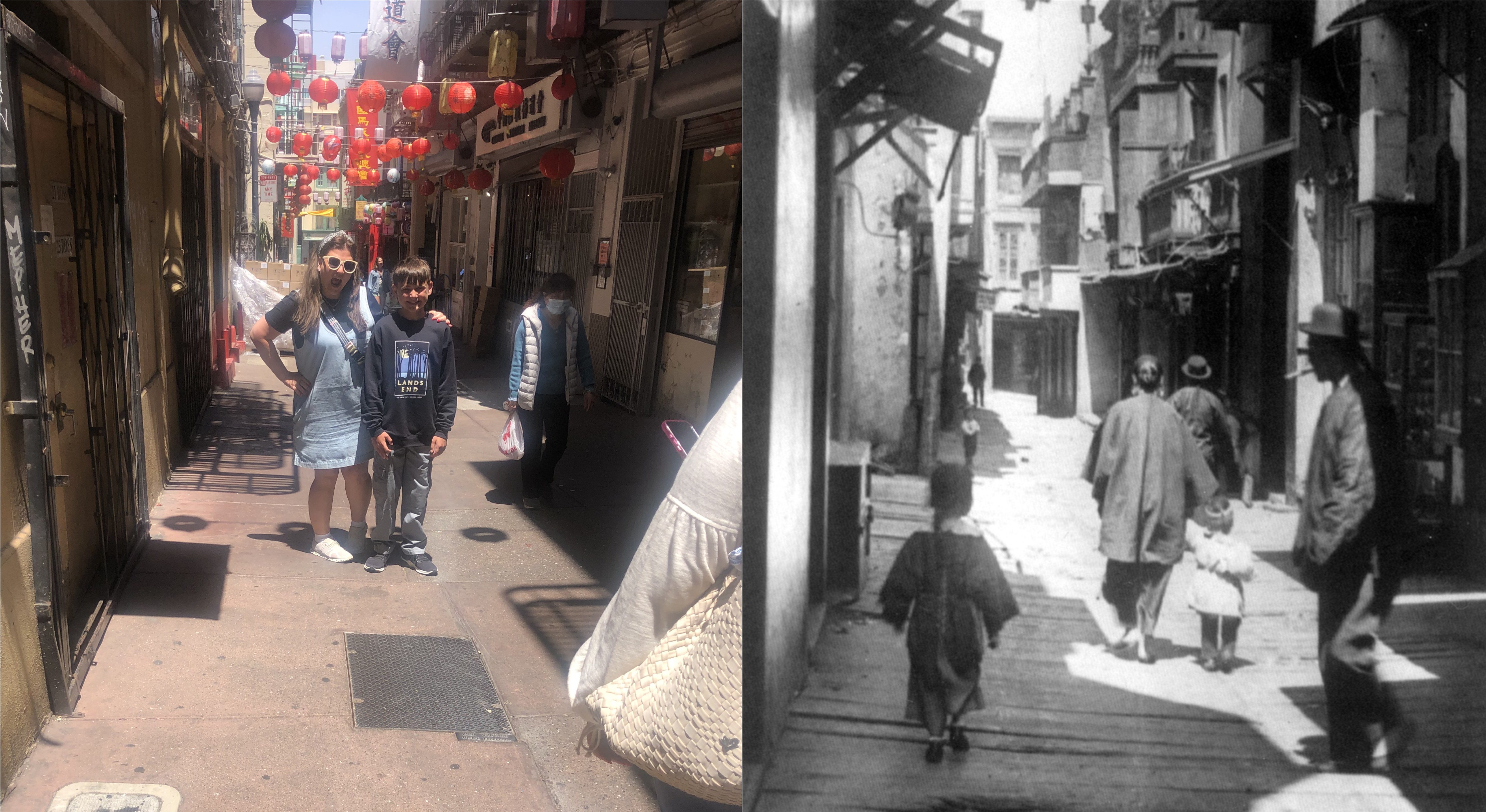
{It was ten minutes to nine and if she walked fast she would arrive at the movie theater before the second show started. She had been reading the paper and discovered that the Bella Union Theater was showing a foreign film.} However, when Bruno reaches Connie”s Telegraph Hill apartment to set up his alibi, she has gone to the movies. The Bella Union Theater was at 825 Kearny Street near Chinatown, seen in the 1970s picture from opensfhistory.org. The remodeled building is now the Self-Help Training Academy.


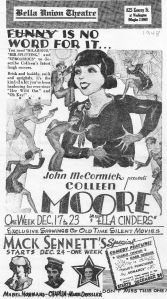
The 1948 Bella Union Program Advertisement here is from Cinema Treasures.


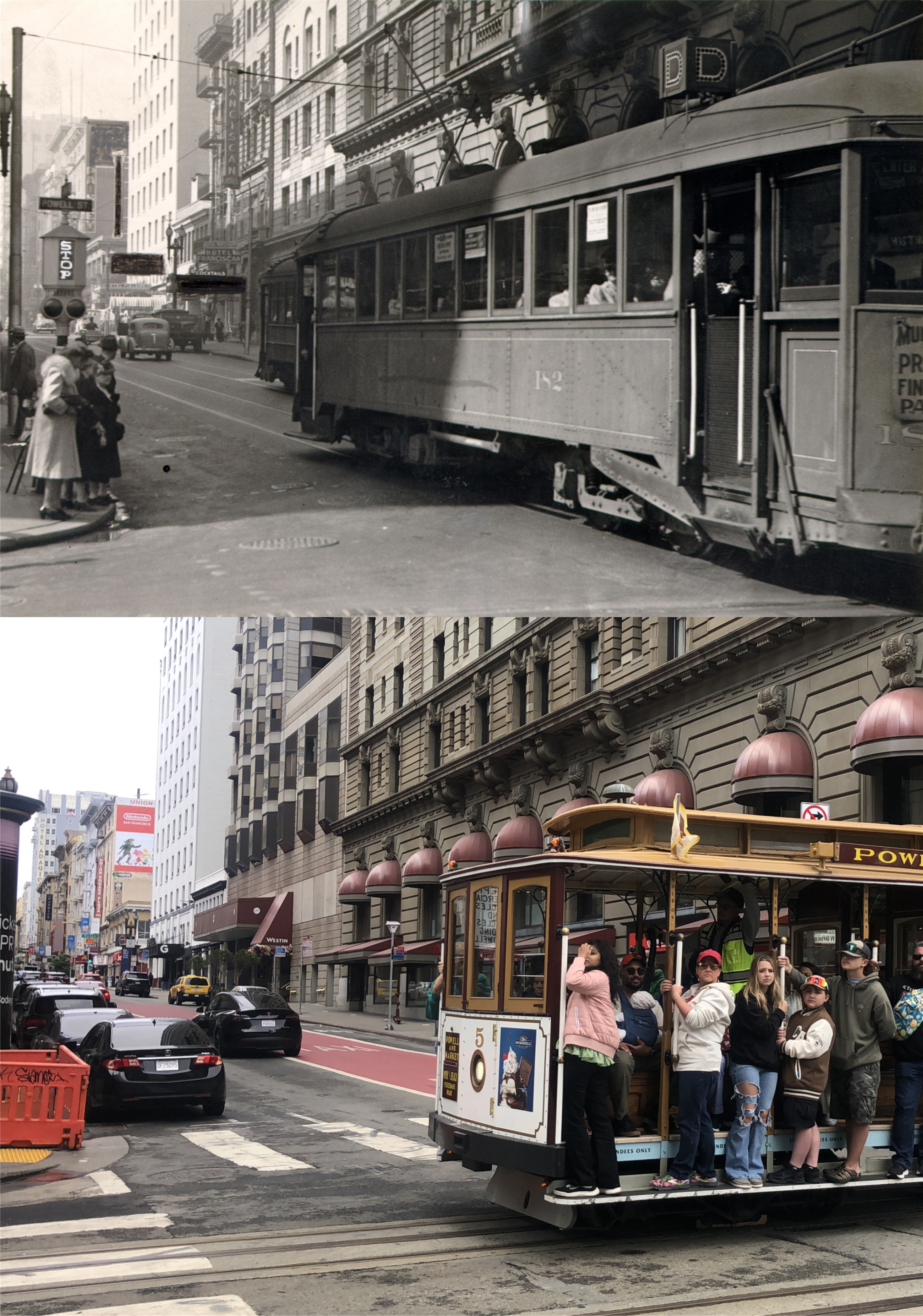
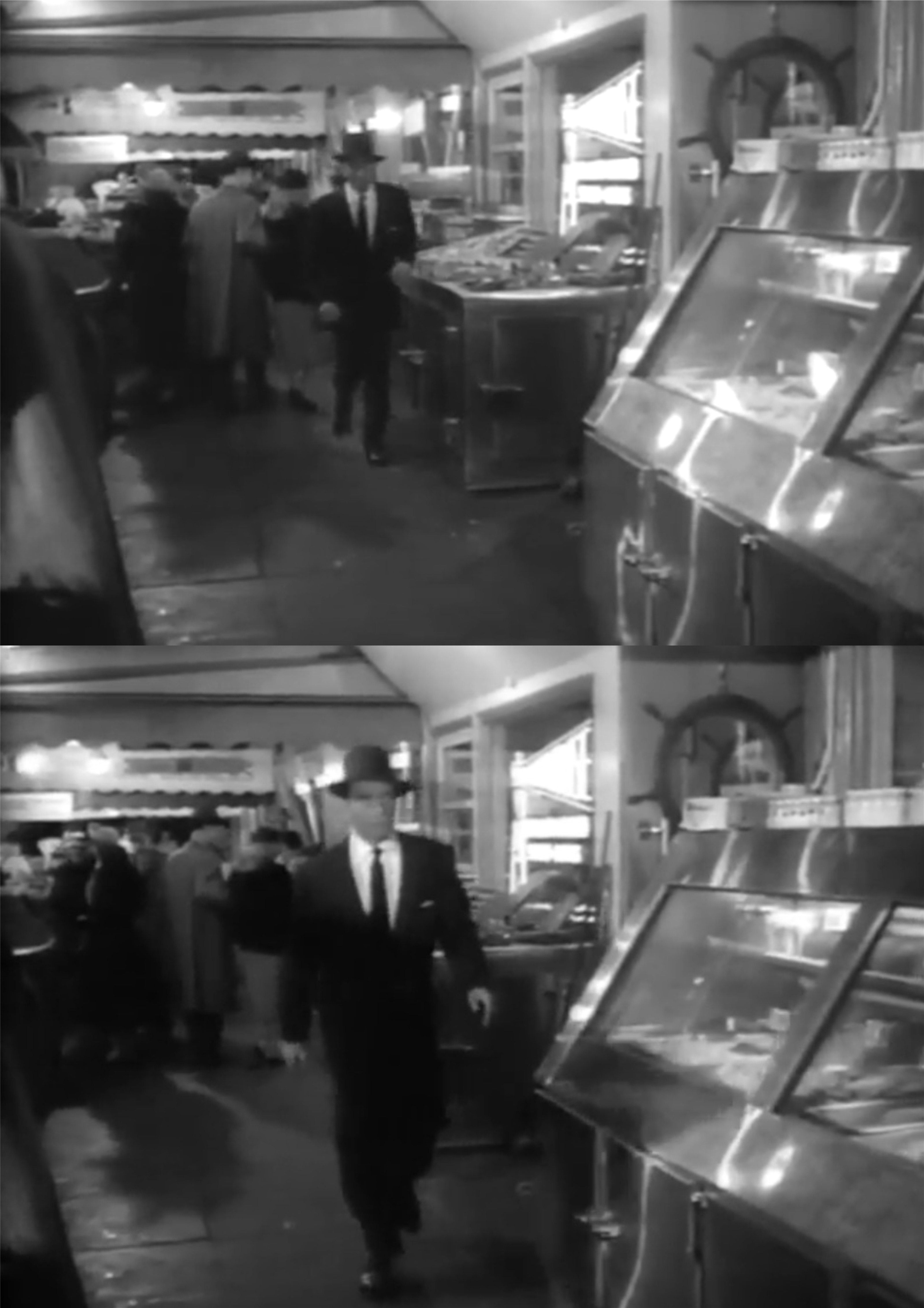
{The running was over. It was walk easy now. Make Progress, but saunter along with the tourists who cluttered the sidewalk from the cable car turntable to the restaurants on Fisherman’s Wharf. The Neptune, Sabella’s, Sabella-Latorre, and Alioto’s—one fish joint right after another, all burning up a lot more electricity than they had a right to be doing.} So in the book and film, Bruno heads to Fisherman’s Wharf from Connie’s apartment. Although his reason for going there is a little vague, this will become a perfect hide out for Bruno.


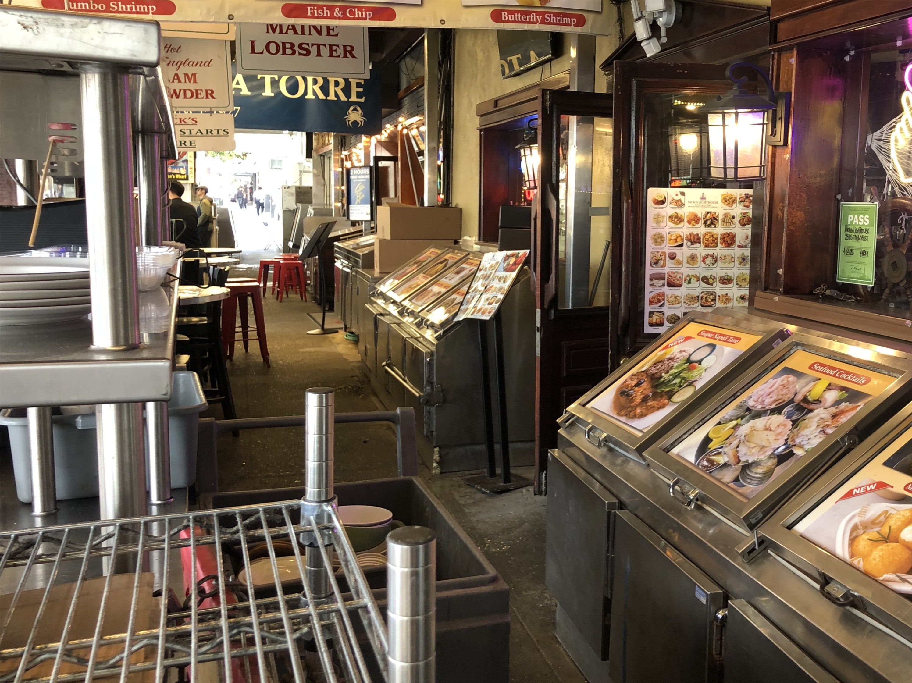
{Hold it! A damned squad car had stopped at the filling station across the street! One of the uniforms was getting out. Sure, Bruno, wait around to see if he’s just going to fill his tank, then you won’t have to worry about running. You’ll have a free ride. There will be the sound of those new-type handcuffs, the kind that hiss like a rattlesnake instead of just click. Move, Bruno. Get going.} Bruno passes through what they used to call Fish Alley on Jefferson Street, and notices a police car at the filling station across the street. The modern picture is Fish Alley in 2025, and like the movie image, the filling station can be seen across sample of cooked crab in the vintage 1950s picture. The parking lot for Boudin Bakery occupies the spot now where the old gas station was located.


{He took a few carefully controlled steps along the lighted window until he reached a narrow alleyway between Alioto’s Restaurant and the next one in line. He took a quick look at the filling station and the motorcycles just crossing Jefferson Street. There was no time to care where the alleyway might lead. A guy couldn’t figure everything. Not when they were breathing down your neck.. Bruno took a deep breath and turned quickly into the alley. He bumped along a line of garbage cans, and started running again.} Bruno makes a dash through the alleyway between Alioto’s and #9 Fishermen’s Grotto (both now closed) and falls asleep from fatigue on one of the fishing boats in the Boat Lagoon. From here on out, Bruno will find friendship and affection toward and from a fisherman who befriends him as a Police Lieutenant named Kelsey searches throughout San Francisco for him, and Connie will have to make up her mind on how far she wants to go to protect Bruno.

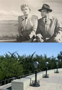
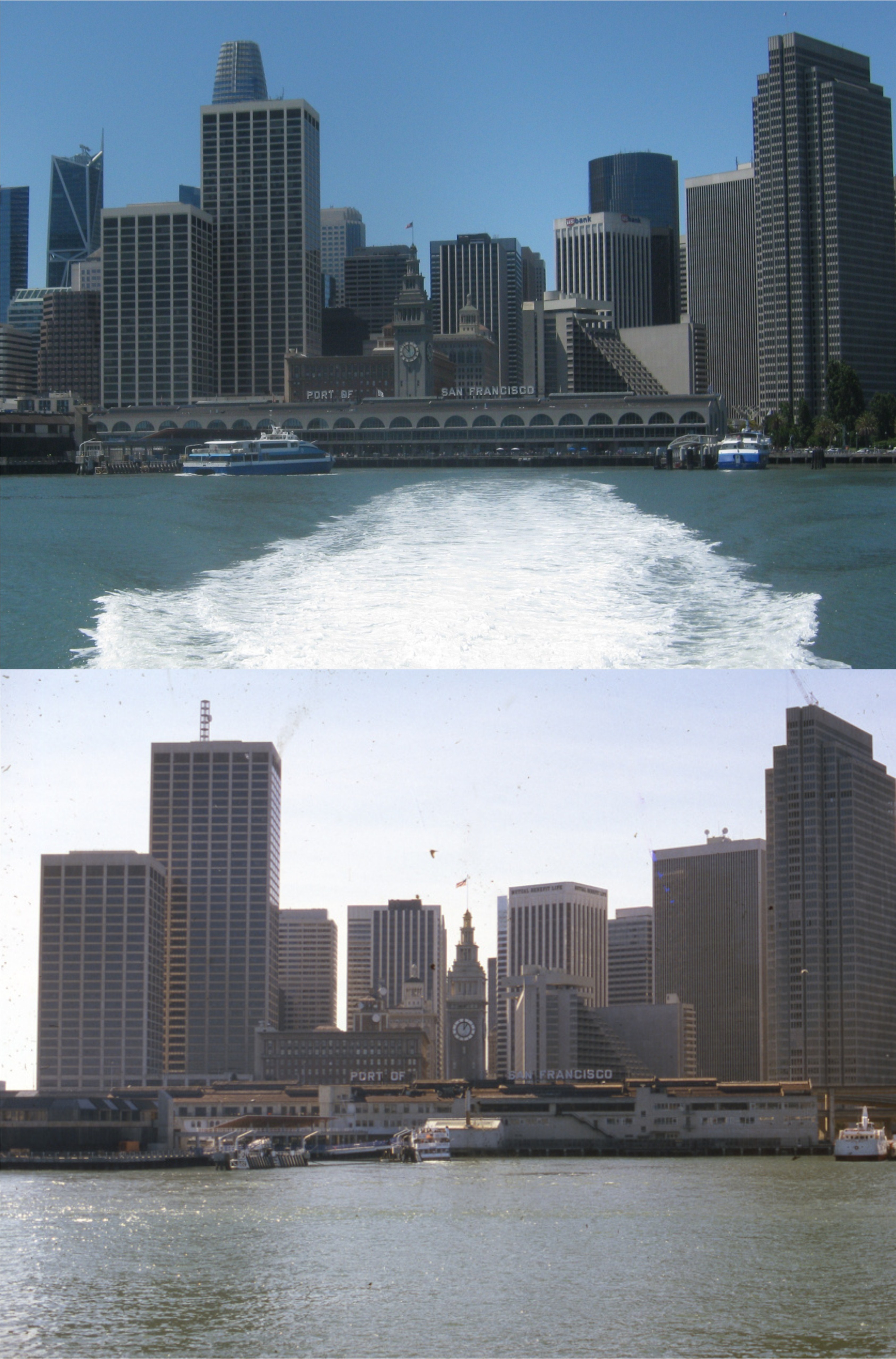
{She led the way up the winding street that led to Coit Tower, breathing deeply of the fresh morning air. They reached the little park at the top of the hill. In every direction the city spread out beneath them, the hills rising and falling until they met the sea and the streets still wet with the morning fog. The wharves fingered out at the base of the city and then there was the bay looking metallic in the sunlight. The islands in the bay still floated in the fine mist and beyond them the mountains had begun to take on depth and substance.} Connie walks up to Coit Tower from her apartment, as Lt. Kelsey walks along with her questioning her as to Bruno’s whereabouts. In an image from Nathaniel Rich’s book, that I did not see in the film, Connie, portrayed by Shelley Winters, is gently being persuaded to tell him where Bruno is hiding. The scene during the opening credits that I showed at the beginning of this post was filmed from here. The bottom photo here is what you see of the waterfront from the Coit Tower parking lot today.


A now and then tour for the Texans

I had relatives from Texas last Tuesday and Wednesday, and I was honored again to be allowed to suggest their itinerary. I took my pictures over the two days, and when I was back in the office after their visit, I scouted up vintage pictures on the internet that came as close to mine as I could find. As I have mentioned in past posts, now and thens are more difficult to match up than then and nows because you don’t have control over getting a perfect line up, obviously, but they’re still fun to try. (Thumbnail images)


On the way to Treasure Island: I had to do a little cropping to get this 1983 photo from opensfhistory.org to come close to my picture. My apologies for cutting out their watermark.


The old Administration Building on Treasure Island: We had a lot of fun here. It’s hard to find many vintage pictures of this building, one of the three surviving structures from the 1939/1940 Exposition. This vintage picture is from the 1950s. (ebay.com)


Huntington Falls at Blue Heron Lake (Stow Lake) in Golden Gate Park: The vintage picture is a circa 1910-1915 postcard of the falls from the UC Berkeley Library Archives.


The alleys of Chinatown, like Ross Alley in my photo, are fun to explore. I saw a site on the internet that read that this prior to 1906 picture that I have in my archives was taken in Ross Alley; it’s possible. The site also gave credit to Arnold Genthe; this I don’t know about, I’ve never seen it in his collections.


High above Fisherman’s Wharf on the SkyStar Wheel Ride: We got pretty far up, but not as far as the old postcard from the 1960s. (ebay.com)


Back to Chinatown: It was nice of the musicians to let him sit in, particularly since he couldn’t play one note. Still, his playing was better than my singing would have been, so I kept quiet. (ebay.com)

Aw, I can’t take credit for this vintage old Cliff House jigsaw puzzle, only the modern picture. Class is where you find it.