Playland-at-the-Beach

In July, they had a screening in the Niles, CA Museum of ‘Remembering Playland at the Beach’; a tribute to San Francisco’s Coney Island, available on DVD. The film includes a brief clip from Balboa Street to Cabrillo shortly before the amusement park closed. (Thumbnail images)


La Playa Street from Sutro Heights: La Playa is to the left of the Shoot the Chutes ride in the vintage picture; Hawai-land (spelled wrong) was behind where Topsy’s Roost was, and was farther to the right in my picture.


The Cabrillo Street turnaround during the 1950s:


Playland had a live boa constrictor at a sideshow once. Eh, I wrestled with a live alligator at the Alameda County Fair in July.


The approximate spot where the Funhouse and Merry-Go-Round were located: (Flickr)

The Playland Merry-Go-round thrilled kids and parents alike until the park closed in 1972. Moms still wave to their kids today on the Playland Merry-go-round relocated to Fourth & Howard Streets in Downtown San Francisco. (SF Chronicle)

Rather a tawdry marker is all that’s left.


Another view of Playland-the-Beach from Sutro Heights; dating to 1972: This stretch of Playland, from the yellowish building at the lower left to the Carousel on the upper right, is what you see in following film clip from the DVD. The following clips are on the Great Highway, scanning from Balboa to Cabrillo Streets shortly before Playland closed in 1972 and August of 2024

Murder on Joice Street

Joice Street is another interesting little known San Francisco Street. It’s actually a little more than an alley that runs three blocks from Pine Street to Clay, and I’ve posted a few updates on it in the past, but I became interested in exploring it again after reading about it in the opening chapter of Gary Kamiya and Paul Madonna’s wonderful book ‘Spirits of San Francisco’, published just at the opening of the Covid-19 Pandemic that shut San Francisco and most of the world down in the spring of 2020. The street runs in sort of a hill-and-dale from, as Gary Kamiya points out, the “glamour” of Nob Hill to the “drabness” of Chinatown. I revisited a little of  street’s history, and also remembered a little known claim to fame, if that makes any sense, that I saw in a 1972 episode of the television show ‘The Streets of San Francisco’ that featured Joice Street. (Thumbnail images)


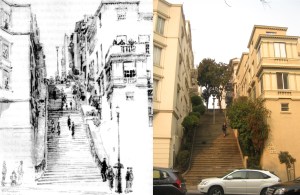
The Joice Steps, descending or ascending, depending on your point of view, Pine Street, seen in Edward H. Suydam’s 1930s drawing.


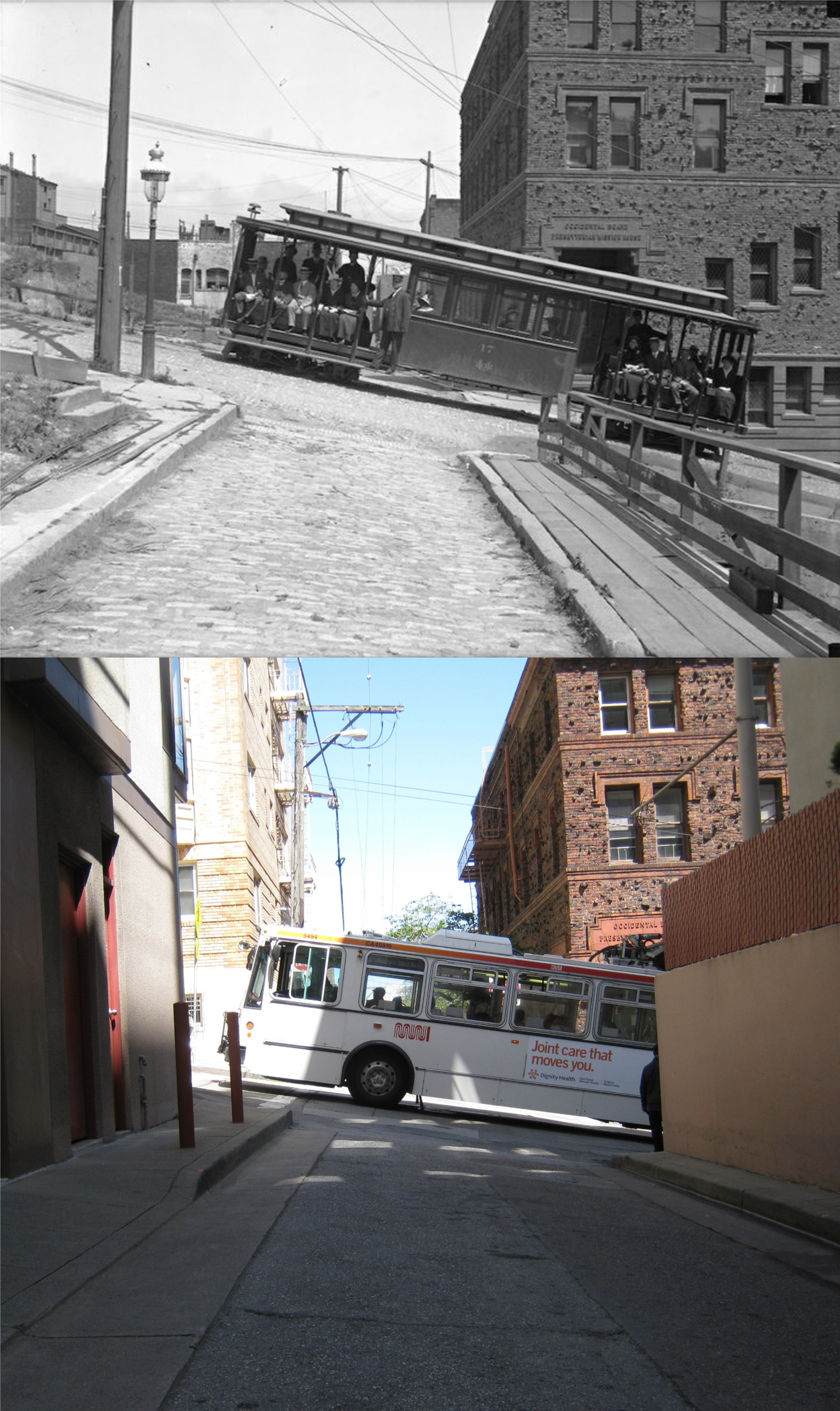
Children and guardians posing in front of the Occidental Board Presbyterian Mission House, more commonly known as the Cameron House, in 1908: The Cameron House got its more prevalent name after Donaldina Cameron, who lived in the building and was famous for rescuing women forced into prostitution in Chinatown. (Wikimedia)


Donaldina Cameron stands at the bottom of the ladder in this staged photo of a Chinatown rescue from FoundSF:


Believe it or not, I wasn’t trying to line this bus up with the cable car in the older photo, taken from Joice Street looking toward Sacramento Street, but the MUNI #1 came by at just the right time to make a nicer comparison. The Cameron House is on the right in both photos.


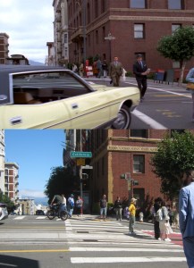
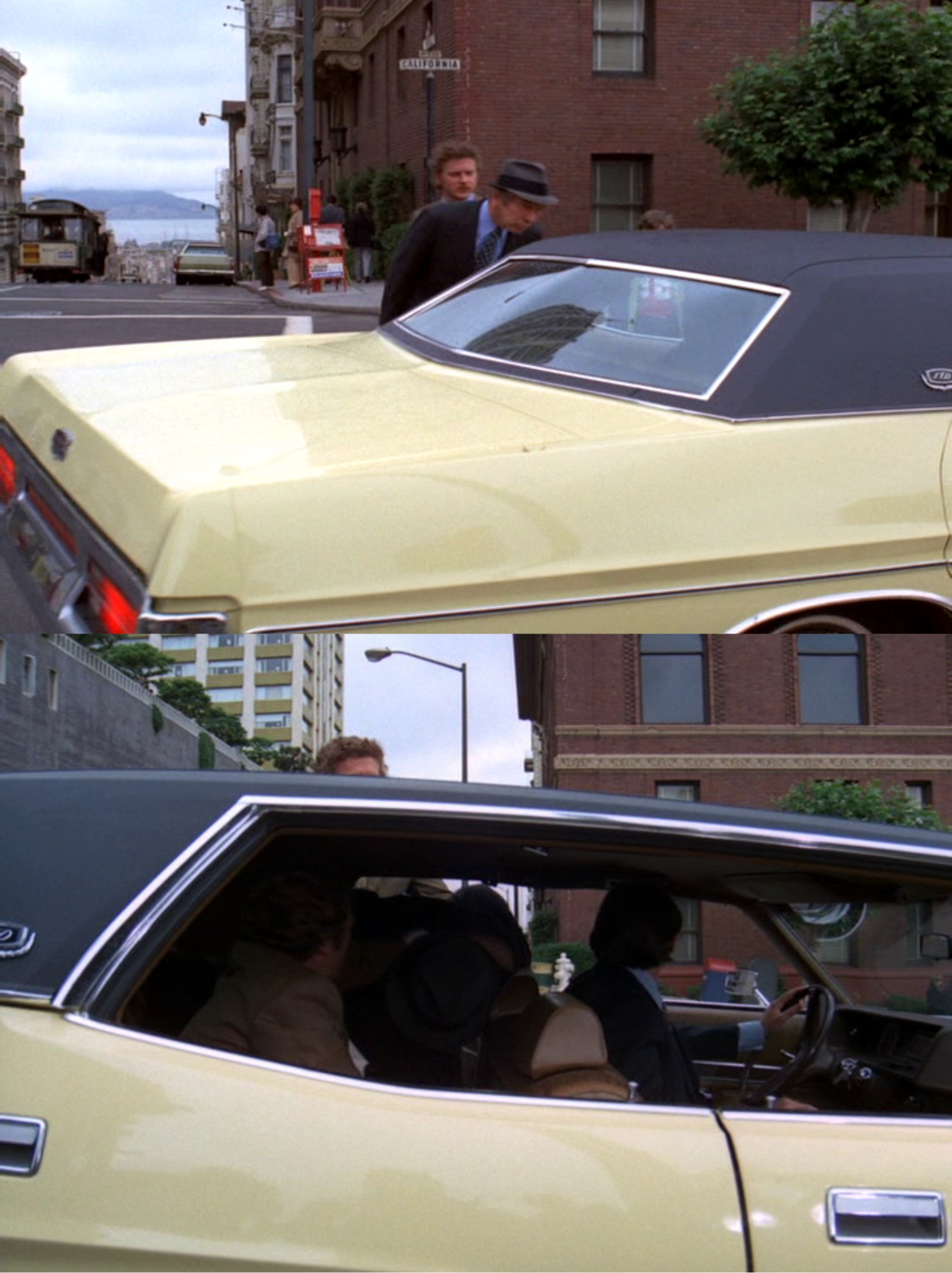
And now, to the main Joice Street story. I did a post in 2018 that covered, in part, what I think was one of the best episodes from the 1970s TV show ‘The Streets of San Francisco’ entitled ‘In the Midst of Strangers’ that showed part of, but not the actual murder on Joice Street, of a cable car passenger. Here’s the set up. The fellow in the hat holding a newspaper has just gotten off of a cable car and is crossing California Street south on Powell Street, followed behind him by the man in the tan suit who knows that he’s carrying a lot of money. The passengers in the yellow car are accomplices of the thug following the cable car passenger.


The yellow car cuts the victim off, supposedly asking for directions, and he’s taken into captivity from behind.

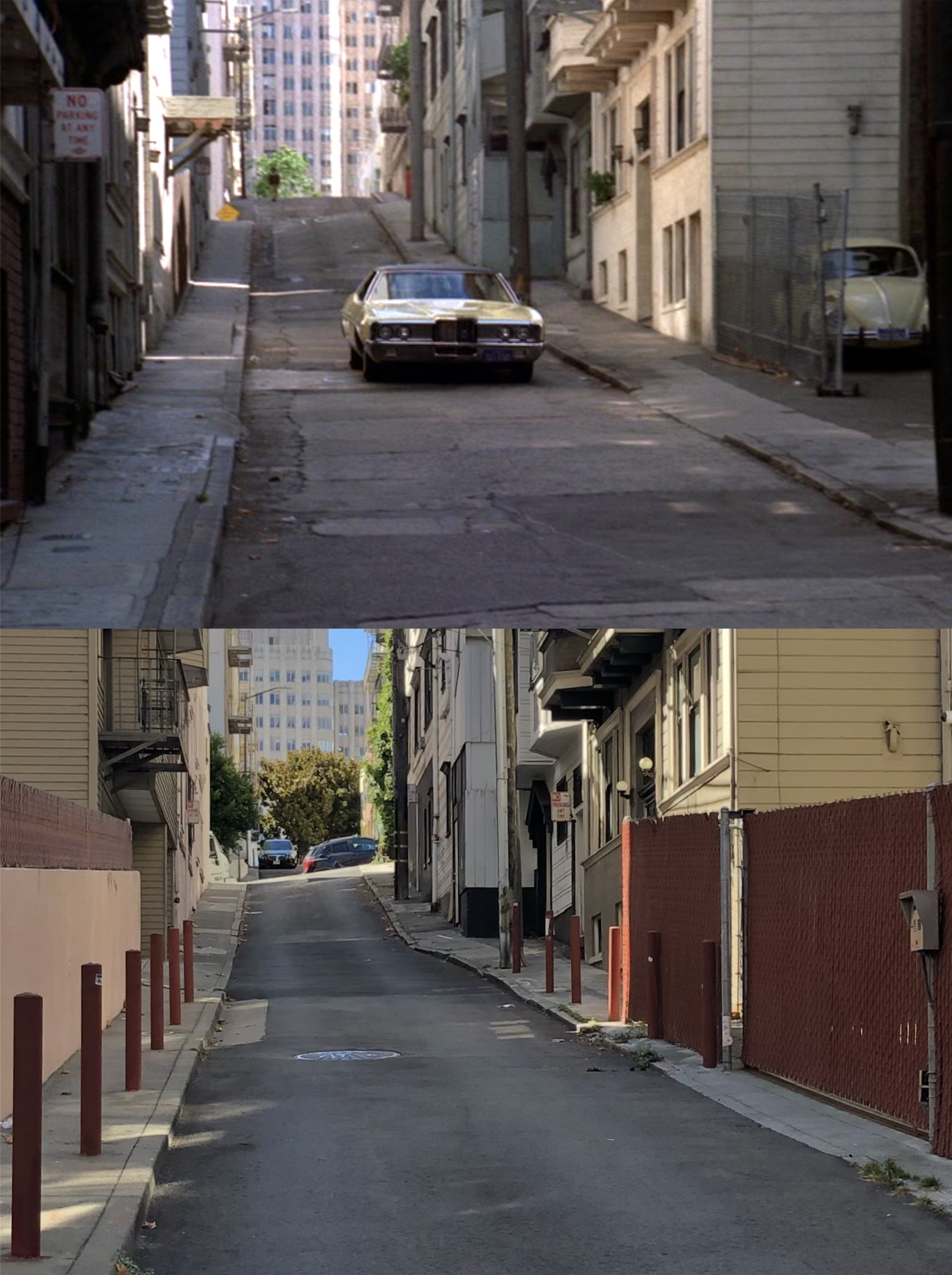
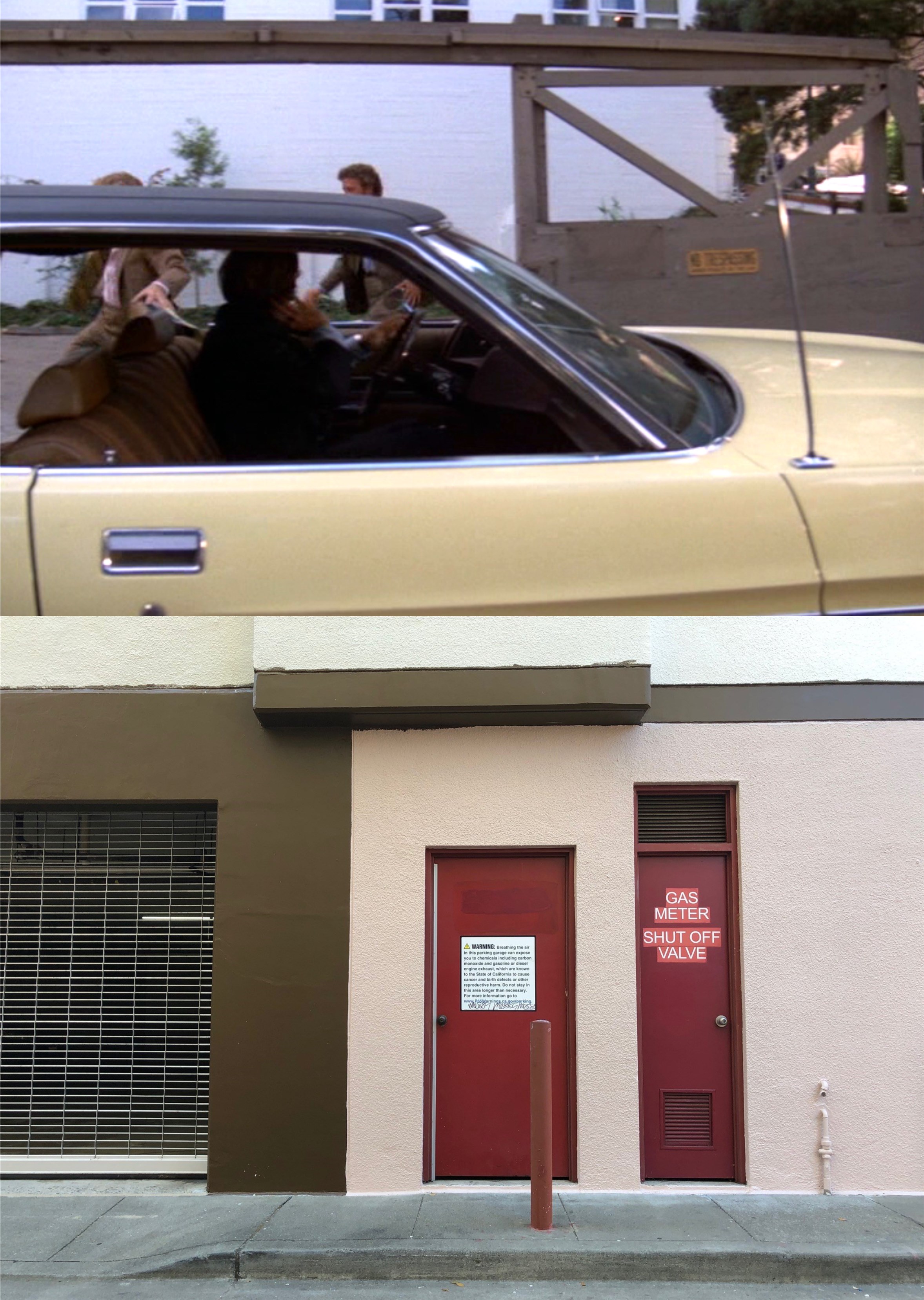
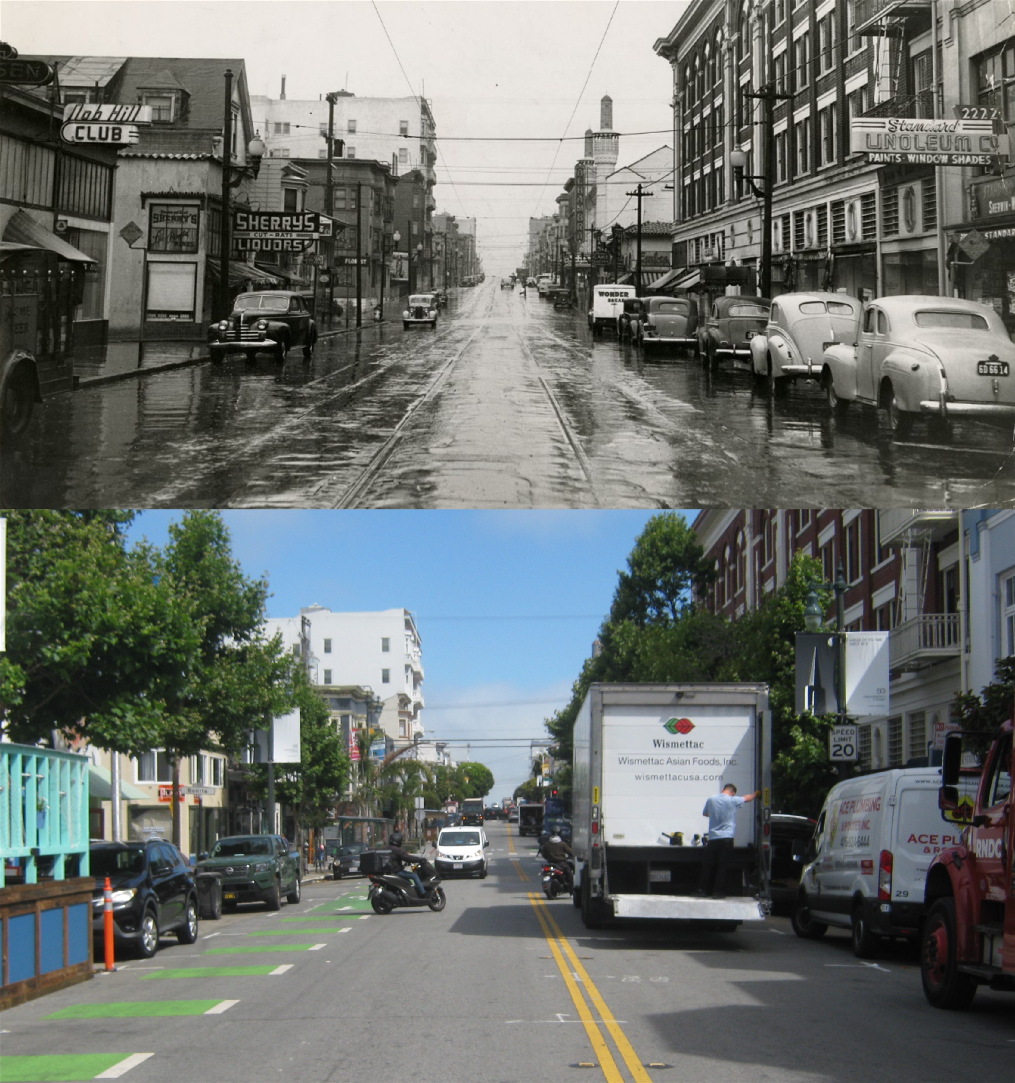
The kidnappers speed down California Street past the obligatory 1970s Volkswagen, and turn left into Joice Street. Joice Street is where the white truck is in the current picture.


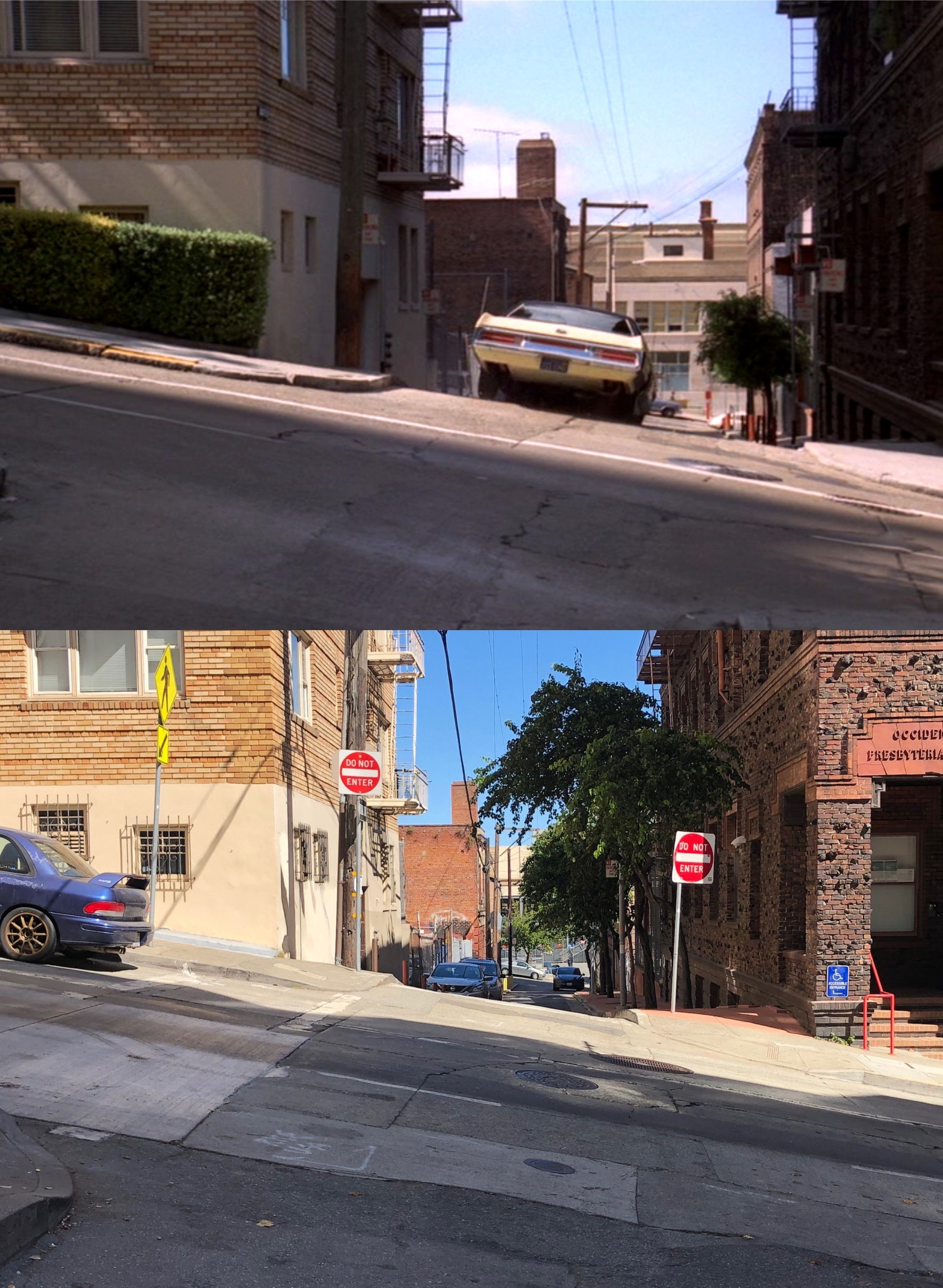
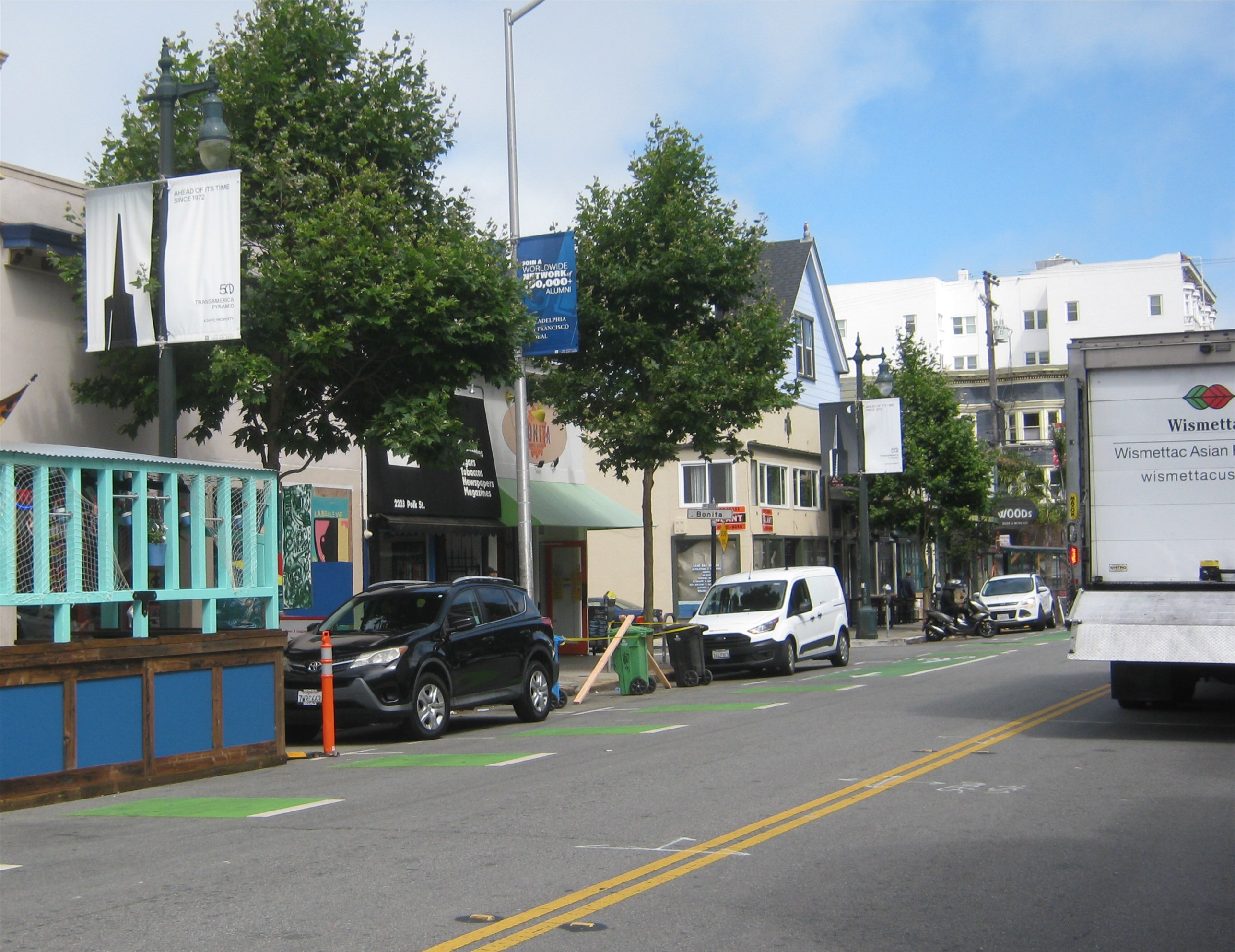
They head down Joice Street toward Sacramento Street past what appears to be another obligatory 1970s Volkswagen parked on the right.


Unfortunately, things don’t turn out too peachy for the victim. As the thugs stop on Joice Street to rob the man, one of the bad guys shoots him as he struggles. There’s always somebody who has to make it worse!


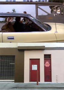
The crooks dump the body of the fellow who “gave the last full measure of devotion” for his money into a building under construction. Here’s where the finished building is today, no doubt haunted.


The murderers cross Sacramento Street and head down Joice to Clay Street, past the Cameron House on the right. Donaldina didn’t help that poor fellow.

Prowling around the Port (Part…… I forget)

I went to SF on Sunday to take advantage of some of MUNIs free rides along the Embarcadero they’re offering through the summer. There’s a lot of San Francisco related personalities in this old poster; Dashiell Hammett and Humphrey Bogart over by the clock, Clark Gable and Jeanette MacDonald from the movie ‘San Francisco’, Laffin’ Sal, Lillie Hitchcock Coit, Emperor Norton, Mark Twain, and probably a lot of others I haven’t spotted yet. (Thumbnail images)


The Embarcadero, south of Market Street, and a hotel that was so seedy they didn’t even give it a name: (San Francisco Public Library Archives)


The spot where the Embarcadero Plaza is now during the 1920s: There’s a lot of talk lately about expanding the area and carpeting it with grass, and also getting rid of the Vaillancourt Fountain. (UC Berkeley Library Archives)


The Embarcadero Plaza, south of the Ferry Building during the 1970s, with the notorious Embarcadero Freeway: (San Francisco Public Library Archives)


Clay Street, when it used to come into the Embarcadero: What’s wrong with this picture? Embarkadero (!) (UC Berkeley Library Archives)


A dramatic picture of the Ferry Building on a cloudy day: (San Francisco Public Library Archives)


Piers 19 and 17: Pier 17 is where the Exploratorium is now.  (San Francisco Public Library Archives)


The Embarcadero, looking north from Pier 11 in 1926: Pier 11 has been demolished and was about where the girl on the bike was. (San Francisco Public Library Archives)


The historic Audiffred Building on the corner on Mission Street and the Embarcadero: (San Francisco Public Library Archives)


Looking back from the Audiffred Building toward a couple of station wagons: (San Francisco Public Library Archives)


A Falcon in San Francisco: Reminds me of an old movie. (San Francisco Public Library Archives)


“Pick a street, any street. Okay, Polk Street.” (For Charlotte and Amelia)

Polk Street, one block east of Van Ness, is another street I never pay much attention to. I don’t know why; parts of it are historical and entertaining. Besides, any street that connects to a cable car line deserves exploring. It runs from Market Street at the Tenderloin past the government buildings where the city’s civic leaders make all of their wise decisions, (pause for yays and boos) and ends up in touristville. (Thumbnail images)


We’ll start at the Polk Street entrance to City Hall. I don’t know what this patriotic event from long ago was, but I don’t think they do things like this around here anymore. (San Francisco Public Library Archives)


You can’t drive a car up City Hall Steps anymore, either. That, PROBABLY, wouldn’t go over too good nowadays. (Shorpy Archives)


An opensfhistorg.org picture, looking north from Golden Gate Avenue in 1920: The large building in the center background is the California Hall, a “splendid survivor” since 1912: I had to look up who George B. Seitz was from the billboard on the right. He was a screenwriter and director of films from 1914 until his death in 1944. His serial film ‘Pirate Gold’ is now considered a lost film. (Source, Wikipedia)


Polk Street looking north from California Street in 1974: Mug Root Beer ads were on MUNI buses all over town back then, including one in a scene from the 1971 film ‘The Organization’ starring Sidney Poitier. (SFGate)


A Polk Street princess walking her pet raccoon on the southeast corner of California and Polk Streets during the 1970s: In any other city that might seem weird, but in San Francisco…… that seems weird! (Street Scenes of San Francisco)

 Well, the Littleman Grocery Store building, at 2139 Polk Street, is still around. “Little man, you’re in the dizzy Bay.” (San Francisco Public Library Archives)


Polk Street, looking north from Vallejo Street on a rainy 1940s day: (San Francisco Public Library)


You can’t see it in the previous comparison picture, but the building where Sherry’s Liquors was is still around.


Polk Street stops northward at the Maritime Museum on Beach Street. The Ghirardelli Square Building is in the right background of both pictures. (SFMTA / San Francisco Pictures Blog)