An ode to BART

BART will be implementing a realignment of its system next month, running trains less often on some lines, and more often on others. They’ll also be replacing all of those old 1972 trains with the newer models that are easier to clean, but far less comfortable. I’m not reading anything about BART addressing its biggest problem, stopping the staggering amount fare evaders, even though the overwhelming majority of problems while riding on the trains are caused by riders who sneak in without paying. Still, I use BART on a regular basis, and it’s still the most practical way for me to get in and out of San Francisco. Last Sunday’s SF Chronicle had an article by Peter Hartlaub about a mysterious cabinet found on the streets of San Francisco containing hundreds and hundreds of old Kodachrome slides taken around San Francisco during the 1960s. The article refers to a website at sfmemory.org that has a link to a collection of some of those slides showing construction work on BART in 1967 and 1968. So I took BART over to SF Thursday to update some of the slides taken along Market Street. (Thumbnail images)

Market Street near Montgomery, looking past to Palace Hotel toward the Ferry Building in October of 1967: (SFMemory.org / sfm005-10038)

Market Street at Powell, where the cable car turnaround is, in March of 1968: On the left is the Flood Building; on the right are the old Emporium Department Store, and the Humboldt and Call Buildings. (SFMemory.org / sfm005-10127)

People crossing Market Street over to the Emporium in October of 1967: (SFMemory.org / sfm005-10248)

Stockton Street at Market in October of 1967: A classy looking lady and a classy looking T-Bird. (SFMemory.org / sfm005-10042)

Market Street at Montgomery, looking west past the Palace Hotel and Call Building in October of 1967: (SFMemory.org / sfm005-10034)

Market Street near 2nd in March of 1968: All of those little stores are gone now. I remember going to Stacey’s Books on Market Street during the 1990s. I’m not sure if that’s the same toy store that is now Jeffry’s Toys on Kearny St. at Maiden Lane. (SFMemory.org / sfm005-10182)

The demolishing of old buildings, where Hallidie Plaza is now, in November of 1967: Among the building being torn down are the old Telenews and Esquire Movie Theaters. (SFMemory.org / sfm005-10072)

Market Street between 8th and 9th Streets, Looking toward the Orpheum Theater on the left, in October of 1967: From here it looks like there’s almost as much construction on Market Street now as there was back then! (SFMemory.org / sfm005-10004)


Little streets

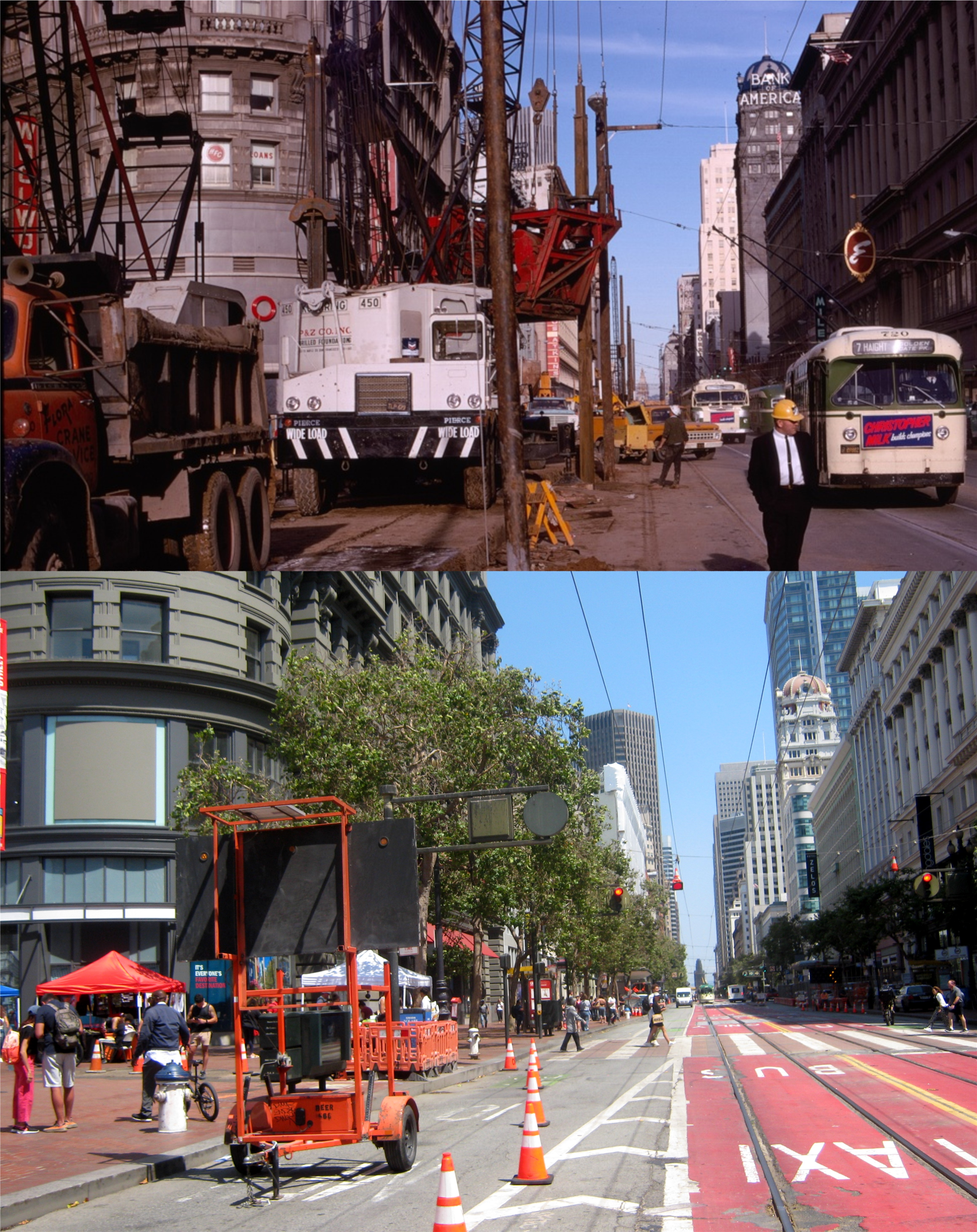
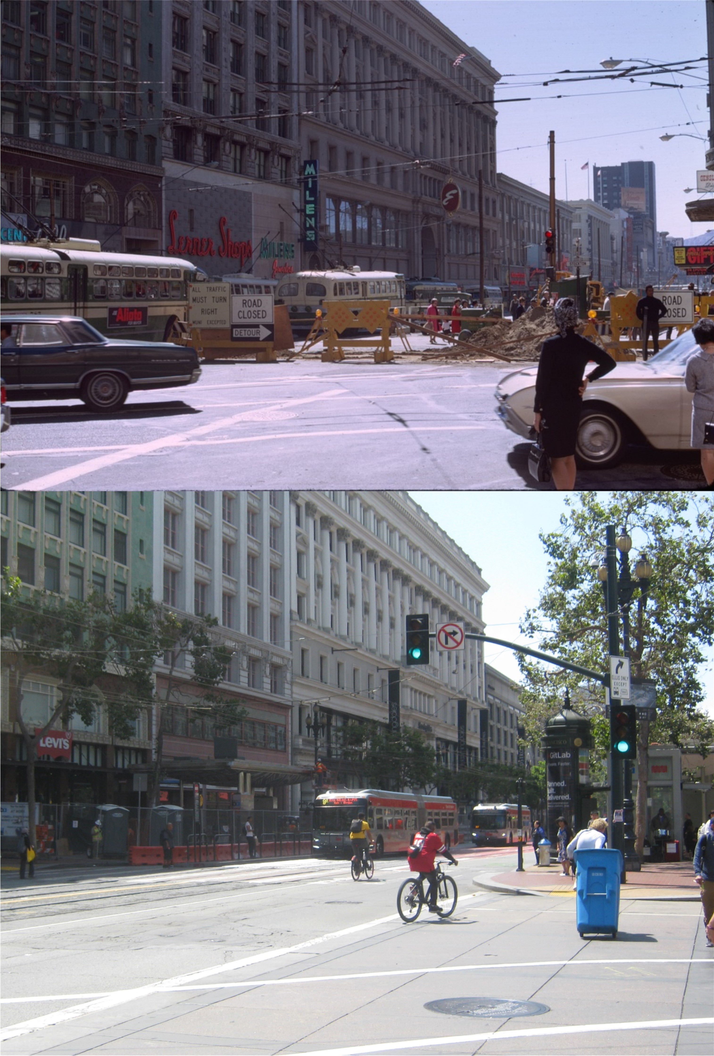
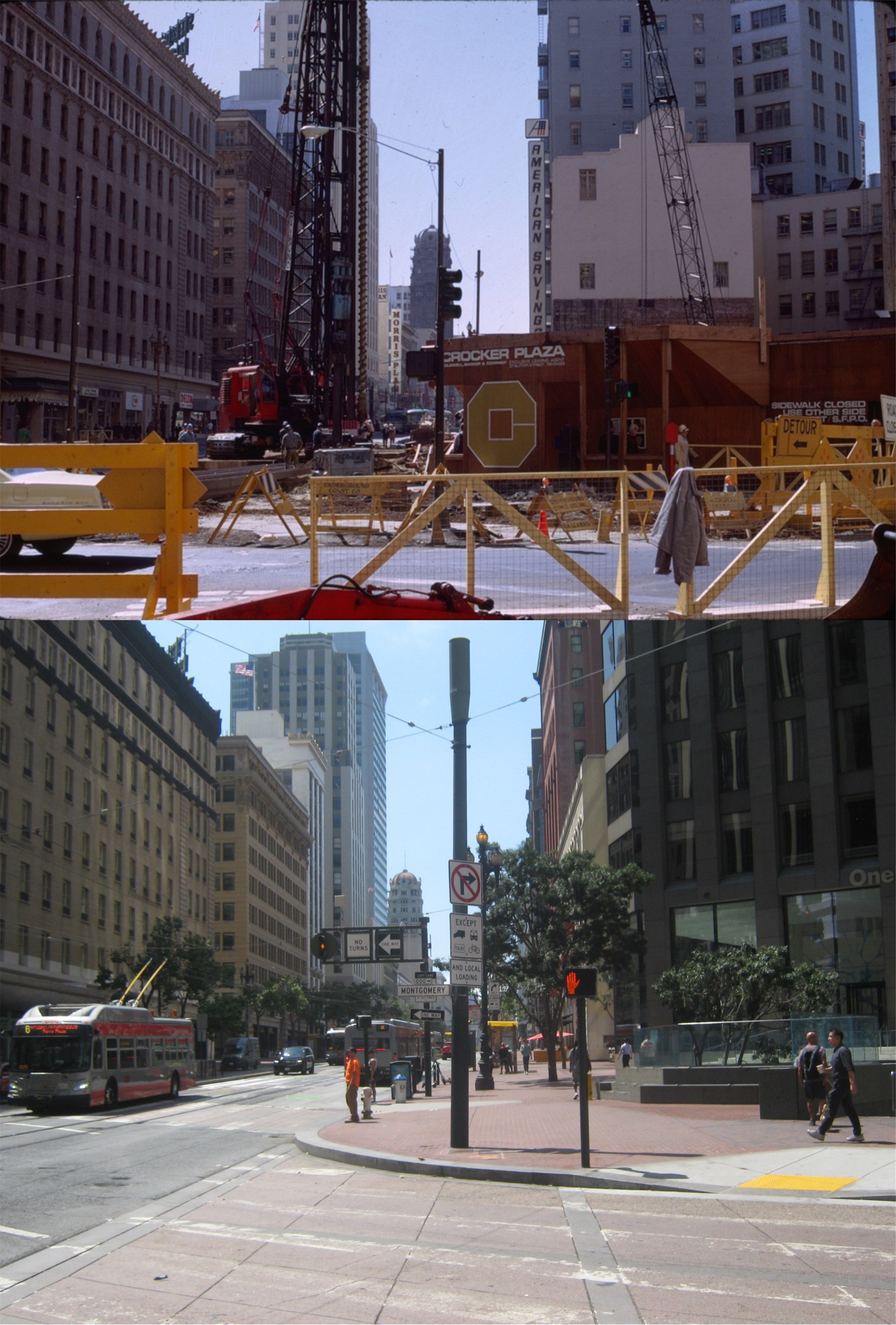
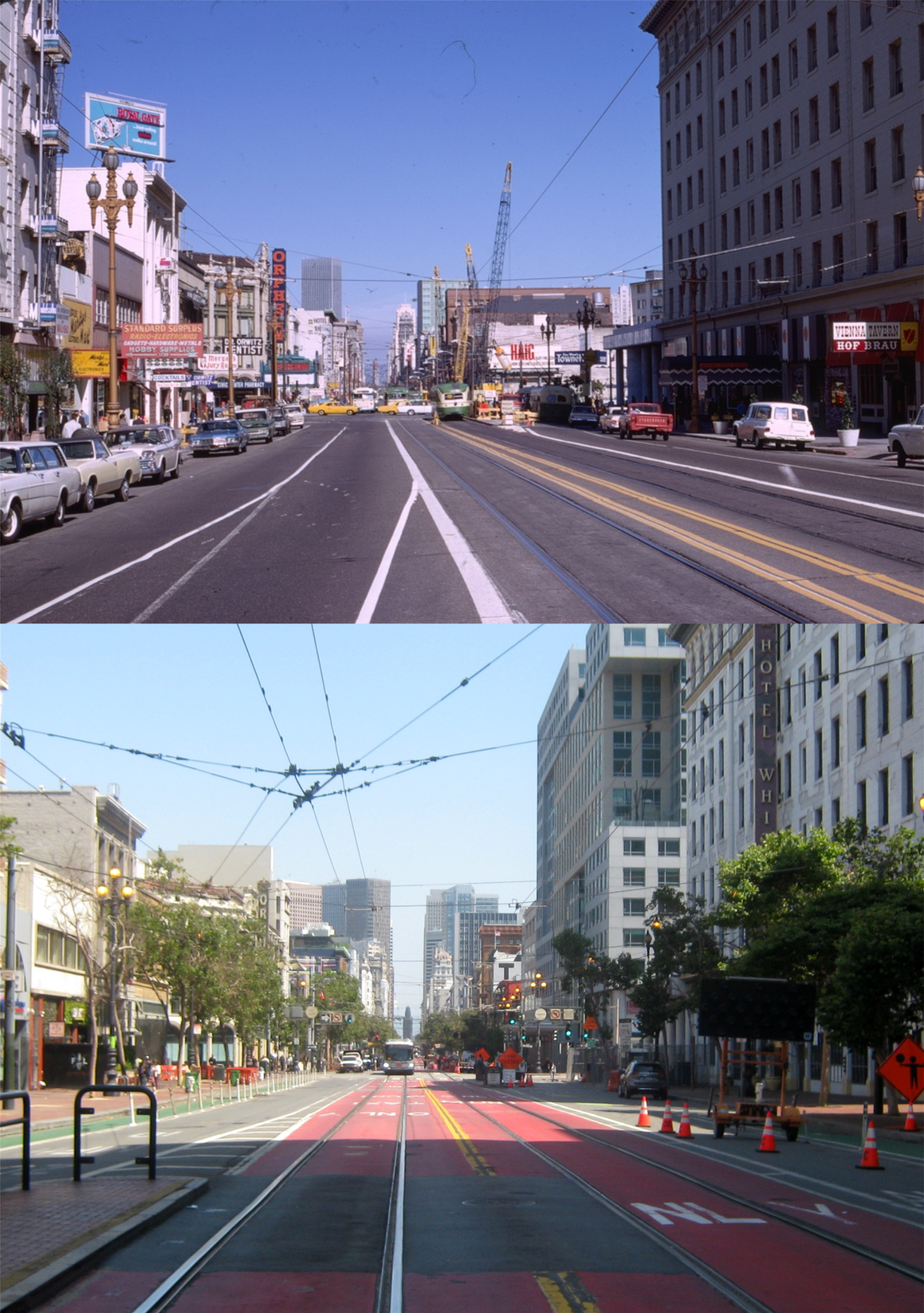
Residents and visitors alike know about San Francisco’s big streets, like California Street, Broadway, the Embarcadero, Columbus Avenue, and, of course, Market Street. However, there’s just as many little streets in the City, some of them relatively unknown, and a few of them with interesting histories. (Thumbnail images)

New Montgomery Street, that runs from south from Market to Howard Streets in the 1920s: The Palace Hotel is on the left, the Old Poodle Dog French Restaurant, at right on the corner of New Montgomery and Stevenson Street, has an interesting story behind it, as well. In operation around San Francisco from around 1849 to the mid 1960s, the famous restaurant catered to some of the most prominent and famous residents and visitors of San Francisco, and even had a few scandals you can read about. According to Wikipedia, the Old Poodle Dog may also have a claim to fame as to where Crab Louis was invented. We’ll be back to take a look at Stevenson Street shortly. (UC Berkeley Library Archives)

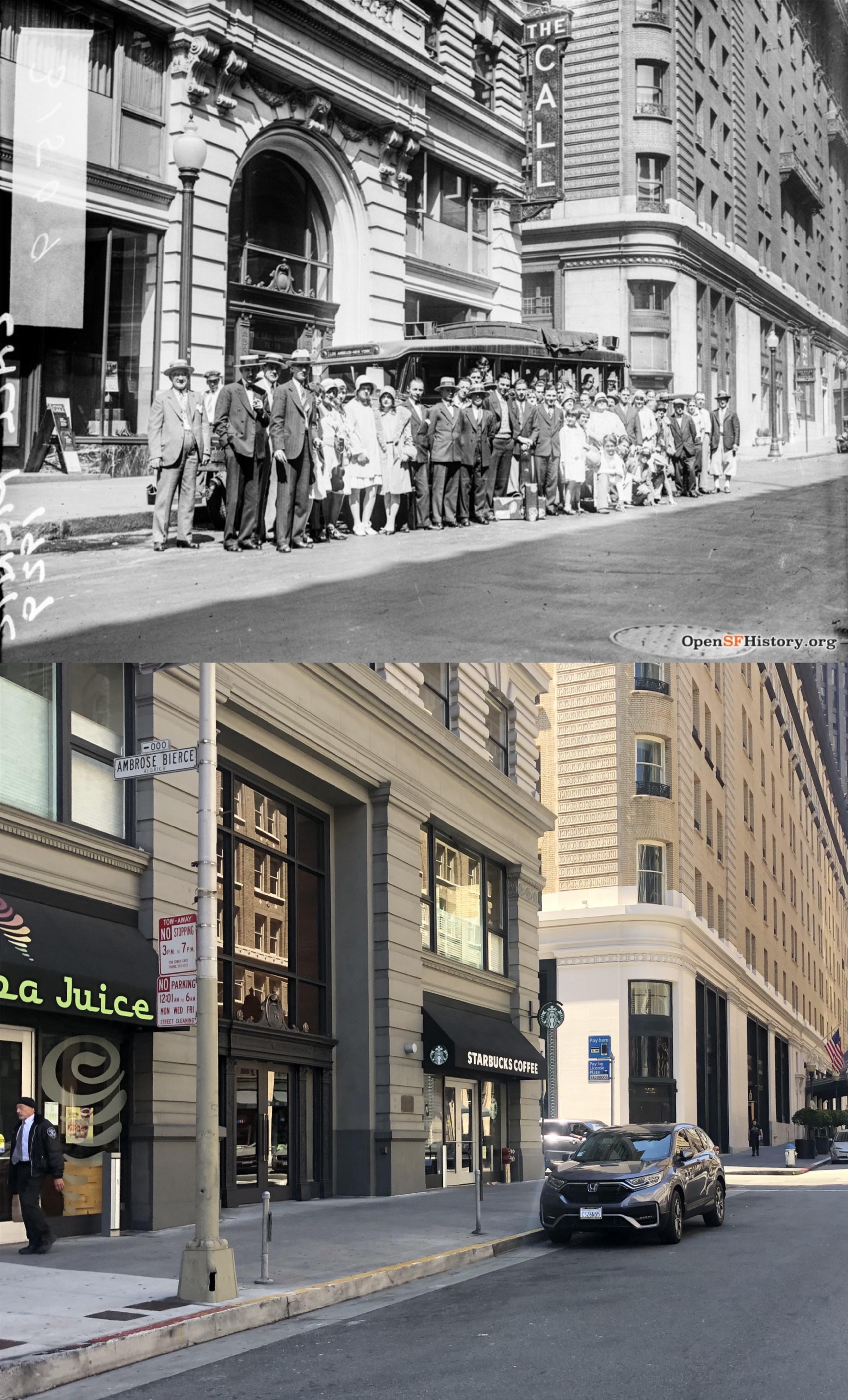
On the corner of New Montgomery and Jessie Street, behind the Palace Hotel, is the building that served as the headquarters for the San Francisco Call Newspaper that officially went out of business in 1965. The vintage picture is the staff of the Call assembling outside the building in 1929. We’ll see another portion of Jessie Street that isn’t this nice later. (opensfhistory.org)

There is a marker here today on the New Montgomery side of the old Call Building

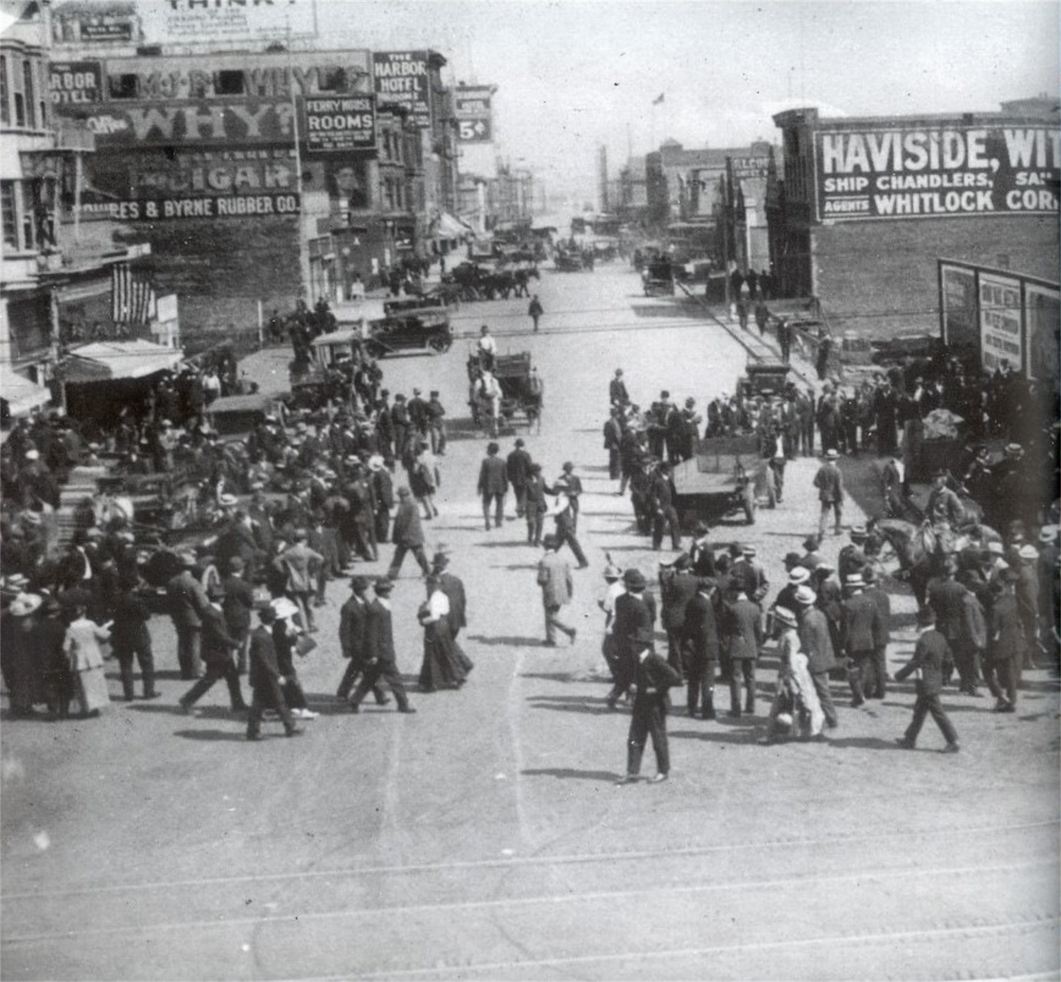
Just across the Embarcadero from the Ferry Building is a short street that runs south from Market Street to just past Howard named Steuart Street. On July 22, 1916 one of the largest parades ever organized in San Francisco was progressing up Market Street from the Ferry Building. Referred to as the ‘Preparedness Day Parade’, it was assembled in an attempt to urge Americans into getting involved in World War l that was raging in Europe. At 2:06 PM a bomb exploded on the western side of Steuart Street, just south of Market Street, killing ten people and maiming dozens of others. It remains the most deadly terrorist attack in San Francisco history. Two men, Thomas Mooney and Warren Billings, were arrested for the crime and served twenty three years in prison before being released when it was confirmed that the evidence against them had been fabricated. Nobody else was ever arrested for the bombing. The above picture, taken from a building across Market Street looking south along Steuart, shows the confusion after the explosion. Some of the dead, covered up with sheets, lay beneath billboards on the right near where the bomb, inside of a suitcase, was placed.

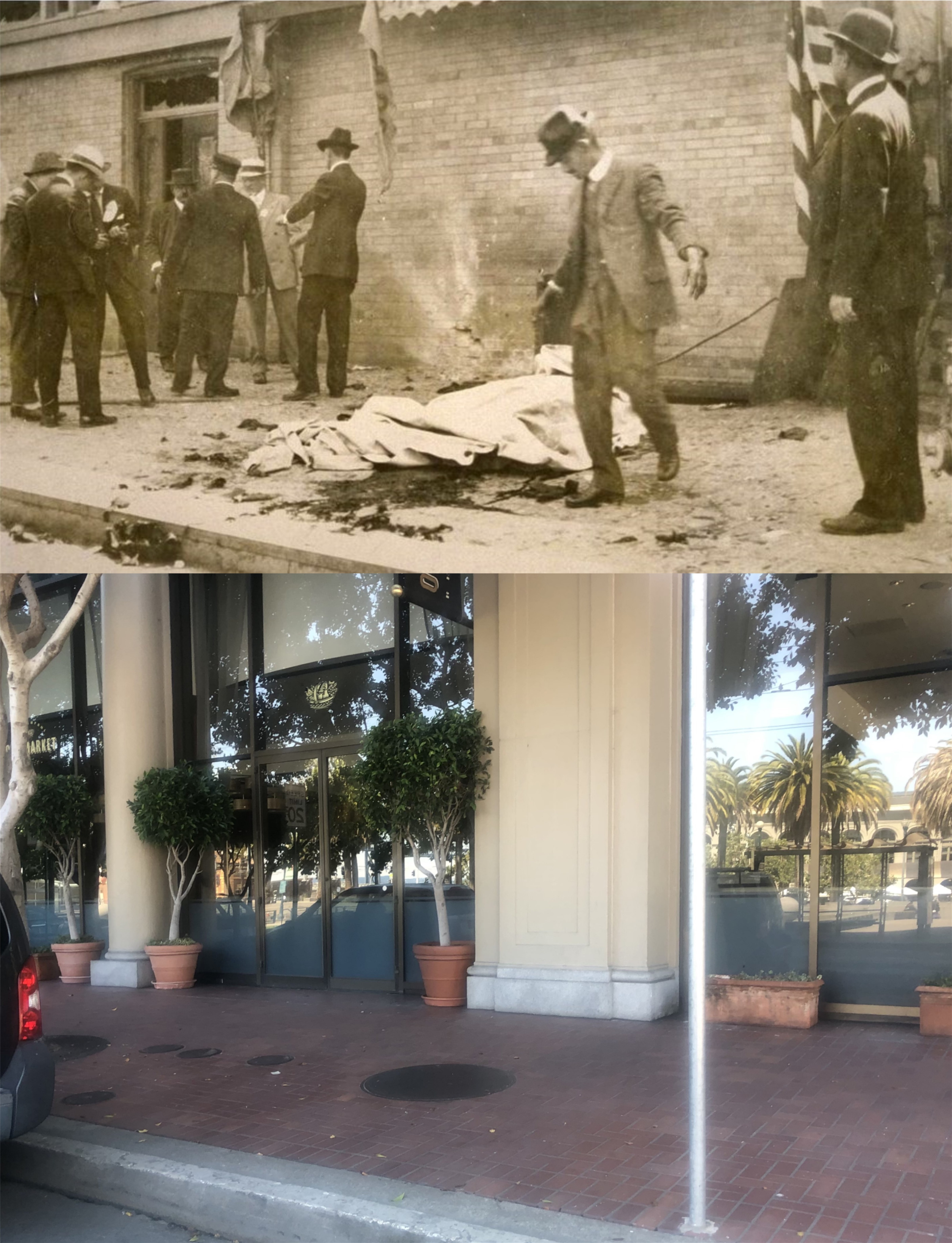
Another photo, taken at the exact spot where the bomb detonated, shows more of the bodies that have been covered up. The Southern Pacific Building now occupies the corner where the bomb went off, and my picture is at the approximate spot where the explosion occurred. (UC Berkeley Library Archives)


Looking back along Steuart Street from Mission Street in 1915, one year before the Preparedness Day attack: The bomb detonated in front of the building in the left background of the vintage picture with the NOB letters showing. (opensfhistory.org)

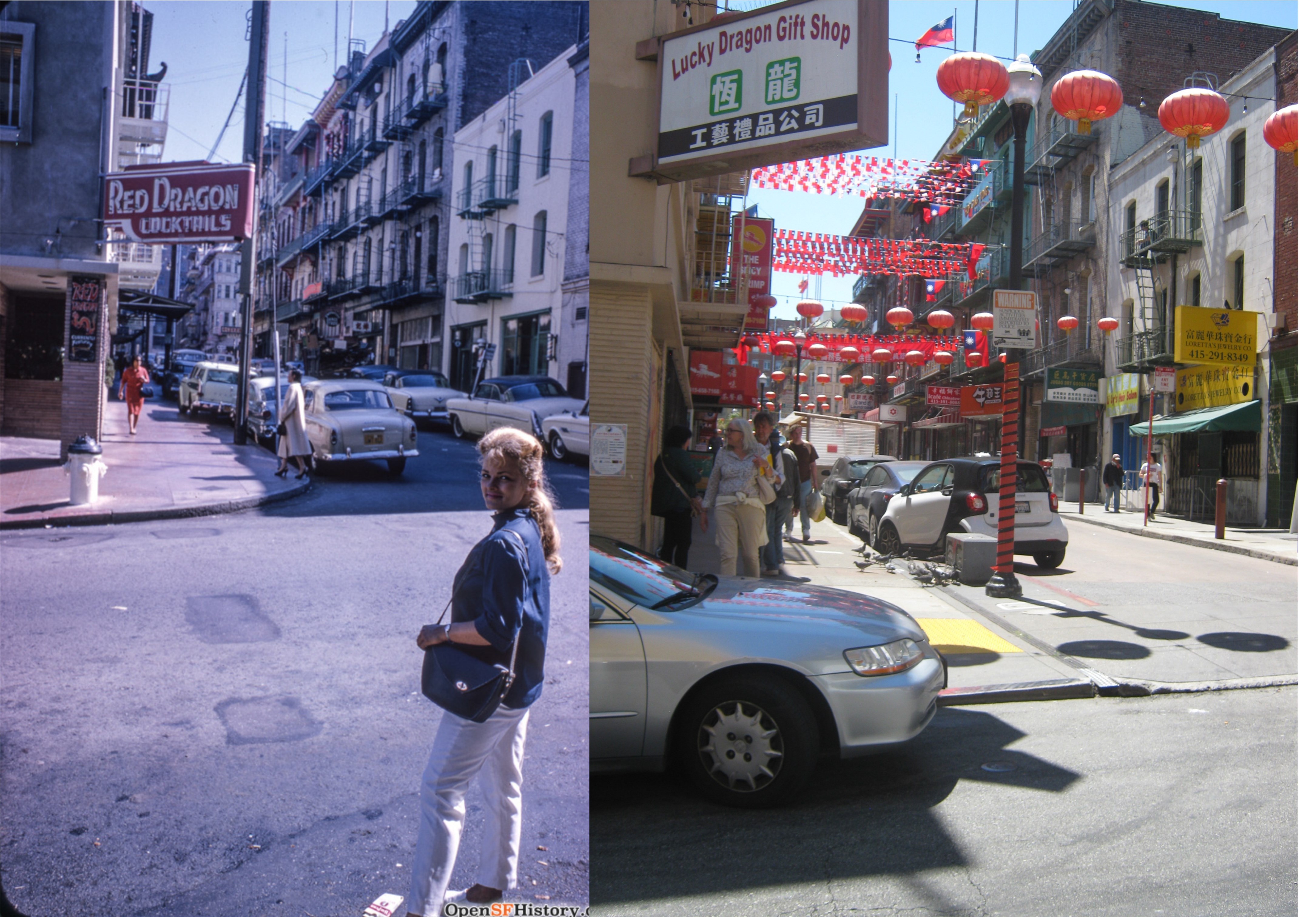
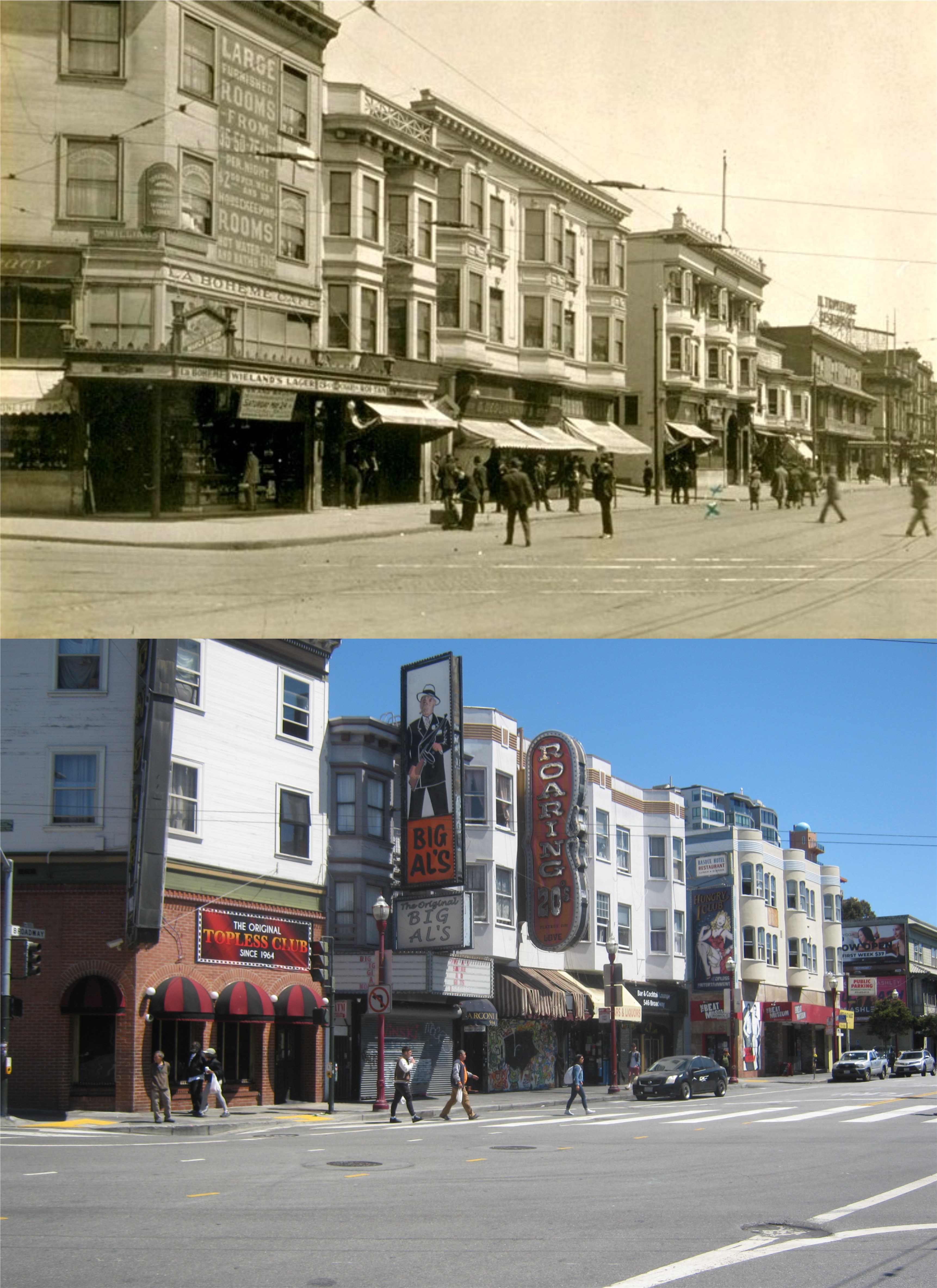
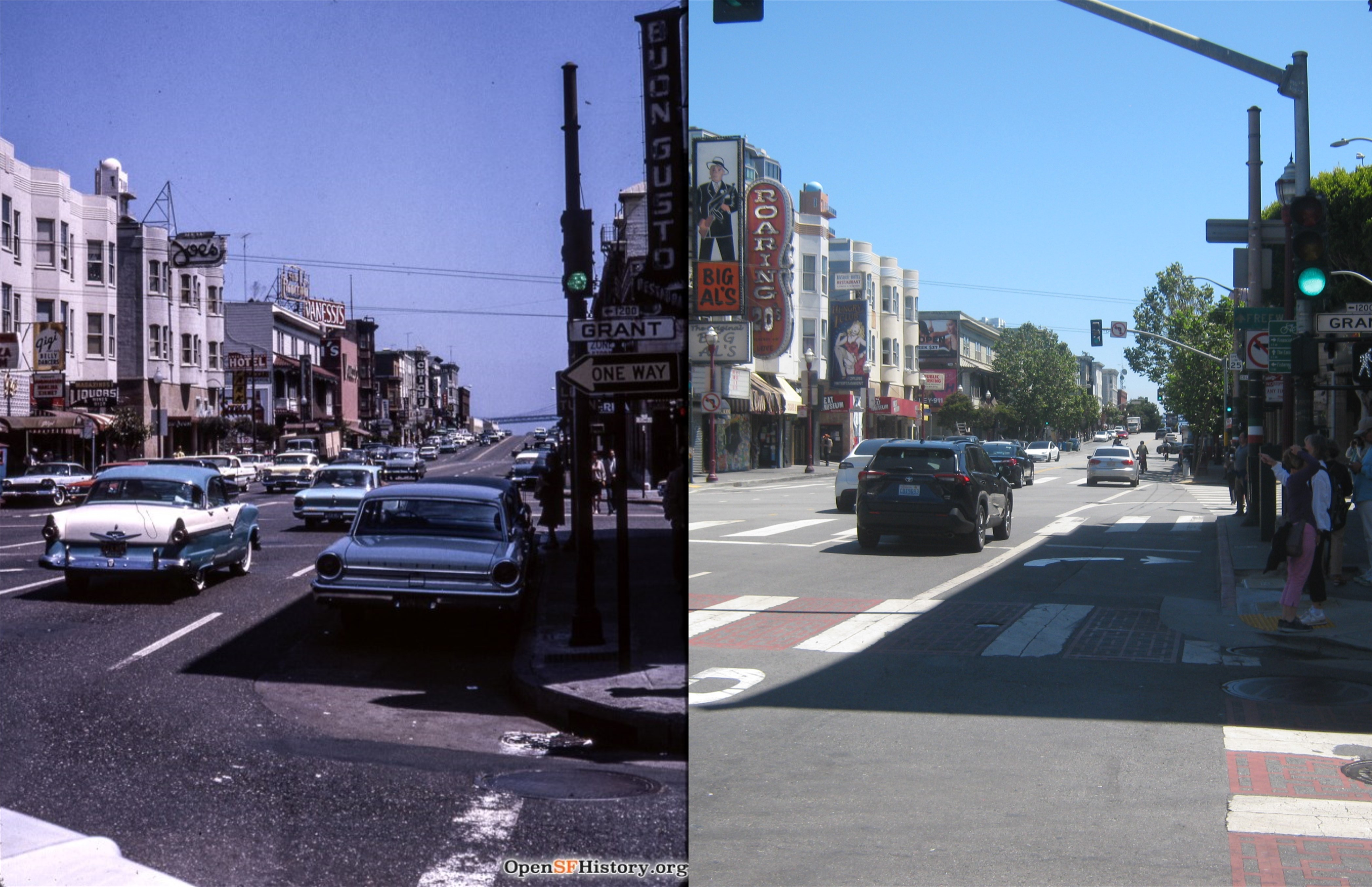
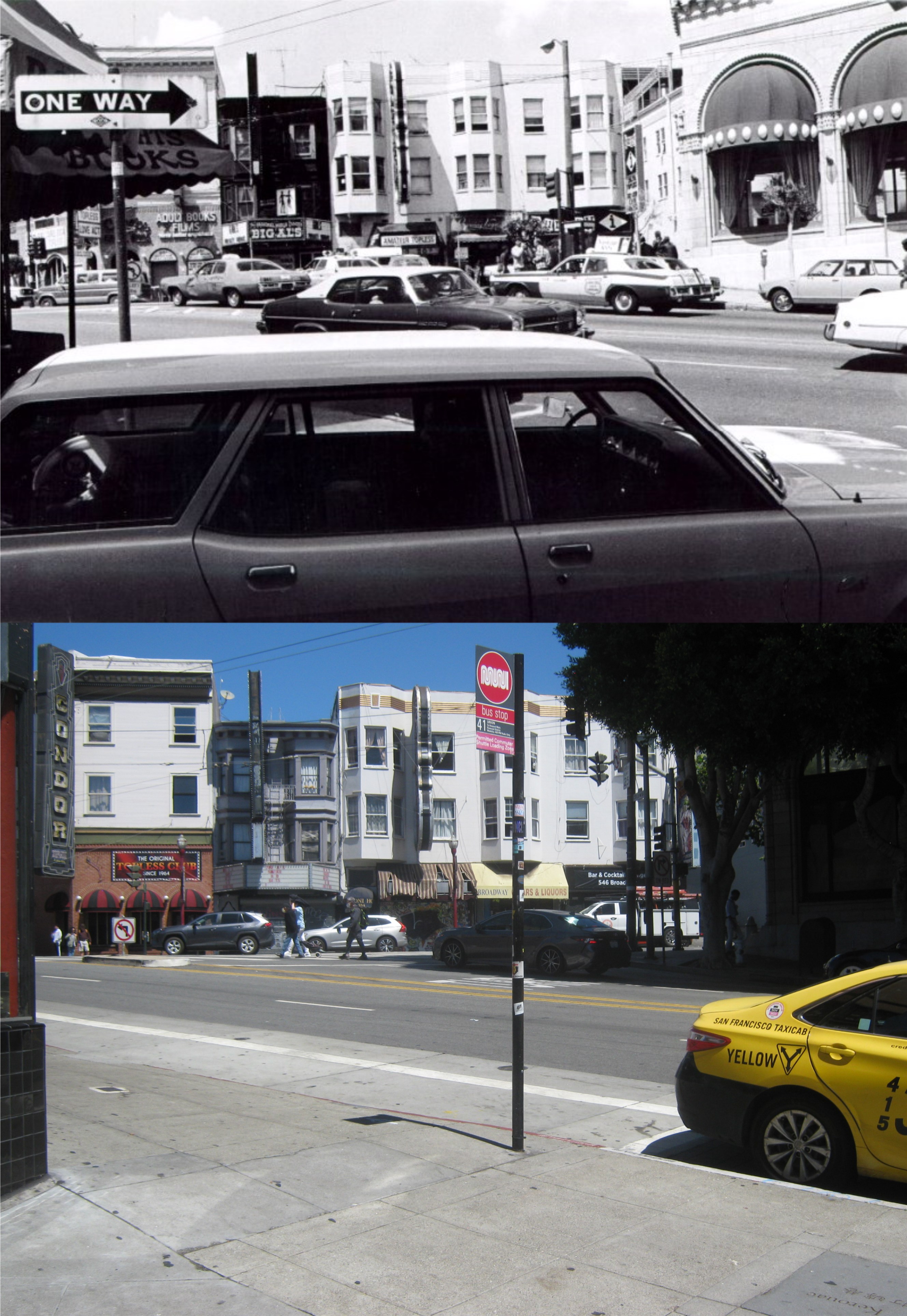
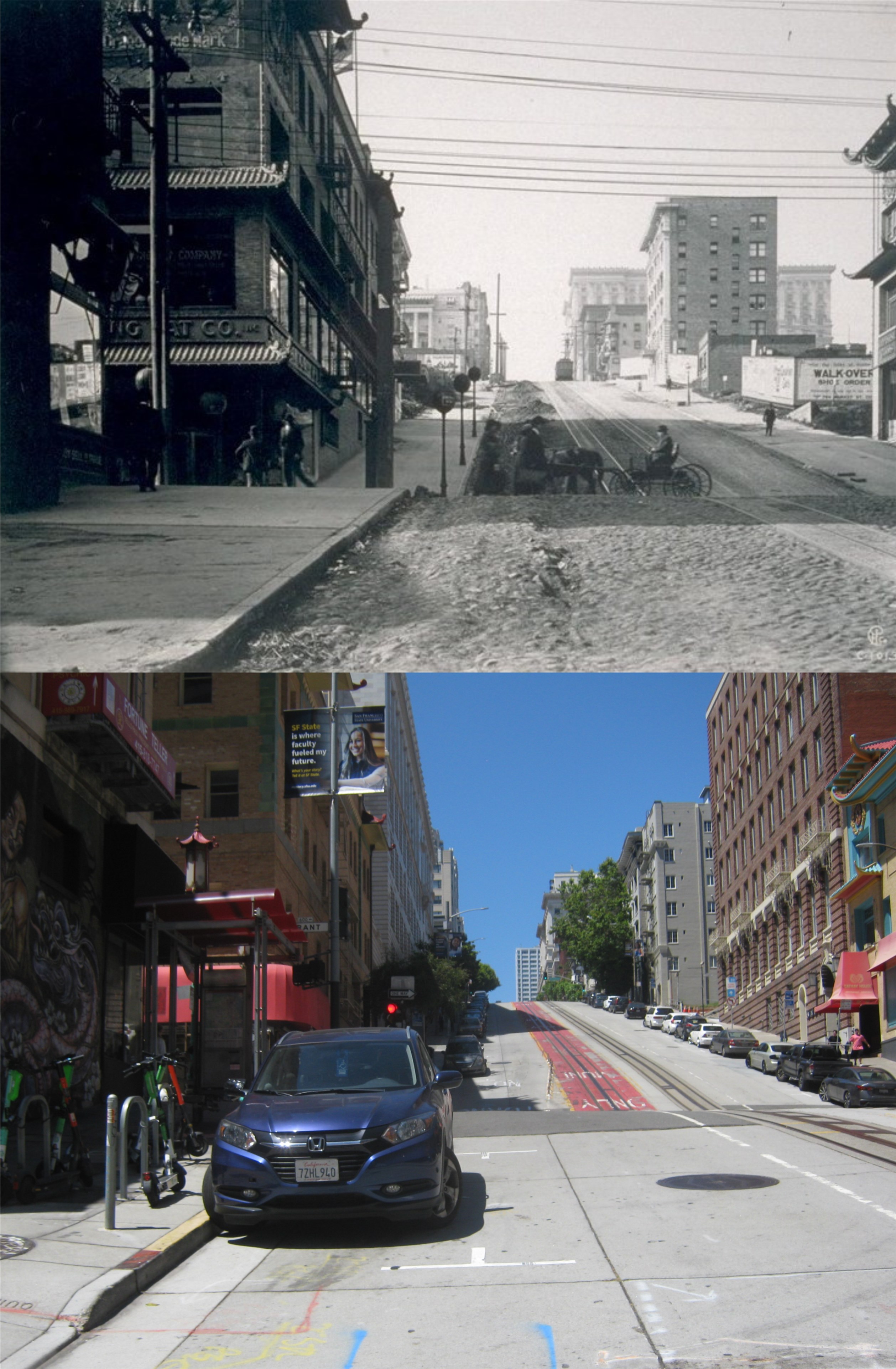
Now off to a little more pleasant picture at Waverly Place in Chinatown during the 1960s: Too wide to be an alley, this two block street is one of the most visited areas of Chinatown. The Red Dragon Cocktails has been replaced by the Lucky Dragon Gift Shop. (opensfhistory.org)

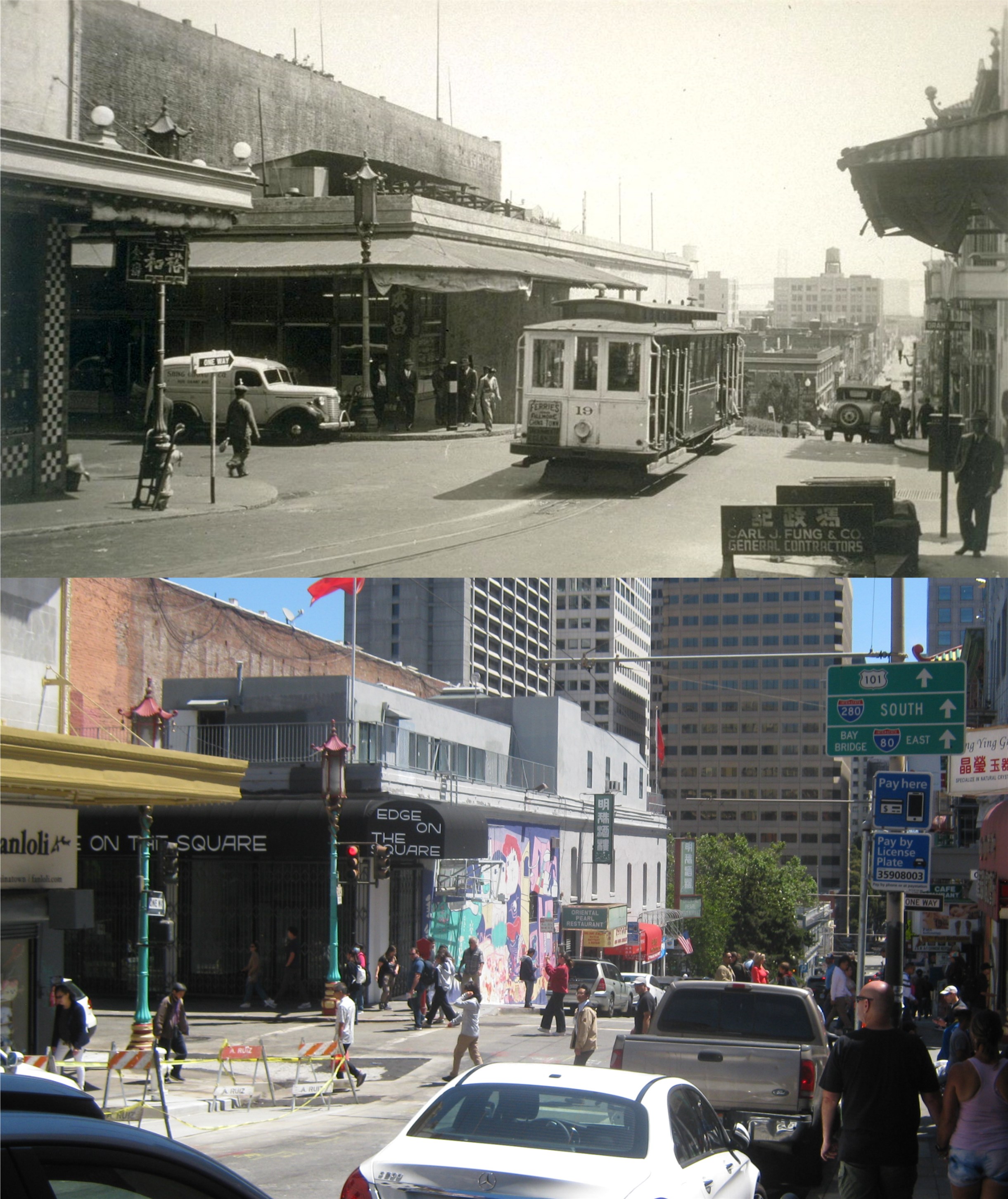
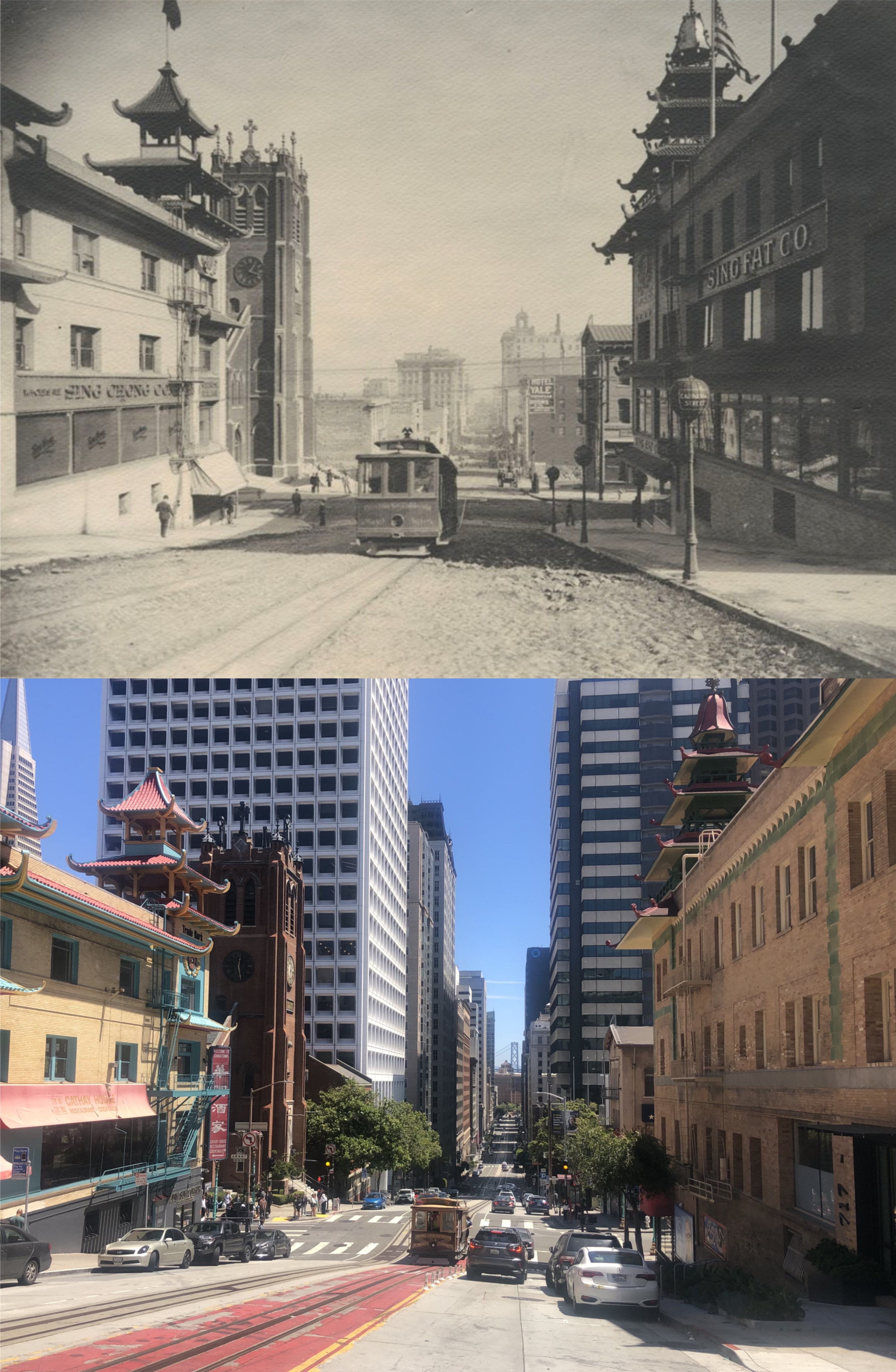
Commercial Street, looking down toward the Ferry Building from Chinatown during the 1930s: Commercial Street is one of only two streets in San Francisco that run directly toward the Ferry Building, the other being Market Street. The building of the Embarcadero Center in the 1970s blocked part of the view of the Ferry Building from here now, but you can still see it, covered up with black scaffolding, in the modern picture. (opensfhistory.org)

Maiden Lane has lost a lot of its charm since when they used to hold Spring Festivals and the famous two block street had a flower shop, a pet store, and was crowded with shoppers, or with people meeting in the lane when the Union Square Lounge was still open. Today it’s mainly quiet now, with little foot traffic. (San Francisco Public Library Archives)

Another one of the establishments in Maiden Lane gone now is the Union Square Lounge, a popular watering hole that went back as far as the 1940s. Jack Lemmon falls off the wagon at the Union Square Lounge in the movie ‘The Days of Wine and Roses’ from 1962. The Union Square Lounge sign can be seen behind the Anthony’s sign in the vintage picture looking toward the Dewey Monument and the St. Francis Hotel. (San Francisco Public Library Archives)

The entrance door to the Union Square Lounge is still there.

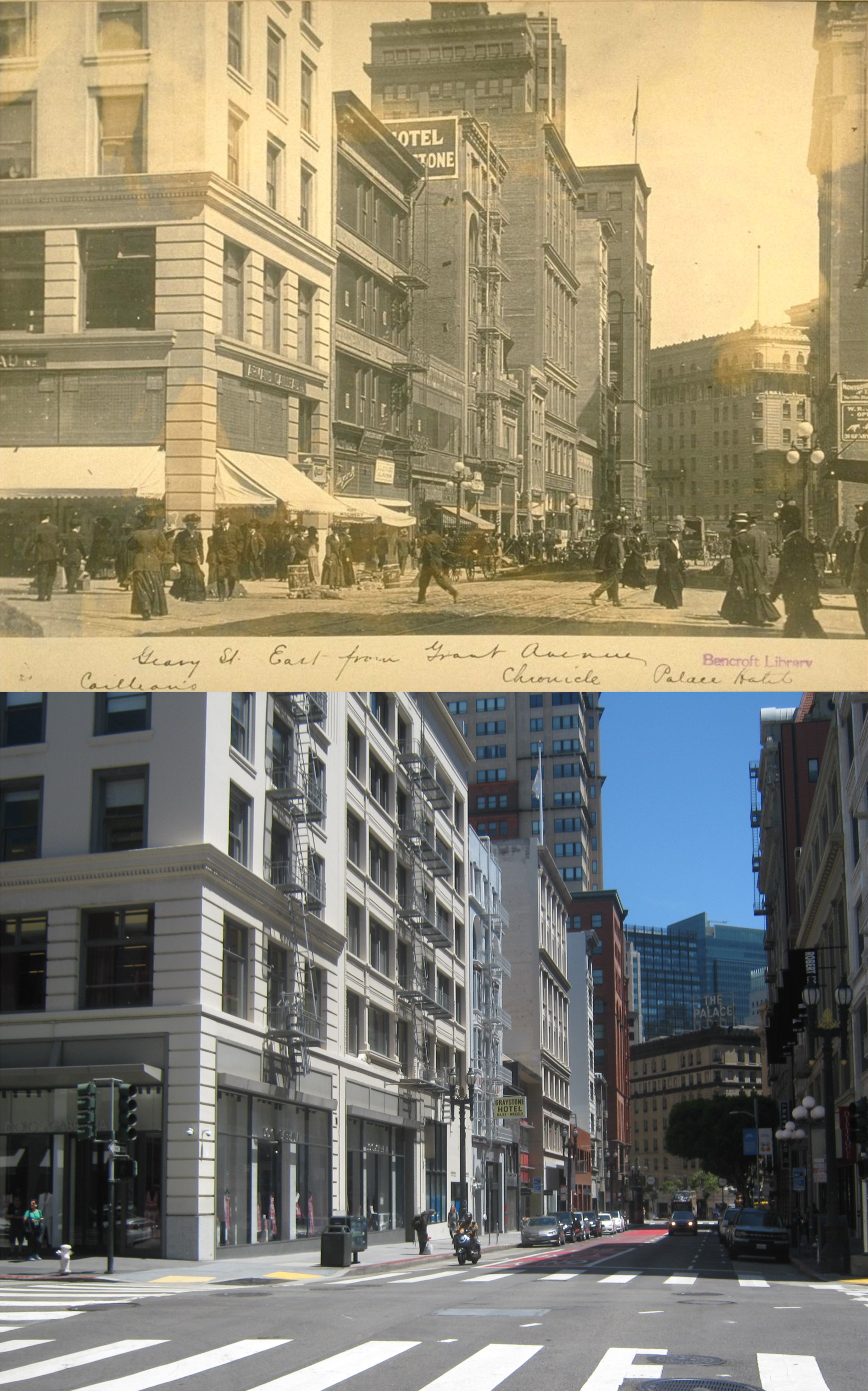
South of Market Street between Market and Howard Street are four little lanes that visitors don’t often explore, including me. Starting from 1st Street, Stevenson, Jessie, Minna and Natoma Streets, run southwest to 10th Street, and Minna and Natoma extend past 11th Street. The alleys, which is what parts of them could be called, are broken up at portions by development, and some of the blocks of a few of the streets are not pleasant to visit. Most old photographs of the four streets, when you can find some, do not show the streets to be glamorous, at best, and shady, if not sleazy, at worst. They were probable laid out as byways for delivery to the larger buildings on Market Mission, and Howard Streets, and are kind of obsolete now, although there are a few nice looking restaurants and businesses throughout the streets. The first one above is Stevenson, looking from 1st to 2nd Streets toward the Palace Hotel in 1921. The crosswalk is where a little alley called Ecker is. The little stretch of Stevenson between 2nd Street and New Montgomery is worth walking along for those great neon signs at the Palace Hotel Parking Garage. (opensfhistory.org)

Jessie Street at 6th, looking toward The Golden Gate Theater during the 1970s: My picture doesn’t match up perfectly, but I didn’t want to stay around here any longer than I had to. The nicest thing you can say about this portion of Jessie Street is that this is not the nicest portion of Jessie Street, and that’s being extremely complimentary. (San Francisco Public Library Archives)

The northwest corner of Minna and 4th Streets in the 1950s: The caption to the vintage photo reads that the man on the corner was named Reverend Avery Heisey. Well, if the eminent Reverend Heisey wants to stop by the SUZ-Z-Q CLUB for a quick one after Services, I’m not going to castigate him. (San Francisco Public Library Archives)

Natoma Street, looking west from 2nd Street in 1920: Much of this portion of the little alley still remains. (UC Berkeley Library Archives)

“See totally vintage pictures!”

“Come on in and see totally vintage pictures of the intersection of Broadway and Columbus Avenue. A fantasy for your eyes to enjoy! Step right in.”

Well, that probably wouldn’t have pulled them in, gawking, off the street on Broadway in the 1960s, but that’s what I’m offering. These are updates before, during, and after the period that the intersection of Broadway and Columbus Avenue became famous or notorious, whichever your viewpoint, as the topless and nude dancing capital of the country. (Thumbnail images)

Looking east across Columbus and along Broadway in 1922: The Condor Club and Big Al’s signs are still there as a reminder of what the area was once renown for. (UC Berkeley Library Archives)

A closer view, looking northeast and probably taken the same day in 1922 as the previous vintage picture: (UC Berkeley Library Archives)

Looking northwest across the intersection in 1943: The building behind the streetcar was painted with various famous jazz musicians by muralist Bill Weber in 1987. (opensfhistory.org)

Looking east across the intersection from Grant Avenue during the 1960s: The area was still relatively quiet, but that was all soon to change drastically. (opensfhistory.org)

This is an interesting picture. The station wagon turning on to Columbus Avenue is exiting from what was then called Adler Avenue. The alley runs between City Lights Books and the Vesuvio Café from Columbus to Grant Avenue. My friends and I spent a lot of time during the 80s and 90s sitting upstairs in Vesuvio’s on Saturday nights watching the parade of humanity passing by below. The alley is now named Jack Kerouac Alley. (San Francisco Public Library Archives)

And then along comes Carol, (sung to the tune of ‘Along Comes Mary’ by the Association). Carol Doda’s naked act, rising from a piano in the Condor club, spawned an industry of topless and totally nude dancing clubs along Broadway in the 1960s and 1970s that attracted visitors from across the country and overseas. I remember when I was a teenage, my Uncle Fritz and Aunt Ellen drove out here from Grand Forks, North Dakota, and talked my mom and dad into taking them over to see the topless clubs that were causing quite stir in the nation at the time. My Uncle Fritz wasn’t all that impressed, saying “What da hell? We got better stuff than that in North Dakota!” To which my dad answered, “Like what, Fritz, a girl in coveralls driving around on a tractor?” When UHF television stations came along in the early 1970s, Carol Doda did a commercial advertising for Channel 36 referring to the channel or herself, which was never quite clear, as “The Perfect 36”. We always wondered why Carol wasn’t advertising for Channel 44 instead. (SF Gate)

By the 1970s there were protests at the Broadway and Columbus intersection, referring to the area as “pornographic”, which by then it was. (San Francisco Public Library Archives)

Another look at the intersection before and after it became the “flesh tart” capital of the country. I had to get my update of the 1950s picture a little further north up Columbus Avenue than from where the vintage picture was taken so I could get the Columbus Tower Building in, still painted white back then rather than today’s green. The area is much less glitzy today, but, as mentioned, the Condor Club and Big Al’s signs remain as a reminder of what once was. (San Francisco Public Library Archives)

A baseball Sunday for the last weekend in July:

The Giants were playing the third game of a three game match-up with the Boston Red Sox last Sunday out at Oracle Park, a team they haven’t played much since the 1912 World Series, seen here in the old score card from Wikipedia. William Taft was President during that World Series, but he got knocked out of office the following month by Woodrow Wilson, just like the Giants got knocked out of the 1912 World Series by the Sox. I put on my old Giants Jersey, or shirt, or whatever it is, that a friend of mine nicknamed Enzo gave me long ago, and headed over to SF to update some vintage pictures from the UC Berkeley Library Archives that were taken back when the Giants were still in New York, and the Red Sox were still in Boston. Oh, wait, the Red Sox are still in Boston. (Thumbnail images)

I took the Metro Subway that opened in January of 2023 to Chinatown and did a walk-back to Downtown SF along Grant Avenue, following the game on the MLB App as I took my pictures. Chinatown was packed yesterday and you’d be surprised how many people were wearing clothes with a Giants logo on them. This is looking down Clay Street at Grant Avenue in the 1930s.

Looking down Clay Street toward Kearny past Portsmouth Square in 1922: The game was one to nothing, Giants, at this point. The Giants got another run and held on to a two to nothing lead until the Seventh Inning.

They block off a large portion of Chinatown’s Grant Avenue lately on weekends.

Chinatown was completely destroyed in the 1906 Earthquake and Fire, but was already coming back to life less than a year later in 1907 here at Grant Avenue and California Street when the Sing Fat Building on the left and the building now known as Dim Sum Corner on the right were built. The Fairmont Hotel where Tony Bennett first sang ‘I left My Heart in San Francisco’ is up Nob Hill in both photos.

Looking back down California Street past Grant Avenue, the exact opposite of the previous photos, and a year later in 1908:

I stayed in Chinatown longer than I planned, so when I got back downtown to Grant Avenue at Geary, looking toward Market Street and the Palace Hotel 1909 in the vintage picture, the Sox had picked up a run, but the Giants still led two to one.

A flower stand on the corner of Grant Avenue and Geary Street in 1939: . You don’t see as many flower stands around San Francisco as there once were, but I don’t think it’s because of the rising crime rate; thieves aren’t romantic and they don’t usually steal flowers. Soon, the game was tied at three each and would go into extra innings, so I decided to head back on BART. On the way, my App told me that the Giants won the game on a walk off single in the Eleventh Inning. I’ll bet they were cheering in San Francisco.