
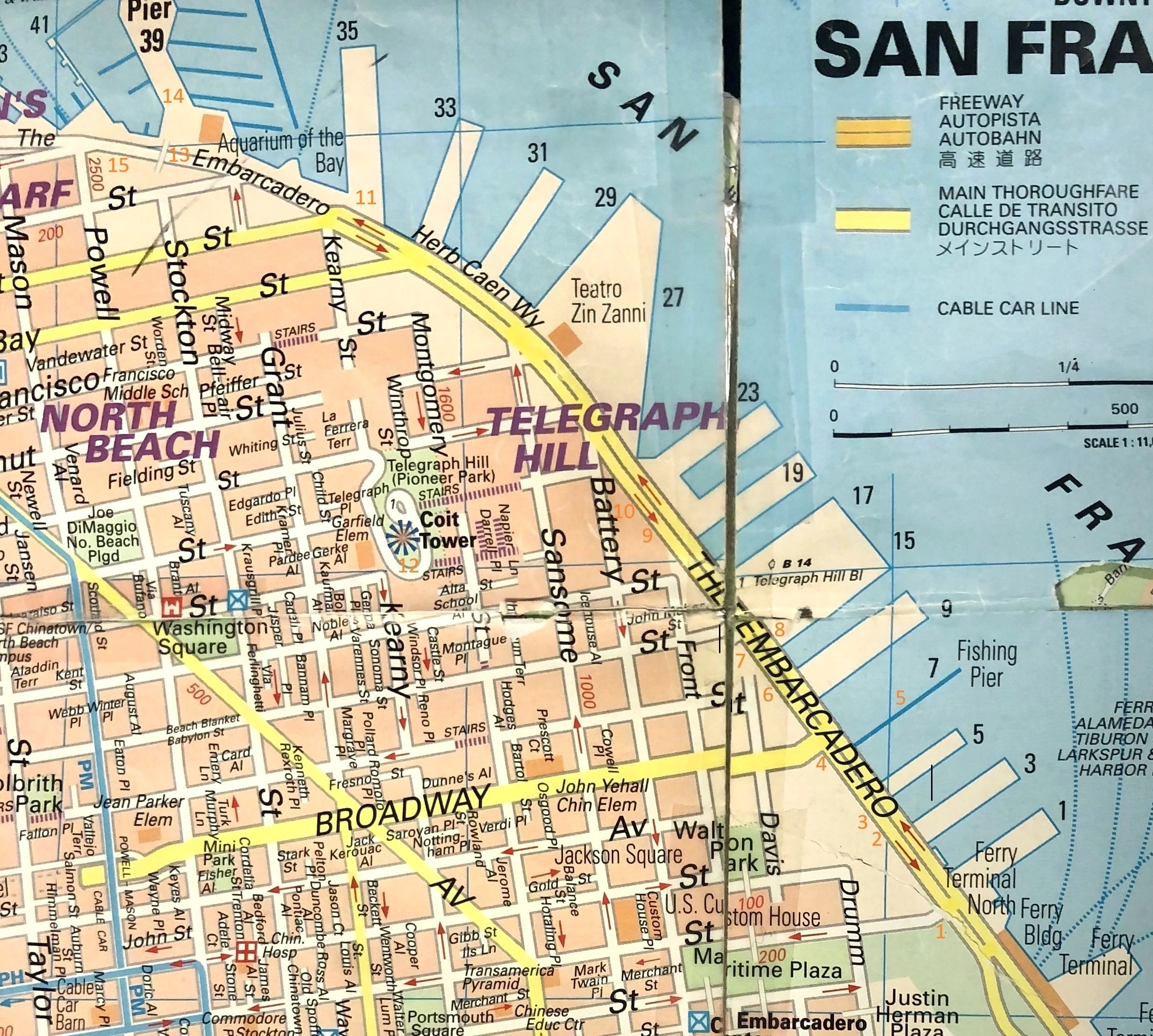
This is another follow-by-the-numbers tour of what’s probably my favorite San Francisco street; courtesy of my trusty City in Your Pocket San Francisco Map that I probably used a lot to get around SF before Google Maps came along. It’s dated 2011 and scotch tape has kept it from disintegrating, but I hold on to it for nostalgia reasons. Also, I always liked the fact that the streets and roads on the entire map are streets and roads, and not just lines. Sometimes little things like that are important to me. You can follow along on my tour with the orange numbers where my updated pictures were taken; the numbers in black from my old map designate the numbers of the piers . We’ll start near the Ferry Building at Pier 1, and proceed north by northwest. (Sorry, Mr. Hitchcock) Although it’s lost its mystery, danger and intrigue, you can still feel a sense of the Embarcadero’s past when you walk along these piers, especially at night, or see it in old film noir movies or television shows like “Harbor Command’ or ‘San Francisco Beat’ or read about the port in books, both fiction and non fiction. (Thumbnail images)
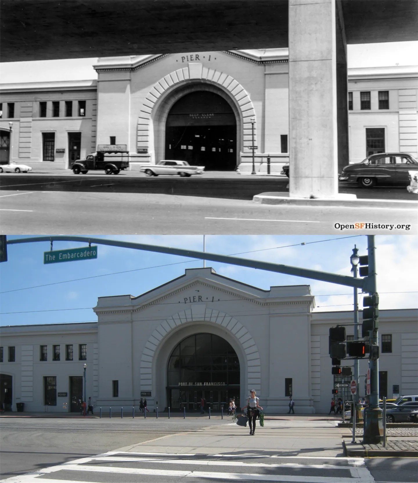
#1 Pier 1, from underneath the Embarcadero Freeway in 1960: (opensfhistory.org)
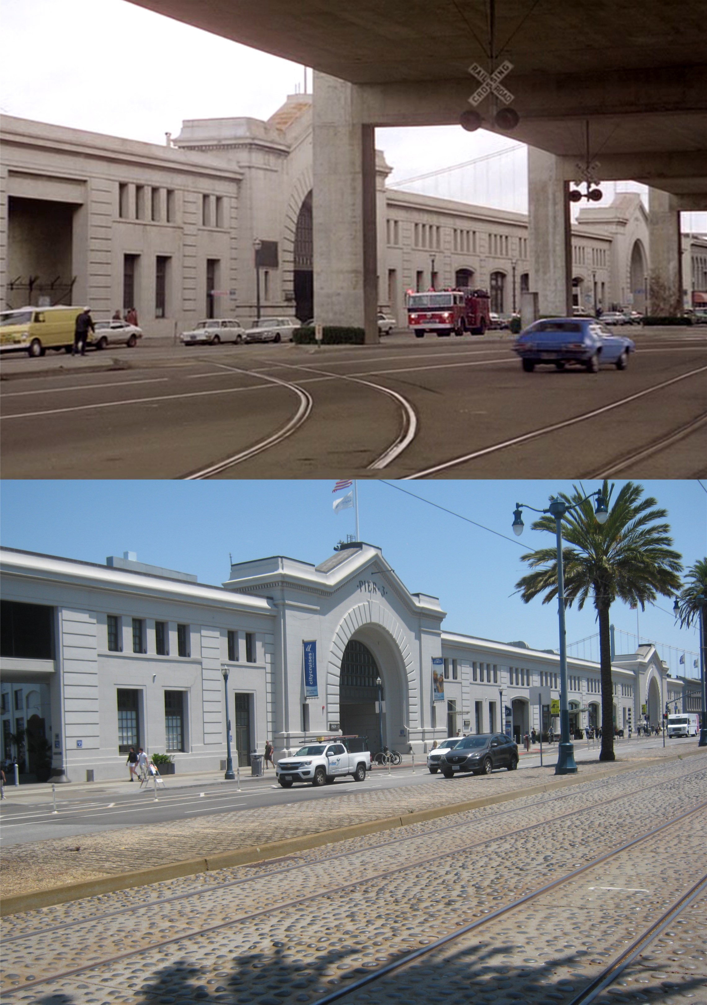
#2 Pier 3, also from underneath the Embacadero Freeway, seen in one of the last episodes of the television show “EMERGENCY!’ from 1979:
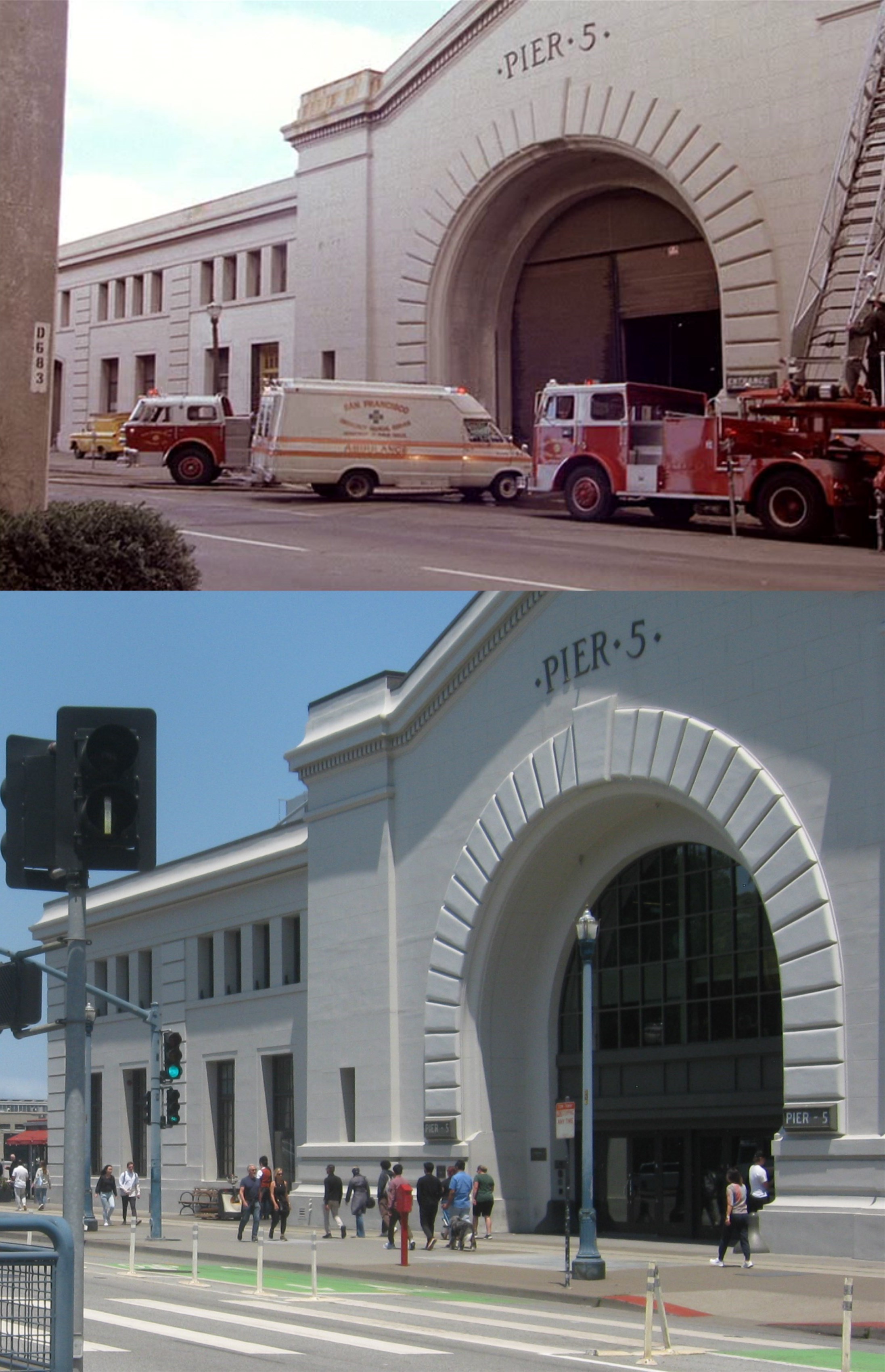
#3 Pier 5 in the same 1979 episode of “EMERGENCY”:
#4 The now demolished Pier 7 in 1931: I took my picture walking past the Walking Pier now at Pier 7 on a rainy afternoon on New Year’s Eve.
#5 Godzilla leaves San Francisco past the Pier 7 Walking Pier after destroying most of San Francisco in the 2014 ‘Godzilla’ film.
#6 Pier 9, looking past the abandoned Belt Line Rail Tracks in 1964: (San Francisco Library Digital Archives)
#7 Pier 15, just after World War Two in 1946: The Exploratorium now occupies Pier 15. I was taking an F Line Streetcar break to Pier 39, that came along near here yesterday while I was finishing my set, but you can’t see me in the streetcar reflection. (San Francisco Library Digital Archives)
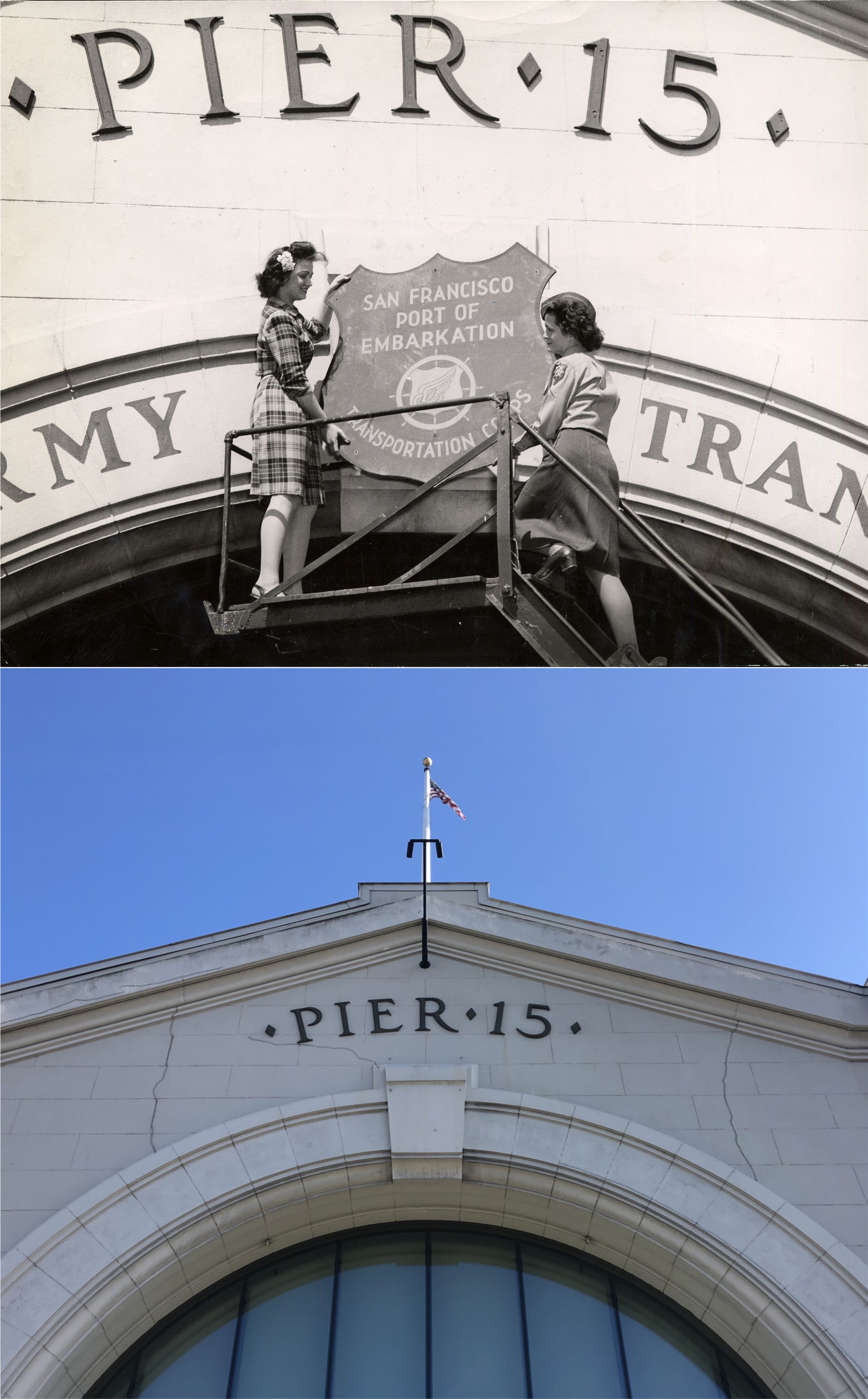
#8 Ladies removing the military Port of Embarkation sign on the top of Pier 15 in 1946: (San Francisco Library Digital Archives)
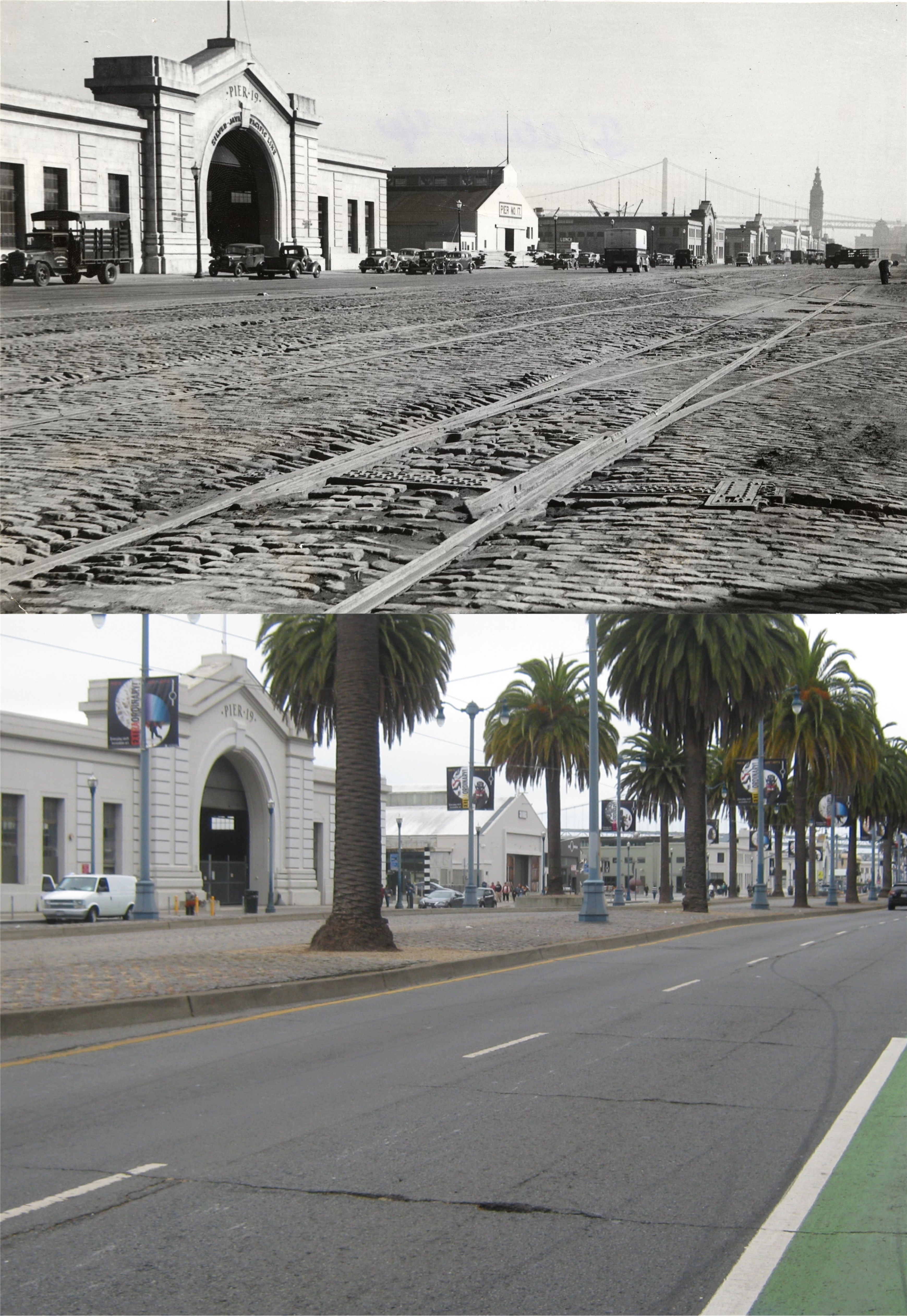
#9 Looking toward Piers 19 and 17 in 1940: The Bay Bridge and Ferry Building are on the far right in the vintage picture. (San Francisco Library Digital Archives)
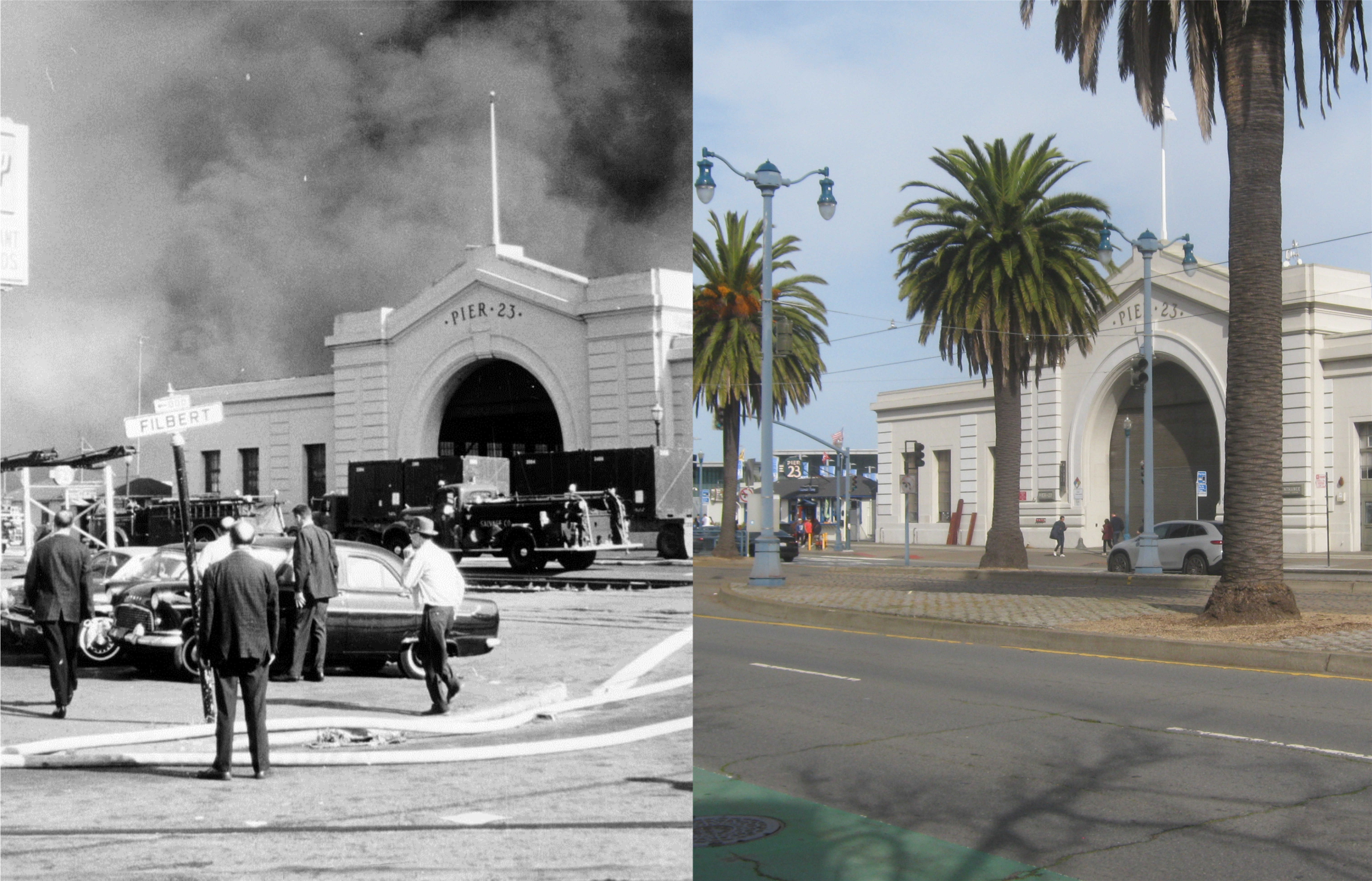
#10 A fire behind Pier 23 near Filbert Street in and undated photo from what looks like the 1950s: Levi Plaza is where I took my picture from yesterday. (San Francisco Library Digital Archives)
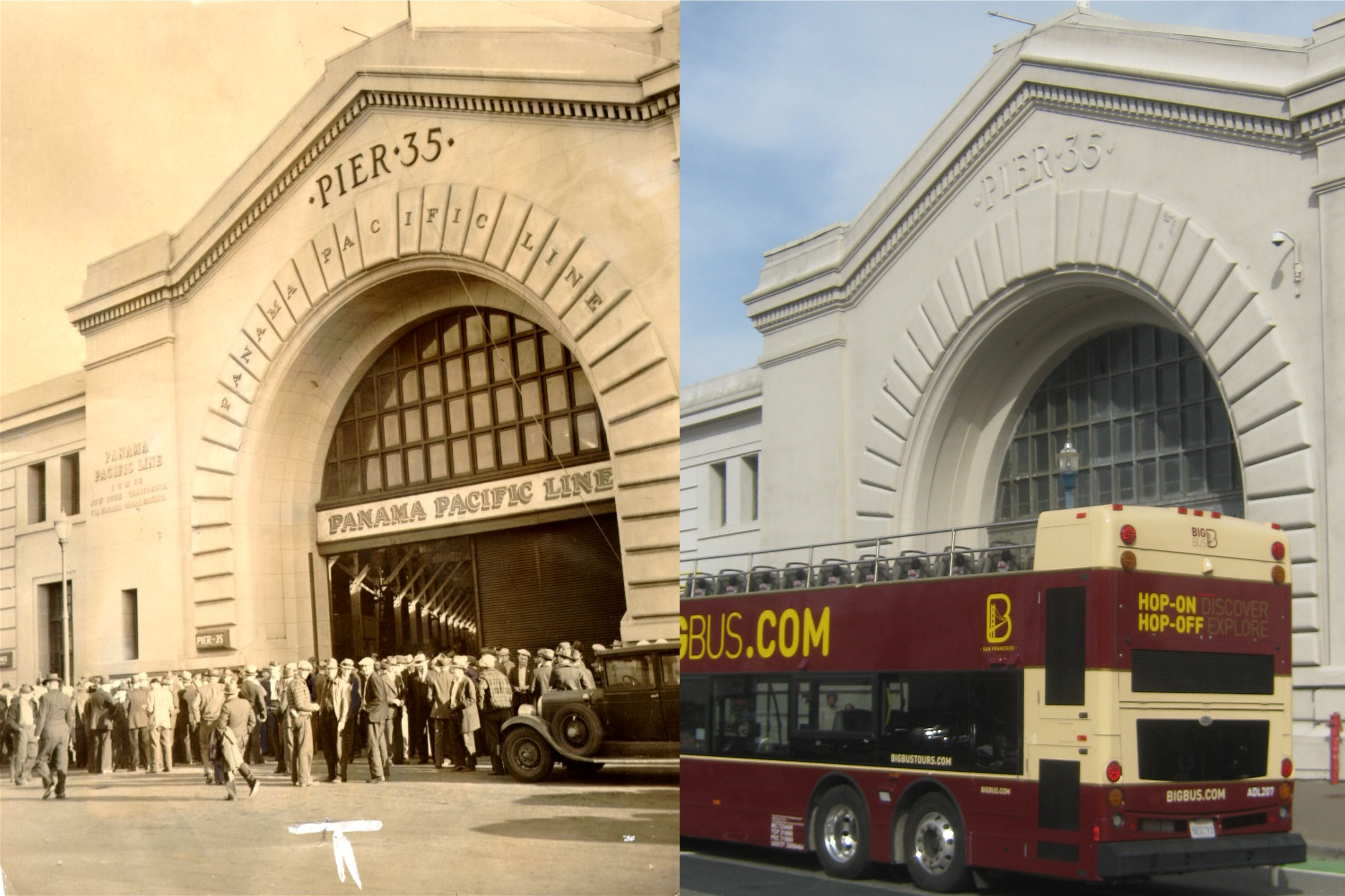
#11 Pier 35 in 1939: The Hop-On, Hop-Off tour bus parked in front of the pier kind of steals the show, but they’re okay. (UC Berkeley Library Archives)
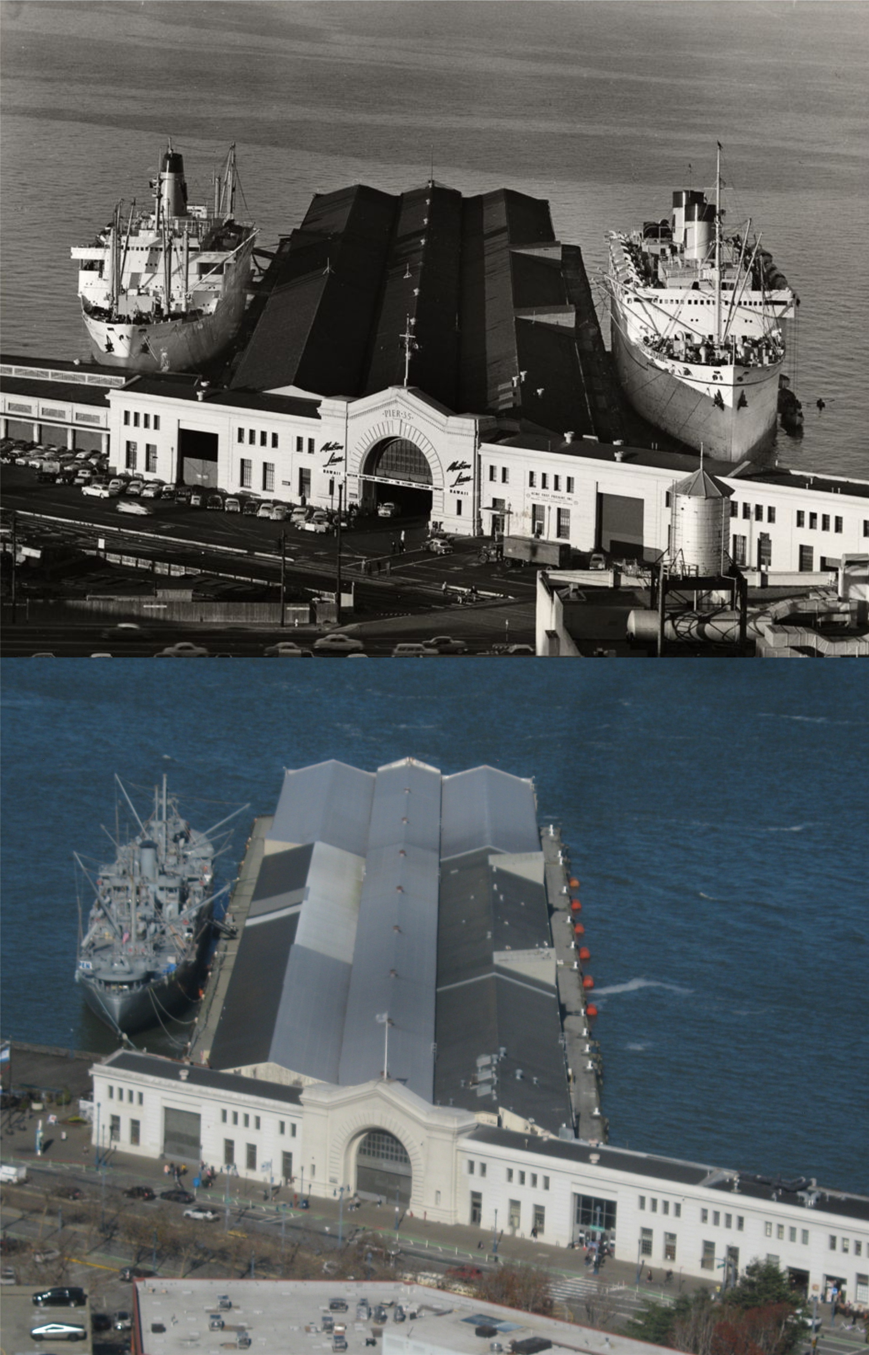
#12 Look for #12 up on Telegraph Hill at Coit Tower, where I took my picture looking down at pier 35 early last month in January. The vintage SF Digital Library picture is from 1957. The ship at Pier 35 in my somewhat blurry close up is the Liberty Ship, the Jeremiah O’Brien.
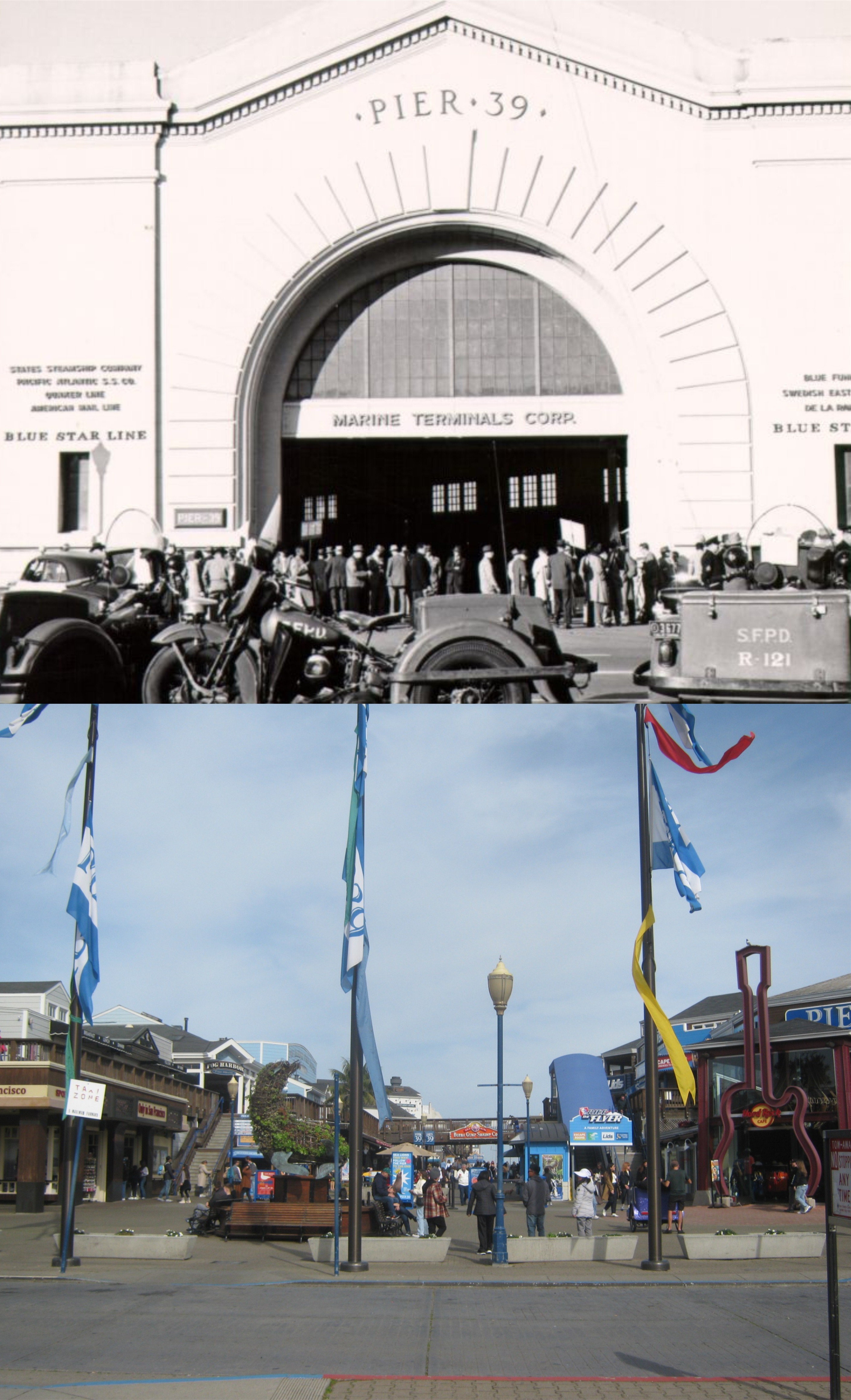
#13 An undated picture of Pier 39 from probably the 1950s, and the same spot today now. (San Francisco Library Digital Archives)
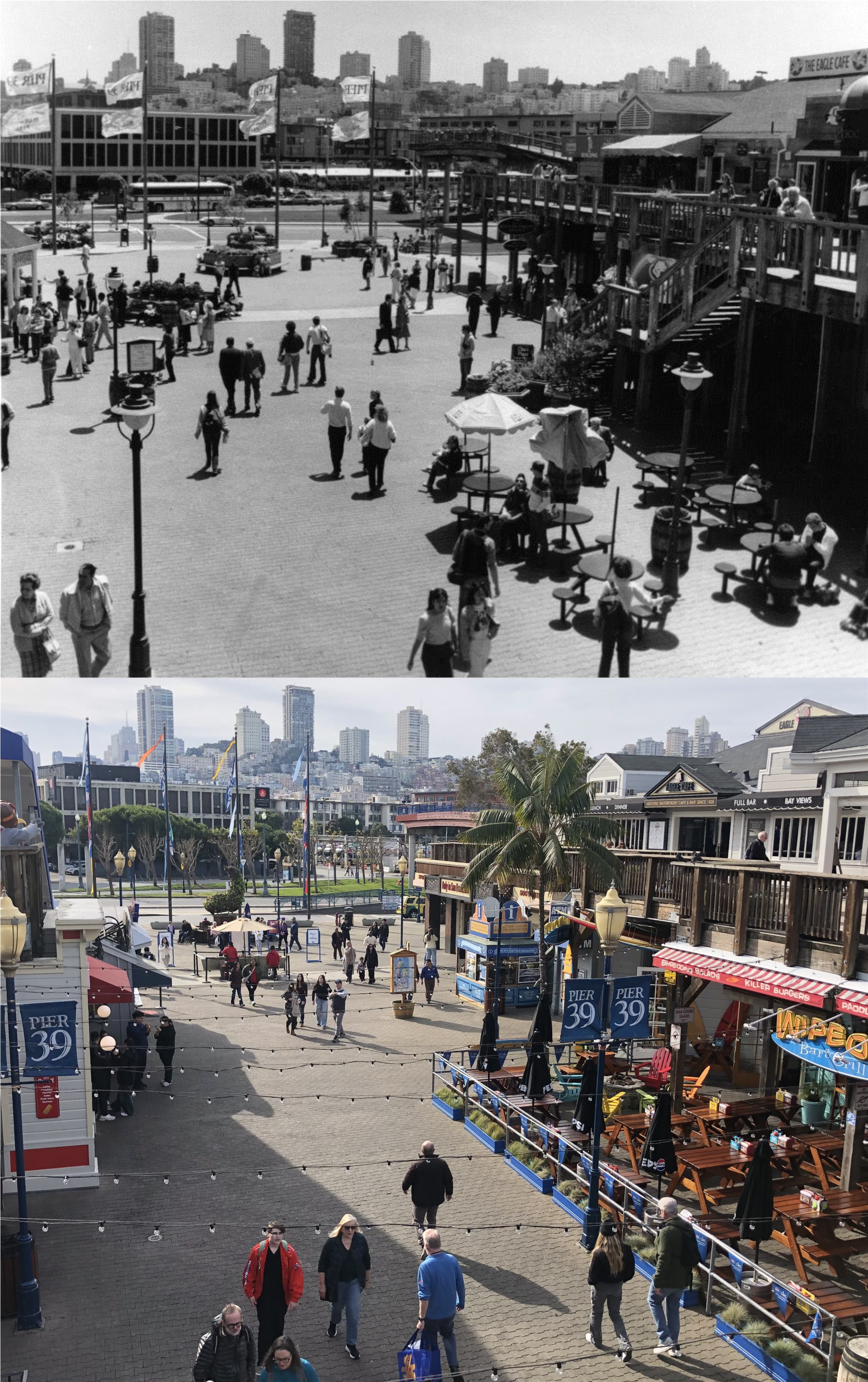
#14 Looking back toward where the previous pictures were taken from the tourist attraction Pier 39 in 1983: (San Francisco Library Digital Archive)
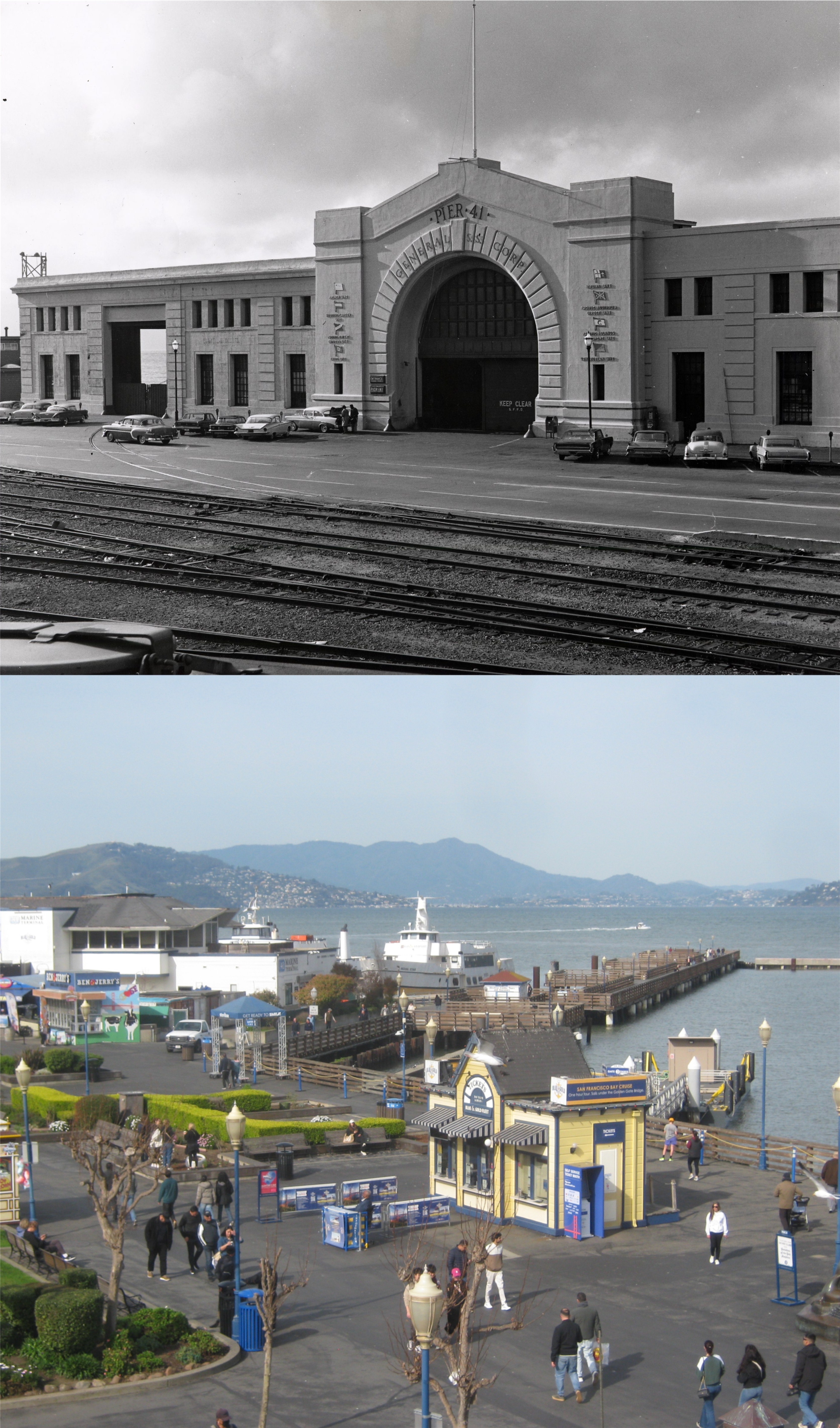
#15 Pier 41 in 1964: The now demolished Pier 41 was where the Bay Walk and Ben & Jerry’s is now. (San Francisco Library Digital Archives)

Very cool! Awesome work always my dear friend! Love and Light God Bless ❤️✨🙏
Thank you! And the same for you.
You’re very welcome! Gratitude! 🥰